Skip header and navigation

6 records – page 1 of 1.

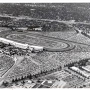
Aerial view taken over Arcadia so that it shows a large area surrounding Arcadia as well as the entire city. Clearly seen is the Santa Anita Park Race Track, and the Arcadia County Park (shown as a dark triangle in center), and the 210 Foothill Freeway crossing photo from west to east and passing north of Santa Anita Park Race Track.

https://arcadiahistory.andornot.com/en/permalink/photographs648
Date
c. 1973

  1 image

Date
c. 1973
Subjects
Aerial Photo Collection
Aerial views
210 Foothill Freeway
Arcadia County Park
Santa Anita Park-1945-1980
Physical Description
8x10 b&w
ID
644
Collection
Photographs
Images
Less detail

Santa Anita Avenue, Arcadia 1 mile. Exit sign on 210 Foothill Freeway. Photograph by Terry Miller.

https://arcadiahistory.andornot.com/en/permalink/photographs2242
Date
April 2001

  1 image

Date
April 2001
Subjects
210 Foothill Freeway
Santa Anita Avenue
Signs
Physical Description
4x6 b&w
ID
2213
Collection
Photographs
Images
Less detail

Santa Anita Avenue, Arcadia 1 mile. Exit sign on 210 Foothill Freeway, with mountain view and freeway wall in background. Photograph by Terry Miller.

https://arcadiahistory.andornot.com/en/permalink/photographs2243
Date
April 2001

  1 image

Date
April 2001
Subjects
210 Foothill Freeway
Santa Anita Avenue
Signs
Physical Description
4x6 b&w
ID
2214
Collection
Photographs
Images
Less detail

Aerial view looking east across Santa Anita Park taken from a position just west of Baldwin Avenue, which is seen at bottom of photo. Huntington Drive appears exactly in center of photo just east of race track. The 210 Foothill Freeway enters area in upper right portion of picture and exits at left side in upper left portion.

https://arcadiahistory.andornot.com/en/permalink/photographs996
Date
c.1979

  1 image

Date
c.1979
Subjects
Aerial Photo Collection
Aerial views
210 Foothill Freeway
Huntington Drive
Santa Anita Park-1945-1980
Physical Description
8x10 b&w
ID
989
Collection
Photographs
Images
Less detail

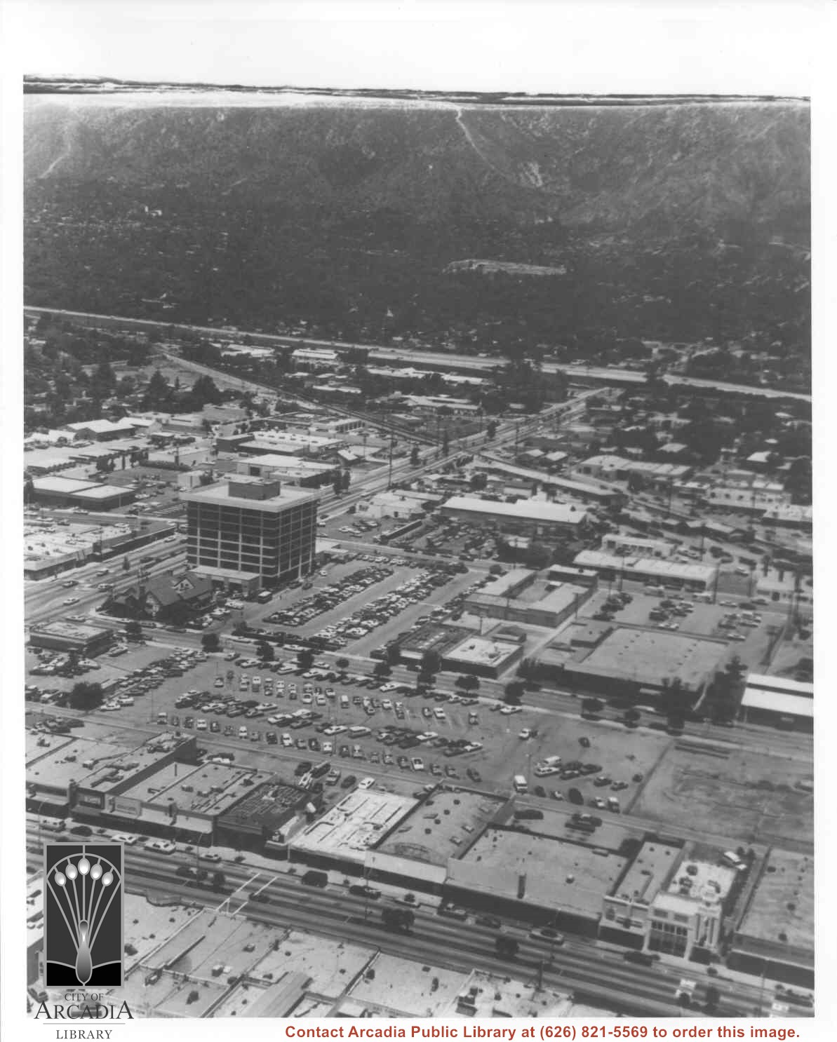
Aerial view north toward San Gabriel Mountains from a position above Huntington Drive near First Avenue. Santa Anita Avenue can plainly be seen running north and south in front of six-story building in center of photo. The 210 Foothill Freeway is top band running across photo from east to west.

https://arcadiahistory.andornot.com/en/permalink/photographs611
Date
July 1976

  1 image

Date
July 1976
Subjects
Aerial Photo Collection
210 Foothill Freeway
Huntington Drive
Railroads
Santa Anita Avenue
Physical Description
8x10 b&w
ID
607
Collection
Photographs
Images
Less detail

Aerial view looking north across Santa Anita Park from a position over Arcadia County Park. Large infield crowd is evident and all parking areas are filled. Arcadia Methodist Hospital shows in lower left part of photo and Arcadia Police facility is seen in lower right. The 210 Foothill Freeway cuts across photo near the top.

https://arcadiahistory.andornot.com/en/permalink/photographs995
Date
c.1979

  1 image

Date
c.1979
Subjects
Aerial Photo Collection
Aerial views
210 Foothill Freeway
Arcadia Methodist Hospital
Santa Anita Park-1945-1980
Physical Description
8x10 b&w
ID
988
Collection
Photographs
Images
Less detail

6 records – page 1 of 1.