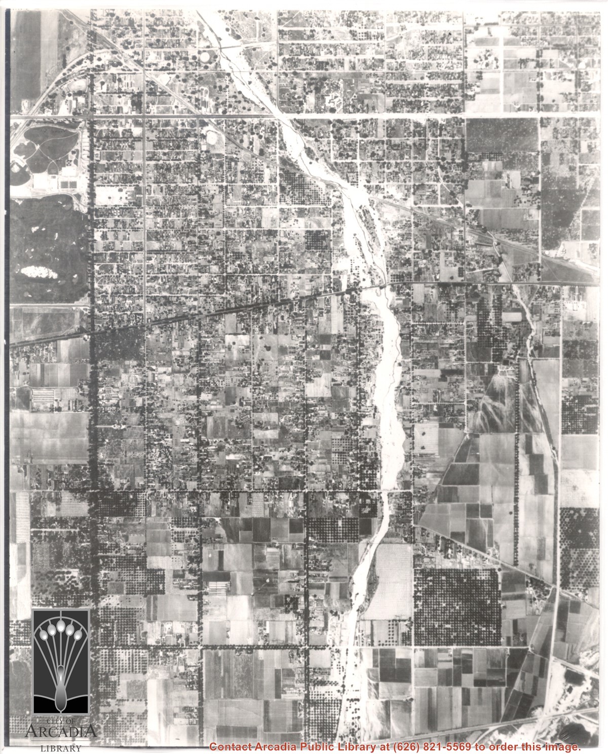
Aerial view toward NE. Plane is over property of Charles W. Stewart (10 acres), and Jaspar Teague (10 acres), at 1320 S. Santa Anita Avenue, which is directly under the plane. Next street east is First Avenue, then Second Avenue, the Fourth Avenue. Reservoir is at corner of Valnett Avenue and Second Avenue and was owned by Walnut Grove Mutual Water Company (Valnett Avenue was first through street south of Duarte Road at this time and became Camino Real).
Most prominent physical feature is Santa Anita Wash running north to south almost in center of photo, just above center(?). Santa Anita Avenue is north/south street, dark with trees approximately one inch from left edge of photo. Arcadia County Park is at upper left edge of photo with baseball diamond showing.
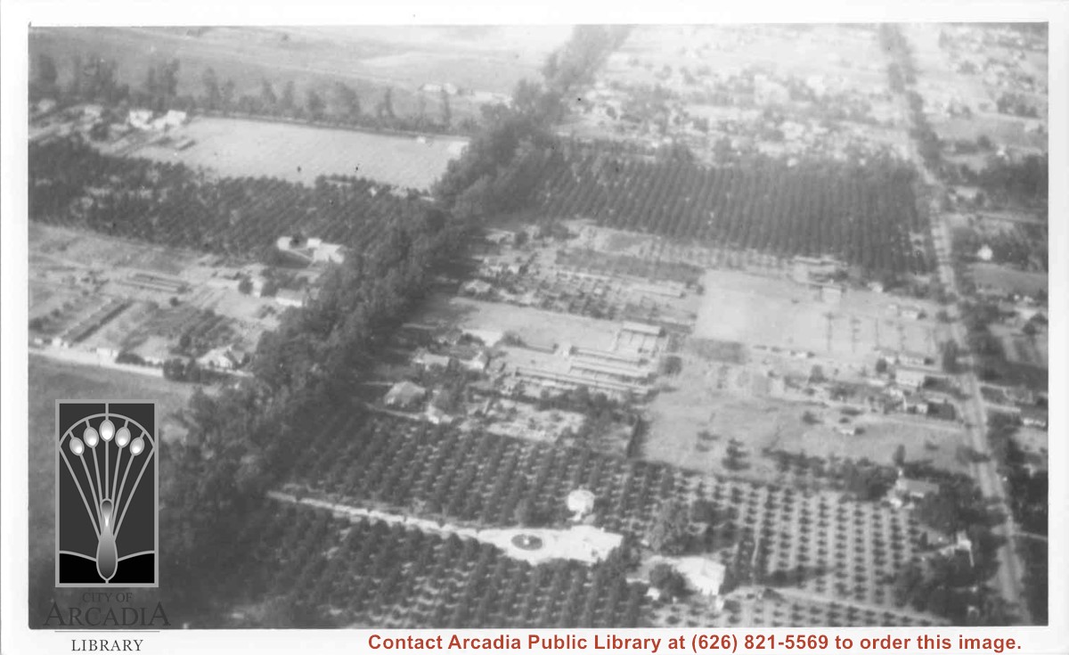
Aerial view north. Main tree-lined street is Santa Anita Avenue. Most of the orange grove in center of photo was owned by Jaspar Teague family. They had built a circular art gallery on their property at 1380 South Santa Anita Avenue. The large buildings north of Teague's and to the west of Santa Anita Avenue are chicken houses. Duarte Road is the east/west street across photo near top of photo.
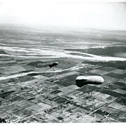
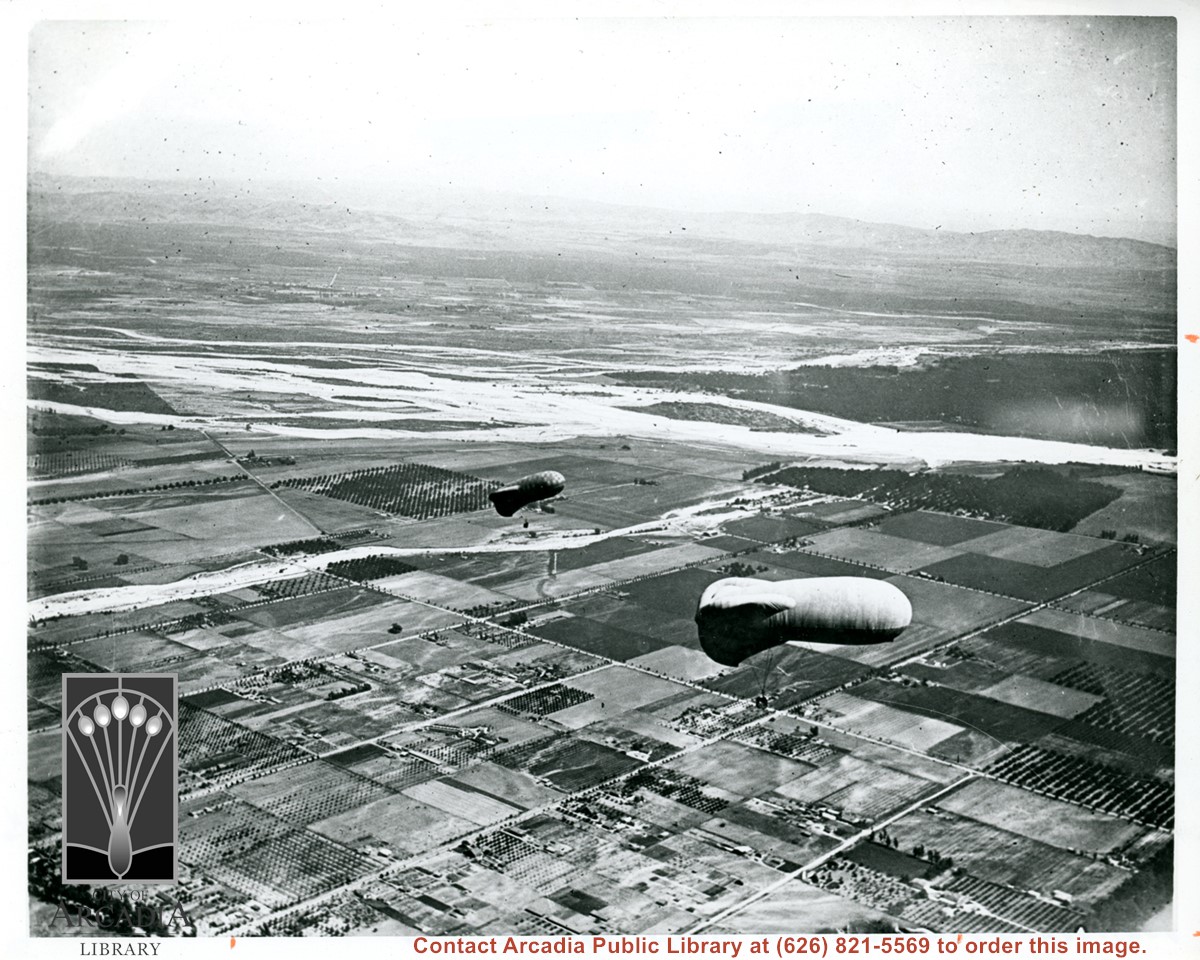
View east shows two balloons aloft over Arcadia and San Gabriel Valley. It is possible that first river up from bottom of photo is Rio Hondo Wash. Some of trees along Santa Anita appear to be in extreme lower right of photo. Tree-lined street showing in extreme lower left of photo is Duarte Road. Second river coming into photo about five inches up from bottom of photo would be San Gabriel River.
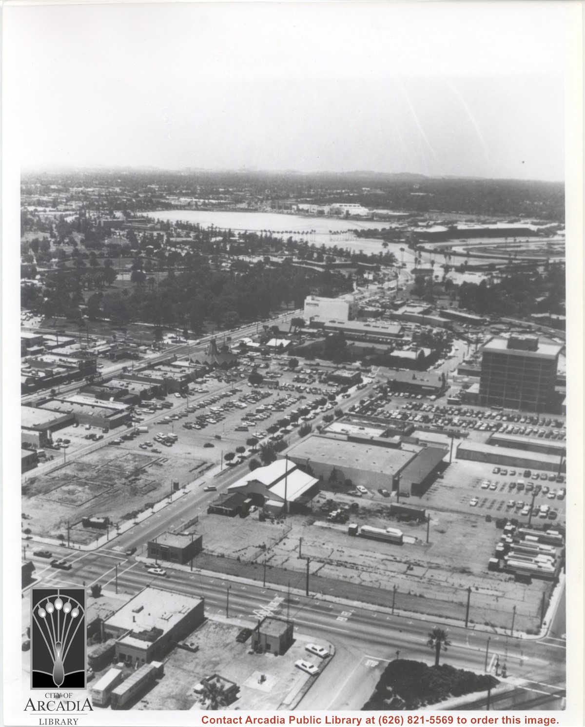
Aerial view looking west from a position approximately over Santa Fe railroad tracks between First Avenue and Second Avenue. Street closest to camera is First Avenue, running north/south, and we see its intersection with Wheeler Avenue in lower left portion of photo. Almost vacant lot on northwest corner of Wheeler Avenue and First Avenue is where Sawmill Restaurant was built in about 1977 (Sawmill Restaurant closed in early 1990's). Foundation work on South side of Wheeler Avenue at corner of First Avenue is for medical building which became 65 N. First Avenue. (Former site of Arcadia Public Library until 1961.) Post Office is largest building in center of the block on north side of Wheeler Avenue. Large white area is parking area for Santa Anita Park Race Track.