Aerial view toward the east from location about over Santa Anita Avenue at Santa Clara Street intersection. Santa Fe Railroad tracks are seen entering the city about in the center of photo. Broad white roadway seen toward left side of photo is 210 or Foothill Freeway still under construction.
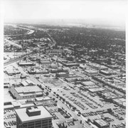
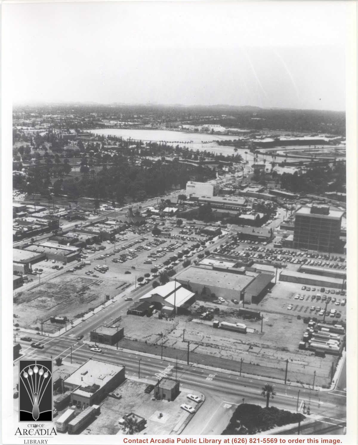
Aerial view looking west from a position approximately over Santa Fe railroad tracks between First Avenue and Second Avenue. Street closest to camera is First Avenue, running north/south, and we see its intersection with Wheeler Avenue in lower left portion of photo. Almost vacant lot on northwest corner of Wheeler Avenue and First Avenue is where Sawmill Restaurant was built in about 1977 (Sawmill Restaurant closed in early 1990's). Foundation work on South side of Wheeler Avenue at corner of First Avenue is for medical building which became 65 N. First Avenue. (Former site of Arcadia Public Library until 1961.) Post Office is largest building in center of the block on north side of Wheeler Avenue. Large white area is parking area for Santa Anita Park Race Track.
Looking west on Huntington Drive from intersection at First Avenue. Corner of City Hall shows on right side of photo. Two people standing are: George Ackerman, City Treasurer; and Louis Altona Building inspector. Building on north side of Huntington Drive with square tower, is Community Presbyterian Church. Service station is opposite City Hall. Part of panorama, ID#s 916-921.
Aerial view of what appears to be either an informal horse show or possible horse sale with a great number of people in attendance. The location has been identified as near intersection of Las Tunas Drive and (with what seem to be railroad tracks in center) Temple City Boulevard. The building (we see only roof) in the lower left corner is Vernon's Pharmacy. The letters VGS can be seen over front entry. There are probably about 100 autos parked nearby. (There is another photo of this event, #539.)