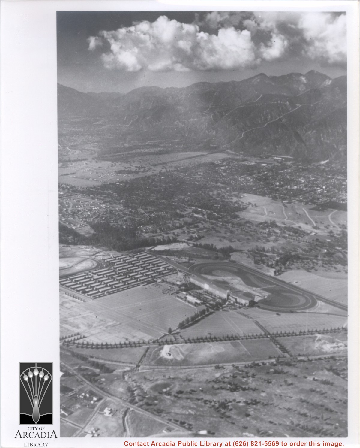
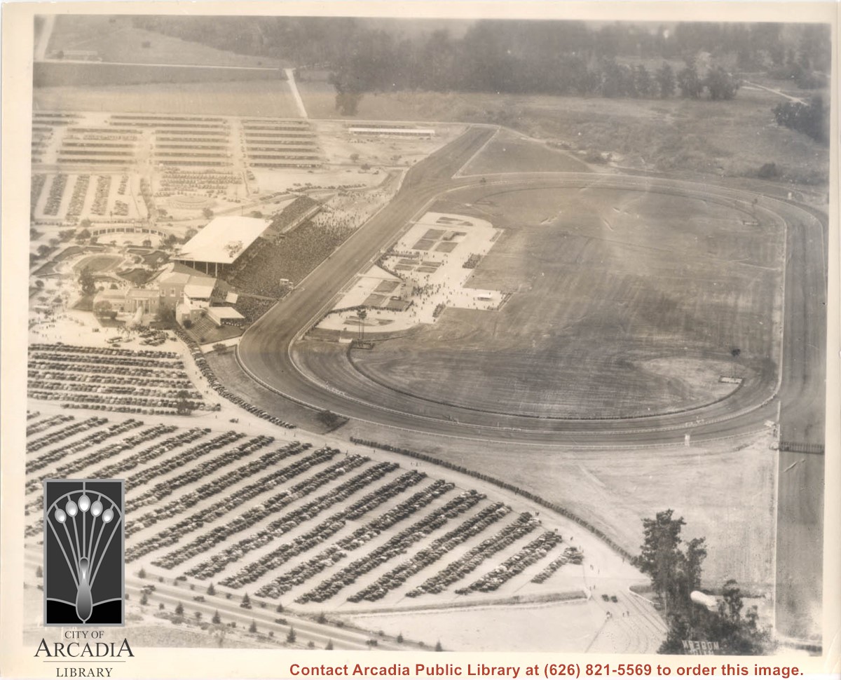
Aerial view taken from about over what became Campus Drive and Arcadia High School, and looking toward (NW) Pasadena and Sierra Madre at foot of San Gabriel Mountains. Photo shows Santa Anita Park Race Track possibly just a few years after opening.
Aerial view south on Colorado Street just over large turn to the west. The residential area known as Santa Anita Gardens shows along upper left section of photo. Note that the only commerical development along the north side of Colorado Street is the Westerner Motel just near intersection with Huntington Drive. Santa Fe Railroad tracks are seen in lower left corner of photo. Santa Anita Park Race Track is on right.
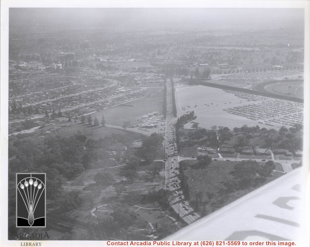
Aerial view looking west over Santa Anita Park. Photo was taken from about over intersection of Colorado Place and Huntington Drive. Note area that was to become Los Angeles County Arboretum across top of photo. Note an open Grandstand has been added to the west of original covered one. There is a small dirigible in lower right corner carrying a sign that seems to read:modern motel. Present Baldwin Avenue would run where road in this photo is seen parallel to top of photo.
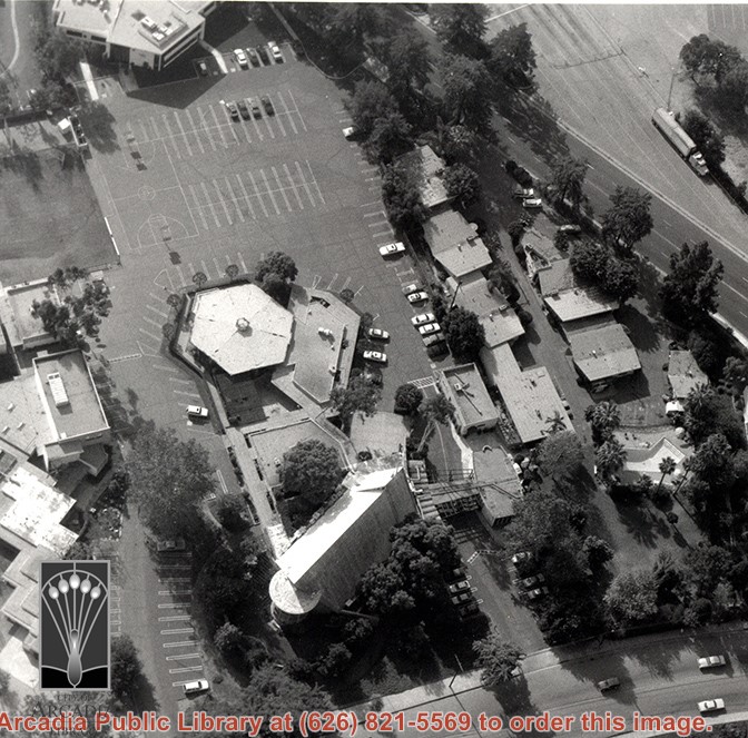
Aerial view, of the white A-Frame roof of Santa Anita Church (address is 226 West Colorado Boulevard, Arcadia, California). A six-sided, hexagon building near Santa Anita Church is the Fireside Room and Fellowship Hall, which is part of the Santa Anita Church. The church property goes all the way to Colorado Place (including "The Village Apartments," formerly the Frontier Motel, which the church purchased in 1972) and includes the parking lot and the building at the top of the photo, the Margaret Stevens Center. Any use of this image must be credited "Photograph by David Stevens. Copyright David Stevens."
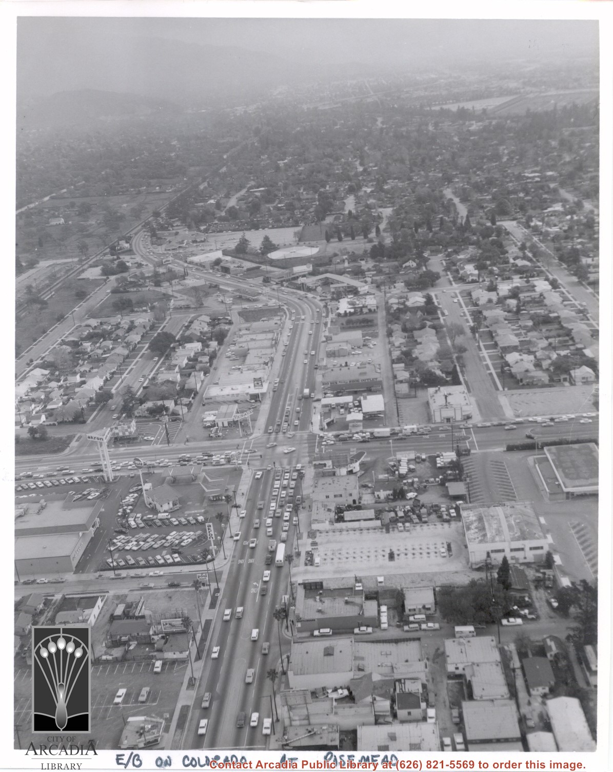
Aerial view looking east into Arcadia from near intersection of Rosemead Boulevard and Colorado Boulevard. Eaton's Santa Anita Hotel and Restaurant is still seen at far end of curve on south side of Colorado Boulevard and Michillinda Avenue (this is present site of Coco's Restaurant and Oak Tree Banquet Room, formerly Reuben's Restaurant, address 1150 W. Colorado Boulevard). The Santa Fe Railroad Tracks are seen just north of Colorado Boulevard. Large clear area in upper right portion of photo is Santa Anita Park Race Track.