Skip header and navigation

6 records – page 1 of 1.

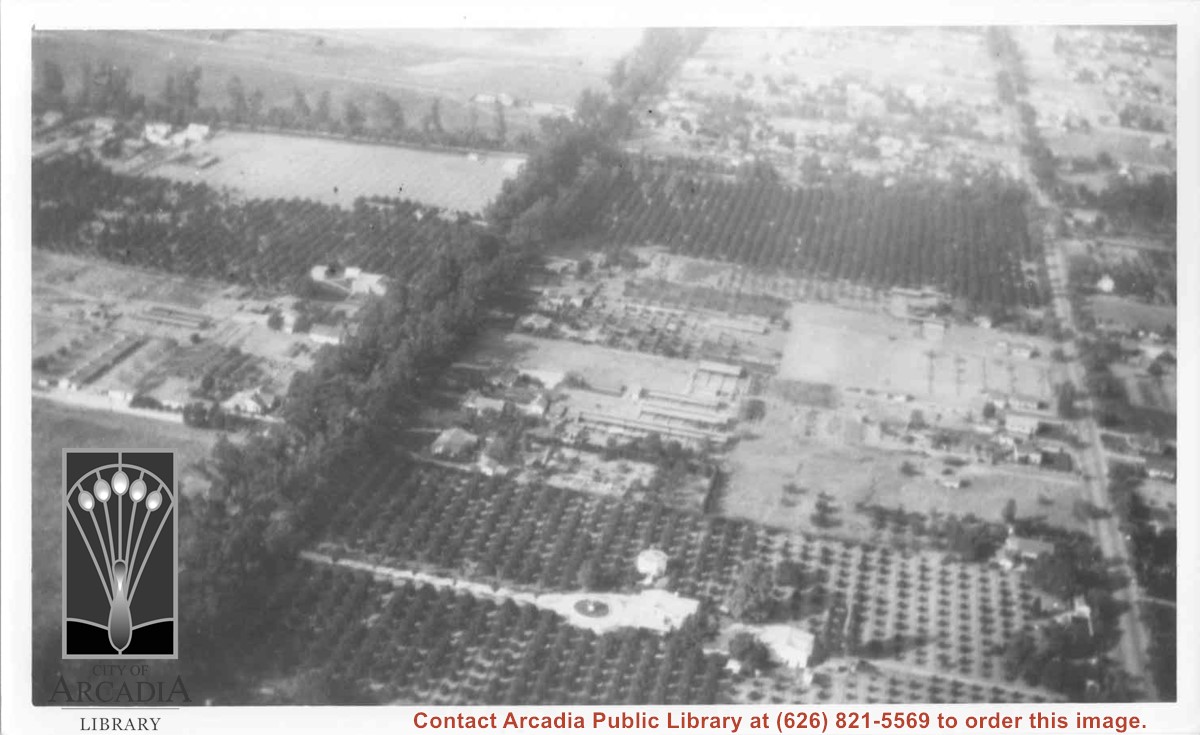
Aerial view north. Main tree-lined street is Santa Anita Avenue. Most of the orange grove in center of photo was owned by Jaspar Teague family. They had built a circular art gallery on their property at 1380 South Santa Anita Avenue. The large buildings north of Teague's and to the west of Santa Anita Avenue are chicken houses. Duarte Road is the east/west street across photo near top of photo.

https://arcadiahistory.andornot.com/en/permalink/photographs645
Date
November 1929

  1 image

Date
November 1929
Subjects
Aerial Photo Collection
Aerial views
Agriculture
Duarte Road
Orange groves
Poultry
Santa Anita Avenue
Teague, Jaspar
Physical Description
6x10 b&w
ID
641
Collection
Photographs
Images
Less detail

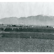
View north toward mountains from Mauch five acre ranch which was near corner of Palm Avenue and Holly Avenue. Note some young walnut trees have been set out and a chicken house has been built (left). There is snow on Mount Wilson. Street on right is Holly Avenue.

https://arcadiahistory.andornot.com/en/permalink/photographs1008
Date
1927

  1 image

Date
1927
Subjects
Agriculture
Holly Avenue
San Gabriel Mountains
Mauch, Aloyosius
Physical Description
6x10 b&w
ID
1001
Collection
Photographs
Images
Less detail

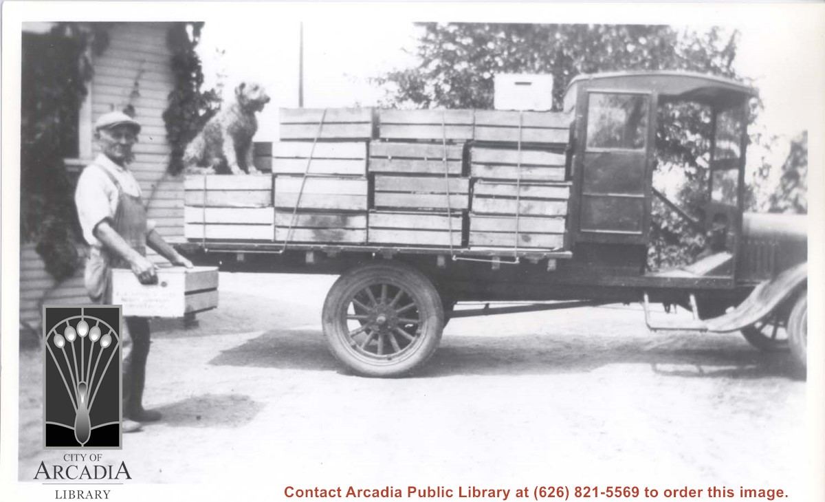
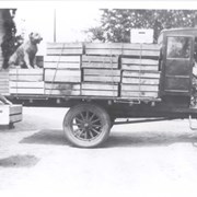
Mr. Aloyosius Mauch is seen loading blackberries packed in wooden crates onto flatbed truck. A dog sits on top of one crate. Mr. Mauch's sons helped run the five acre ranch which was at Palm Avenue and Holly Avenue. Information provided by son Henry (86 years old in 1980) and his wife.

https://arcadiahistory.andornot.com/en/permalink/photographs1001
Date
1926

  1 image

Date
1926
Subjects
Agriculture
Mauch, Aloyosius
Physical Description
6x10 b&w
ID
994
Collection
Photographs
Images
Less detail

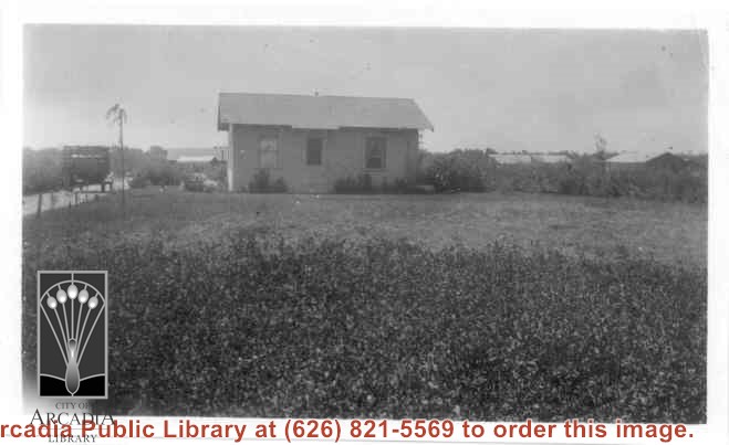
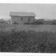
Home of Charles and Pearl Strong at 460 W. Duarte Road. View shows small clapboard house standing by itself. There is a high-sided trailer standing at left of house. What appears to be chicken houses show in the photo. Claimed to be first white leghorn chicken ranch in Arcadia.

https://arcadiahistory.andornot.com/en/permalink/photographs278
Date
1921

  1 image

Date
1921
Subjects
Agriculture
Houses
Poultry
Strong, Charles
Physical Description
4 3/8 x 2 5/8 b&w
ID
276
Collection
Photographs
Images
Less detail

Chicken ranch buildings belonging to Roy H. Pike. Shows neat hedges along drive leading to buildings.

https://arcadiahistory.andornot.com/en/permalink/photographs7
Date
1928-1930

  1 image

Date
1928-1930
Subjects
Agriculture
Arcadia(City)-History-1920-1929
Pike, Roy
Poultry
Physical Description
8x10 b&w
ID
7
Collection
Photographs
Images
Less detail

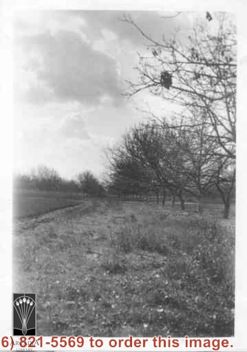
Church of Transfiguration is now located where this view shows. Path in photo is First Avenue of today. Shows what appears to be orchard and possible strawberry patch on left side of photo between First and Second Avenues.

https://arcadiahistory.andornot.com/en/permalink/photographs14
Date
c.1910-1915

  1 image

Date
c.1910-1915
Subjects
Agriculture
Church of the Transfiguration
Arcadia(City)-History-1903-1919
Physical Description
2x3 b&w vertical
ID
14
Collection
Photographs
Images
Less detail

6 records – page 1 of 1.