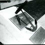
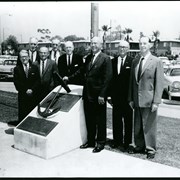
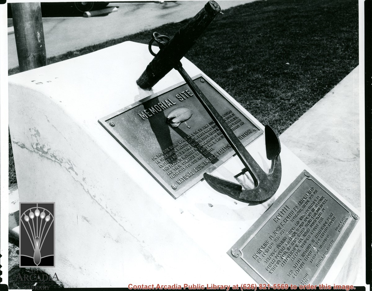
Photo of one plaque that was placed commemorating Balloon School and another plaque in honor of Lt. John Hoeppel, who was responsible for getting the land from U.S. government for Los Angeles County Park. See also photo #184.
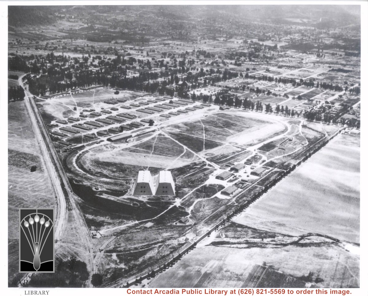
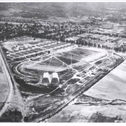
Aerial view of Ross Field looking east from a position of about Huntington Drive and present Holly Avenue. Two large hangars are at west point of triangular property. The wash cutting across foreground is the wash just to west of present high school.
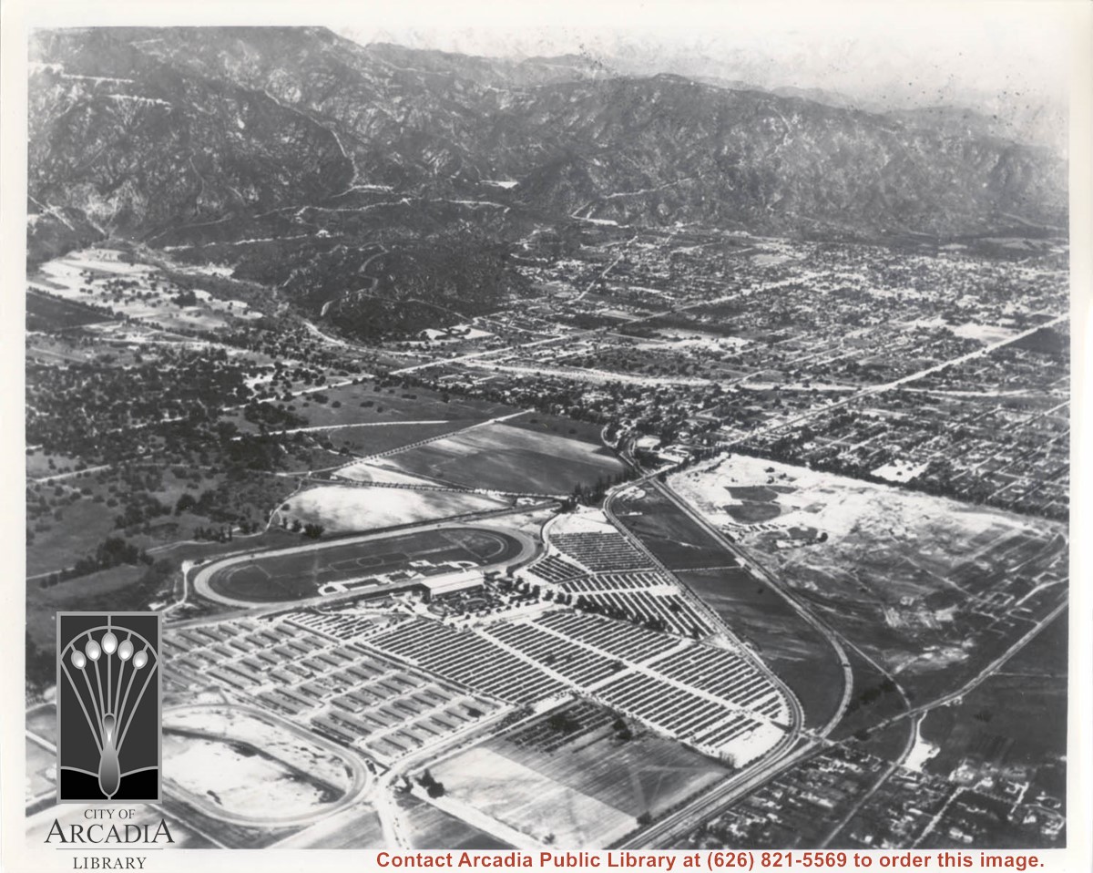
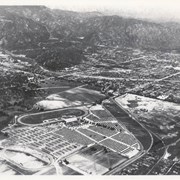
Aerial view looking northeast across Santa Anita Park toward mountains. Note training track called Anita Chiquita has been added (lower left corner), open grandstand has been added to west of covered stand. Note, too, that work has begun to change Balloon School site to Arcadia County Park. Santa Anita Avenue is tree-lined street running entire width of photo about middle of print.
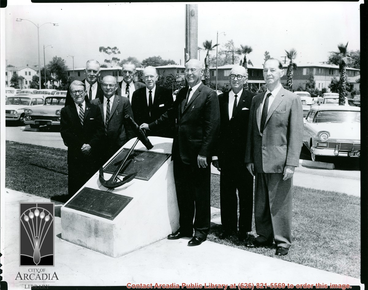
Photo of dignitaries at the dedication of plaque marking site of Ross Field. Man on extreme right is ex-Congressman John Hoeppel who was most responsible for securing land for Los Angeles County Park. Others in photo not identified.
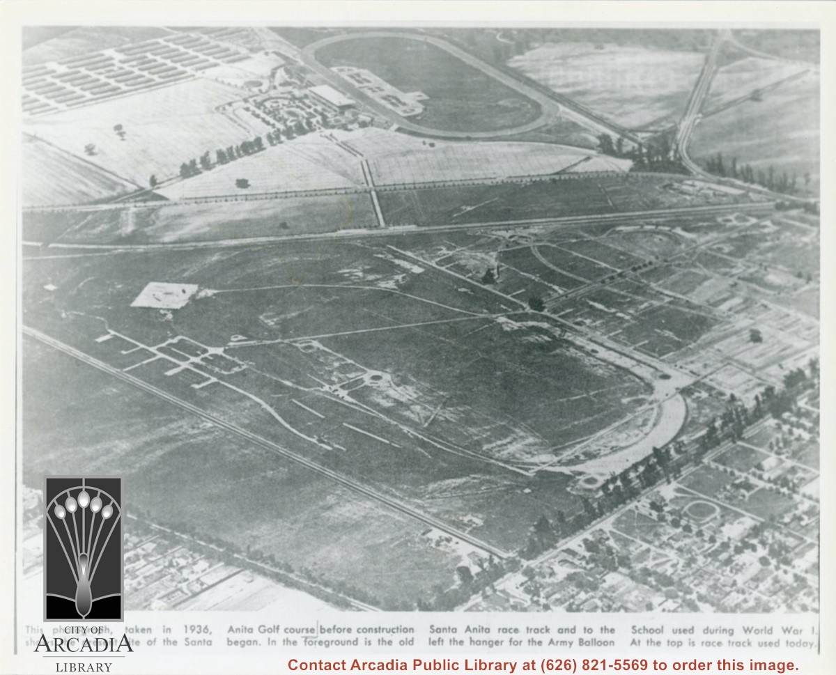
Photographically reproduced copy of an old newspaper photo taken in 1936 which is an aerial view looking north west over original race track built by Baldwin. In lower right corner can be seen Santa Anita Ave lined with Eucalyptus. On lower left, one can see present Campus Drive. Across top third of photo, one can see Huntington Drive. Note how small the trees are that line the street.
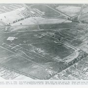
Aerial view taken looking southeast from position about over present Arboretum. Photo shows Santa Anita Park, probably in opening season. Present City Hall sits in area just beyond cars parked at east end of track. Part of oval of old Santa Anita track built by Elias J. "Lucky" Baldwin is seen in upper portion of photo, in area that is now Arcadia County Park. Duarte Road is seen crossing photo in upper right corner. Present Arcadia County Park area is in this photo, bordered on the north by Pacific Electric Railroad tracks. A train has just brought a group to the races and they are seen walking in center of photo. White square seen near right side, is slab left from hangars when U.S. Army Balloon School occupied this site, 1917-1927.