Skip header and navigation

7 records – page 1 of 1.

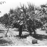
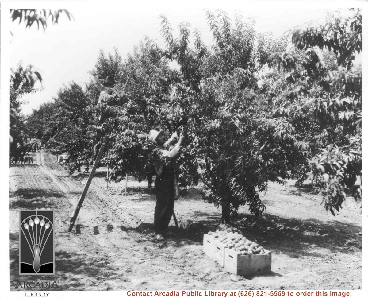
Cuccia Peach orchard, 60 acres from Lovell to Holly Avenue and Leroy to Norman. Shows one man on ladder picking in grove; one man standing picking; boxes of fruit.

https://arcadiahistory.andornot.com/en/permalink/photographs10
Date
c.1925

  1 image

Date
c.1925
Subjects
Cuccia, Peter
Agriculture
Arcadia(City)-History-1920-1929
Physical Description
8x10 b&w
ID
10
Collection
Photographs
Images
Less detail

Chicken ranch buildings belonging to Roy H. Pike. Shows neat hedges along drive leading to buildings.

https://arcadiahistory.andornot.com/en/permalink/photographs7
Date
1928-1930

  1 image

Date
1928-1930
Subjects
Agriculture
Arcadia(City)-History-1920-1929
Pike, Roy
Poultry
Physical Description
8x10 b&w
ID
7
Collection
Photographs
Images
Less detail

Closeup of shiny truck bearing name: Pike-Krenz Hatchery, Arcadia, Calif. Ranch was located at 641 West Lemon, Arcadia.

https://arcadiahistory.andornot.com/en/permalink/photographs9
Date
c.1928-1930

  1 image

Date
c.1928-1930
Subjects
Agriculture
Arcadia(City)-History-1920-1929
Pike, Roy
Poultry
Physical Description
8x10 b&w
ID
9
Collection
Photographs
Images
Less detail

View across Santa Anita Rancho lands toward San Gabriel Mountains, looking north, slightly to the west.

https://arcadiahistory.andornot.com/en/permalink/photographs16
Date
probably 1935

  1 image

Date
probably 1935
Subjects
San Gabriel Mountains
Agriculture
Arcadia(City)-History-1930-1939
Physical Description
one 3x5, one 8x10 b&w
ID
16
Collection
Photographs
Images
Less detail

Roy H. Pike on his chicken ranch at 641 West Lemon. Man with glasses and hat with white chickens.

https://arcadiahistory.andornot.com/en/permalink/photographs6
Date
1928-1930

  1 image

Date
1928-1930
Subjects
Agriculture
Arcadia(City)-History-1920-1929
Houses
Pike, Roy
Poultry
Physical Description
8x10 b&w
ID
6
Collection
Photographs
Images
Less detail

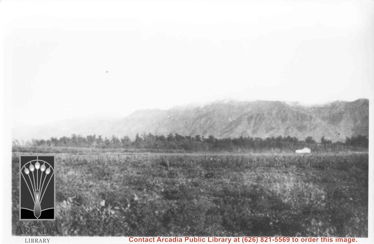
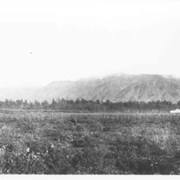
Spring 1935. Santa Anita Rancho field crops of many varieties were grown. View is toward the north. San Gabriel mountains completely across the photo. Chantry Flats Road visible at right side. White barn prominent in center of photo.

https://arcadiahistory.andornot.com/en/permalink/photographs15
Date
Spring 1935

  1 image

Date
Spring 1935
Subjects
Agriculture
Arcadia(City)-History-1930-1939
Rancho Santa Anita
San Gabriel Mountains
Physical Description
6x10 b&w 2 prints
ID
15
Collection
Photographs
Images
Less detail

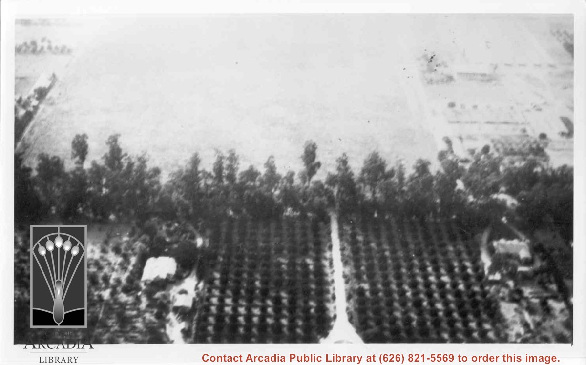
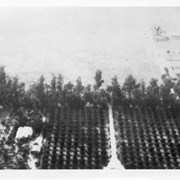
Aerial view west toward Santa Anita Ave. from above First Avenue, site of new grammar school. Long driveway heads to Jaspar N. Teague home in center of 10 acre orange grove. (Address in City Directory for this name is 1380 S. Santa Anita.) House to left and south was that of Charles W. Stewart in another 10 acre plot. Both ranches are now occupied by First Avenue Junior High School.

https://arcadiahistory.andornot.com/en/permalink/photographs12
Date
November 1929

  1 image

Date
November 1929
Subjects
Houses
Teague, Jaspar
Stewart, Charles W.
Agriculture
First Avenue Junior High School
Arcadia(City)-History-1920-1929
Physical Description
6x10 b&w
ID
12
Collection
Photographs
Images
Less detail

7 records – page 1 of 1.