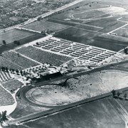
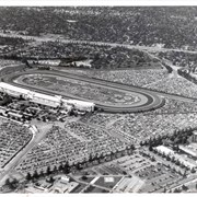
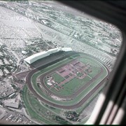
Aerial photograph looking toward Santa Anita Park race track, showing ...
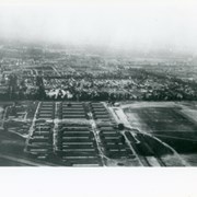
Looking east over barracks and main building at Ross Field. ...
Aerial view taken looking southeast from position about over present ...
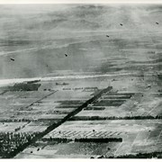
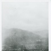
Aerial view south of Balloon School and surrounding part of ...
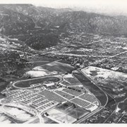
Aerial view looking northeast across Santa Anita Park toward mountains. ...
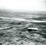
View east shows two balloons aloft over Arcadia and San ...
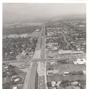
Aerial view east on Huntington Drive toward Arcadia from a ...
Aerial view toward north from a position south of Huntington ...
Aerial view looking west across Santa Anita Park from a ...
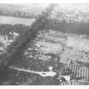
Dark, tree-lined street completely bisecting photo from west to east ...
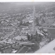
Aerial view north. Main tree-lined street is Santa Anita Avenue. ...
Aerial view taken over Arcadia so that it shows a ...
Aerial view looking north across Santa Anita Park from a ...
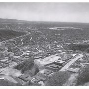
Aerial view south from Chantry Flats Road over the still-developing ...
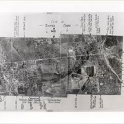
Aerial view of Arcadia. Photo is dated in lower left ...
View across Arcadia taken from Chantry Flats Road at night. ...
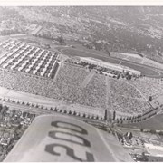
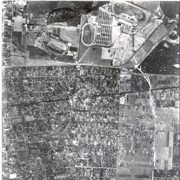
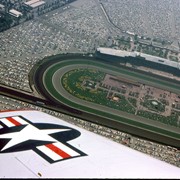
Aerial view, of Santa Anita Park Race Track, address is ...
Aerial view north up Santa Anita Avenue. Note Chantry Flats ...
Aerial view looking east along Huntington Drive taken over the ...