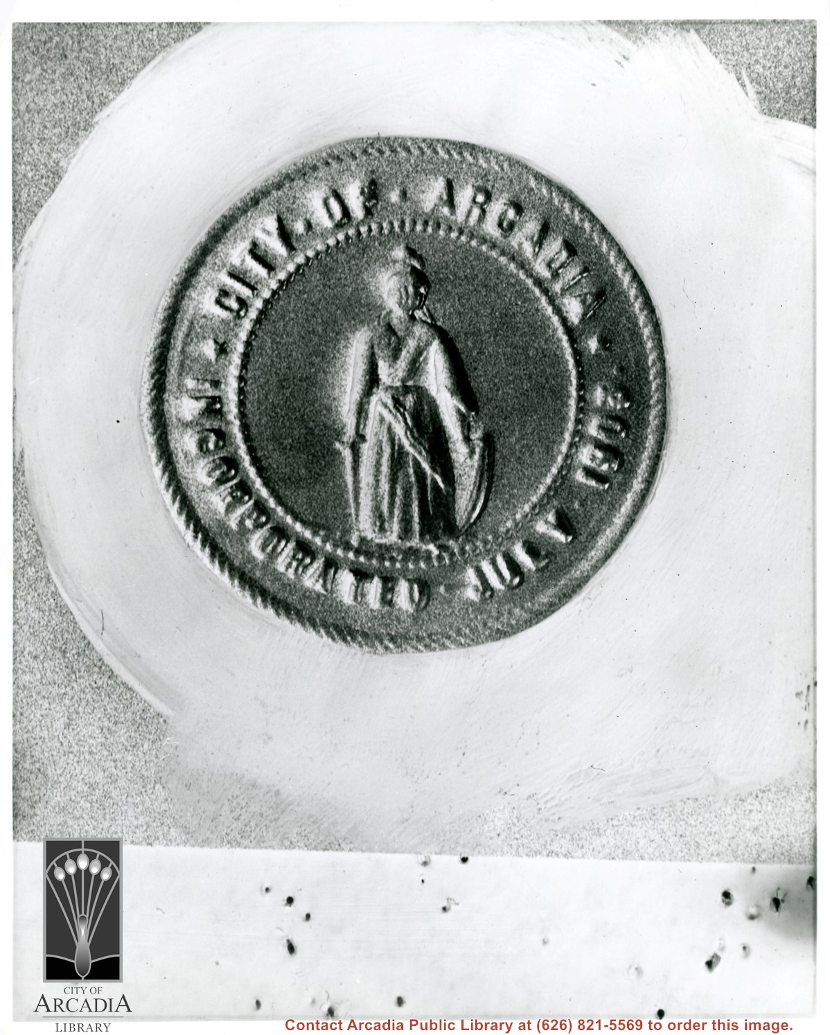
Photo of Arcadia City Seal showing peacock and Queen Anne Cottage, with mountains in distance. Rows of citrus trees reflect predominant livelihood of earlier residents.
https://arcadiahistory.andornot.com/en/permalink/photographs580
- Date
- ? (currently in use, 1993)
1 image
- Date
- ? (currently in use, 1993)
- Subjects
- Arcadia City Seal
- Physical Description
- 8x10 b&w
- ID
- 576
- Collection
- Photographs
Images
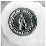
Portion of earliest seal of the City of Arcadia showing only one figure with sword in one hand and shield in another. It reads: CITY OF ARCADIA. INCORPORATED JULY 1903.
https://arcadiahistory.andornot.com/en/permalink/photographs578
- Date
- 1903
1 image
- Date
- 1903
- Subjects
- Arcadia City Seal
- Physical Description
- 8x10 b&w
- ID
- 574
- Collection
- Photographs
Images
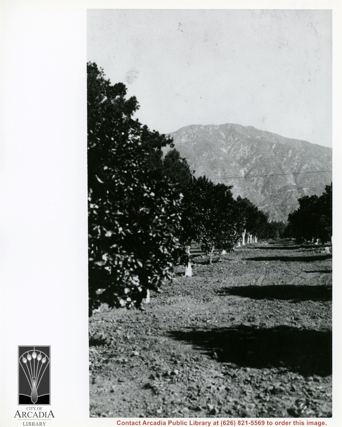
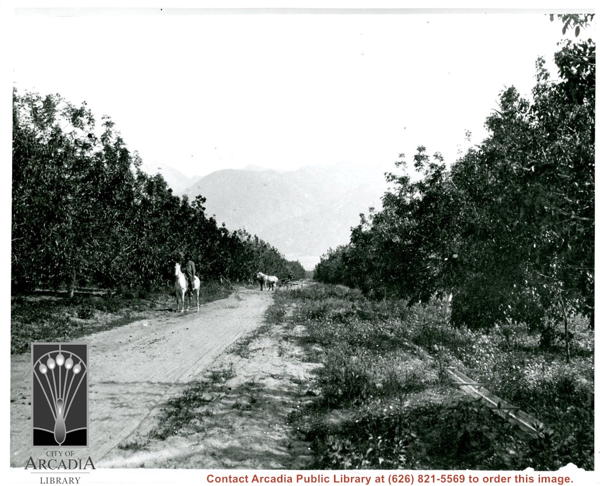
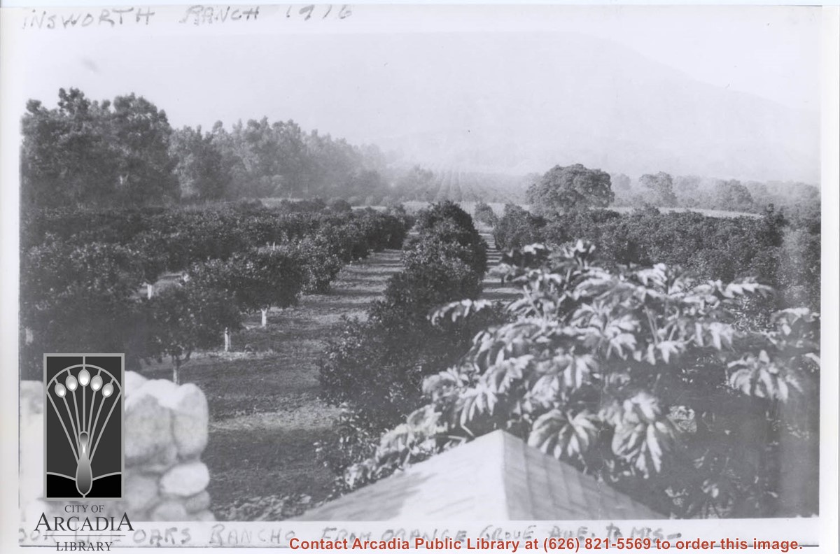
Harry Ainsworth Ranch, upper grove looking north to mountains. Present day Highland Oaks School would be located about where trees block the end of the row of citrus trees.
https://arcadiahistory.andornot.com/en/permalink/photographs1081
- Date
- c.1916
1 image
- Date
- c.1916
- Subjects
- Agriculture
- Ainsworth Ranch
- Physical Description
- 8x10 b&w
- ID
- 1072
- Collection
- Photographs
Images
Looking SW from mountains north of Arcadia. Major tree-lined street running from mountains south is Santa Anita Avenue. Southernmost tree-lined street cutting across entire middle of photo is Duarte Road. Barracks at the Balloon School can be seen just below Huntington Drive. Notice that Huntington Drive stops just west of the Balloon School, at the Baldwin Ranch. Much of Foothill area was planted to citrus.
https://arcadiahistory.andornot.com/en/permalink/photographs1114
- Date
- c.1927
1 image
- Date
- c.1927
- Subjects
- Aerial views
- Arcadia(City)-History-1920-1929
- Balloon School
- Santa Anita Avenue
- Santa Anita Highlands
- Physical Description
- 10 x 14 b&w
- ID
- 1105
- Collection
- Photographs
Images


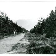
View north up Santa Anita Avenue with mountains in background. This photo was taken about where present Orange Grove Avenue intersects with Santa Anita Avenue. Note orange groves all along west side of Santa Anita as far as the mountains. Street is not paved.
https://arcadiahistory.andornot.com/en/permalink/photographs584
- Date
- 1916
1 image
- Date
- 1916
- Subjects
- Santa Anita Avenue
- Agriculture
- Physical Description
- 8x11 b&w
- ID
- 580
- Collection
- Photographs
Images
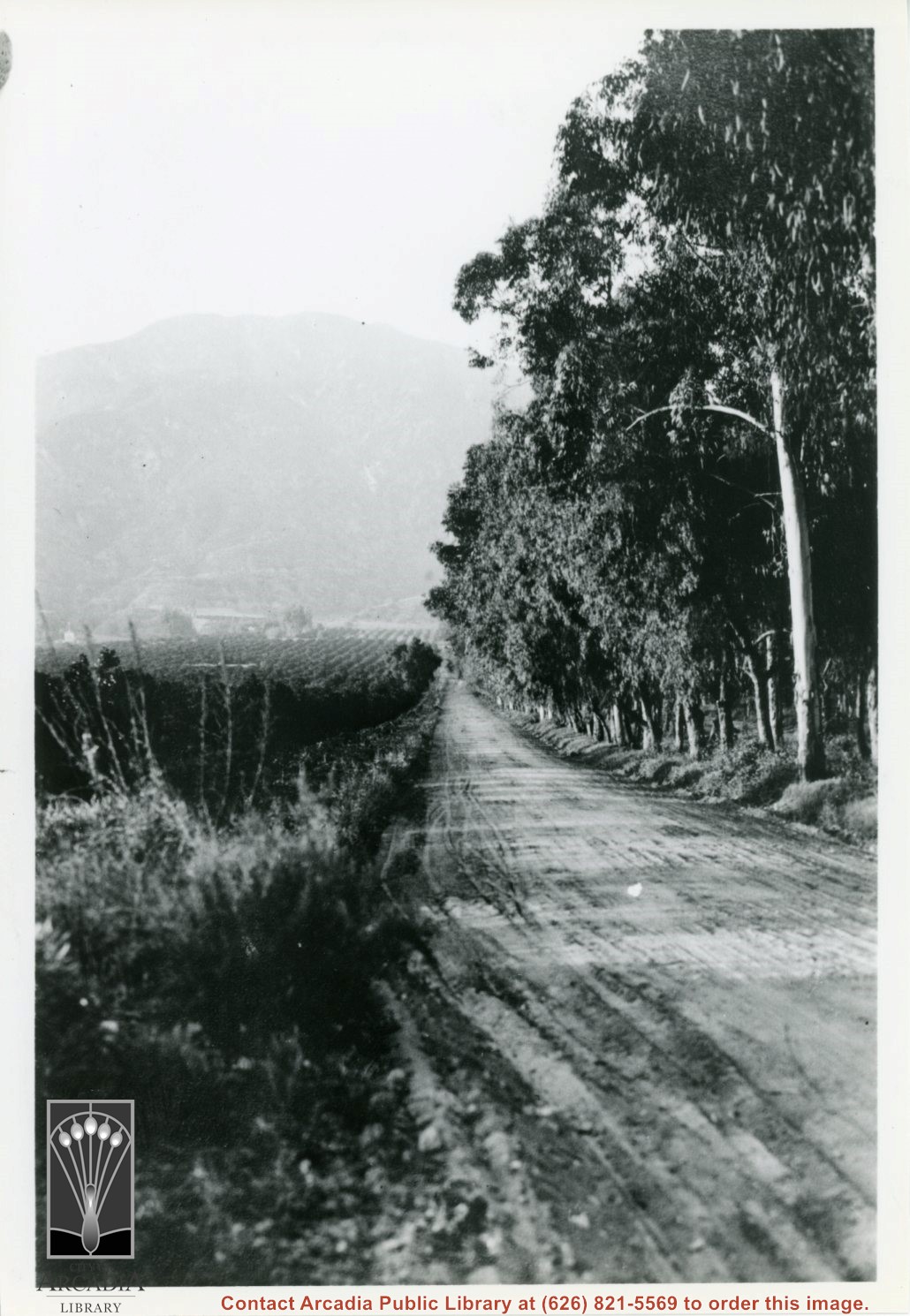
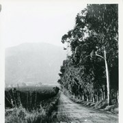
Photo of part of Roy Pike's chicken ranch at 641 W. Lemon. Foreground has many chicken coops with fencing showing on right side of photo.
https://arcadiahistory.andornot.com/en/permalink/photographs230
- Date
- c.1928-1930
1 image
- Date
- c.1928-1930
- Subjects
- Agriculture
- Pike, Roy
- Poultry
- Physical Description
- 8x10 b&w
- ID
- 228
- Collection
- Photographs
Images
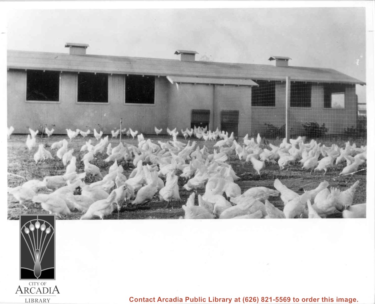

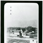
View north toward San Gabriel Mountains showing Arcadia Santa Fe Railroad Station. This is one of playing cards made by E.J."Lucky" Baldwin, each showing a different scene of the Ranch or Arcadia area. This is the three of hearts. This photo belongs to the Huntington Library. It is shown here for research only.
https://arcadiahistory.andornot.com/en/permalink/photographs539
- Date
- c.1890
1 image
- Date
- c.1890
- Subjects
- Railroads-Arcadia Railroad Station
- Railroads-Arcadia Santa Fe Station
- Baldwin, Elias J. "Lucky"-Playing cards
- Physical Description
- 8x10 b&w
- ID
- 535
- Collection
- Photographs
Images
Arcadia City Council has decided not to change the city seal, as the city's 100th birthday approaches, in two years.
https://arcadiahistory.andornot.com/en/permalink/newspaper33308
- Newspaper
- Arcadia Weekly,
- Date
- August 2, 2001
- Pages
- p. 8
- Subjects
- Arcadia centennial
- Arcadia city seal
- Item ID
- 33504AN
- Collection
- Newspaper Index
- Contents
- 1. Subdivision ordinance No. 860 of the City of Arcadia. Page from ordinance with city seal adopted January 20, 1953. 2. Arcadia's city symbol now official. Newspost. April 5, 1971. 3. Arcadia's city crest. Postcard with Chamber of Commerce seal. April 1971. (2 copies) 4. A new official se…
- Contents
- 1. Subdivision ordinance No. 860 of the City of Arcadia. Page from ordinance with city seal adopted January 20, 1953.
- 2. Arcadia's city symbol now official. Newspost. April 5, 1971.
- 3. Arcadia's city crest. Postcard with Chamber of Commerce seal. April 1971. (2 copies)
- 4. A new official seal has been adopted by the Arcadia Chamber of Commerce. News photo, n.d. circa 1971.
- 5. Arcadia seal. 1971.
- 6. Ordinance No. 4 providing for a common seal. E.J. Baldwin 1903.
- 7. Ordinance No. 49 adopting a common seal. 1915.
- 8. Ordinance No. 324 adopting a common seal. 1936.
- 9. Ordinance No. 1429 establishing the design of the seal. 1971.
- 10. Arcadia City Seal 1936-1971.
- 11. Arcadia Tribune article regarding emblem to be adopted by the City August 2, 1935.
- 12. Copy of first seal adopted February 1915. (Approx. 9x12). Gold medallion of first city seal
- 13. Copy of first seal adopted February 1915, raised impression. (Given by Carla, August 1978)
- 14. Copy of first seal adopted February 1915. (approx. 5x5)
- 15. History and the city seals. Arcadia Tribune July 27, 1978.
- 16. Emblem accepted August 6, 1935 (work of P.K. Wood). news clip, n.d.
- 17. Arcadia City Seal Updated. Changes to the City seal adopted on September 7, 2004, Ordinance Number 2200. Posted September 8, 2004 on the City of Arcadia Website.
- 18. Memo re: Ordinance No. 2200 amending section 2710 of the Arcadia municipal code to establish the design of the seal of the city of Arcadia. From William R. Kelly.
- 19. Large color reproduction of Arcadia City Seal 1936-1971 with memorandum addressed to Dick Miller, Librarian. Sticker is 7.5 inches in diameter.
- 20. City Seal in color. Sticker is 8.5 inches in diameter.
- 21. Gold medallion of City Seal (Community of Homes, Incorporated 1903).
- see also ARCHIVES - ARCADIA-SEAL
- Subjects
- Seal
- Item ID
- 230AF
- Collection
- Subject Files
Diamond Jubilee article on the history of the City seal. Includes pictures of the seal - the first, second (1936) and latest (1971).
https://arcadiahistory.andornot.com/en/permalink/newspaper3228
- Newspaper
- Arcadia Tribune
- Date
- July 27, 1978
- Pages
- p. A-1
- Subjects
- Seal
- Item ID
- 3135AN
- Collection
- Newspaper Index
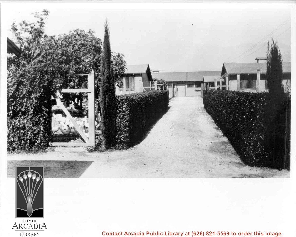
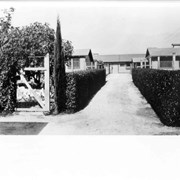
Chicken ranch buildings belonging to Roy H. Pike. Shows neat hedges along drive leading to buildings.
https://arcadiahistory.andornot.com/en/permalink/photographs7
- Date
- 1928-1930
1 image
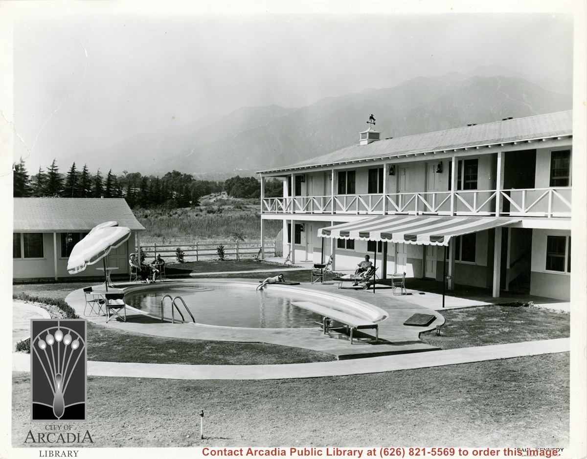
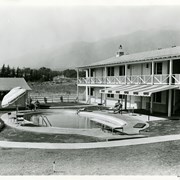
Portion of the exterior of the guest accommodations at the Westerner Motel. Photo shows swimming pool, with people lounging about. The Y at intersection of Colorado Place and Colorado is visible as well as the San Gabriel Mountains.
https://arcadiahistory.andornot.com/en/permalink/photographs425
- Date
- c.1951
1 image
- Date
- c.1951
- Subjects
- Westerner Motel
- San Gabriel Mountains
- Physical Description
- 8x10 b&w
- ID
- 423
- Collection
- Photographs
Images
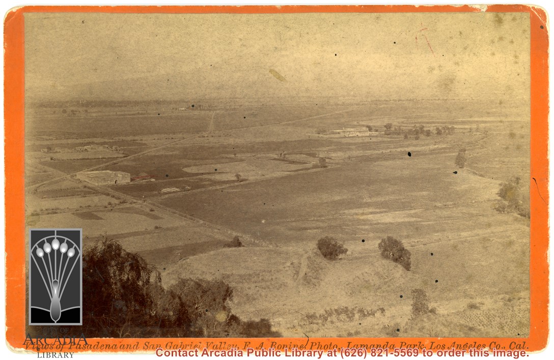
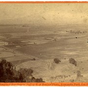
View west across San Gabriel Valley toward Pasadena from unknown vantage point. Photo shows two roads across valley with very few ranches in evidence.
https://arcadiahistory.andornot.com/en/permalink/photographs614
- Date
- c.1890
1 image
- Date
- c.1890
- Subjects
- San Gabriel Valley
- Physical Description
- 4 1/2 x 7 rigid postcard
- ID
- 610
- Collection
- Photographs
Images
Baldwin Ranch groves looking north toward mountains. Also in photo is wooden irrigating trough on right, and a two-horse team hitched to light wagon, also a single horse with rider. It appears that present-day Henniger Flats is high flat mountain just above and to the left of the road. Also Hastings Ranch area would be low foothills. This photo belongs to the Huntington Library. It is shown here for research only.
https://arcadiahistory.andornot.com/en/permalink/photographs146
- Date
- c.1890's
1 image
- Date
- c.1890's
- Subjects
- Rancho Santa Anita
- Baldwin Ranch
- Physical Description
- 8x10 b&w
- ID
- 145
- Collection
- Photographs
Images
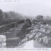
View north toward mountains and Chantry Flats Road. From vicinity just east of Santa Anita, where present Orange Grove intersects, showing orange groves. An open field apparently planted to grain and having a large oak tree, would be present site of Highland Oaks School. Eucalyptus trees lining Santa Anita are on left in photo, this property belonged to Harry and Hattie Ainsworth.
https://arcadiahistory.andornot.com/en/permalink/photographs368
- Date
- 1916
1 image
Area City seals are described.
https://arcadiahistory.andornot.com/en/permalink/newspaper20451
- Newspaper
- Pasadena Star News
- Date
- March 25, 2001
- Pages
- p. A1 w/photo
- Subjects
- Seal
- Item ID
- 20683AN
- Collection
- Newspaper Index
Unidentified park, showing baseball field and basketball hoop. San Gabriel Mountains in background.
https://arcadiahistory.andornot.com/en/permalink/photographs2055
- Date
- c. June 1989
1 image
- Date
- c. June 1989
- Subjects
- Recreation Department Collection
- Parks
- Physical Description
- 4 x 6 color
- ID
- 2034
- Collection
- Photographs
Images

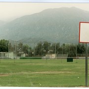
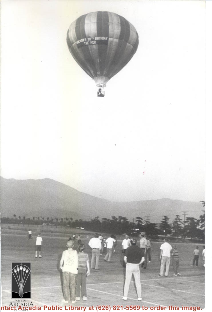
Photo showing hot-air balloon aloft over Santa Anita Race Track parking lot. View is toward east and shows mountains in background. Occasion was the 70th birthday of Arcadia. Approximately 18 people are shown viewing it.
https://arcadiahistory.andornot.com/en/permalink/photographs379
- Date
- August 18, 1973
1 image
2020 ELECTIONS - Outcomes for boards of college districts - Open seats draw range of challengers to lead local higher education. Citrus Community College In Area 2, Laura Bollinger had an early lead over Joseph Hamer Salas for the Citrus Community College District race. The Citrus Community College District encompasses Azusa, Bradbury, Claremont, Duarte, Glendora, Monrovia, and portions of San Dimas, La Verne, Pomona, Arcadia, Covina and Irwindale. The district enrolls more than 20,000 students.
https://arcadiahistory.andornot.com/en/permalink/newspaper35828
- Newspaper
- Pasadena Star News
- Date
- November 4, 2020
- Pages
- p. A5
- Subjects
- Citrus Community College
- Elections-2020
- Collection
- Newspaper Index
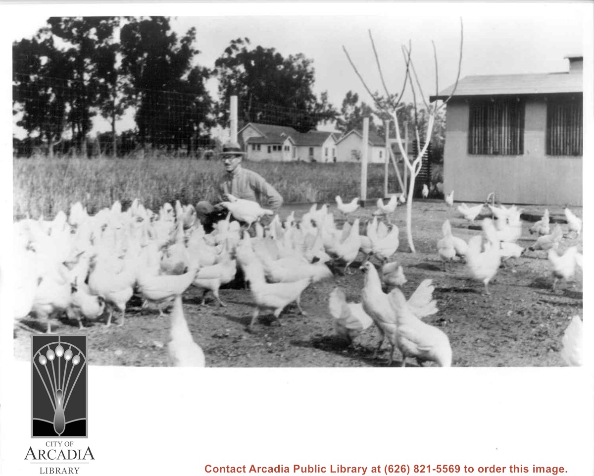
Roy H. Pike on his chicken ranch at 641 West Lemon. Man with glasses and hat with white chickens.
https://arcadiahistory.andornot.com/en/permalink/photographs6
- Date
- 1928-1930
1 image