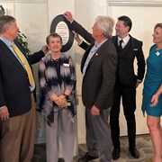
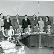
Arcadia City Council Members at the unveiling of plaque designating Arcadia Woman's Club Clubhouse the City of Arcadia Historic Landmark No. 1, at 324 S. First Avenue, Arcadia, CA. Left to right: Council Member Sho Tay, Council Member Michael Danielson, Cheryl Alberg, Mayor Tom Beck, Council Member Paul P. Cheng, Council Member April Verlato, and Marilyn Daleo. This is the first City of Arcadia Historical Landmark.
https://arcadiahistory.andornot.com/en/permalink/photographs2408
- Date
- October 5, 2022
1 image
- Date
- October 5, 2022
- Subjects
- Alberg, Cheryl
- Arcadia City Council-2020-2029
- Arcadia Woman's Club
- Beck, Tom
- Cheng, Paul P.
- City of Arcadia Historic Landmarks
- Daleo, Marilyn
- Danielson, Michael
- Tay, Sho
- Verlato, April
- Physical Description
- digital, see i:images
- ID
- 2269
- Collection
- Photographs
Images

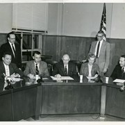
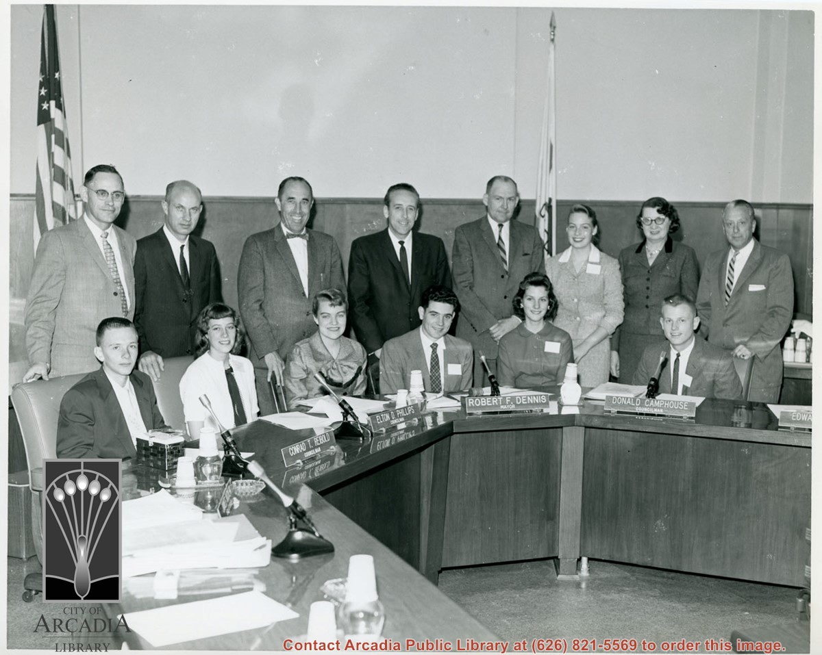
City Council members standing behind unidentified seated youth in what appears to be a "Student Government" day. Council name plates read: Conrad T. Reibold, Elton D. Phillips, Robert F. Dennis and Donald Camphouse. Not all name plates are visible. Photo appears to have been taken in Council chambers.
https://arcadiahistory.andornot.com/en/permalink/photographs1457
- Date
- c.1957
1 image
- Date
- c.1957
- Subjects
- City Council, 1950-1959
- Physical Description
- 8x10 b&w
- ID
- 1441
- Collection
- Photographs
Images
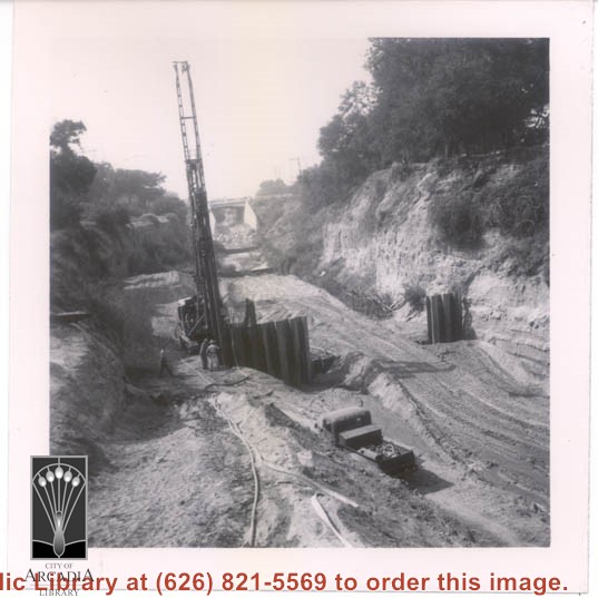
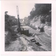
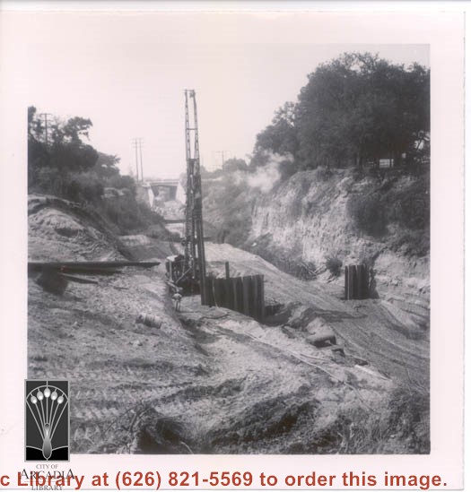
What appears to be a pile-driver in wash that apparently runs through Santa Anita Oaks during building of concrete channel.
https://arcadiahistory.andornot.com/en/permalink/photographs382
- Date
- c.1940's?
1 image
- Date
- c.1940's?
- Subjects
- Flood control
- Physical Description
- 3x3 b&w
- ID
- 380
- Collection
- Photographs
Images
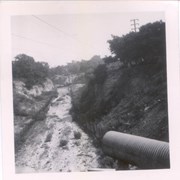
Stream channel before flood control work was undertaken to build concrete channel. It appears that this is channel that runs through Santa Anita Oaks.
https://arcadiahistory.andornot.com/en/permalink/photographs383
- Date
- early 1940's
1 image
- Date
- early 1940's
- Subjects
- Flood control
- Physical Description
- 3x3 b&w
- ID
- 381
- Collection
- Photographs
Images
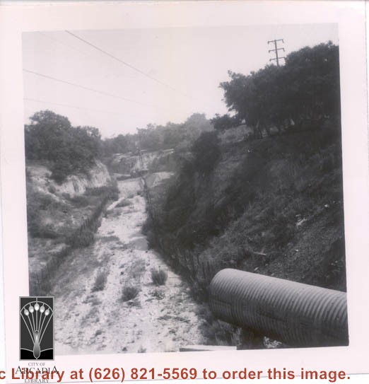
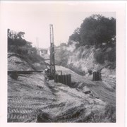
View (apparently toward Foothill Boulevard) south down wash where pile-driver is at work prior to construction of concrete channel.
https://arcadiahistory.andornot.com/en/permalink/photographs384
- Date
- probably early 1940's
1 image
- Date
- probably early 1940's
- Subjects
- Flood control
- Physical Description
- 3x3 b&w
- ID
- 382
- Collection
- Photographs
Images
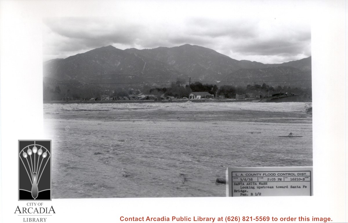
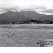
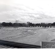
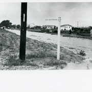
Looking NE up flooded Santa Anita Wash following heavy rains of early March 1938. Caption on photo reads: Looking upstream toward Santa Fe Bridge. San Gabriel Mountains in background. Where cars are parked would be east side of wash.
https://arcadiahistory.andornot.com/en/permalink/photographs811
- Date
- March 6, 1938
1 image
- Date
- March 6, 1938
- Subjects
- Flood control
- Physical Description
- 5x7 b&w
- ID
- 805
- Collection
- Photographs
Images
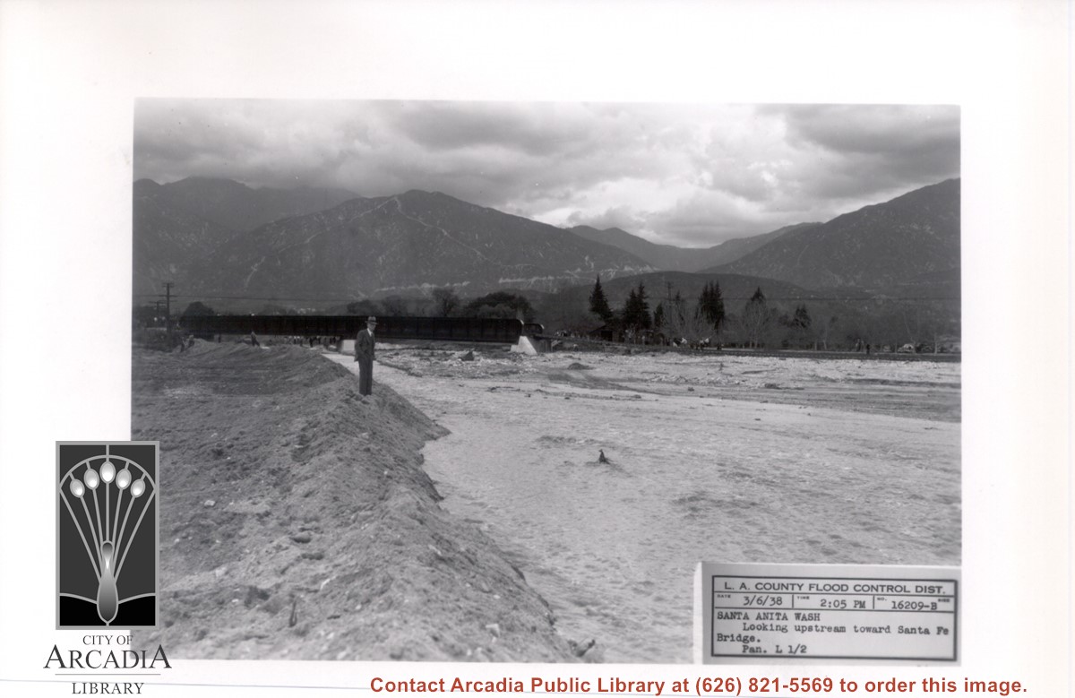
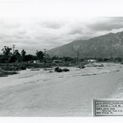
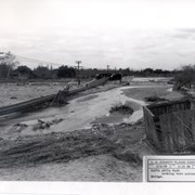
Looking directly north up flooded Santa Anita Wash. Santa Fe Railroad Bridge can be seen upstream. There is a man in a suit and hat standing at west edge of wash. This was following heavy rains of early March 1938.
https://arcadiahistory.andornot.com/en/permalink/photographs812
- Date
- March 6, 1938
1 image
- Date
- March 6, 1938
- Subjects
- Flood control
- Physical Description
- 5x7 b&w
- ID
- 806
- Collection
- Photographs
Images
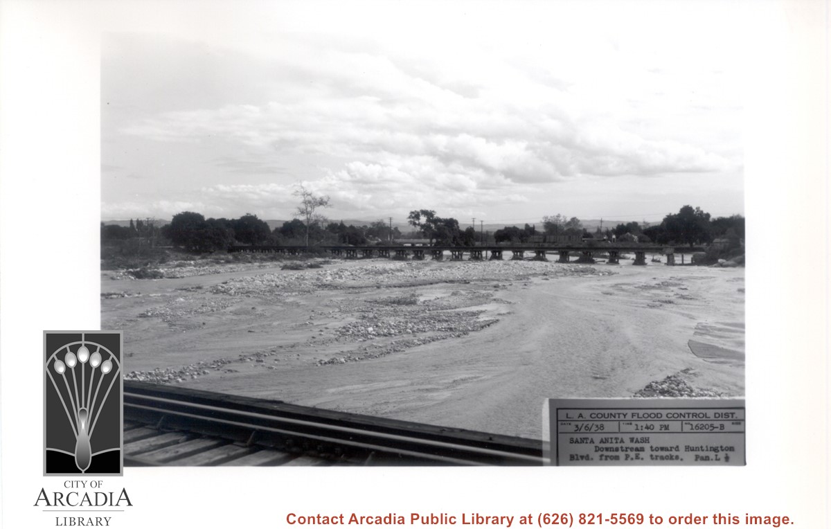
Looking south down stream of Santa Anita Wash. (Puente Hills can be seen in distance.) Caption of photo says picture was taken from PE Bridge and looking toward Huntington Drive Bridge.
https://arcadiahistory.andornot.com/en/permalink/photographs813
- Date
- March 6, 1938
1 image
- Date
- March 6, 1938
- Subjects
- Flood control
- Physical Description
- 5x7 b&w
- ID
- 807
- Collection
- Photographs
Images
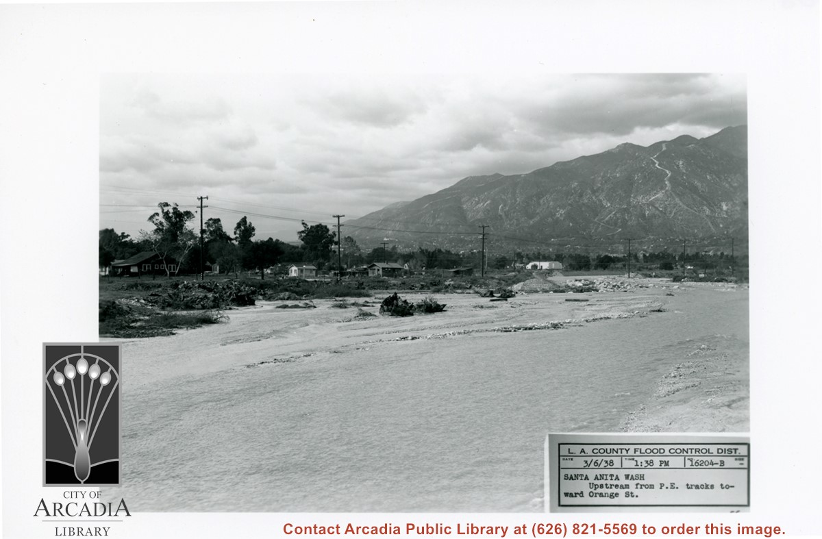
View NW up Santa Anita Wash toward San Gabriel Mountains. Caption says this was taken from Pacific Electric Railroad tracks toward Orange Street (this is present day Colorado Street).
https://arcadiahistory.andornot.com/en/permalink/photographs814
- Date
- March 6, 1938
1 image
- Date
- March 6, 1938
- Subjects
- Flood control
- Physical Description
- 5x7 b&w
- ID
- 808
- Collection
- Photographs
Images
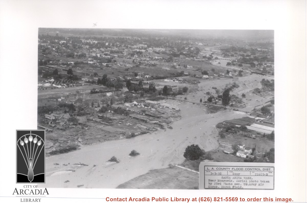
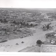
View NW up flooded Santa Anita Wash from above East bank below Duarte Road, probably the street seen crossing photo from right to left about half way down. Nest crossing north with dark bridge, is Santa Fe Railroad tracks; next we believe to be for a pipeline; last clearly visible crossing is for Pacific Electric Railroad tracks. Photo was taken following extreme flooding in 1938.
https://arcadiahistory.andornot.com/en/permalink/photographs816
- Date
- March 3, 1938
1 image
- Date
- March 3, 1938
- Subjects
- Flood control
- Physical Description
- 5x7 b&w
- ID
- 810
- Collection
- Photographs
Images
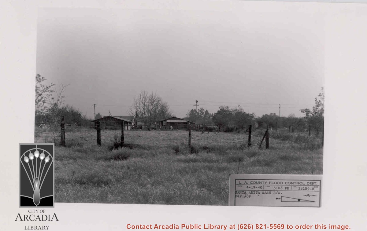
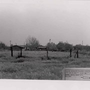
View across dry grass field toward fenced area with two cows grazing. A house with some outbuildings appears in center background. Flood control label indicates it is along Santa Anita Wash.
https://arcadiahistory.andornot.com/en/permalink/photographs817
- Date
- April 19, 1940
1 image
- Date
- April 19, 1940
- Subjects
- Flood control
- Physical Description
- 5x7 b&w
- ID
- 811
- Collection
- Photographs
Images
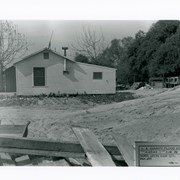
Clapboard house shown at the very edge of excavation work for flood control channel being constructed. There are rabbit hutches in area behind house. Exact location in Arcadia not known.
https://arcadiahistory.andornot.com/en/permalink/photographs820
- Date
- April 19, 1940
1 image
- Date
- April 19, 1940
- Subjects
- Flood control
- Physical Description
- 5x7 b&w
- ID
- 814
- Collection
- Photographs
Images

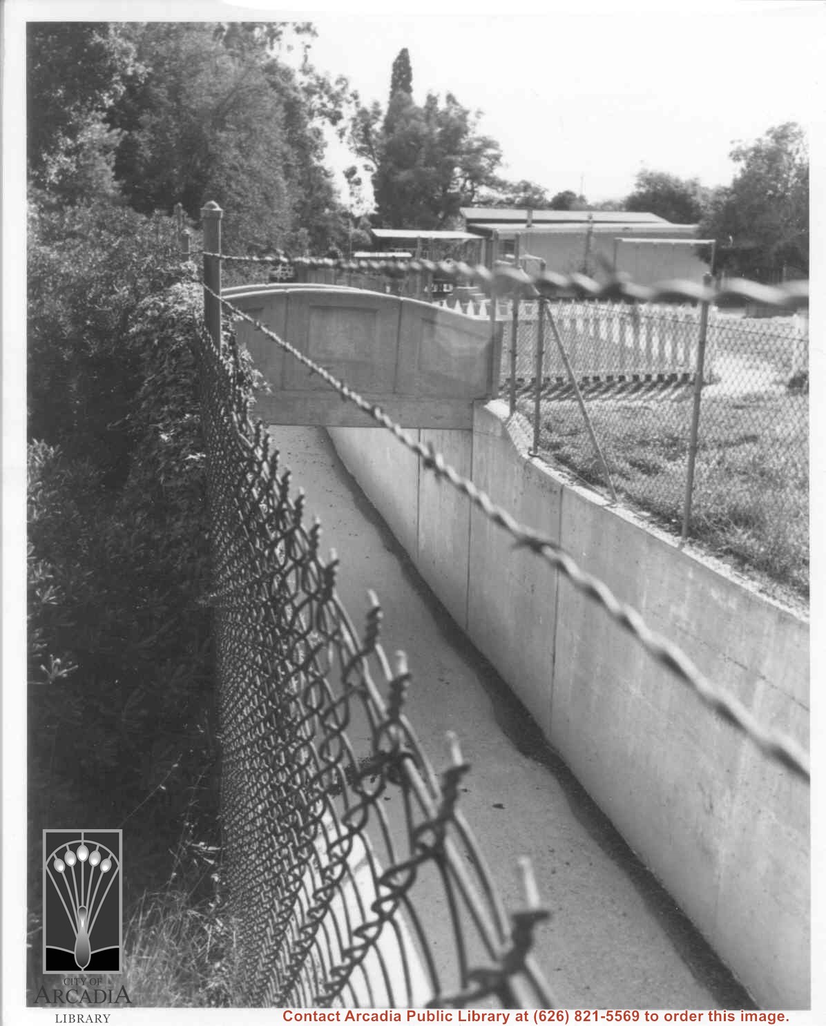
View across storm drain which runs north and south across property at Anoakia, west of mansion and swimming pool. Building on right of picture is school.
https://arcadiahistory.andornot.com/en/permalink/photographs60
- Date
- November 1976, photo by David McAdam
1 image
- Date
- November 1976, photo by David McAdam
- Subjects
- Anoakia
- Flood control
- Physical Description
- 8x10 b&w
- ID
- 60
- Collection
- Photographs
Images
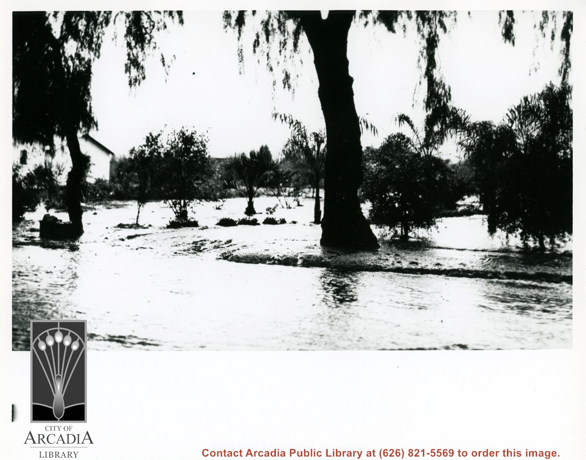
View of heavily flooded street, probably Duarte Road. There are some orchard trees also being flooded. A white house is shown on left side of photo.
https://arcadiahistory.andornot.com/en/permalink/photographs598
- Date
- c. mid-1930's
1 image
- Date
- c. mid-1930's
- Subjects
- Agriculture
- Duarte Road
- Flood control
- Physical Description
- 8x10 b&w
- ID
- 594
- Collection
- Photographs
Images
View of intersection of Golden West and possibly Arcadia Avenue during heavy flooding. There are four people walking near right side of photo. There are four homes on right side of flooded street. Two cars are coming toward intersection.
https://arcadiahistory.andornot.com/en/permalink/photographs599
- Date
- c. mid-1930's
1 image
- Date
- c. mid-1930's
- Subjects
- Golden West Avenue
- Flood control
- Physical Description
- 8x10 b&w
- ID
- 595
- Collection
- Photographs
Images

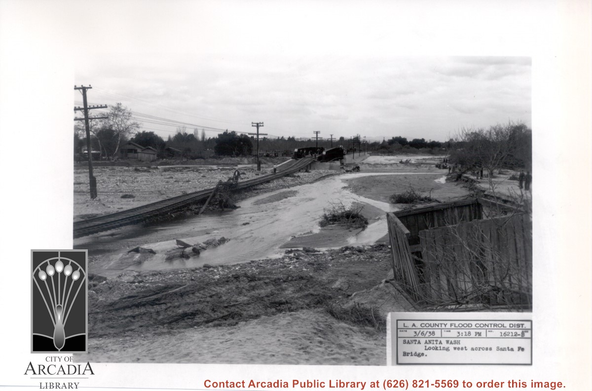
Santa Anita Wash following flooding of early 1938. View is looking west along washed-out Santa Fe Railroad tracks toward Santa Fe Bridge across Santa Anita Wash. People can be seen looking at the damage.
https://arcadiahistory.andornot.com/en/permalink/photographs818
- Date
- March 3, 1938
1 image
- Date
- March 3, 1938
- Subjects
- Flood control
- Santa Anita Wash
- Physical Description
- 5x7 b&w
- ID
- 812
- Collection
- Photographs
Images
Looking downstream of Santa Anita Wash from east side of Santa Fe Bridge approach. In this photo the tracks and ties are seen completely suspended and a man is walking across the span. Two men are seen on extreme left side of photo.
https://arcadiahistory.andornot.com/en/permalink/photographs819
- Date
- March 6, 1938
1 image
- Date
- March 6, 1938
- Subjects
- Santa Anita Wash
- Flood control
- Physical Description
- 5x5 b&w
- ID
- 813
- Collection
- Photographs
Images

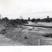
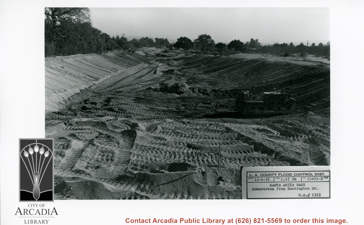
Looking south from Huntington Drive along Santa Anita Wash, following earth-moving preparatory to paving channel.
https://arcadiahistory.andornot.com/en/permalink/photographs823
- Date
- December 6, 1938
1 image
- Date
- December 6, 1938
- Subjects
- Santa Anita Wash
- Flood control
- Physical Description
- 5x7 b&w
- ID
- 817
- Collection
- Photographs
Images
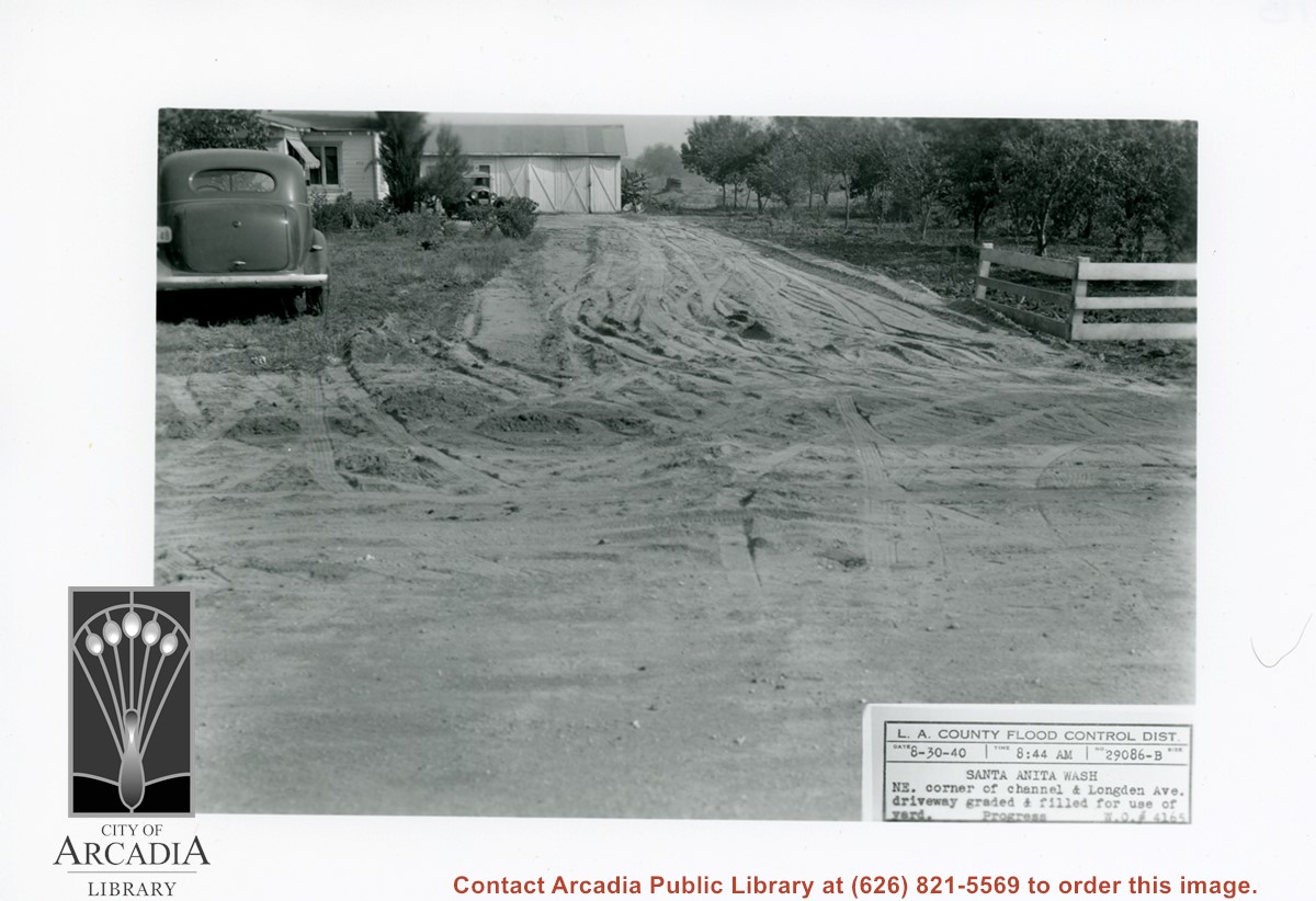
White house and garage at left, with driveway freshly graded. On right side of photo is part of a family orchard. Caption on photo reads: NE corner of Santa Anita Wash and Longden Avenue.
https://arcadiahistory.andornot.com/en/permalink/photographs824
- Date
- August 30, 1940
1 image
- Date
- August 30, 1940
- Subjects
- Agriculture
- Longden Avenue
- Flood control
- Physical Description
- 5x7 b&w
- ID
- 818
- Collection
- Photographs
Images
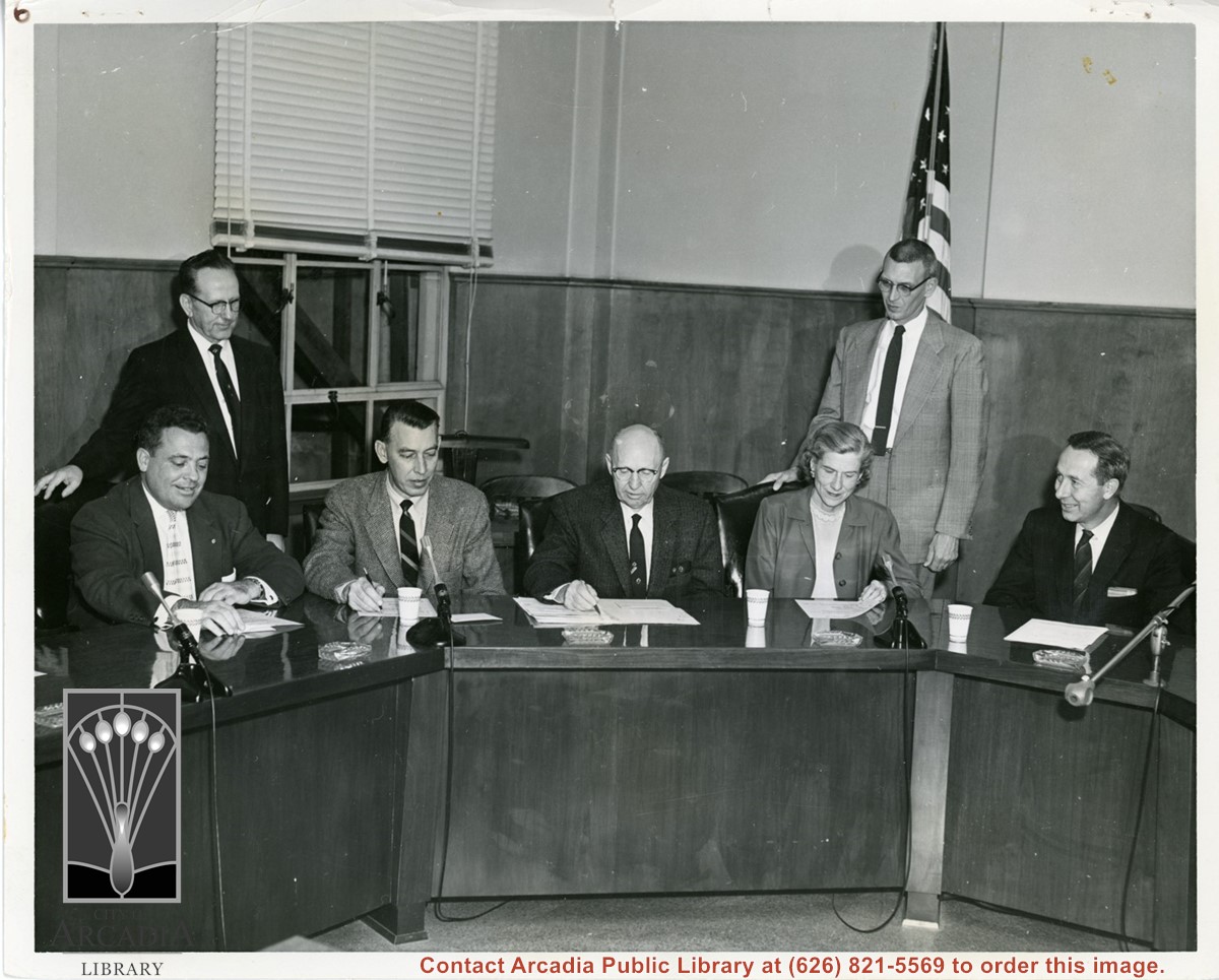
Four men and one woman seated at what seems to be City Council. Two men stand behind the seated people. There are ashtrays on the tables. Note same wall and microphone parts are visible in photo ID 1931.
https://arcadiahistory.andornot.com/en/permalink/photographs1953
- Date
- c. 1950s
1 image