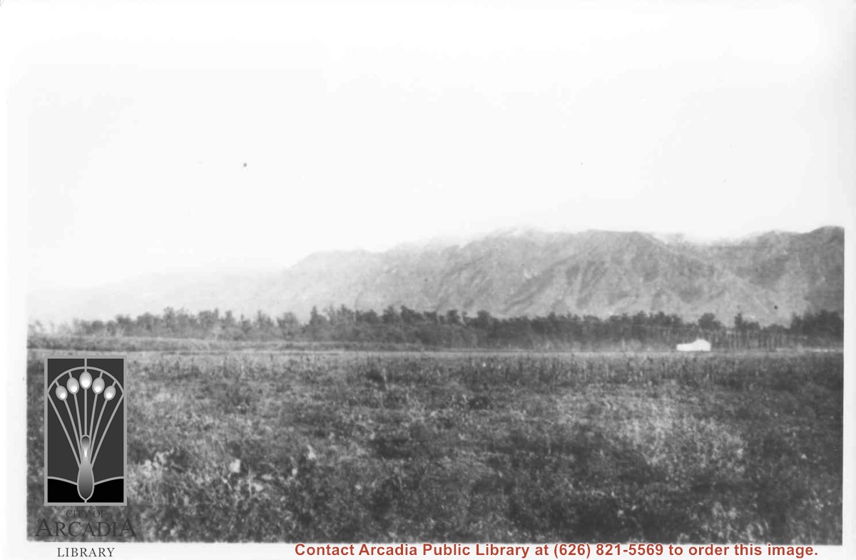
View across Santa Anita Rancho lands toward San Gabriel Mountains, looking north, slightly to the west.
https://arcadiahistory.andornot.com/en/permalink/photographs16
- Date
- probably 1935
1 image
- Date
- probably 1935
- Physical Description
- one 3x5, one 8x10 b&w
- ID
- 16
- Collection
- Photographs
Images
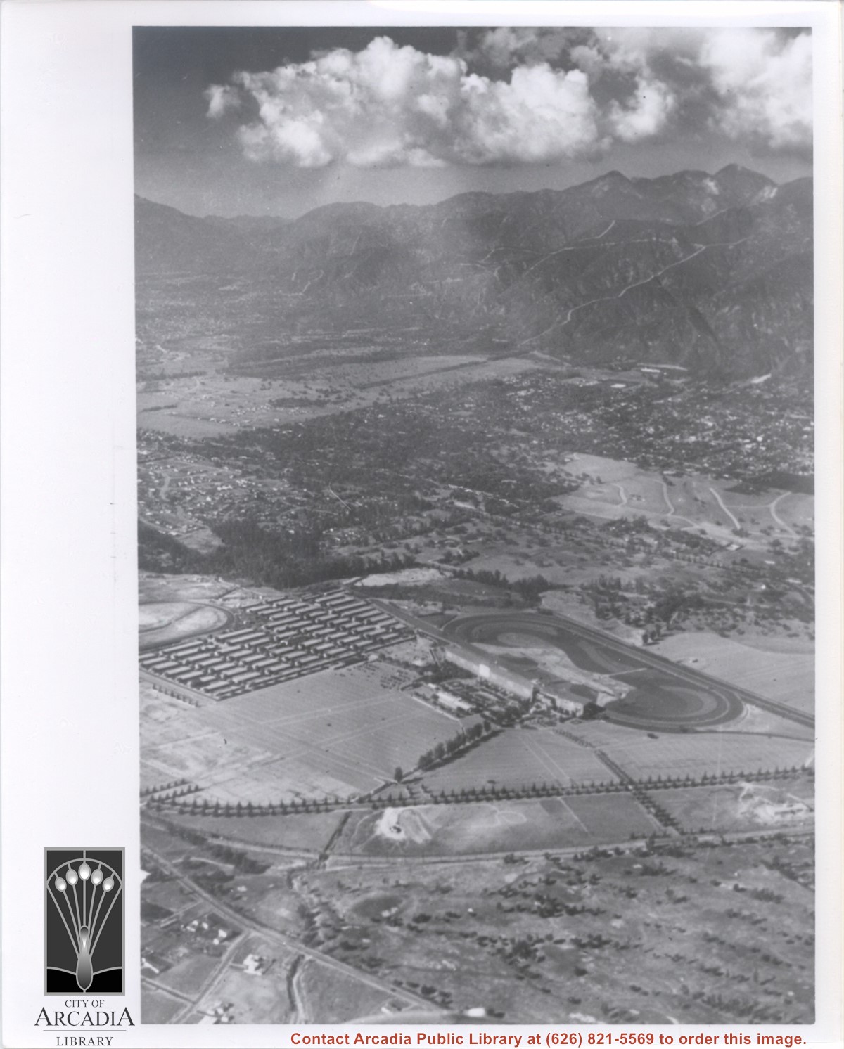
Aerial view taken from about over what became Campus Drive and Arcadia High School, and looking toward (NW) Pasadena and Sierra Madre at foot of San Gabriel Mountains. Photo shows Santa Anita Park Race Track possibly just a few years after opening.
https://arcadiahistory.andornot.com/en/permalink/photographs633
- Date
- c.1936
1 image
- Date
- c.1936
- Subjects
- Aerial Photo Collection
- Aerial views
- Arcadia High School
- Campus Drive
- San Gabriel Mountains
- Santa Anita Park-1934-1942
- Physical Description
- 8x10 b&w
- ID
- 629
- Collection
- Photographs
Images
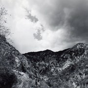
A view looking up toward the San Gabriel Mountains, looking northeast from Wilderness Park, with dark clouds. Photo by Terry Miller.
https://arcadiahistory.andornot.com/en/permalink/photographs2373
- Date
- 2001
1 image

A chart shows the API scores for West San Gabriel Valley schools for 2004 on page A4. 85 percent of schools in the West San Gabriel Valley maintained or increased their Academic Performance Index ranking compared to schools across the state.
https://arcadiahistory.andornot.com/en/permalink/newspaper29450
- Newspaper
- Pasadena Star News
- Date
- March 16, 2005
- Pages
- p. A1
- Subjects
- Academic Performance Index (API) - 2004
- Schools - San Gabriel Valley
- Rankings
- Standardized Testing and Reporting (STAR)
- California High School Exit Exam (CAHSEE)
- Item ID
- 29635AN
- Collection
- Newspaper Index
Secession of San Gabriel Valley from Los Angeles County.
https://arcadiahistory.andornot.com/en/permalink/newspaper4296
- Newspaper
- Arcadia Tribune
- Date
- August 1, 1971 p. 1 (split studied)
- August 15, 1971 p. 1 ( " )
- September 1, 1971 p. 1 ( "" )
- September 12, 1971 p. 1 ( " )
- September 29, 1971 p. 1 ( " )
- October 31, 1971 p. 1 (reprisal feared)
- November 28, 1971 p. 1 (Arcadia in avor)
- December 8, 1971 p. 1 (City OK's study)
- December 12, 1971 p. 1 (support for new study)
- February 9, 1972 p. 1 (new law regarding splits)
- April 19 1972 p. 1 (legislation eases secession)
- June 1, 1972 p. 1
- Maryc 1, 1973 p. 1
- Subjects
- San Gabriel Valley - Secession
- Item ID
- 4172AN
- Collection
- Newspaper Index
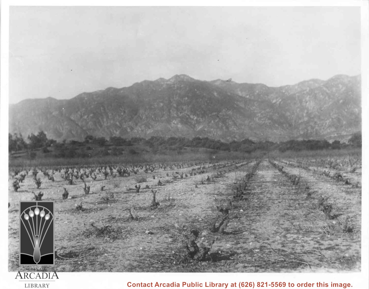
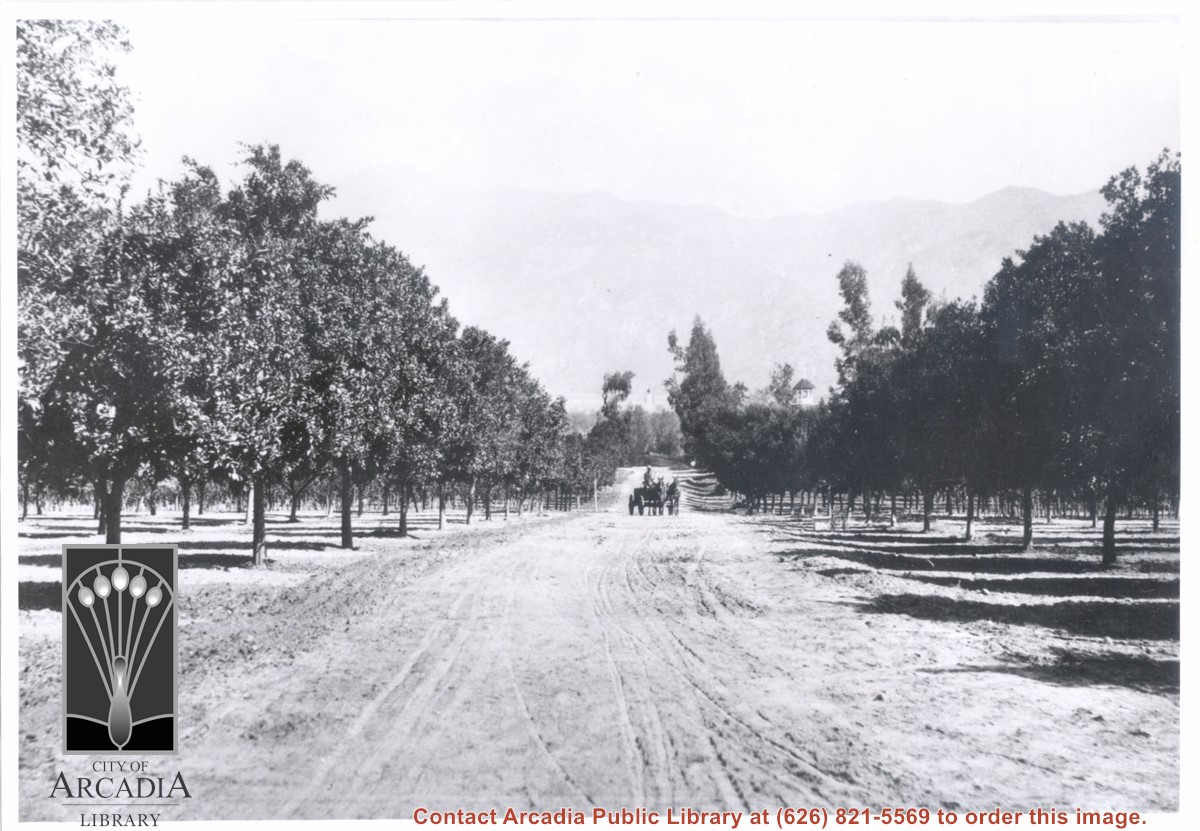
Vineyards on Baldwin Ranch. View is north from a point of present Huntington Drive. Chantry Flats Road is visible at right edge of photo. San Gabriel Mountains form background.
https://arcadiahistory.andornot.com/en/permalink/photographs2
- Date
- c.1900
1 image
- Date
- c.1900
- Subjects
- Agriculture
- Rancho Santa Anita
- Baldwin, Elias J. "Lucky" - Wines and winemaking
- San Gabriel Mountains
- Physical Description
- 8x10 b&w 2 prints 2 slides
- ID
- 2
- Collection
- Photographs
Images
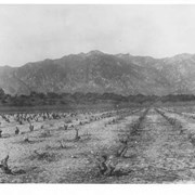
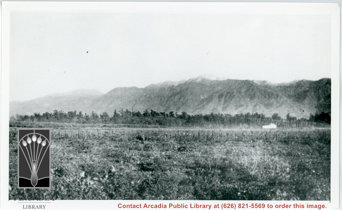
Spring 1935. Santa Anita Rancho field crops of many varieties were grown. View is toward the north. San Gabriel mountains completely across the photo. Chantry Flats Road visible at right side. White barn prominent in center of photo.
https://arcadiahistory.andornot.com/en/permalink/photographs15
- Date
- Spring 1935
1 image
- Date
- Spring 1935
- Physical Description
- 6x10 b&w 2 prints
- ID
- 15
- Collection
- Photographs
Images

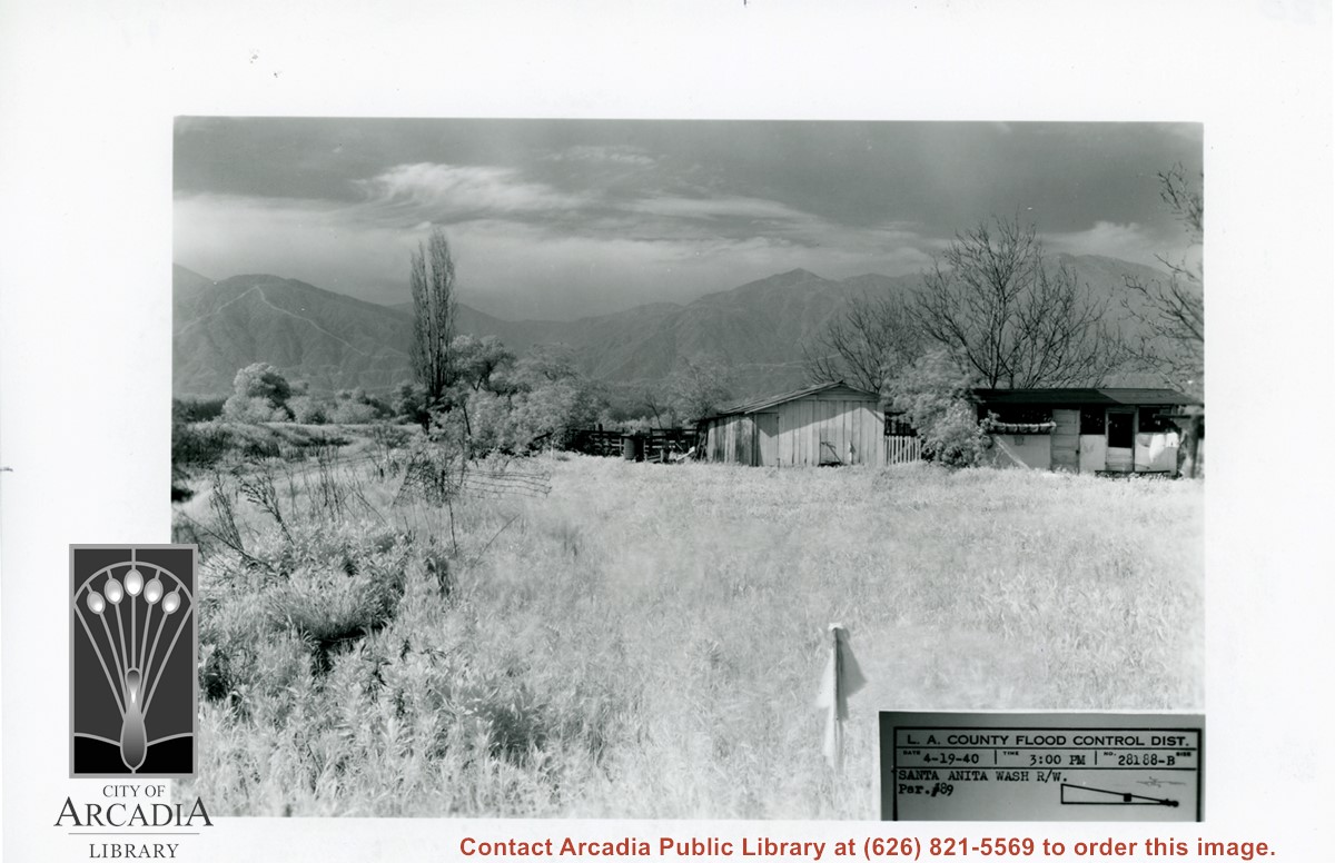
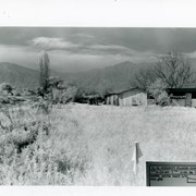
Small house and garage pictured on right side of photo. The view is across field of grass toward San Gabriel Mountains in background. Dramatic clouds fill the sky. There is a bare, tall Lombardy Poplar pictured near the wash. Caption on photo says it is Santa Anita Wash, but viewer is not aware of it. It must lie along left side of photo.
https://arcadiahistory.andornot.com/en/permalink/photographs826
- Date
- April 19, 1940
1 image
- Date
- April 19, 1940
- Subjects
- Santa Anita Wash
- San Gabriel Mountains
- Physical Description
- 5x7 b&w
- ID
- 820
- Collection
- Photographs
Images
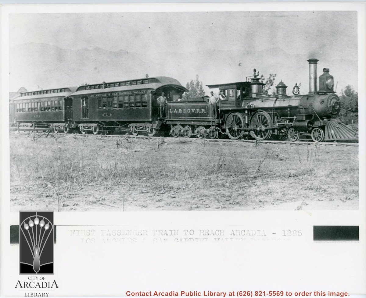
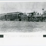
Engine, coal car, and two passenger coaches standing on track. The train is of the Los Angeles and San Gabriel Valley line. The engineer is sitting at his window in cab. Several other crew members can be seen. San Gabriel Mountains form backdrop of photo.
https://arcadiahistory.andornot.com/en/permalink/photographs216
- Date
- c.1885
1 image
- Date
- c.1885
- Subjects
- Railroads
- San Gabriel Mountains
- Physical Description
- 8x10 b&w
- ID
- 215
- Collection
- Photographs
Images
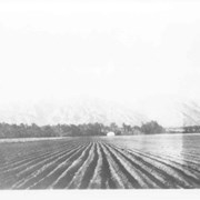
View north across ranch fields from approximate location of Huntington Drive near present Baldwin White Building. May have been fruit packing shed according to map drawn from memory by Lupe Cuellar. (See photo #123. Also see photo #15 taken from almost the same location.) San Gabriel Mountains across photo.
https://arcadiahistory.andornot.com/en/permalink/photographs122
- Date
- 1937
1 image
Summary of Los Angeles County reform efforts that perhaps will make unnecessary the efforts of the San Fernando Valley, the San Gabriel Valley and other areas to secede from Los Angeles County.
https://arcadiahistory.andornot.com/en/permalink/newspaper2419
- Newspaper
- Arcadia Tribune
- Date
- March 10, 1977
- Pages
- p. A-
- Subjects
- San Gabriel Valley - Secession
- Item ID
- 2370AN
- Collection
- Newspaper Index
View north toward San Gabriel Mountains from orchards on Baldwin Ranch. Wagon pulled by two horses is on dirt lane coming toward camera. Note tower of Queen Anne Cottage on the right side of lane. On the back of this photo at Huntington Library is printed: Carter, 1937. Possible given by N. Carter family of Sierra Madre at this time. This photo belongs to the Huntington Library. It is shown here for research only.
https://arcadiahistory.andornot.com/en/permalink/photographs220
- Date
- c.1890
1 image
San Gabriel Valley News.
https://arcadiahistory.andornot.com/en/permalink/subject359
- Contents
- San Gabriel Valley News. August 3, 1922 – Feb. 28, 1924. Temple Times and San Gabriel Valley News. March 6, 1924 – July 31, 1924. (Two Bound Volumes)
- Contents
- San Gabriel Valley News. August 3, 1922 – Feb. 28, 1924. Temple Times and San Gabriel Valley News. March 6, 1924 – July 31, 1924. (Two Bound Volumes)
- Subjects
- San Gabriel Valley News.
- Location
- History Room
- Box Number
- Box 49.
- Shelf Number
- Shelf F7
- Item ID
- 360AF
- Collection
- Subject Files
A shortage of trauma centers leaves people in the East San Gabriel Valley unprotected. Officials from the San Gabriel Valley Council of Governments are upset that the valley received 1.4 percent of Measure B though it paid 19.8 percent of the tax.
https://arcadiahistory.andornot.com/en/permalink/newspaper29329
- Newspaper
- Pasadena Star News
- Date
- December 5, 2004
- Pages
- p. A8
- Item ID
- 29513AN
- Collection
- Newspaper Index
Arcadia joins San Gabriel Valley Master Plan
https://arcadiahistory.andornot.com/en/permalink/newspaper4294
- Newspaper
- Arcadia Tribune
- Date
- October 29, 1967 p. 1
- November 5, 1967 p. 1
- Subjects
- San Gabriel Valley
- Item ID
- 4170AN
- Collection
- Newspaper Index
The defeat of Canyon County's bid in the November election dims prospects of the San Gabriel Valley separating from Los Angeles County.
https://arcadiahistory.andornot.com/en/permalink/newspaper2416
- Newspaper
- Arcadia Tribune
- Date
- November 8, 1976
- Pages
- p. A-1
- Subjects
- San Gabriel Valley - Secession
- Item ID
- 2367AN
- Collection
- Newspaper Index
One of the most comprehensive pictorial presentations of San Gabriel Valley history will be shown at Fashion Park June 24 through July 12. Done by history students from Cal State LA, it has been over two years in the planning.
https://arcadiahistory.andornot.com/en/permalink/newspaper2404
- Newspaper
- Arcadia Tribune
- Date
- June 24, 1976
- Pages
- p. A-3
- Subjects
- San Gabriel Valley
- Item ID
- 2356AN
- Collection
- Newspaper Index
Summary of the most recent population of San Gabriel Valley cities.
https://arcadiahistory.andornot.com/en/permalink/newspaper2406
- Newspaper
- Arcadia Tribune
- Date
- March 20, 1977
- Pages
- p. A-1
- Subjects
- San Gabriel Valley
- Item ID
- 2357AN
- Collection
- Newspaper Index
Arcadia supports the North San Gabriel Valley Educational Center
https://arcadiahistory.andornot.com/en/permalink/newspaper4295
- Newspaper
- Arcadia Tribune
- Date
- April 30, 1969
- Pages
- p. 1
- Subjects
- San Gabriel Valley
- Item ID
- 4171AN
- Collection
- Newspaper Index
Article includes biographical information on Tony Walker, director of the West San Gabriel Valley Juvenile Diversion Project. The Project's work is also discussed.
https://arcadiahistory.andornot.com/en/permalink/newspaper3618
- Newspaper
- Arcadia Tribune
- Date
- February 10, 1980
- Pages
- p. A-1
- Item ID
- 3494AN
- Collection
- Newspaper Index