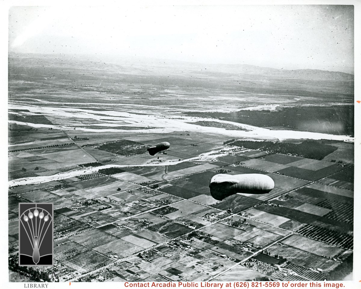
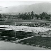
View east shows two balloons aloft over Arcadia and San Gabriel Valley. It is possible that first river up from bottom of photo is Rio Hondo Wash. Some of trees along Santa Anita appear to be in extreme lower right of photo. Tree-lined street showing in extreme lower left of photo is Duarte Road. Second river coming into photo about five inches up from bottom of photo would be San Gabriel River.
https://arcadiahistory.andornot.com/en/permalink/photographs154
- Date
- c.1918
1 image
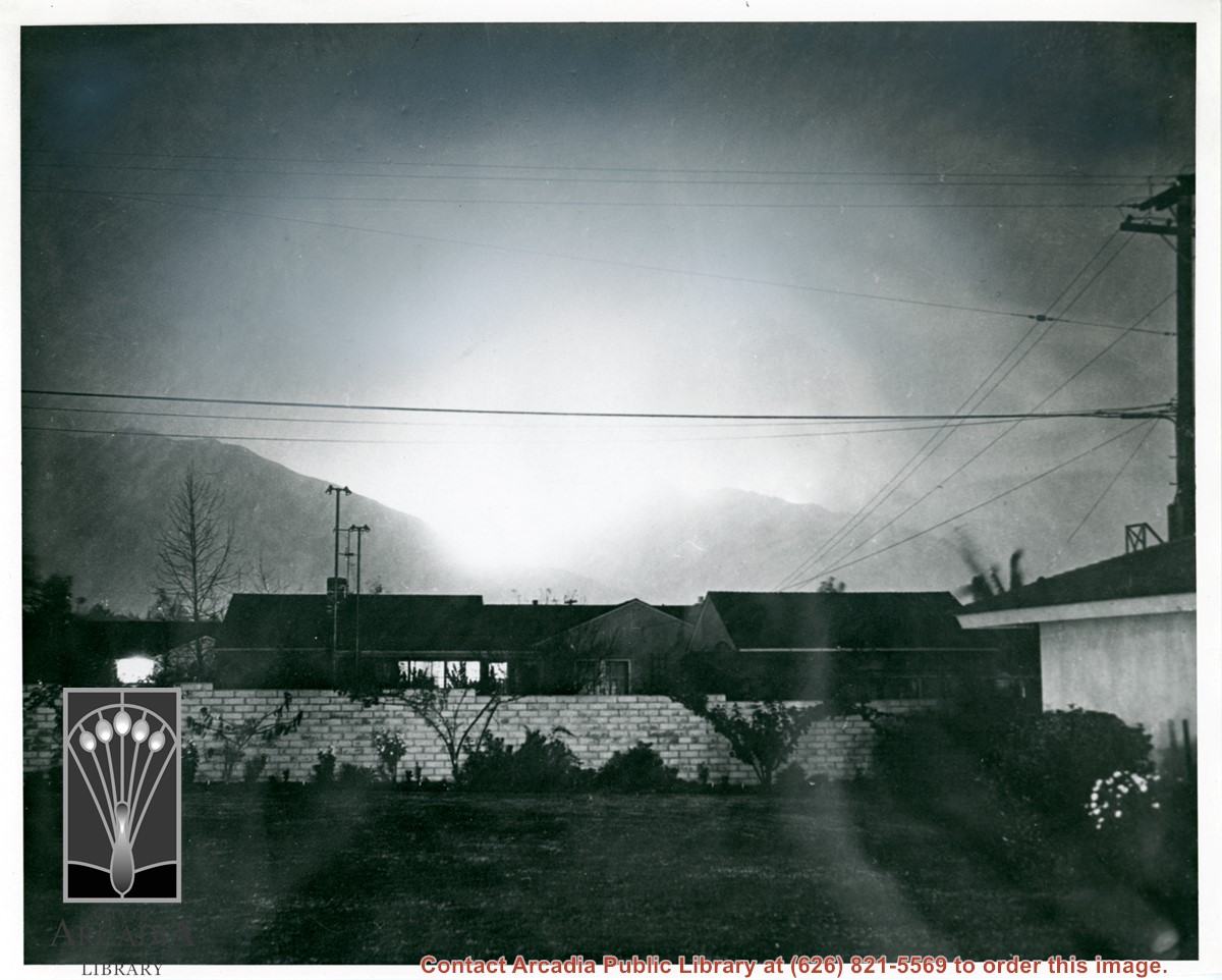
Looking north toward San Gabriel Mountains at devastating Monrovia Peak fire on first night. It was to eventually burn more than 13,000 acres and be out of control for five days.
https://arcadiahistory.andornot.com/en/permalink/photographs902
- Date
- December 27, 1953
1 image
- Date
- December 27, 1953
- Subjects
- Forest fires
- Physical Description
- 8x10 b&w
- ID
- 895
- Collection
- Photographs
Images
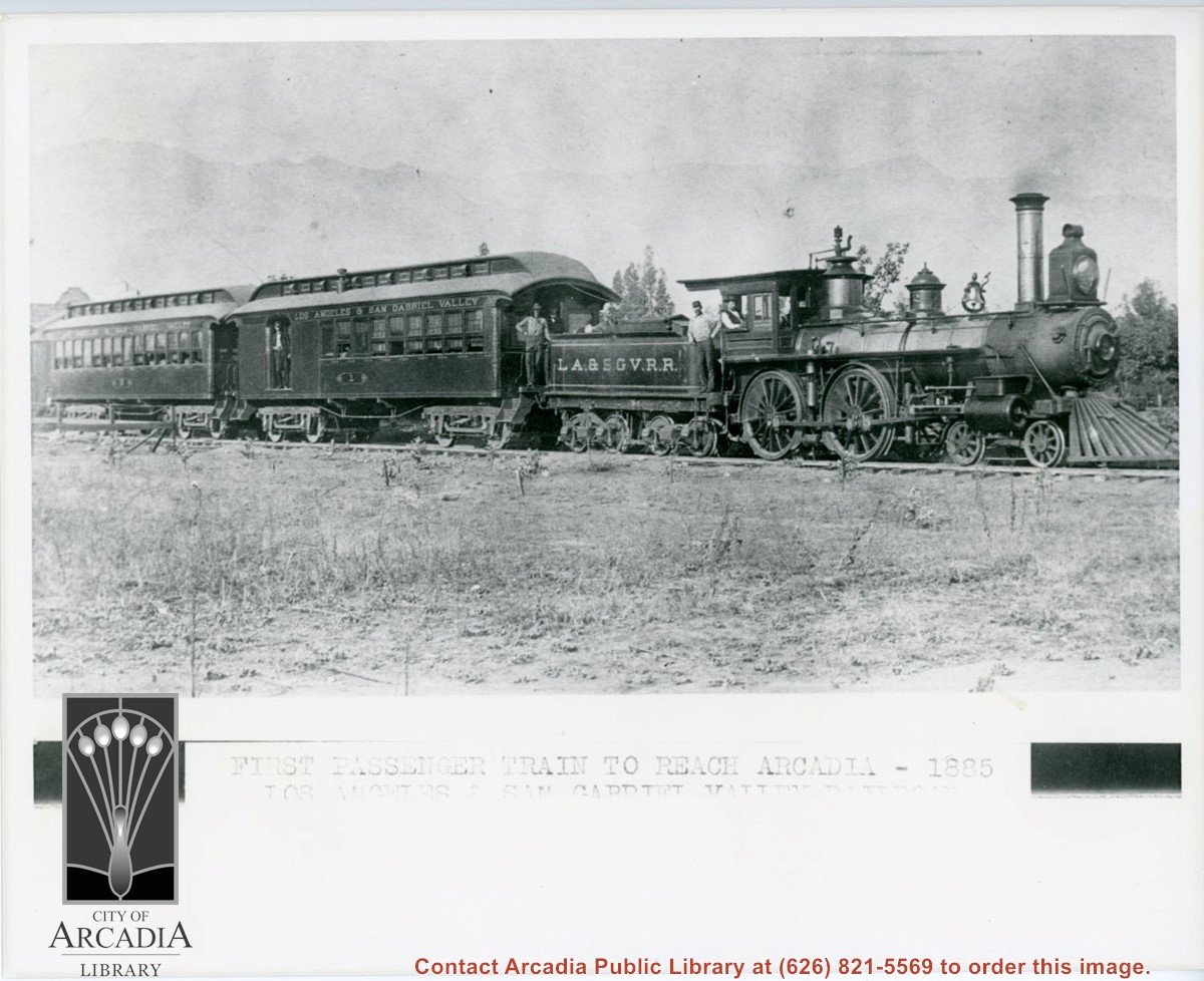
Engine, coal car, and two passenger coaches standing on track. The train is of the Los Angeles and San Gabriel Valley line. The engineer is sitting at his window in cab. Several other crew members can be seen. San Gabriel Mountains form backdrop of photo.
https://arcadiahistory.andornot.com/en/permalink/photographs216
- Date
- c.1885
1 image
- Date
- c.1885
- Subjects
- Railroads
- San Gabriel Mountains
- Physical Description
- 8x10 b&w
- ID
- 215
- Collection
- Photographs
Images
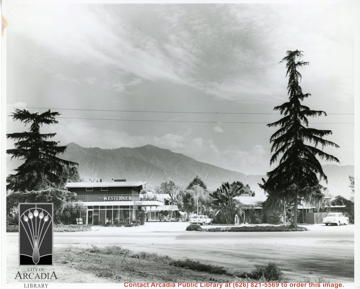
Looking east toward front entrance and grounds of Westerner Motel. San Gabriel Mountains show very prominently in the background. There are two cars in the parking area.
https://arcadiahistory.andornot.com/en/permalink/photographs1043
- Date
- September 10, 1959
1 image
- Date
- September 10, 1959
- Subjects
- Westerner Motel
- Physical Description
- 8x10 b&w
- ID
- 1035
- Collection
- Photographs
Images
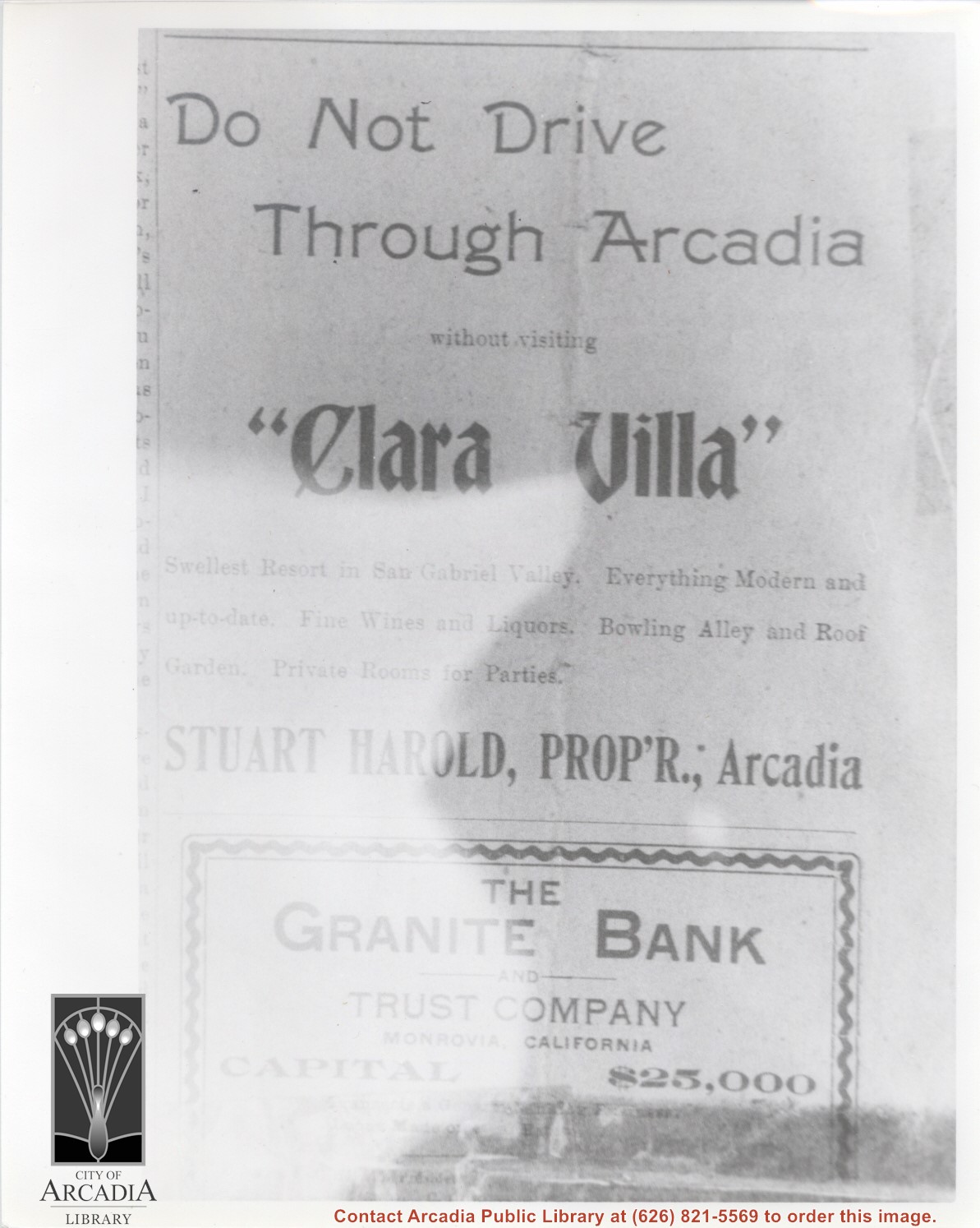
Close up of an ad that appeared in first issue of Arcadia Bulletin. Ad is for Clara Villa. It is billed as the "swellest resort in the San Gabriel Valley".
https://arcadiahistory.andornot.com/en/permalink/photographs1094
- Date
- May 7, 1904
1 image
- Date
- May 7, 1904
- Subjects
- Clara Villa
- Newspapers-Arcadia Bulletin
- Physical Description
- 8x10 b&w
- ID
- 1085
- Collection
- Photographs
Images
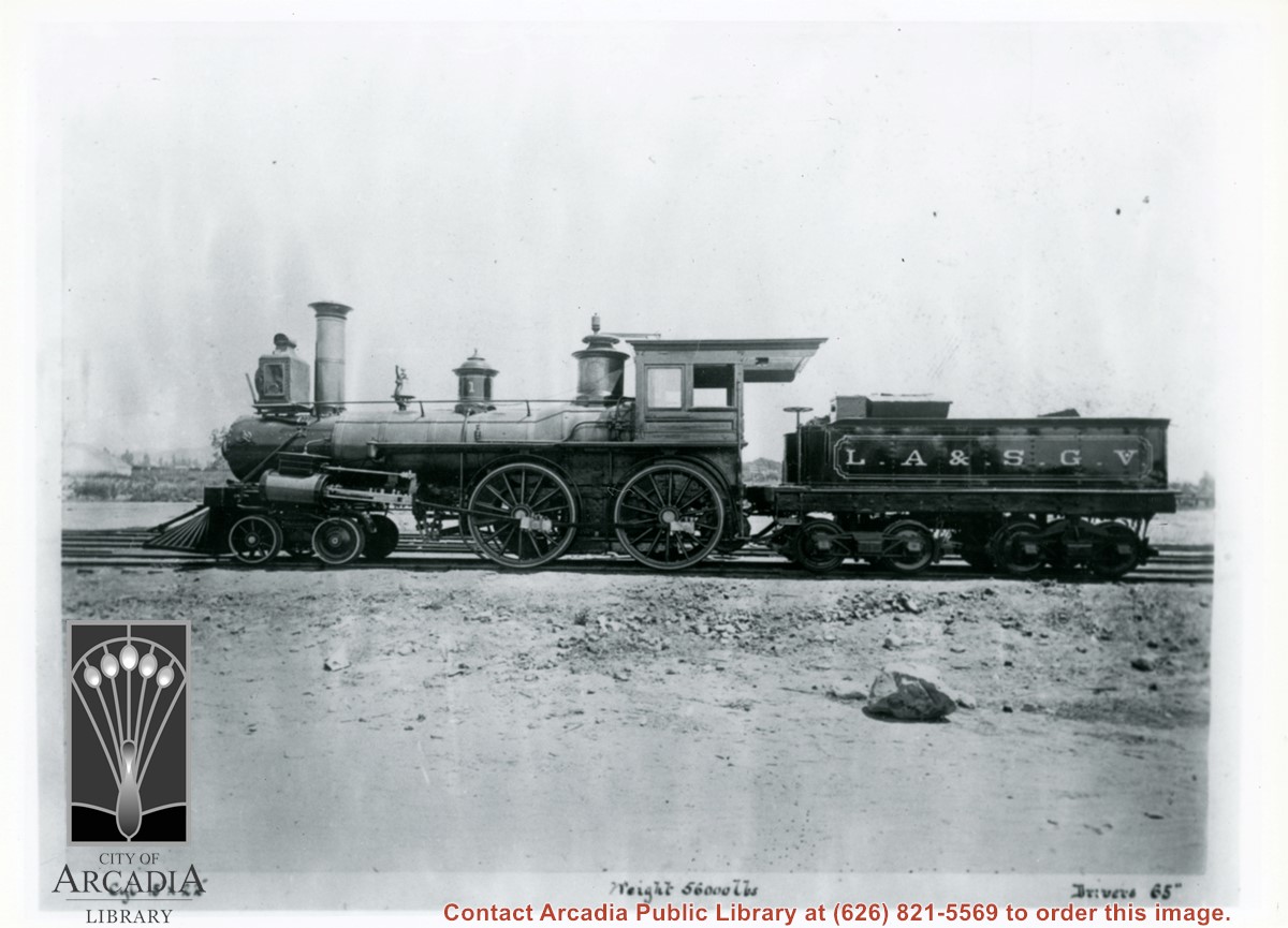
Steam locomotive and tender belonging to Los Angeles & San Gabriel Valley Line. Stan Garner, train authority, tells us it is a second hand Civil War period engine considerably rebuilt.
https://arcadiahistory.andornot.com/en/permalink/photographs1014
- Date
- c.1885-1887
1 image
- Date
- c.1885-1887
- Subjects
- Railroads
- Physical Description
- 8x10 b&w
- ID
- 1007
- Collection
- Photographs
Images
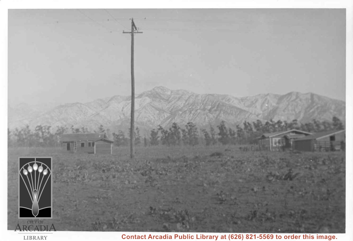
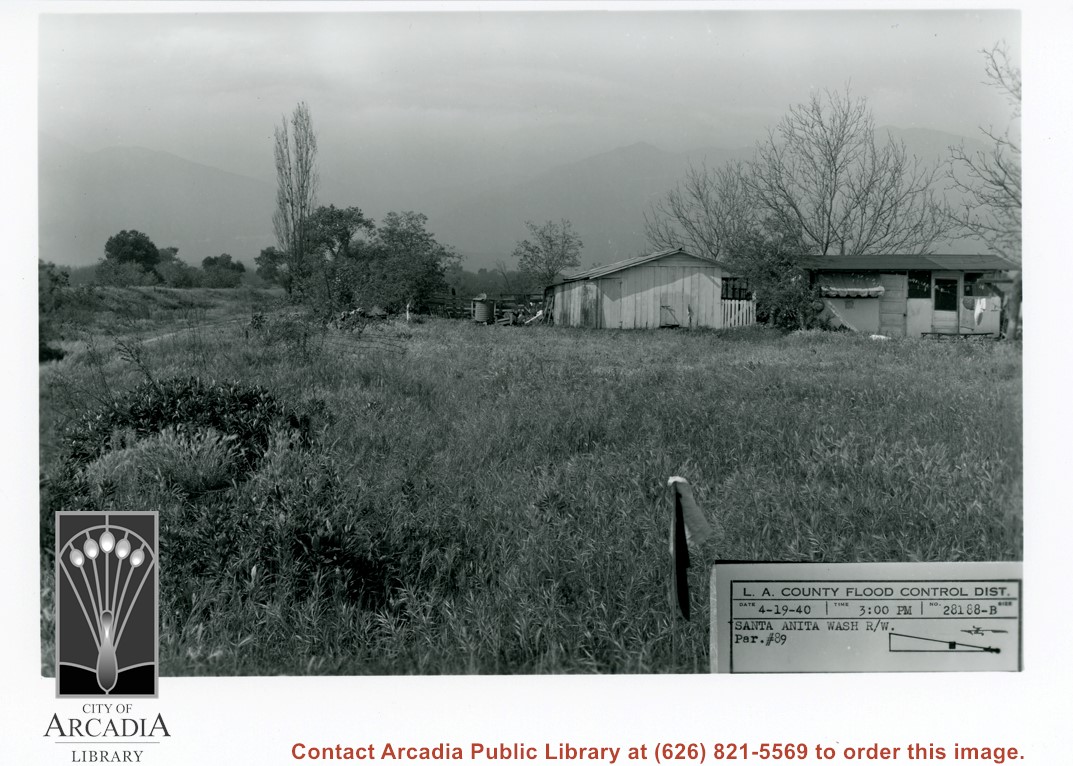
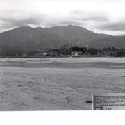
View toward San Gabriel Mountains across grass covered field probably on east side of Santa Anita Wash. A small house and outbuildings can be seen with large bare tree behind.
https://arcadiahistory.andornot.com/en/permalink/photographs821
- Date
- March 3, 1938
1 image
- Date
- March 3, 1938
- Subjects
- Santa Anita Wash
- Physical Description
- 5x7 b&w
- ID
- 815
- Collection
- Photographs
Images
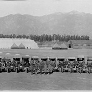
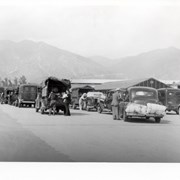
U.S. Army Balloon School (Ross Field) in Arcadia. View is to the north with the San Gabriel Mountains in the background. In the foreground are Army vehicles lined in a row. Buildings are visible behind the vehicles.
https://arcadiahistory.andornot.com/en/permalink/photographs1350
- Date
- c.1917-1918
1 image
- Date
- c.1917-1918
- Subjects
- Balloon School
- Physical Description
- 68x11 1/2 b&w self- framed
- ID
- 1341
- Collection
- Photographs
Images

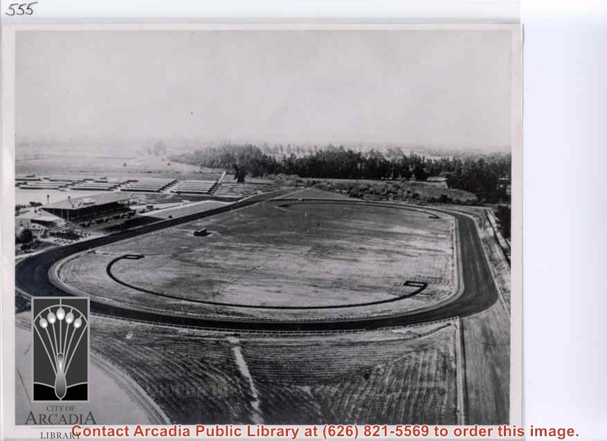
Aerial view from east looking west over Santa Anita Race Track shortly after its opening. Baldwin Avenue shows just faintly as a white line above track barns. Note total absence of homes in what we call Santa Anita Village and Lower Rancho.
https://arcadiahistory.andornot.com/en/permalink/photographs559
- Date
- c. December 1934
1 image
- Date
- c. December 1934
- Subjects
- Santa Anita Park-1934-1942
- Physical Description
- 8x10 b&w
- ID
- 555
- Collection
- Photographs
Images
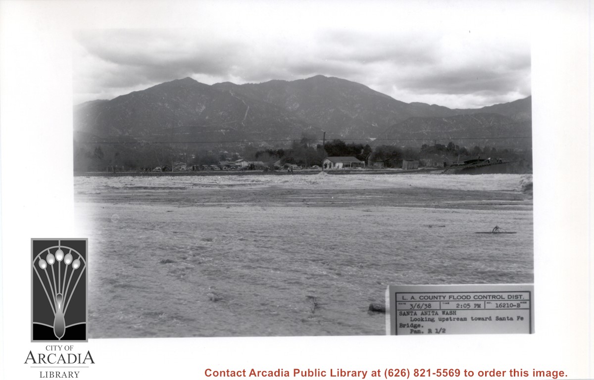
Looking NE up flooded Santa Anita Wash following heavy rains of early March 1938. Caption on photo reads: Looking upstream toward Santa Fe Bridge. San Gabriel Mountains in background. Where cars are parked would be east side of wash.
https://arcadiahistory.andornot.com/en/permalink/photographs811
- Date
- March 6, 1938
1 image
- Date
- March 6, 1938
- Subjects
- Flood control
- Physical Description
- 5x7 b&w
- ID
- 805
- Collection
- Photographs
Images
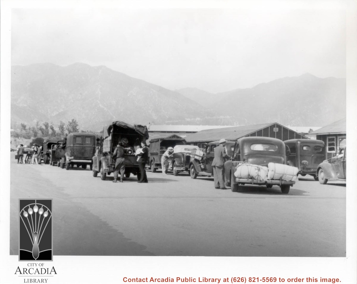
Evacuees of Japanese ancestry arriving a Santa Anita Assembly Center for the Japanese from San Pedro. They are lined up with their vehicles loaded and waiting to be checked in. Note road to Chantry Flats seen over roof tops.
https://arcadiahistory.andornot.com/en/permalink/photographs653
- Date
- April 1942
1 image
- Date
- April 1942
- Subjects
- Santa Anita Assembly Center for the Japanese-Inspection & processing of internees
- Santa Anita Park-1942-1945
- Physical Description
- 8x10 b&w
- ID
- 649
- Collection
- Photographs
Images
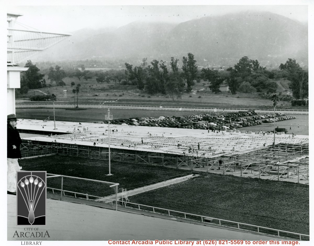
View north and a bit west toward San Gabriel Mountains over the enormous warehouse under construction on the infield of the track at the Santa Anita Assembly Center for the Japanese. Highest white buildings visible in left third of photo is Passonist's Father's Monastery in Sierra Madre.
https://arcadiahistory.andornot.com/en/permalink/photographs652
- Date
- April 1942
1 image
- Date
- April 1942
- Subjects
- Santa Anita Assembly Center for the Japanese-Construction & maintenance
- Santa Anita Park-1942-1945
- Physical Description
- 8x10 b&w
- ID
- 648
- Collection
- Photographs
Images
Aerial view toward NE. Plane is over property of Charles W. Stewart (10 acres), and Jaspar Teague (10 acres), at 1320 S. Santa Anita Avenue, which is directly under the plane. Next street east is First Avenue, then Second Avenue, the Fourth Avenue. Reservoir is at corner of Valnett Avenue and Second Avenue and was owned by Walnut Grove Mutual Water Company (Valnett Avenue was first through street south of Duarte Road at this time and became Camino Real).
https://arcadiahistory.andornot.com/en/permalink/photographs644
- Date
- November 1929
1 image
- Date
- November 1929
- Subjects
- Aerial Photo Collection
- Aerial views
- Camino Real
- Duarte Road
- First Avenue
- Fourth Avenue
- Second Avenue
- Santa Anita Avenue (South)
- Stewart, Charles W.
- Teague, Jaspar
- Valnett Avenue
- Physical Description
- 6x10 b&w
- ID
- 640
- Collection
- Photographs
Images


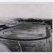
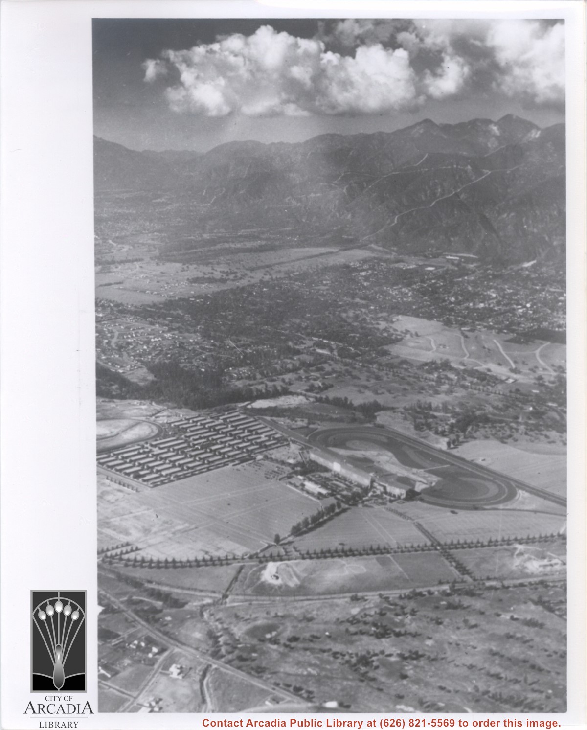
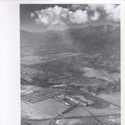
Aerial view taken from about over what became Campus Drive and Arcadia High School, and looking toward (NW) Pasadena and Sierra Madre at foot of San Gabriel Mountains. Photo shows Santa Anita Park Race Track possibly just a few years after opening.
https://arcadiahistory.andornot.com/en/permalink/photographs633
- Date
- c.1936
1 image
- Date
- c.1936
- Subjects
- Aerial Photo Collection
- Aerial views
- Arcadia High School
- Campus Drive
- San Gabriel Mountains
- Santa Anita Park-1934-1942
- Physical Description
- 8x10 b&w
- ID
- 629
- Collection
- Photographs
Images
Aerial view north toward San Gabriel Mountains from a position above Huntington Drive near First Avenue. Santa Anita Avenue can plainly be seen running north and south in front of six-story building in center of photo. The 210 Foothill Freeway is top band running across photo from east to west.
https://arcadiahistory.andornot.com/en/permalink/photographs611
- Date
- July 1976
1 image
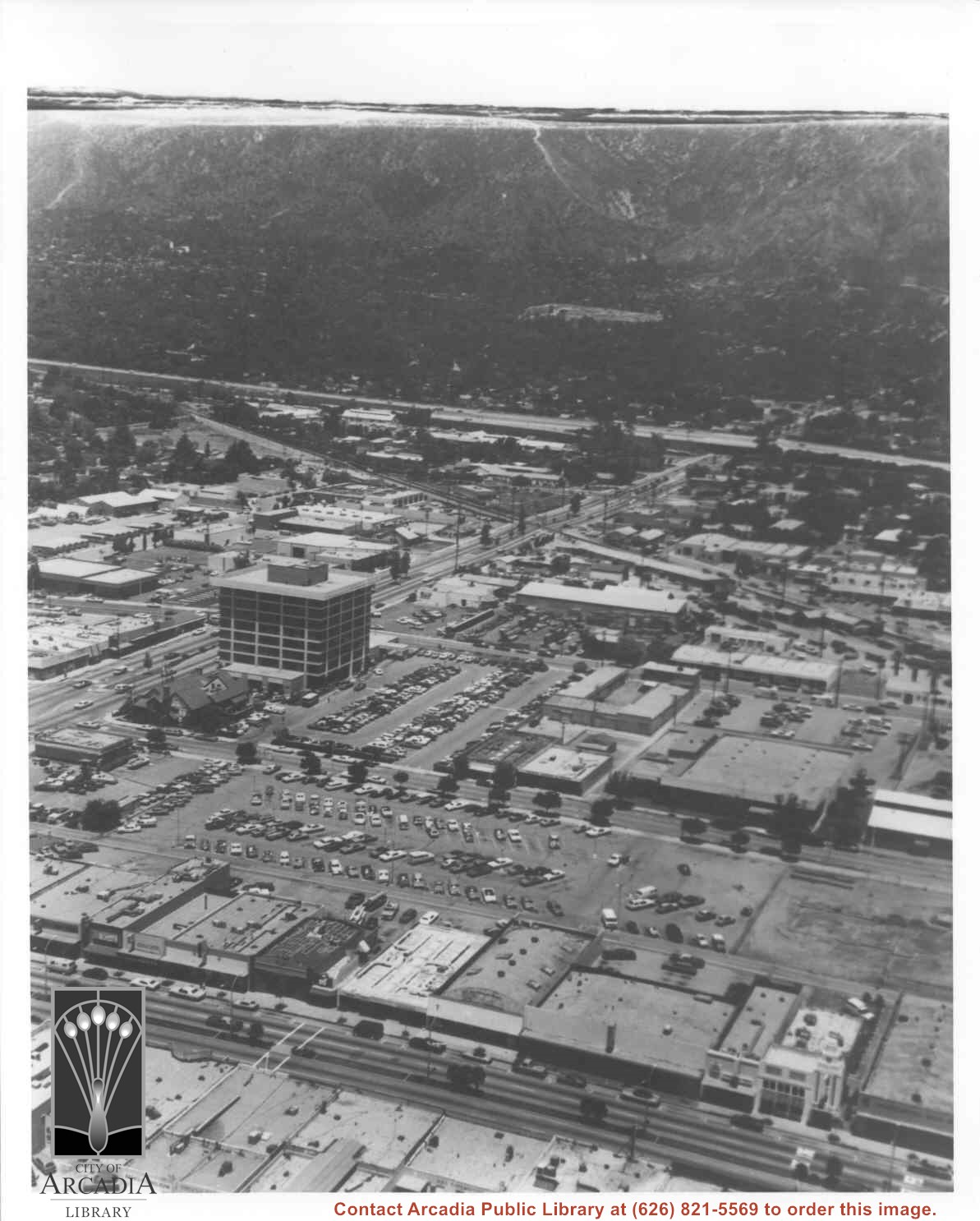

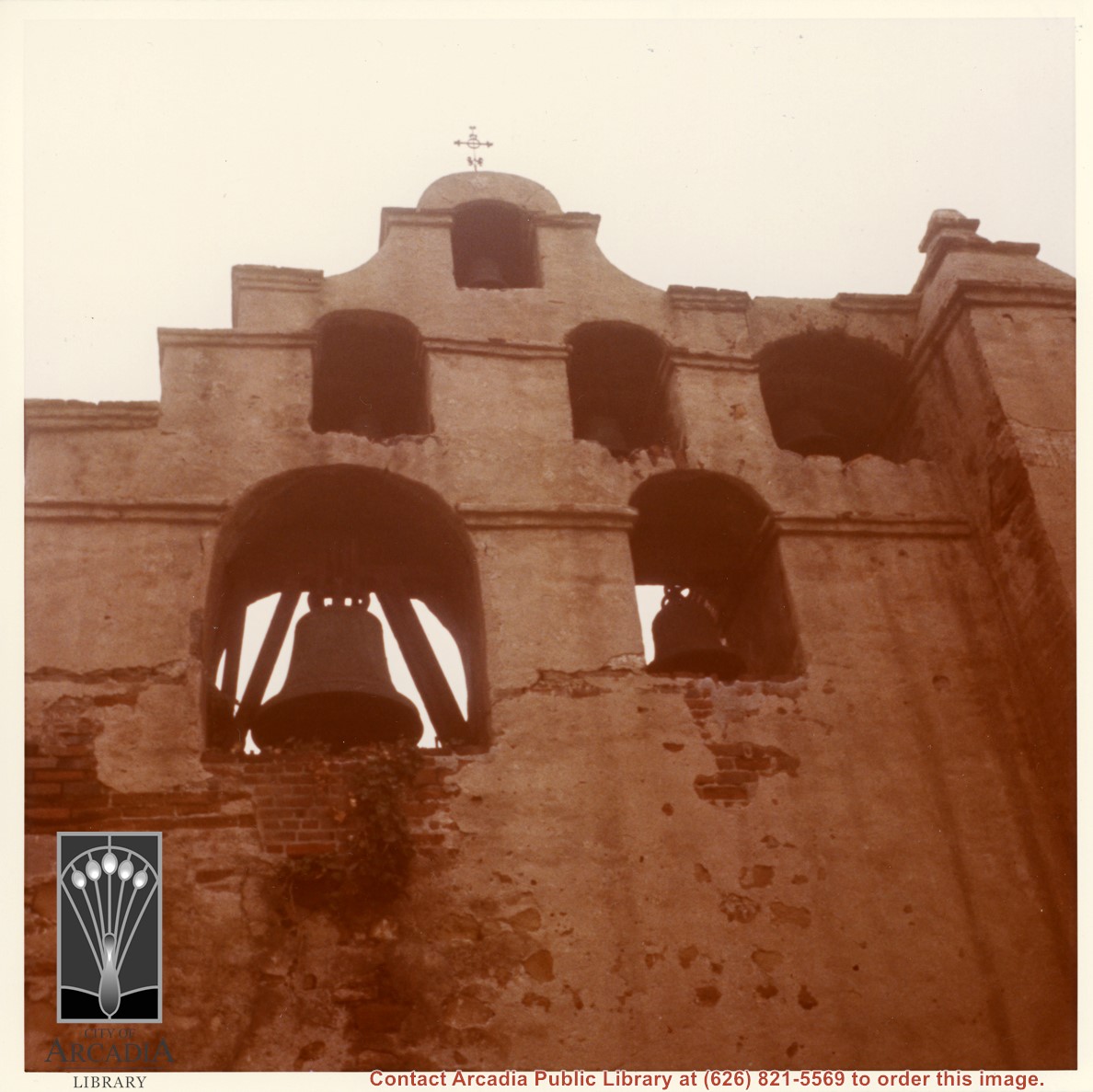
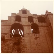
Photo of Bell Tower of Mission San Gabriel.
https://arcadiahistory.andornot.com/en/permalink/photographs615
- Date
- c. 1970
1 image
- Date
- c. 1970
- Subjects
- San Gabriel Valley
- Mission San Gabriel
- Physical Description
- 8x8 color
- ID
- 611
- Collection
- Photographs
Images
Aerial view taken over Arcadia so that it shows a large area surrounding Arcadia as well as the entire city. Clearly seen is the Santa Anita Park Race Track, and the Arcadia County Park (shown as a dark triangle in center), and the 210 Foothill Freeway crossing photo from west to east and passing north of Santa Anita Park Race Track.
https://arcadiahistory.andornot.com/en/permalink/photographs648
- Date
- c. 1973
1 image
- Date
- c. 1973
- Subjects
- Aerial Photo Collection
- Aerial views
- 210 Foothill Freeway
- Arcadia County Park
- Santa Anita Park-1945-1980
- Physical Description
- 8x10 b&w
- ID
- 644
- Collection
- Photographs
Images


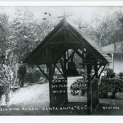
View looking east toward wing of Hugo Reid adobe added by Baldwin. Lake is on left. In foreground is a rustic shelter built to house bell which came from San Gabriel Mission under peculiar circumstances (and that was in later years returned to Mission by Anita Baldwin). There is also one of Baldwin's mastiffs (dog) standing in left foreground and unidentified man in background.
https://arcadiahistory.andornot.com/en/permalink/photographs886
- Date
- c.1893
1 image
- Date
- c.1893
- Subjects
- Rancho Santa Anita-1875-1909
- Physical Description
- 7x10 b&w
- ID
- 879
- Collection
- Photographs
Images

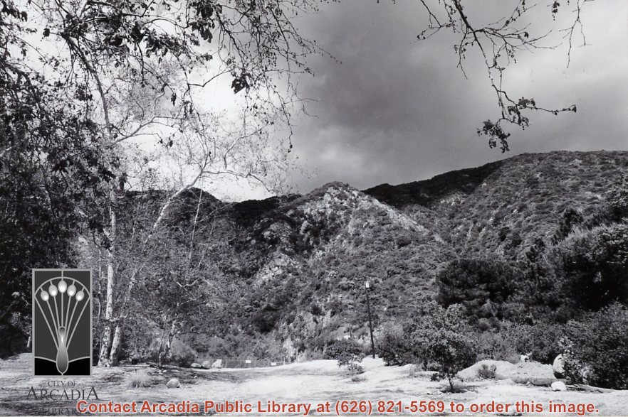
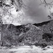
View of the San Gabriel Mountains from Wilderness Park, Arcadia, CA.
https://arcadiahistory.andornot.com/en/permalink/photographs2369
- Date
- 2001
1 image
- Date
- 2001
- Subjects
- Landscapes
- Nature
- Trees
- Wilderness Park
- Physical Description
- 4x6 b&w
- ID
- 2254D
- Collection
- Photographs
Images
View from back yard of Ramuz family home on Arcadia Ave. looking north toward San Gabriel Mountains. (Later they would build home on South Santa Anita in conjunction with their business, The Arcadia Nursery.) There are two small houses, one on left is still under construction. Just to left of center is a power pole. Line of eucalyptus in background apparently was along Huntington Drive.
https://arcadiahistory.andornot.com/en/permalink/photographs884
- Date
- c.1917
1 image
- Date
- c.1917
- Subjects
- Houses
- San Gabriel Mountains
- Physical Description
- 7x10 b&w
- ID
- 878
- Collection
- Photographs
Images