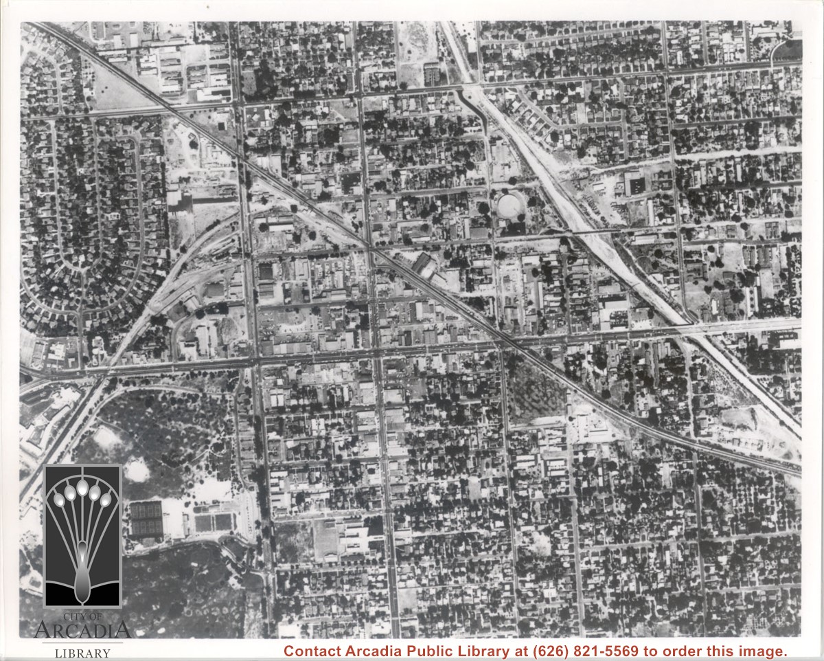
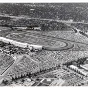
Santa Fe Railroad tracks cut diagonally across photo from east to west. Huntington Drive bisects photo from east to west approximately at center of photo. Arcadia County Park appears in lower left corner, showing baseball diamond. Santa Anita Wash is shown on right side of photo.
https://arcadiahistory.andornot.com/en/permalink/photographs625
- Date
- c. early 1950's
1 image
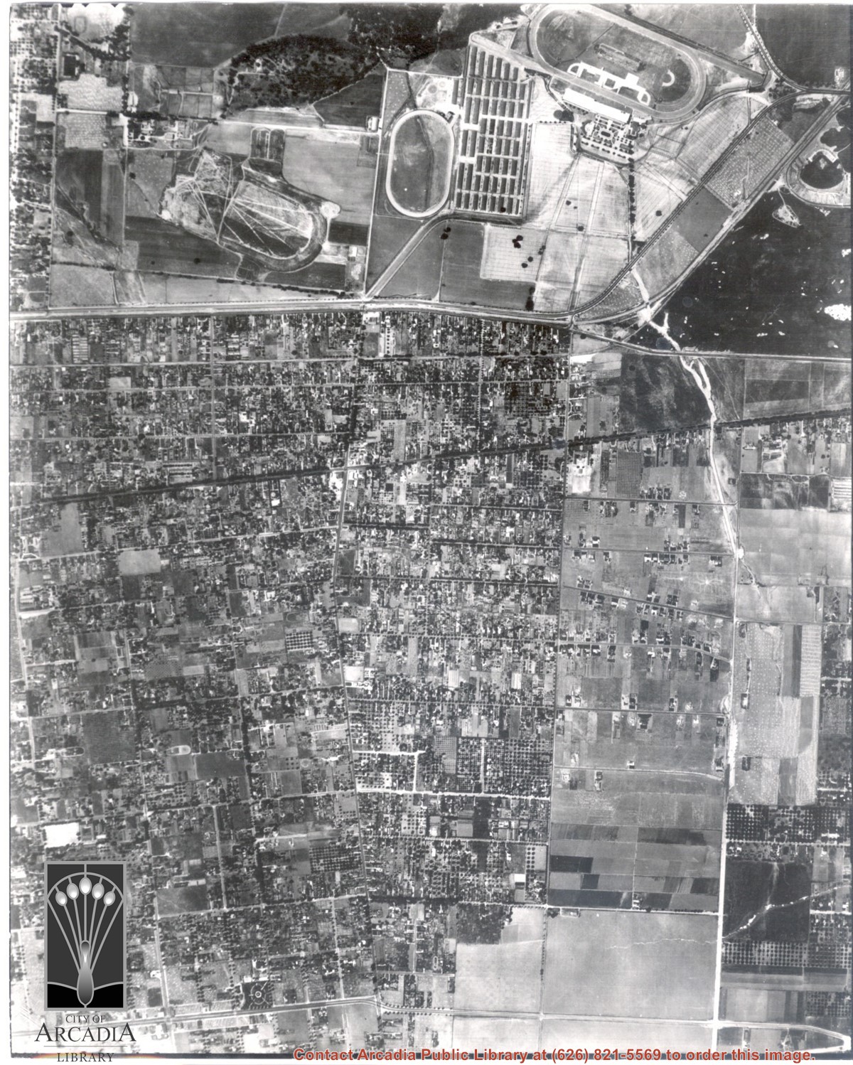
Dark, tree-lined street completely bisecting photo from west to east just above, is Duarte Road. Santa Anita Park Race Track is at upper right edge of photo. Smaller oval nearby is a training track. The incomplete oval in upper left is the race track that Anita Baldwin and Joe Smoot attempted to build in 1933 but abandoned the project. Huntington Drive and Colorado Place form a "y" just east of Santa Anita Park Race Track. Note grove of olive trees on land where City Hall is located today (240 W. Huntington Drive, Arcadia). Baseball diamond in upper right corner of photo, just below the convergence of the "y" is at Arcadia County Park. Corrected description as of 11/04/2008.
https://arcadiahistory.andornot.com/en/permalink/photographs621
- Date
- June 5, 1938
1 image
- Date
- June 5, 1938
- Subjects
- Aerial Photo Collection
- Aerial views
- Colorado Place
- Duarte Road
- Los Angeles Jockey Club
- Santa Anita Park-1934-1942
- Physical Description
- 8x10 b&w
- ID
- 617
- Collection
- Photographs
Images
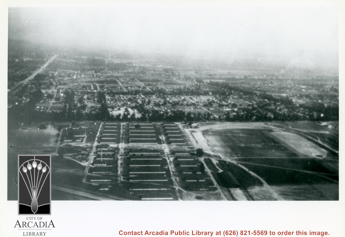
Looking east over barracks and main building at Ross Field. Tree-lined street cutting across photo at far side of field is Santa Anita Avenue. The oval of the race track built by E.J."Lucky" Baldwin and which opened in 1907 can clearly be seen on right. Broad E/W street seen on far left is Huntington Drive.
https://arcadiahistory.andornot.com/en/permalink/photographs867
- Date
- c.1928
1 image
Aerial view looking north across Santa Anita Park from a position over Arcadia County Park. Large infield crowd is evident and all parking areas are filled. Arcadia Methodist Hospital shows in lower left part of photo and Arcadia Police facility is seen in lower right. The 210 Foothill Freeway cuts across photo near the top.
https://arcadiahistory.andornot.com/en/permalink/photographs995
- Date
- c.1979
1 image
- Date
- c.1979
- Subjects
- Aerial Photo Collection
- Aerial views
- 210 Foothill Freeway
- Arcadia Methodist Hospital
- Santa Anita Park-1945-1980
- Physical Description
- 8x10 b&w
- ID
- 988
- Collection
- Photographs
Images

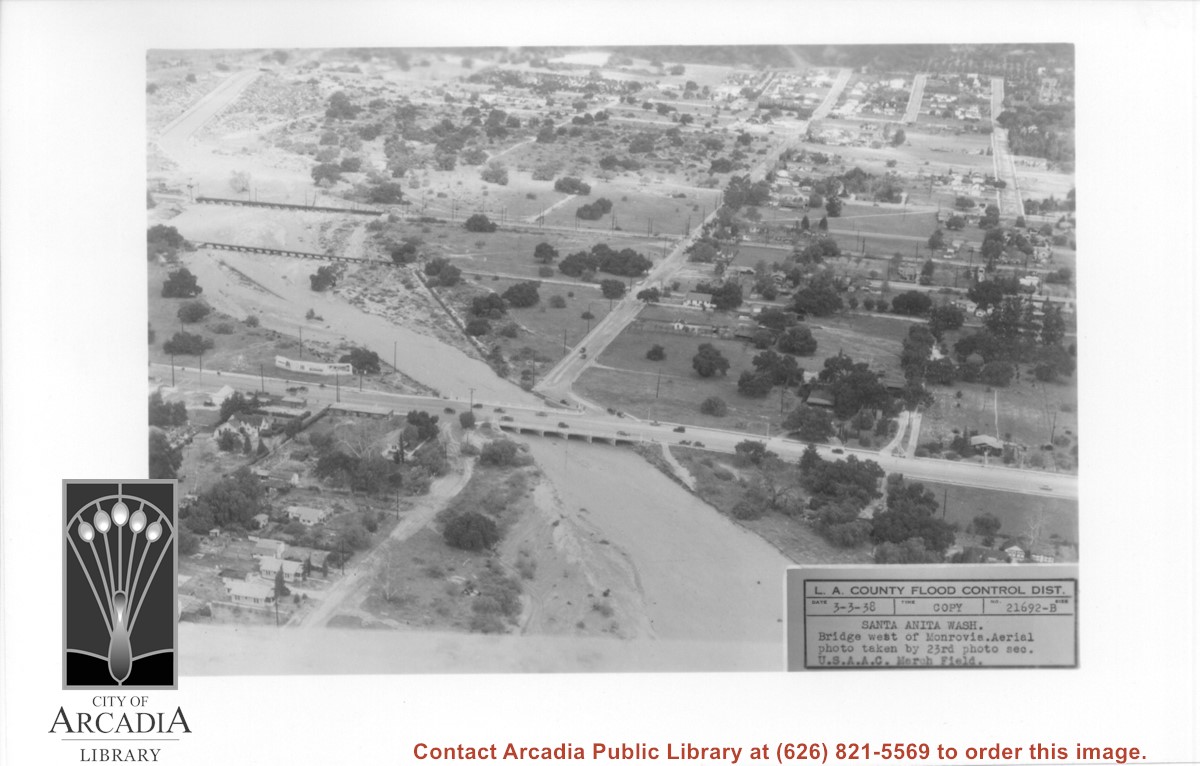
Aerial view looking north over flooded Santa Anita Wash looking upstream. Street cutting across photo closest to bottom is Huntington Drive. The next crossing upstream carries Santa Fe Railroad track. The last crossing that is clearly visible is Pacific Electric Railroad bridge. North/south street crossing Huntington Drive nearest wash would be Fifth Avenue. Foothill Boulevard is just barely visible near top of photo.
https://arcadiahistory.andornot.com/en/permalink/photographs815
- Date
- March 3, 1938
1 image
- Date
- March 3, 1938
- Subjects
- Aerial Photo Collection
- Aerial views
- Fifth Avenue
- Flood control
- Foothill Boulevard
- Huntington Drive
- Railroads
- Santa Anita Wash
- Physical Description
- 5x7 b&w
- ID
- 809
- Collection
- Photographs
Images