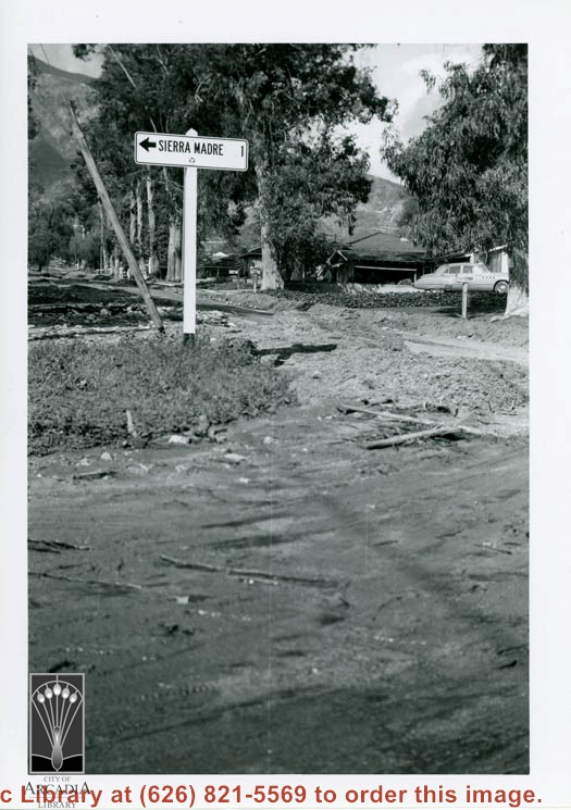
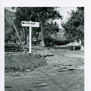
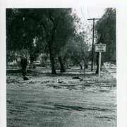
Flood damage on N. Santa Anita Avenue. This view was taken at Perkins and Santa Anita. A sign pointing toward Sierra Madre is visible on the left and the San Gabriel Mountains are visible in the background. There is a car on the right.
https://arcadiahistory.andornot.com/en/permalink/photographs1434
- Date
- March 1954
1 image
- Date
- March 1954
- Subjects
- Streets-Santa Anita Avenue
- Floods
- Physical Description
- 3x4
- ID
- 1421
- Collection
- Photographs
Images
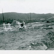
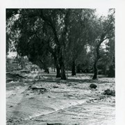
Flood damage on N. Santa Anita Avenue. A house is visible to the right and a person is standing with his/her back to the camera on the left. There are two sawhorses visible. The San Gabriel Mountains are seen in the background.
https://arcadiahistory.andornot.com/en/permalink/photographs1437
- Date
- March 1954
1 image
- Date
- March 1954
- Subjects
- Streets-Santa Anita Avenue
- Floods
- Physical Description
- 3x4
- ID
- 1424
- Collection
- Photographs
Images

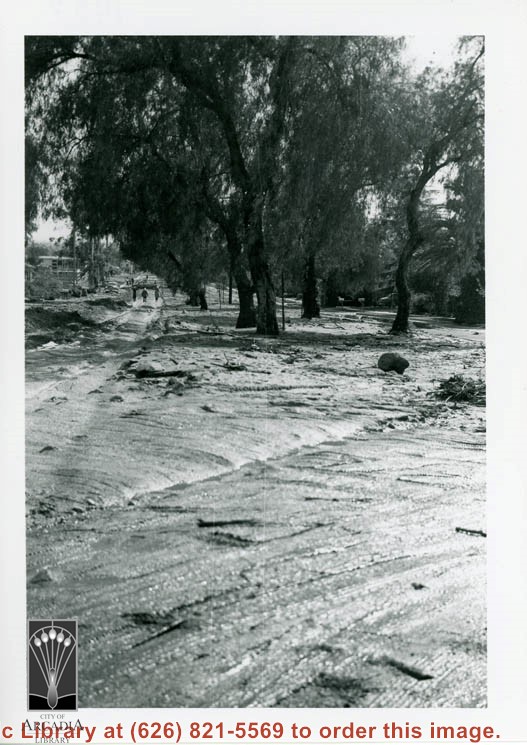
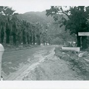
Flood damage on N. Santa Anita Avenue at Perkins Drive. Two or three people are seen walking in the distance.
https://arcadiahistory.andornot.com/en/permalink/photographs1436
- Date
- March 1954
1 image
- Date
- March 1954
- Subjects
- Streets-Santa Anita Avenue
- Floods
- Physical Description
- 3x4
- ID
- 1423
- Collection
- Photographs
Images
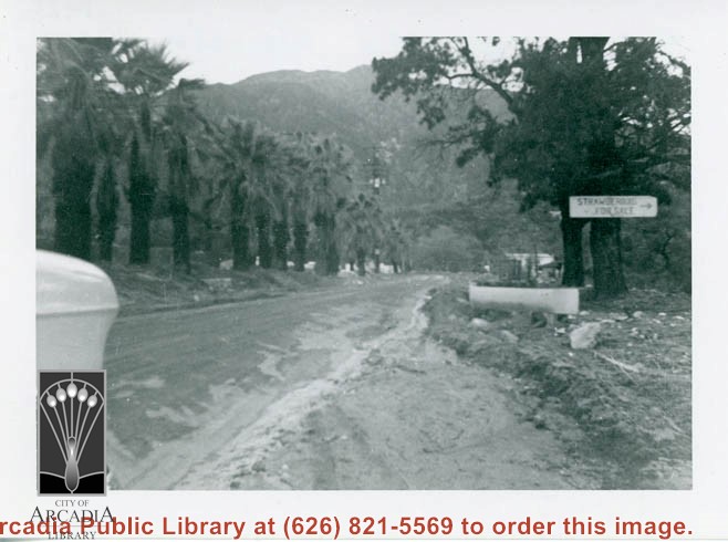
Flood damage on N. Santa Anita Avenue. The front end of a car is just visible in the left foreground. A sign nailed to a tree reads "STRAWBERRIES FOR SALE." The San Gabriel mountains are seen in the background.
https://arcadiahistory.andornot.com/en/permalink/photographs1438
- Date
- March 1954
1 image
- Date
- March 1954
- Subjects
- Streets-Santa Anita Avenue
- Floods
- Physical Description
- 3x4
- ID
- 1425
- Collection
- Photographs
Images
Flood damage on N. Santa Anita Avenue. A sign reads "FIRST BAPTIST CHURCH a MILE." There is an unidentified man walking toward the camera on the left.
https://arcadiahistory.andornot.com/en/permalink/photographs1439
- Date
- March 1954
1 image
- Date
- March 1954
- Subjects
- Streets-Santa Anita Avenue
- Floods
- Physical Description
- 3x4
- ID
- 1426
- Collection
- Photographs
Images

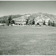
Santa Anita Race Track seen from a distance. View is toward the north. The San Gabriel mountains are visible behind the track. Cars are parked in the parking lot.
https://arcadiahistory.andornot.com/en/permalink/photographs1348
- Date
- c. mid 1950's
1 image
- Date
- c. mid 1950's
- Subjects
- Santa Anita Park-1945-1980
- Physical Description
- 8x10 b&w
- ID
- 1339
- Collection
- Photographs
Images

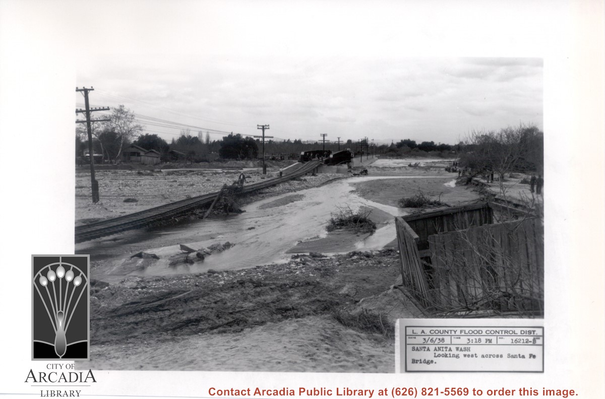
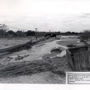
Santa Anita Wash following flooding of early 1938. View is looking west along washed-out Santa Fe Railroad tracks toward Santa Fe Bridge across Santa Anita Wash. People can be seen looking at the damage.
https://arcadiahistory.andornot.com/en/permalink/photographs818
- Date
- March 3, 1938
1 image
- Date
- March 3, 1938
- Subjects
- Flood control
- Santa Anita Wash
- Physical Description
- 5x7 b&w
- ID
- 812
- Collection
- Photographs
Images
The city's efforts to save homes beneath the fire-ravaged hillsides from a flood of mud and debris have been praised, but mud and debris are still flowing onto Highland Vista, Monte Place, Vista and Santa Anita Avenues.
https://arcadiahistory.andornot.com/en/permalink/newspaper27429
- Newspaper
- Arcadia Weekly
- Date
- February 24, 2000
- Pages
- p. 1
- Item ID
- 27626AN
- Collection
- Newspaper Index
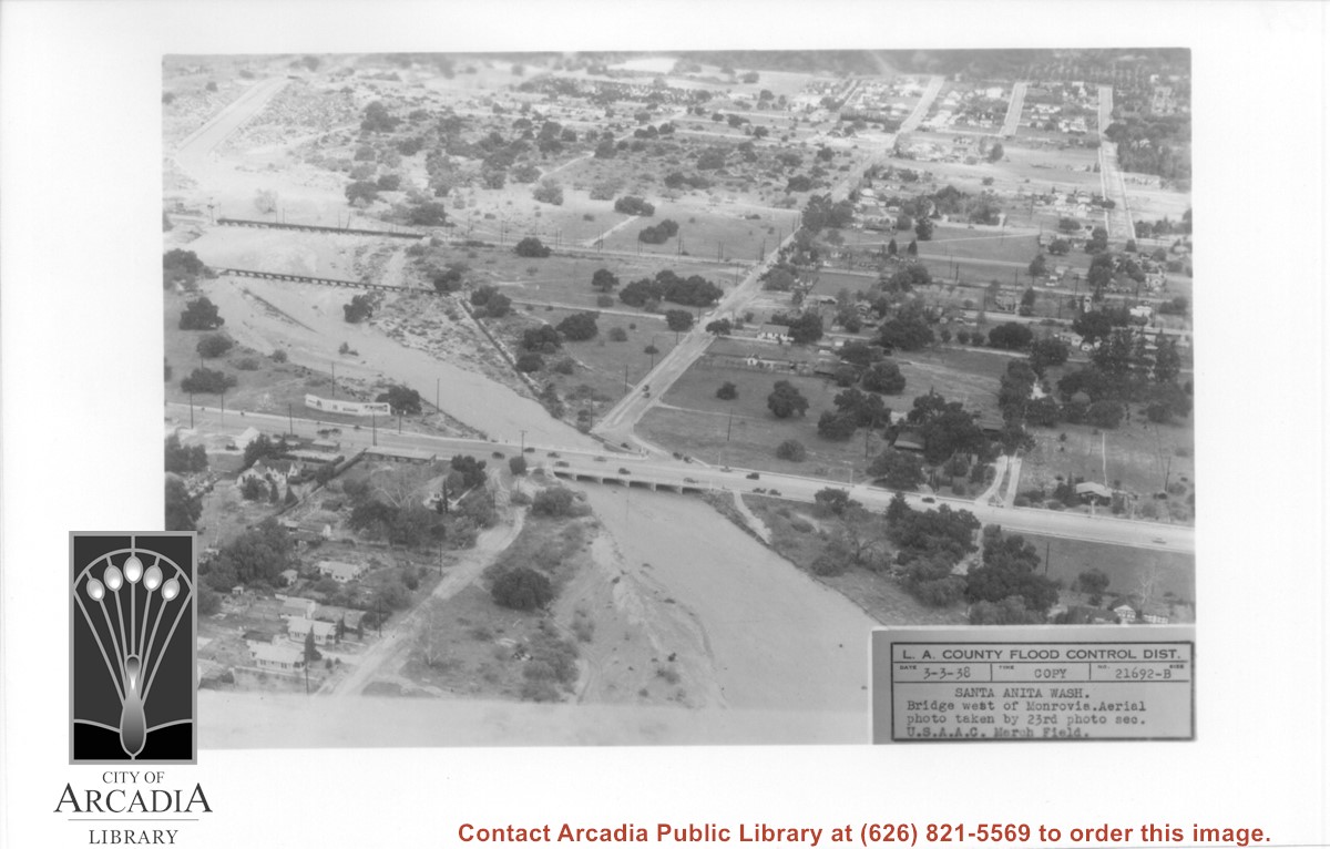
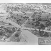
Aerial view looking north over flooded Santa Anita Wash looking upstream. Street cutting across photo closest to bottom is Huntington Drive. The next crossing upstream carries Santa Fe Railroad track. The last crossing that is clearly visible is Pacific Electric Railroad bridge. North/south street crossing Huntington Drive nearest wash would be Fifth Avenue. Foothill Boulevard is just barely visible near top of photo.
https://arcadiahistory.andornot.com/en/permalink/photographs815
- Date
- March 3, 1938
1 image
- Date
- March 3, 1938
- Subjects
- Aerial Photo Collection
- Aerial views
- Fifth Avenue
- Flood control
- Foothill Boulevard
- Huntington Drive
- Railroads
- Santa Anita Wash
- Physical Description
- 5x7 b&w
- ID
- 809
- Collection
- Photographs
Images
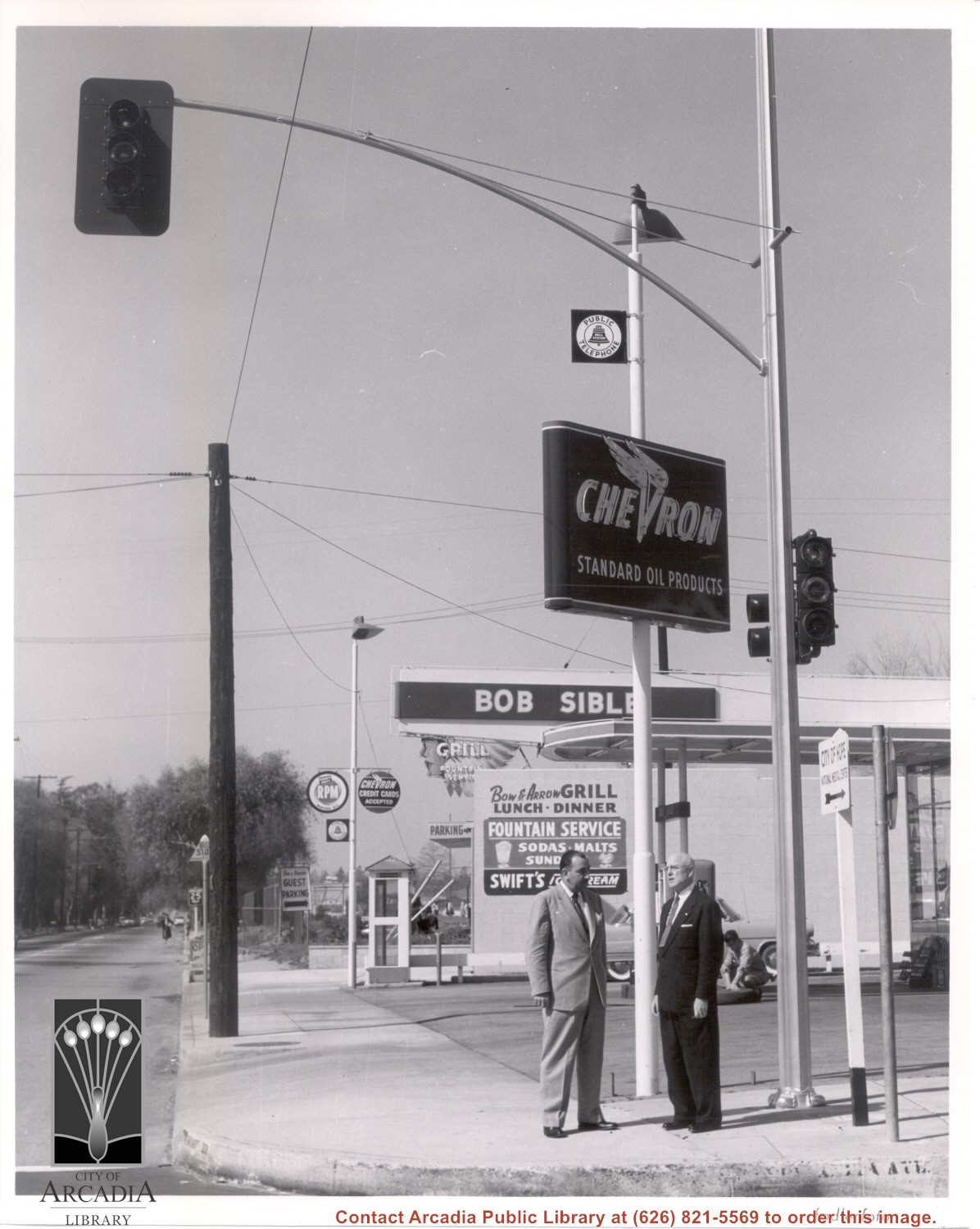
Corner of Santa Anita Avenue and Duarte Road. Two unidentified men are standing at the corner next to a Chevron Sign. Bob Sible's Chevron Service, located at 5 W. Duarte Road, is partly visible on the right corner. The Bow & Arrow Grill at 11 W. Duarte Road is seen just west of the Chevron station. Both businesses are listed in the 1955 City Directory.
https://arcadiahistory.andornot.com/en/permalink/photographs1652
- Date
- c. early 1950s
1 image
- Date
- c. early 1950s
- Subjects
- Streets - Santa Anita Avenue
- Streets - Duarte Road
- Service Stations - Bob Sible Chevron Service
- Bow & Arrow Grill
- Physical Description
- 8x10 b&w
- ID
- 1640
- Collection
- Photographs
Images

Santa Anita Church sustained considerable windstorm damage. The colored glass plates got smashed in several places by the winds. The church is at 226 W. Colorado Boulevard, Arcadia.
https://arcadiahistory.andornot.com/en/permalink/newspaper32751
- Newspaper
- Arcadia Weekly,
- Date
- December 22, 2011
- Pages
- p. 23
- Subjects
- Dore, Rupa
- Santa Anita Church
- Weather
- Windstorms
- Item ID
- 32948AN
- Collection
- Newspaper Index
Article, with map, about public hearing on a request by the Santa Anita Oaks Homeowners Association to barricade several streets on a temporary basis.
https://arcadiahistory.andornot.com/en/permalink/newspaper3385
- Newspaper
- Arcadia Tribune
- Date
- March 18, 1979
- Pages
- p. A-1
- Subjects
- Streets
- Item ID
- 3275AN
- Collection
- Newspaper Index
Items regarding Santa Anita
https://arcadiahistory.andornot.com/en/permalink/newspaper4400
- Newspaper
- Arcadia Tribune
- Date
- February 26, 1953 p. 1 (improvements)
- November 7, 1957 p. q (landscaping)
- April 6, 1959 p. 5 (Eucalyptus trees removed)
- August 20, 1959 p. 1 (widening)
- March 3, 1960 p. 1 (trees)
- February 20, 1961 p. 1 (widening)
- May 28, 1962 p. 4 ( " )
- July 19, 1964 p. 1 (underpass at railroad crossing)
- September 1, 1968 p. 1 (restricted parking)
- Subjects
- Streets - Santa Anita
- Item ID
- 4276AN
- Collection
- Newspaper Index
Several blocks of Live Oak Avenue will be closed through Thursday while Edison crews remove street lights, traffic signals and wooden power poles that snapped under powerful overnight wind gusts Monday from the Santa Ana winds.
https://arcadiahistory.andornot.com/en/permalink/newspaper24846
- Newspaper
- Pasadena Star News
- Date
- January 7, 2003
- Pages
- p. A1
- Subjects
- Santa Ana Winds
- Streets - Live Oak Avenue
- Item ID
- 25042AN
- Collection
- Newspaper Index
View across dry grass field toward fenced area with two cows grazing. A house with some outbuildings appears in center background. Flood control label indicates it is along Santa Anita Wash.
https://arcadiahistory.andornot.com/en/permalink/photographs817
- Date
- April 19, 1940
1 image
- Date
- April 19, 1940
- Subjects
- Flood control
- Physical Description
- 5x7 b&w
- ID
- 811
- Collection
- Photographs
Images
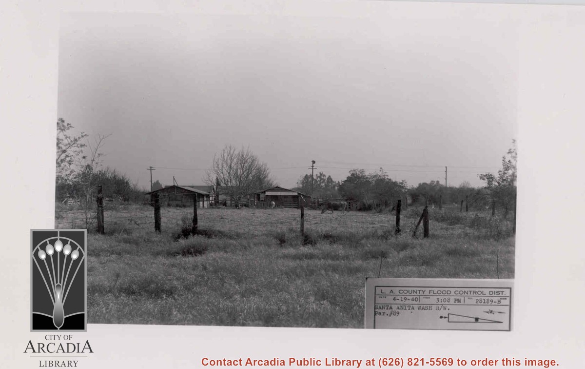
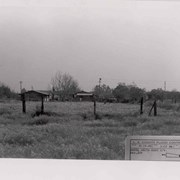
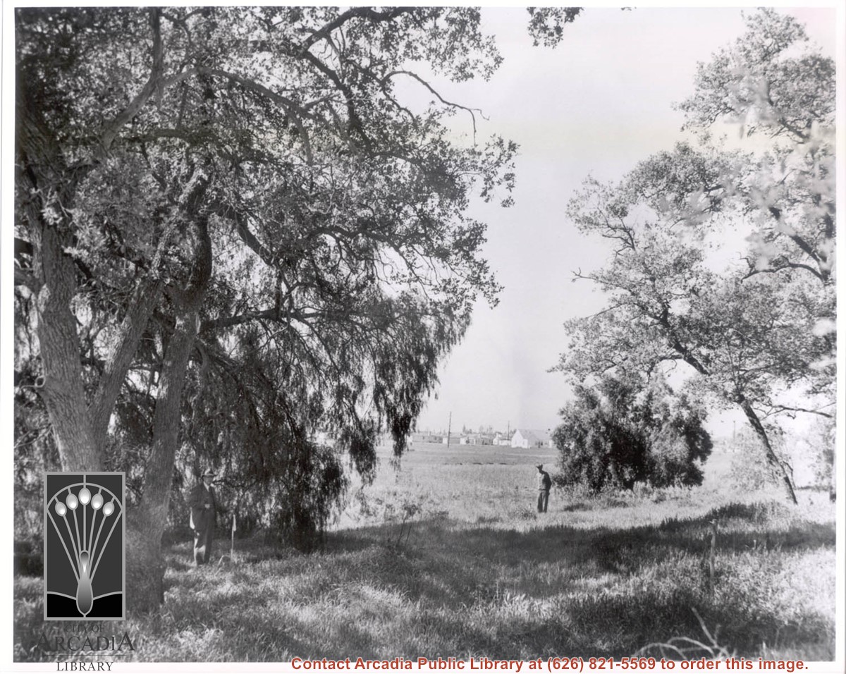
Photo of Rancho Santa Anita with one man standing near an oak tree on left and another man standing to the right. Houses are visible in the background. The men appear to be the same as in photos #1541 and 1542. Handwritten note on back reads, "Showing where proposed road turns from so. slope knoll towards south."
https://arcadiahistory.andornot.com/en/permalink/photographs1553
- Date
- probably March 24, 1943 (see photo #1541)
1 image
- Date
- probably March 24, 1943 (see photo #1541)
- Subjects
- Rancho Santa Anita Inc.
- Tallac Knoll
- Physical Description
- 8x10 b&w
- ID
- 1540
- Collection
- Photographs
Images
Westfield Santa Anita mall, Santa Anita Park race track, and other businesses cope with power outages and wind damage. Westfield Santa Anita mall was unable to open due to a widespread power outage although power was restored to the center's east end by 4:30 PM yesterday. Santa Anita Park was closed yesterday due to a power outage. The race track also sustained wind-related damage to the roof in its stable area and also had several uprooted trees. Huge, old trees were blown down in Arcadia.
https://arcadiahistory.andornot.com/en/permalink/newspaper32660
- Newspaper
- Pasadena Star News
- Date
- December 2, 2011
- Pages
- p. A19
- Subjects
- Disasters
- Santa Anita Park race track
- Weather
- Westfield Santa Anita mall
- Wind and windstorms
- Item ID
- 32857AN
- Collection
- Newspaper Index
Santa Anita Dam sediment project is nearly complete but residents and activists continue to question Los Angeles County's intentions for demolishing the 11-acre Arcadia Woodlands 1.5 years ago. Following the removal of the trees on January 12, 2011, the Los Angeles County Department of Public Works has been moving mud and debris from the dam to the middle and lower sediment placement sites by a massive conveyor belt. Moving the dirt makes flood control and water conservation possible for the neighboring populations of Arcadia and Sierra Madre.
https://arcadiahistory.andornot.com/en/permalink/newspaper33170
- Newspaper
- Arcadia Weekly
- Date
- September 27, 2012
- Pages
- p. 1, 4
- Subjects
- Environment
- Los Angeles County Public Works
- Oak trees
- Santa Anita Dam Sediment Placement Site
- Item ID
- 33367AN
- Collection
- Newspaper Index
Santa Anita Companies is in final negotiations with several financial buyers.
https://arcadiahistory.andornot.com/en/permalink/newspaper25815
- Newspaper
- Arcadia Weekly
- Date
- April 10, 1997
- Pages
- p. 1
- Subjects
- Santa Anita Companies
- Item ID
- 26015AN
- Collection
- Newspaper Index
Heck Yeah, the race horse, goes the distance in win at Santa Anita Park in the California Cup Derby.
https://arcadiahistory.andornot.com/en/permalink/newspaper35093
- Newspaper
- Pasadena Star News
- Date
- February 20, 2018
- Pages
- p. B9
- Item ID
- 35282AN
- Collection
- Newspaper Index