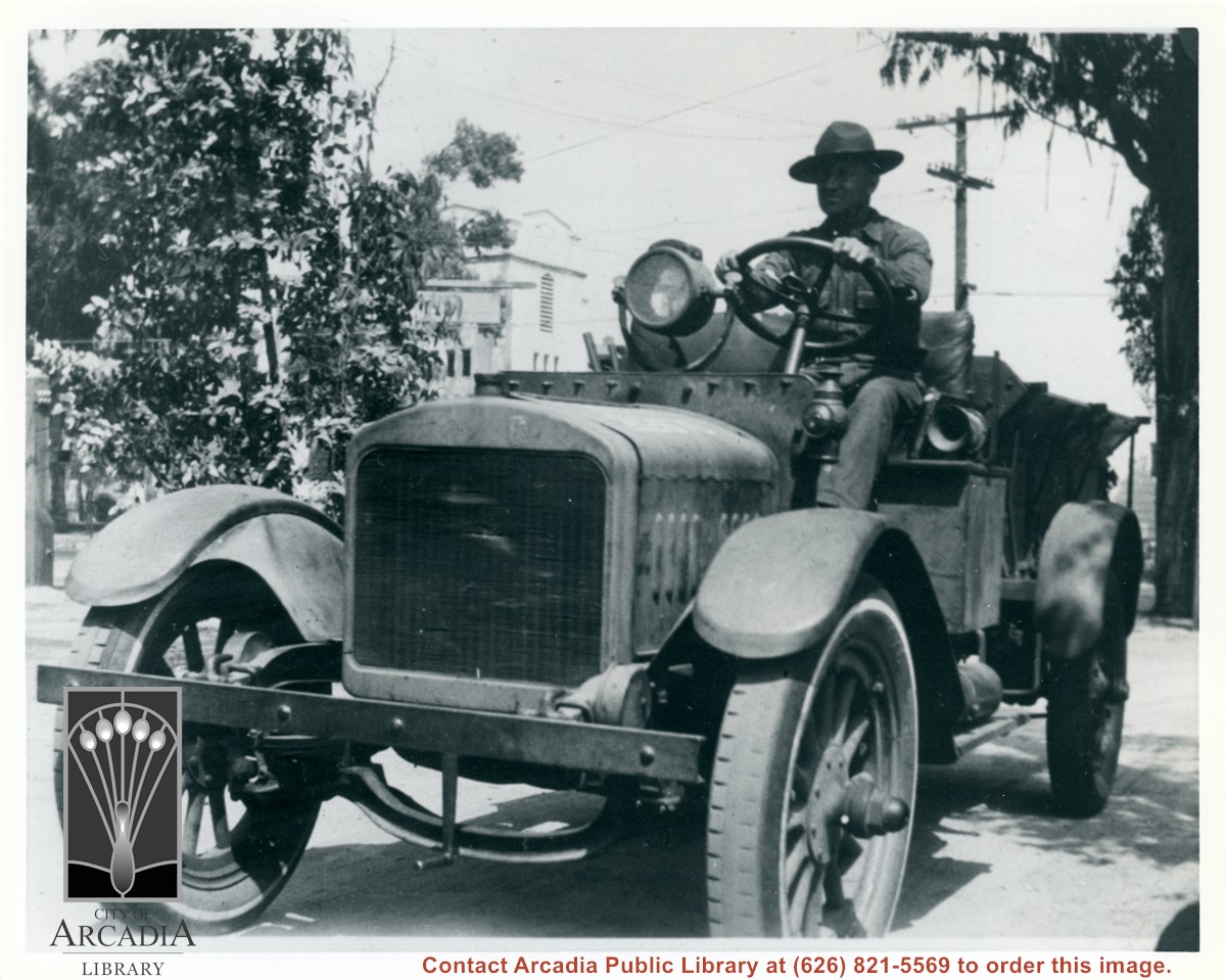
Military vehicle, probably used to hoist and pull down the observation balloons used at Ross Field. Two men stand at the back, one with his arm raised as a signal. The San Gabriel Mountains can be seen VERY faintly in background. Buildings at the Balloon School can be seen on either side of the truck.
https://arcadiahistory.andornot.com/en/permalink/photographs1055
- Date
- c.1918
1 image
- Date
- c.1918
- Subjects
- Balloon School
- Physical Description
- 8x10 b&w
- ID
- 1047
- Collection
- Photographs
Images

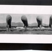
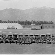
Shows six balloons inflated and secured just off the ground. Officers and men are in formations beneath the balloons. Buildings and tents of Ross Field are arrayed across photo. Eucalyptus make a row completely across photo. San Gabriel Mountains form backdrop.
https://arcadiahistory.andornot.com/en/permalink/photographs187
- Date
- c.1918
1 image
- Date
- c.1918
- Subjects
- Balloon School
- San Gabriel Mountains
- Physical Description
- 4x10 b&w
- ID
- 186
- Collection
- Photographs
Images

U.S. Army Balloon School (Ross Field) in Arcadia. View is to the north with the San Gabriel Mountains in the background. In the foreground are Army vehicles lined in a row. Buildings are visible behind the vehicles.
https://arcadiahistory.andornot.com/en/permalink/photographs1350
- Date
- c.1917-1918
1 image
- Date
- c.1917-1918
- Subjects
- Balloon School
- Physical Description
- 68x11 1/2 b&w self- framed
- ID
- 1341
- Collection
- Photographs
Images

Bobcat Fire, on its 9th day in the San Gabriel Mountains, continued to grow north of the San Gabriel Valley. It had charred 38,299 acres Monday with containment at 3%. The fire has crossed to west side of Santa Anita Canyon. On Sunday, residents in Arcadia and Sierra Madre who live north of Elkins Avenue and east of Santa Anita Avenue were ordered to evacuate. About 305 homes were in the evacuation zone. Most are in Arcadia and 32 are in Sierra Madre.
https://arcadiahistory.andornot.com/en/permalink/newspaper35803
- Newspaper
- Pasadena Star News
- Date
- September 15, 2020
- Pages
- p. A1, A6
- Collection
- Newspaper Index
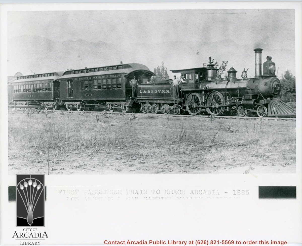
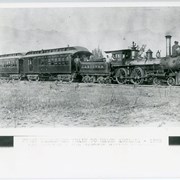
Engine, coal car, and two passenger coaches standing on track. The train is of the Los Angeles and San Gabriel Valley line. The engineer is sitting at his window in cab. Several other crew members can be seen. San Gabriel Mountains form backdrop of photo.
https://arcadiahistory.andornot.com/en/permalink/photographs216
- Date
- c.1885
1 image
- Date
- c.1885
- Subjects
- Railroads
- San Gabriel Mountains
- Physical Description
- 8x10 b&w
- ID
- 215
- Collection
- Photographs
Images
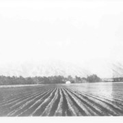
Spring 1935. Santa Anita Rancho field crops of many varieties were grown. View is toward the north. San Gabriel mountains completely across the photo. Chantry Flats Road visible at right side. White barn prominent in center of photo.
https://arcadiahistory.andornot.com/en/permalink/photographs15
- Date
- Spring 1935
1 image
- Date
- Spring 1935
- Physical Description
- 6x10 b&w 2 prints
- ID
- 15
- Collection
- Photographs
Images

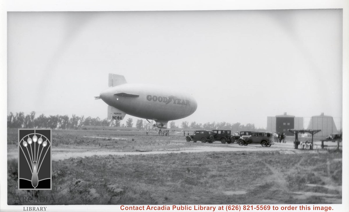
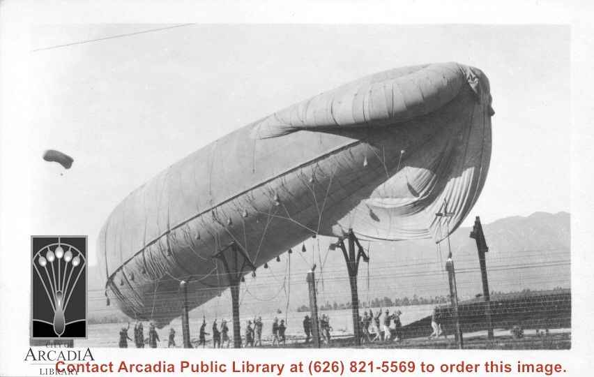
Goodyear blimp VOLUNTEER is seen stopping at Ross Field Balloon School in 1929. Five automobiles are seen parked and interested spectators are standing nearby. The two large hangars at the extreme west portion of the Balloon School land are seen in background.
https://arcadiahistory.andornot.com/en/permalink/photographs868
- Date
- 1929
1 image
- Date
- 1929
- Subjects
- Balloon School
- Aeronautics
- Physical Description
- 8x10 b&w
- ID
- 862
- Collection
- Photographs
Images
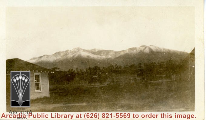
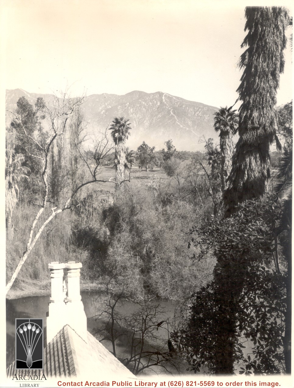
View from top of Queen Anne cottage toward San Gabriel Mountains. Double chimney of Queen Anne shows clearly. Water of the lake can also be seen.
https://arcadiahistory.andornot.com/en/permalink/photographs139
- Date
- unknown
1 image
A special supplement, "Hi Neighbor . . . A Guide to Living in the San Gabriel Valley," offers information on the organization, services, entertainment, shopping, etc. of various cities in the area, including Arcadia.
https://arcadiahistory.andornot.com/en/permalink/newspaper2423
- Date
- October 29, 1981
- Subjects
- San Gabriel Valley
- Item ID
- 2374AN
- Collection
- Newspaper Index
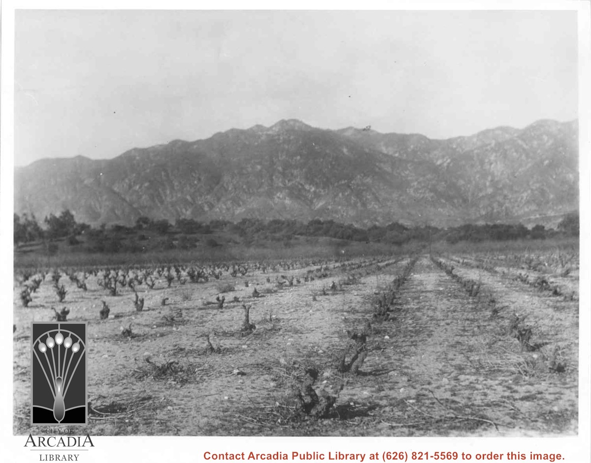
Vineyards on Baldwin Ranch. View is north from a point of present Huntington Drive. Chantry Flats Road is visible at right edge of photo. San Gabriel Mountains form background.
https://arcadiahistory.andornot.com/en/permalink/photographs2
- Date
- c.1900
1 image
- Date
- c.1900
- Subjects
- Agriculture
- Rancho Santa Anita
- Baldwin, Elias J. "Lucky" - Wines and winemaking
- San Gabriel Mountains
- Physical Description
- 8x10 b&w 2 prints 2 slides
- ID
- 2
- Collection
- Photographs
Images
One balloon in sky (extreme left) and one balloon on ground with approximately 23 men making it secure. High wire fence in foreground. San Gabriel Mountains form background.
https://arcadiahistory.andornot.com/en/permalink/photographs158
- Date
- c.1917 or 1918
1 image
- Date
- c.1917 or 1918
- Subjects
- Balloon School
- Physical Description
- 3x5 b&w
- ID
- 157
- Collection
- Photographs
Images
A special 40 page supplement titled A GUIDE TO LIVING IN THE WEST SAN GABRIEL VALLEY offers information on city governments, recreation facilities, service organizations, medical facilities, restaurants, etc.
https://arcadiahistory.andornot.com/en/permalink/newspaper2407
- Newspaper
- Arcadia Tribune Special Supplement photo
- Date
- October 30, 1980
- Subjects
- San Gabriel Valley
- Item ID
- 2358AN
- Collection
- Newspaper Index
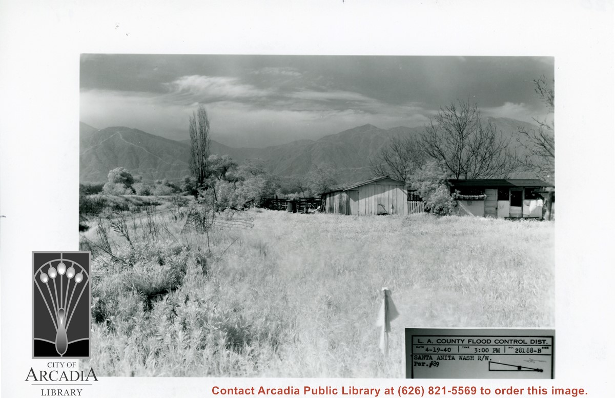
Small house and garage pictured on right side of photo. The view is across field of grass toward San Gabriel Mountains in background. Dramatic clouds fill the sky. There is a bare, tall Lombardy Poplar pictured near the wash. Caption on photo says it is Santa Anita Wash, but viewer is not aware of it. It must lie along left side of photo.
https://arcadiahistory.andornot.com/en/permalink/photographs826
- Date
- April 19, 1940
1 image
- Date
- April 19, 1940
- Subjects
- Santa Anita Wash
- San Gabriel Mountains
- Physical Description
- 5x7 b&w
- ID
- 820
- Collection
- Photographs
Images
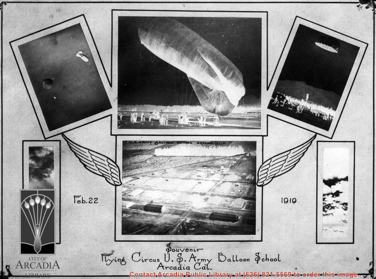
Copy of souvenir photo that may have been program cover for something called Flying Circus held February 22, 1919. Shows left to right: [a] bi-plane; [b] parachute and balloon in same shot; [c] balloon being secured by group of men; [d] parachute coming to the ground with group of people watching. [e] ? [f] aerial view of base.
https://arcadiahistory.andornot.com/en/permalink/photographs184
- Date
- 1919
1 image
- Date
- 1919
- Subjects
- Balloon School
- Physical Description
- 5x7 b&w
- ID
- 183
- Collection
- Photographs
Images
Flames continue north to homes. Residents evacuate as Bobcat Fire jumps Highway 2, tops mountain ridge, menaces Antelope Valley. The 50,539-acre fire which once primarily threatened San Gabriel Valley foothill communities after it started on September 6, jumped Highway 2 overnight and continues to spread north, putting Antelope Valley under an evacuation warning. Evacuation warnings were still in place for parts of Monrovia, Arcadia, Duarte, Bradbury, Sierra Madre, Pasadena, and Altadena, though evacuation orders in parts of Sierra Madre and Arcadia were lifted Wednesday.
https://arcadiahistory.andornot.com/en/permalink/newspaper35806
- Newspaper
- Pasadena Star News
- Date
- September 18, 2020
- Pages
- p. A1, A7
- Collection
- Newspaper Index
Secession took a new turn with the news that the San Fernando Valley is also considering splitting off from Los Angeles County. Background of the reasons and feelings behind these moves in both the San Fernando and San Gabriel valleys is outlined.
https://arcadiahistory.andornot.com/en/permalink/newspaper2410
- Newspaper
- Arcadia Tribune
- Date
- June 22, 1975
- Pages
- p. A-1
- Subjects
- San Gabriel Valley - Secession
- Item ID
- 2361AN
- Collection
- Newspaper Index
View north toward San Gabriel Mountains. Men of Ross Field Balloon School, holding gondola or basket just coming to the ground or being readied to go aloft.
https://arcadiahistory.andornot.com/en/permalink/photographs161
- Date
- c.1917-1918
1 image
- Date
- c.1917-1918
- Subjects
- Balloon School
- Physical Description
- 2x3 b&w
- ID
- 160
- Collection
- Photographs
Images
Master Sgt. William Bucher sitting at steering wheel of Army vehicle just inside grounds of Ross Field Balloon School. Behind him can be seen tower of Santa Anita Avenue and Huntington Drive.
https://arcadiahistory.andornot.com/en/permalink/photographs1015
- Date
- c.1927
1 image
- Date
- c.1927
- Subjects
- Balloon School
- Bucher, William
- Physical Description
- 8x10 b&w
- ID
- 1008
- Collection
- Photographs
Images
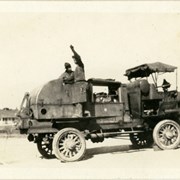
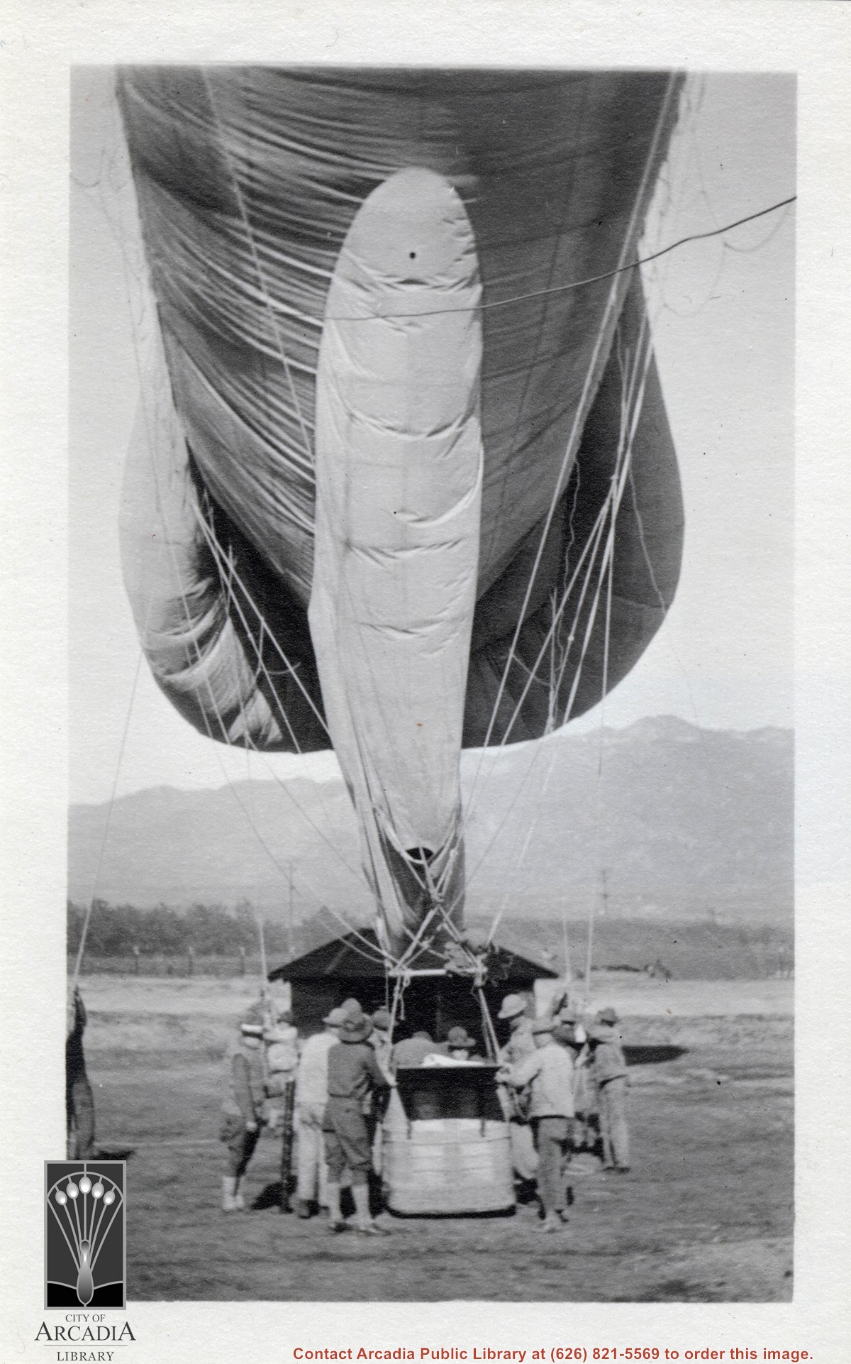
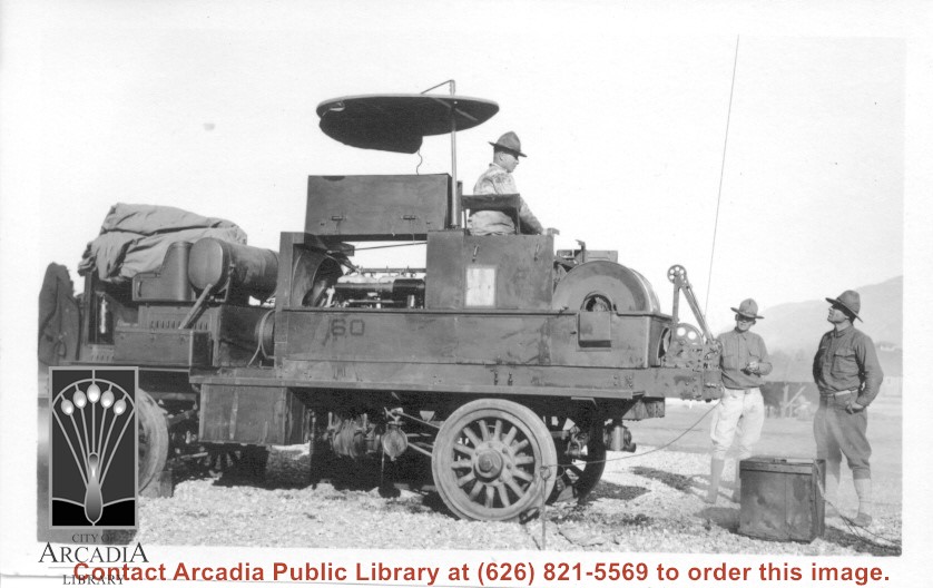
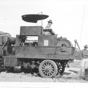
Four wheel drive truck with Cunningham winch used to get balloon aloft and back down and to keep them anchored. One truck for each balloon and had 1500 meters of heavy cable. Tires of truck were solid rubber. Note: ground line coming from truck near winch. This was to take care of static electricity generated along cable due to telephone in balloon. Information from H.F.Paden, Arcadia resident in 1978, former officer at Balloon School.
https://arcadiahistory.andornot.com/en/permalink/photographs157
- Date
- c.1917 or 1918
1 image
- Date
- c.1917 or 1918
- Subjects
- Balloon School
- Physical Description
- 3x5 b&w
- ID
- 156
- Collection
- Photographs
Images
Series of seven small photos of Ross Field. Photos are numbered as follows: a. Part of a building on left with San Gabriel Mountains very prominent in background; b. two balloons on the ground; c. airplane landing on what looks like an airstrip (barely visible): d. Balloon a few feet off ground in the distance; e. Man in uniform climbing the side of a mountain; f. Building; g. Balloon a few feet above the ground with many people standing on the ground looking toward it.
https://arcadiahistory.andornot.com/en/permalink/photographs1373
- Date
- c.1917-1918
1 image
- Date
- c.1917-1918
- Subjects
- Balloon School
- Physical Description
- seven photos, mostly 2x3 and 2.5x4
- ID
- 1363A
- Collection
- Photographs
Images