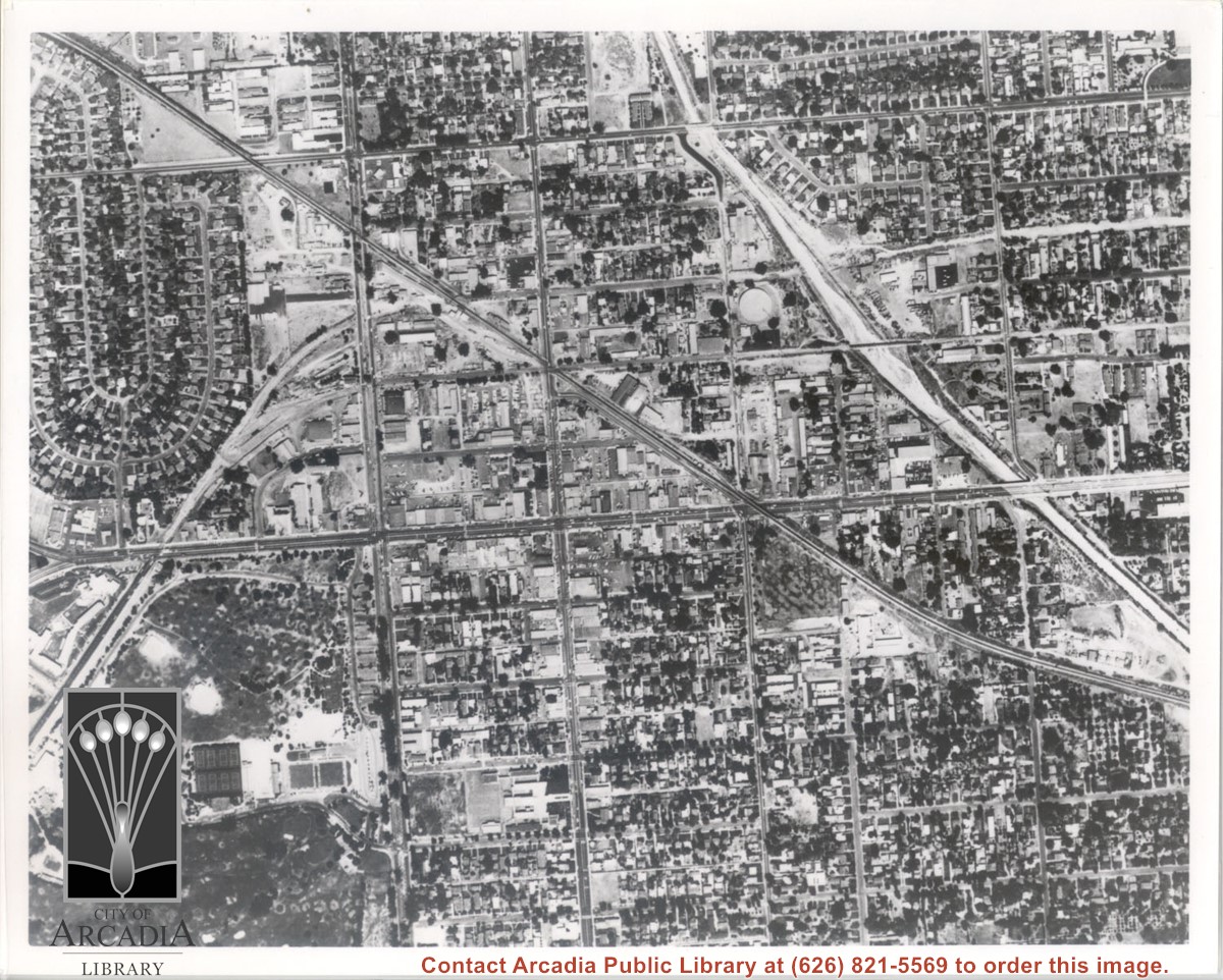
Santa Fe Railroad tracks cut diagonally across photo from east to west. Huntington Drive bisects photo from east to west approximately at center of photo. Arcadia County Park appears in lower left corner, showing baseball diamond. Santa Anita Wash is shown on right side of photo.
https://arcadiahistory.andornot.com/en/permalink/photographs625
- Date
- c. early 1950's
1 image
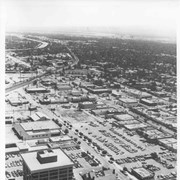
Aerial view toward the east from location about over Santa Anita Avenue at Santa Clara Street intersection. Santa Fe Railroad tracks are seen entering the city about in the center of photo. Broad white roadway seen toward left side of photo is 210 or Foothill Freeway still under construction.
https://arcadiahistory.andornot.com/en/permalink/photographs610
- Date
- c. 1968 or 1969
1 image
- Date
- c. 1968 or 1969
- Subjects
- Aerial Photo Collection
- Aerial views
- 210 Foothill Freeway
- Postal Service - post office
- Railroads
- Santa Anita Avenue
- Wheeler Avenue
- Physical Description
- 8x10 b&w
- ID
- 606
- Collection
- Photographs
Images

Aerial view taken looking southeast from position about over present Arboretum. Photo shows Santa Anita Park, probably in opening season. Present City Hall sits in area just beyond cars parked at east end of track. Part of oval of old Santa Anita track built by Elias J. "Lucky" Baldwin is seen in upper portion of photo, in area that is now Arcadia County Park. Duarte Road is seen crossing photo in upper right corner. Present Arcadia County Park area is in this photo, bordered on the north by Pacific Electric Railroad tracks. A train has just brought a group to the races and they are seen walking in center of photo. White square seen near right side, is slab left from hangars when U.S. Army Balloon School occupied this site, 1917-1927.
https://arcadiahistory.andornot.com/en/permalink/photographs986
- Date
- c.1934 racing season
1 image
- Date
- c.1934 racing season
- Subjects
- Aerial Photo Collection
- Aerial views
- Arcadia County Park
- Duarte Road
- Race tracks
- Railroads
- Santa Anita Park-1934-1942
- Santa Anita Park-1907-1912
- Physical Description
- 8x10 b&w
- ID
- 978
- Collection
- Photographs
Images

