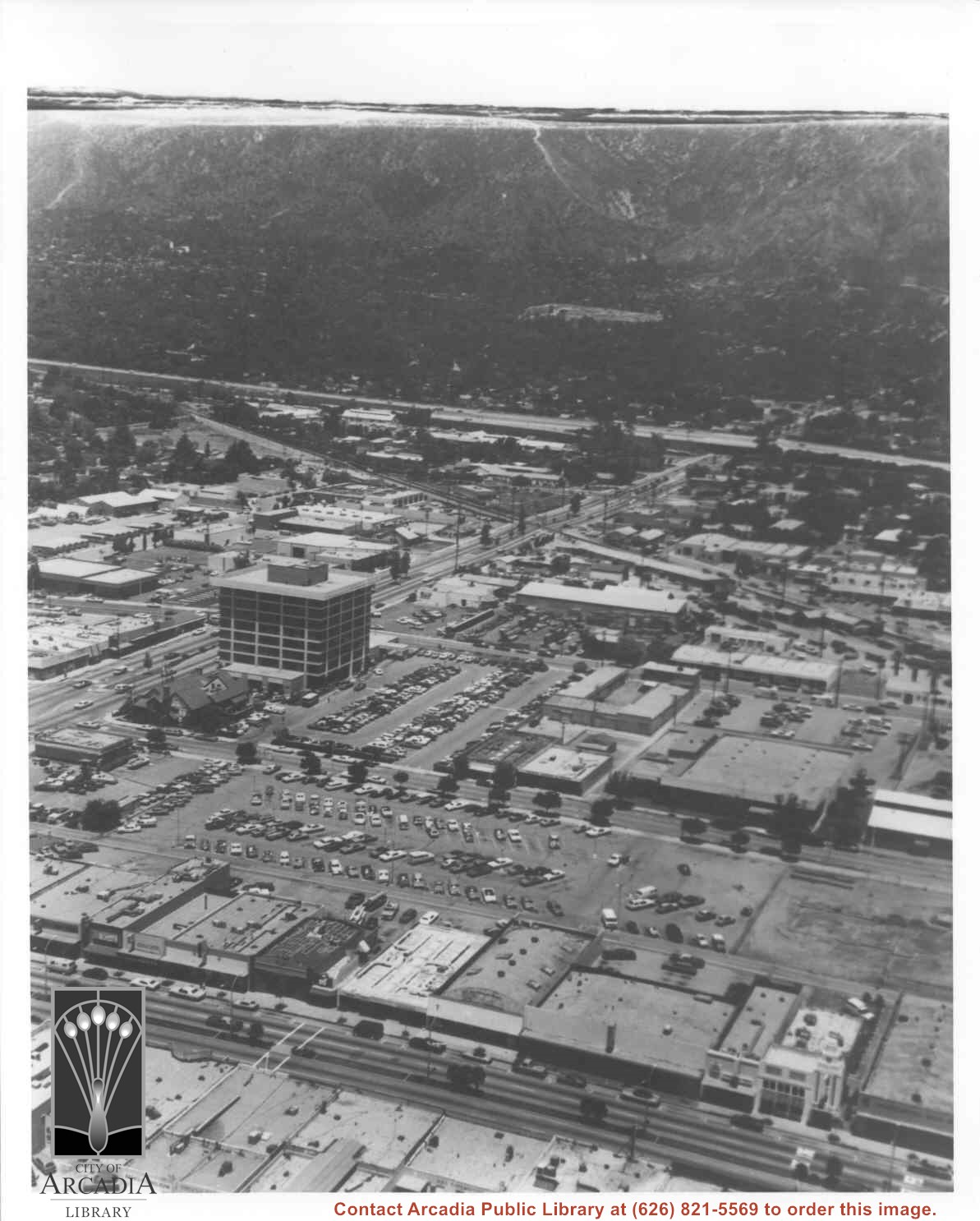
Aerial view looking east across Santa Anita Park taken from a position just west of Baldwin Avenue, which is seen at bottom of photo. Huntington Drive appears exactly in center of photo just east of race track. The 210 Foothill Freeway enters area in upper right portion of picture and exits at left side in upper left portion.
https://arcadiahistory.andornot.com/en/permalink/photographs996
- Date
- c.1979
1 image
- Date
- c.1979
- Subjects
- Aerial Photo Collection
- Aerial views
- 210 Foothill Freeway
- Huntington Drive
- Santa Anita Park-1945-1980
- Physical Description
- 8x10 b&w
- ID
- 989
- Collection
- Photographs
Images


Aerial view north toward San Gabriel Mountains from a position above Huntington Drive near First Avenue. Santa Anita Avenue can plainly be seen running north and south in front of six-story building in center of photo. The 210 Foothill Freeway is top band running across photo from east to west.
https://arcadiahistory.andornot.com/en/permalink/photographs611
- Date
- July 1976
1 image

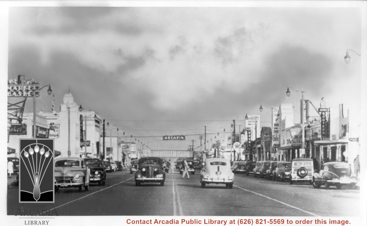
View east on Huntington Drive from near intersection with Santa Anita. Old City Hall was still at NW corner of Huntington Drive and First at this time. Theater which was on south side appears to be gone. Seeley's Jewelers is in 1948 City Directory, but not 1944 City Directory.
https://arcadiahistory.andornot.com/en/permalink/photographs603
- Date
- c. mid-1940's
1 image

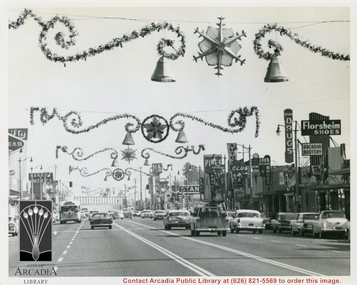
View east on Huntington Drive mid-way in block between Santa Anita and First Avenue during holiday season. Notice the Arcadia sign that had for many years hung over intersection at First Avenue has been removed (also referred to as a "Welcome" sign). Santa Fe Railroad overpass in view crossing over Huntington Drive.
https://arcadiahistory.andornot.com/en/permalink/photographs605
- Date
- November 13, 1959
1 image
- Date
- November 13, 1959
- Physical Description
- 8x10 b&w
- ID
- 601
- Collection
- Photographs
Images