Aerial view looking east across Santa Anita Park taken from a position just west of Baldwin Avenue, which is seen at bottom of photo. Huntington Drive appears exactly in center of photo just east of race track. The 210 Foothill Freeway enters area in upper right portion of picture and exits at left side in upper left portion.
https://arcadiahistory.andornot.com/en/permalink/photographs996
- Date
- c.1979
1 image
- Date
- c.1979
- Subjects
- Aerial Photo Collection
- Aerial views
- 210 Foothill Freeway
- Huntington Drive
- Santa Anita Park-1945-1980
- Physical Description
- 8x10 b&w
- ID
- 989
- Collection
- Photographs
Images


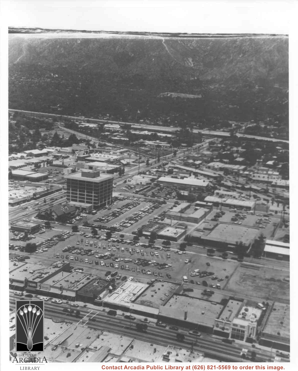
Aerial view north toward San Gabriel Mountains from a position above Huntington Drive near First Avenue. Santa Anita Avenue can plainly be seen running north and south in front of six-story building in center of photo. The 210 Foothill Freeway is top band running across photo from east to west.
https://arcadiahistory.andornot.com/en/permalink/photographs611
- Date
- July 1976
1 image

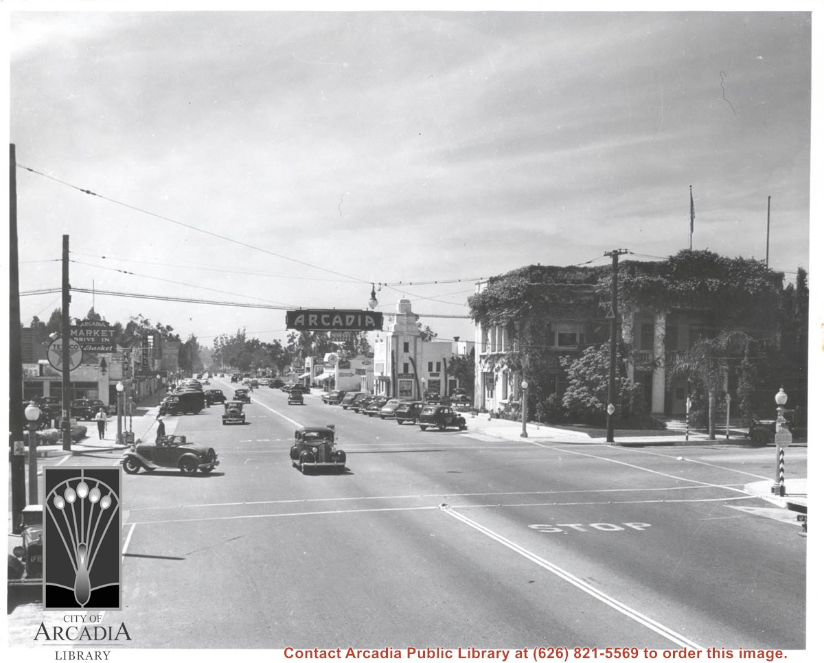
Huntington Drive looking west from near intersection of First Avenue. On NW corner is vine-covered City Hall. Open roadster has just made a left turn and is going south on First. There is a moving picture theater mid-way along street on south side with large banner advertising Charles Laughton Film. This photo belongs to the Huntington Library. It is shown here for research only.
https://arcadiahistory.andornot.com/en/permalink/photographs594
- Date
- 1938
1 image
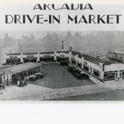
View south, perhaps from top of City Hall on Corner of First and Huntington Drive, to Arcadia Drive-In Market. Located on SW corner of the same intersection there was, in addition to the Service Station, a dry cleaners, a bakery, a fresh vegetable market, a meat market, a grocery store, and the Pines Cafe. First Avenue is street seen on the left.
https://arcadiahistory.andornot.com/en/permalink/photographs899
- Date
- Market opened 1929
1 image
- Date
- Market opened 1929
- Physical Description
- 6 1/2 x 10 b&w
- ID
- 892
- Collection
- Photographs
Images