Looking SW from mountains north of Arcadia. Major tree-lined street running from mountains south is Santa Anita Avenue. Southernmost tree-lined street cutting across entire middle of photo is Duarte Road. Barracks at the Balloon School can be seen just below Huntington Drive. Notice that Huntington Drive stops just west of the Balloon School, at the Baldwin Ranch. Much of Foothill area was planted to citrus.
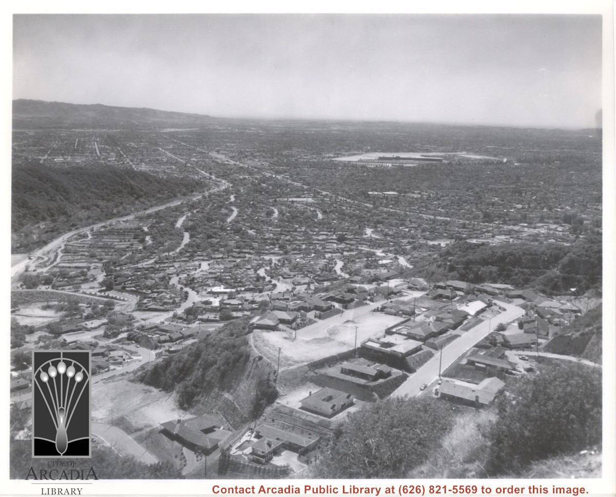
Aerial view south from Chantry Flats Road over the still-developing upper Highlands section of Arcadia. View is across Arcadia toward the Puente Hills. Santa Anita Park Race Track is seen in the center. Santa Anita Wash is seen on extreme left.
Aerial view toward north from a position south of Huntington Drive near intersection with Baldwin Avenue. It shows Santa Anita Fashion Park (currently known as Westfield Santa Anita Shopping Mall) developed by and on property owned by Santa Anita Consolidated. The Santa Anita Park Race Track and club house can be seen in center of photo. The straight white line about one inch above the club house roof is 210 Foothill Freeway. Chantry Flats road can be seen going up into San Gabriel Mountains in distance.