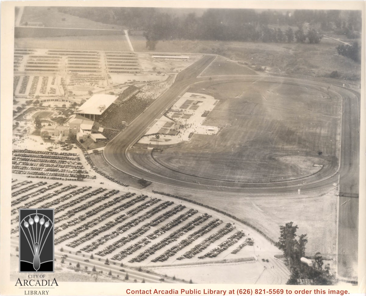
Aerial view looking west over Santa Anita Park. Photo was taken from about over intersection of Colorado Place and Huntington Drive. Note area that was to become Los Angeles County Arboretum across top of photo. Note an open Grandstand has been added to the west of original covered one. There is a small dirigible in lower right corner carrying a sign that seems to read:modern motel. Present Baldwin Avenue would run where road in this photo is seen parallel to top of photo.
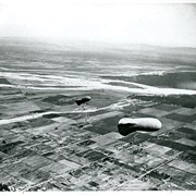
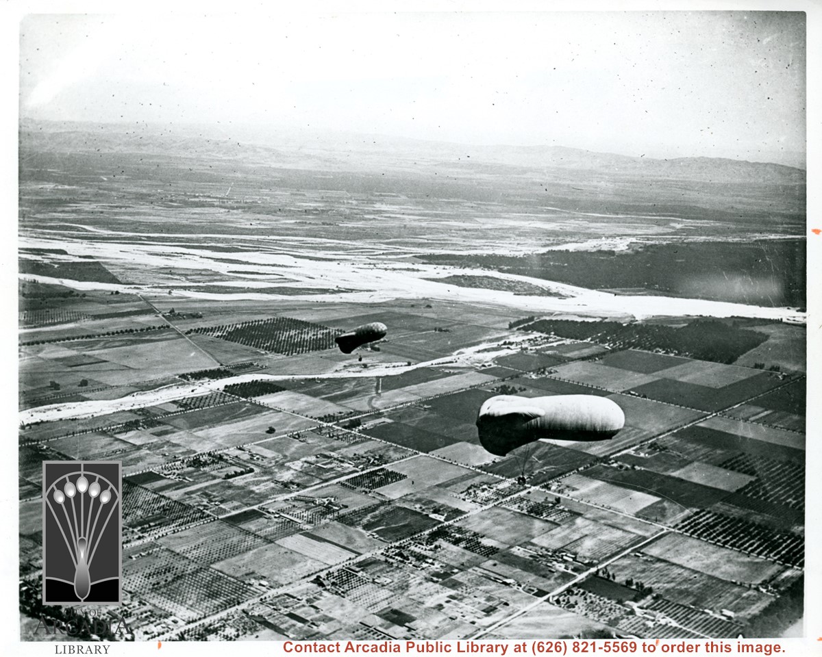
View east shows two balloons aloft over Arcadia and San Gabriel Valley. It is possible that first river up from bottom of photo is Rio Hondo Wash. Some of trees along Santa Anita appear to be in extreme lower right of photo. Tree-lined street showing in extreme lower left of photo is Duarte Road. Second river coming into photo about five inches up from bottom of photo would be San Gabriel River.
Santa Anita School Mrs. Rutherford's fifth grade classroom photo by Thompson Photo Service, Los Angeles (from the envelope which has been discarded). The school was located at 1900 South Santa Anita Avenue from about 1950 until June, 1981. In 1982, Arcadia Christian School moved in to this location. Identification on the back reads: 1st row from left
Janet Johnson
Susan Cross
Lea Balabanoff
Holly Johnson
Margery Bailey
Janet Schlaifer
Cindy Humboldt
Vandy Savage
Linda Fryer
Joanne (Sue Sue) Goral
2nd row
Gary Kovacic
Sue Anne Tillman
Mary Noble
Kathy Kidd
Kathy Pounds
Christine Robinson
Shirley Blake
Karen Walker
Linda Smith
Mark Johnson
3rd row
Bob Berger
Clayton Fabeck
Ricky Ganzer
Drew Opel
Brett Winger
Scott Curry
Ronny Pon
Roy Poole
Marc Coleman
Roger Able
Mrs. Rutherford
Aerial view north up Santa Anita Avenue. Note Chantry Flats Road on mountain near right side of photo. This view was taken from just south of Huntington Drive. This image belongs to Arcadia Historical Society.
Aerial view toward north from a position south of Huntington Drive near intersection with Baldwin Avenue. It shows Santa Anita Fashion Park (currently known as Westfield Santa Anita Shopping Mall) developed by and on property owned by Santa Anita Consolidated. The Santa Anita Park Race Track and club house can be seen in center of photo. The straight white line about one inch above the club house roof is 210 Foothill Freeway. Chantry Flats road can be seen going up into San Gabriel Mountains in distance.