11 Arcadia High students named National Merit Scholarship Program semifinalis
Arcadia High School continues its 28-year streak of seeing a double-digit number of students represented in the renowned National Merit Scholarship Program. This year, 11 Arcadia High students are counted among less than 1% of high school seniors across the nation that have been named 2022 National Merit Scholarship semifinalists, who now have the opportunity to vie for one of nearly 7,500 scholarships that collectively total close to $30 million.
Los Angeles County National Merit Scholarship semi-finalists named. They will now compete for a share of scholarships worth almost $28 million. Those from Arcadia High School students are Isaac Cheng, Hongji Dai, Casey R. Kim, Kaitlyn A. Kwan, Caroline J. Ji, Jeffrey Oo, Steven H. Shi, Philip Tan, William Wong, Felicia Ye, Katelyn A. Yu.
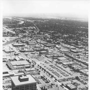
Aerial view toward the east from location about over Santa Anita Avenue at Santa Clara Street intersection. Santa Fe Railroad tracks are seen entering the city about in the center of photo. Broad white roadway seen toward left side of photo is 210 or Foothill Freeway still under construction.
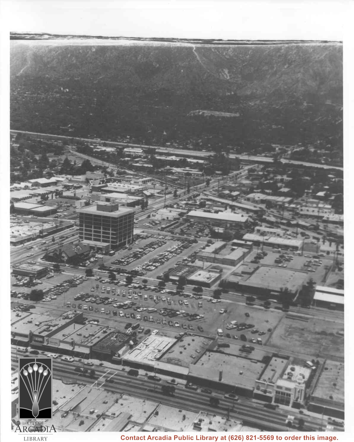
Aerial view north toward San Gabriel Mountains from a position above Huntington Drive near First Avenue. Santa Anita Avenue can plainly be seen running north and south in front of six-story building in center of photo. The 210 Foothill Freeway is top band running across photo from east to west.
Aerial view looking north across Santa Anita Park from a position over Arcadia County Park. Large infield crowd is evident and all parking areas are filled. Arcadia Methodist Hospital shows in lower left part of photo and Arcadia Police facility is seen in lower right. The 210 Foothill Freeway cuts across photo near the top.
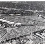
Aerial view looking east across Santa Anita Park taken from a position just west of Baldwin Avenue, which is seen at bottom of photo. Huntington Drive appears exactly in center of photo just east of race track. The 210 Foothill Freeway enters area in upper right portion of picture and exits at left side in upper left portion.
Aerial view taken over Arcadia so that it shows a large area surrounding Arcadia as well as the entire city. Clearly seen is the Santa Anita Park Race Track, and the Arcadia County Park (shown as a dark triangle in center), and the 210 Foothill Freeway crossing photo from west to east and passing north of Santa Anita Park Race Track.
Aerial view toward north from a position south of Huntington Drive near intersection with Baldwin Avenue. It shows Santa Anita Fashion Park (currently known as Westfield Santa Anita Shopping Mall) developed by and on property owned by Santa Anita Consolidated. The Santa Anita Park Race Track and club house can be seen in center of photo. The straight white line about one inch above the club house roof is 210 Foothill Freeway. Chantry Flats road can be seen going up into San Gabriel Mountains in distance.