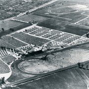
Aerial view looking west across Santa Anita Park from a position about Santa Anita Avenue just north of Huntington Drive. In the upper right portion of the photo can be seen the extensive earthwork done for the track Anita Baldwin and Joe Smoot planned to build. That vast area now is entirely built with homes and apartments and is called Santa Anita Village. Present-day Baldwin Avenue would follow the line shown by the Ranch Road bisecting the photo from right to left just east of the track abandoned by Anita Baldwin and Joe Smoot.
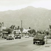
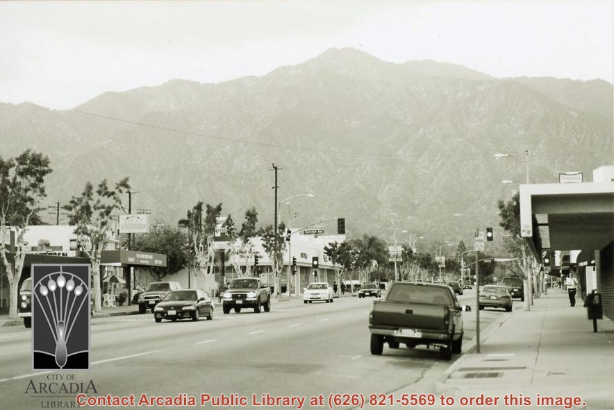
Street view looking north on Baldwin Avenue. Intersection in the middle is Fairview Avenue. 7-11 convenience store is on the southwest corner of Baldwin Avenue and Fairview Avenue, and Thai Classic restaurant is also visible. Photograph by Terry Miller.
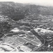
Aerial view looking northeast across Santa Anita Park toward mountains. Note training track called Anita Chiquita has been added (lower left corner), open grandstand has been added to west of covered stand. Note, too, that work has begun to change Balloon School site to Arcadia County Park. Santa Anita Avenue is tree-lined street running entire width of photo about middle of print.
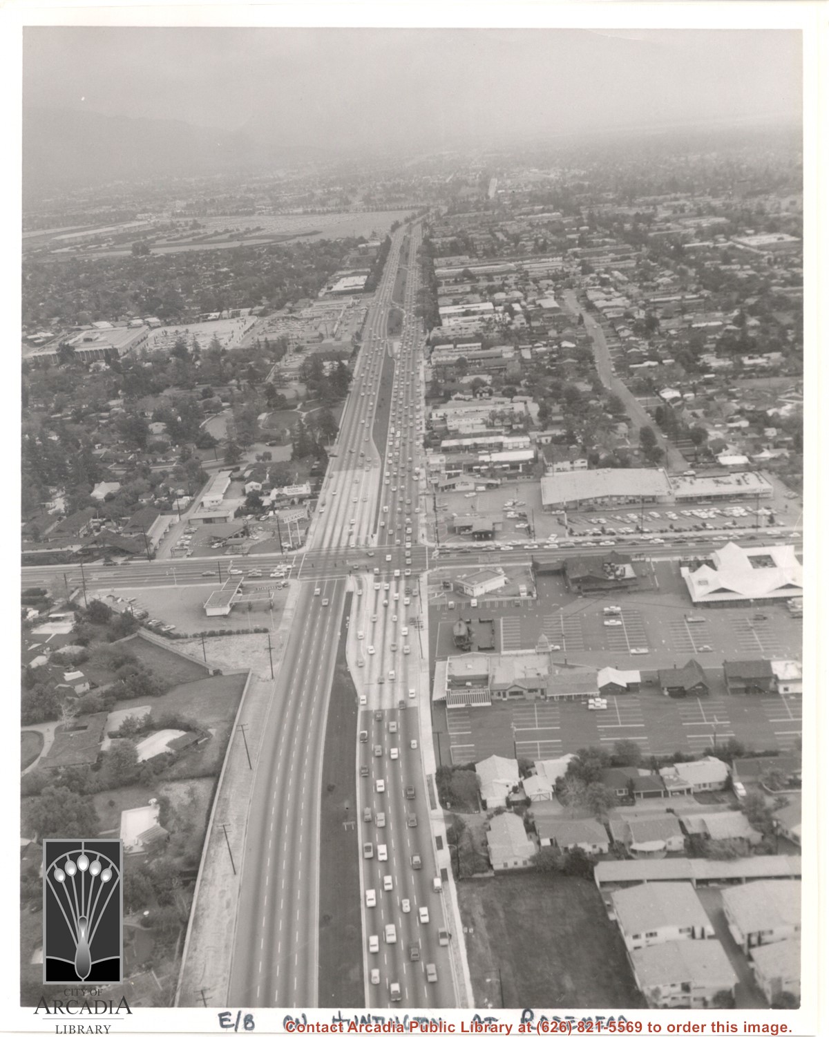
Aerial view east on Huntington Drive toward Arcadia from a position just west of Rosemead Boulevard. El Rancho Shopping Center and May Company Department Store can be seen as the business complex on the north side of Huntington Drive one block east of Rosemead Boulevard. Santa Anita Park Race Track can be seen on the left in upper portion of photo.
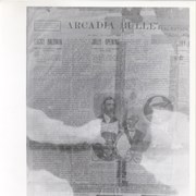
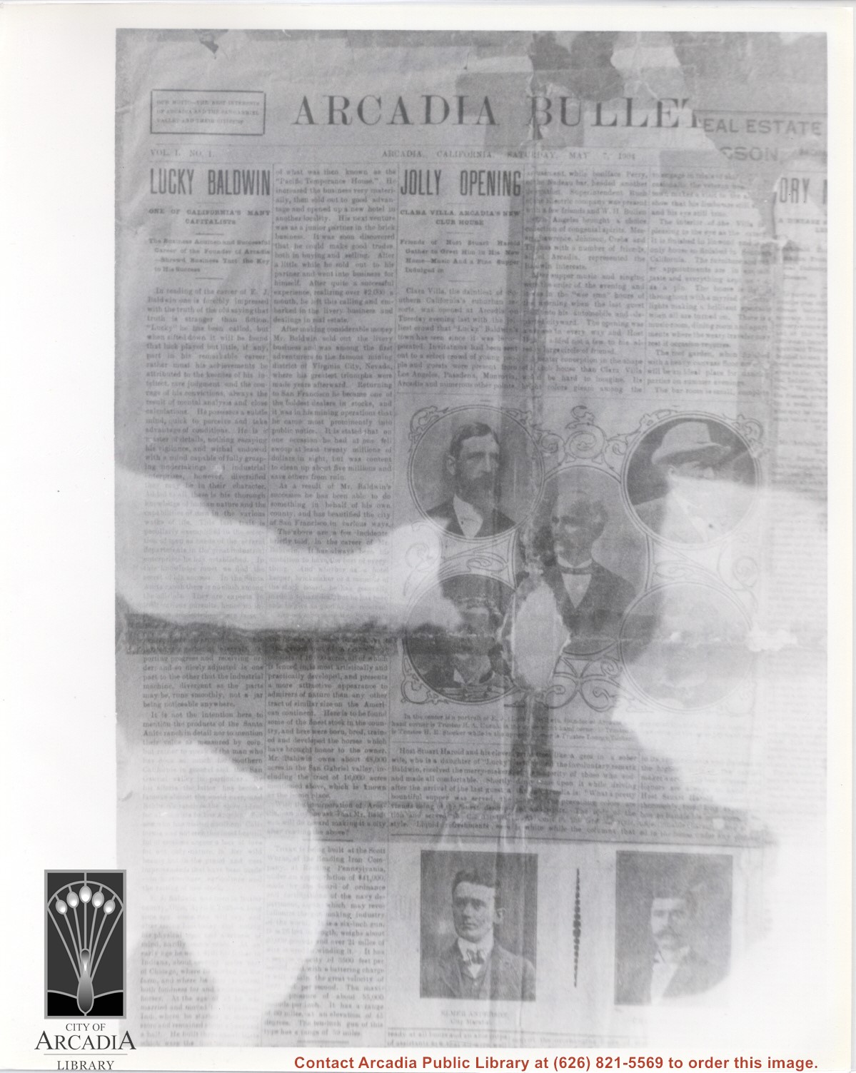
Volume I no. 1 issue of first Arcadia newspaper, THE ARCADIA BULLETIN. Paper included an article on the opening of Clara Villa which opened May 3, 1904. The paper has photos of five members of the Board of Trustees (now City Council) and also one of Arcadia's first City Marshall, Elmer Anderson and his brother, Charles Anderson, City Treasurer.
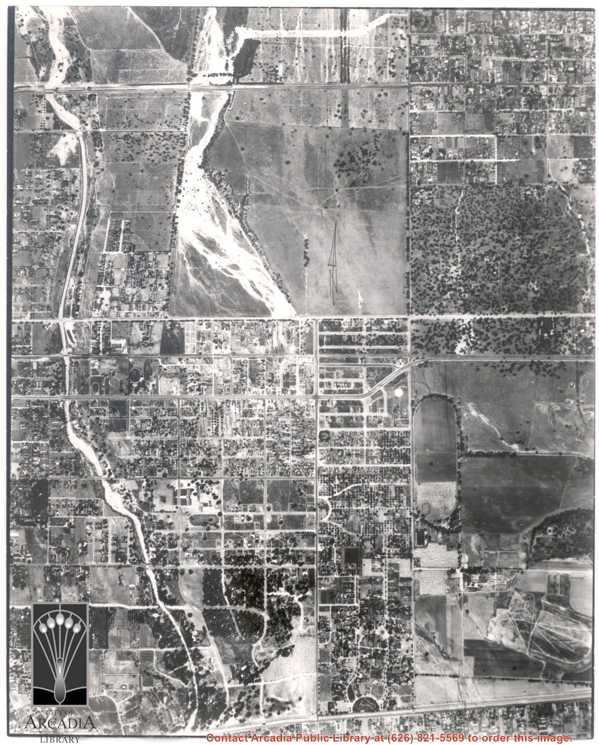
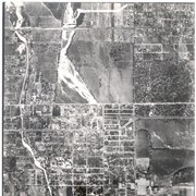
Main north/south running street to right of center is Michillinda Avenue. Oval adjacent to Michillinda Avenue is Elias J. "Lucky" Baldwin's training track. Lower right corner of photo is abandoned project of Anita Baldwin and Joe Smoot, c. 1933 (about where May Company was and where Vons, a Safeway Company, Southern California Division Headquarters is now, at 618 Michillinda Avenue). Street running east/west across center of photo is present day Colorado Boulevard. East/west-running street near top of photo is present Foothill Boulevard. Wash along left side of photo is Eaton Wash, Pasadena. Scale: 1 inch=660 feet.
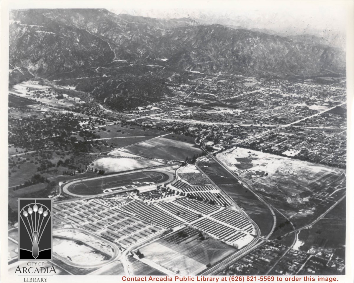
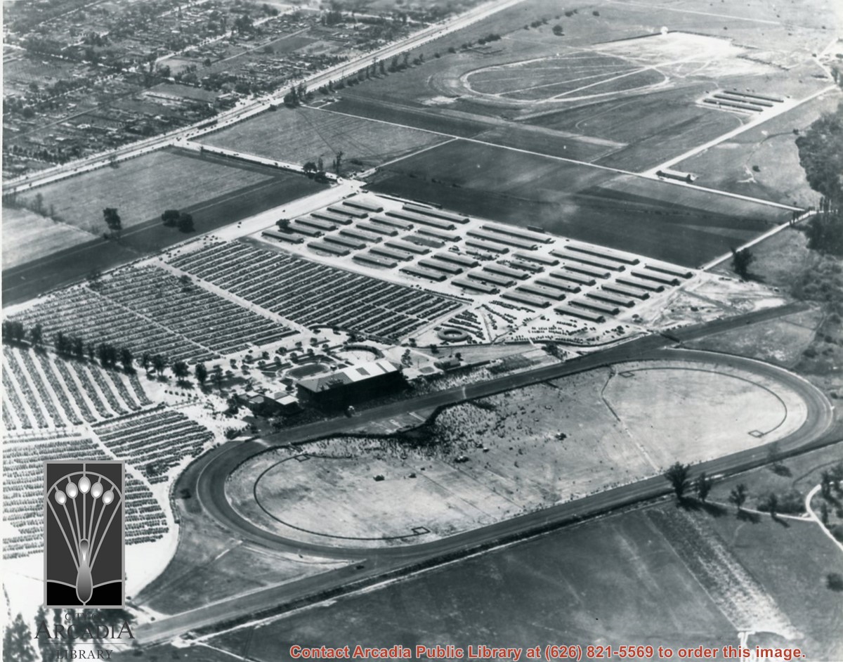
Aerial view taken looking southeast from position about over present Arboretum. Photo shows Santa Anita Park, probably in opening season. Present City Hall sits in area just beyond cars parked at east end of track. Part of oval of old Santa Anita track built by Elias J. "Lucky" Baldwin is seen in upper portion of photo, in area that is now Arcadia County Park. Duarte Road is seen crossing photo in upper right corner. Present Arcadia County Park area is in this photo, bordered on the north by Pacific Electric Railroad tracks. A train has just brought a group to the races and they are seen walking in center of photo. White square seen near right side, is slab left from hangars when U.S. Army Balloon School occupied this site, 1917-1927.