Skip header and navigation

4 records – page 1 of 1.

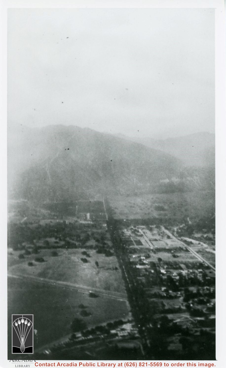
Aerial view north up Santa Anita Avenue. Note Chantry Flats Road on mountain near right side of photo. This view was taken from just south of Huntington Drive. This image belongs to Arcadia Historical Society.

https://arcadiahistory.andornot.com/en/permalink/photographs587
Date
November 1926

  1 image

Date
November 1926
Subjects
Aerial Photo Collection
Aerial views
Chantry Flats Road
Santa Anita Avenue
Physical Description
6x10 vertical
ID
583
Collection
Photographs
Images
Less detail

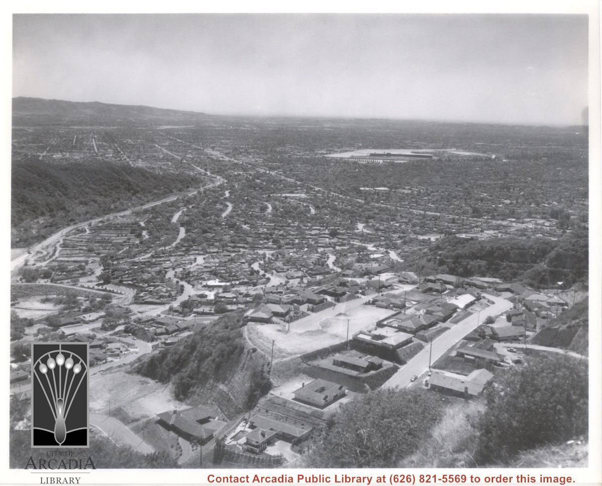
Aerial view south from Chantry Flats Road over the still-developing upper Highlands section of Arcadia. View is across Arcadia toward the Puente Hills. Santa Anita Park Race Track is seen in the center. Santa Anita Wash is seen on extreme left.

https://arcadiahistory.andornot.com/en/permalink/photographs955
Date
c.1965

  1 image

Date
c.1965
Subjects
Aerial Photo Collection
Aerial views
Arcadia(City)-History-1960-1969
Chantry Flats Road
Santa Anita Wash
Physical Description
8x10 b&w
ID
949
Collection
Photographs
Images
Less detail

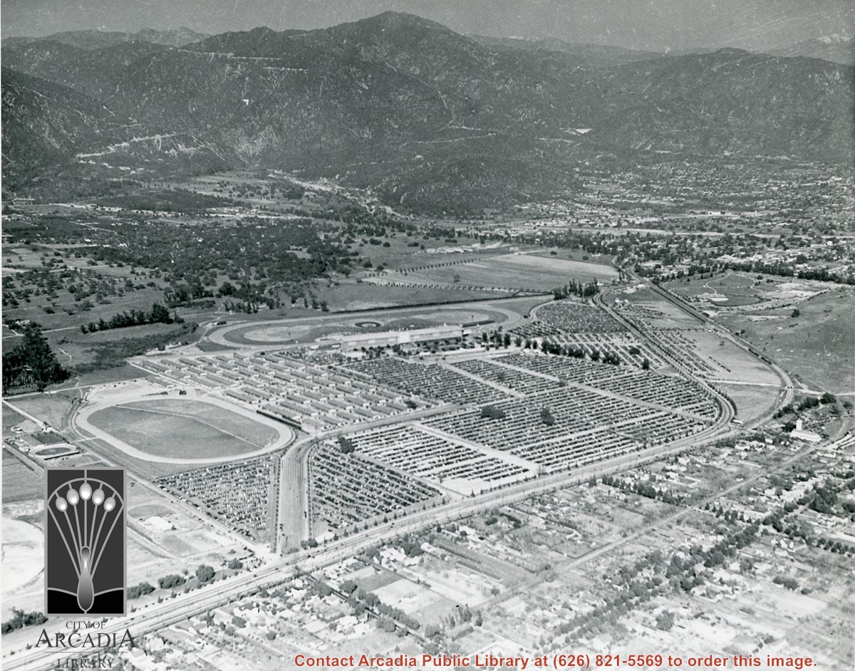
Aerial view toward NE. Main thoroughfare cutting across east to west with young trees planted on north side, is Huntington Drive. Main race track at Santa Anita is seen almost directly in center of photo, with Club House on side closest to camera. The smaller oval near left edge of photo was a training track belonging to Santa Anita which was removed for the Fashion Park. The Chantry Flats Road up to Santa Anita Canyon is clearly seen as it zig-zags around San Gabriel Mountains. This photo belongs to the Huntington Library. It is shown here for research only.

https://arcadiahistory.andornot.com/en/permalink/photographs629
Date
c. 1940s

  1 image

Date
c. 1940s
Subjects
San Gabriel Mountains
Santa Anita Park-1934-1942
Chantry Flats Road
Huntington Drive
Fashion Park
Physical Description
8x10 b&w
ID
625
Collection
Photographs
Images
Less detail

View across Arcadia taken from Chantry Flats Road at night. Long diagonal streak starting near bottom of lower right, marks Santa Anita Avenue.

https://arcadiahistory.andornot.com/en/permalink/photographs1159
Date
c.1952

  1 image

Date
c.1952
Subjects
Aerial Photo Collection
Aerial views
Arcadia(City)-History-1950-1959
Chantry Flats Road
Physical Description
5x10 b&w
ID
1150
Collection
Photographs
Images
Less detail