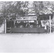
Many people are seen waiting in line to buy fresh corn at road-side stand called Carl's Sweet Corn and owned by Carl Kophamer at 75 Las Tunas. (NW corner of Las Tunas and Santa Anita Ave.) Corn is seen growing in large field behind the stand.
https://arcadiahistory.andornot.com/en/permalink/photographs893
- Date
- c.1951
1 image
- Date
- c.1951
- Subjects
- Carl's Sweet Corn
- Physical Description
- 8x10 b&w
- ID
- 886
- Collection
- Photographs
Images
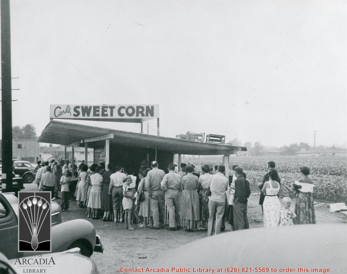
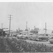
Looking SE across Las Tunas Drive near intersection with Santa Anita Ave. at road-side stand of Carl's Sweet Corn owned by Carl Kophamer at 75 Las Tunas. Customers and their cars are in view. Corn growing in field near stand is also seen.
https://arcadiahistory.andornot.com/en/permalink/photographs894
- Date
- c.1951
1 image
- Date
- c.1951
- Subjects
- Carl's Sweet Corn
- Physical Description
- 8x10 b&w
- ID
- 887
- Collection
- Photographs
Images

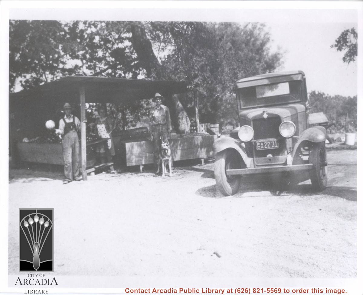
View of early road-side stand owned by Carl Kophamer and his family on Las Tunas just west of Santa Anita Ave. L-R: Morry, Carl, and Arly Kophamer. Corn is piled on counter.
https://arcadiahistory.andornot.com/en/permalink/photographs892
- Date
- c.1944
1 image

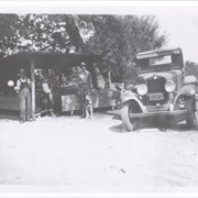
Early corn stand run by Carl Kophamer and his family on Las Tunas. L-R;Carl; his wife, Estella; and Morry, his son. A Chevrolet flat bed truck is on right.
https://arcadiahistory.andornot.com/en/permalink/photographs891
- Date
- 1939
1 image
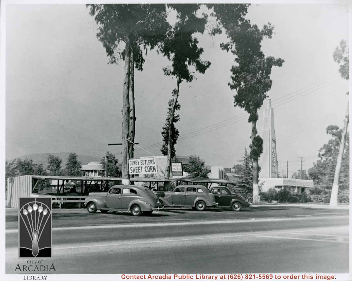
Dewey Butler's Sweet Corn stand with three cars parked at an angle in front is shown next to the Santa Anita Motor Inn, which opened in 1938 at 101 W. Huntington Drive.
https://arcadiahistory.andornot.com/en/permalink/photographs1543
- Date
- c.1938-1939
1 image
Dewey Butler's Sweet Corn Stand is shown next to the Santa Anita Motor Inn, which opened in 1938. There are four cars parked in front of the stand. Hand written note in scrapbook states, "Dewey Butler's - Golden Bantam Corn, and Melon Stand on Huntington Drive just west of the Santa Anita Motor Inn. The Sweetest corn and melon's you ever tasted, grown in the matchless soil of Old Rancho Santa Anita."
https://arcadiahistory.andornot.com/en/permalink/photographs1544
- Date
- c.1938-1939
1 image


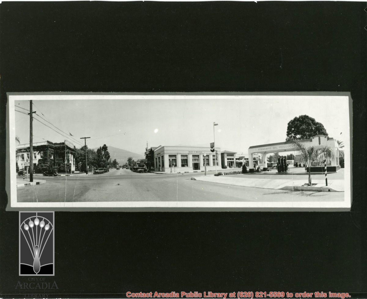
View looking north from intersection of Huntington Drive and First Avenue. Old City Hall is on the NW corner with quite a bit of ivy growing on the walls. There is a Standard Oil gas station on the SE corner. There is a stop sign in the middle of First Avenue.
https://arcadiahistory.andornot.com/en/permalink/photographs863
- Date
- probably 1920's
1 image
- Date
- probably 1920's
- Physical Description
- 8x24 original 3x9 copy print
- ID
- 857
- Collection
- Photographs
Images
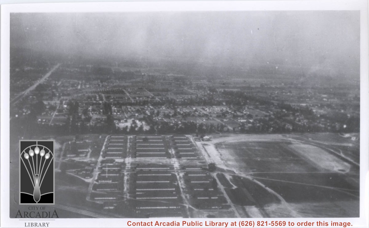
Aerial view toward the east taken from about over present Club House at Santa Anita Park Race Track. The main street running North/South is Santa Anita Avenue. View shows the oval of Elias J. "Lucky" Baldwin's race track in what is currently Arcadia County Park. The buildings would be barracks of Ross Field U.S. Army Balloon School. Duarte Road can be seen coming into photo at right edge of photo near intersection with Santa Anita Avenue. The broad street along left side would be Huntington Drive. Railroad tracks can be seen in lower left corner.
https://arcadiahistory.andornot.com/en/permalink/photographs635
- Date
- November 1929
1 image
- Date
- November 1929
- Subjects
- Aerial Photo Collection
- Aerial views
- Balloon School
- Huntington Drive
- Race tracks
- Railroads
- Santa Anita Avenue
- Physical Description
- 6x10 b&w
- ID
- 631
- Collection
- Photographs
Images

Dewey Butler's Corn Stand with four people standing at the stand. A sign propped up on the ground next to the stand reads, "Butler's Golden Bantam Corn," and another hanging sign reads, "Home of Dewey Butler's Corn and Melons Grown on Rancho Santa Anita."
https://arcadiahistory.andornot.com/en/permalink/photographs1545
- Date
- c.1938-1939
1 image
- Date
- c.1938-1939
- Subjects
- Dewey Butler's Corn Stand
- Physical Description
- 8x10 b&w
- ID
- 1529
- Collection
- Photographs
Images


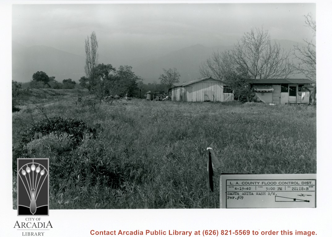
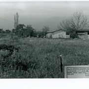
View toward San Gabriel Mountains across grass covered field probably on east side of Santa Anita Wash. A small house and outbuildings can be seen with large bare tree behind.
https://arcadiahistory.andornot.com/en/permalink/photographs821
- Date
- March 3, 1938
1 image
- Date
- March 3, 1938
- Subjects
- Santa Anita Wash
- Physical Description
- 5x7 b&w
- ID
- 815
- Collection
- Photographs
Images
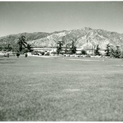
Santa Anita Race Track seen from a distance. View is toward the north. The San Gabriel mountains are visible behind the track. Cars are parked in the parking lot.
https://arcadiahistory.andornot.com/en/permalink/photographs1348
- Date
- c. mid 1950's
1 image
- Date
- c. mid 1950's
- Subjects
- Santa Anita Park-1945-1980
- Physical Description
- 8x10 b&w
- ID
- 1339
- Collection
- Photographs
Images

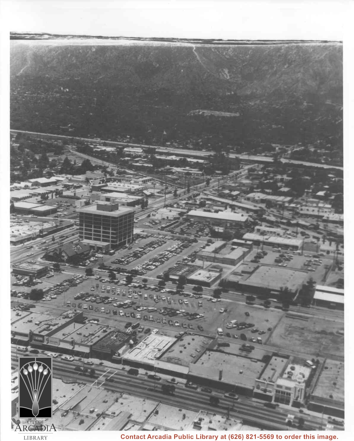
Aerial view north toward San Gabriel Mountains from a position above Huntington Drive near First Avenue. Santa Anita Avenue can plainly be seen running north and south in front of six-story building in center of photo. The 210 Foothill Freeway is top band running across photo from east to west.
https://arcadiahistory.andornot.com/en/permalink/photographs611
- Date
- July 1976
1 image

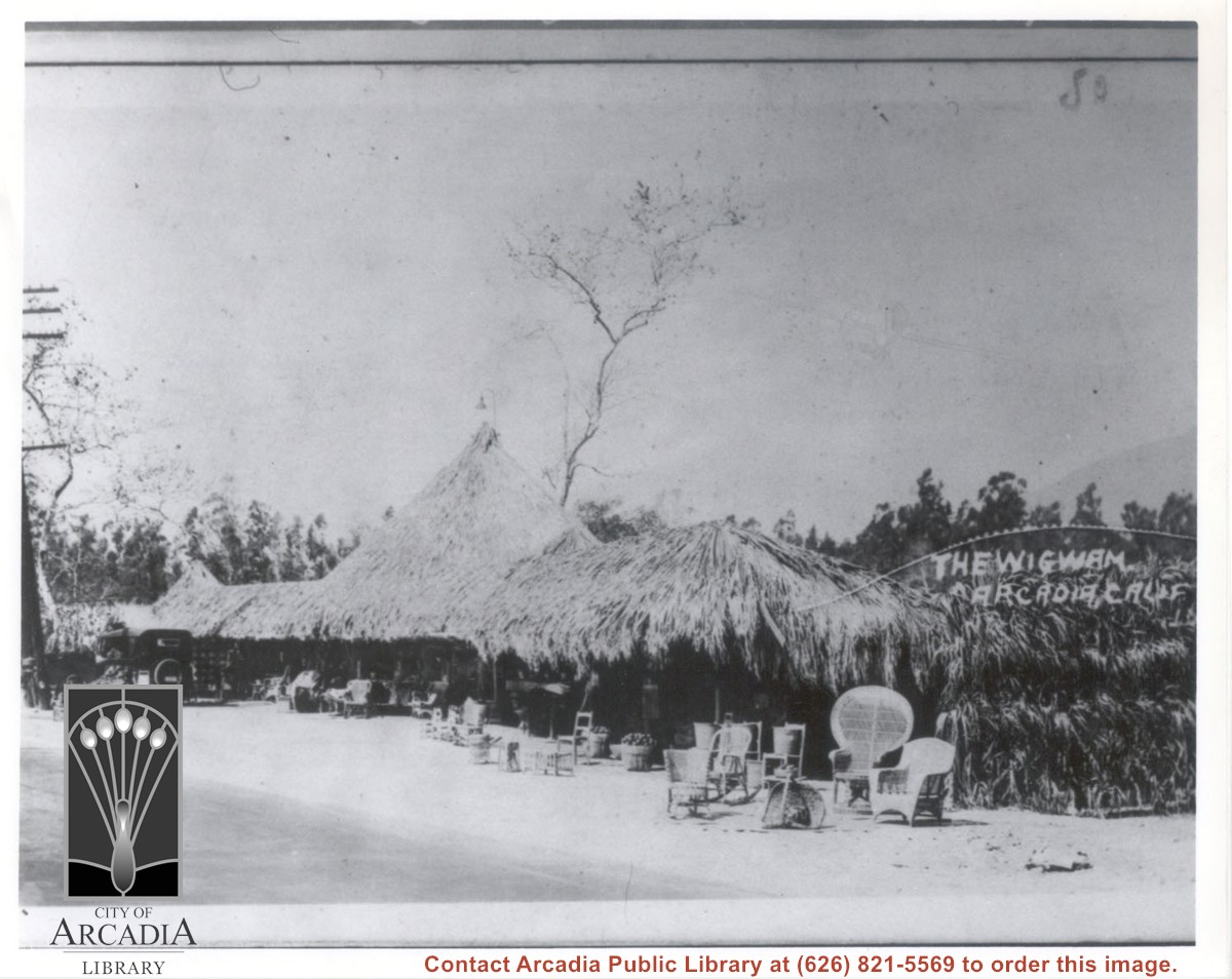
View toward west at front of a thatched-roof fruit and refreshment stand. On right is painted: THE WIGWAM, ARCADIA,CALIF. There are rattan chairs about and an automobile. There is a sycamore tree seen behind the building. The eucalyptus trees of Santa Anita Avenue can be seen beyond.
https://arcadiahistory.andornot.com/en/permalink/photographs828
- Date
- c.1929-1930
1 image
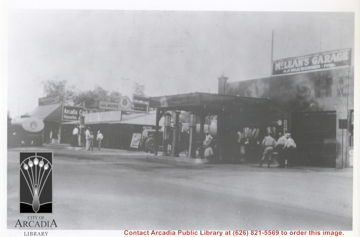
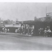
Looking north east toward intersection of Santa Anita Ave. near point where Campus Drive intersects. McLean's Garage is plainly seen on the right. A large gasoline truck is parked just to the north. Farther north can be seen Arcadia Cash Market with another tank truck parked in front. There are at least 9 people seen standing by; one, a police officer, third from right.
https://arcadiahistory.andornot.com/en/permalink/photographs855
- Date
- c.1933
1 image
Aerial view toward north from a position south of Huntington Drive near intersection with Baldwin Avenue. It shows Santa Anita Fashion Park (currently known as Westfield Santa Anita Shopping Mall) developed by and on property owned by Santa Anita Consolidated. The Santa Anita Park Race Track and club house can be seen in center of photo. The straight white line about one inch above the club house roof is 210 Foothill Freeway. Chantry Flats road can be seen going up into San Gabriel Mountains in distance.
https://arcadiahistory.andornot.com/en/permalink/photographs646
- Date
- c. 1975
1 image
- Date
- c. 1975
- Subjects
- Aerial Photo Collection
- Aerial views
- 210 Foothill Freeway
- Chantry Flats Road
- Malls
- San Gabriel Mountains
- Santa Anita Park-1945-1980
- Santa Anita Fashion Park
- Westfield Santa Anita Shopping Mall
- Physical Description
- 8x10 b&w
- ID
- 642
- Collection
- Photographs
Images


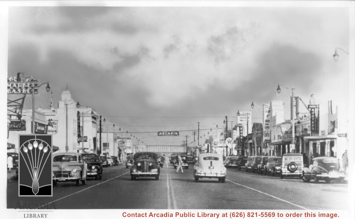
View east on Huntington Drive from near intersection with Santa Anita. Old City Hall was still at NW corner of Huntington Drive and First at this time. Theater which was on south side appears to be gone. Seeley's Jewelers is in 1948 City Directory, but not 1944 City Directory.
https://arcadiahistory.andornot.com/en/permalink/photographs603
- Date
- c. mid-1940's
1 image

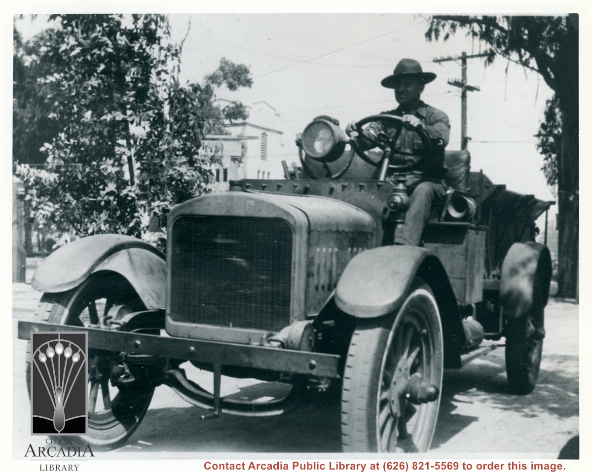
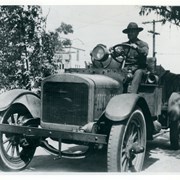
Master Sgt. William Bucher sitting at steering wheel of Army vehicle just inside grounds of Ross Field Balloon School. Behind him can be seen tower of Santa Anita Avenue and Huntington Drive.
https://arcadiahistory.andornot.com/en/permalink/photographs1015
- Date
- c.1927
1 image
- Date
- c.1927
- Subjects
- Balloon School
- Bucher, William
- Physical Description
- 8x10 b&w
- ID
- 1008
- Collection
- Photographs
Images
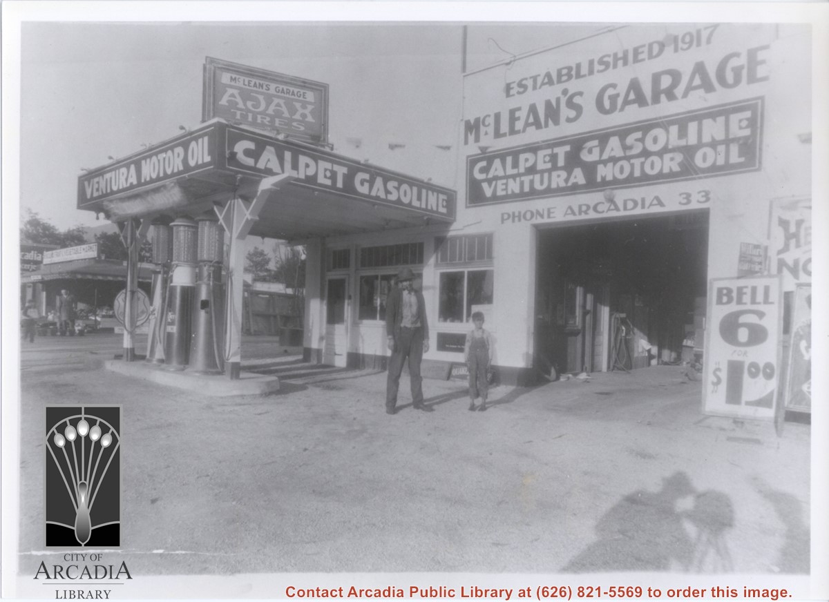
View looking east toward McLean's Garage located at 808 S. Santa Anita Avenue. Standing in front is Mr. McLean, owner, and an unknown boy. North of garage and service station is seen Arcadia Cash Market and Arcadia Fruit and Vegetable Market at 804 S. Santa Anita Avenue.
https://arcadiahistory.andornot.com/en/permalink/photographs856
- Date
- c.1928
1 image
- Date
- c.1928
- Subjects
- McLean's Garage
- Arcadia Cash Market
- Arcadia Fruit and Vegetable Market
- Gas stations
- Markets
- McLean, C.A.
- Physical Description
- 8x10 b&w
- ID
- 850
- Collection
- Photographs
Images
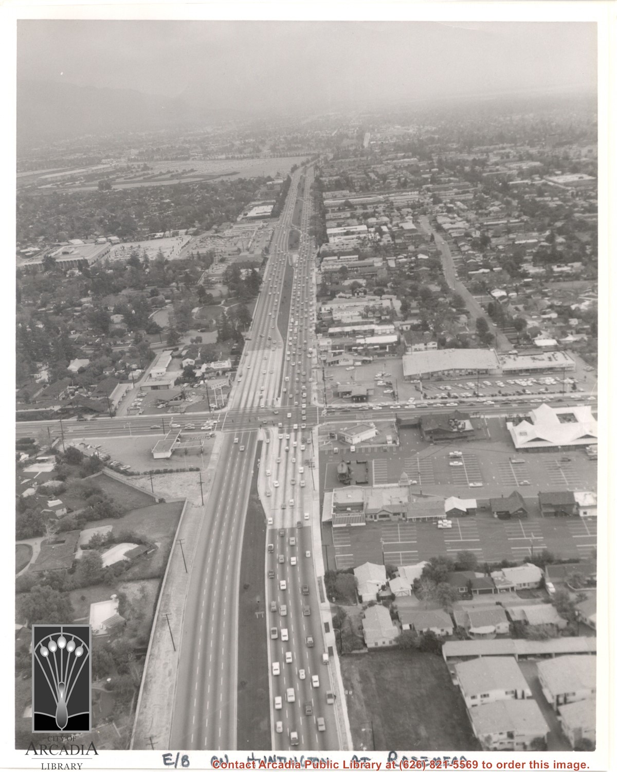
Aerial view east on Huntington Drive toward Arcadia from a position just west of Rosemead Boulevard. El Rancho Shopping Center and May Company Department Store can be seen as the business complex on the north side of Huntington Drive one block east of Rosemead Boulevard. Santa Anita Park Race Track can be seen on the left in upper portion of photo.
https://arcadiahistory.andornot.com/en/permalink/photographs637
- Date
- c.1970
1 image
- Date
- c.1970
- Subjects
- Aerial Photo Collection
- Aerial views
- El Rancho Shopping District
- Huntington Drive
- May Company Department Store
- Santa Anita Park-1945-1980
- Physical Description
- 8x10 b&w
- ID
- 633
- Collection
- Photographs
Images
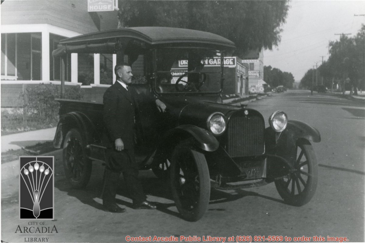
Carl Ettensperger standing by milk delivery truck owned by the Mountain View Dairy, Arcadia. This photo was on a Monrovia street. Dairy was located on Jeffries Street. (However, 1924 City Directory says Mountain View Dairy was at Valnett Ave sw corner 6th Ave.)
https://arcadiahistory.andornot.com/en/permalink/photographs1113
- Date
- c.1925
1 image
- Date
- c.1925
- Subjects
- Ettensperger, Carl
- Mountain View Dairy
- Physical Description
- 8x10 b&w
- ID
- 1104
- Collection
- Photographs
Images