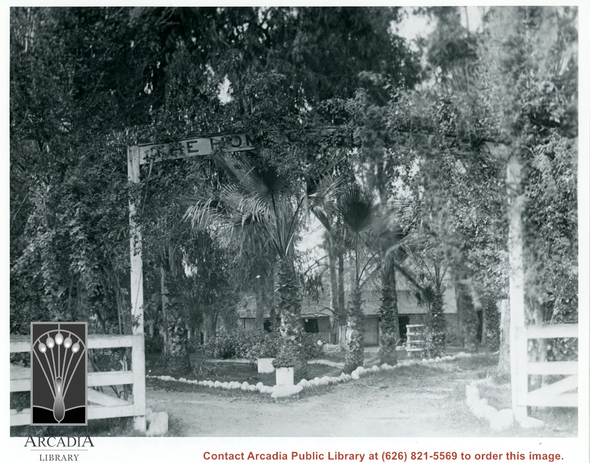
Entrance to stable area on Baldwin Ranch. White fences, white-washed rocks line drive. Sign above gate says "Home of (Grinstead or Strathmead)."
https://arcadiahistory.andornot.com/en/permalink/photographs150
- Date
- c.1880's or 1890's
1 image
- Date
- c.1880's or 1890's
- Physical Description
- 8x10 b&w
- ID
- 149
- Collection
- Photographs
Images
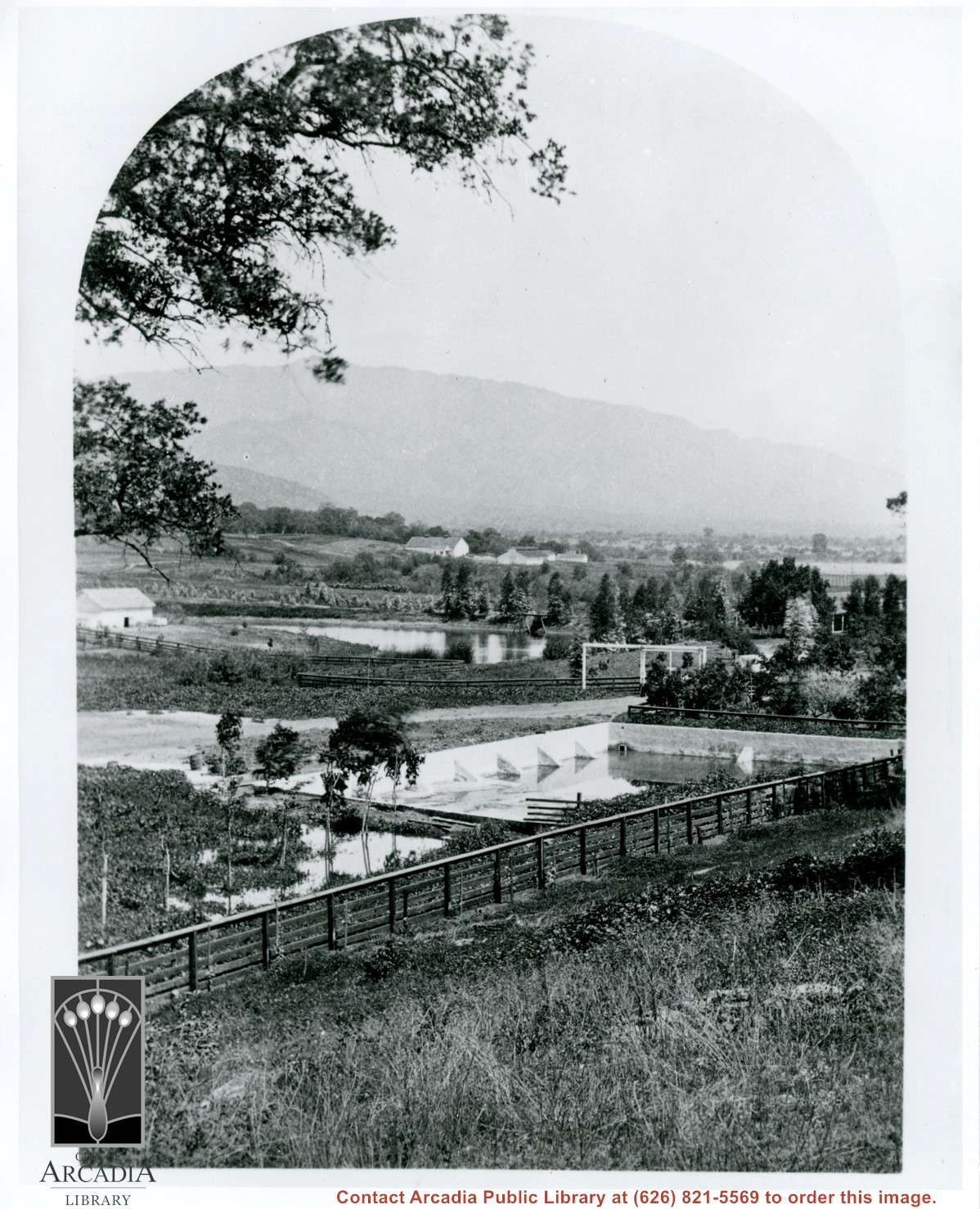
View east from center of Baldwin Ranch. Concrete type reservoir in foreground. The lagoon is in center of photo. White barns on the knoll in center of photo. View similar to photo #143. This photograph belongs to the Huntington Library. It is shown here for research only.
https://arcadiahistory.andornot.com/en/permalink/photographs221
- Date
- c.1880's
1 image
- Date
- c.1880's
- Subjects
- Rancho Santa Anita
- Baldwin Ranch
- Physical Description
- 8x10 b&w
- ID
- 220
- Collection
- Photographs
Images
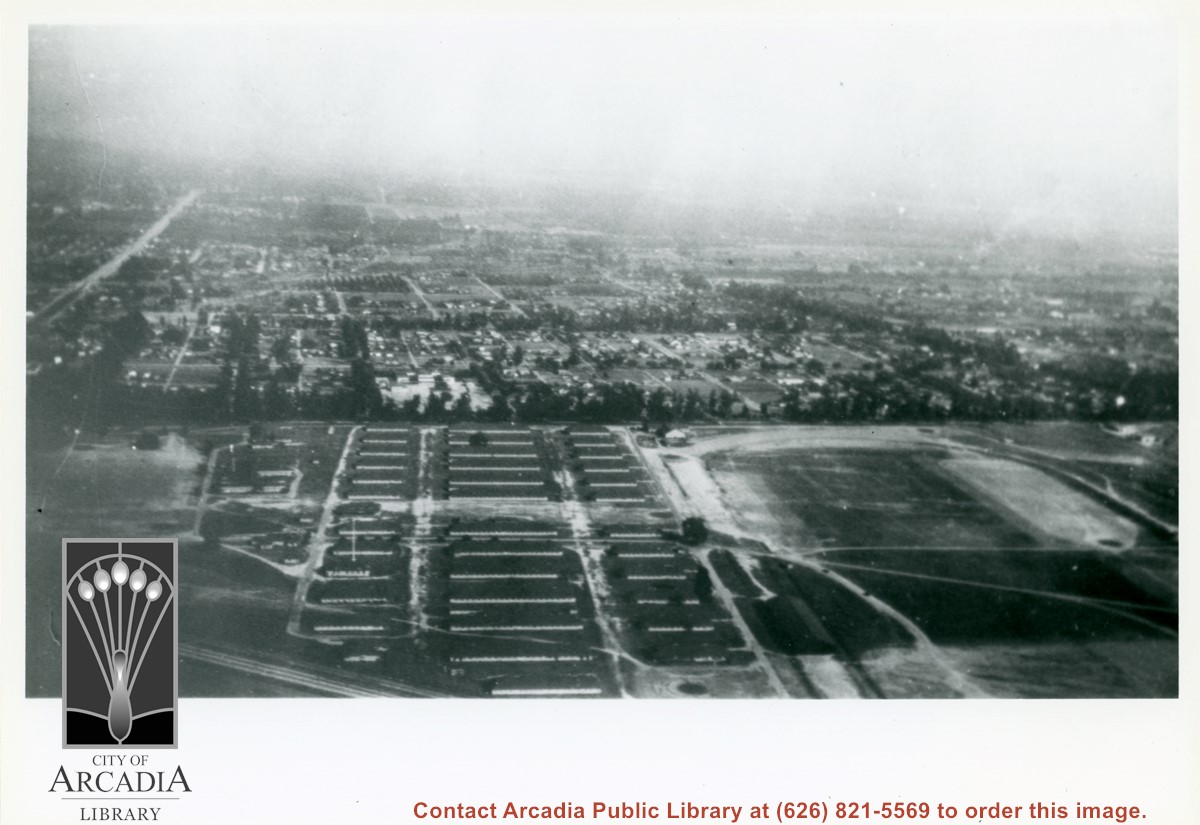
Looking SW from mountains north of Arcadia. Major tree-lined street running from mountains south is Santa Anita Avenue. Southernmost tree-lined street cutting across entire middle of photo is Duarte Road. Barracks at the Balloon School can be seen just below Huntington Drive. Notice that Huntington Drive stops just west of the Balloon School, at the Baldwin Ranch. Much of Foothill area was planted to citrus.
https://arcadiahistory.andornot.com/en/permalink/photographs1114
- Date
- c.1927
1 image
- Date
- c.1927
- Subjects
- Aerial views
- Arcadia(City)-History-1920-1929
- Balloon School
- Santa Anita Avenue
- Santa Anita Highlands
- Physical Description
- 10 x 14 b&w
- ID
- 1105
- Collection
- Photographs
Images


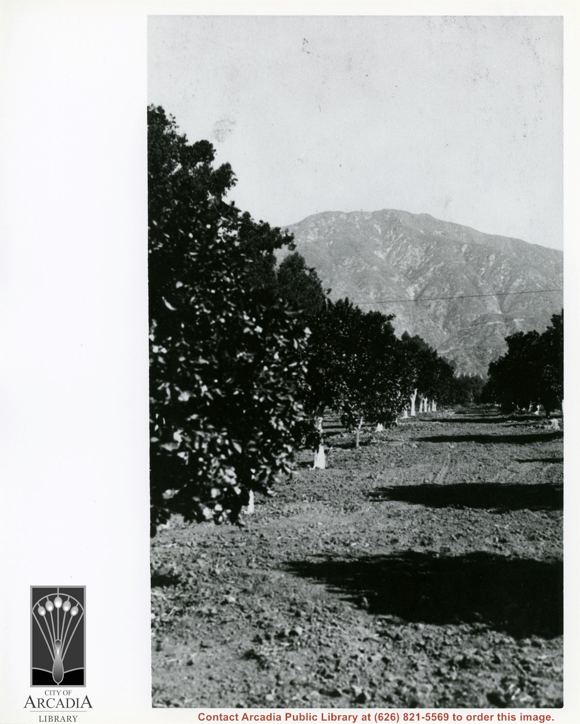
Harry Ainsworth Ranch, upper grove looking north to mountains. Present day Highland Oaks School would be located about where trees block the end of the row of citrus trees.
https://arcadiahistory.andornot.com/en/permalink/photographs1081
- Date
- c.1916
1 image
- Date
- c.1916
- Subjects
- Agriculture
- Ainsworth Ranch
- Physical Description
- 8x10 b&w
- ID
- 1072
- Collection
- Photographs
Images
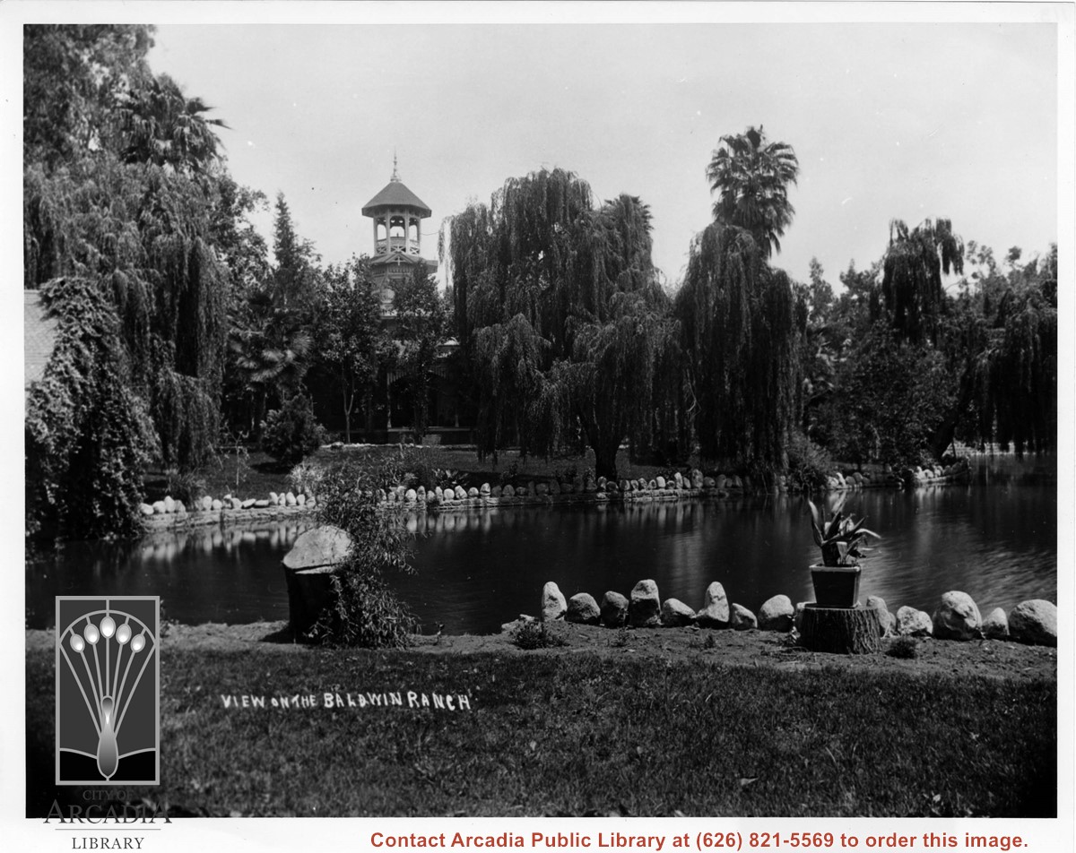
View across lake on the Baldwin Ranch toward Queen Anne Cottage. Writing on bottom of photo reads: view on the Baldwin Ranch.
https://arcadiahistory.andornot.com/en/permalink/photographs113
- Date
- c.1898
1 image
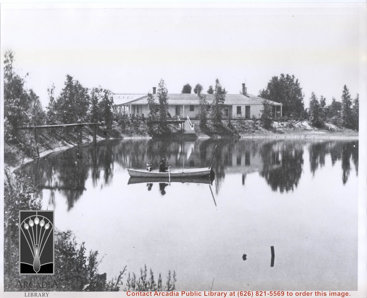
An early view south across lagoon toward Hugo Reid Adobe. At this time, the adobe had been greatly enlarged by E.J."Lucky" Baldwin. There is a row boat on the lagoon with a man at oars. Adobe appears to be painted white. This photograph belongs to the Huntington Library. It is shown here for research only.
https://arcadiahistory.andornot.com/en/permalink/photographs297
- Date
- c.1880's
1 image
- Date
- c.1880's
- Subjects
- Hugo Reid Adobe
- Physical Description
- 8x10 b&w
- ID
- 295
- Collection
- Photographs
Images
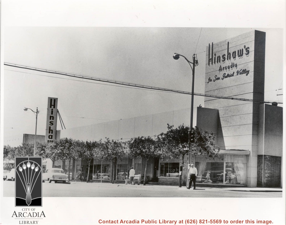
Looking west across intersection of Baldwin and Duarte Road to Hinshaw's Department Store, which was located at 1201 S. Baldwin. The street trees planted by the City of Arcadia are seen as an attractive addition to the street. Hinshaw's went out of business in 1992.
https://arcadiahistory.andornot.com/en/permalink/photographs1040
- Date
- c. 1960
1 image
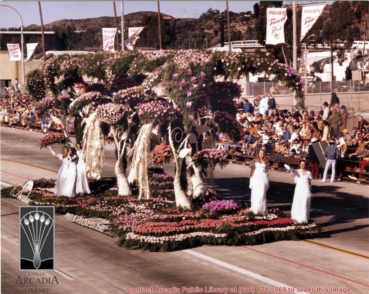
"Proud as a Peacock - 200 Years," Arcadia's float entry in the 1976 Pasadena Tournament of Roses Parade, features stylized 12 foot peacocks of white carnation petals gracefully perched in rose-covered trees. The sculptured trees slowly revolve beneath a canopy of roses and carnations. A framed copy of this removed from wall outside Admin. office and currently stored in map case in basement, as of February 2017.
https://arcadiahistory.andornot.com/en/permalink/photographs1315
- Date
- January 1976
1 image
- Date
- January 1976
- Subjects
- Tournament of Roses-Floats-1976
- Physical Description
- 8x10 color
- ID
- 1306
- Collection
- Photographs
Images
View north up Baldwin Avenue from a position about 300 feet south of Duarte Road. Note large eucalyptus trees on left side of street.
https://arcadiahistory.andornot.com/en/permalink/photographs586
- Date
- c.1920's, possibly 1930's
1 image
- Date
- c.1920's, possibly 1930's
- Subjects
- Baldwin Avenue
- Eucalyptus trees
- Physical Description
- 7x11 b&w
- ID
- 582
- Collection
- Photographs
Images
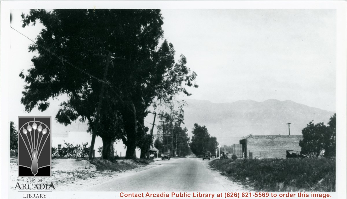
Road approaching entrance to Baldwin Ranch. Eucalyptus trees along roadside, on a foggy day.
https://arcadiahistory.andornot.com/en/permalink/photographs151
- Date
- unknown
1 image
- Date
- unknown
- Subjects
- Rancho Santa Anita
- Baldwin Ranch
- Physical Description
- 6x10 b&w
- ID
- 150
- Collection
- Photographs
Images

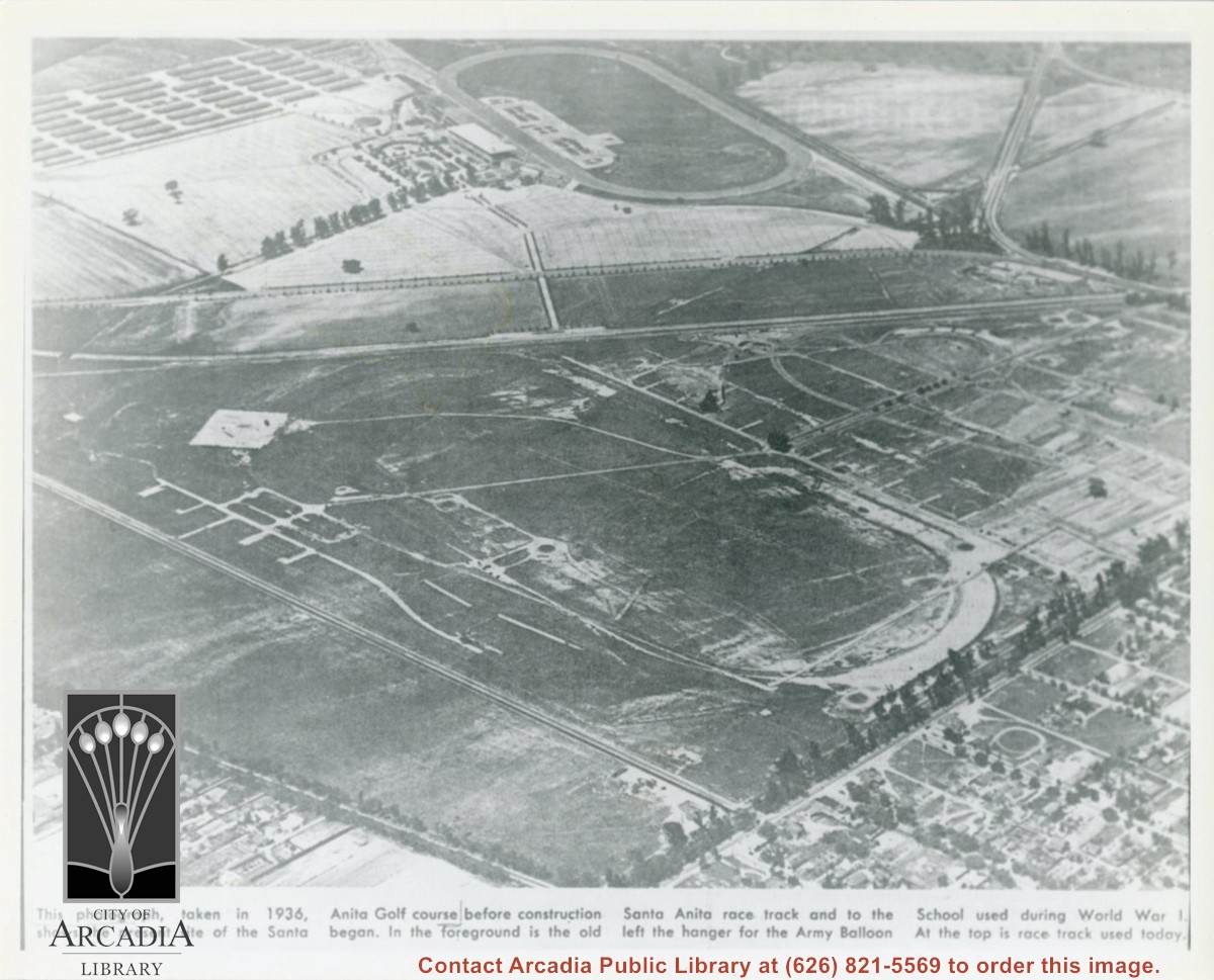
Photographically reproduced copy of an old newspaper photo taken in 1936 which is an aerial view looking north west over original race track built by Baldwin. In lower right corner can be seen Santa Anita Ave lined with Eucalyptus. On lower left, one can see present Campus Drive. Across top third of photo, one can see Huntington Drive. Note how small the trees are that line the street.
https://arcadiahistory.andornot.com/en/permalink/photographs864
- Date
- 1936
1 image
- Date
- 1936
- Subjects
- Baldwin, Elias J. "Lucky"-Horses and horse racing
- Huntington Drive
- Santa Anita Park-1907-1912
- Balloon School
- Physical Description
- 8x10 b&w
- ID
- 858
- Collection
- Photographs
Images
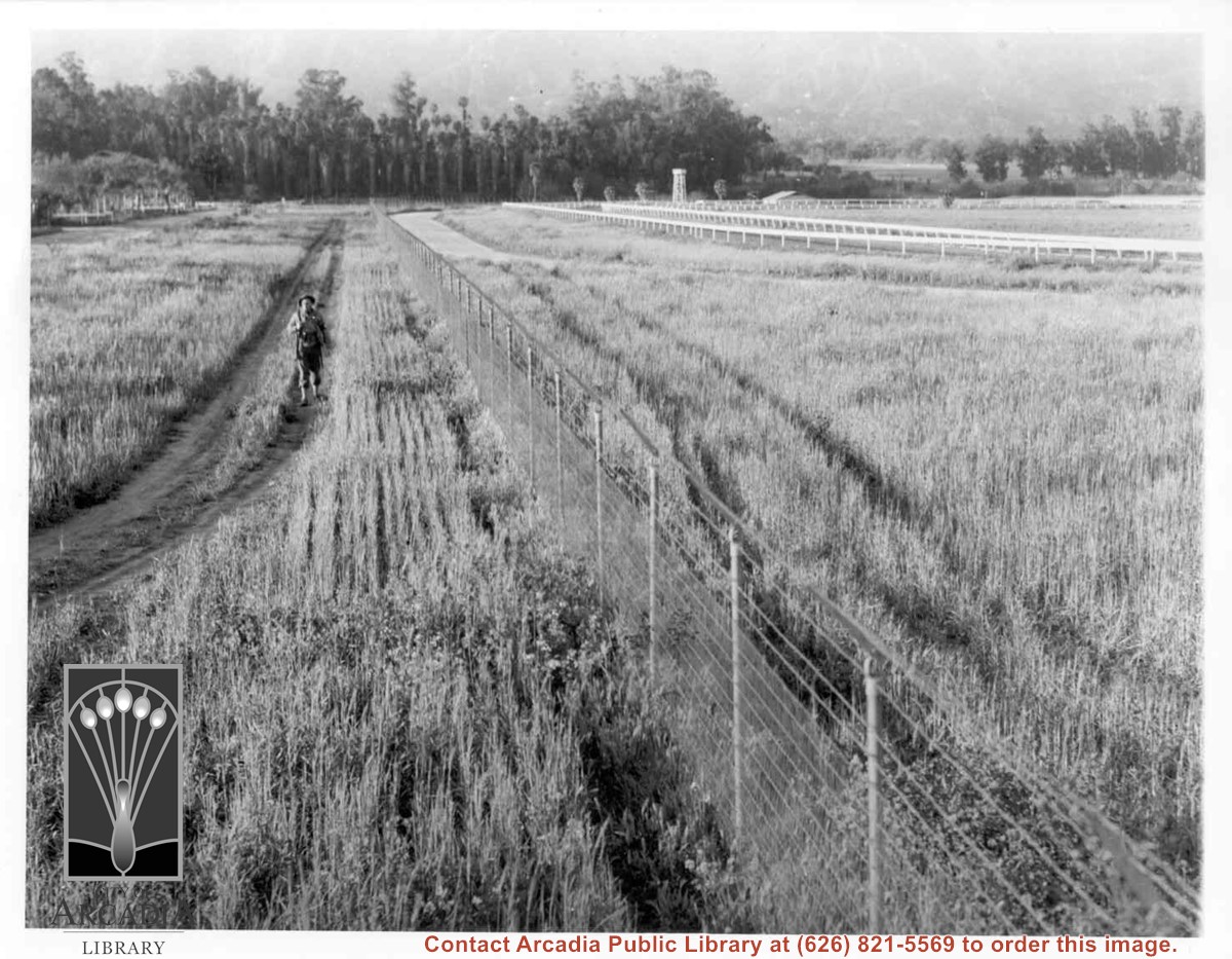
Lone army sentry patrolling outside fence of Santa Anita Assembly Center for the Japanese. White fencing encloses training track which was located alongside Baldwin Avenue, approximately where west parking area for Fashion Park (now Westfield Santa Anita mall) is now. Palm trees seen on left side, would be on grounds of present Arboretum.
https://arcadiahistory.andornot.com/en/permalink/photographs661
- Date
- April 1942
1 image
View of Orange Avenue (present day Colorado Boulevard) with eucalyptus trees along both sides. Scene is near Baldwin Ranch. This photograph belongs to the Huntington Library. It is shown here for research only.
https://arcadiahistory.andornot.com/en/permalink/photographs582
- Date
- c.1880's
1 image
- Date
- c.1880's
- Subjects
- Colorado Blvd.
- Eucalyptus trees
- Physical Description
- 8x10 b&w
- ID
- 578
- Collection
- Photographs
Images


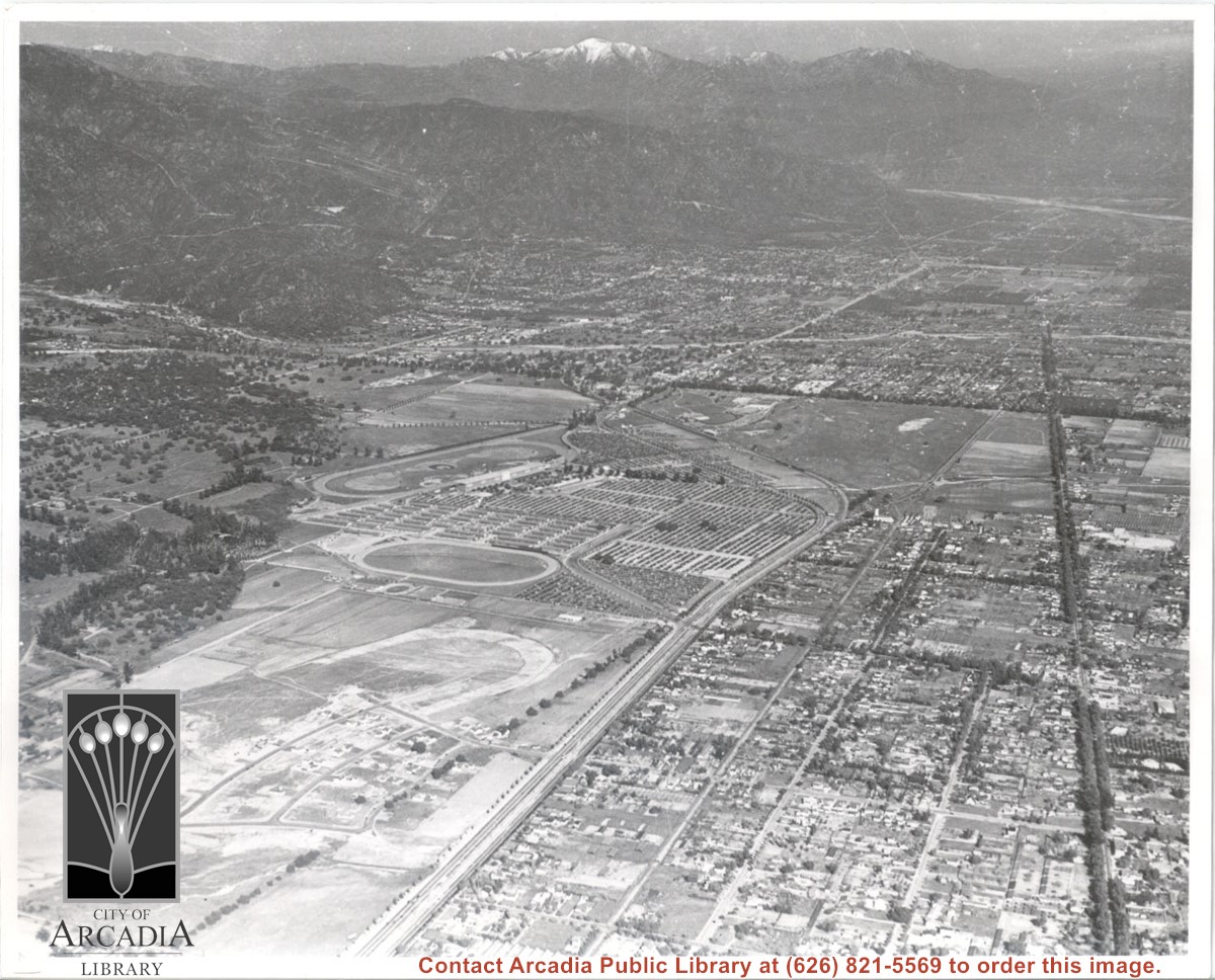
Aerial view toward the east from location about over Santa Anita Avenue at Santa Clara Street intersection. Santa Fe Railroad tracks are seen entering the city about in the center of photo. Broad white roadway seen toward left side of photo is 210 or Foothill Freeway still under construction.
https://arcadiahistory.andornot.com/en/permalink/photographs610
- Date
- c. 1968 or 1969
1 image
- Date
- c. 1968 or 1969
- Subjects
- Aerial Photo Collection
- Aerial views
- 210 Foothill Freeway
- Postal Service - post office
- Railroads
- Santa Anita Avenue
- Wheeler Avenue
- Physical Description
- 8x10 b&w
- ID
- 606
- Collection
- Photographs
Images

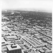
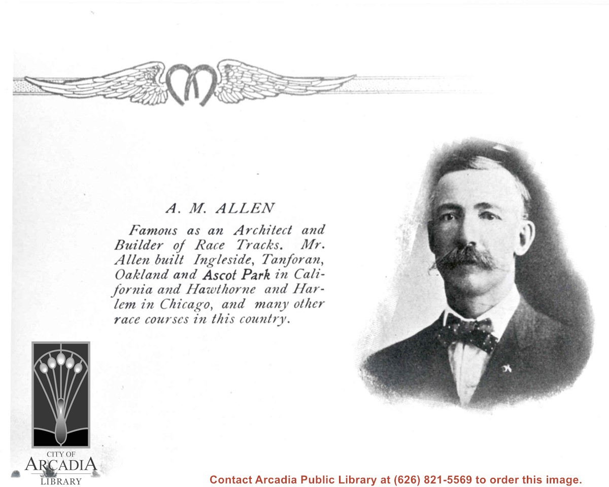
Photo and caption of A.M. Allen, architect for Elias J. "Lucky" Baldwin's first race track.
https://arcadiahistory.andornot.com/en/permalink/photographs1345
- Date
- c.1906
1 image
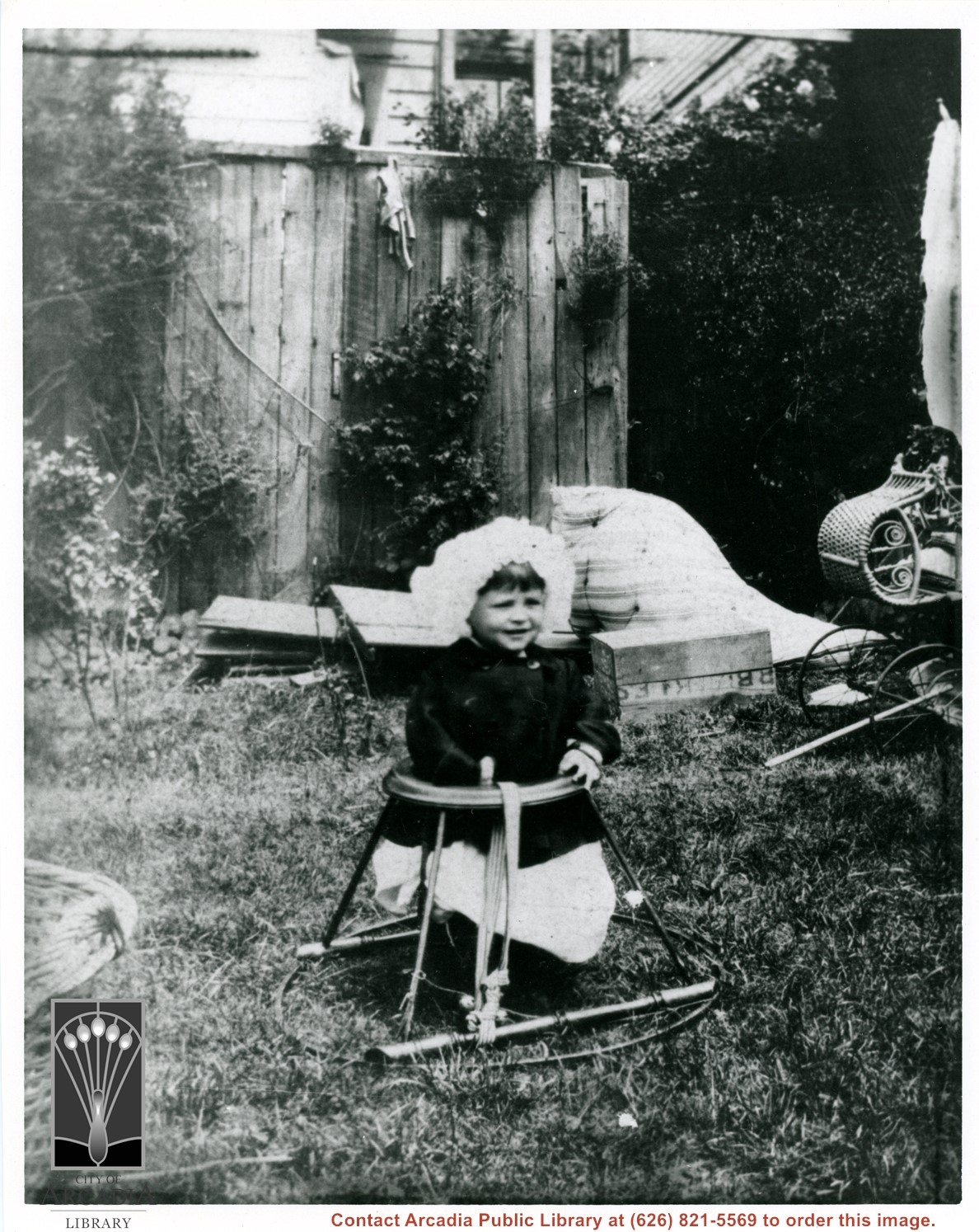
Baldwin M. Baldwin in child's metal seat outdoors. He has on dark jacket and white bonnet. Wicker baby buggy shows on right of photo. Photo probably taken at Baldwin Ranch.
https://arcadiahistory.andornot.com/en/permalink/photographs99
- Date
- c.1907
1 image
- Date
- c.1907
- Subjects
- Baldwin, Baldwin M.
- Baldwin family
- Physical Description
- 8x10 b&w
- ID
- 99
- Collection
- Photographs
Images
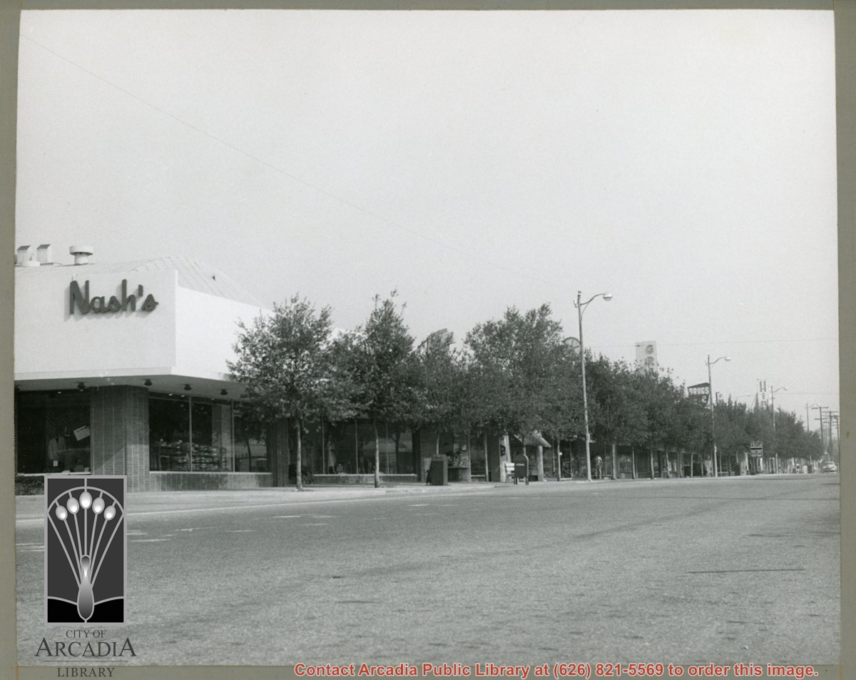
View of west side of Baldwin looking north from intersection with Naomi Avenue. Street trees obscure names of most shops but Nash's Department Store and Hinshaw's Department Store are visible.
https://arcadiahistory.andornot.com/en/permalink/photographs609
- Date
- c. late 1960's
1 image
Aerial view. Looking east. Street along right edge of photo which is lined with trees is Duarte Road. Santa Anita Avenue cuts across photo from right to left and up into the San Gabriel Mountains. Huntington Drive can be seen in center of photo with young trees planted on north side of it. Santa Anita Race Track is one furthest from camera. The next small track is a training track belonging to Santa Anita. There is a VERY small round track across the street from the training track, which was part of a private horse stables. The incompleted oval was part of work done in 1933 by Joe Smoot and Anita Baldwin in their effort to develop the Jockey Club Track. This photo belongs to the Huntington Library. It is shown here for research only.
https://arcadiahistory.andornot.com/en/permalink/photographs627
- Date
- c. 1935
1 image
- Date
- c. 1935
- Subjects
- Duarte Road
- Huntington Drive
- Los Angeles Jockey Club
- San Gabriel Mountains
- Santa Anita Park-1934-1942
- Physical Description
- 8x10 b&w
- ID
- 623
- Collection
- Photographs
Images
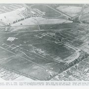
Looking east over barracks and main building at Ross Field. Tree-lined street cutting across photo at far side of field is Santa Anita Avenue. The oval of the race track built by E.J."Lucky" Baldwin and which opened in 1907 can clearly be seen on right. Broad E/W street seen on far left is Huntington Drive.
https://arcadiahistory.andornot.com/en/permalink/photographs867
- Date
- c.1928
1 image
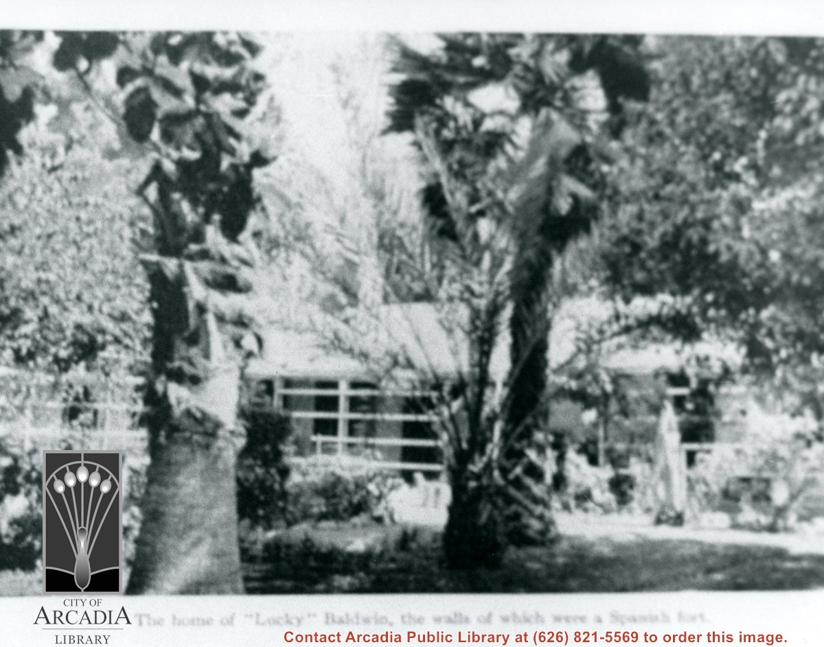
Part of Hugo Reid Adobe seen between two palms and foliage. Caption reads:The home of "Lucky" Baldwin, the walls of which were a Spanish fort. (THIS INFO IS NOT CORRECT.)
https://arcadiahistory.andornot.com/en/permalink/photographs918
- Date
- 1906
1 image