The Insurance Services Office (ISO) recently evaluated the Arcadia Fire Department and reconfirmed its designation as a "Class 1" department. This is the second time Arcadia has been so honored. Only 41 fire agencies in the country have this elite distinction.
https://arcadiahistory.andornot.com/en/permalink/newspaper29526
- Newspaper
- Arcadia Weekly
- Date
- May 10, 2001
- Pages
- p. 8
- Subjects
- Arcadia Fire Department - 2001-2010
- Awards-honors-recognitions
- Insurance Services Office (ISO)
- Item ID
- 29710AN
- Collection
- Newspaper Index
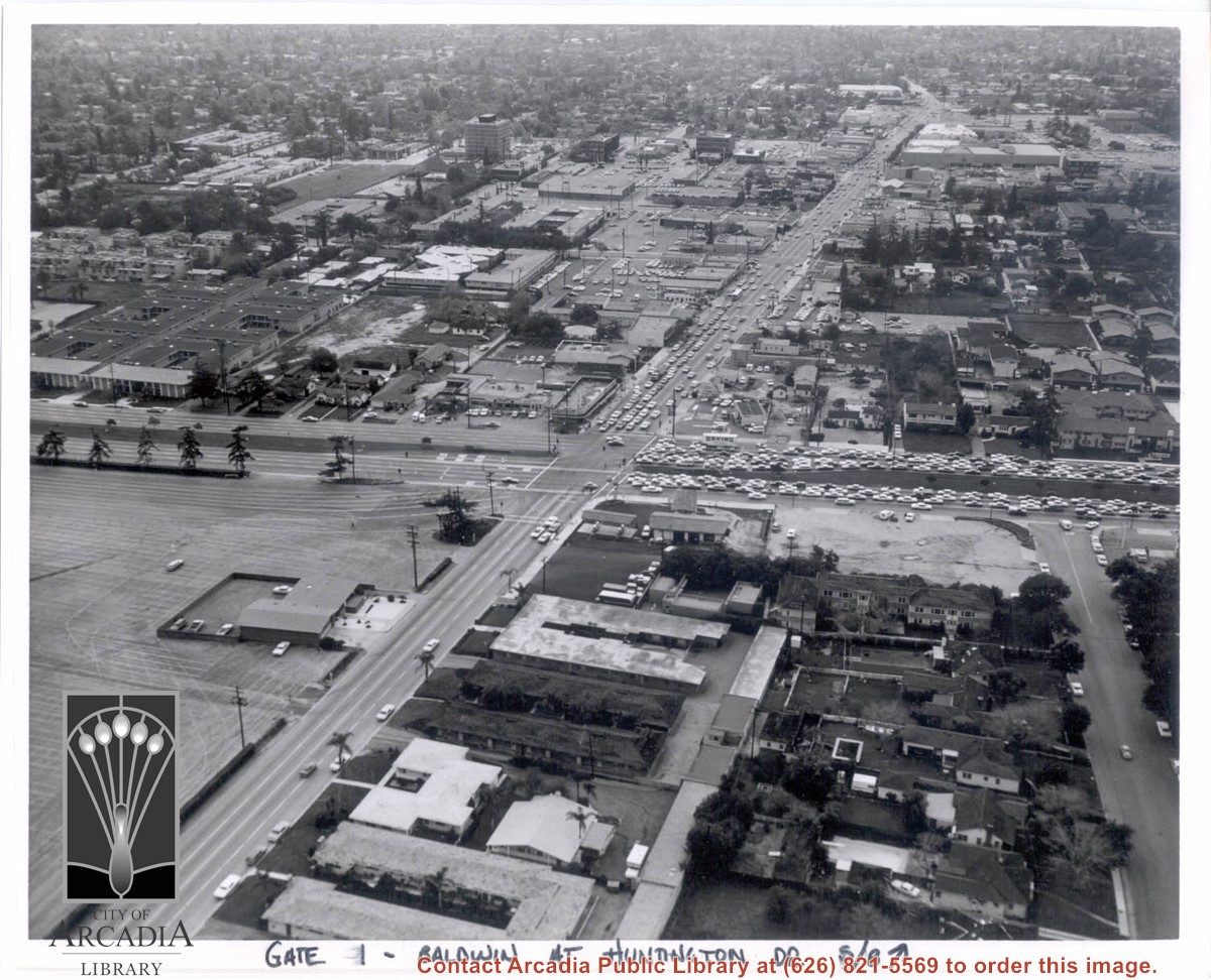
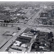
Aerial view south on Baldwin Avenue. From position just north of Huntington Drive (during racing season) showing great number of cars coming east on Huntington Drive to races through Gate #1. One building in Santa Anita Park Race Track parking lot is Fire Station at 630 S. Baldwin Avenue. Duarte Road is distantly seen in upper portion of photo, about 1 1/4 in. from top of photo. The multi-storied Medical Building seen is at 612 W. Duarte Road.
https://arcadiahistory.andornot.com/en/permalink/photographs636
- Date
- c.1970
1 image
- Date
- c.1970
- Subjects
- Aerial Photo Collection
- Aerial views
- Arcadia Fire Department
- Baldwin Avenue
- Duarte Road
- Huntington Drive
- Santa Anita Park-1945-1980
- Physical Description
- 8x10 b&w
- ID
- 632
- Collection
- Photographs
Images
Aerial looking west from a position just east of First Avenue and just north of Wheeler Avenue. Large white barn-like roof is San Gabriel Valley Lumber Co. building. This later became the Sawmill Restaurant and in the early 1990's became Sports Rock Cafe. Directly opposite, is cleared land where Arcadia Public Library, Fire and Police were previously located. Today there is a Medical Building on the site (65 N. First Avenue). Santa Anita Park and parking lot are seen in the distance.
https://arcadiahistory.andornot.com/en/permalink/photographs999
- Date
- c.1977
1 image

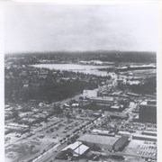
Aerial view taken over Arcadia so that it shows a large area surrounding Arcadia as well as the entire city. Clearly seen is the Santa Anita Park Race Track, and the Arcadia County Park (shown as a dark triangle in center), and the 210 Foothill Freeway crossing photo from west to east and passing north of Santa Anita Park Race Track.
https://arcadiahistory.andornot.com/en/permalink/photographs648
- Date
- c. 1973
1 image
- Date
- c. 1973
- Subjects
- Aerial Photo Collection
- Aerial views
- 210 Foothill Freeway
- Arcadia County Park
- Santa Anita Park-1945-1980
- Physical Description
- 8x10 b&w
- ID
- 644
- Collection
- Photographs
Images


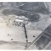
Aerial view from position above Huntington Drive near Holly Avenue intersection looking north over Santa Anita Park. Colorado Place and Huntington Drive are seen coming together at right side of photo. Note how small the deodar (?) trees planted along Huntington Drive and Colorado Place are. Row of trees seen in center of photo were apparently left from Ranch days and were later removed.
https://arcadiahistory.andornot.com/en/permalink/photographs984
- Date
- December 1, 1935
1 image
- Date
- December 1, 1935
- Subjects
- Aerial Photo Collection
- Aerial views
- Colorado Place
- Huntington Drive
- Santa Anita Park-1934-1942
- Physical Description
- 8x10 b&w
- ID
- 976
- Collection
- Photographs
Images