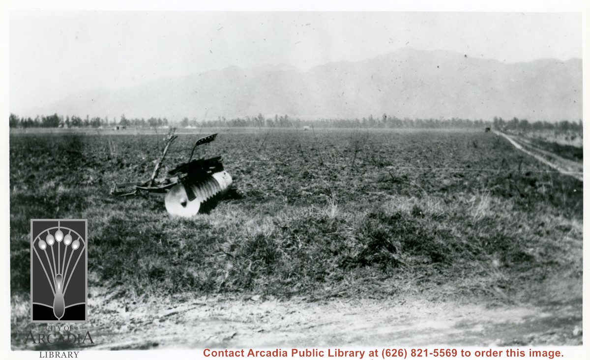
A disc plow sits in field in this view looking north toward mountains. This was very shortly after Mauch family bought the 5 acres near Palm Avenue and Holly Avenue. The dirt road on extreme right is Holly Avenue.
https://arcadiahistory.andornot.com/en/permalink/photographs1006
- Date
- Feb. 1922
1 image
- Date
- Feb. 1922
- Physical Description
- 6x10 b&w (this is left portion of a panorama - photo 1000 completes scene)
- ID
- 999
- Collection
- Photographs
Images
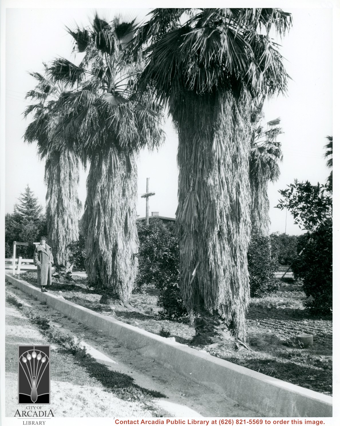
Unknown lady standing on street curbing beside three large palm trees which adjoin a citrus orchard. Location in city is not known, but possibly Santa Anita. Note deep curbs to control rain run-off.
https://arcadiahistory.andornot.com/en/permalink/photographs604
- Date
- c.1930's
1 image
- Date
- c.1930's
- Subjects
- Agriculture
- Santa Anita Avenue
- Physical Description
- 8x10 b&w
- ID
- 600
- Collection
- Photographs
Images
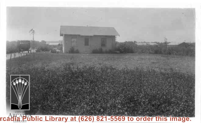
Home of Charles and Pearl Strong at 460 W. Duarte Road. View shows small clapboard house standing by itself. There is a high-sided trailer standing at left of house. What appears to be chicken houses show in the photo. Claimed to be first white leghorn chicken ranch in Arcadia.
https://arcadiahistory.andornot.com/en/permalink/photographs278
- Date
- 1921
1 image
- Date
- 1921
- Subjects
- Agriculture
- Houses
- Poultry
- Strong, Charles
- Physical Description
- 4 3/8 x 2 5/8 b&w
- ID
- 276
- Collection
- Photographs
Images
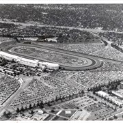
Aerial view taken from about over what became Campus Drive and Arcadia High School, and looking toward (NW) Pasadena and Sierra Madre at foot of San Gabriel Mountains. Photo shows Santa Anita Park Race Track possibly just a few years after opening.
https://arcadiahistory.andornot.com/en/permalink/photographs633
- Date
- c.1936
1 image
- Date
- c.1936
- Subjects
- Aerial Photo Collection
- Aerial views
- Arcadia High School
- Campus Drive
- San Gabriel Mountains
- Santa Anita Park-1934-1942
- Physical Description
- 8x10 b&w
- ID
- 629
- Collection
- Photographs
Images
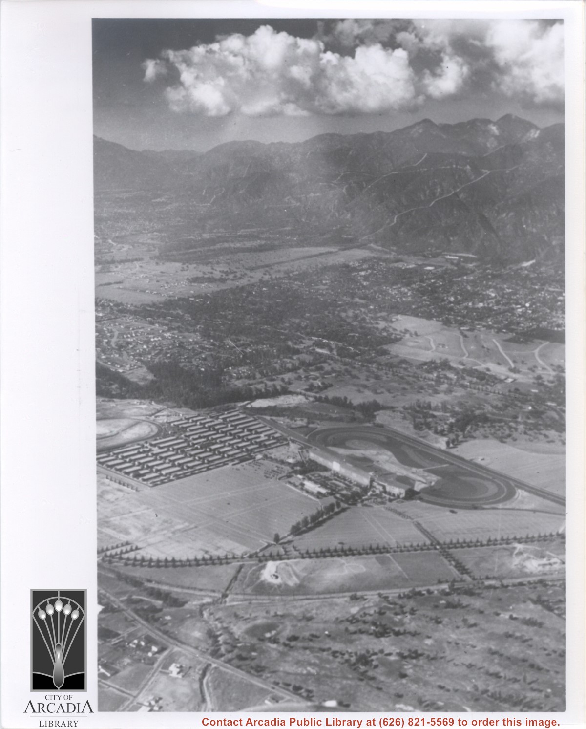
Aerial view taken looking southeast from position about over present Arboretum. Photo shows Santa Anita Park, probably in opening season. Present City Hall sits in area just beyond cars parked at east end of track. Part of oval of old Santa Anita track built by Elias J. "Lucky" Baldwin is seen in upper portion of photo, in area that is now Arcadia County Park. Duarte Road is seen crossing photo in upper right corner. Present Arcadia County Park area is in this photo, bordered on the north by Pacific Electric Railroad tracks. A train has just brought a group to the races and they are seen walking in center of photo. White square seen near right side, is slab left from hangars when U.S. Army Balloon School occupied this site, 1917-1927.
https://arcadiahistory.andornot.com/en/permalink/photographs986
- Date
- c.1934 racing season
1 image
- Date
- c.1934 racing season
- Subjects
- Aerial Photo Collection
- Aerial views
- Arcadia County Park
- Duarte Road
- Race tracks
- Railroads
- Santa Anita Park-1934-1942
- Santa Anita Park-1907-1912
- Physical Description
- 8x10 b&w
- ID
- 978
- Collection
- Photographs
Images


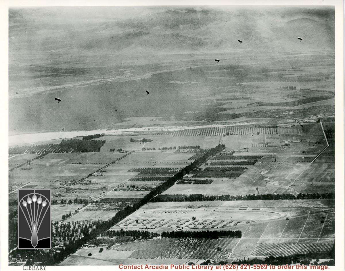
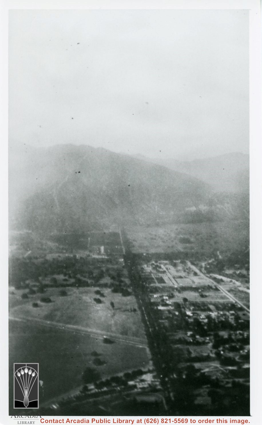
Aerial view south of Balloon School and surrounding part of valley. Large tree-lined street running from center of photo toward lower left edge of photo is Santa Anita. Tree-lined street coming in on right edge of photo about two inches from bottom of photo and intersecting Santa Anita, is Duarte Road. Note wash that at present is just west of Arcadia High School. Rio Hondo Wash runs east to west across middle of photo.
https://arcadiahistory.andornot.com/en/permalink/photographs153
- Date
- c.1918
1 image
- Date
- c.1918
- Subjects
- Aerial Photo Collection
- Aerial views
- U.S. Army Balloon School see Balloon School
- Balloon School
- Physical Description
- 8x10 b&w
- ID
- 152
- Collection
- Photographs
Images
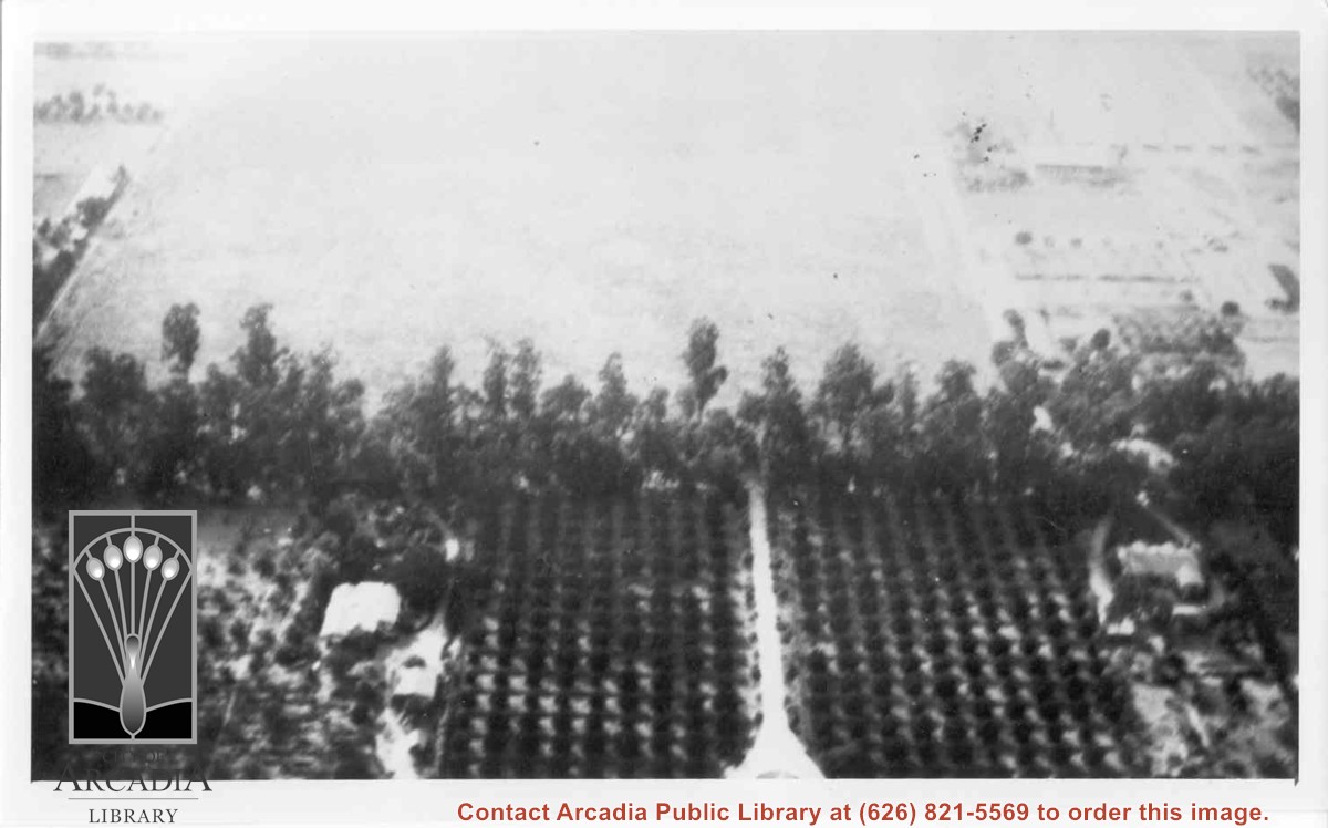
Aerial view west toward Santa Anita Ave. from above First Avenue, site of new grammar school. Long driveway heads to Jaspar N. Teague home in center of 10 acre orange grove. (Address in City Directory for this name is 1380 S. Santa Anita.) House to left and south was that of Charles W. Stewart in another 10 acre plot. Both ranches are now occupied by First Avenue Junior High School.
https://arcadiahistory.andornot.com/en/permalink/photographs12
- Date
- November 1929
1 image
- Date
- November 1929
- Subjects
- Houses
- Teague, Jaspar
- Stewart, Charles W.
- Agriculture
- First Avenue Junior High School
- Arcadia(City)-History-1920-1929
- Physical Description
- 6x10 b&w
- ID
- 12
- Collection
- Photographs
Images
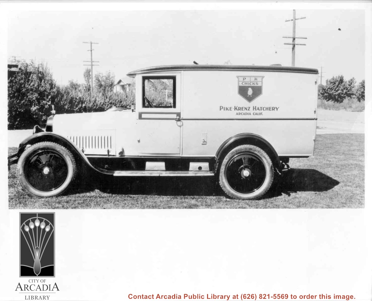
Closeup of shiny truck bearing name: Pike-Krenz Hatchery, Arcadia, Calif. Ranch was located at 641 West Lemon, Arcadia.
https://arcadiahistory.andornot.com/en/permalink/photographs9
- Date
- c.1928-1930
1 image
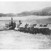
38 horse combine harvester working near Arcadia.
https://arcadiahistory.andornot.com/en/permalink/photographs1
- Date
- June 25, 1906
1 image
- Date
- June 25, 1906
- Physical Description
- 8x10 (1), 3x5 (1)
- ID
- 1
- Collection
- Photographs
Images

Aerial view taken over Arcadia so that it shows a large area surrounding Arcadia as well as the entire city. Clearly seen is the Santa Anita Park Race Track, and the Arcadia County Park (shown as a dark triangle in center), and the 210 Foothill Freeway crossing photo from west to east and passing north of Santa Anita Park Race Track.
https://arcadiahistory.andornot.com/en/permalink/photographs648
- Date
- c. 1973
1 image
- Date
- c. 1973
- Subjects
- Aerial Photo Collection
- Aerial views
- 210 Foothill Freeway
- Arcadia County Park
- Santa Anita Park-1945-1980
- Physical Description
- 8x10 b&w
- ID
- 644
- Collection
- Photographs
Images


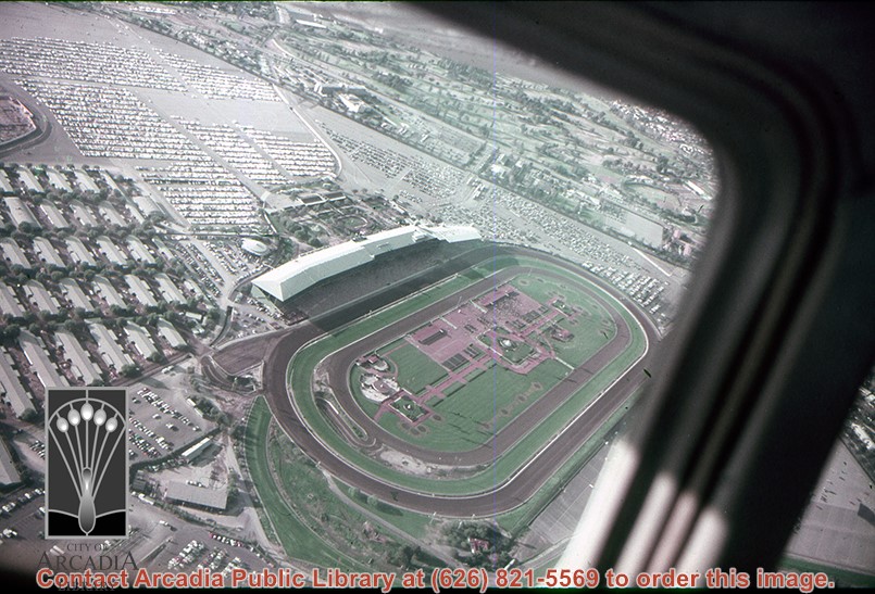
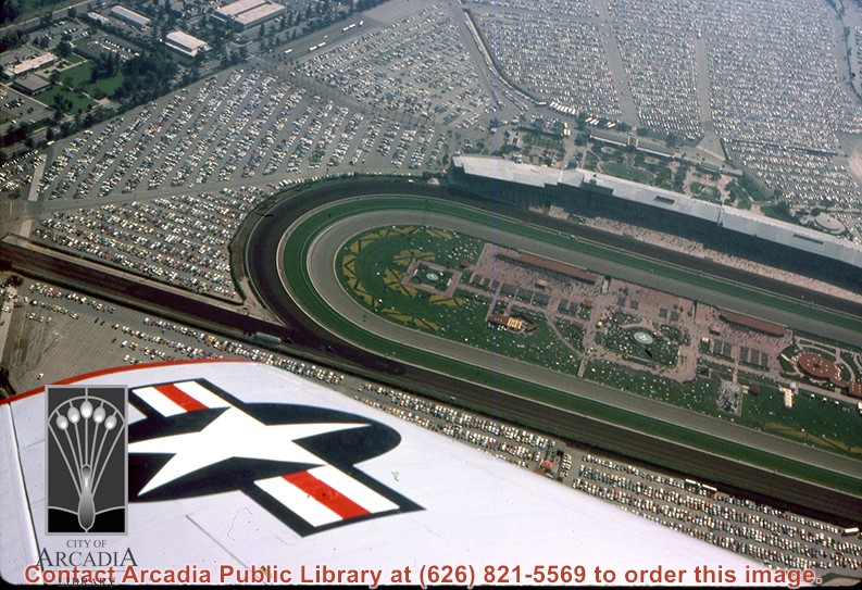
Aerial view looking north across Santa Anita Park from a position over Arcadia County Park. Large infield crowd is evident and all parking areas are filled. Arcadia Methodist Hospital shows in lower left part of photo and Arcadia Police facility is seen in lower right. The 210 Foothill Freeway cuts across photo near the top.
https://arcadiahistory.andornot.com/en/permalink/photographs995
- Date
- c.1979
1 image
- Date
- c.1979
- Subjects
- Aerial Photo Collection
- Aerial views
- 210 Foothill Freeway
- Arcadia Methodist Hospital
- Santa Anita Park-1945-1980
- Physical Description
- 8x10 b&w
- ID
- 988
- Collection
- Photographs
Images

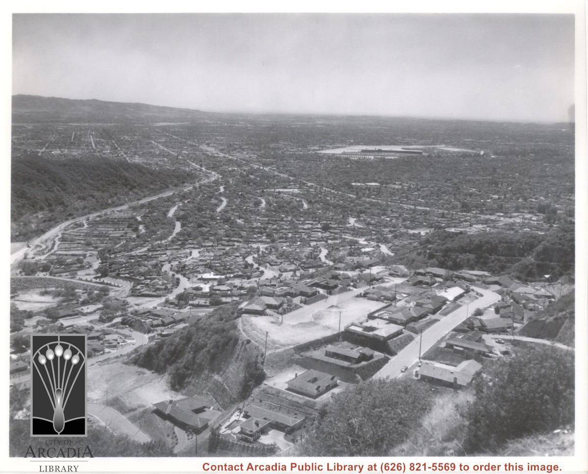
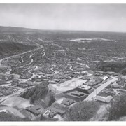
Aerial view south from Chantry Flats Road over the still-developing upper Highlands section of Arcadia. View is across Arcadia toward the Puente Hills. Santa Anita Park Race Track is seen in the center. Santa Anita Wash is seen on extreme left.
https://arcadiahistory.andornot.com/en/permalink/photographs955
- Date
- c.1965
1 image
- Date
- c.1965
- Subjects
- Aerial Photo Collection
- Aerial views
- Arcadia(City)-History-1960-1969
- Chantry Flats Road
- Santa Anita Wash
- Physical Description
- 8x10 b&w
- ID
- 949
- Collection
- Photographs
Images
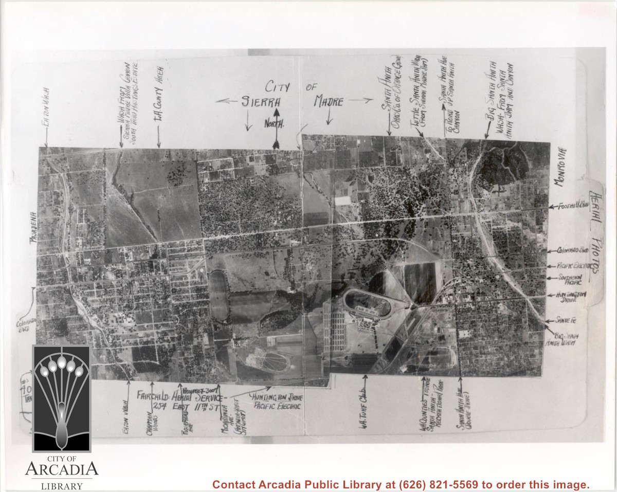
Aerial view of Arcadia. Photo is dated in lower left corner and has descriptions and arrows all along the border.
https://arcadiahistory.andornot.com/en/permalink/photographs1560
- Date
- June 11, 1936
1 image
- Date
- June 11, 1936
- Subjects
- Aerial Photo Collection
- Aerial views
- Physical Description
- 8x10 b&w
- ID
- 1539
- Collection
- Photographs
Images
View across Arcadia taken from Chantry Flats Road at night. Long diagonal streak starting near bottom of lower right, marks Santa Anita Avenue.
https://arcadiahistory.andornot.com/en/permalink/photographs1159
- Date
- c.1952
1 image


Aerial view, of Santa Anita Park Race Track, address is 285 West Huntington Drive, Arcadia, California. Any use of this image must be credited "Photograph by David Stevens. Copyright David Stevens."
https://arcadiahistory.andornot.com/en/permalink/photographs2417
- Date
- 1990?
1 image
- Date
- 1990?
- Physical Description
- color image, digital, see i:images
- ID
- 2275
- Collection
- Photographs
Images
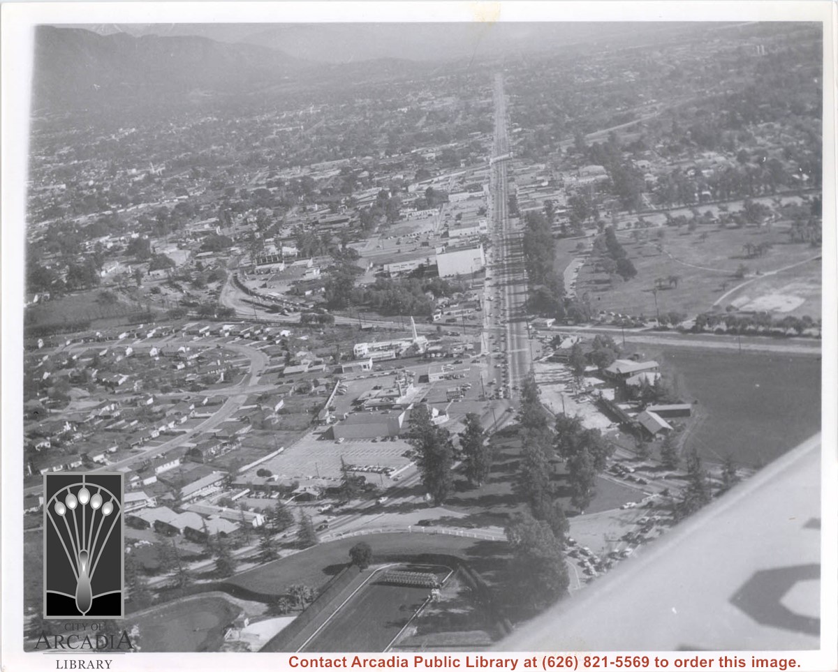
Aerial view north up Santa Anita Avenue. Note Chantry Flats Road on mountain near right side of photo. This view was taken from just south of Huntington Drive. This image belongs to Arcadia Historical Society.
https://arcadiahistory.andornot.com/en/permalink/photographs587
- Date
- November 1926
1 image
- Date
- November 1926
- Physical Description
- 6x10 vertical
- ID
- 583
- Collection
- Photographs
Images
Aerial view, of Santa Anita Park Race Track, address is 285 West Huntington Drive, Arcadia, California. Many cars are parked there. Any use of this image must be credited "Photograph by David Stevens. Copyright David Stevens."
https://arcadiahistory.andornot.com/en/permalink/photographs2418
- Date
- 1990?
1 image
- Date
- 1990?
- Physical Description
- color image, digital, see i:images
- ID
- 2276
- Collection
- Photographs
Images
Aerial view looking east along Huntington Drive taken over the Club House at Santa Anita Park Race Track. Pony Express Museum is just to right of the "y" intersection of Huntington Drive coming into Arcadia just below the wing of the plane. Theater that was opened in 1942 is almost directly opposite Museum. Santa Anita Motor Inn, two buildings east of theater, distinguished by tall tower, opened in 1938. (It was torn down in 1975.) The residential area directly north of there is known as Santa Anita Gardens. Santa Anita Avenue is just beyond Arcadia County Park on right.
https://arcadiahistory.andornot.com/en/permalink/photographs642
- Date
- c. 1957-58
1 image
- Date
- c. 1957-58
- Subjects
- Aerial Photo Collection
- Aerial views
- Huntington Drive
- Pony Express Museum
- Santa Anita Avenue
- Santa Anita Motor Inn
- Physical Description
- 8x10 b&w
- ID
- 638
- Collection
- Photographs
Images
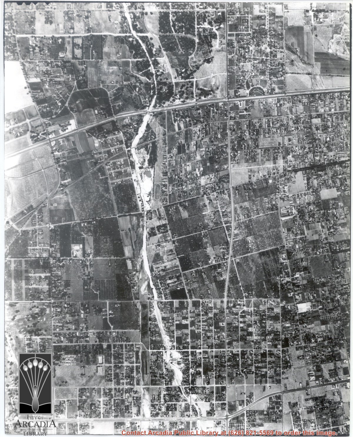
Main road crossing photo east to west in top third of photo is Huntington Drive. The main street running North/South in right portion of photo is Rosemead Boulevard. Wash running North/South is Eaton Wash. Very little in this view is of Arcadia.
https://arcadiahistory.andornot.com/en/permalink/photographs624
- Date
- June 5, 1938
1 image
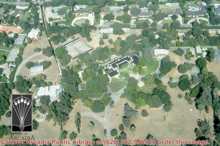
Aerial view, of Anita M. Baldwin's former estate known as Anoakia, looking north. Address was at 701 West Foothill Boulevard in Arcadia, when it was the Anoakia School. Any use of this image must be credited "Photograph by David Stevens. Copyright David Stevens."
https://arcadiahistory.andornot.com/en/permalink/photographs2411
- Date
- 1990?
1 image
- Date
- 1990?
- Subjects
- Aerial Photo Collection
- Aerial views
- Anoakia
- Anoakia School
- Baldwin, Anita M.
- David Stevens Collection
- Physical Description
- color image, digital, see i:images
- ID
- 2271
- Collection
- Photographs
Images