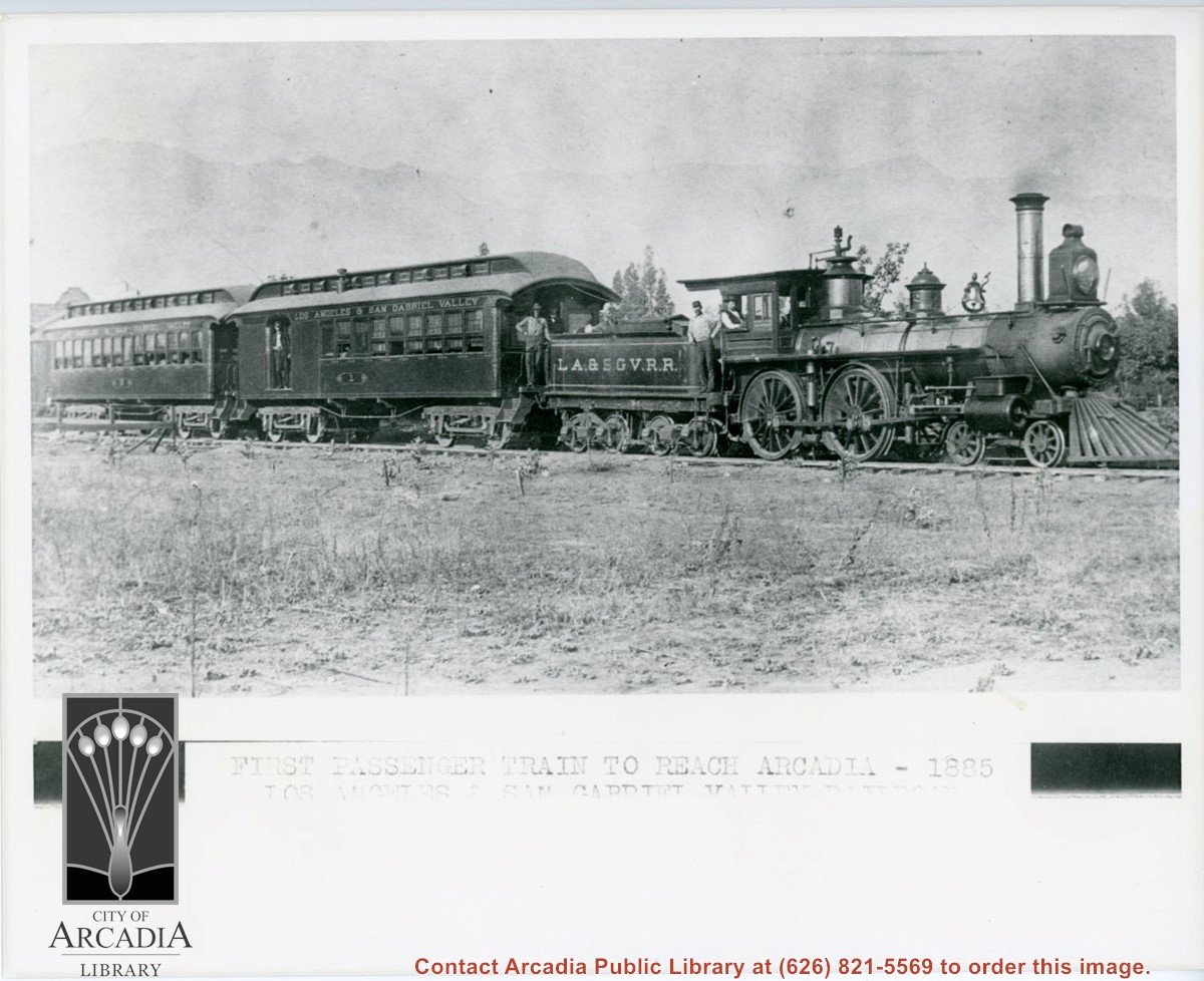
Engine, coal car, and two passenger coaches standing on track. The train is of the Los Angeles and San Gabriel Valley line. The engineer is sitting at his window in cab. Several other crew members can be seen. San Gabriel Mountains form backdrop of photo.
https://arcadiahistory.andornot.com/en/permalink/photographs216
- Date
- c.1885
1 image
- Date
- c.1885
- Subjects
- Railroads
- San Gabriel Mountains
- Physical Description
- 8x10 b&w
- ID
- 215
- Collection
- Photographs
Images
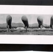
Shows six balloons inflated and secured just off the ground. Officers and men are in formations beneath the balloons. Buildings and tents of Ross Field are arrayed across photo. Eucalyptus make a row completely across photo. San Gabriel Mountains form backdrop.
https://arcadiahistory.andornot.com/en/permalink/photographs187
- Date
- c.1918
1 image
- Date
- c.1918
- Subjects
- Balloon School
- San Gabriel Mountains
- Physical Description
- 4x10 b&w
- ID
- 186
- Collection
- Photographs
Images

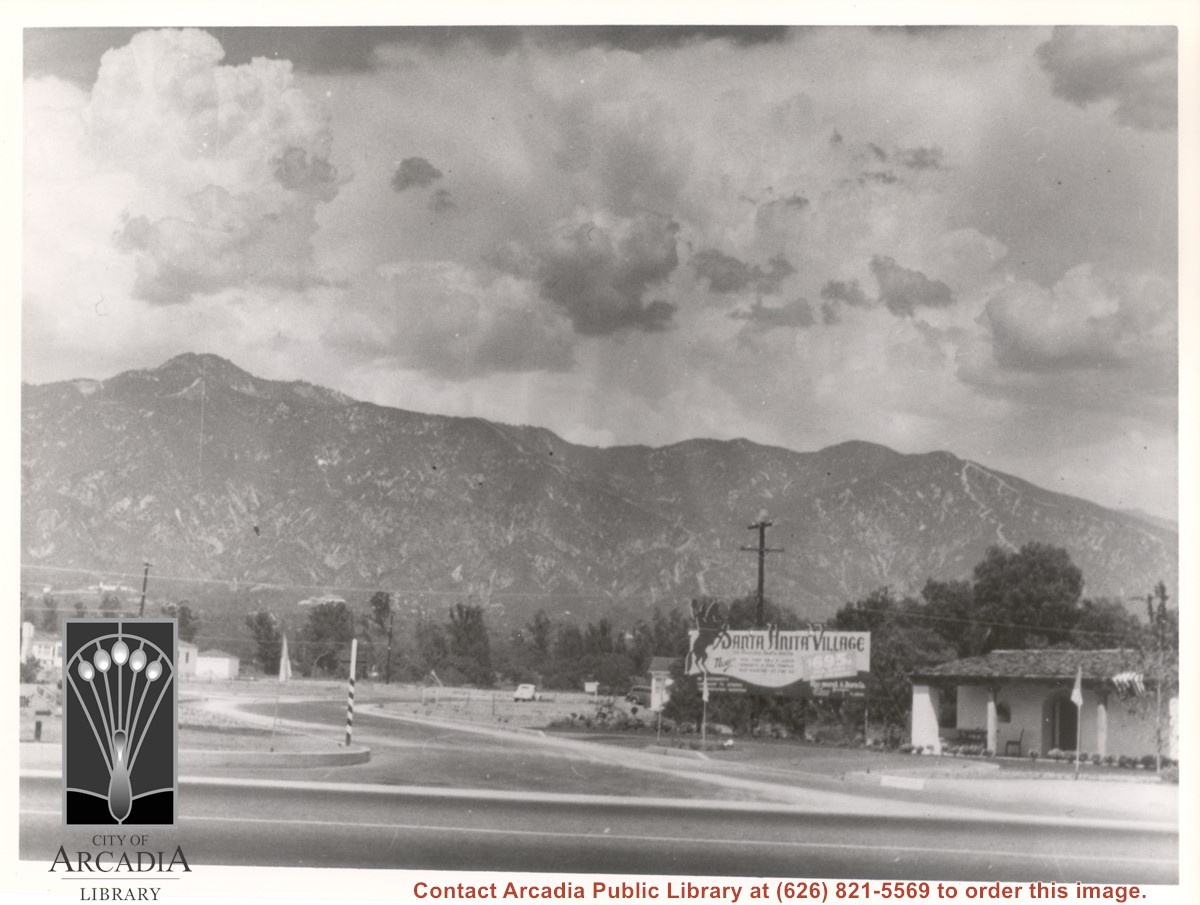
View north toward mountains from Huntington Drive near Golden West at the time of the opening of Santa Anita Village Tract. Note on the large sign the price of $695 for a lot. Tract opened March 29, 1939. See also History Room Box A and History Room Box 2.
https://arcadiahistory.andornot.com/en/permalink/photographs879
- Date
- c.1940
1 image
- Date
- c.1940
- Subjects
- Santa Anita Village
- San Gabriel Mountains
- Physical Description
- 8x10 b&w
- ID
- 874
- Collection
- Photographs
Images
Arcadia has new hiking shuttle. U.S. Forest Service starts bus service to Chantry Flat trails from Arcadia Gold Line station. The shuttle goes to Chantry Flat Road, an area that connects to trails that lead to Sturtevant Falls, Hermit Falls, and historic Mount Wilson. The shuttle will run the next three weekends. Plans to make it permanent have not been formulated. See also Pasadena Star News, September 21, 2016, p. A7.
https://arcadiahistory.andornot.com/en/permalink/newspaper34675
- Newspaper
- Pasadena Star News
- Date
- September 20, 2016
- Pages
- p. A1, A6
- Subjects
- Angeles National Forest
- Bus
- Chantry Flat
- Hiking
- San Gabriel Mountains
- Shuttle Service
- United States Forest Service
- Item ID
- 34867AN
- Collection
- Newspaper Index
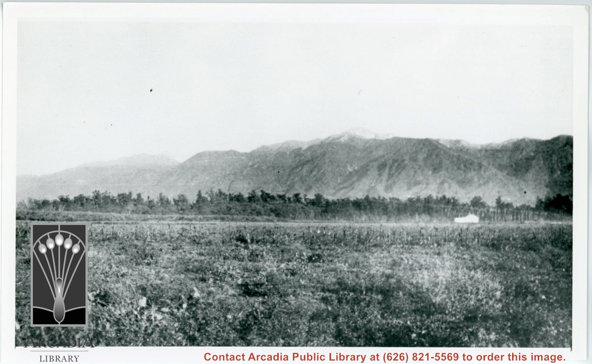
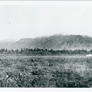
View north across ranch fields from approximate location of Huntington Drive near present Baldwin White Building. May have been fruit packing shed according to map drawn from memory by Lupe Cuellar. (See photo #123. Also see photo #15 taken from almost the same location.) San Gabriel Mountains across photo.
https://arcadiahistory.andornot.com/en/permalink/photographs122
- Date
- 1937
1 image
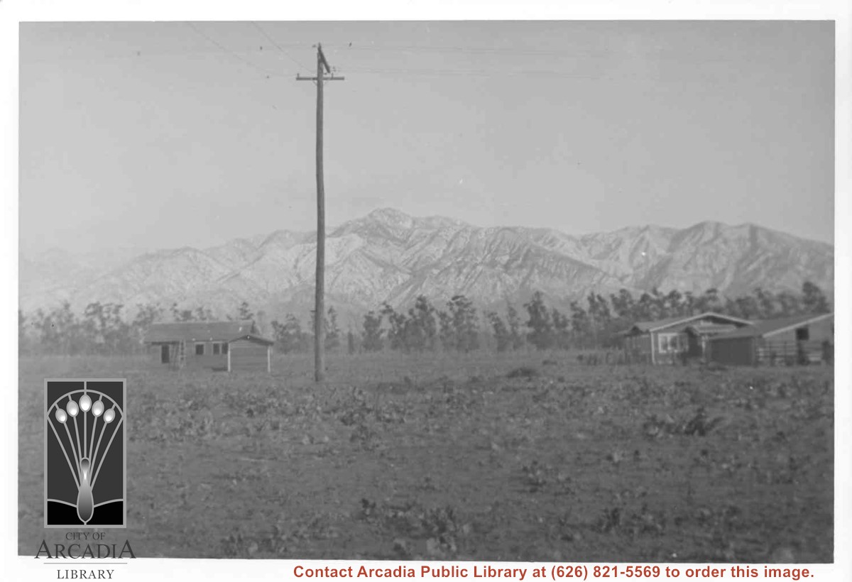
View from back yard of Ramuz family home on Arcadia Ave. looking north toward San Gabriel Mountains. (Later they would build home on South Santa Anita in conjunction with their business, The Arcadia Nursery.) There are two small houses, one on left is still under construction. Just to left of center is a power pole. Line of eucalyptus in background apparently was along Huntington Drive.
https://arcadiahistory.andornot.com/en/permalink/photographs884
- Date
- c.1917
1 image
- Date
- c.1917
- Subjects
- Houses
- San Gabriel Mountains
- Physical Description
- 7x10 b&w
- ID
- 878
- Collection
- Photographs
Images
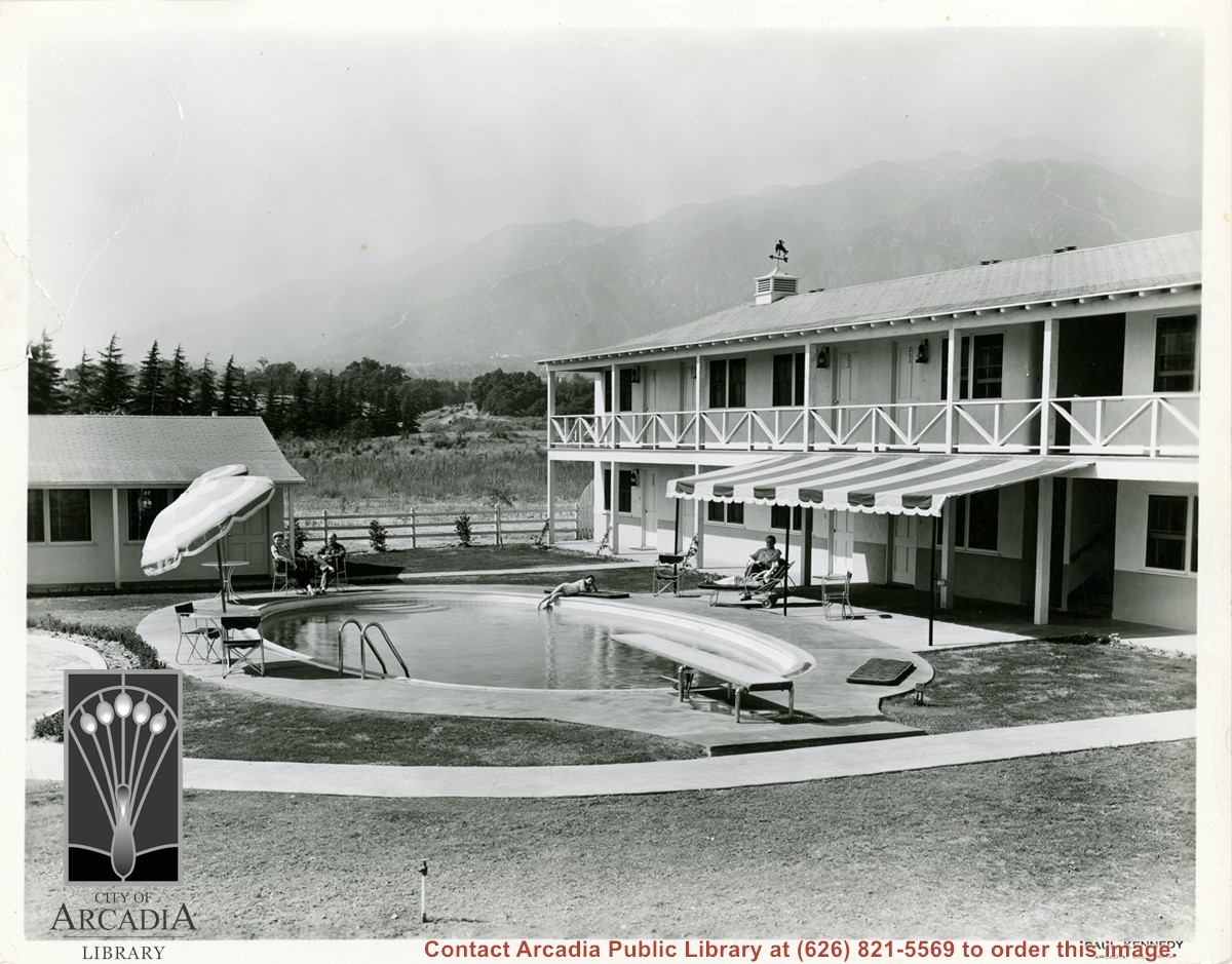
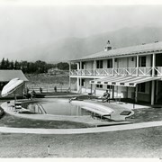
Portion of the exterior of the guest accommodations at the Westerner Motel. Photo shows swimming pool, with people lounging about. The Y at intersection of Colorado Place and Colorado is visible as well as the San Gabriel Mountains.
https://arcadiahistory.andornot.com/en/permalink/photographs425
- Date
- c.1951
1 image
- Date
- c.1951
- Subjects
- Westerner Motel
- San Gabriel Mountains
- Physical Description
- 8x10 b&w
- ID
- 423
- Collection
- Photographs
Images
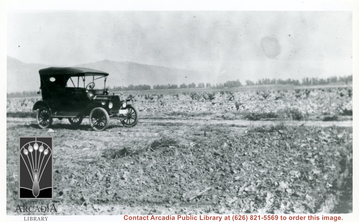
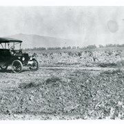
Car sitting alongside Holly Avenue at property just purchased by Aloyosius Mauch and his family near Palm Avenue and Holly Avenue. This view is toward NE.
https://arcadiahistory.andornot.com/en/permalink/photographs1007
- Date
- Feb. 1922
1 image
- Date
- Feb. 1922
- Physical Description
- 6x10 b&w (this is right portion of a panorama - photo 999 forms left portion)
- ID
- 1000
- Collection
- Photographs
Images
Bobcat Fire continues to wreak havoc. Nearly 24,000 acres burned above foothill communities, north of Monrovia, and still spreading out of control yesterday as firefighters contended with powerful winds. The fire has burned 23,890 acres of pristine forest lands. It was 6% contained. Evacuation warnings are still in effect in Monrovia, Arcadia, Azusa, Sierra Madre, Duarte, Pasadena, Altadena & Bradbury.
https://arcadiahistory.andornot.com/en/permalink/newspaper35801
- Newspaper
- Pasadena Star News
- Date
- September 11, 2020
- Pages
- p. A1, A4
- Collection
- Newspaper Index
Flames continue north to homes. Residents evacuate as Bobcat Fire jumps Highway 2, tops mountain ridge, menaces Antelope Valley. The 50,539-acre fire which once primarily threatened San Gabriel Valley foothill communities after it started on September 6, jumped Highway 2 overnight and continues to spread north, putting Antelope Valley under an evacuation warning. Evacuation warnings were still in place for parts of Monrovia, Arcadia, Duarte, Bradbury, Sierra Madre, Pasadena, and Altadena, though evacuation orders in parts of Sierra Madre and Arcadia were lifted Wednesday.
https://arcadiahistory.andornot.com/en/permalink/newspaper35806
- Newspaper
- Pasadena Star News
- Date
- September 18, 2020
- Pages
- p. A1, A7
- Collection
- Newspaper Index
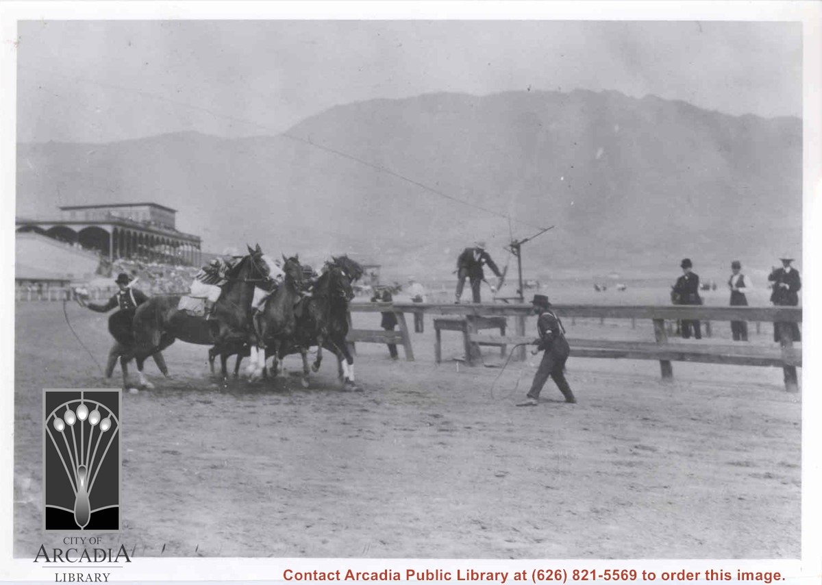
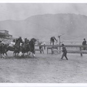
View of racetrack with what appears to be the San Gabriel Mountains in the background. There are four horses and riders apparently headed for a fall and two men on the track with whips trying to right things. Numerous people are watching. There is a large grandstand structure.
https://arcadiahistory.andornot.com/en/permalink/photographs223
- Date
- c.1890's
1 image
New risk rises from wildfires. Smoke can make people more subject to COVID-19, experts say. Smoke inhalation can weaken the immune system and make people more vulnerable to respiratory infections, including the novel coronavirus. Smoke from nearby Bobcat Fire shrouds Foothill Boulevard in Arcadia (in photo).
https://arcadiahistory.andornot.com/en/permalink/newspaper35807
- Newspaper
- Pasadena Star News
- Date
- September 19, 2020
- Pages
- p. A3, A7
- Collection
- Newspaper Index
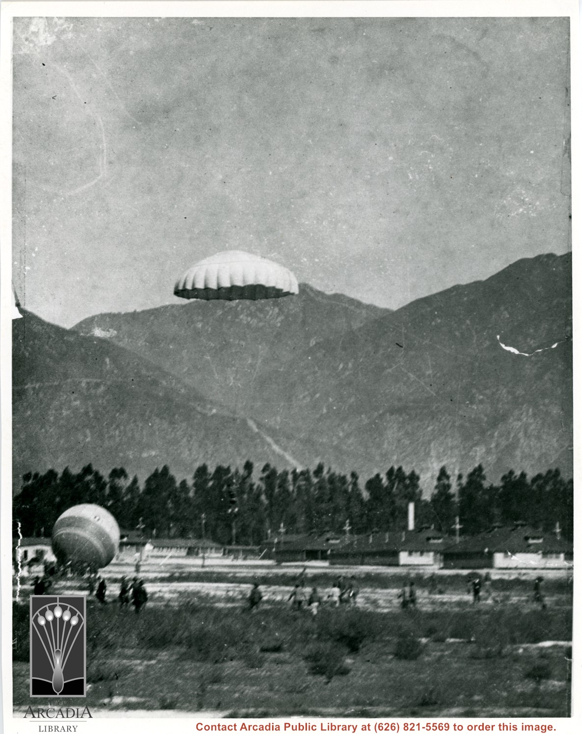
Parachute pictured coming down on Balloon School field. San Gabriel Mountains and Chantry Flats Road can be seen in background. Parachutes were used as emergency way to evacuate balloon in case of enemy fire, lightning, etc., according to H.F.Paden.
https://arcadiahistory.andornot.com/en/permalink/photographs156
- Date
- c.1917 or 1918
1 image
- Date
- c.1917 or 1918
- Subjects
- San Gabriel Mountains
- Balloon School
- Physical Description
- 8x10 b&w
- ID
- 155
- Collection
- Photographs
Images
The owner of the last mule pack station in Southern California has been told to close the business and remove all on-site buildings within thirty days.
https://arcadiahistory.andornot.com/en/permalink/newspaper20280
- Newspaper
- Pasadena Star News
- Date
- March 2, 2001
- Pages
- p. A1
- Subjects
- San Gabriel Mountains
- Kelley, Kim
- Item ID
- 20514AN
- Collection
- Newspaper Index
Bobcat Fire, on its 9th day in the San Gabriel Mountains, continued to grow north of the San Gabriel Valley. It had charred 38,299 acres Monday with containment at 3%. The fire has crossed to west side of Santa Anita Canyon. On Sunday, residents in Arcadia and Sierra Madre who live north of Elkins Avenue and east of Santa Anita Avenue were ordered to evacuate. About 305 homes were in the evacuation zone. Most are in Arcadia and 32 are in Sierra Madre.
https://arcadiahistory.andornot.com/en/permalink/newspaper35803
- Newspaper
- Pasadena Star News
- Date
- September 15, 2020
- Pages
- p. A1, A6
- Collection
- Newspaper Index
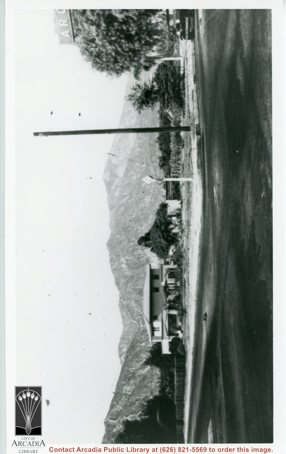
View NE across Baldwin Avenue at two-story Frank Grote home at 1128 S. Baldwin. This is NE corner of Baldwin Avenue and Duarte Road. Note ARCADIA sign over Duarte Road showing on right edge of photo.
https://arcadiahistory.andornot.com/en/permalink/photographs279
- Date
- c.1930
1 image
- Date
- c.1930
- Subjects
- Houses
- San Gabriel Mountains
- Baldwin Avenue
- Physical Description
- 6x10 b&w
- ID
- 277
- Collection
- Photographs
Images
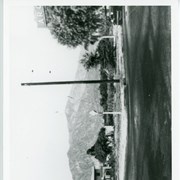
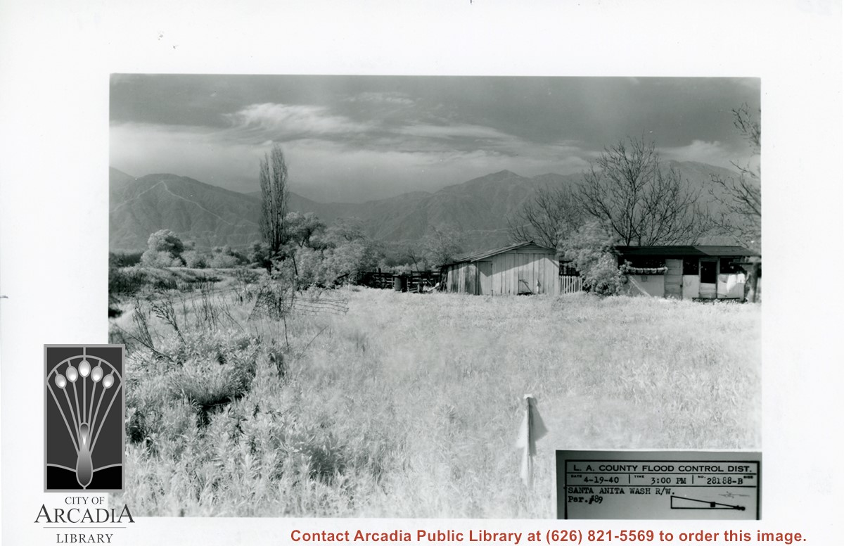
Small house and garage pictured on right side of photo. The view is across field of grass toward San Gabriel Mountains in background. Dramatic clouds fill the sky. There is a bare, tall Lombardy Poplar pictured near the wash. Caption on photo says it is Santa Anita Wash, but viewer is not aware of it. It must lie along left side of photo.
https://arcadiahistory.andornot.com/en/permalink/photographs826
- Date
- April 19, 1940
1 image
- Date
- April 19, 1940
- Subjects
- Santa Anita Wash
- San Gabriel Mountains
- Physical Description
- 5x7 b&w
- ID
- 820
- Collection
- Photographs
Images
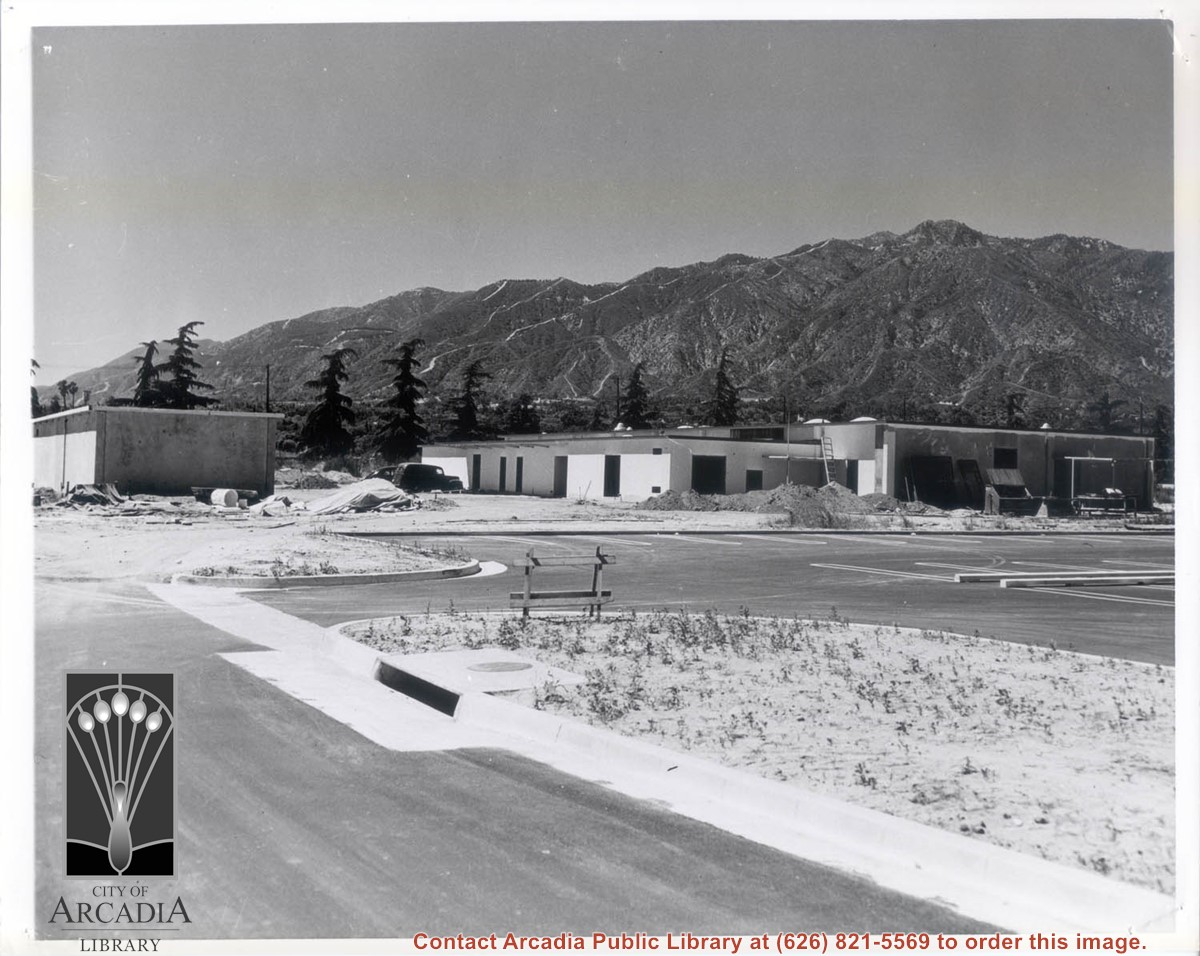
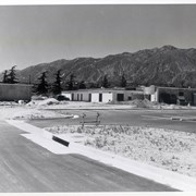
Side and back view of the yet unfinished Arcadia Police Department and its parking lot at 250 W. Huntington Drive. View of the San Gabriel Mountains is clear in the background.
https://arcadiahistory.andornot.com/en/permalink/photographs1787
- Date
- 1956
1 image
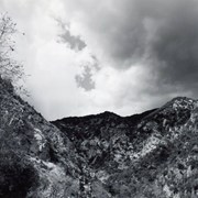
A view looking up toward the San Gabriel Mountains, looking northeast from Wilderness Park, with dark clouds. Photo by Terry Miller.
https://arcadiahistory.andornot.com/en/permalink/photographs2373
- Date
- 2001
1 image

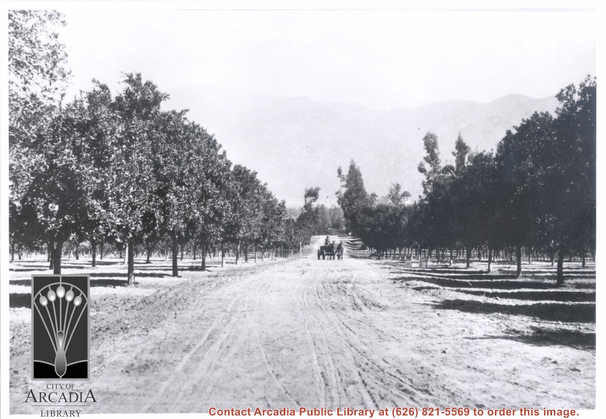
View north toward San Gabriel Mountains from orchards on Baldwin Ranch. Wagon pulled by two horses is on dirt lane coming toward camera. Note tower of Queen Anne Cottage on the right side of lane. On the back of this photo at Huntington Library is printed: Carter, 1937. Possible given by N. Carter family of Sierra Madre at this time. This photo belongs to the Huntington Library. It is shown here for research only.
https://arcadiahistory.andornot.com/en/permalink/photographs220
- Date
- c.1890
1 image