Main road crossing photo east to west in top third of photo is Huntington Drive. The main street running North/South in right portion of photo is Rosemead Boulevard. Wash running North/South is Eaton Wash. Very little in this view is of Arcadia.
https://arcadiahistory.andornot.com/en/permalink/photographs624
- Date
- June 5, 1938
1 image
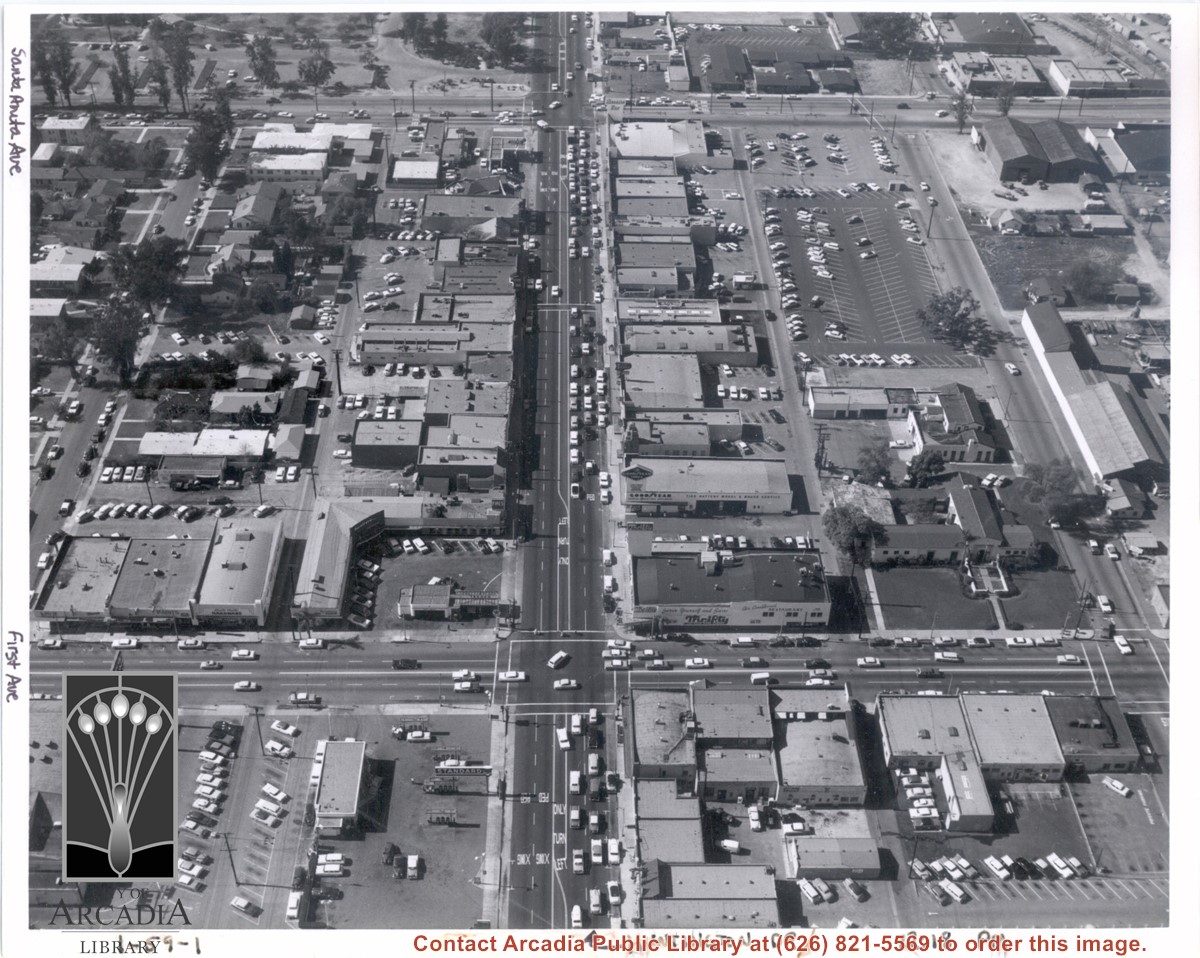
Aerial view from above Huntington Drive between Santa Anita Avenue and First Avenue. Huntington Drive intersects the photo from north to south. The street closest to the bottom is First Avenue and Santa Anita Avenue is near the top.
https://arcadiahistory.andornot.com/en/permalink/photographs1403
- Date
- c.1959
1 image
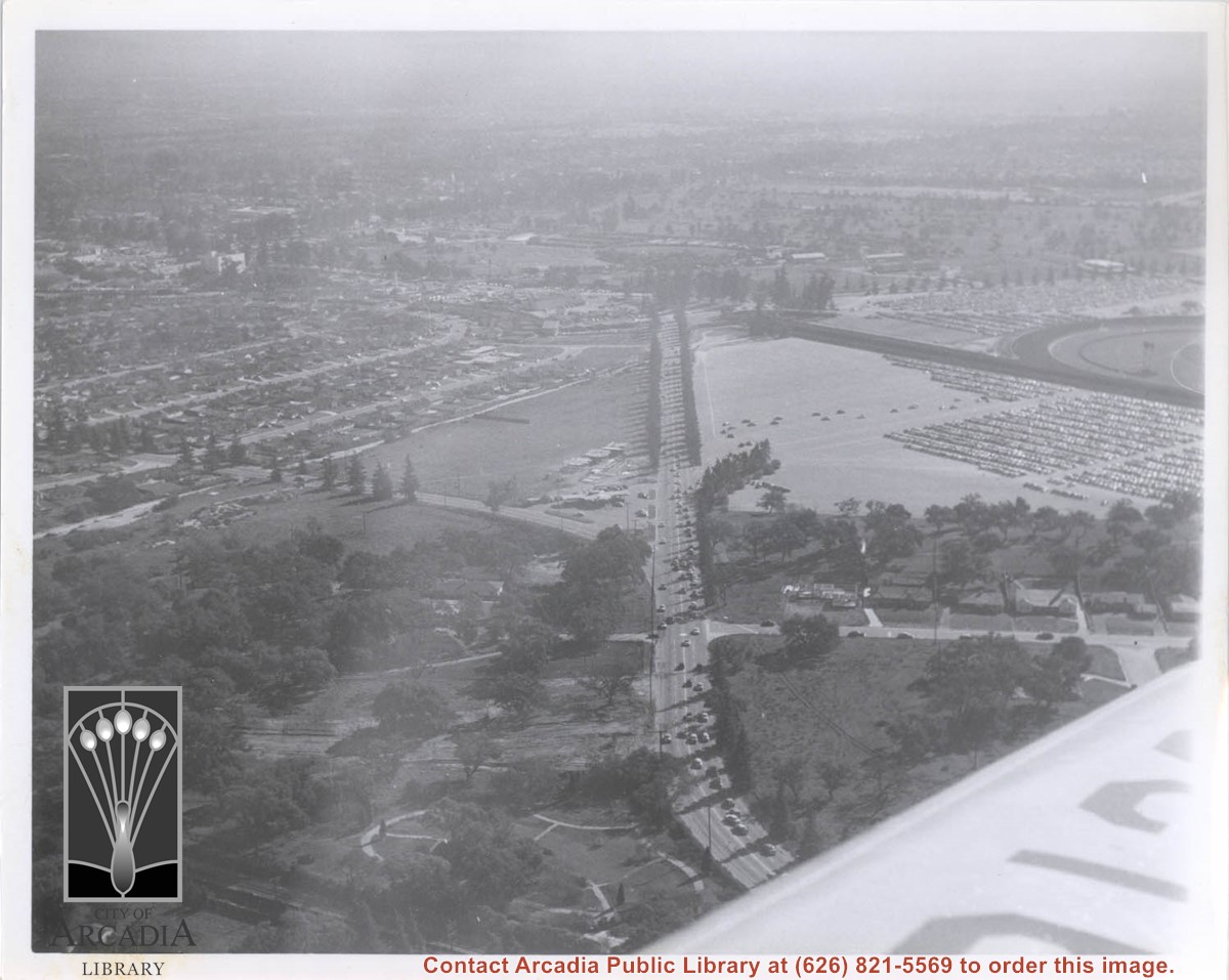
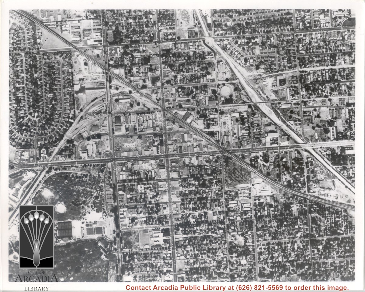
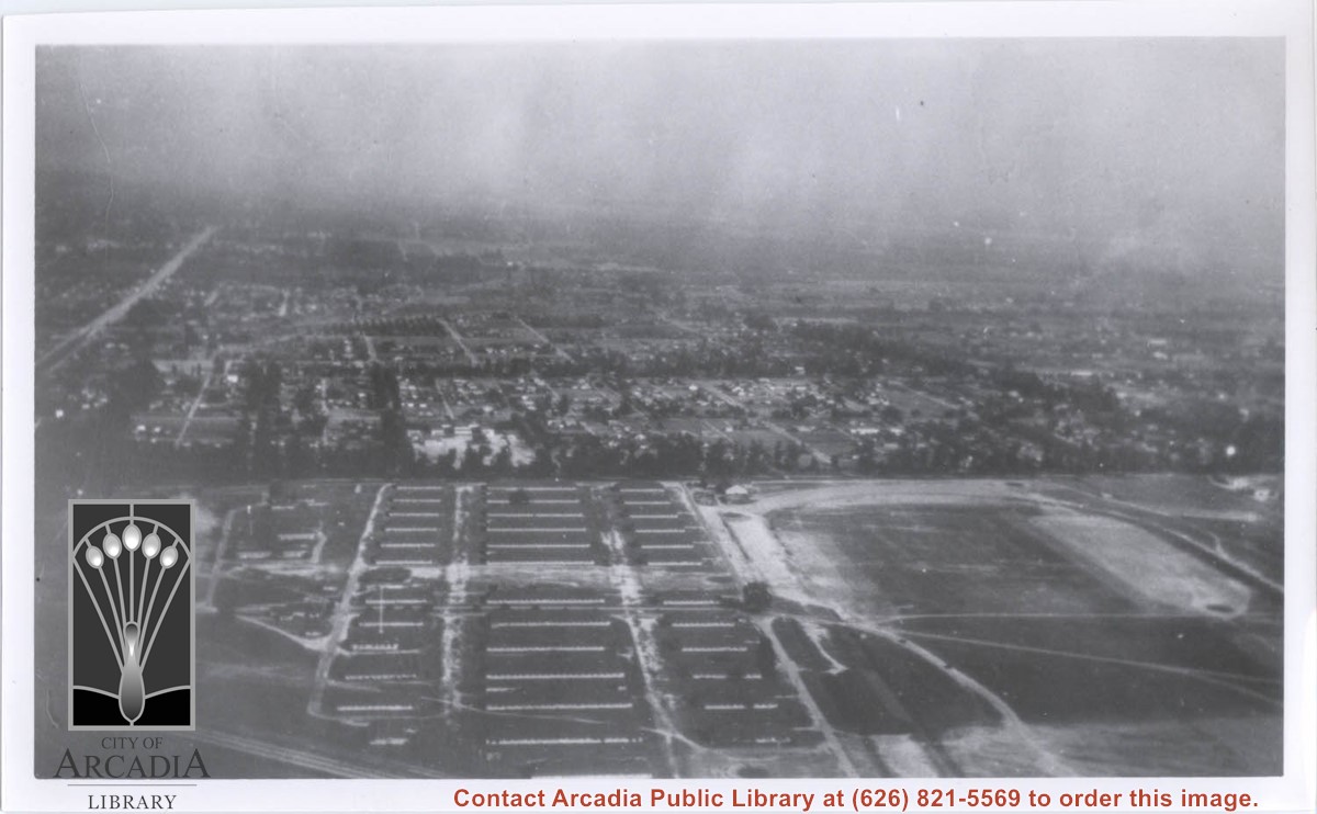
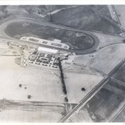
Aerial view south on Colorado Street just over large turn to the west. The residential area known as Santa Anita Gardens shows along upper left section of photo. Note that the only commerical development along the north side of Colorado Street is the Westerner Motel just near intersection with Huntington Drive. Santa Fe Railroad tracks are seen in lower left corner of photo. Santa Anita Park Race Track is on right.
https://arcadiahistory.andornot.com/en/permalink/photographs641
- Date
- c. 1956
1 image
- Date
- c. 1956
- Subjects
- Aerial Photo Collection
- Aerial views
- Colorado Boulevard
- Colorado Street
- Huntington Drive
- Railroads
- Santa Anita Park-1945-1980
- Westerner Motel
- Physical Description
- 8x10 b&w
- ID
- 637
- Collection
- Photographs
Images
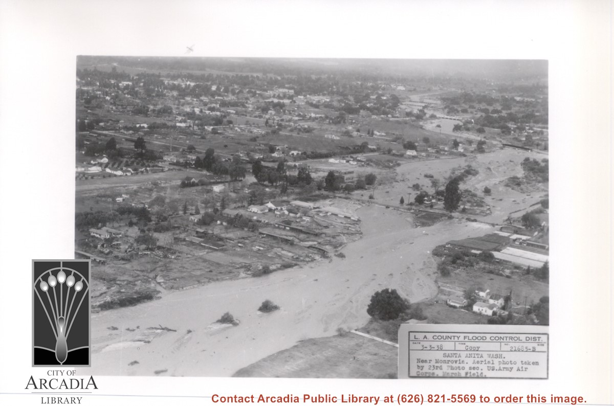
View NW up flooded Santa Anita Wash from above East bank below Duarte Road, probably the street seen crossing photo from right to left about half way down. Nest crossing north with dark bridge, is Santa Fe Railroad tracks; next we believe to be for a pipeline; last clearly visible crossing is for Pacific Electric Railroad tracks. Photo was taken following extreme flooding in 1938.
https://arcadiahistory.andornot.com/en/permalink/photographs816
- Date
- March 3, 1938
1 image
- Date
- March 3, 1938
- Subjects
- Flood control
- Physical Description
- 5x7 b&w
- ID
- 810
- Collection
- Photographs
Images
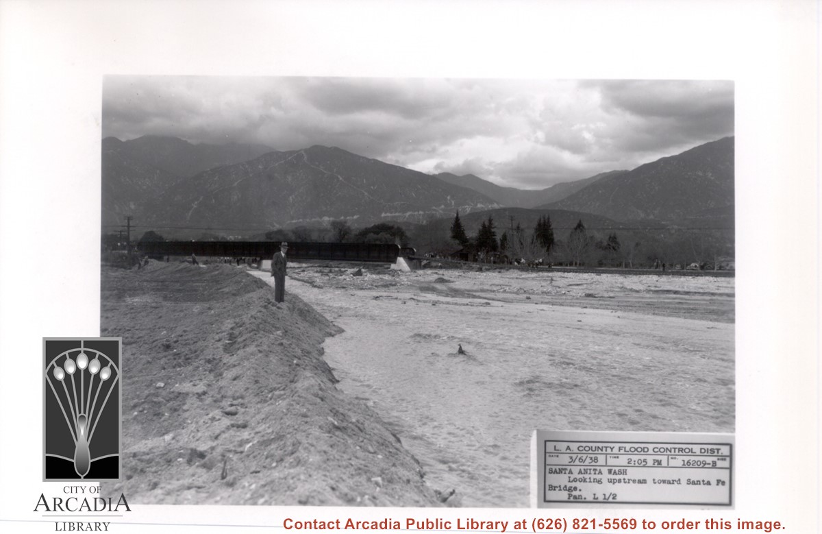
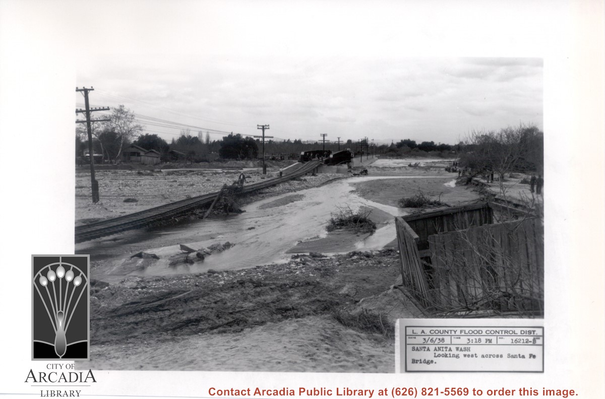
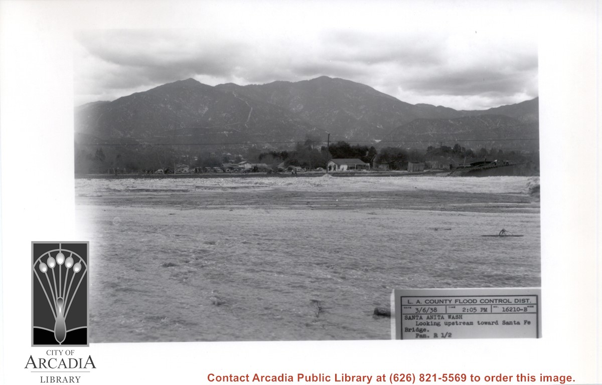
Looking directly north up flooded Santa Anita Wash. Santa Fe Railroad Bridge can be seen upstream. There is a man in a suit and hat standing at west edge of wash. This was following heavy rains of early March 1938.
https://arcadiahistory.andornot.com/en/permalink/photographs812
- Date
- March 6, 1938
1 image
- Date
- March 6, 1938
- Subjects
- Flood control
- Physical Description
- 5x7 b&w
- ID
- 806
- Collection
- Photographs
Images
Santa Fe Railroad tracks cut diagonally across photo from east to west. Huntington Drive bisects photo from east to west approximately at center of photo. Arcadia County Park appears in lower left corner, showing baseball diamond. Santa Anita Wash is shown on right side of photo.
https://arcadiahistory.andornot.com/en/permalink/photographs625
- Date
- c. early 1950's
1 image
Santa Anita Wash following flooding of early 1938. View is looking west along washed-out Santa Fe Railroad tracks toward Santa Fe Bridge across Santa Anita Wash. People can be seen looking at the damage.
https://arcadiahistory.andornot.com/en/permalink/photographs818
- Date
- March 3, 1938
1 image
- Date
- March 3, 1938
- Subjects
- Flood control
- Santa Anita Wash
- Physical Description
- 5x7 b&w
- ID
- 812
- Collection
- Photographs
Images
Looking downstream of Santa Anita Wash from east side of Santa Fe Bridge approach. In this photo the tracks and ties are seen completely suspended and a man is walking across the span. Two men are seen on extreme left side of photo.
https://arcadiahistory.andornot.com/en/permalink/photographs819
- Date
- March 6, 1938
1 image
- Date
- March 6, 1938
- Subjects
- Santa Anita Wash
- Flood control
- Physical Description
- 5x5 b&w
- ID
- 813
- Collection
- Photographs
Images

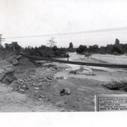
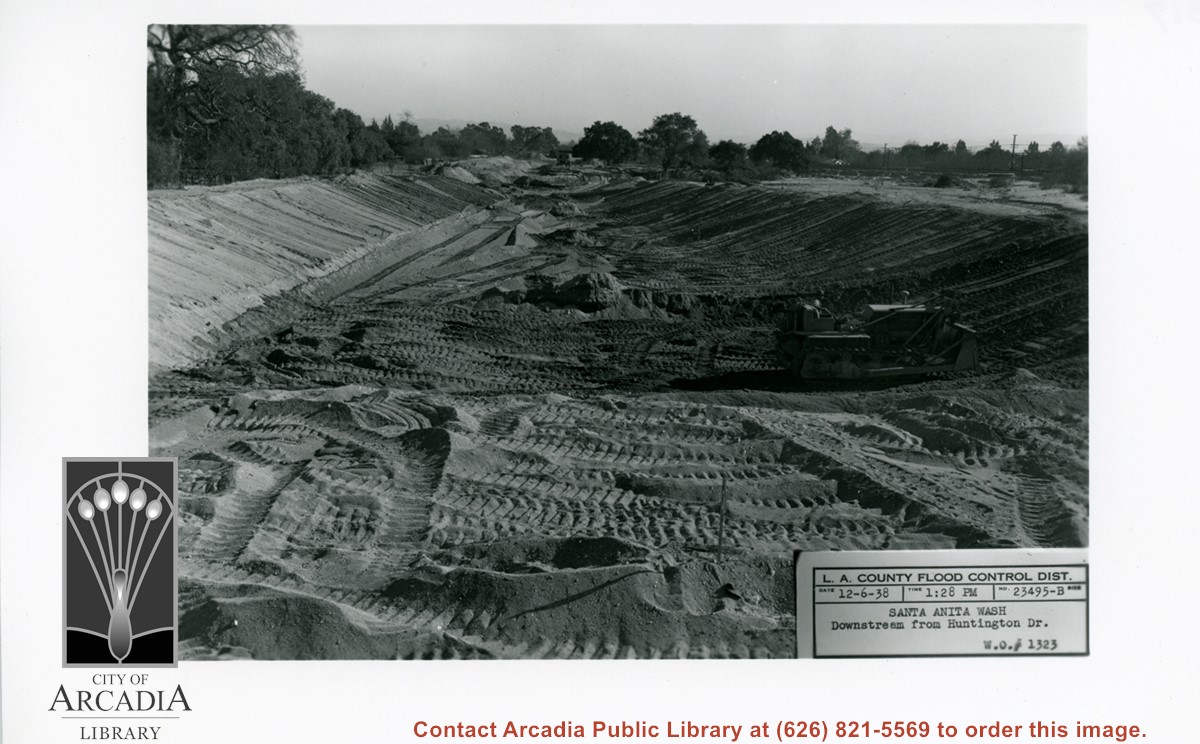
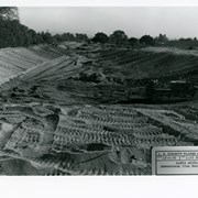
Looking south from Huntington Drive along Santa Anita Wash, following earth-moving preparatory to paving channel.
https://arcadiahistory.andornot.com/en/permalink/photographs823
- Date
- December 6, 1938
1 image
- Date
- December 6, 1938
- Subjects
- Santa Anita Wash
- Flood control
- Physical Description
- 5x7 b&w
- ID
- 817
- Collection
- Photographs
Images
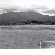
Looking NE up flooded Santa Anita Wash following heavy rains of early March 1938. Caption on photo reads: Looking upstream toward Santa Fe Bridge. San Gabriel Mountains in background. Where cars are parked would be east side of wash.
https://arcadiahistory.andornot.com/en/permalink/photographs811
- Date
- March 6, 1938
1 image
- Date
- March 6, 1938
- Subjects
- Flood control
- Physical Description
- 5x7 b&w
- ID
- 805
- Collection
- Photographs
Images
Aerial view toward the east taken from about over present Club House at Santa Anita Park Race Track. The main street running North/South is Santa Anita Avenue. View shows the oval of Elias J. "Lucky" Baldwin's race track in what is currently Arcadia County Park. The buildings would be barracks of Ross Field U.S. Army Balloon School. Duarte Road can be seen coming into photo at right edge of photo near intersection with Santa Anita Avenue. The broad street along left side would be Huntington Drive. Railroad tracks can be seen in lower left corner.
https://arcadiahistory.andornot.com/en/permalink/photographs635
- Date
- November 1929
1 image
- Date
- November 1929
- Subjects
- Aerial Photo Collection
- Aerial views
- Balloon School
- Huntington Drive
- Race tracks
- Railroads
- Santa Anita Avenue
- Physical Description
- 6x10 b&w
- ID
- 631
- Collection
- Photographs
Images

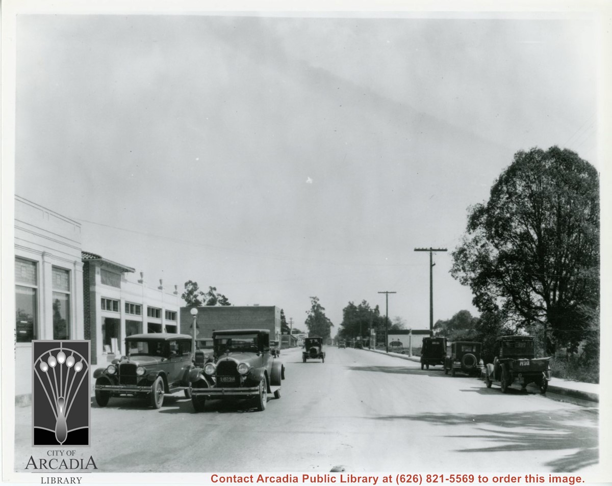
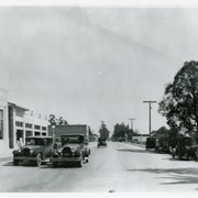
View east on Huntington Drive from intersection with First Avenue. In the distance can be seen a railroad crossing marker which was for the Santa Fe Line (which is now serviced with an overpass of Huntington Dr.). Building at extreme left is Bank of Italy Building on N.E. corner of First and Huntington Dr.
https://arcadiahistory.andornot.com/en/permalink/photographs204
- Date
- 1927
1 image
Aerial view from position above Huntington Drive near Holly Avenue intersection looking north over Santa Anita Park. Colorado Place and Huntington Drive are seen coming together at right side of photo. Note how small the deodar (?) trees planted along Huntington Drive and Colorado Place are. Row of trees seen in center of photo were apparently left from Ranch days and were later removed.
https://arcadiahistory.andornot.com/en/permalink/photographs984
- Date
- December 1, 1935
1 image
- Date
- December 1, 1935
- Subjects
- Aerial Photo Collection
- Aerial views
- Colorado Place
- Huntington Drive
- Santa Anita Park-1934-1942
- Physical Description
- 8x10 b&w
- ID
- 976
- Collection
- Photographs
Images

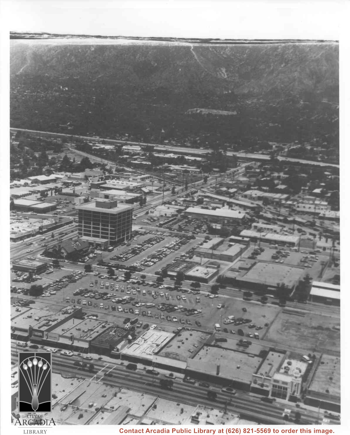
Aerial view north toward San Gabriel Mountains from a position above Huntington Drive near First Avenue. Santa Anita Avenue can plainly be seen running north and south in front of six-story building in center of photo. The 210 Foothill Freeway is top band running across photo from east to west.
https://arcadiahistory.andornot.com/en/permalink/photographs611
- Date
- July 1976
1 image

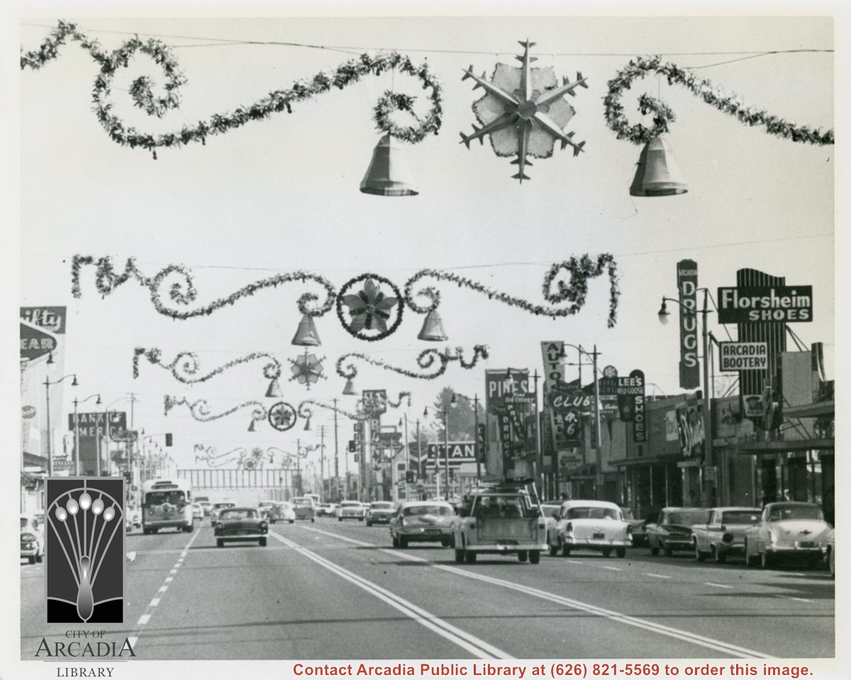
View east on Huntington Drive mid-way in block between Santa Anita and First Avenue during holiday season. Notice the Arcadia sign that had for many years hung over intersection at First Avenue has been removed (also referred to as a "Welcome" sign). Santa Fe Railroad overpass in view crossing over Huntington Drive.
https://arcadiahistory.andornot.com/en/permalink/photographs605
- Date
- November 13, 1959
1 image
- Date
- November 13, 1959
- Physical Description
- 8x10 b&w
- ID
- 601
- Collection
- Photographs
Images
Aerial view looking east across Santa Anita Park taken from a position just west of Baldwin Avenue, which is seen at bottom of photo. Huntington Drive appears exactly in center of photo just east of race track. The 210 Foothill Freeway enters area in upper right portion of picture and exits at left side in upper left portion.
https://arcadiahistory.andornot.com/en/permalink/photographs996
- Date
- c.1979
1 image
- Date
- c.1979
- Subjects
- Aerial Photo Collection
- Aerial views
- 210 Foothill Freeway
- Huntington Drive
- Santa Anita Park-1945-1980
- Physical Description
- 8x10 b&w
- ID
- 989
- Collection
- Photographs
Images


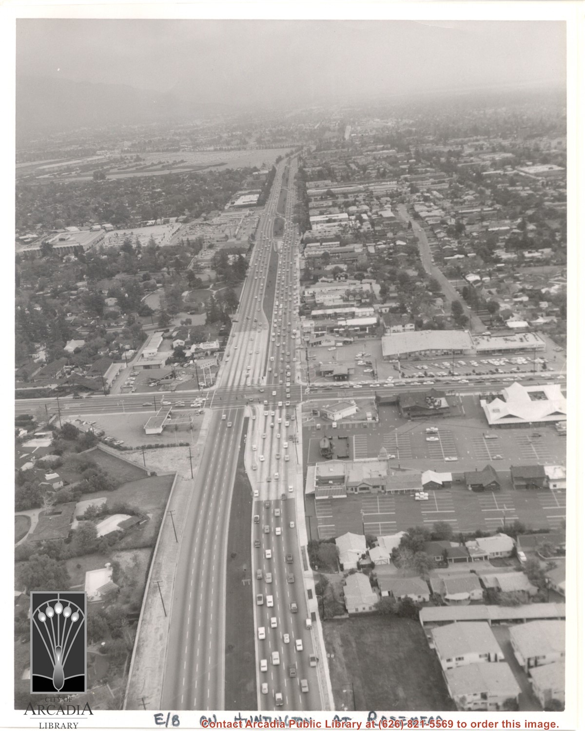
Aerial view east on Huntington Drive toward Arcadia from a position just west of Rosemead Boulevard. El Rancho Shopping Center and May Company Department Store can be seen as the business complex on the north side of Huntington Drive one block east of Rosemead Boulevard. Santa Anita Park Race Track can be seen on the left in upper portion of photo.
https://arcadiahistory.andornot.com/en/permalink/photographs637
- Date
- c.1970
1 image
- Date
- c.1970
- Subjects
- Aerial Photo Collection
- Aerial views
- El Rancho Shopping District
- Huntington Drive
- May Company Department Store
- Santa Anita Park-1945-1980
- Physical Description
- 8x10 b&w
- ID
- 633
- Collection
- Photographs
Images
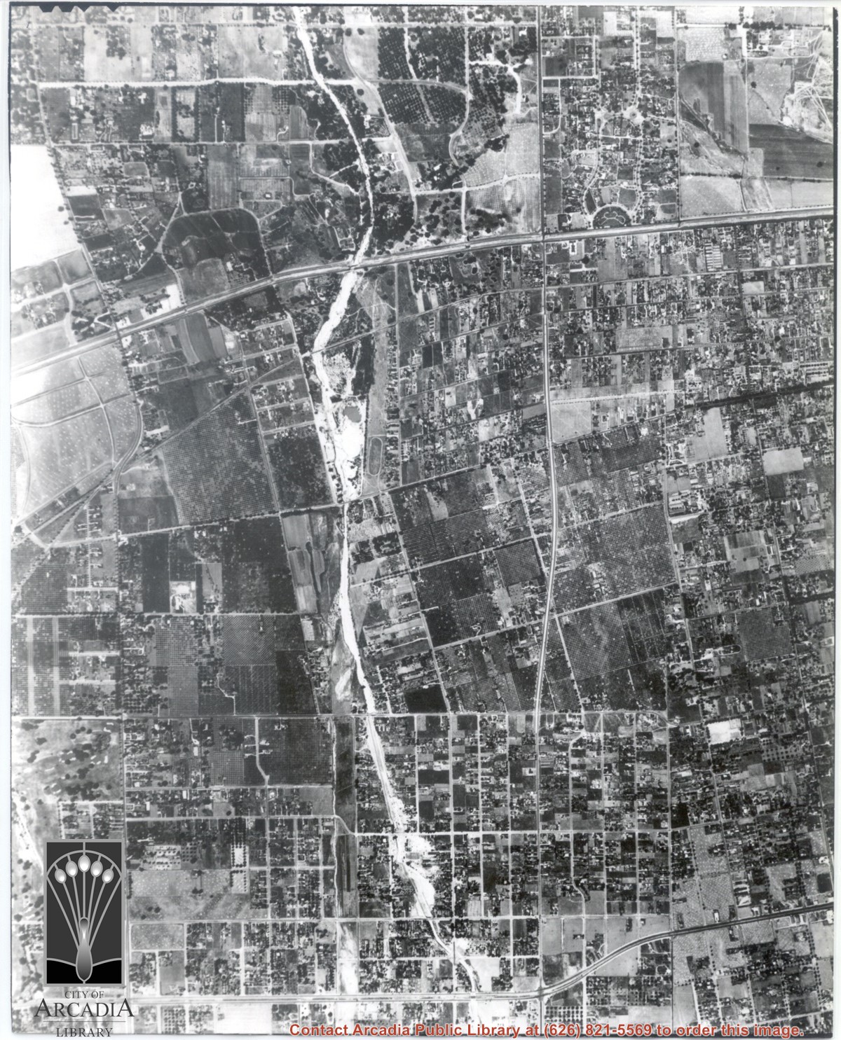
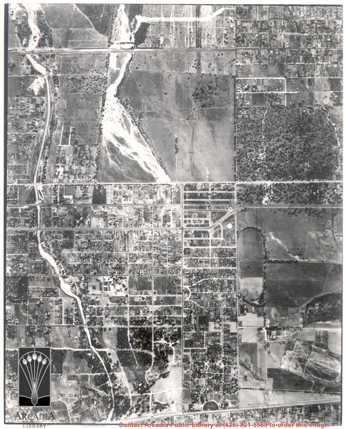
Main north/south running street to right of center is Michillinda Avenue. Oval adjacent to Michillinda Avenue is Elias J. "Lucky" Baldwin's training track. Lower right corner of photo is abandoned project of Anita Baldwin and Joe Smoot, c. 1933 (about where May Company was and where Vons, a Safeway Company, Southern California Division Headquarters is now, at 618 Michillinda Avenue). Street running east/west across center of photo is present day Colorado Boulevard. East/west-running street near top of photo is present Foothill Boulevard. Wash along left side of photo is Eaton Wash, Pasadena. Scale: 1 inch=660 feet.
https://arcadiahistory.andornot.com/en/permalink/photographs623
- Date
- June 5, 1938
1 image
- Date
- June 5, 1938
- Subjects
- Aerial Photo Collection
- Aerial views
- Eaton Wash
- Foothill Boulevard
- Los Angeles Jockey Club
- Michillinda Avenue
- Physical Description
- 8x10 b&w
- ID
- 619
- Collection
- Photographs
Images
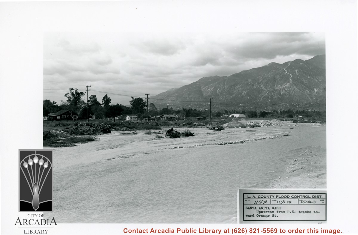
View NW up Santa Anita Wash toward San Gabriel Mountains. Caption says this was taken from Pacific Electric Railroad tracks toward Orange Street (this is present day Colorado Street).
https://arcadiahistory.andornot.com/en/permalink/photographs814
- Date
- March 6, 1938
1 image
- Date
- March 6, 1938
- Subjects
- Flood control
- Physical Description
- 5x7 b&w
- ID
- 808
- Collection
- Photographs
Images
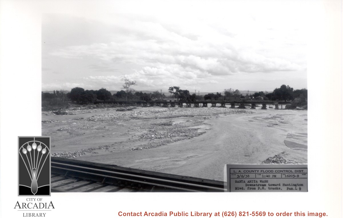
Looking south down stream of Santa Anita Wash. (Puente Hills can be seen in distance.) Caption of photo says picture was taken from PE Bridge and looking toward Huntington Drive Bridge.
https://arcadiahistory.andornot.com/en/permalink/photographs813
- Date
- March 6, 1938
1 image
- Date
- March 6, 1938
- Subjects
- Flood control
- Physical Description
- 5x7 b&w
- ID
- 807
- Collection
- Photographs
Images