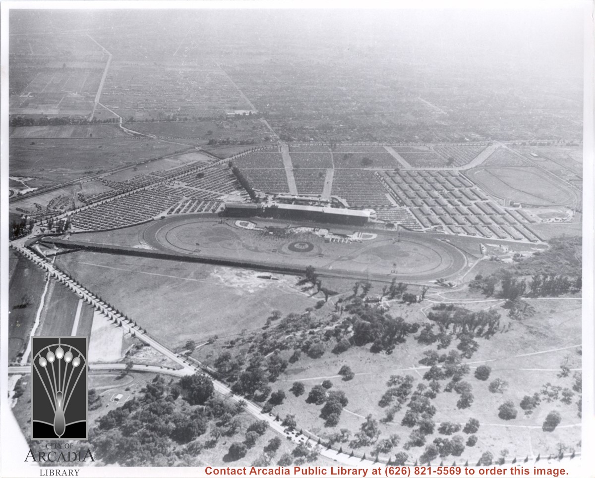
Aerial view due south from a position almost directly over sharp curve of Colorado Street. Showing in this photo are the Track and Club House on a day of large attendance, the stables, and a training track. All along Huntington Drive and Colorado Street young trees have been planted. Old-time resident Reid Greer says that the large tree at the very left edge of photo about 2 1/2 in. from bottom is same tree as seen in photo #654, on flat ground just below knolls seen here, and therefore he places homes of Indians on ranch at this spot. E.J."Lucky" Baldwin winery is only building seen on knoll. There is an "x" on reverse side to mark location. This photo belongs to the Huntington Library. It is shown here for research only.
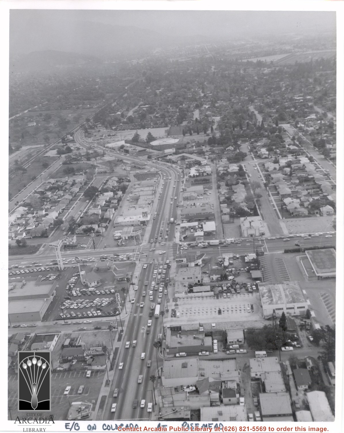
Aerial view looking east into Arcadia from near intersection of Rosemead Boulevard and Colorado Boulevard. Eaton's Santa Anita Hotel and Restaurant is still seen at far end of curve on south side of Colorado Boulevard and Michillinda Avenue (this is present site of Coco's Restaurant and Oak Tree Banquet Room, formerly Reuben's Restaurant, address 1150 W. Colorado Boulevard). The Santa Fe Railroad Tracks are seen just north of Colorado Boulevard. Large clear area in upper right portion of photo is Santa Anita Park Race Track.
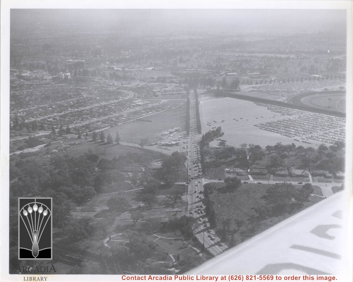
Aerial view south on Colorado Street just over large turn to the west. The residential area known as Santa Anita Gardens shows along upper left section of photo. Note that the only commerical development along the north side of Colorado Street is the Westerner Motel just near intersection with Huntington Drive. Santa Fe Railroad tracks are seen in lower left corner of photo. Santa Anita Park Race Track is on right.
Santa Anita Park Race Track just right of center at south edge of photo. Oval to the left of Santa Anita Park Race Track was training track which was removed to make room for Santa Anita Fashion Park (currently Westfield Santa Anita Shopping Mall). Street just to left of training track is Baldwin Avenue. Huntington Drive and Colorado Place form a "y" just east of Santa Anita Park Race Track. Along both can be noticed the conifer trees planted a few years earlier. Street completely bisecting photo just below center is Foothill Boulevard, next one is Orange Grove Avenue. Santa Anita Avenue is partially in view on right edge of photo. Oval on extreme lower left side of photo is old Baldwin training track. Baseball diamond in lower right corner is at Arcadia County Park. Scale: 1"=660'