A bronze statue of Andres Avelino Duarte, located at 1600 Huntington Drive in the city of Duarte, will be dedicated on March 31, 2007. Duarte was the Spanish rancher and soldier that owned the land that would later become Duarte, Bradbury, Monrovia, Arcadia, Azusa, Baldwin Park, and Irwindale.
https://arcadiahistory.andornot.com/en/permalink/newspaper30456
- Newspaper
- Pasadena Star News
- Date
- March 30, 2007
- Pages
- p. Local 1
- Item ID
- 30643AN
- Collection
- Newspaper Index
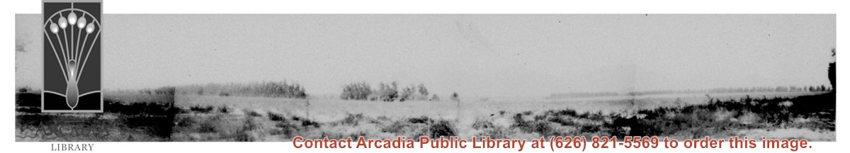
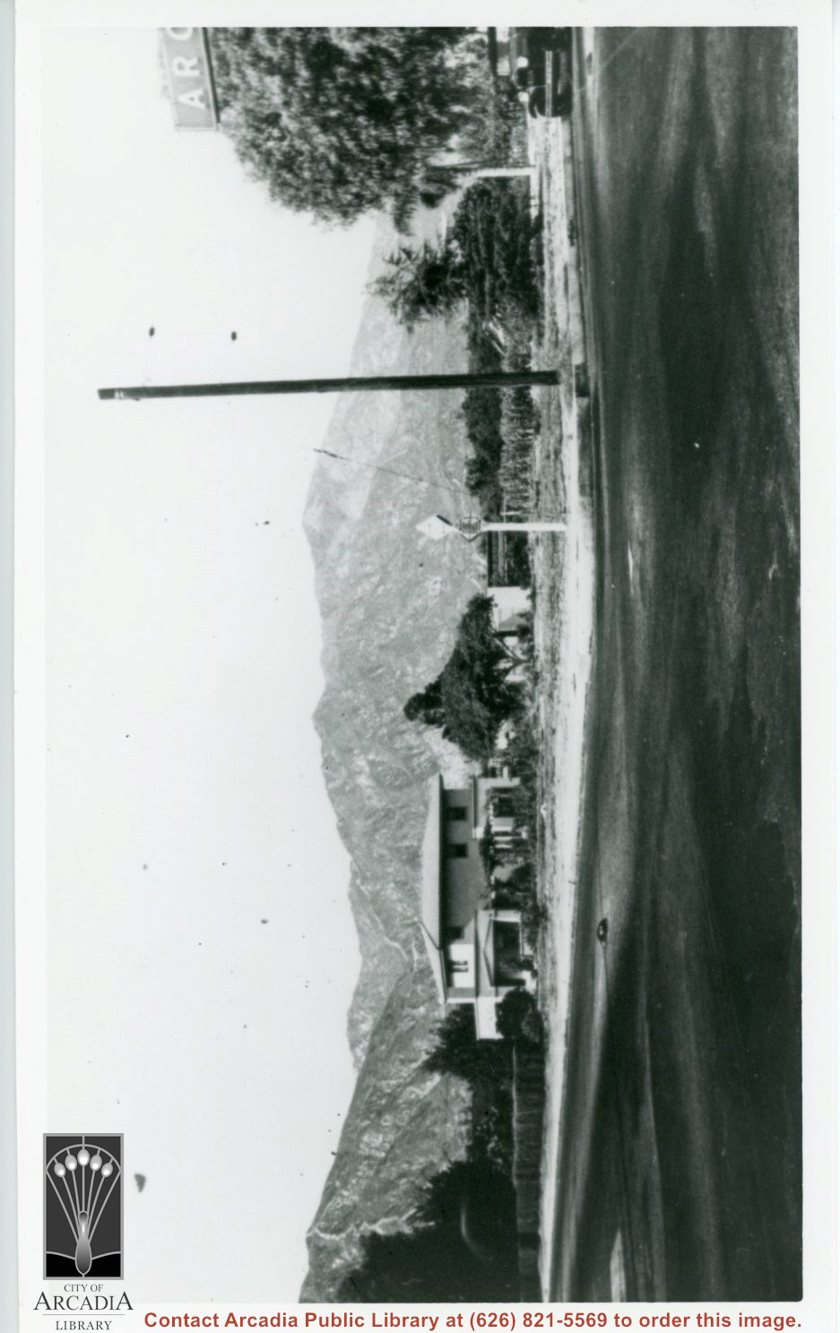
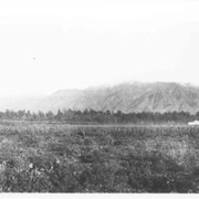
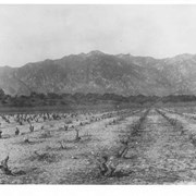
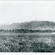
Photo taken looking north from possibly Duarte Road, of 120 acres of tomatoes being grown on Baldwin Ranch land. In photo, highest mountain on right side of photo is Monrovia Peak. Big Santa Anita Canyon comes down to the left of it. Oversized.
https://arcadiahistory.andornot.com/en/permalink/photographs124
- Date
- 1914
1 image
Bobcat Fire continues to wreak havoc. Nearly 24,000 acres burned above foothill communities, north of Monrovia, and still spreading out of control yesterday as firefighters contended with powerful winds. The fire has burned 23,890 acres of pristine forest lands. It was 6% contained. Evacuation warnings are still in effect in Monrovia, Arcadia, Azusa, Sierra Madre, Duarte, Pasadena, Altadena & Bradbury.
https://arcadiahistory.andornot.com/en/permalink/newspaper35801
- Newspaper
- Pasadena Star News
- Date
- September 11, 2020
- Pages
- p. A1, A4
- Collection
- Newspaper Index
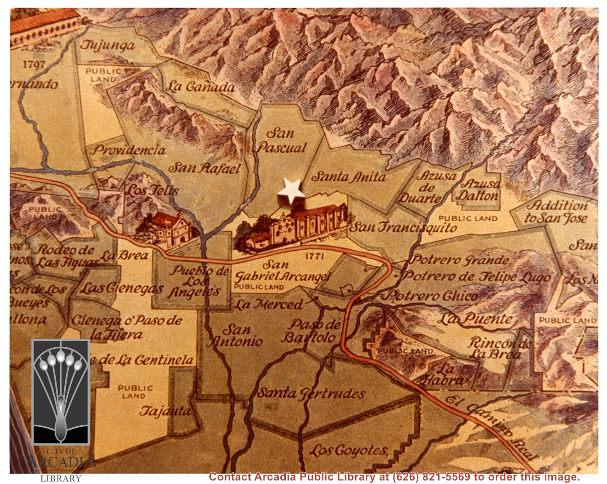
Section of map of the Ranchos, centered around San Gabriel Mission, showing about 20 Rancho boundaries in the area.
https://arcadiahistory.andornot.com/en/permalink/photographs616
- Date
- c. 1840
1 image
- Date
- c. 1840
- Subjects
- San Gabriel Valley
- Mission San Gabriel
- Physical Description
- 8x10 color
- ID
- 612
- Collection
- Photographs
Images
View NE across Baldwin Avenue at two-story Frank Grote home at 1128 S. Baldwin. This is NE corner of Baldwin Avenue and Duarte Road. Note ARCADIA sign over Duarte Road showing on right edge of photo.
https://arcadiahistory.andornot.com/en/permalink/photographs279
- Date
- c.1930
1 image
- Date
- c.1930
- Subjects
- Houses
- San Gabriel Mountains
- Baldwin Avenue
- Physical Description
- 6x10 b&w
- ID
- 277
- Collection
- Photographs
Images
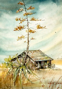
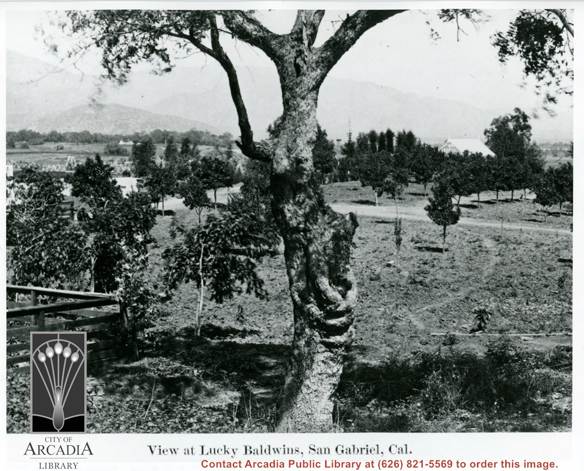
Dalton, Henry. Rancho de Azusa. Azusa
https://arcadiahistory.andornot.com/en/permalink/paintings26
- Artist
- Edna Lenz
- Description
- Dalton Adobe -- Captain Henry Dalton, a prosperous Englishman, was one of the few settlers who purchased his land grant. He is reputed to have paid $125,000 for the "Rancho de Azusa" land, and in 1844 built this adobe on it in Azusa Canyon.
1 image
- Artist
- Edna Lenz
- Description
- Dalton Adobe -- Captain Henry Dalton, a prosperous Englishman, was one of the few settlers who purchased his land grant. He is reputed to have paid $125,000 for the "Rancho de Azusa" land, and in 1844 built this adobe on it in Azusa Canyon.
- Item ID
- 17L
- Collection
- Paintings
Images

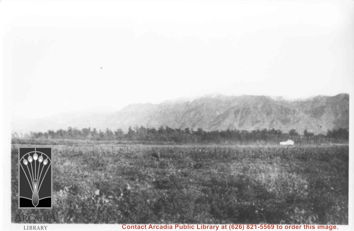
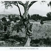
View across Santa Anita Rancho lands toward San Gabriel Mountains, looking north, slightly to the west.
https://arcadiahistory.andornot.com/en/permalink/photographs16
- Date
- probably 1935
1 image
- Date
- probably 1935
- Physical Description
- one 3x5, one 8x10 b&w
- ID
- 16
- Collection
- Photographs
Images
Mayors ask for zoning bill veto. 27 San Gabriel Valley cities urge Governor Gavin Newsom to kill legislation that changes single-family lots to allow zoning for up to 4 units. This is Senate Bill 9, introduced by Senator Toni Atkins. The San Gabriel Valley Council of Governments advocates for addressing the affordable housing shortage by rezoning vacant and nonviable commercial properties and providing incentives to affordable housing developers to build on that land. SGVCG's letter in opposition was signed by Alhambra, Arcadia, Azusa, Baldwin Park, Bradbury, and others.
https://arcadiahistory.andornot.com/en/permalink/newspaper36033
- Newspaper
- Pasadena Star News
- Date
- September 11, 2021
- Pages
- p. A1, A5
- Collection
- Newspaper Index
$2 million in funding to help provide more homes. San Gabriel Valley Regional Housing Trust gets state award for affordable, transitional housing. About 2 dozen cities have partnered, including Alhambra, Arcadia, Azusa, Baldwin Park, and others, to develop affordable housing.
https://arcadiahistory.andornot.com/en/permalink/newspaper36565
- Newspaper
- Pasadena Star News
- Date
- October 23, 2023
- Pages
- p. A3
- Subjects
- Choi, Ricky
- Housing
- San Gabriel Valley Council of Governments
- San Gabriel Valley Regional Housing Trust
- Collection
- Newspaper Index
Local residents fearful after fifth fatality in Monrovia/Duarte area. Arcadia teen Gabriel Shea Carlos was shot dead at approximately 1:40 a.m. last Sunday in the 400 block of Shrode Avenue. Mourners say that is a dangerous area with at least two gangs, but Carlos was not a gang member.
https://arcadiahistory.andornot.com/en/permalink/newspaper34908
- Newspaper
- Arcadia Weekly
- Date
- June 8, 2017
- Pages
- p. 1, 11
- Subjects
- Carlos, Gabriel Shea
- Deaths
- Shootings
- Item ID
- 35098AN
- Collection
- Newspaper Index
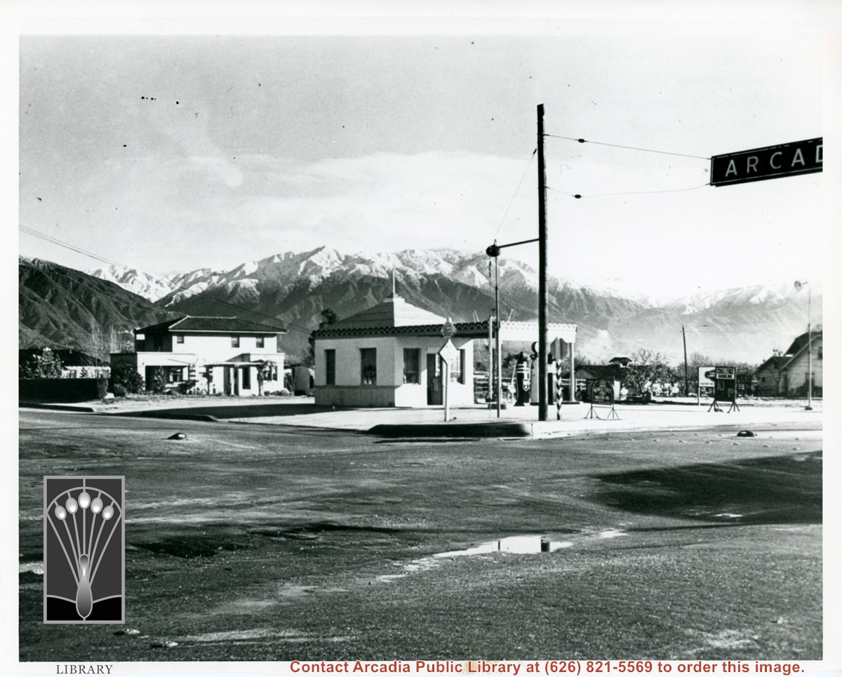
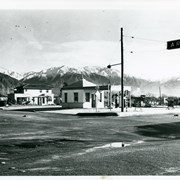
View of intersection of Baldwin Avenue and Duarte Road. Service station on the NE corner was owned by Mr. Renshaw. There is a two story house just north of station. There has been a recent snow fall in the San Gabriel Mountains. Home to the north is F.E. Grote home.
https://arcadiahistory.andornot.com/en/permalink/photographs590
- Date
- c.1935
1 image
View east from a point a bit south of photo #220. Note chimney of Hugo Reid Adobe just to right of large tree trunk. Note Glass house located to right in photo. This photograph belongs to the Huntington Library. It is shown here for research only.
https://arcadiahistory.andornot.com/en/permalink/photographs222
- Date
- c.1880's
1 image
210 Freeway closure creates 5-mile backup for 5 days. 605 Freeway also affected by work on a bridge. Caltrans is repairing a 50-year-old concrete bridge on the 210 Freeway spanning the San Gabriel River. Most affected were motorists and truckers from eastern Los Angeles County and Inland Empire, driving the preferred route into Irwindale, Duarte, Arcadia, Monrovia, Pasadena, and San Fernando Valley.
https://arcadiahistory.andornot.com/en/permalink/newspaper36284
- Newspaper
- Pasadena Star News
- Date
- July 22, 2022
- Pages
- p. A3, A4
- Collection
- Newspaper Index
210 Freeway closure returns this week. For second time in a month, motorists face delays during a 5-day shutdown for bridge construction, closing eastbound lanes of the 210 Freeway from the 605 Freeway interchange to Irwindale Avenue. The delays may be more pronounced in the weekday afternoon during peak hours through Pasadena, Arcadia, Monrovia, Duarte, and Irwindale, as the eastbound lanes detour from 6 lanes into 3 lanes.
https://arcadiahistory.andornot.com/en/permalink/newspaper36306
- Newspaper
- Pasadena Star News
- Date
- August 15, 2022
- Pages
- p. A1, A7
- Collection
- Newspaper Index
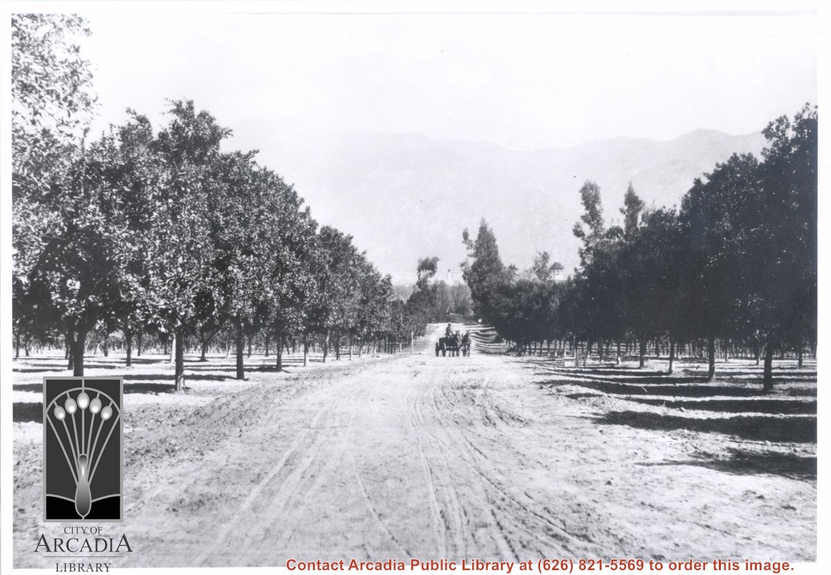
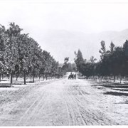
View north toward San Gabriel Mountains from orchards on Baldwin Ranch. Wagon pulled by two horses is on dirt lane coming toward camera. Note tower of Queen Anne Cottage on the right side of lane. On the back of this photo at Huntington Library is printed: Carter, 1937. Possible given by N. Carter family of Sierra Madre at this time. This photo belongs to the Huntington Library. It is shown here for research only.
https://arcadiahistory.andornot.com/en/permalink/photographs220
- Date
- c.1890
1 image
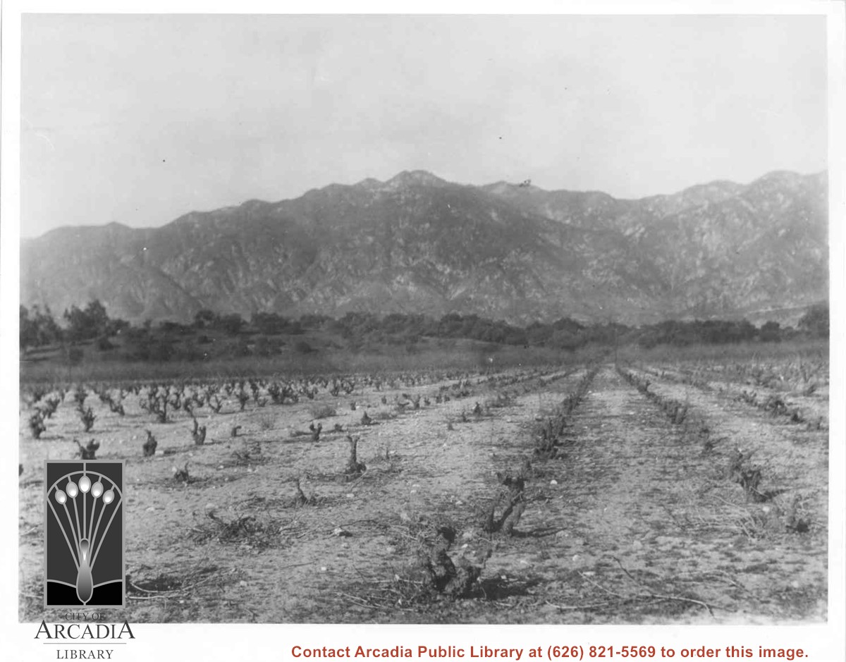
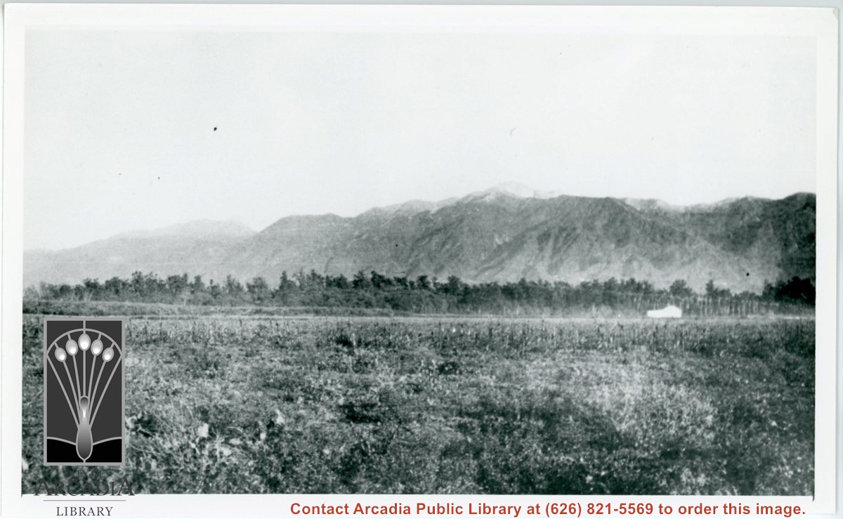
Vineyards on Baldwin Ranch. View is north from a point of present Huntington Drive. Chantry Flats Road is visible at right edge of photo. San Gabriel Mountains form background.
https://arcadiahistory.andornot.com/en/permalink/photographs2
- Date
- c.1900
1 image
- Date
- c.1900
- Subjects
- Agriculture
- Rancho Santa Anita
- Baldwin, Elias J. "Lucky" - Wines and winemaking
- San Gabriel Mountains
- Physical Description
- 8x10 b&w 2 prints 2 slides
- ID
- 2
- Collection
- Photographs
Images
San Gabriel Valley Mosquito and Vector Control District wants to control the West-Nile virus epidemic by sending Pasadena police helicopters over Alhambra, Arcadia, Azusa, Covina, Monrovia and West Covina. They identified 94 green pools and stagnant bodies of water yesterday. Owners will be ordered to clean them up or face a $1000 fine. Dirty swimming pools are the most significant source of mosquito breeding.
https://arcadiahistory.andornot.com/en/permalink/newspaper29460
- Newspaper
- Pasadena Star News
- Date
- April 6, 2005
- Pages
- p. A1
- Subjects
- Swimming pools
- West Nile Virus
- San Gabriel Valley Mosquito and Vector Control District
- Helicopters
- Mosquitoes
- Item ID
- 29645AN
- Collection
- Newspaper Index
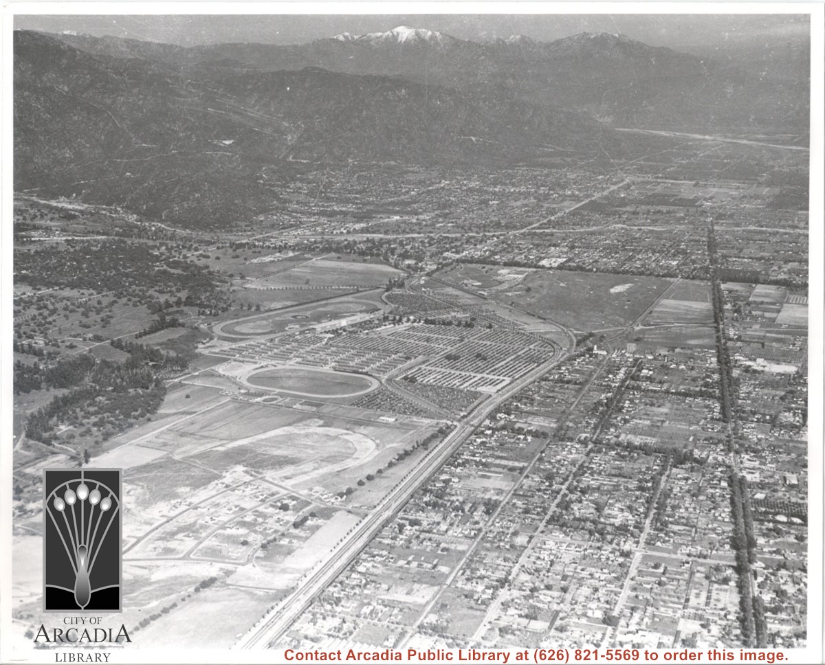
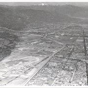
Aerial view. Looking east. Street along right edge of photo which is lined with trees is Duarte Road. Santa Anita Avenue cuts across photo from right to left and up into the San Gabriel Mountains. Huntington Drive can be seen in center of photo with young trees planted on north side of it. Santa Anita Race Track is one furthest from camera. The next small track is a training track belonging to Santa Anita. There is a VERY small round track across the street from the training track, which was part of a private horse stables. The incompleted oval was part of work done in 1933 by Joe Smoot and Anita Baldwin in their effort to develop the Jockey Club Track. This photo belongs to the Huntington Library. It is shown here for research only.
https://arcadiahistory.andornot.com/en/permalink/photographs627
- Date
- c. 1935
1 image
- Date
- c. 1935
- Subjects
- Duarte Road
- Huntington Drive
- Los Angeles Jockey Club
- San Gabriel Mountains
- Santa Anita Park-1934-1942
- Physical Description
- 8x10 b&w
- ID
- 623
- Collection
- Photographs
Images
View north across ranch fields from approximate location of Huntington Drive near present Baldwin White Building. May have been fruit packing shed according to map drawn from memory by Lupe Cuellar. (See photo #123. Also see photo #15 taken from almost the same location.) San Gabriel Mountains across photo.
https://arcadiahistory.andornot.com/en/permalink/photographs122
- Date
- 1937
1 image
Flames continue north to homes. Residents evacuate as Bobcat Fire jumps Highway 2, tops mountain ridge, menaces Antelope Valley. The 50,539-acre fire which once primarily threatened San Gabriel Valley foothill communities after it started on September 6, jumped Highway 2 overnight and continues to spread north, putting Antelope Valley under an evacuation warning. Evacuation warnings were still in place for parts of Monrovia, Arcadia, Duarte, Bradbury, Sierra Madre, Pasadena, and Altadena, though evacuation orders in parts of Sierra Madre and Arcadia were lifted Wednesday.
https://arcadiahistory.andornot.com/en/permalink/newspaper35806
- Newspaper
- Pasadena Star News
- Date
- September 18, 2020
- Pages
- p. A1, A7
- Collection
- Newspaper Index