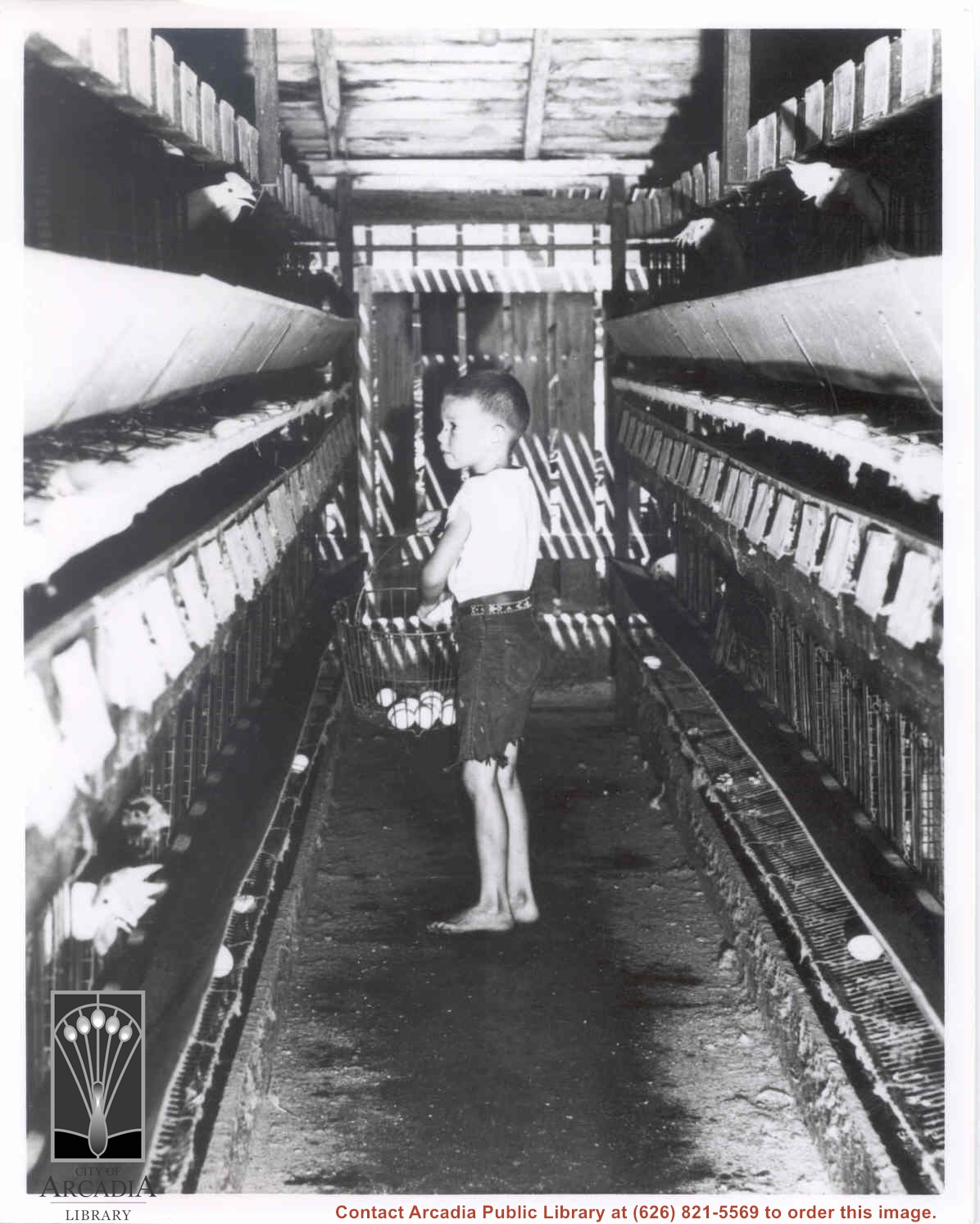
John Schmocker gathering eggs in a hen house.
https://arcadiahistory.andornot.com/en/permalink/photographs5
- Date
- July, 1959
1 image
- Date
- July, 1959
- Physical Description
- 8x10 b&w vertical
- ID
- 5
- Collection
- Photographs
Images
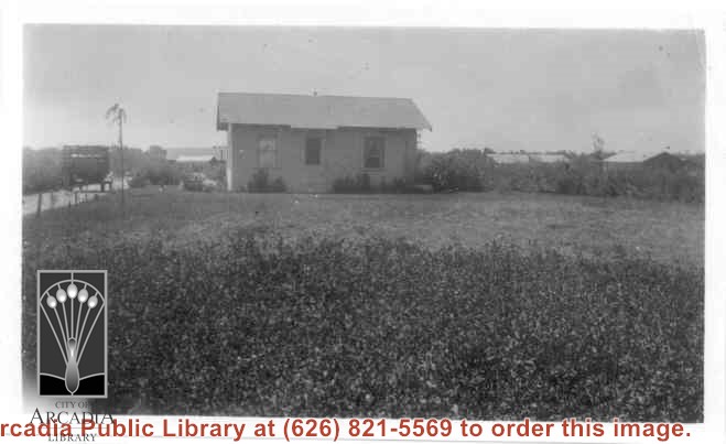
Home of Charles and Pearl Strong at 460 W. Duarte Road. View shows small clapboard house standing by itself. There is a high-sided trailer standing at left of house. What appears to be chicken houses show in the photo. Claimed to be first white leghorn chicken ranch in Arcadia.
https://arcadiahistory.andornot.com/en/permalink/photographs278
- Date
- 1921
1 image
- Date
- 1921
- Subjects
- Agriculture
- Houses
- Poultry
- Strong, Charles
- Physical Description
- 4 3/8 x 2 5/8 b&w
- ID
- 276
- Collection
- Photographs
Images
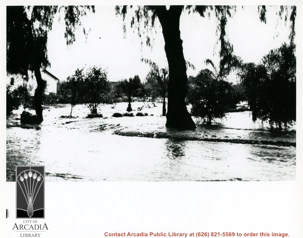
View of heavily flooded street, probably Duarte Road. There are some orchard trees also being flooded. A white house is shown on left side of photo.
https://arcadiahistory.andornot.com/en/permalink/photographs598
- Date
- c. mid-1930's
1 image
- Date
- c. mid-1930's
- Subjects
- Agriculture
- Duarte Road
- Flood control
- Physical Description
- 8x10 b&w
- ID
- 594
- Collection
- Photographs
Images
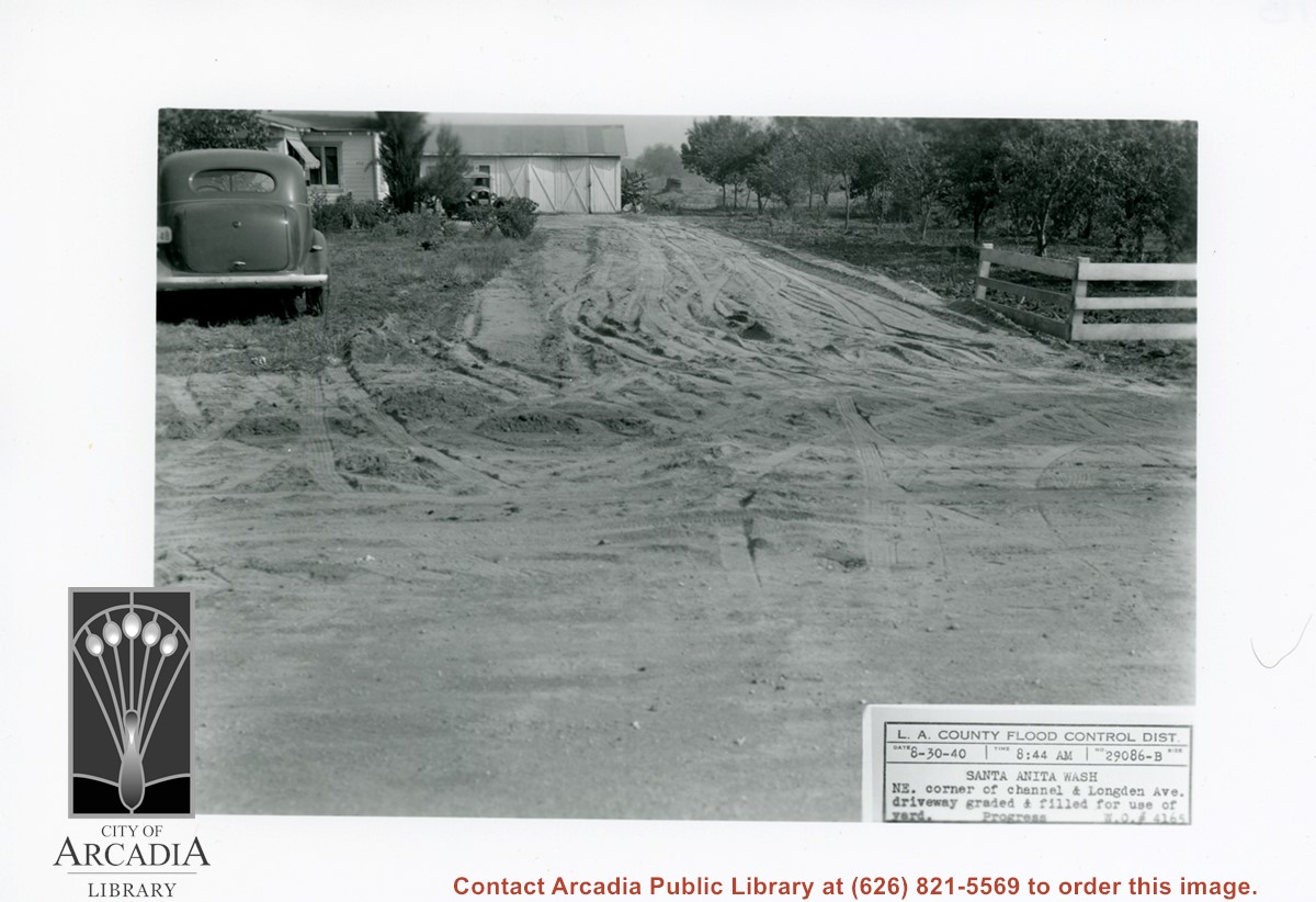
White house and garage at left, with driveway freshly graded. On right side of photo is part of a family orchard. Caption on photo reads: NE corner of Santa Anita Wash and Longden Avenue.
https://arcadiahistory.andornot.com/en/permalink/photographs824
- Date
- August 30, 1940
1 image
- Date
- August 30, 1940
- Subjects
- Agriculture
- Longden Avenue
- Flood control
- Physical Description
- 5x7 b&w
- ID
- 818
- Collection
- Photographs
Images
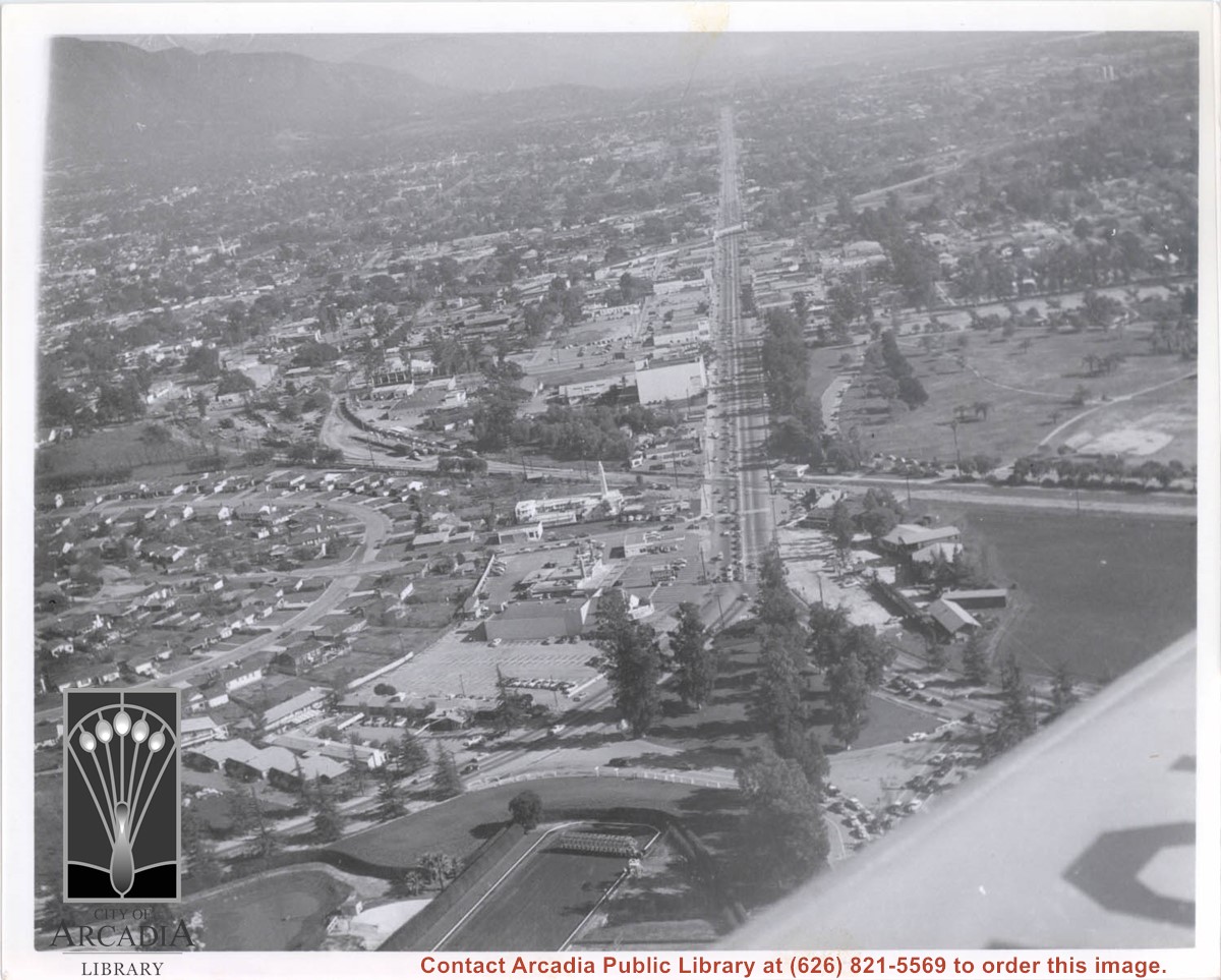
Aerial view toward north from a position south of Huntington Drive near intersection with Baldwin Avenue. It shows Santa Anita Fashion Park (currently known as Westfield Santa Anita Shopping Mall) developed by and on property owned by Santa Anita Consolidated. The Santa Anita Park Race Track and club house can be seen in center of photo. The straight white line about one inch above the club house roof is 210 Foothill Freeway. Chantry Flats road can be seen going up into San Gabriel Mountains in distance.
https://arcadiahistory.andornot.com/en/permalink/photographs646
- Date
- c. 1975
1 image
- Date
- c. 1975
- Subjects
- Aerial Photo Collection
- Aerial views
- 210 Foothill Freeway
- Chantry Flats Road
- Malls
- San Gabriel Mountains
- Santa Anita Park-1945-1980
- Santa Anita Fashion Park
- Westfield Santa Anita Shopping Mall
- Physical Description
- 8x10 b&w
- ID
- 642
- Collection
- Photographs
Images


View north toward mountains from Mauch five acre ranch which was near corner of Palm Avenue and Holly Avenue. Note some young walnut trees have been set out and a chicken house has been built (left). There is snow on Mount Wilson. Street on right is Holly Avenue.
https://arcadiahistory.andornot.com/en/permalink/photographs1008
- Date
- 1927
1 image

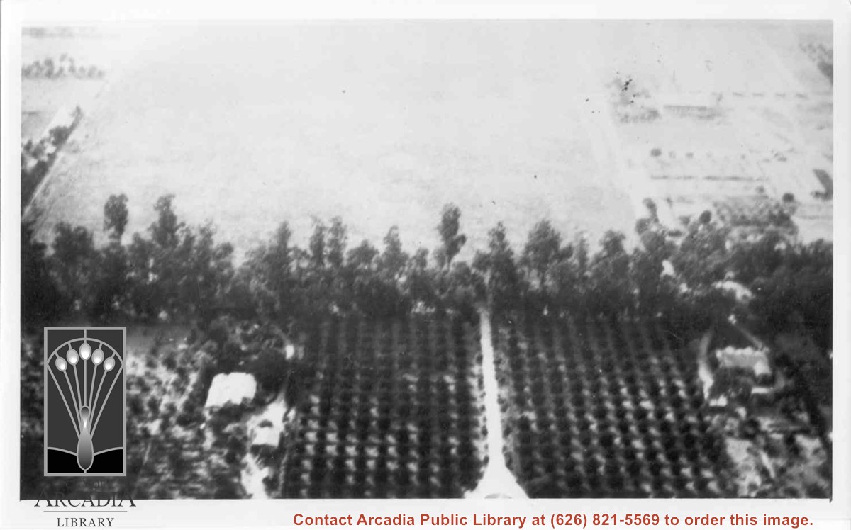
Aerial view west toward Santa Anita Ave. from above First Avenue, site of new grammar school. Long driveway heads to Jaspar N. Teague home in center of 10 acre orange grove. (Address in City Directory for this name is 1380 S. Santa Anita.) House to left and south was that of Charles W. Stewart in another 10 acre plot. Both ranches are now occupied by First Avenue Junior High School.
https://arcadiahistory.andornot.com/en/permalink/photographs12
- Date
- November 1929
1 image
- Date
- November 1929
- Subjects
- Houses
- Teague, Jaspar
- Stewart, Charles W.
- Agriculture
- First Avenue Junior High School
- Arcadia(City)-History-1920-1929
- Physical Description
- 6x10 b&w
- ID
- 12
- Collection
- Photographs
Images
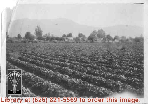
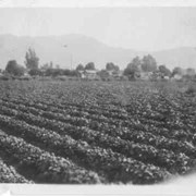
Strawberry patch. Looking northeast between First Avenue and Second Avenue. Houses and mountains in view.
https://arcadiahistory.andornot.com/en/permalink/photographs13
- Date
- c.1910-1915
1 image
- Date
- c.1910-1915
- Physical Description
- 2x3 b&w (top left corner torn)
- ID
- 13
- Collection
- Photographs
Images
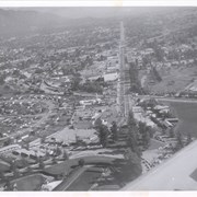
Aerial view looking east along Huntington Drive taken over the Club House at Santa Anita Park Race Track. Pony Express Museum is just to right of the "y" intersection of Huntington Drive coming into Arcadia just below the wing of the plane. Theater that was opened in 1942 is almost directly opposite Museum. Santa Anita Motor Inn, two buildings east of theater, distinguished by tall tower, opened in 1938. (It was torn down in 1975.) The residential area directly north of there is known as Santa Anita Gardens. Santa Anita Avenue is just beyond Arcadia County Park on right.
https://arcadiahistory.andornot.com/en/permalink/photographs642
- Date
- c. 1957-58
1 image
- Date
- c. 1957-58
- Subjects
- Aerial Photo Collection
- Aerial views
- Huntington Drive
- Pony Express Museum
- Santa Anita Avenue
- Santa Anita Motor Inn
- Physical Description
- 8x10 b&w
- ID
- 638
- Collection
- Photographs
Images
Aerial view toward the east taken from about over present Club House at Santa Anita Park Race Track. The main street running North/South is Santa Anita Avenue. View shows the oval of Elias J. "Lucky" Baldwin's race track in what is currently Arcadia County Park. The buildings would be barracks of Ross Field U.S. Army Balloon School. Duarte Road can be seen coming into photo at right edge of photo near intersection with Santa Anita Avenue. The broad street along left side would be Huntington Drive. Railroad tracks can be seen in lower left corner.
https://arcadiahistory.andornot.com/en/permalink/photographs635
- Date
- November 1929
1 image
- Date
- November 1929
- Subjects
- Aerial Photo Collection
- Aerial views
- Balloon School
- Huntington Drive
- Race tracks
- Railroads
- Santa Anita Avenue
- Physical Description
- 6x10 b&w
- ID
- 631
- Collection
- Photographs
Images
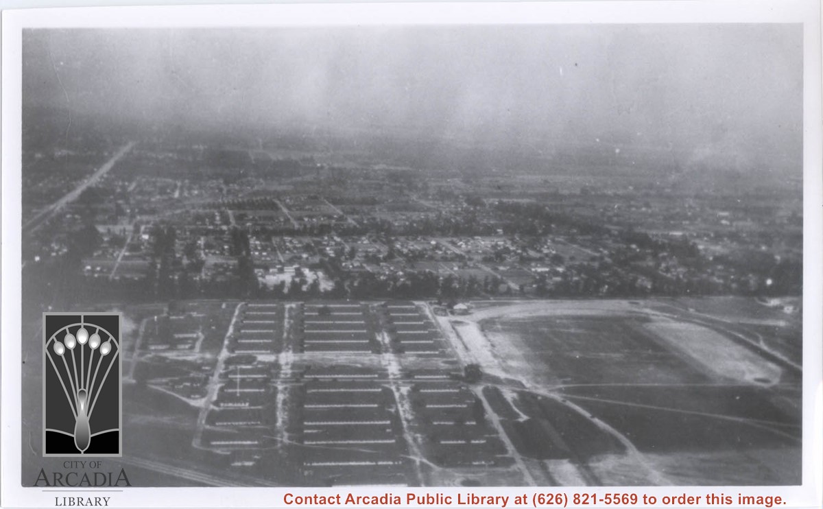

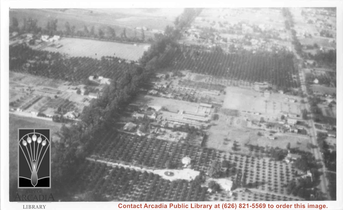
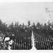
Aerial view north. Main tree-lined street is Santa Anita Avenue. Most of the orange grove in center of photo was owned by Jaspar Teague family. They had built a circular art gallery on their property at 1380 South Santa Anita Avenue. The large buildings north of Teague's and to the west of Santa Anita Avenue are chicken houses. Duarte Road is the east/west street across photo near top of photo.
https://arcadiahistory.andornot.com/en/permalink/photographs645
- Date
- November 1929
1 image
- Date
- November 1929
- Subjects
- Aerial Photo Collection
- Aerial views
- Agriculture
- Duarte Road
- Orange groves
- Poultry
- Santa Anita Avenue
- Teague, Jaspar
- Physical Description
- 6x10 b&w
- ID
- 641
- Collection
- Photographs
Images