Home of Mr. and Mrs. Leo Bertolina. It was originally located on California (a street which at this time was 3 blocks south of Duarte Road). It washed off its foundation and was then moved to NW corner of 2nd and Alta. There are broad front steps and stone foundation seen in photo.
https://arcadiahistory.andornot.com/en/permalink/photographs276
- Date
- 1912
1 image
- Date
- 1912
- Subjects
- Houses
- Bertolina, Leo
- Physical Description
- 4x6 b&w
- ID
- 274
- Collection
- Photographs
Images
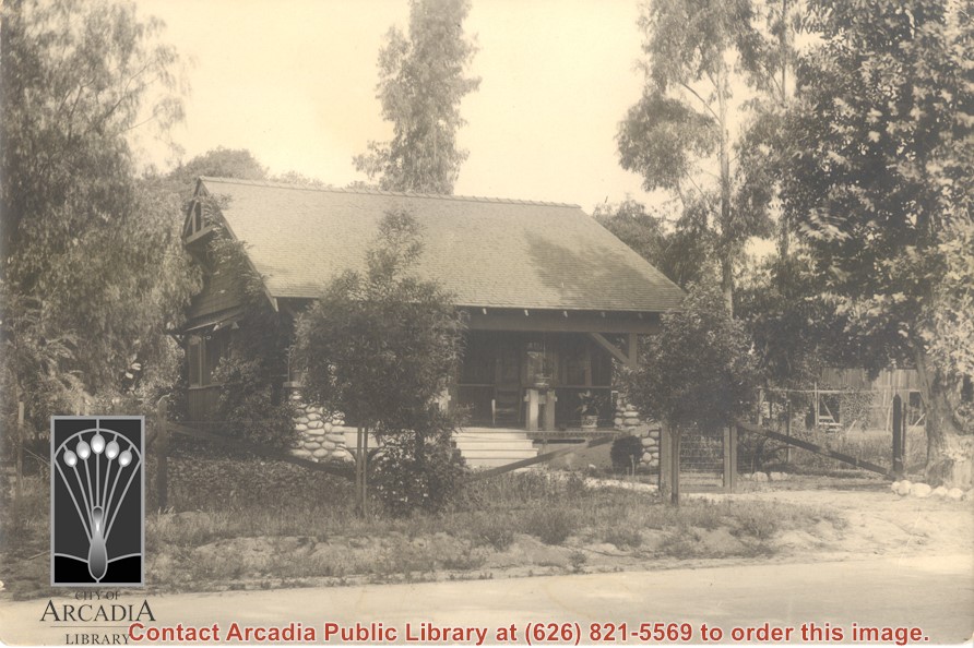
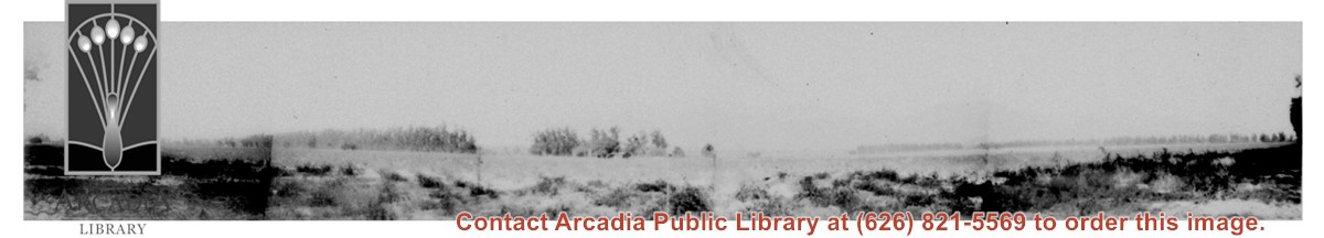
Photo taken looking north from possibly Duarte Road, of 120 acres of tomatoes being grown on Baldwin Ranch land. In photo, highest mountain on right side of photo is Monrovia Peak. Big Santa Anita Canyon comes down to the left of it. Oversized.
https://arcadiahistory.andornot.com/en/permalink/photographs124
- Date
- 1914
1 image
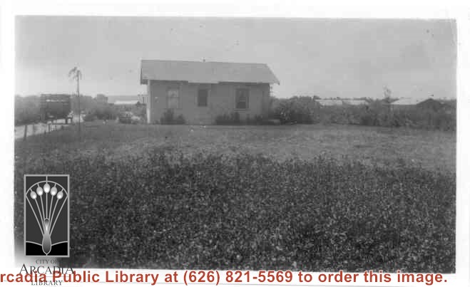
Home of Charles and Pearl Strong at 460 W. Duarte Road. View shows small clapboard house standing by itself. There is a high-sided trailer standing at left of house. What appears to be chicken houses show in the photo. Claimed to be first white leghorn chicken ranch in Arcadia.
https://arcadiahistory.andornot.com/en/permalink/photographs278
- Date
- 1921
1 image
- Date
- 1921
- Subjects
- Agriculture
- Houses
- Poultry
- Strong, Charles
- Physical Description
- 4 3/8 x 2 5/8 b&w
- ID
- 276
- Collection
- Photographs
Images
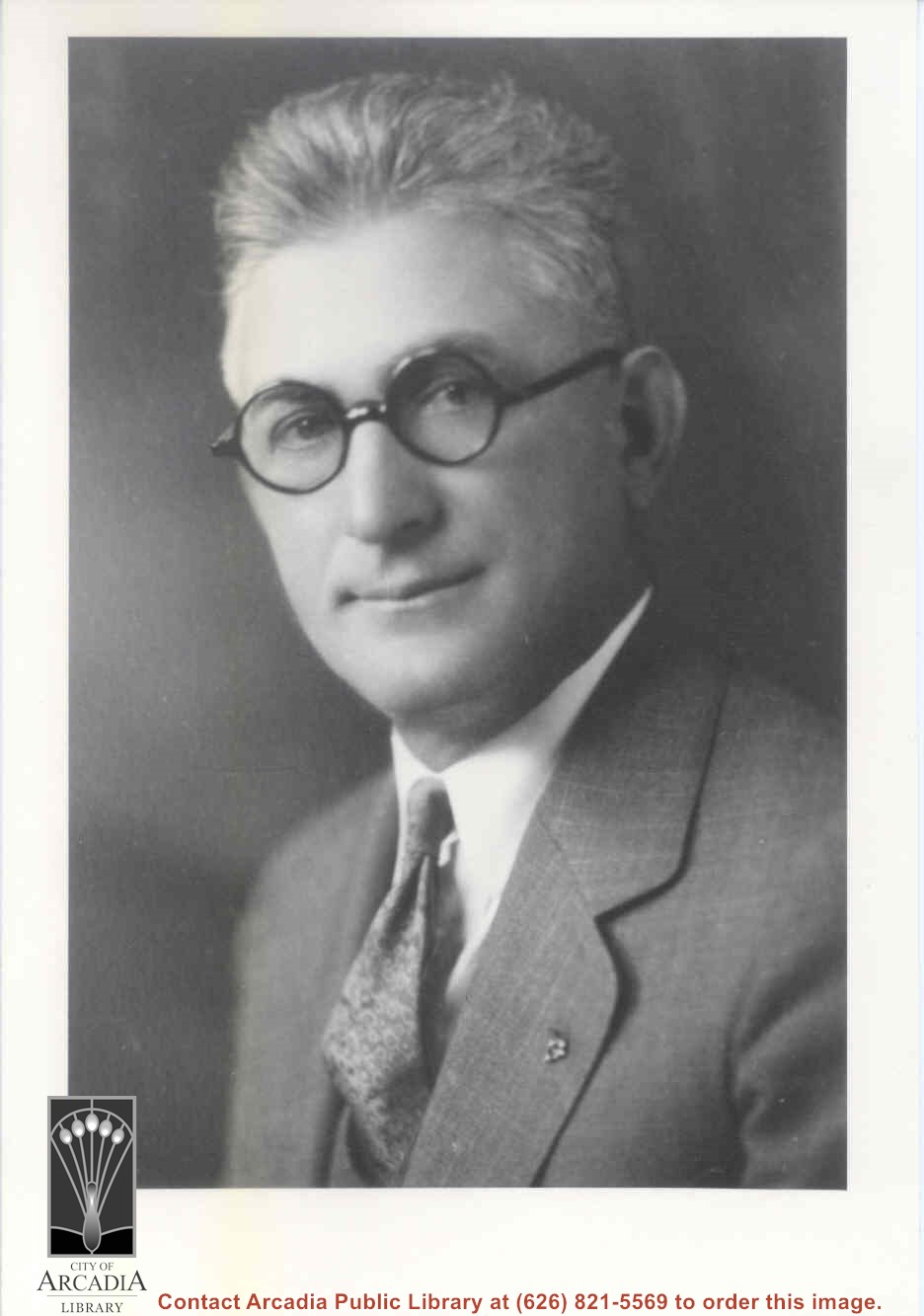
Peter Cuccia portrait. Mr. Cuccia was longtime resident of Arcadia and raised fruit on his property along Duarte Road. Born 1878, died January 1950.
https://arcadiahistory.andornot.com/en/permalink/photographs417
- Date
- 1925
1 image
- Date
- 1925
- Subjects
- Cuccia, Peter
- Physical Description
- 5x8 b&w vertical
- ID
- 415
- Collection
- Photographs
Images
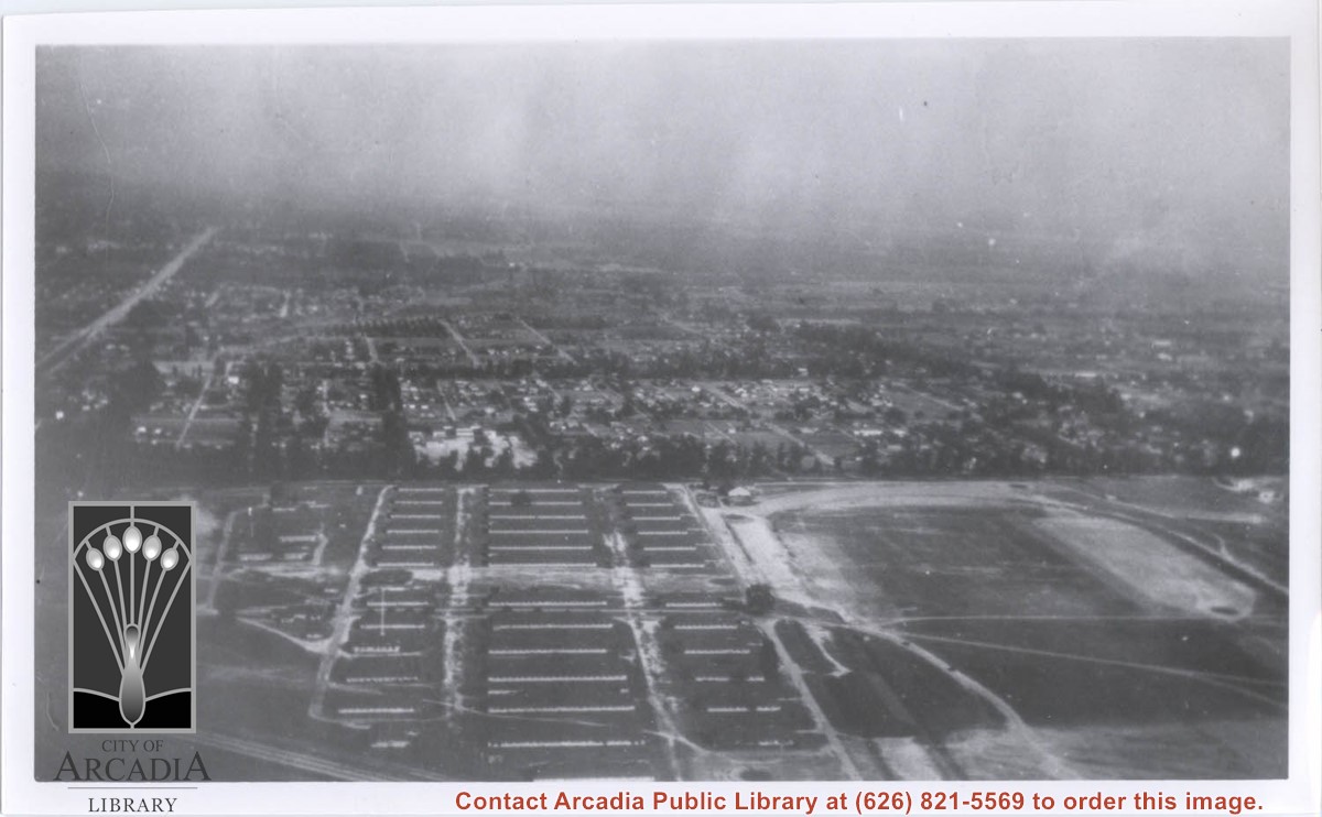
Aerial view toward the east taken from about over present Club House at Santa Anita Park Race Track. The main street running North/South is Santa Anita Avenue. View shows the oval of Elias J. "Lucky" Baldwin's race track in what is currently Arcadia County Park. The buildings would be barracks of Ross Field U.S. Army Balloon School. Duarte Road can be seen coming into photo at right edge of photo near intersection with Santa Anita Avenue. The broad street along left side would be Huntington Drive. Railroad tracks can be seen in lower left corner.
https://arcadiahistory.andornot.com/en/permalink/photographs635
- Date
- November 1929
1 image
- Date
- November 1929
- Subjects
- Aerial Photo Collection
- Aerial views
- Balloon School
- Huntington Drive
- Race tracks
- Railroads
- Santa Anita Avenue
- Physical Description
- 6x10 b&w
- ID
- 631
- Collection
- Photographs
Images

Aerial view toward NE. Plane is over property of Charles W. Stewart (10 acres), and Jaspar Teague (10 acres), at 1320 S. Santa Anita Avenue, which is directly under the plane. Next street east is First Avenue, then Second Avenue, the Fourth Avenue. Reservoir is at corner of Valnett Avenue and Second Avenue and was owned by Walnut Grove Mutual Water Company (Valnett Avenue was first through street south of Duarte Road at this time and became Camino Real).
https://arcadiahistory.andornot.com/en/permalink/photographs644
- Date
- November 1929
1 image
- Date
- November 1929
- Subjects
- Aerial Photo Collection
- Aerial views
- Camino Real
- Duarte Road
- First Avenue
- Fourth Avenue
- Second Avenue
- Santa Anita Avenue (South)
- Stewart, Charles W.
- Teague, Jaspar
- Valnett Avenue
- Physical Description
- 6x10 b&w
- ID
- 640
- Collection
- Photographs
Images


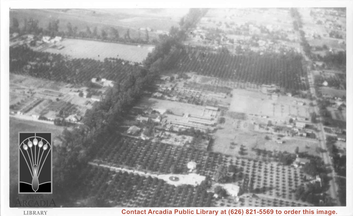
Aerial view north. Main tree-lined street is Santa Anita Avenue. Most of the orange grove in center of photo was owned by Jaspar Teague family. They had built a circular art gallery on their property at 1380 South Santa Anita Avenue. The large buildings north of Teague's and to the west of Santa Anita Avenue are chicken houses. Duarte Road is the east/west street across photo near top of photo.
https://arcadiahistory.andornot.com/en/permalink/photographs645
- Date
- November 1929
1 image
- Date
- November 1929
- Subjects
- Aerial Photo Collection
- Aerial views
- Agriculture
- Duarte Road
- Orange groves
- Poultry
- Santa Anita Avenue
- Teague, Jaspar
- Physical Description
- 6x10 b&w
- ID
- 641
- Collection
- Photographs
Images
Santa Anita Motor Inn
https://arcadiahistory.andornot.com/en/permalink/newspaper4084
- Newspaper
- Arcadia Tribune
- Date
- November 12, 1936
- Pages
- p. 1
- Subjects
- Hotels, Motels, etc.
- Item ID
- 3960AN
- Collection
- Newspaper Index
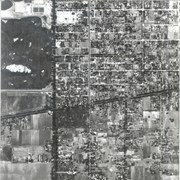
Santa Anita Avenue running north and south on the left and Duarte Road intersects the middle. Enlargement of a section of photo ID 618.
https://arcadiahistory.andornot.com/en/permalink/photographs1449
- Date
- 1938
1 image
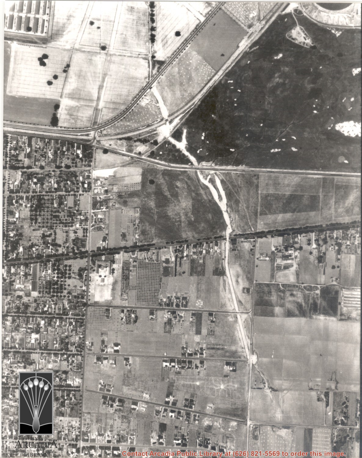
Duarte Road running east-west intersects the middle and a small portion of Santa Anita Park parking lot visible in the upper left. Enlargement of a section of photo ID 617.
https://arcadiahistory.andornot.com/en/permalink/photographs1450
- Date
- 1938
1 image
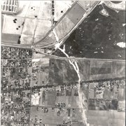
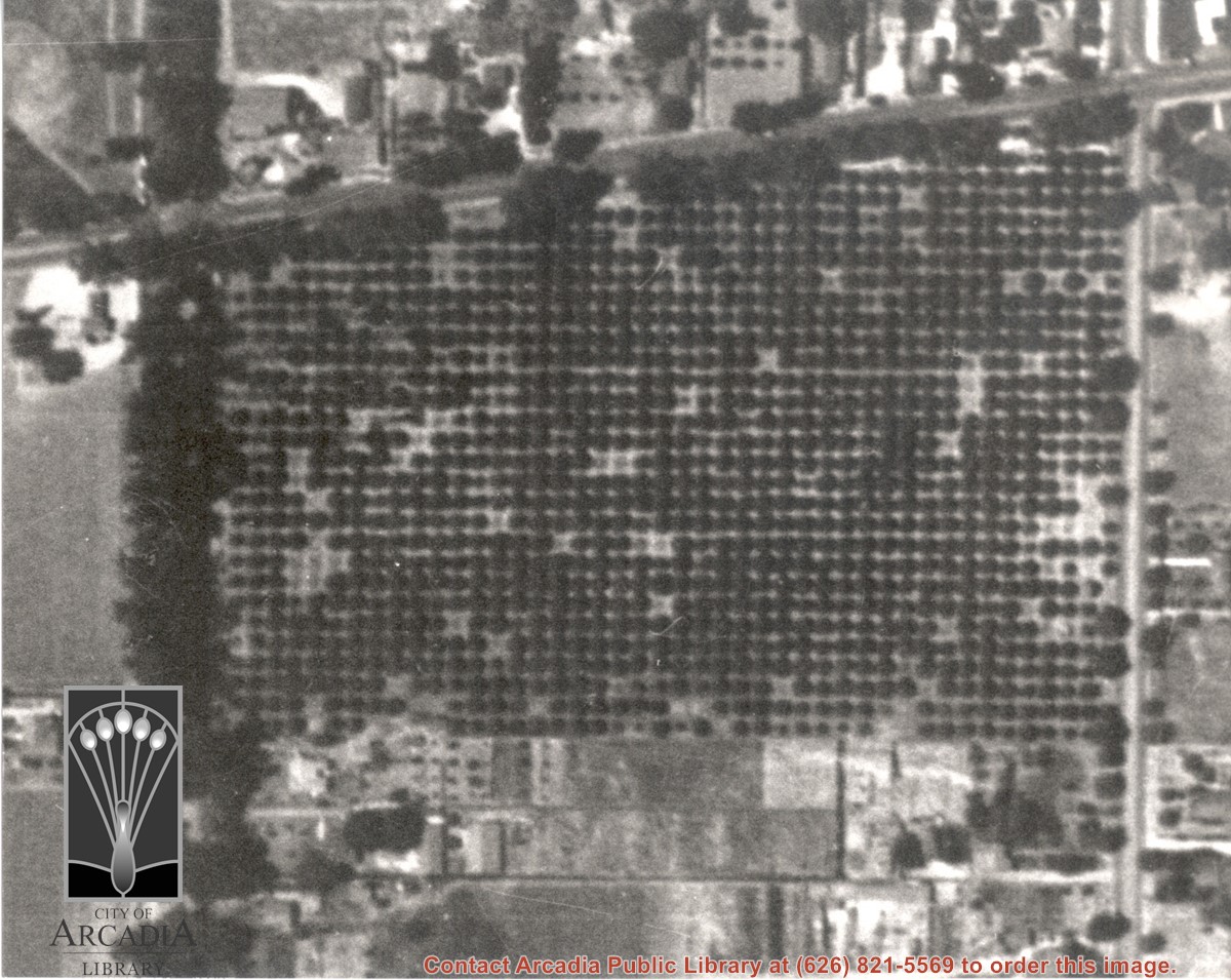
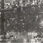
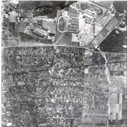
Intersection of Santa Anita Avenue and Duarte Road. There is a large orchard of some kind on the southeast corner. Enlargement of a section of photo ID 618.
https://arcadiahistory.andornot.com/en/permalink/photographs1451
- Date
- 1938
1 image
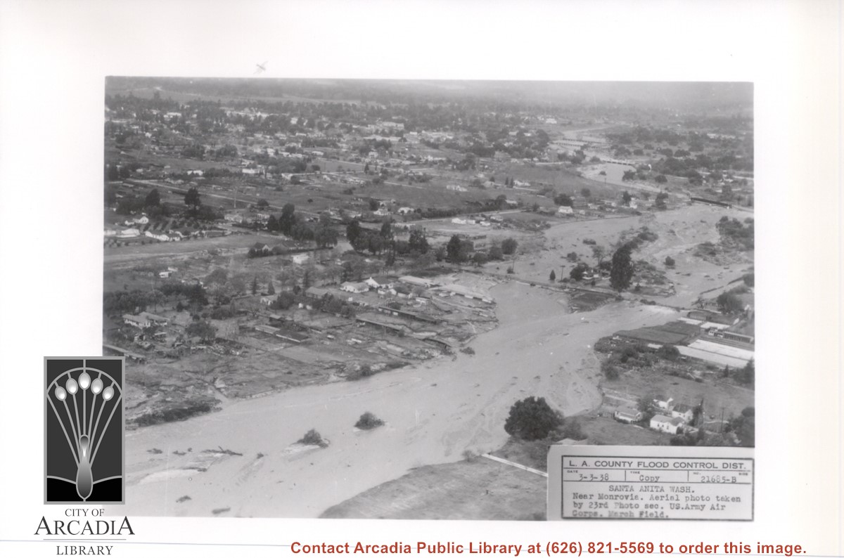
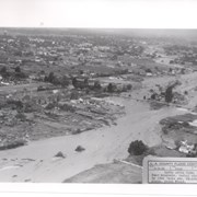
View NW up flooded Santa Anita Wash from above East bank below Duarte Road, probably the street seen crossing photo from right to left about half way down. Nest crossing north with dark bridge, is Santa Fe Railroad tracks; next we believe to be for a pipeline; last clearly visible crossing is for Pacific Electric Railroad tracks. Photo was taken following extreme flooding in 1938.
https://arcadiahistory.andornot.com/en/permalink/photographs816
- Date
- March 3, 1938
1 image
- Date
- March 3, 1938
- Subjects
- Flood control
- Physical Description
- 5x7 b&w
- ID
- 810
- Collection
- Photographs
Images
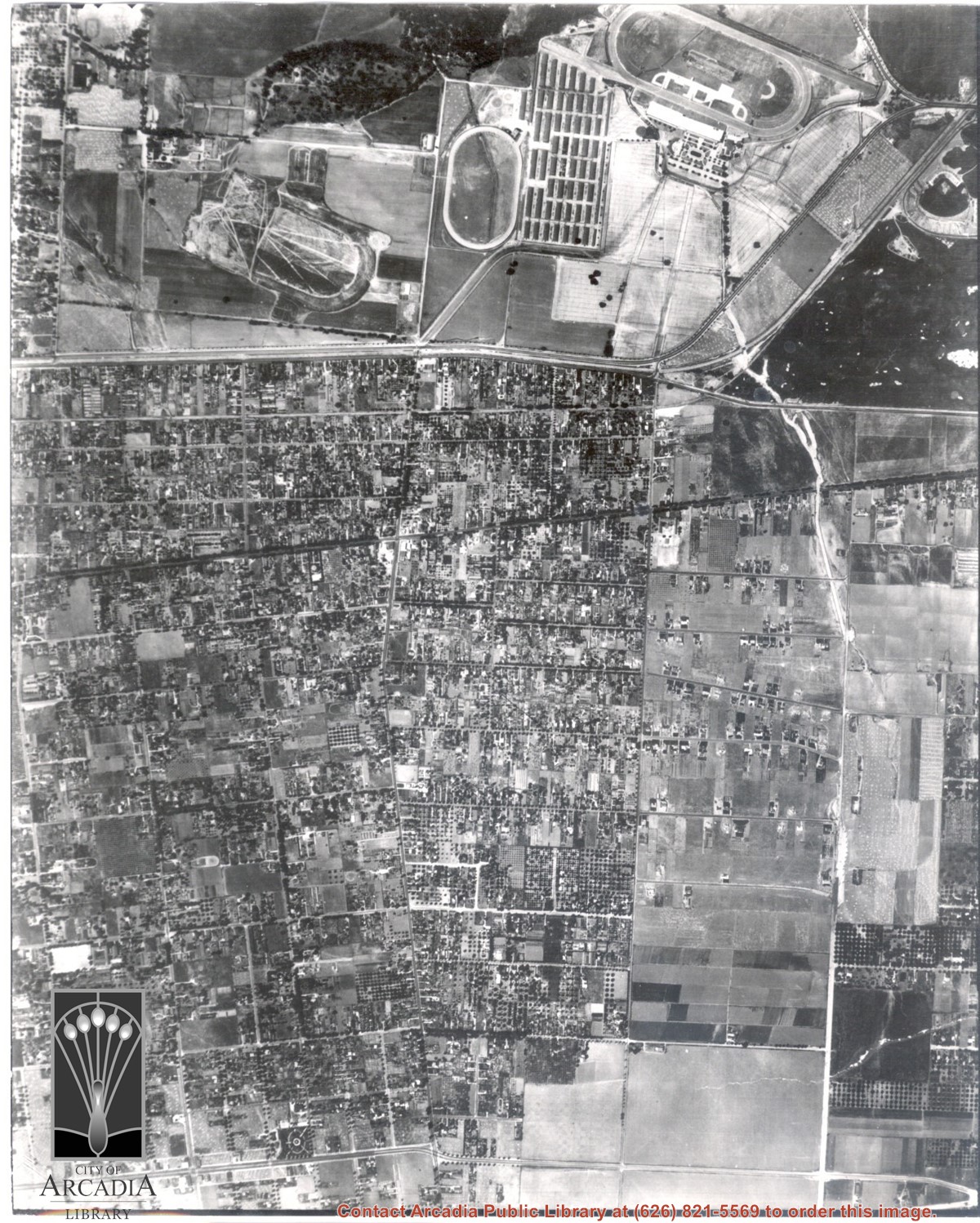
Dark, tree-lined street completely bisecting photo from west to east just above, is Duarte Road. Santa Anita Park Race Track is at upper right edge of photo. Smaller oval nearby is a training track. The incomplete oval in upper left is the race track that Anita Baldwin and Joe Smoot attempted to build in 1933 but abandoned the project. Huntington Drive and Colorado Place form a "y" just east of Santa Anita Park Race Track. Note grove of olive trees on land where City Hall is located today (240 W. Huntington Drive, Arcadia). Baseball diamond in upper right corner of photo, just below the convergence of the "y" is at Arcadia County Park. Corrected description as of 11/04/2008.
https://arcadiahistory.andornot.com/en/permalink/photographs621
- Date
- June 5, 1938
1 image
- Date
- June 5, 1938
- Subjects
- Aerial Photo Collection
- Aerial views
- Colorado Place
- Duarte Road
- Los Angeles Jockey Club
- Santa Anita Park-1934-1942
- Physical Description
- 8x10 b&w
- ID
- 617
- Collection
- Photographs
Images
A description and history of businesses near the intersection of Baldwin Avenue and Duarte Road.
https://arcadiahistory.andornot.com/en/permalink/newspaper7382
- Newspaper
- Arcadia Tribune
- Date
- February 25, 1943
- Pages
- p. 8
- Item ID
- 7267AN
- Collection
- Newspaper Index
History of Baldwin-Duarte Business Center
https://arcadiahistory.andornot.com/en/permalink/newspaper3829
- Newspaper
- Arcadia Tribune
- Date
- February 25, 1943
- Pages
- p. 8
- Subjects
- Business and Industry
- Item ID
- 3702AN
- Collection
- Newspaper Index
Photo of half of front page of Monrovia-Arcadia-Duarte High School paper, the WILDCAT for November 5, 1943.
https://arcadiahistory.andornot.com/en/permalink/photographs1108
- Date
- November 5,1943
1 image
- Date
- November 5,1943
- Subjects
- Monrovia-Arcadia-Duarte High School
- Physical Description
- 3x5 b&w
- ID
- 1099
- Collection
- Photographs
Images
Union Oil Co. will build a gas station in West Arcadia at the northwest corner of Baldwin Avenue and Duarte Road, formerly West Arcadia Cafe.
https://arcadiahistory.andornot.com/en/permalink/newspaper33050
- Newspaper
- The Journal
- Date
- December 28, 1949
- Pages
- p. 1 (See basement box 112.)
- Subjects
- Gas stations
- Union Oil Co.
- Item ID
- 33247AN
- Collection
- Newspaper Index
Plans to withdraw from Monrovia-Arcadia-Duarte (M-A-D) high school district.
https://arcadiahistory.andornot.com/en/permalink/newspaper33004
- Newspaper
- The Journal
- Date
- January 4, 1950
- Pages
- p. 1 (See basement box 112.)
- Item ID
- 33201AN
- Collection
- Newspaper Index
The school bond and the Monrovia-Arcadia-Duarte (M-A-D) tax hike will have no bearing on the matter of having a separate Arcadia High School.
https://arcadiahistory.andornot.com/en/permalink/newspaper33011
- Newspaper
- The Journal
- Date
- January 11, 1950
- Pages
- p. 1 (See basement box 112.)
- Subjects
- Schools bonds
- Taxes
- Item ID
- 33208AN
- Collection
- Newspaper Index
Editorial on withdrawal from Monrovia-Arcadia-Duarte M-A-D High School District.
https://arcadiahistory.andornot.com/en/permalink/newspaper33022
- Newspaper
- The Journal
- Date
- January 18, 1950
- Pages
- p. 6 (See basement box 112.)
- Item ID
- 33219AN
- Collection
- Newspaper Index