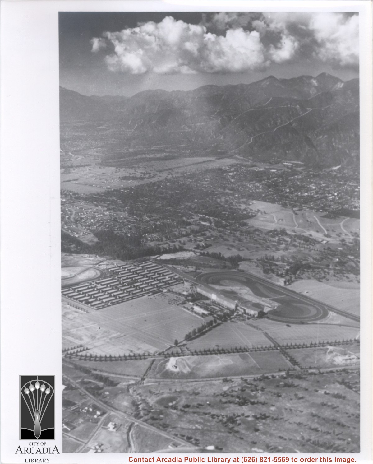
Aerial view taken from about over what became Campus Drive and Arcadia High School, and looking toward (NW) Pasadena and Sierra Madre at foot of San Gabriel Mountains. Photo shows Santa Anita Park Race Track possibly just a few years after opening.
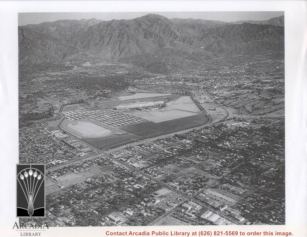
Aerial view looking towards San Gabriel Mountains showing intersection of Baldwin Avenue and Huntington Drive, the Santa Anita Park and training track where Santa Anita Fashion Park (currently known as Westfield Santa Anita Shopping Mall) was built.
Aerial view toward north from a position south of Huntington Drive near intersection with Baldwin Avenue. It shows Santa Anita Fashion Park (currently known as Westfield Santa Anita Shopping Mall) developed by and on property owned by Santa Anita Consolidated. The Santa Anita Park Race Track and club house can be seen in center of photo. The straight white line about one inch above the club house roof is 210 Foothill Freeway. Chantry Flats road can be seen going up into San Gabriel Mountains in distance.
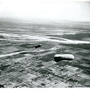
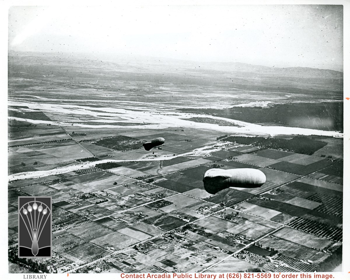
View east shows two balloons aloft over Arcadia and San Gabriel Valley. It is possible that first river up from bottom of photo is Rio Hondo Wash. Some of trees along Santa Anita appear to be in extreme lower right of photo. Tree-lined street showing in extreme lower left of photo is Duarte Road. Second river coming into photo about five inches up from bottom of photo would be San Gabriel River.
Aerial view toward NE. Plane is over property of Charles W. Stewart (10 acres), and Jaspar Teague (10 acres), at 1320 S. Santa Anita Avenue, which is directly under the plane. Next street east is First Avenue, then Second Avenue, the Fourth Avenue. Reservoir is at corner of Valnett Avenue and Second Avenue and was owned by Walnut Grove Mutual Water Company (Valnett Avenue was first through street south of Duarte Road at this time and became Camino Real).
Aerial looking west from a position just east of First Avenue and just north of Wheeler Avenue. Large white barn-like roof is San Gabriel Valley Lumber Co. building. This later became the Sawmill Restaurant and in the early 1990's became Sports Rock Cafe. Directly opposite, is cleared land where Arcadia Public Library, Fire and Police were previously located. Today there is a Medical Building on the site (65 N. First Avenue). Santa Anita Park and parking lot are seen in the distance.