Aerial view of what appears to be either an informal horse show or possible horse sale with a great number of people in attendance. The location has been identified as near intersection of Las Tunas Drive and (with what seem to be railroad tracks in center) Temple City Boulevard. The building (we see only roof) in the lower left corner is Vernon's Pharmacy. The letters VGS can be seen over front entry. There are probably about 100 autos parked nearby. (There is another photo of this event, #539.)
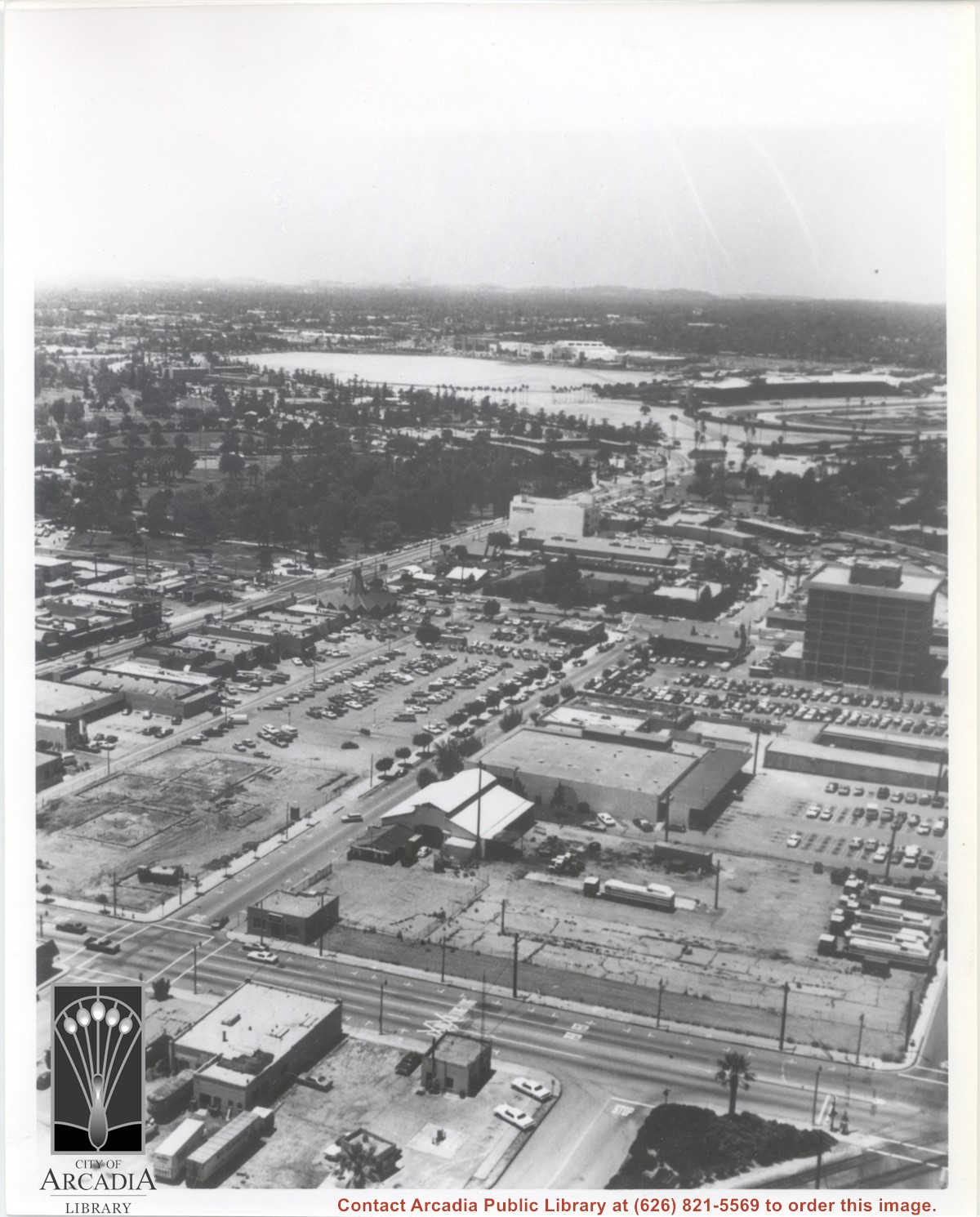
Aerial view looking west from a position approximately over Santa Fe railroad tracks between First Avenue and Second Avenue. Street closest to camera is First Avenue, running north/south, and we see its intersection with Wheeler Avenue in lower left portion of photo. Almost vacant lot on northwest corner of Wheeler Avenue and First Avenue is where Sawmill Restaurant was built in about 1977 (Sawmill Restaurant closed in early 1990's). Foundation work on South side of Wheeler Avenue at corner of First Avenue is for medical building which became 65 N. First Avenue. (Former site of Arcadia Public Library until 1961.) Post Office is largest building in center of the block on north side of Wheeler Avenue. Large white area is parking area for Santa Anita Park Race Track.
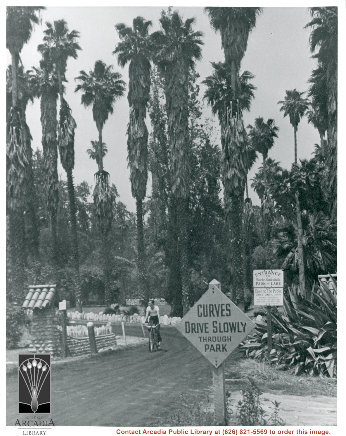
Man is riding bicycle on a path inside Rancho Santa Anita Park and Lake (later, the Arboretum), with many palm trees. Sign reads "Open to the Public Daily until 7PM, private property" and "Curves, drive slowly through park." The following information is from Sandy Snider: This is indeed, today’s Arboretum, but at the time the property was owned by a real estate syndicate named Rancho Santa Anita Inc. The enterprise was headed by the Chandler family (Harry until he died), and they bought the land from Anita Baldwin in 1936 for purposes of residential development. About 1939 they opened “the park” to visitors in hopes of encouraging land sales. About 30 acres surrounding the lake was sort of set aside as Santa Anita Park and Lake, that was roughly the area made available for movie location rentals and clearly for bicyclists, etc. 1939 is the circa date for this photograph, but it could have been anytime between 1936 and 1947 (when the land was sold to State and County for use as an Arboretum). The granite boulders lining roadways were typical Baldwin Ranch landscape features, and the pillars seen in the photo are also from Baldwin times. In the background you can see more boulders in a circular sort of shape – likely the old Baldwin Lily Pond.
Looking SW from mountains north of Arcadia. Major tree-lined street running from mountains south is Santa Anita Avenue. Southernmost tree-lined street cutting across entire middle of photo is Duarte Road. Barracks at the Balloon School can be seen just below Huntington Drive. Notice that Huntington Drive stops just west of the Balloon School, at the Baldwin Ranch. Much of Foothill area was planted to citrus.
Santa Anita Park Race Track just right of center at south edge of photo. Oval to the left of Santa Anita Park Race Track was training track which was removed to make room for Santa Anita Fashion Park (currently Westfield Santa Anita Shopping Mall). Street just to left of training track is Baldwin Avenue. Huntington Drive and Colorado Place form a "y" just east of Santa Anita Park Race Track. Along both can be noticed the conifer trees planted a few years earlier. Street completely bisecting photo just below center is Foothill Boulevard, next one is Orange Grove Avenue. Santa Anita Avenue is partially in view on right edge of photo. Oval on extreme lower left side of photo is old Baldwin training track. Baseball diamond in lower right corner is at Arcadia County Park. Scale: 1"=660'