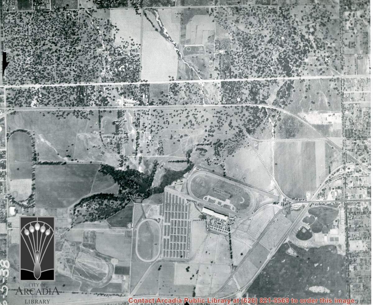
Santa Anita Park Race Track just right of center at south edge of photo. Oval to the left of Santa Anita Park Race Track was training track which was removed to make room for Santa Anita Fashion Park (currently Westfield Santa Anita Shopping Mall). Street just to left of training track is Baldwin Avenue. Huntington Drive and Colorado Place form a "y" just east of Santa Anita Park Race Track. Along both can be noticed the conifer trees planted a few years earlier. Street completely bisecting photo just below center is Foothill Boulevard, next one is Orange Grove Avenue. Santa Anita Avenue is partially in view on right edge of photo. Oval on extreme lower left side of photo is old Baldwin training track. Baseball diamond in lower right corner is at Arcadia County Park. Scale: 1"=660'
Michillinda Avenue is street running parallel to left edge of photo. Santa Anita Avenue is close to right edge of photo. Four tracks are in view. Left to right they would be: 1. Training track used by Elias J. "Lucky" Baldwin, 2. Aborted L. A. Jockey Club Track project of Anita Baldwin and Joe Smoot in 1933, 3. Small training track belonging to Santa Anita Park Race Track, and 4. Main track and grandstand of Santa Anita Park. Arcadia County Park is seen in lower right portion of photo.
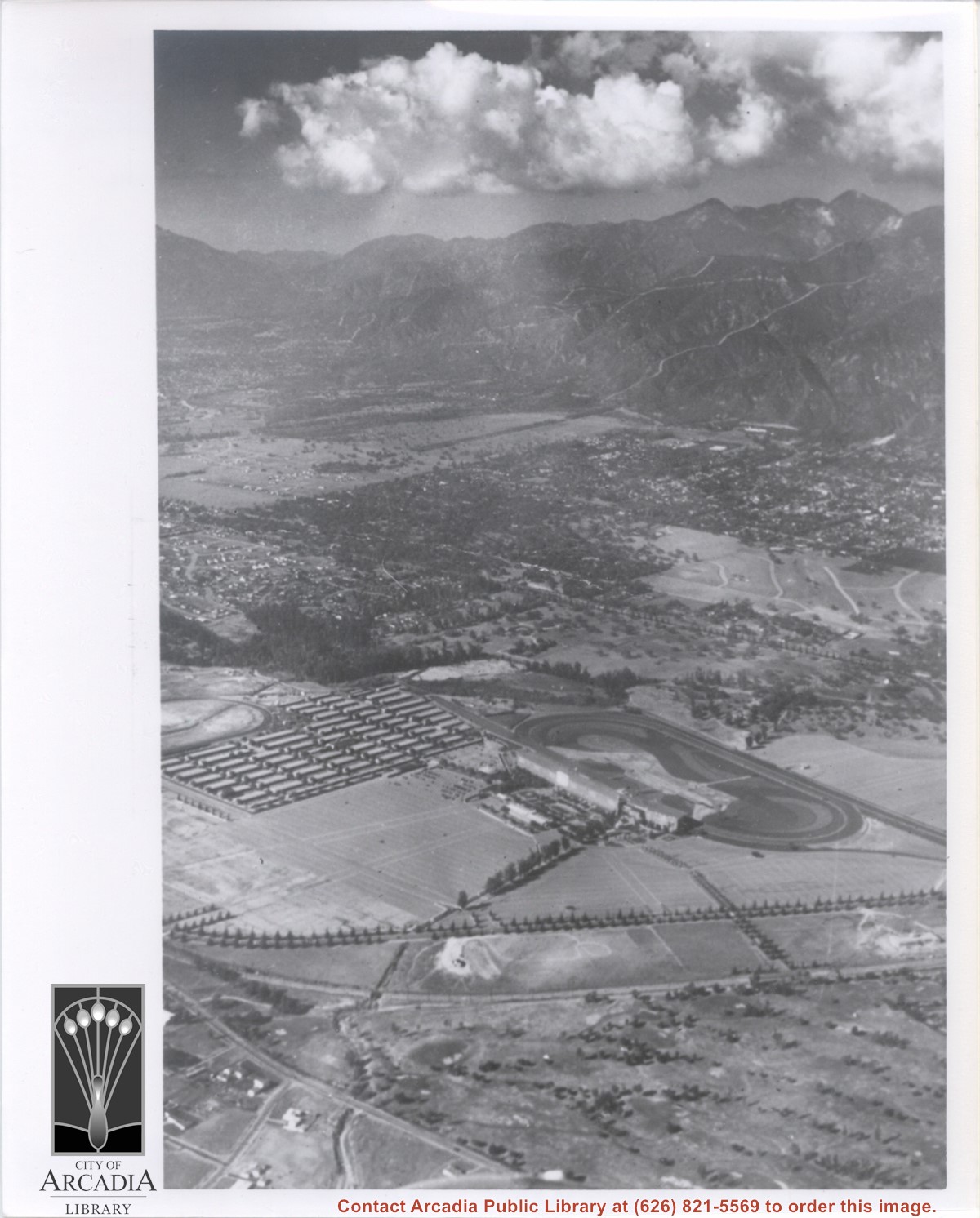
Aerial view taken from about over what became Campus Drive and Arcadia High School, and looking toward (NW) Pasadena and Sierra Madre at foot of San Gabriel Mountains. Photo shows Santa Anita Park Race Track possibly just a few years after opening.
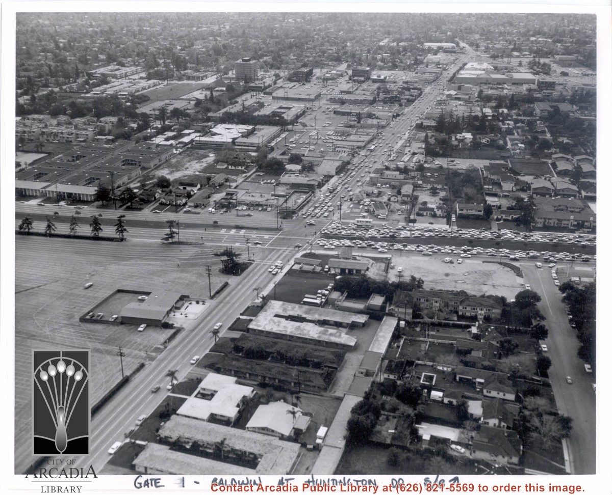
Aerial view south on Baldwin Avenue. From position just north of Huntington Drive (during racing season) showing great number of cars coming east on Huntington Drive to races through Gate #1. One building in Santa Anita Park Race Track parking lot is Fire Station at 630 S. Baldwin Avenue. Duarte Road is distantly seen in upper portion of photo, about 1 1/4 in. from top of photo. The multi-storied Medical Building seen is at 612 W. Duarte Road.