Aerial view toward NE. Plane is over property of Charles W. Stewart (10 acres), and Jaspar Teague (10 acres), at 1320 S. Santa Anita Avenue, which is directly under the plane. Next street east is First Avenue, then Second Avenue, the Fourth Avenue. Reservoir is at corner of Valnett Avenue and Second Avenue and was owned by Walnut Grove Mutual Water Company (Valnett Avenue was first through street south of Duarte Road at this time and became Camino Real).
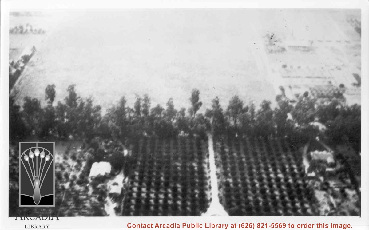
Aerial view west toward Santa Anita Ave. from above First Avenue, site of new grammar school. Long driveway heads to Jaspar N. Teague home in center of 10 acre orange grove. (Address in City Directory for this name is 1380 S. Santa Anita.) House to left and south was that of Charles W. Stewart in another 10 acre plot. Both ranches are now occupied by First Avenue Junior High School.
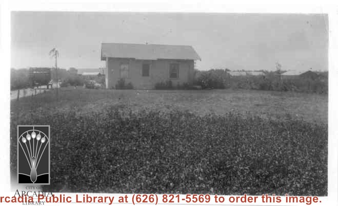
Home of Charles and Pearl Strong at 460 W. Duarte Road. View shows small clapboard house standing by itself. There is a high-sided trailer standing at left of house. What appears to be chicken houses show in the photo. Claimed to be first white leghorn chicken ranch in Arcadia.
Looking SW from mountains north of Arcadia. Major tree-lined street running from mountains south is Santa Anita Avenue. Southernmost tree-lined street cutting across entire middle of photo is Duarte Road. Barracks at the Balloon School can be seen just below Huntington Drive. Notice that Huntington Drive stops just west of the Balloon School, at the Baldwin Ranch. Much of Foothill area was planted to citrus.
Santa Anita Park Race Track just right of center at south edge of photo. Oval to the left of Santa Anita Park Race Track was training track which was removed to make room for Santa Anita Fashion Park (currently Westfield Santa Anita Shopping Mall). Street just to left of training track is Baldwin Avenue. Huntington Drive and Colorado Place form a "y" just east of Santa Anita Park Race Track. Along both can be noticed the conifer trees planted a few years earlier. Street completely bisecting photo just below center is Foothill Boulevard, next one is Orange Grove Avenue. Santa Anita Avenue is partially in view on right edge of photo. Oval on extreme lower left side of photo is old Baldwin training track. Baseball diamond in lower right corner is at Arcadia County Park. Scale: 1"=660'