Aerial view toward NE. Plane is over property of Charles W. Stewart (10 acres), and Jaspar Teague (10 acres), at 1320 S. Santa Anita Avenue, which is directly under the plane. Next street east is First Avenue, then Second Avenue, the Fourth Avenue. Reservoir is at corner of Valnett Avenue and Second Avenue and was owned by Walnut Grove Mutual Water Company (Valnett Avenue was first through street south of Duarte Road at this time and became Camino Real).
Looking SW from mountains north of Arcadia. Major tree-lined street running from mountains south is Santa Anita Avenue. Southernmost tree-lined street cutting across entire middle of photo is Duarte Road. Barracks at the Balloon School can be seen just below Huntington Drive. Notice that Huntington Drive stops just west of the Balloon School, at the Baldwin Ranch. Much of Foothill area was planted to citrus.
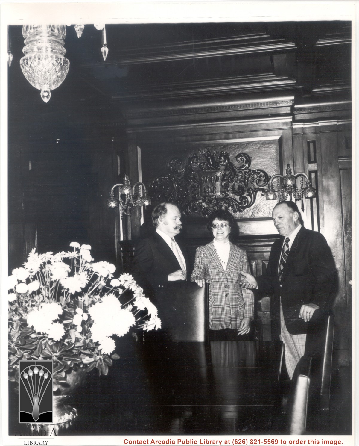
Lowry McCaslin, on right, stands before fireplace in dining room at Anoakia, which Mr. McCaslin has owned since the mid 1940's. Other people are Mr. and Mrs. Dale Spickler, as identified in Arcadia Tribune article on January 22, 1976. Mr. Spickler was committee chairman for Arcadia Tournament of Roses Association benefit party held at Anoakia Saturday, January 31, 1976. See Arcadia VF-Anoakia Item #17 for article and similar photo. Baldwin family crest is handsomely carved above fireplace.
Santa Anita Park Race Track just right of center at south edge of photo. Oval to the left of Santa Anita Park Race Track was training track which was removed to make room for Santa Anita Fashion Park (currently Westfield Santa Anita Shopping Mall). Street just to left of training track is Baldwin Avenue. Huntington Drive and Colorado Place form a "y" just east of Santa Anita Park Race Track. Along both can be noticed the conifer trees planted a few years earlier. Street completely bisecting photo just below center is Foothill Boulevard, next one is Orange Grove Avenue. Santa Anita Avenue is partially in view on right edge of photo. Oval on extreme lower left side of photo is old Baldwin training track. Baseball diamond in lower right corner is at Arcadia County Park. Scale: 1"=660'