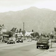
Street view looking north on Baldwin Avenue. Intersection in the middle is Fairview Avenue. 7-11 convenience store is on the southwest corner of Baldwin Avenue and Fairview Avenue, and Thai Classic restaurant is also visible. Photograph by Terry Miller.
https://arcadiahistory.andornot.com/en/permalink/photographs2234
- Date
- April 2001
1 image
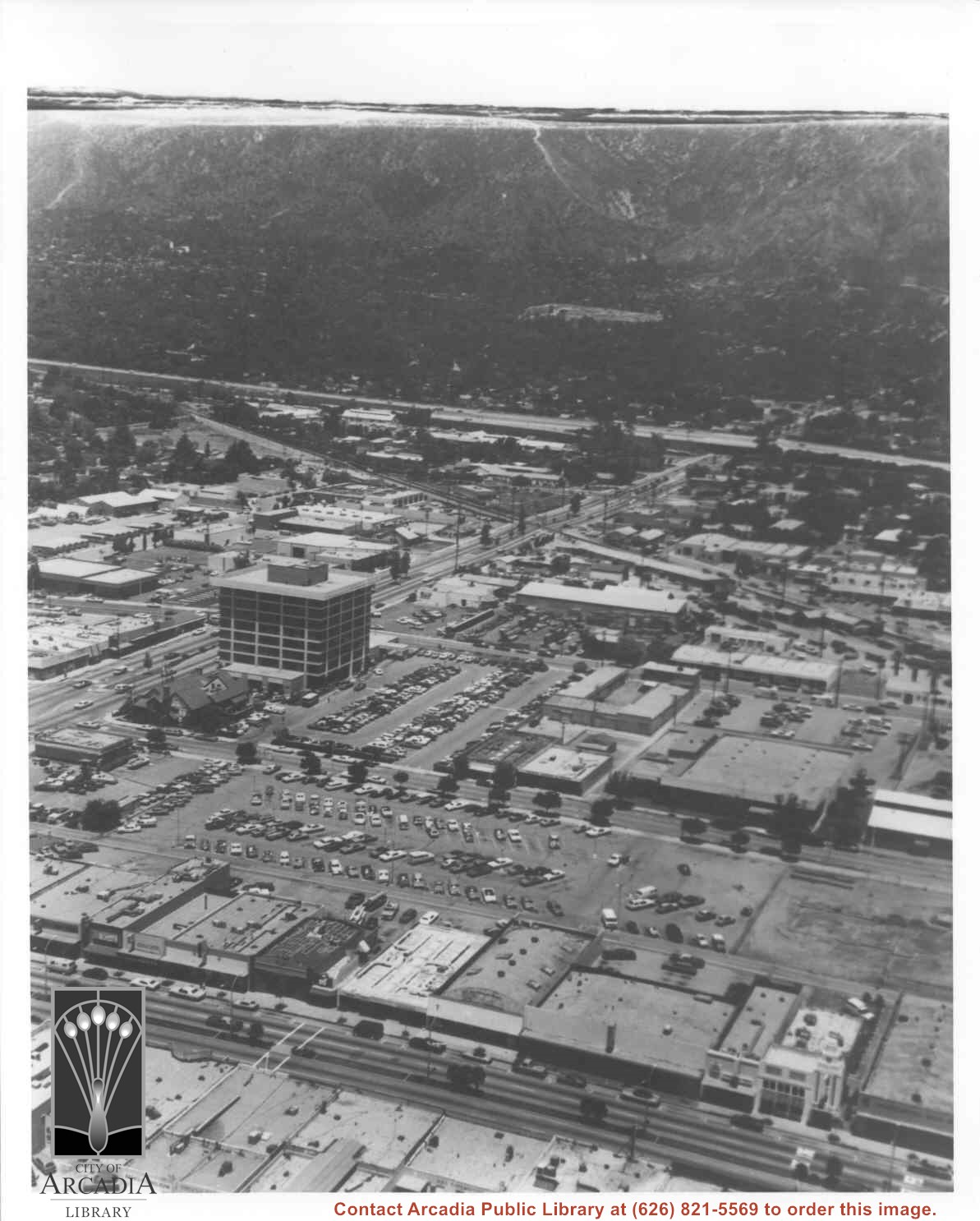
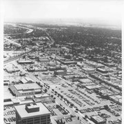
Aerial view north toward San Gabriel Mountains from a position above Huntington Drive near First Avenue. Santa Anita Avenue can plainly be seen running north and south in front of six-story building in center of photo. The 210 Foothill Freeway is top band running across photo from east to west.
https://arcadiahistory.andornot.com/en/permalink/photographs611
- Date
- July 1976
1 image

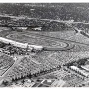
Aerial view looking east across Santa Anita Park taken from a position just west of Baldwin Avenue, which is seen at bottom of photo. Huntington Drive appears exactly in center of photo just east of race track. The 210 Foothill Freeway enters area in upper right portion of picture and exits at left side in upper left portion.
https://arcadiahistory.andornot.com/en/permalink/photographs996
- Date
- c.1979
1 image
- Date
- c.1979
- Subjects
- Aerial Photo Collection
- Aerial views
- 210 Foothill Freeway
- Huntington Drive
- Santa Anita Park-1945-1980
- Physical Description
- 8x10 b&w
- ID
- 989
- Collection
- Photographs
Images


Construction is stalled on a $11.9 million project to build sound walls on a stretch of the westbound 210 Foothill Freeway, between Baldwin Avenue and Rosemead Boulevard, but work is expected to resume soon. The delay is due to inaccurate design plans that are being modified.
https://arcadiahistory.andornot.com/en/permalink/newspaper31066
- Newspaper
- Pasadena Star News
- Date
- June 28, 2008
- Pages
- p. A1
- Item ID
- 31261AN
- Collection
- Newspaper Index
Aerial view toward the east from location about over Santa Anita Avenue at Santa Clara Street intersection. Santa Fe Railroad tracks are seen entering the city about in the center of photo. Broad white roadway seen toward left side of photo is 210 or Foothill Freeway still under construction.
https://arcadiahistory.andornot.com/en/permalink/photographs610
- Date
- c. 1968 or 1969
1 image
- Date
- c. 1968 or 1969
- Subjects
- Aerial Photo Collection
- Aerial views
- 210 Foothill Freeway
- Postal Service - post office
- Railroads
- Santa Anita Avenue
- Wheeler Avenue
- Physical Description
- 8x10 b&w
- ID
- 606
- Collection
- Photographs
Images

Aerial view toward north from a position south of Huntington Drive near intersection with Baldwin Avenue. It shows Santa Anita Fashion Park (currently known as Westfield Santa Anita Shopping Mall) developed by and on property owned by Santa Anita Consolidated. The Santa Anita Park Race Track and club house can be seen in center of photo. The straight white line about one inch above the club house roof is 210 Foothill Freeway. Chantry Flats road can be seen going up into San Gabriel Mountains in distance.
https://arcadiahistory.andornot.com/en/permalink/photographs646
- Date
- c. 1975
1 image
- Date
- c. 1975
- Subjects
- Aerial Photo Collection
- Aerial views
- 210 Foothill Freeway
- Chantry Flats Road
- Malls
- San Gabriel Mountains
- Santa Anita Park-1945-1980
- Santa Anita Fashion Park
- Westfield Santa Anita Shopping Mall
- Physical Description
- 8x10 b&w
- ID
- 642
- Collection
- Photographs
Images


About 1000 feet of sound walls will be built by the westbound lanes of the 210 Foothill Freeway between Second Avenue and Fifth Avenue. There is also discussion of future sound wall construction projects.
https://arcadiahistory.andornot.com/en/permalink/newspaper30026
- Newspaper
- Arcadia Weekly
- Date
- July 12, 2001
- Pages
- p. 1, 10
- Item ID
- 30213AN
- Collection
- Newspaper Index
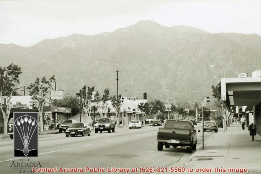
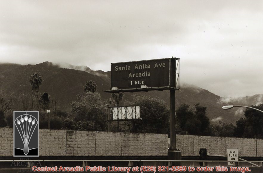
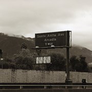
Santa Anita Avenue, Arcadia 1 mile. Exit sign on 210 Foothill Freeway, with mountain view and freeway wall in background. Photograph by Terry Miller.
https://arcadiahistory.andornot.com/en/permalink/photographs2243
- Date
- April 2001
1 image
- Date
- April 2001
- Subjects
- 210 Foothill Freeway
- Santa Anita Avenue
- Signs
- Physical Description
- 4x6 b&w
- ID
- 2214
- Collection
- Photographs
Images
Aerial view taken over Arcadia so that it shows a large area surrounding Arcadia as well as the entire city. Clearly seen is the Santa Anita Park Race Track, and the Arcadia County Park (shown as a dark triangle in center), and the 210 Foothill Freeway crossing photo from west to east and passing north of Santa Anita Park Race Track.
https://arcadiahistory.andornot.com/en/permalink/photographs648
- Date
- c. 1973
1 image
- Date
- c. 1973
- Subjects
- Aerial Photo Collection
- Aerial views
- 210 Foothill Freeway
- Arcadia County Park
- Santa Anita Park-1945-1980
- Physical Description
- 8x10 b&w
- ID
- 644
- Collection
- Photographs
Images


Aerial view looking north across Santa Anita Park from a position over Arcadia County Park. Large infield crowd is evident and all parking areas are filled. Arcadia Methodist Hospital shows in lower left part of photo and Arcadia Police facility is seen in lower right. The 210 Foothill Freeway cuts across photo near the top.
https://arcadiahistory.andornot.com/en/permalink/photographs995
- Date
- c.1979
1 image
- Date
- c.1979
- Subjects
- Aerial Photo Collection
- Aerial views
- 210 Foothill Freeway
- Arcadia Methodist Hospital
- Santa Anita Park-1945-1980
- Physical Description
- 8x10 b&w
- ID
- 988
- Collection
- Photographs
Images