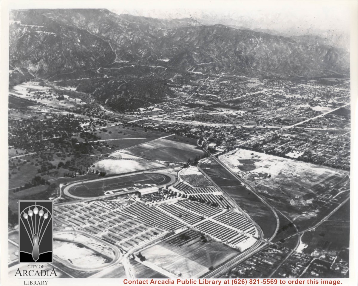
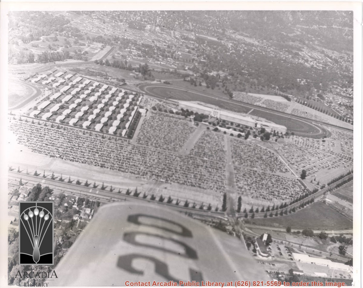
Michillinda Avenue is street running parallel to left edge of photo. Santa Anita Avenue is close to right edge of photo. Four tracks are in view. Left to right they would be: 1. Training track used by Elias J. "Lucky" Baldwin, 2. Aborted L. A. Jockey Club Track project of Anita Baldwin and Joe Smoot in 1933, 3. Small training track belonging to Santa Anita Park Race Track, and 4. Main track and grandstand of Santa Anita Park. Arcadia County Park is seen in lower right portion of photo.
https://arcadiahistory.andornot.com/en/permalink/photographs626
- Date
- June 5, 1938
1 image
- Date
- June 5, 1938
- Subjects
- Aerial Photo Collection
- Aerial views
- Los Angeles Jockey Club
- Michillinda Avenue
- Race tracks
- Santa Anita Park-1934-1942
- Physical Description
- 8x10 b&w
- ID
- 622
- Collection
- Photographs
Images
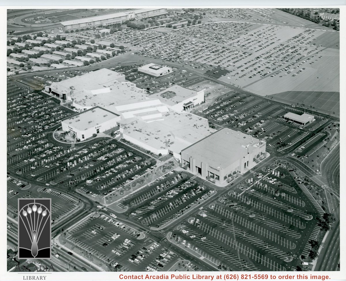
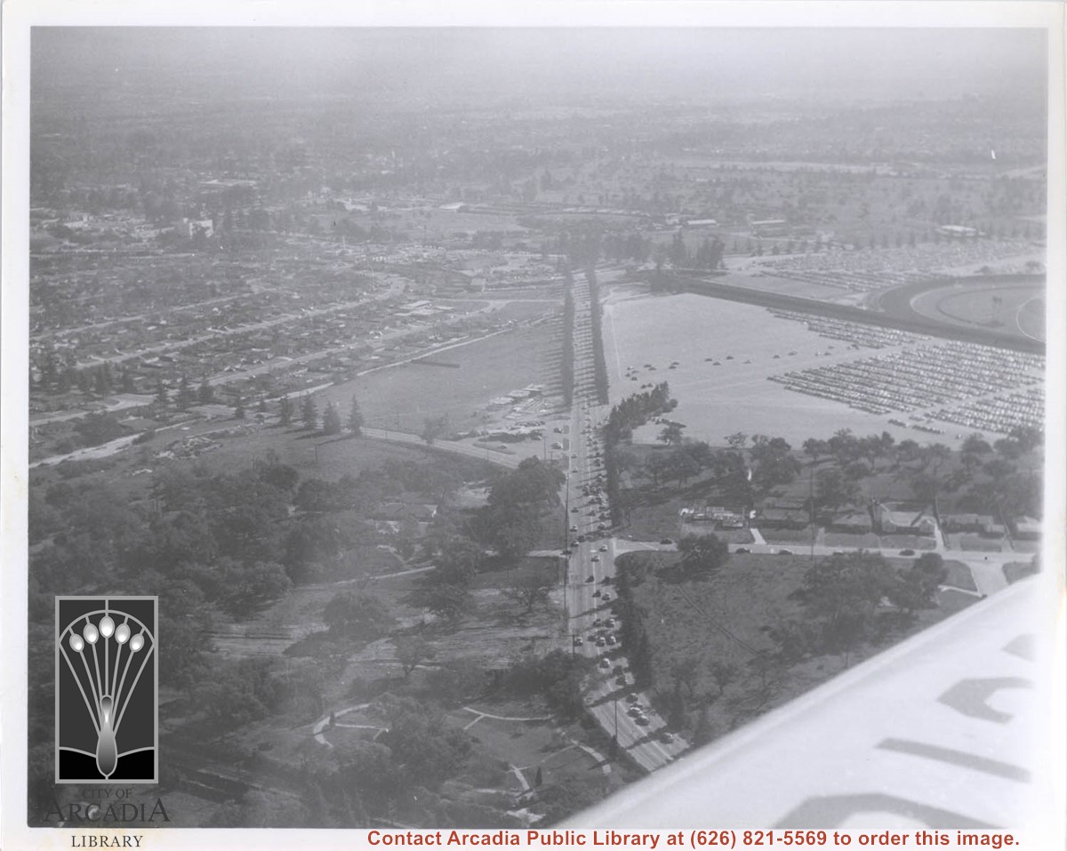
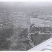
Aerial view looking down on Fashion Park from a position over intersection of Baldwin & Huntington Drive. Looking N toward Santa Anita Race Track grandstand during racing season (all of the cars parked on light-surfaced parking area are attending races.)
https://arcadiahistory.andornot.com/en/permalink/photographs736
- Date
- c.1975
1 image
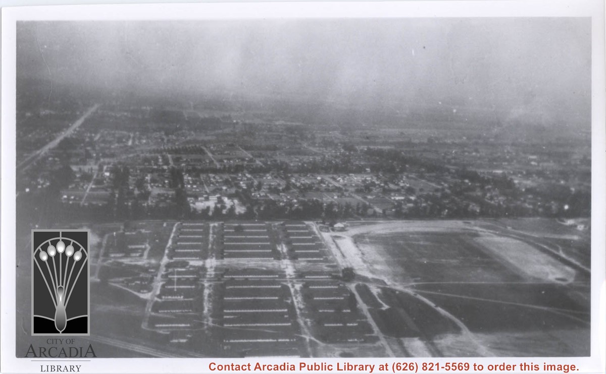
Aerial view toward the east taken from about over present Club House at Santa Anita Park Race Track. The main street running North/South is Santa Anita Avenue. View shows the oval of Elias J. "Lucky" Baldwin's race track in what is currently Arcadia County Park. The buildings would be barracks of Ross Field U.S. Army Balloon School. Duarte Road can be seen coming into photo at right edge of photo near intersection with Santa Anita Avenue. The broad street along left side would be Huntington Drive. Railroad tracks can be seen in lower left corner.
https://arcadiahistory.andornot.com/en/permalink/photographs635
- Date
- November 1929
1 image
- Date
- November 1929
- Subjects
- Aerial Photo Collection
- Aerial views
- Balloon School
- Huntington Drive
- Race tracks
- Railroads
- Santa Anita Avenue
- Physical Description
- 6x10 b&w
- ID
- 631
- Collection
- Photographs
Images

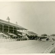
Grandstand and portion of track at Ascot Park, a racetrack built near the center of Los Angeles that offered racing from 1903-1907. It was closed due to a city ordinance forbidding gambling. Baldwin's track, Santa Anita Park, which opened in December 1907 was designed and built by the same architect that built Ascot Park: A.M. Allen. The two tracks are similar in style and are occasionally mistaken for each other. In this photo the stands are full and there are eight horses with jockeys on the track.
https://arcadiahistory.andornot.com/en/permalink/photographs551
- Date
- c.1905
1 image
- Date
- c.1905
- Subjects
- Ascot Park
- Horse racing
- Physical Description
- 8x10 b&w
- ID
- 547
- Collection
- Photographs
Images

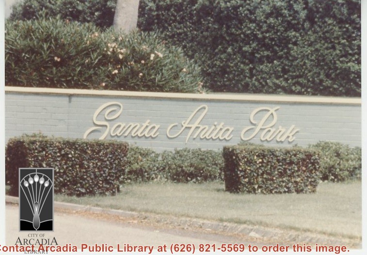
Santa Anita Park race track sign at east entrance.
https://arcadiahistory.andornot.com/en/permalink/photographs1232
- Date
- 1979
1 image
- Date
- 1979
- Subjects
- Santa Anita Park-1945-1980
- Physical Description
- 4x5 color
- ID
- 1223
- Collection
- Photographs
Images
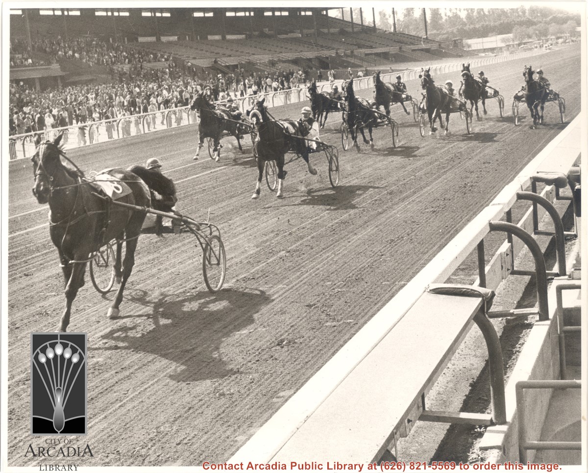
Nine sulkies and horses with drivers racing at Santa Anita Park. View is across track and racers into grandstand. Photo by photographer Milton Bell of Monrovia.
https://arcadiahistory.andornot.com/en/permalink/photographs1039
- Date
- March 12, 1963
1 image
- Date
- March 12, 1963
- Subjects
- Santa Anita Park-1945-1980
- Horse racing
- Physical Description
- 8x10 b&w
- ID
- 1031
- Collection
- Photographs
Images
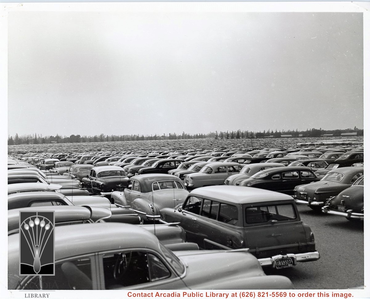
Santa Anita Park race track parking lot, very full of cars.
https://arcadiahistory.andornot.com/en/permalink/photographs1848
- Date
- 1940s or 1950s
1 image
- Date
- 1940s or 1950s
- Subjects
- Automobiles
- Santa Anita Park
- Physical Description
- 8 x 10 b & w
- ID
- 1770
- Collection
- Photographs
Images
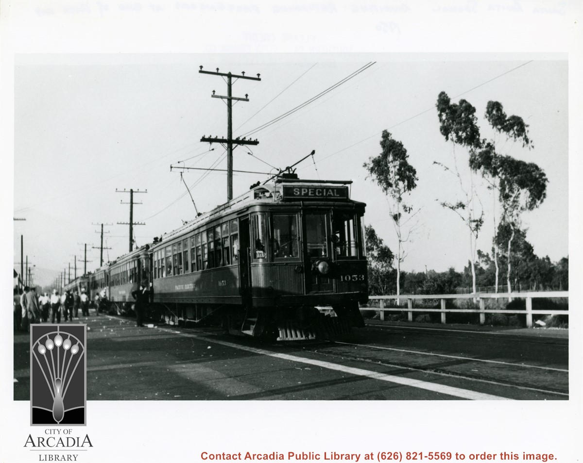
Santa Anita Race Track Special waiting for returning race-goers at the end of the day's racing. Note Arcadia County Park Golf Course in view on right side of photo. This photo belongs to Southern California Edison Co. Historical Collection. It is shown here for research only.
https://arcadiahistory.andornot.com/en/permalink/photographs401
- Date
- 1950
1 image
- Date
- 1950
- Subjects
- Pacific Electric Railway
- Railroads
- Physical Description
- 8x10 b&w
- ID
- 399
- Collection
- Photographs
Images
Aerial photograph looking toward Santa Anita Park race track, showing a busy day at the races, evident from the appearance of a full parking lot.
https://arcadiahistory.andornot.com/en/permalink/photographs1850
- Date
- 1940s or 1950s
1 image
- Date
- 1940s or 1950s
- Physical Description
- 8 x 10 b & w
- ID
- 1772
- Collection
- Photographs
Images
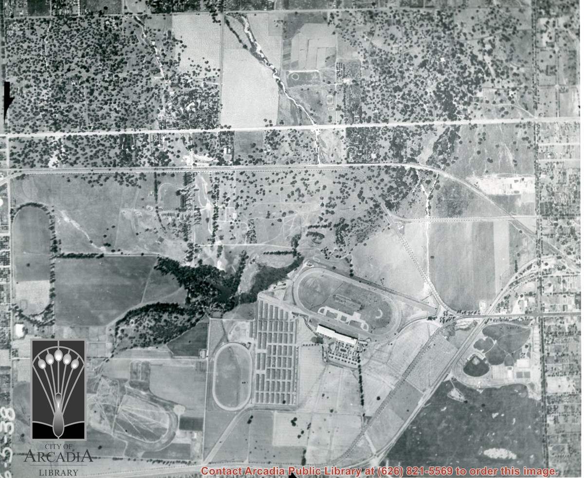
Santa Anita Park Race Track just right of center at south edge of photo. Oval to the left of Santa Anita Park Race Track was training track which was removed to make room for Santa Anita Fashion Park (currently Westfield Santa Anita Shopping Mall). Street just to left of training track is Baldwin Avenue. Huntington Drive and Colorado Place form a "y" just east of Santa Anita Park Race Track. Along both can be noticed the conifer trees planted a few years earlier. Street completely bisecting photo just below center is Foothill Boulevard, next one is Orange Grove Avenue. Santa Anita Avenue is partially in view on right edge of photo. Oval on extreme lower left side of photo is old Baldwin training track. Baseball diamond in lower right corner is at Arcadia County Park. Scale: 1"=660'
https://arcadiahistory.andornot.com/en/permalink/photographs620
- Date
- June 5, 1938
1 image
- Date
- June 5, 1938
- Subjects
- Aerial Photo Collection
- Aerial views
- Baldwin Avenue
- Colorado Boulevard
- Colorado Place
- Colorado Street
- Foothill Boulevard
- Huntington Drive
- Orange Grove Avenue
- Santa Anita Fashion Park (later known as Westfield Santa Anita)
- Santa Anita Park-1934-1942
- Physical Description
- 8x10 b&w
- ID
- 616
- Collection
- Photographs
Images


Aerial view taken over Arcadia so that it shows a large area surrounding Arcadia as well as the entire city. Clearly seen is the Santa Anita Park Race Track, and the Arcadia County Park (shown as a dark triangle in center), and the 210 Foothill Freeway crossing photo from west to east and passing north of Santa Anita Park Race Track.
https://arcadiahistory.andornot.com/en/permalink/photographs648
- Date
- c. 1973
1 image
- Date
- c. 1973
- Subjects
- Aerial Photo Collection
- Aerial views
- 210 Foothill Freeway
- Arcadia County Park
- Santa Anita Park-1945-1980
- Physical Description
- 8x10 b&w
- ID
- 644
- Collection
- Photographs
Images


Santa Anita Race Track seen from a distance. View is toward the north. The San Gabriel mountains are visible behind the track. Cars are parked in the parking lot.
https://arcadiahistory.andornot.com/en/permalink/photographs1348
- Date
- c. mid 1950's
1 image
- Date
- c. mid 1950's
- Subjects
- Santa Anita Park-1945-1980
- Physical Description
- 8x10 b&w
- ID
- 1339
- Collection
- Photographs
Images

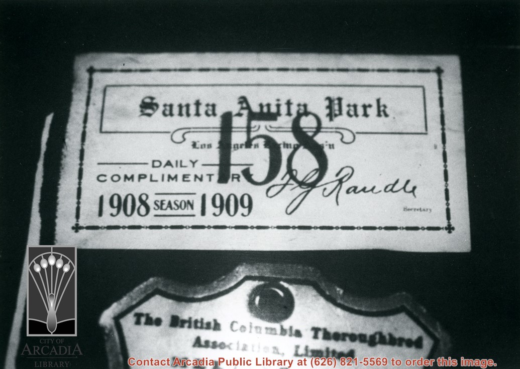
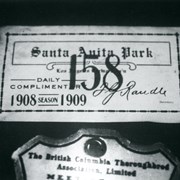
Photo of complimentary day pass to 1908-1909 season at Baldwin's Santa Anita Race Track signed by F.G. Randle, secretary and treasurer of Los Angeles Racing Association.
https://arcadiahistory.andornot.com/en/permalink/photographs946
- Date
- c.1908
1 image
- Date
- c.1908
- Subjects
- Santa Anita Park-1907-1912
- Physical Description
- 8x10 b&w
- ID
- 940
- Collection
- Photographs
Images
Aerial view south on Colorado Street just over large turn to the west. The residential area known as Santa Anita Gardens shows along upper left section of photo. Note that the only commerical development along the north side of Colorado Street is the Westerner Motel just near intersection with Huntington Drive. Santa Fe Railroad tracks are seen in lower left corner of photo. Santa Anita Park Race Track is on right.
https://arcadiahistory.andornot.com/en/permalink/photographs641
- Date
- c. 1956
1 image
- Date
- c. 1956
- Subjects
- Aerial Photo Collection
- Aerial views
- Colorado Boulevard
- Colorado Street
- Huntington Drive
- Railroads
- Santa Anita Park-1945-1980
- Westerner Motel
- Physical Description
- 8x10 b&w
- ID
- 637
- Collection
- Photographs
Images
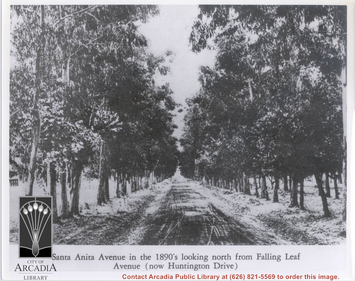
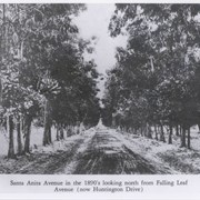
View north from present Huntington Drive up Santa Anita Avenue. Eucalyptus trees on either side appear to be about 60 feet tall. Surface of street seems to be dirt.
https://arcadiahistory.andornot.com/en/permalink/photographs298
- Date
- c.1890's
1 image
- Date
- c.1890's
- Subjects
- Santa Anita Avenue
- Physical Description
- 8x10 b&w
- ID
- 296
- Collection
- Photographs
Images
Aerial view taken looking southeast from position about over present Arboretum. Photo shows Santa Anita Park, probably in opening season. Present City Hall sits in area just beyond cars parked at east end of track. Part of oval of old Santa Anita track built by Elias J. "Lucky" Baldwin is seen in upper portion of photo, in area that is now Arcadia County Park. Duarte Road is seen crossing photo in upper right corner. Present Arcadia County Park area is in this photo, bordered on the north by Pacific Electric Railroad tracks. A train has just brought a group to the races and they are seen walking in center of photo. White square seen near right side, is slab left from hangars when U.S. Army Balloon School occupied this site, 1917-1927.
https://arcadiahistory.andornot.com/en/permalink/photographs986
- Date
- c.1934 racing season
1 image
- Date
- c.1934 racing season
- Subjects
- Aerial Photo Collection
- Aerial views
- Arcadia County Park
- Duarte Road
- Race tracks
- Railroads
- Santa Anita Park-1934-1942
- Santa Anita Park-1907-1912
- Physical Description
- 8x10 b&w
- ID
- 978
- Collection
- Photographs
Images


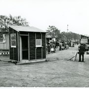
Large number of evacuees watch continuing transformation of facilities from Race Track operation to Santa Anita Assembly Center for the Japanese. Here two small booth-like buildings are moved.
https://arcadiahistory.andornot.com/en/permalink/photographs674
- Date
- April 1942
1 image
- Date
- April 1942
- Subjects
- Santa Anita Assembly Center for the Japanese-Construction & maintenance
- Santa Anita Park-1942-1945
- Physical Description
- 8x10 b&w
- ID
- 670
- Collection
- Photographs
Images

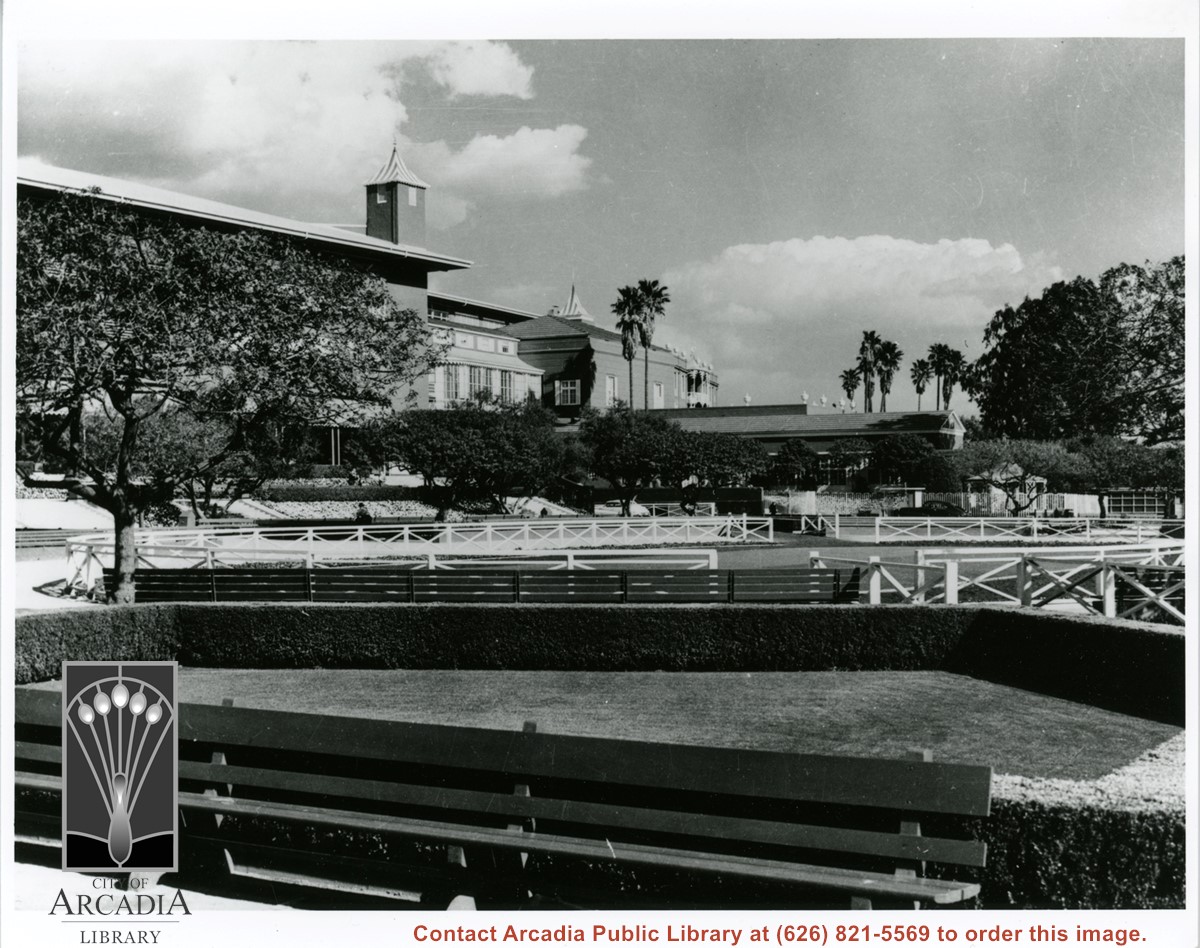
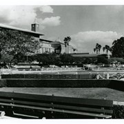
Santa Anita Race Track, looking east and north.
https://arcadiahistory.andornot.com/en/permalink/photographs1341
- Date
- c. late 1940's or 1950's
1 image
- Date
- c. late 1940's or 1950's
- Subjects
- Santa Anita Park-1945-1980
- Physical Description
- 8x10 b&w; 15x20 b&w
- ID
- 1332
- Collection
- Photographs
Images
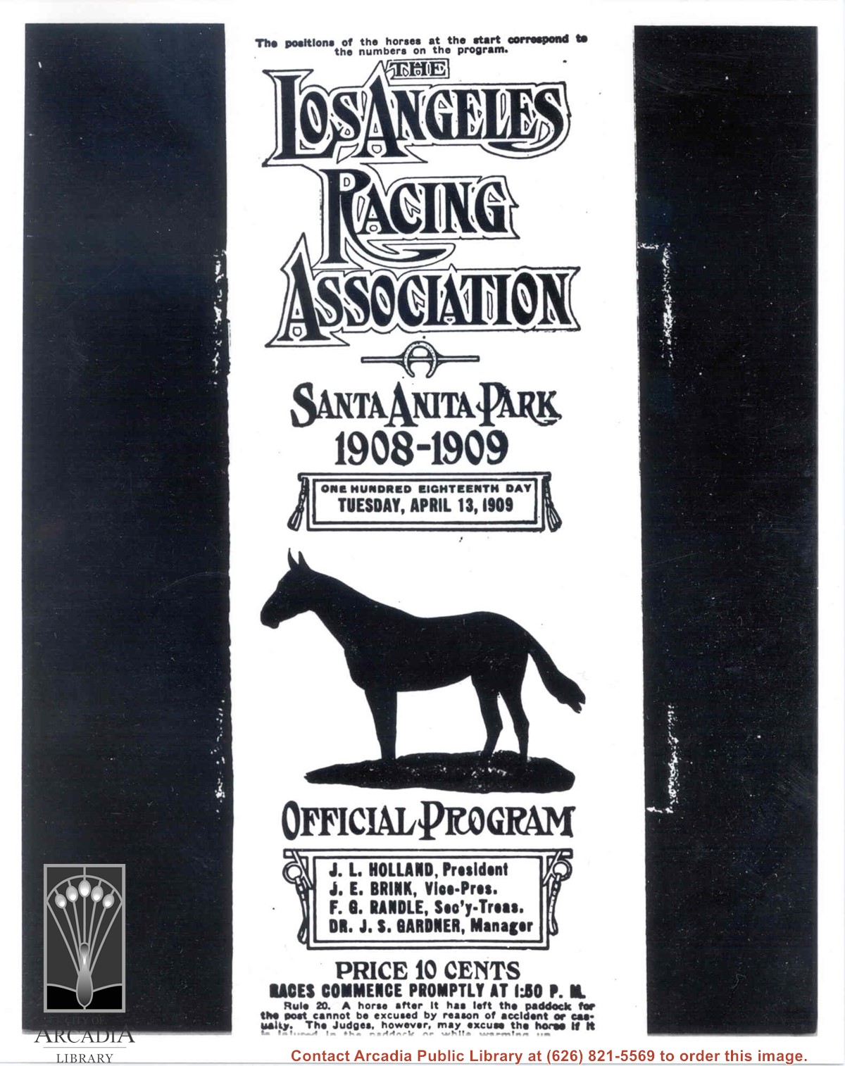
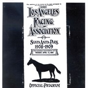
Cover page of the Official Program for the Los Angeles Racing Association, Tuesday, April 13, 1909 at Santa Anita Park.
https://arcadiahistory.andornot.com/en/permalink/photographs1179
- Date
- 1909
1 image
- Date
- 1909
- Subjects
- Santa Anita Park-1907-1912
- Physical Description
- 8x10 b&w
- ID
- 1170
- Collection
- Photographs
Images
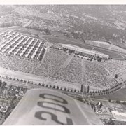
Aerial view looking northeast across Santa Anita Park toward mountains. Note training track called Anita Chiquita has been added (lower left corner), open grandstand has been added to west of covered stand. Note, too, that work has begun to change Balloon School site to Arcadia County Park. Santa Anita Avenue is tree-lined street running entire width of photo about middle of print.
https://arcadiahistory.andornot.com/en/permalink/photographs987
- Date
- 1937
1 image
- Date
- 1937
- Subjects
- Aerial Photo Collection
- Aerial views
- Anita Chiquita training track
- Arcadia County Park
- Balloon School
- Santa Anita Avenue
- Santa Anita Park-1934-1942
- Physical Description
- 8x10 b&w
- ID
- 979
- Collection
- Photographs
Images