Hall of Fame jockey and Sierra Madre resident Gary Stevens is doing well after a fall that injured his lung and shoulders at the Arlington Million. Stevens, in his first acting role, starred as George "The Iceman" Woolf in the Universal film, Seabiscuit. Stevens has won the Santa Anita Derby.
https://arcadiahistory.andornot.com/en/permalink/newspaper31839
- Newspaper
- Arcadia Weekly
- Date
- August 21, 2003
- Pages
- p. 18
- Subjects
- Actors
- Jockeys
- Stevens, Gary
- Item ID
- 32036AN
- Collection
- Newspaper Index
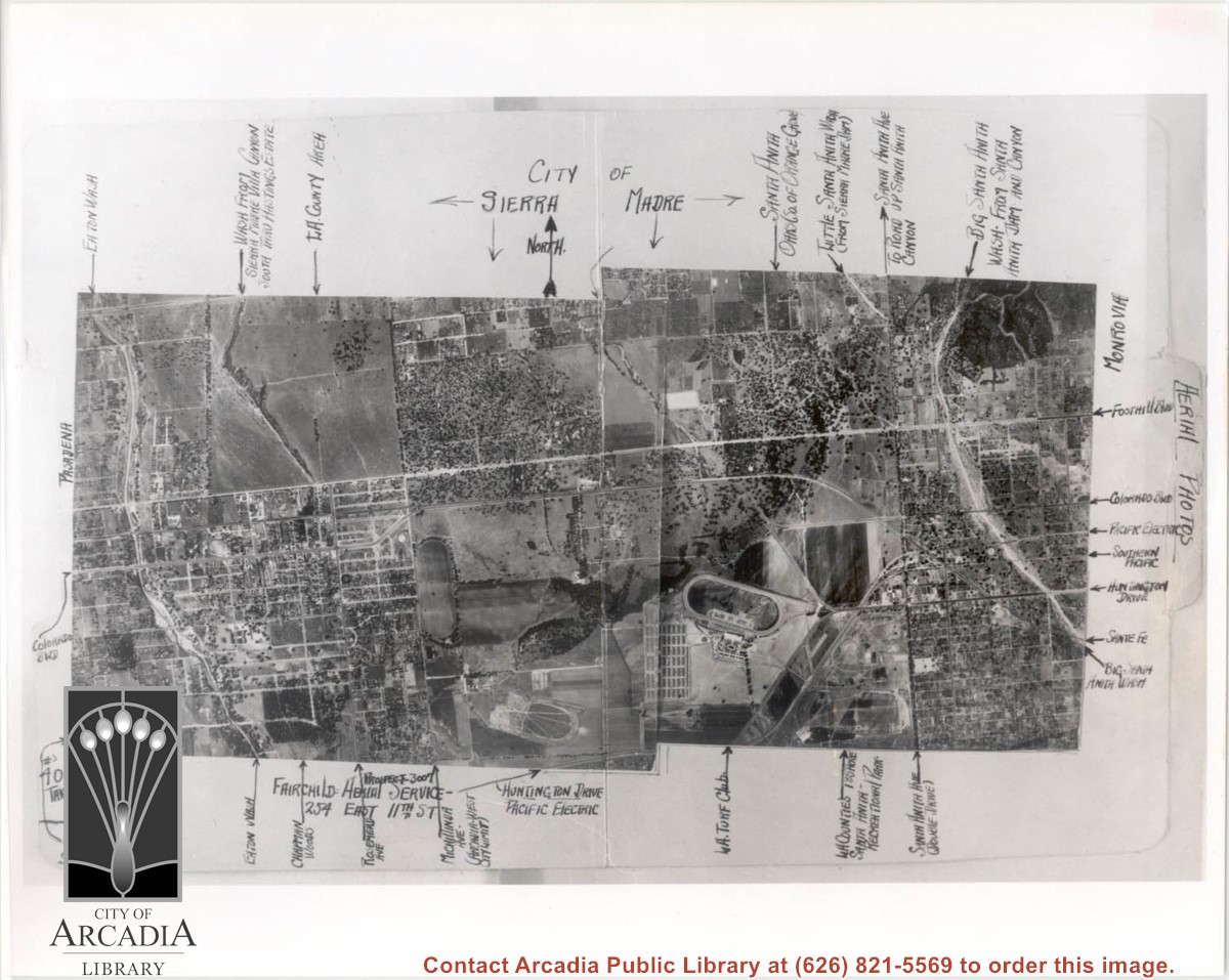
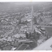
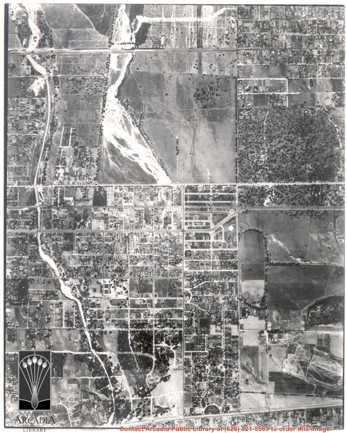
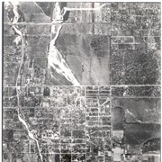
Aerial view of Arcadia. Photo is dated in lower left corner and has descriptions and arrows all along the border.
https://arcadiahistory.andornot.com/en/permalink/photographs1560
- Date
- June 11, 1936
1 image
- Date
- June 11, 1936
- Subjects
- Aerial Photo Collection
- Aerial views
- Physical Description
- 8x10 b&w
- ID
- 1539
- Collection
- Photographs
Images
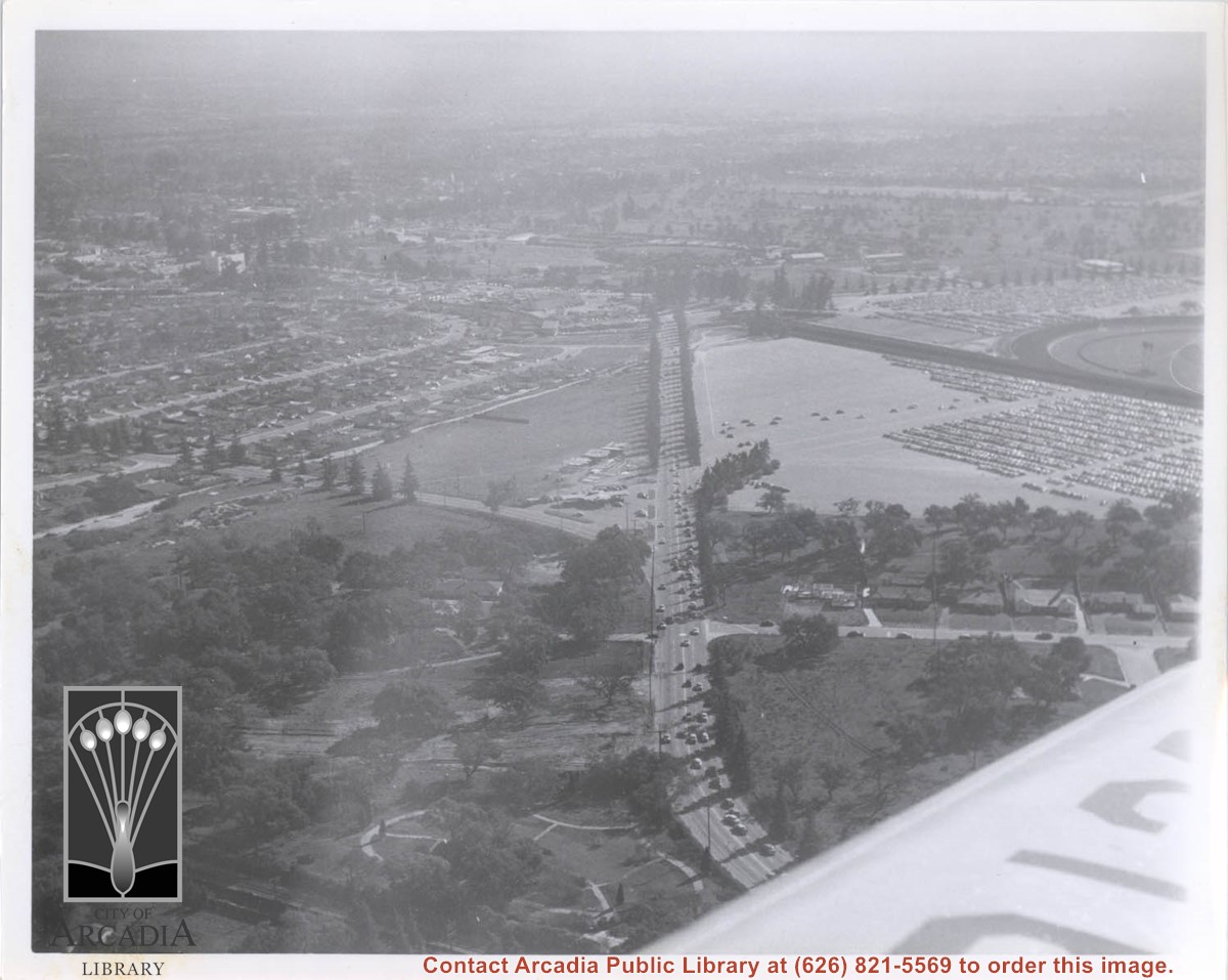
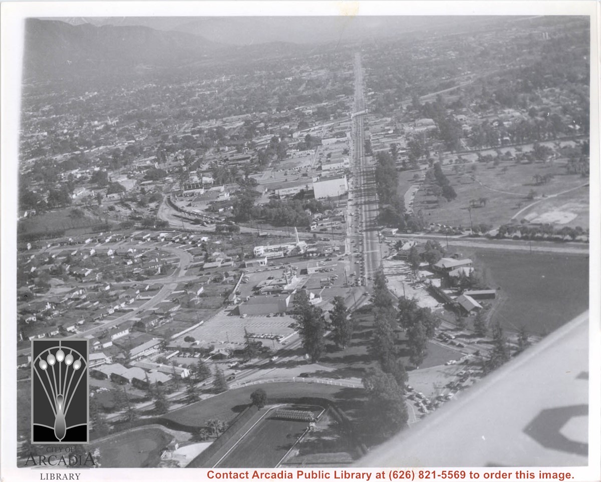
Aerial view south on Colorado Street just over large turn to the west. The residential area known as Santa Anita Gardens shows along upper left section of photo. Note that the only commerical development along the north side of Colorado Street is the Westerner Motel just near intersection with Huntington Drive. Santa Fe Railroad tracks are seen in lower left corner of photo. Santa Anita Park Race Track is on right.
https://arcadiahistory.andornot.com/en/permalink/photographs641
- Date
- c. 1956
1 image
- Date
- c. 1956
- Subjects
- Aerial Photo Collection
- Aerial views
- Colorado Boulevard
- Colorado Street
- Huntington Drive
- Railroads
- Santa Anita Park-1945-1980
- Westerner Motel
- Physical Description
- 8x10 b&w
- ID
- 637
- Collection
- Photographs
Images
Thousands of Arnold Schwarzenegger supporters came out to see him at the Los Angeles County Arboretum on his campaign tour in the special election to recall Governor Gray Davis. Voters have chosen Arnold Schwarzenegger to replace Gray Davis as governor of California.
https://arcadiahistory.andornot.com/en/permalink/newspaper33099
- Newspaper
- Arcadia Weekly,
- Date
- October 9, 2003
- Pages
- p. 18
- Subjects
- Actors
- Politicians
- Schwarzenegger, Arnold
- Item ID
- 33296AN
- Collection
- Newspaper Index
Drive-in movie fundraiser, a tribute to former addict and prison inmage, actor Danny Trejo, to help drug treatment organization CRI-Help. Features Universal Studio's award-winning documentary "Inmate #1: the rise of Danny Trejo" on a 50-foot screen at Santa Anita Park on May 14. The film chronicles Trejo's journey from addiction to Hollywood stardom. He will appear and his restaurant Trejo's Tacos will cater the event.
https://arcadiahistory.andornot.com/en/permalink/newspaper35961
- Newspaper
- Pasadena Star News
- Date
- May 6, 2021
- Pages
- p. A1, A6
- Subjects
- Actors
- Documentary films
- Fundraisers
- Trejo, Danny
- Collection
- Newspaper Index
Actor and activist George Takei, 75, famous for his portrayal of Sulu on television series Star Trek, will talk about gay rights and a childhood spent in internment camps at Santa Anita Park (assembly center), Tule Lake and Rohwer, Arkansas, during World War II. He will be speaking at Cal Poly Pomona on Tuesday.
https://arcadiahistory.andornot.com/en/permalink/newspaper33419
- Newspaper
- Pasadena Star News
- Date
- February 15, 2013
- Pages
- p. B1, B8
- Item ID
- 33615AN
- Collection
- Newspaper Index
Aerial view from position above Huntington Drive near Holly Avenue intersection looking north over Santa Anita Park. Colorado Place and Huntington Drive are seen coming together at right side of photo. Note how small the deodar (?) trees planted along Huntington Drive and Colorado Place are. Row of trees seen in center of photo were apparently left from Ranch days and were later removed.
https://arcadiahistory.andornot.com/en/permalink/photographs984
- Date
- December 1, 1935
1 image
- Date
- December 1, 1935
- Subjects
- Aerial Photo Collection
- Aerial views
- Colorado Place
- Huntington Drive
- Santa Anita Park-1934-1942
- Physical Description
- 8x10 b&w
- ID
- 976
- Collection
- Photographs
Images

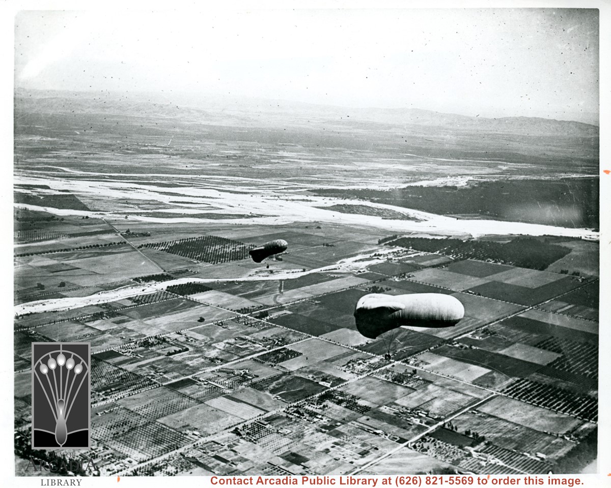
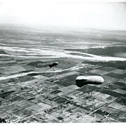
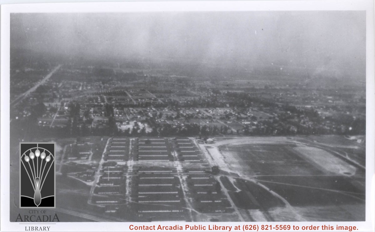
View east shows two balloons aloft over Arcadia and San Gabriel Valley. It is possible that first river up from bottom of photo is Rio Hondo Wash. Some of trees along Santa Anita appear to be in extreme lower right of photo. Tree-lined street showing in extreme lower left of photo is Duarte Road. Second river coming into photo about five inches up from bottom of photo would be San Gabriel River.
https://arcadiahistory.andornot.com/en/permalink/photographs154
- Date
- c.1918
1 image
Aerial view looking east along Huntington Drive taken over the Club House at Santa Anita Park Race Track. Pony Express Museum is just to right of the "y" intersection of Huntington Drive coming into Arcadia just below the wing of the plane. Theater that was opened in 1942 is almost directly opposite Museum. Santa Anita Motor Inn, two buildings east of theater, distinguished by tall tower, opened in 1938. (It was torn down in 1975.) The residential area directly north of there is known as Santa Anita Gardens. Santa Anita Avenue is just beyond Arcadia County Park on right.
https://arcadiahistory.andornot.com/en/permalink/photographs642
- Date
- c. 1957-58
1 image
- Date
- c. 1957-58
- Subjects
- Aerial Photo Collection
- Aerial views
- Huntington Drive
- Pony Express Museum
- Santa Anita Avenue
- Santa Anita Motor Inn
- Physical Description
- 8x10 b&w
- ID
- 638
- Collection
- Photographs
Images
Aerial view looking west over Santa Anita Park. Photo was taken from about over intersection of Colorado Place and Huntington Drive. Note area that was to become Los Angeles County Arboretum across top of photo. Note an open Grandstand has been added to the west of original covered one. There is a small dirigible in lower right corner carrying a sign that seems to read:modern motel. Present Baldwin Avenue would run where road in this photo is seen parallel to top of photo.
https://arcadiahistory.andornot.com/en/permalink/photographs983
- Date
- December 28, 1935
1 image
- Date
- December 28, 1935
- Physical Description
- 8x10 b&w
- ID
- 975
- Collection
- Photographs
Images
Aerial view toward the east taken from about over present Club House at Santa Anita Park Race Track. The main street running North/South is Santa Anita Avenue. View shows the oval of Elias J. "Lucky" Baldwin's race track in what is currently Arcadia County Park. The buildings would be barracks of Ross Field U.S. Army Balloon School. Duarte Road can be seen coming into photo at right edge of photo near intersection with Santa Anita Avenue. The broad street along left side would be Huntington Drive. Railroad tracks can be seen in lower left corner.
https://arcadiahistory.andornot.com/en/permalink/photographs635
- Date
- November 1929
1 image
- Date
- November 1929
- Subjects
- Aerial Photo Collection
- Aerial views
- Balloon School
- Huntington Drive
- Race tracks
- Railroads
- Santa Anita Avenue
- Physical Description
- 6x10 b&w
- ID
- 631
- Collection
- Photographs
Images

Main north/south running street to right of center is Michillinda Avenue. Oval adjacent to Michillinda Avenue is Elias J. "Lucky" Baldwin's training track. Lower right corner of photo is abandoned project of Anita Baldwin and Joe Smoot, c. 1933 (about where May Company was and where Vons, a Safeway Company, Southern California Division Headquarters is now, at 618 Michillinda Avenue). Street running east/west across center of photo is present day Colorado Boulevard. East/west-running street near top of photo is present Foothill Boulevard. Wash along left side of photo is Eaton Wash, Pasadena. Scale: 1 inch=660 feet.
https://arcadiahistory.andornot.com/en/permalink/photographs623
- Date
- June 5, 1938
1 image
- Date
- June 5, 1938
- Subjects
- Aerial Photo Collection
- Aerial views
- Eaton Wash
- Foothill Boulevard
- Los Angeles Jockey Club
- Michillinda Avenue
- Physical Description
- 8x10 b&w
- ID
- 619
- Collection
- Photographs
Images
Santa Anita Park Race Track just right of center at south edge of photo. Oval to the left of Santa Anita Park Race Track was training track which was removed to make room for Santa Anita Fashion Park (currently Westfield Santa Anita Shopping Mall). Street just to left of training track is Baldwin Avenue. Huntington Drive and Colorado Place form a "y" just east of Santa Anita Park Race Track. Along both can be noticed the conifer trees planted a few years earlier. Street completely bisecting photo just below center is Foothill Boulevard, next one is Orange Grove Avenue. Santa Anita Avenue is partially in view on right edge of photo. Oval on extreme lower left side of photo is old Baldwin training track. Baseball diamond in lower right corner is at Arcadia County Park. Scale: 1"=660'
https://arcadiahistory.andornot.com/en/permalink/photographs620
- Date
- June 5, 1938
1 image
- Date
- June 5, 1938
- Subjects
- Aerial Photo Collection
- Aerial views
- Baldwin Avenue
- Colorado Boulevard
- Colorado Place
- Colorado Street
- Foothill Boulevard
- Huntington Drive
- Orange Grove Avenue
- Santa Anita Fashion Park (later known as Westfield Santa Anita)
- Santa Anita Park-1934-1942
- Physical Description
- 8x10 b&w
- ID
- 616
- Collection
- Photographs
Images


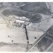
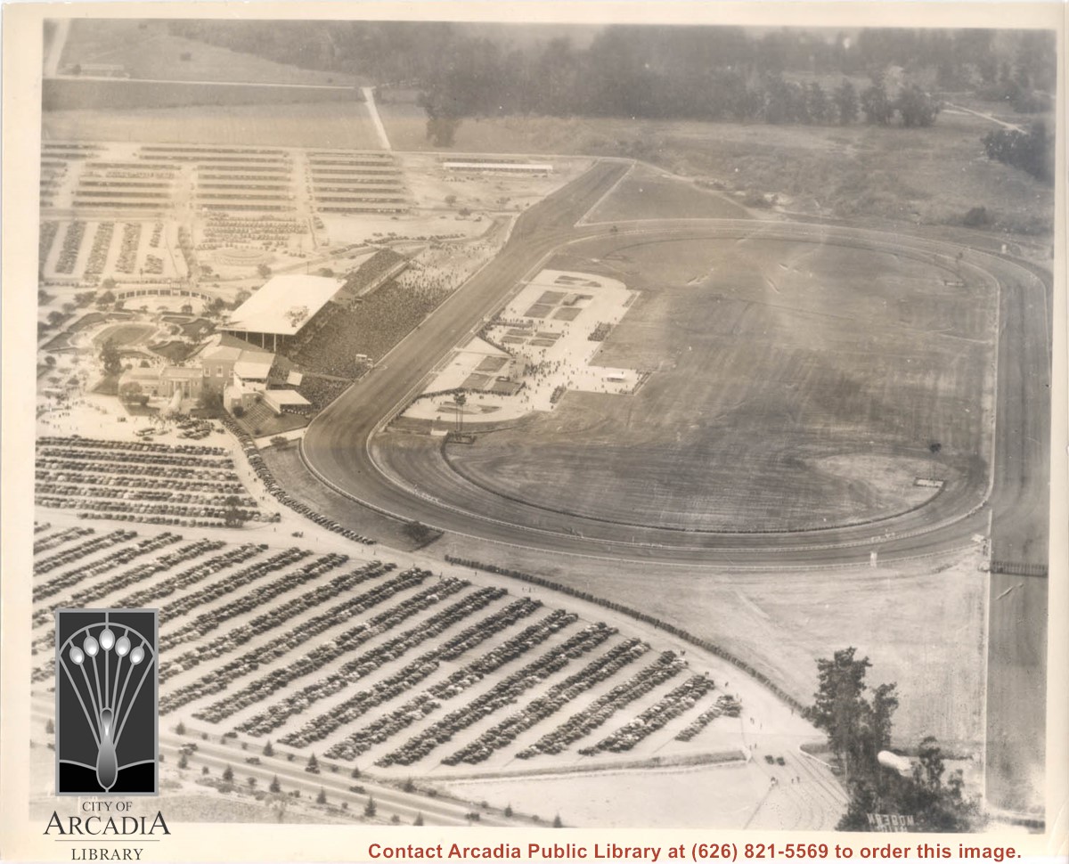
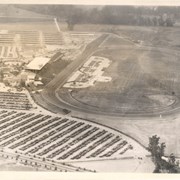
Aerial view taken looking southeast from position about over present Arboretum. Photo shows Santa Anita Park, probably in opening season. Present City Hall sits in area just beyond cars parked at east end of track. Part of oval of old Santa Anita track built by Elias J. "Lucky" Baldwin is seen in upper portion of photo, in area that is now Arcadia County Park. Duarte Road is seen crossing photo in upper right corner. Present Arcadia County Park area is in this photo, bordered on the north by Pacific Electric Railroad tracks. A train has just brought a group to the races and they are seen walking in center of photo. White square seen near right side, is slab left from hangars when U.S. Army Balloon School occupied this site, 1917-1927.
https://arcadiahistory.andornot.com/en/permalink/photographs986
- Date
- c.1934 racing season
1 image
- Date
- c.1934 racing season
- Subjects
- Aerial Photo Collection
- Aerial views
- Arcadia County Park
- Duarte Road
- Race tracks
- Railroads
- Santa Anita Park-1934-1942
- Santa Anita Park-1907-1912
- Physical Description
- 8x10 b&w
- ID
- 978
- Collection
- Photographs
Images

