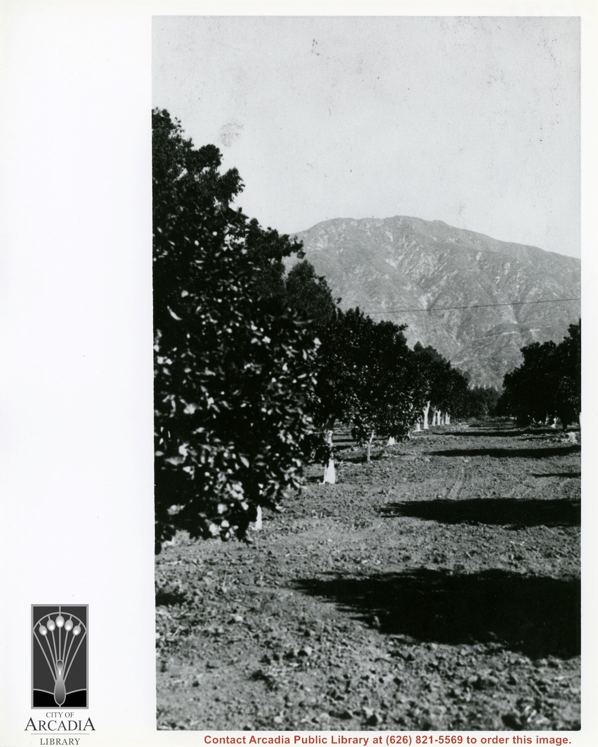
Harry Ainsworth Ranch, upper grove looking north to mountains. Present day Highland Oaks School would be located about where trees block the end of the row of citrus trees.
https://arcadiahistory.andornot.com/en/permalink/photographs1081
- Date
- c.1916
1 image
- Date
- c.1916
- Subjects
- Agriculture
- Ainsworth Ranch
- Physical Description
- 8x10 b&w
- ID
- 1072
- Collection
- Photographs
Images
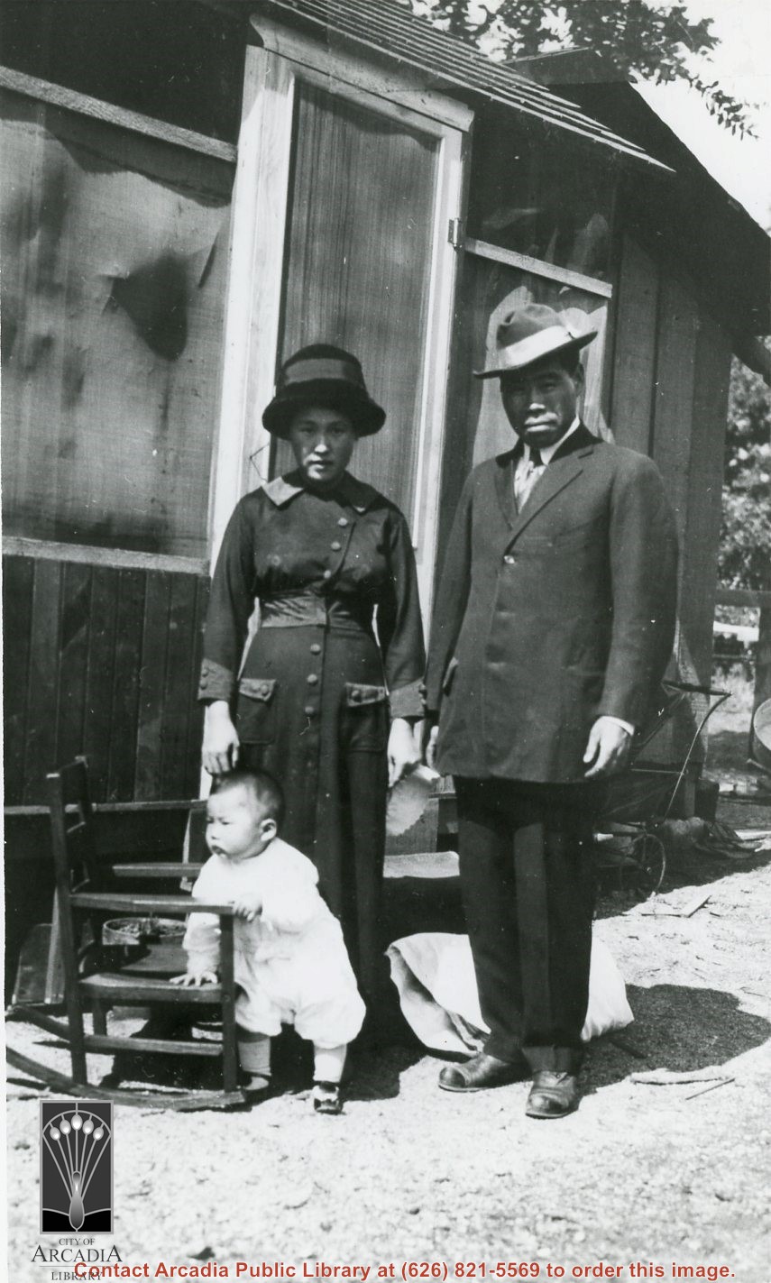
A Japanese family (child, mother, father) pictured by small house they lived in on Harry Ainsworth Ranch which was just east of intersection of Santa Anita and Orange Grove Ave. The father was the head gardener for Ainsworth. Name unknown.
https://arcadiahistory.andornot.com/en/permalink/photographs1077
- Date
- c.1916
1 image
- Date
- c.1916
- Subjects
- Japanese
- Ainsworth Ranch
- Physical Description
- 8x10 b&w
- ID
- 1068
- Collection
- Photographs
Images
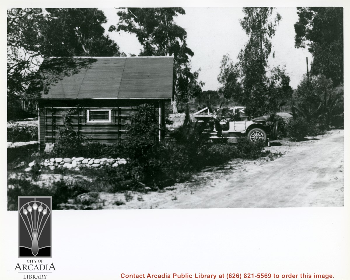
On Ainsworth Ranch just east of Santa Anita and Orange Grove Avenue. Pictured on left is a wooden garage on stone foundation. Parked near is family Packard Touring car with top down. Beyond can be seen small bridge on Santa Anita Avenue which spanned the Sierra Madre Wash.
https://arcadiahistory.andornot.com/en/permalink/photographs1082
- Date
- c.1919
1 image
- Date
- c.1919
- Subjects
- Santa Anita Avenue
- Ainsworth Ranch
- Physical Description
- 8x10 b&w
- ID
- 1073
- Collection
- Photographs
Images
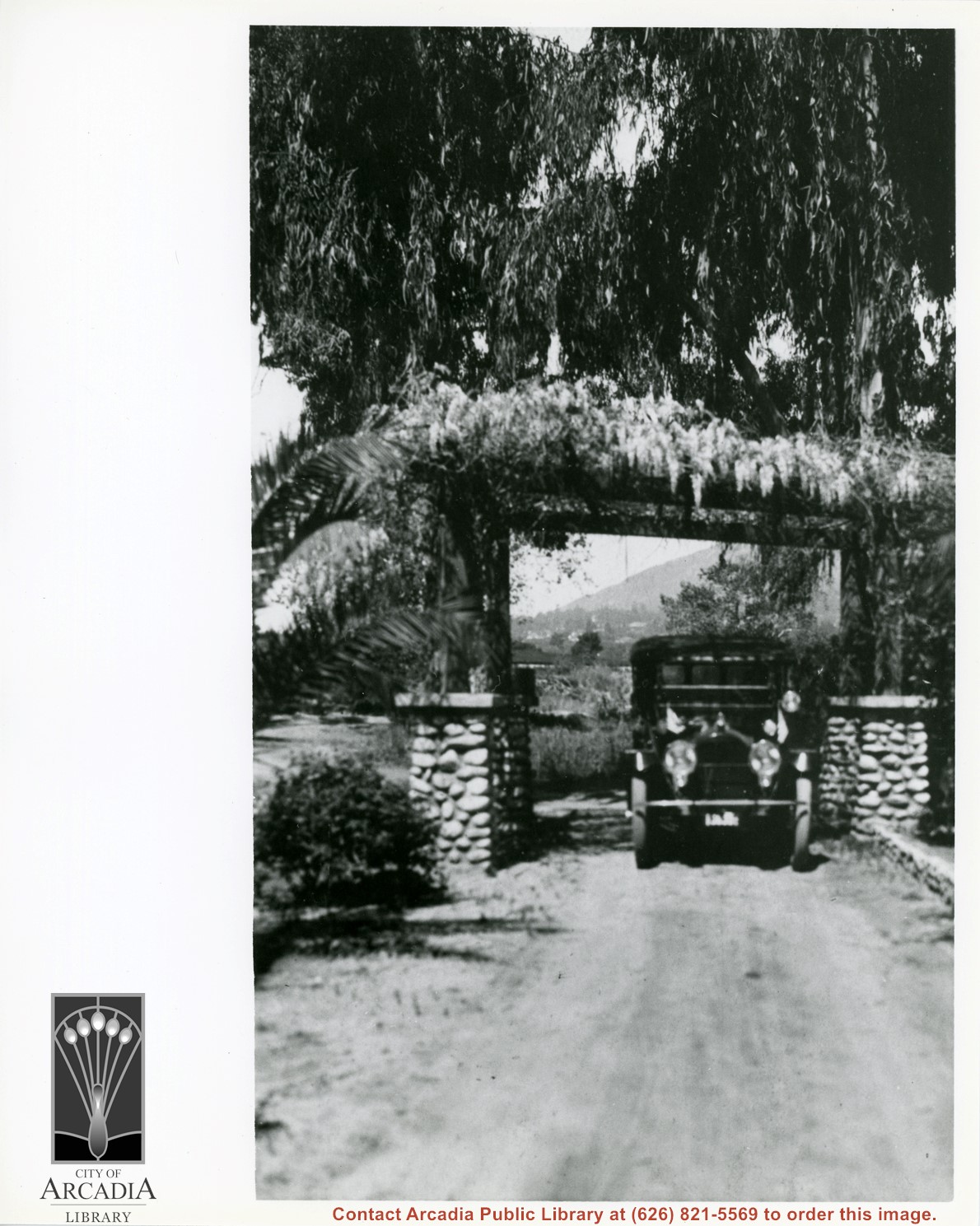
Entrance to Harry Ainsworth Ranch which was just to east of intersection of Santa Anita and Orange Grove Avenue. In this view we are on ranch property looking west through gate toward town of Sierra Madre. Tall eucalyptus are on Santa Anita Avenue. Car is driving through stone-based pillars of gate. Wistaria vine in blossom covers frame over entry.
https://arcadiahistory.andornot.com/en/permalink/photographs1083
- Date
- c.1916
1 image
- Date
- c.1916
- Subjects
- Ainsworth Ranch
- Physical Description
- 8x10 b&w
- ID
- 1074
- Collection
- Photographs
Images
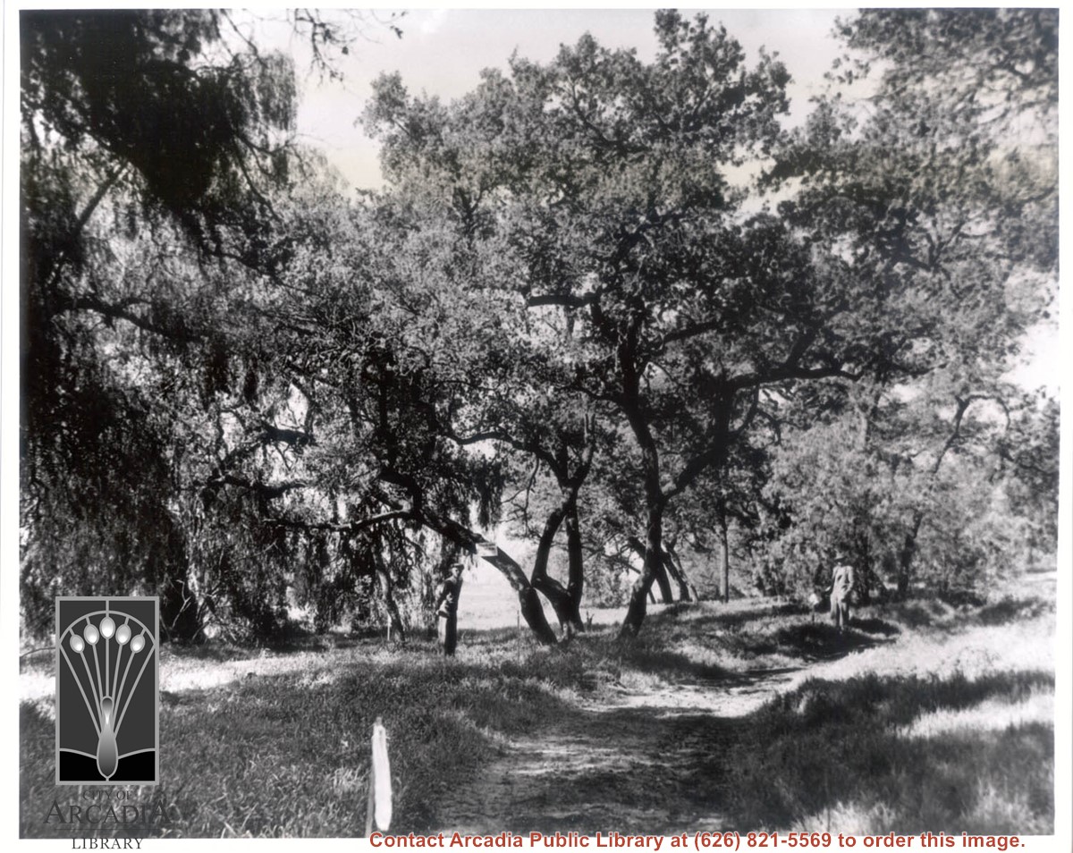
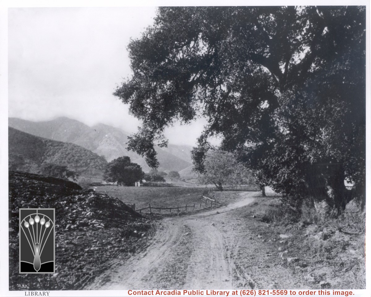
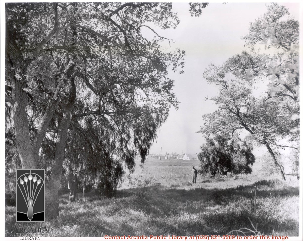
View toward the east believed to be from a point about at corner of present Santa Anita and Elkins Drive in the Highland Oaks area. The large canyon opening to left side of photo would be at mouth of Big Santa Anita. Large oak on right, dirt road, white building near center of photo.
https://arcadiahistory.andornot.com/en/permalink/photographs612
- Date
- c.1930
1 image
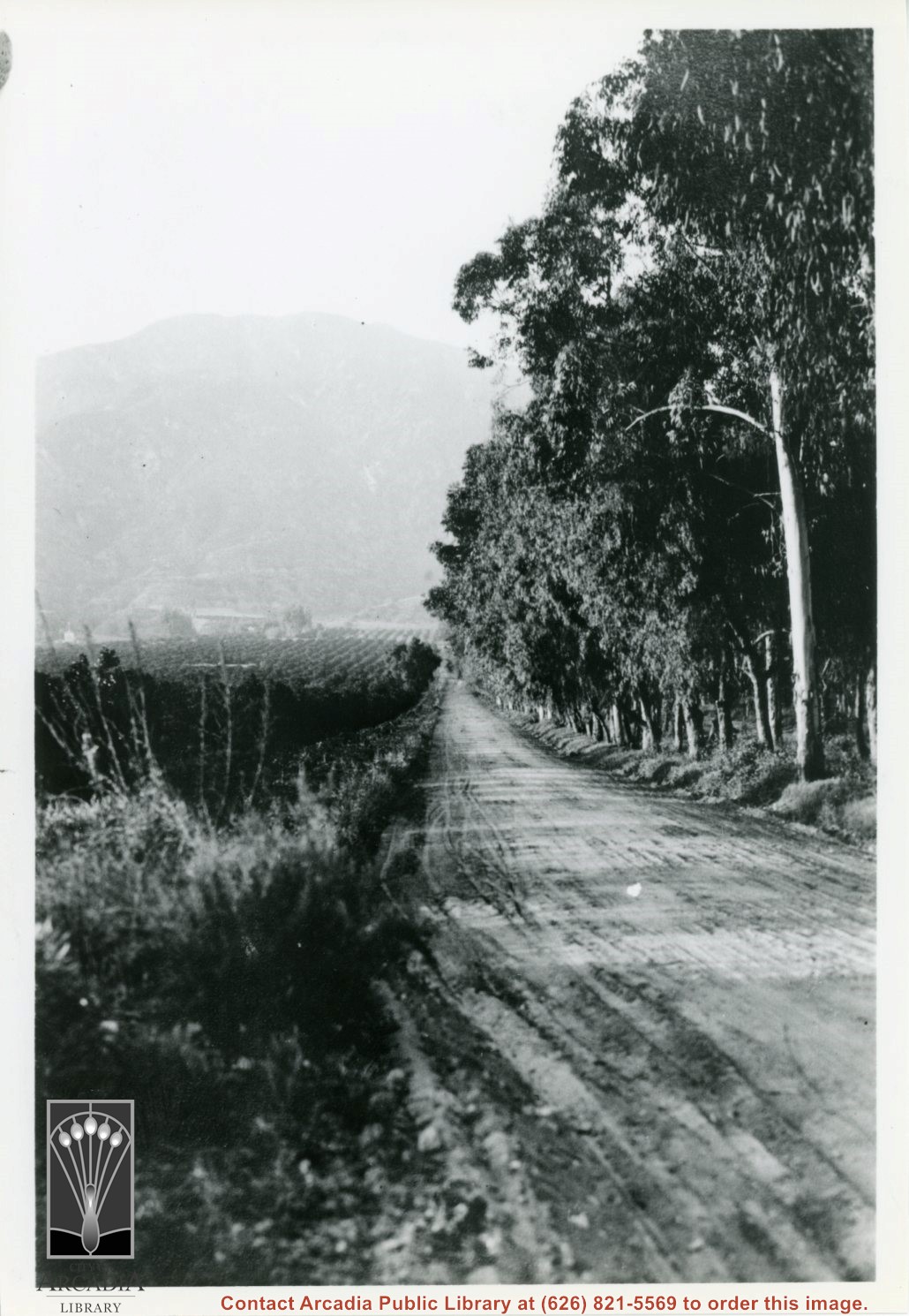
View north up Santa Anita Avenue with mountains in background. This photo was taken about where present Orange Grove Avenue intersects with Santa Anita Avenue. Note orange groves all along west side of Santa Anita as far as the mountains. Street is not paved.
https://arcadiahistory.andornot.com/en/permalink/photographs584
- Date
- 1916
1 image
- Date
- 1916
- Subjects
- Santa Anita Avenue
- Agriculture
- Physical Description
- 8x11 b&w
- ID
- 580
- Collection
- Photographs
Images
Looking east across Santa Anita Avenue to 110 N. Santa Anita Avenue at Arcadia Hay & Grain (owned in 1944 by M.F.Hartley). The Model Laundry just to the north, was a commercial linen supply and laundry. They are on present site of the Towne Center Building and The Great Scot Restaurant. (as of 1976)
https://arcadiahistory.andornot.com/en/permalink/photographs208
- Date
- c.1950s
1 image


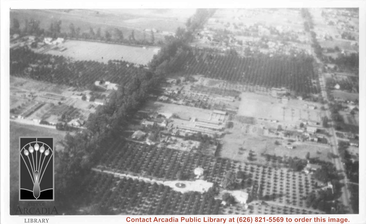
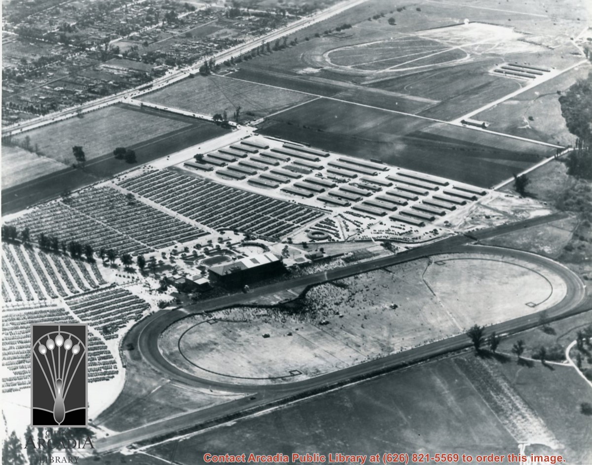
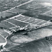
Aerial view north. Main tree-lined street is Santa Anita Avenue. Most of the orange grove in center of photo was owned by Jaspar Teague family. They had built a circular art gallery on their property at 1380 South Santa Anita Avenue. The large buildings north of Teague's and to the west of Santa Anita Avenue are chicken houses. Duarte Road is the east/west street across photo near top of photo.
https://arcadiahistory.andornot.com/en/permalink/photographs645
- Date
- November 1929
1 image
- Date
- November 1929
- Subjects
- Aerial Photo Collection
- Aerial views
- Agriculture
- Duarte Road
- Orange groves
- Poultry
- Santa Anita Avenue
- Teague, Jaspar
- Physical Description
- 6x10 b&w
- ID
- 641
- Collection
- Photographs
Images
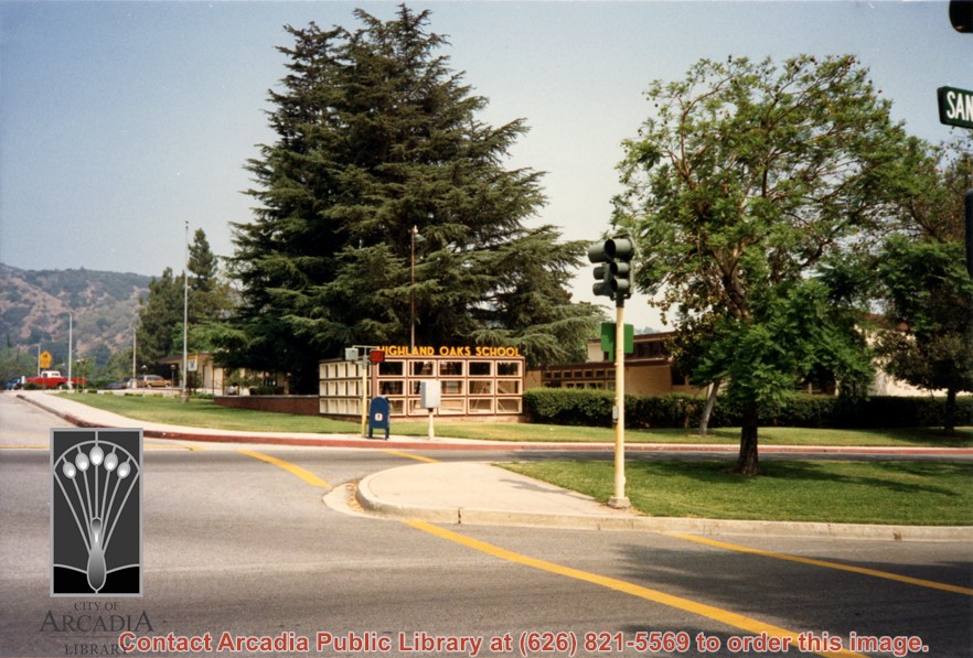
Highland Oaks Elementary School, 10 W. Virginia Road, corner of Santa Anita and Virginia.
https://arcadiahistory.andornot.com/en/permalink/photographs1195
- Date
- July 8, 1987
1 image
- Date
- July 8, 1987
- Subjects
- Highland Oaks Elementary School
- Physical Description
- 4x6 color
- ID
- 1186
- Collection
- Photographs
Images
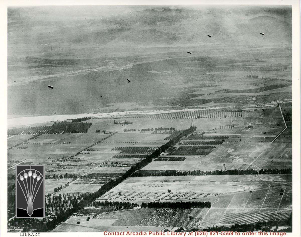
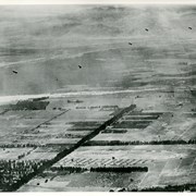
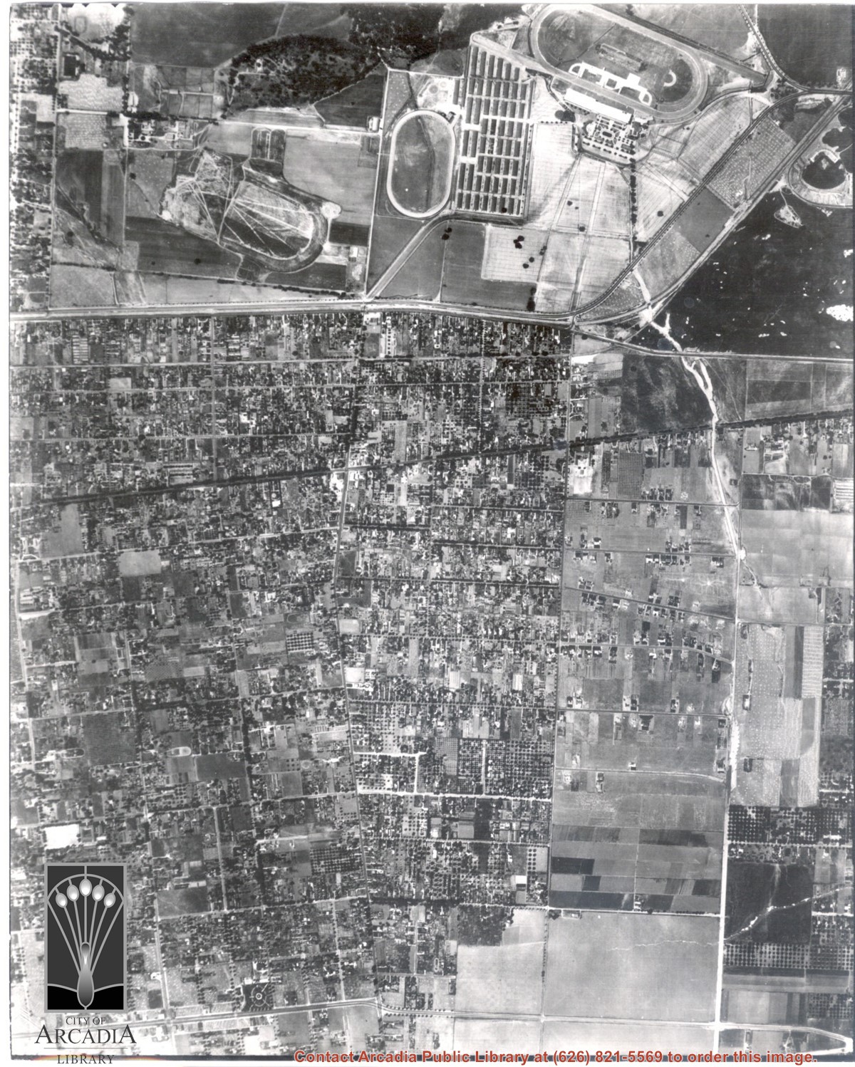
Aerial view toward the east taken from about over present Club House at Santa Anita Park Race Track. The main street running North/South is Santa Anita Avenue. View shows the oval of Elias J. "Lucky" Baldwin's race track in what is currently Arcadia County Park. The buildings would be barracks of Ross Field U.S. Army Balloon School. Duarte Road can be seen coming into photo at right edge of photo near intersection with Santa Anita Avenue. The broad street along left side would be Huntington Drive. Railroad tracks can be seen in lower left corner.
https://arcadiahistory.andornot.com/en/permalink/photographs635
- Date
- November 1929
1 image
- Date
- November 1929
- Subjects
- Aerial Photo Collection
- Aerial views
- Balloon School
- Huntington Drive
- Race tracks
- Railroads
- Santa Anita Avenue
- Physical Description
- 6x10 b&w
- ID
- 631
- Collection
- Photographs
Images
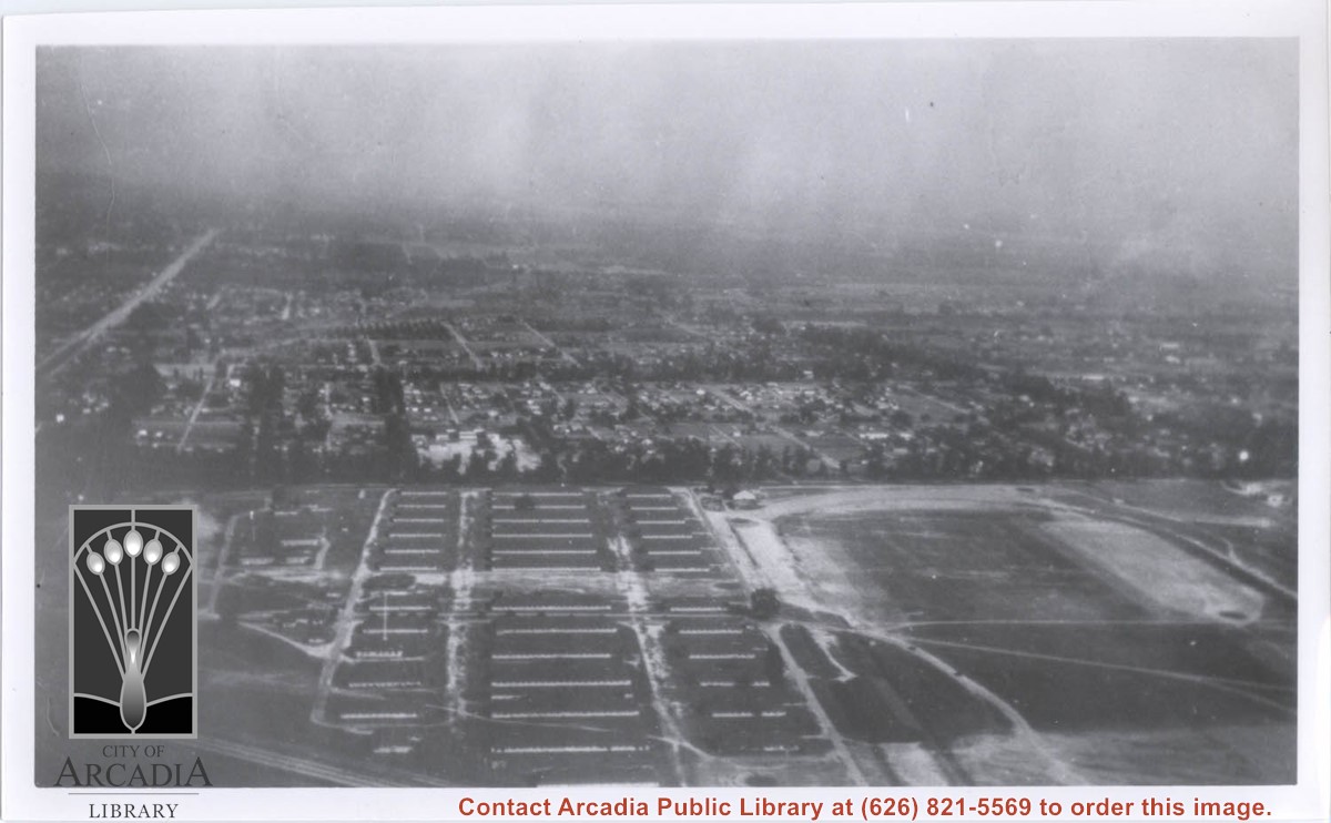

Aerial view south of Balloon School and surrounding part of valley. Large tree-lined street running from center of photo toward lower left edge of photo is Santa Anita. Tree-lined street coming in on right edge of photo about two inches from bottom of photo and intersecting Santa Anita, is Duarte Road. Note wash that at present is just west of Arcadia High School. Rio Hondo Wash runs east to west across middle of photo.
https://arcadiahistory.andornot.com/en/permalink/photographs153
- Date
- c.1918
1 image
- Date
- c.1918
- Subjects
- Aerial Photo Collection
- Aerial views
- U.S. Army Balloon School see Balloon School
- Balloon School
- Physical Description
- 8x10 b&w
- ID
- 152
- Collection
- Photographs
Images
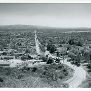
View looking south down Santa Anita Ave. from a point just where road starts up toward Chantry Flats. Note that eucalyptus trees have been removed from Santa Anita and present plantings are still very small. As of 1980, houses fill land shown in foreground of the photo.
https://arcadiahistory.andornot.com/en/permalink/photographs909
- Date
- c.1960
1 image
- Date
- c.1960
- Subjects
- Santa Anita Avenue
- Physical Description
- 8x10 b&w
- ID
- 902
- Collection
- Photographs
Images

Aerial view looking west across Santa Anita Park from a position about Santa Anita Avenue just north of Huntington Drive. In the upper right portion of the photo can be seen the extensive earthwork done for the track Anita Baldwin and Joe Smoot planned to build. That vast area now is entirely built with homes and apartments and is called Santa Anita Village. Present-day Baldwin Avenue would follow the line shown by the Ranch Road bisecting the photo from right to left just east of the track abandoned by Anita Baldwin and Joe Smoot.
https://arcadiahistory.andornot.com/en/permalink/photographs985
- Date
- c.1934
1 image
Dark, tree-lined street completely bisecting photo from west to east just above, is Duarte Road. Santa Anita Park Race Track is at upper right edge of photo. Smaller oval nearby is a training track. The incomplete oval in upper left is the race track that Anita Baldwin and Joe Smoot attempted to build in 1933 but abandoned the project. Huntington Drive and Colorado Place form a "y" just east of Santa Anita Park Race Track. Note grove of olive trees on land where City Hall is located today (240 W. Huntington Drive, Arcadia). Baseball diamond in upper right corner of photo, just below the convergence of the "y" is at Arcadia County Park. Corrected description as of 11/04/2008.
https://arcadiahistory.andornot.com/en/permalink/photographs621
- Date
- June 5, 1938
1 image
- Date
- June 5, 1938
- Subjects
- Aerial Photo Collection
- Aerial views
- Colorado Place
- Duarte Road
- Los Angeles Jockey Club
- Santa Anita Park-1934-1942
- Physical Description
- 8x10 b&w
- ID
- 617
- Collection
- Photographs
Images
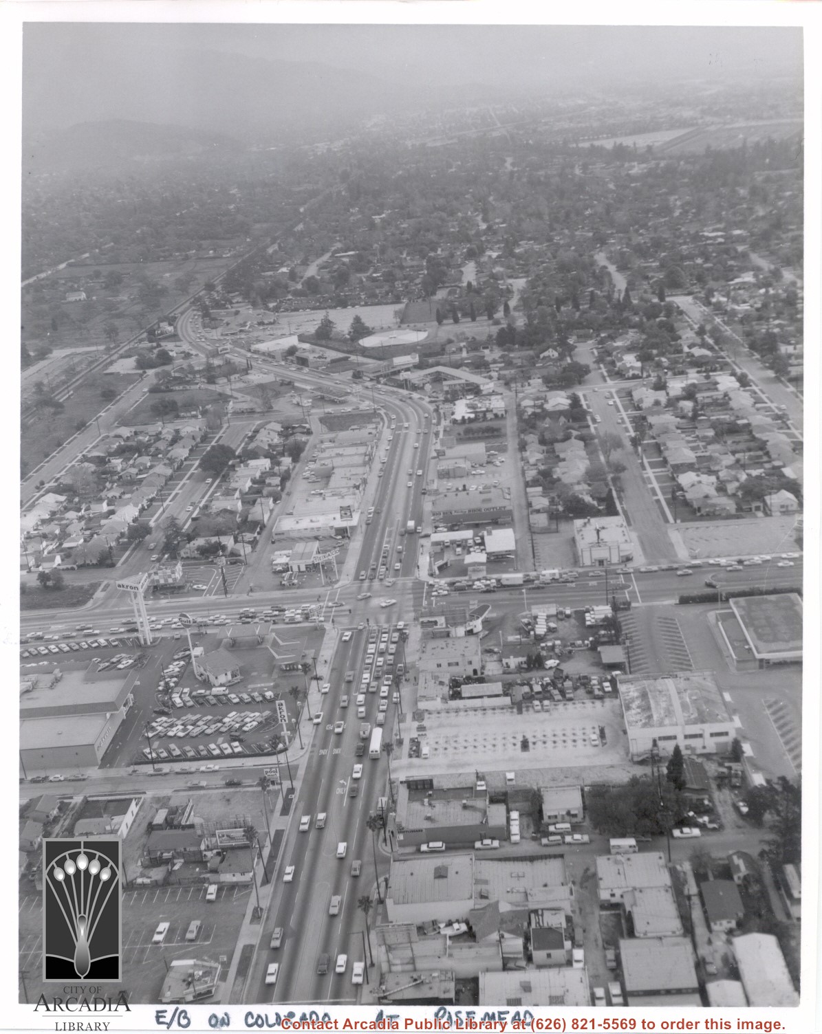
Aerial view looking east into Arcadia from near intersection of Rosemead Boulevard and Colorado Boulevard. Eaton's Santa Anita Hotel and Restaurant is still seen at far end of curve on south side of Colorado Boulevard and Michillinda Avenue (this is present site of Coco's Restaurant and Oak Tree Banquet Room, formerly Reuben's Restaurant, address 1150 W. Colorado Boulevard). The Santa Fe Railroad Tracks are seen just north of Colorado Boulevard. Large clear area in upper right portion of photo is Santa Anita Park Race Track.
https://arcadiahistory.andornot.com/en/permalink/photographs638
- Date
- c.1970
1 image
- Date
- c.1970
- Subjects
- Aerial Photo Collection
- Aerial views
- Colorado Boulevard
- Colorado Street
- Eaton's Santa Anita Hotel and Restaurant (1939-1969)
- Michillinda Avenue
- Railroads
- Santa Anita Park-1945-1980
- Physical Description
- 8x10 b&w
- ID
- 634
- Collection
- Photographs
Images
Baldwin Ranch groves looking north toward mountains. Also in photo is wooden irrigating trough on right, and a two-horse team hitched to light wagon, also a single horse with rider. It appears that present-day Henniger Flats is high flat mountain just above and to the left of the road. Also Hastings Ranch area would be low foothills. This photo belongs to the Huntington Library. It is shown here for research only.
https://arcadiahistory.andornot.com/en/permalink/photographs146
- Date
- c.1890's
1 image
- Date
- c.1890's
- Subjects
- Rancho Santa Anita
- Baldwin Ranch
- Physical Description
- 8x10 b&w
- ID
- 145
- Collection
- Photographs
Images
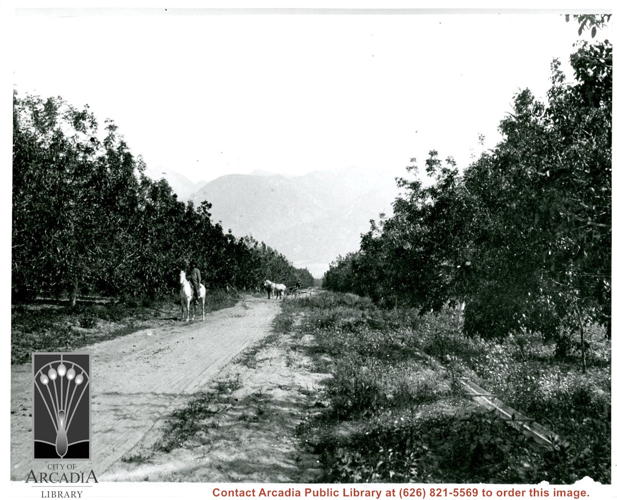
Photo of Rancho Santa Anita with one man standing near an oak tree on left and another man standing to the right. Houses are visible in the background. The men appear to be the same as in photos #1541 and 1542. Handwritten note on back reads, "Showing where proposed road turns from so. slope knoll towards south."
https://arcadiahistory.andornot.com/en/permalink/photographs1553
- Date
- probably March 24, 1943 (see photo #1541)
1 image
- Date
- probably March 24, 1943 (see photo #1541)
- Subjects
- Rancho Santa Anita Inc.
- Tallac Knoll
- Physical Description
- 8x10 b&w
- ID
- 1540
- Collection
- Photographs
Images
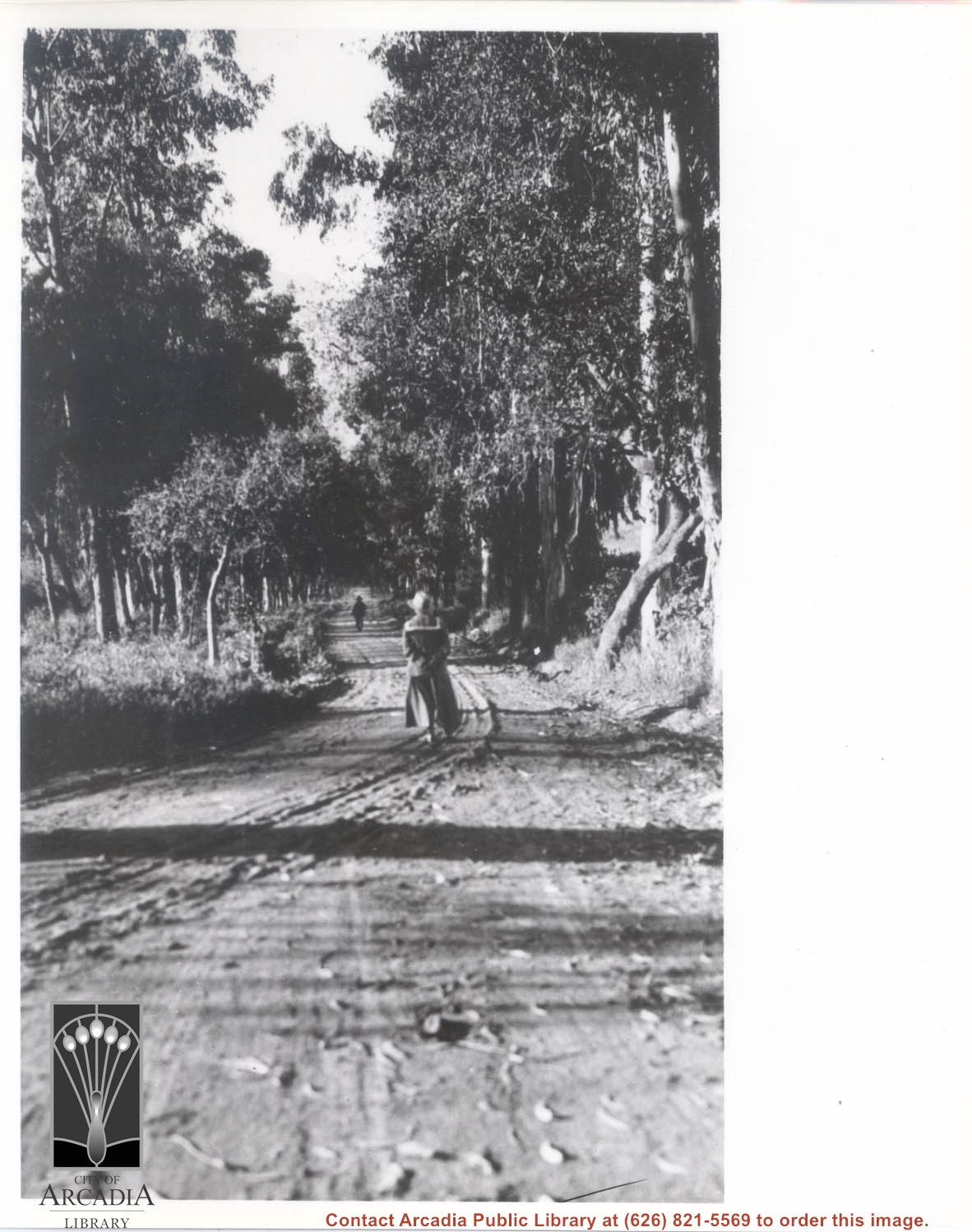
Looking north up Santa Anita Ave near its intersection with Orange Grove Avenue. Note it is still a dirt road at this time. There is a young lady with long two-piece suit with a sailor collar (back to camera) and farther up the Avenue, a man is seen.
https://arcadiahistory.andornot.com/en/permalink/photographs1078
- Date
- c.1916
1 image
- Date
- c.1916
- Subjects
- Santa Anita Avenue
- Physical Description
- 8x10 b&w
- ID
- 1069
- Collection
- Photographs
Images

Santa Anita Park Race Track just right of center at south edge of photo. Oval to the left of Santa Anita Park Race Track was training track which was removed to make room for Santa Anita Fashion Park (currently Westfield Santa Anita Shopping Mall). Street just to left of training track is Baldwin Avenue. Huntington Drive and Colorado Place form a "y" just east of Santa Anita Park Race Track. Along both can be noticed the conifer trees planted a few years earlier. Street completely bisecting photo just below center is Foothill Boulevard, next one is Orange Grove Avenue. Santa Anita Avenue is partially in view on right edge of photo. Oval on extreme lower left side of photo is old Baldwin training track. Baseball diamond in lower right corner is at Arcadia County Park. Scale: 1"=660'
https://arcadiahistory.andornot.com/en/permalink/photographs620
- Date
- June 5, 1938
1 image
- Date
- June 5, 1938
- Subjects
- Aerial Photo Collection
- Aerial views
- Baldwin Avenue
- Colorado Boulevard
- Colorado Place
- Colorado Street
- Foothill Boulevard
- Huntington Drive
- Orange Grove Avenue
- Santa Anita Fashion Park (later known as Westfield Santa Anita)
- Santa Anita Park-1934-1942
- Physical Description
- 8x10 b&w
- ID
- 616
- Collection
- Photographs
Images


Photo taken at Rancho Santa Anita with three oak trees in center and one man on either side looking toward camera. Same men appear to be in photos #1540 and 1542. Handwritten note, "Showing three pronged oak where road takes a turn to so. west."
https://arcadiahistory.andornot.com/en/permalink/photographs1551
- Date
- c. 1943
1 image
- Date
- c. 1943
- Subjects
- Rancho Santa Anita Inc.
- Physical Description
- 8x10 b&w
- ID
- 1541
- Collection
- Photographs
Images