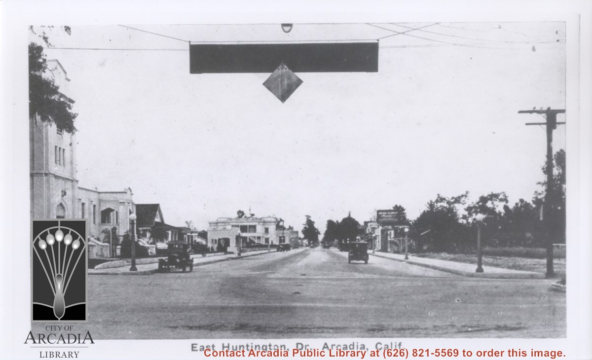
View east on Huntington Drive from intersection with First Avenue. In the distance can be seen a railroad crossing marker which was for the Santa Fe Line (which is now serviced with an overpass of Huntington Dr.). Building at extreme left is Bank of Italy Building on N.E. corner of First and Huntington Dr.
https://arcadiahistory.andornot.com/en/permalink/photographs204
- Date
- 1927
1 image
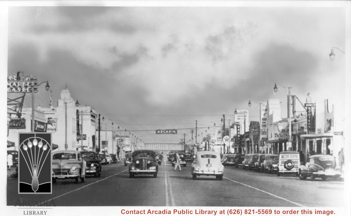
View east on Huntington Drive from near intersection with Santa Anita. Old City Hall was still at NW corner of Huntington Drive and First at this time. Theater which was on south side appears to be gone. Seeley's Jewelers is in 1948 City Directory, but not 1944 City Directory.
https://arcadiahistory.andornot.com/en/permalink/photographs603
- Date
- c. mid-1940's
1 image

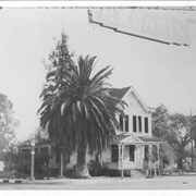
The Hiram Unruh home located on SE corner of First Avenue and Huntington Drive. This view is looking SE from center of Huntington Drive. Overhead is highway sign (also referred to as a "Welcome" sign) which hung over this intersection reading: ARCADIA.
https://arcadiahistory.andornot.com/en/permalink/photographs962
- Date
- c.1927 or 1928 or 1933 (see VF Historic Houses Item #6)
1 image
- Date
- c.1927 or 1928 or 1933 (see VF Historic Houses Item #6)
- Physical Description
- 8x10 b&w
- ID
- 956
- Collection
- Photographs
Images

View east on Huntington Drive from intersection of Santa Anita Avenue and Huntington Drive. Community Church on NE corner was moved in 1934 to S. First Street and became Arcadia Presbyterian Church. Two storied building on NW corner was City Hall. Large sign on south side may say: Arcadia Pharmacy.
https://arcadiahistory.andornot.com/en/permalink/photographs585
- Date
- c.1923
1 image
View west on Huntington Drive clearly showing Drive-In Markets which were located around service station on SW corner of First and Huntington Drive. Moving picture theater is mid-way in block on south side of street. Church with tower on NE corner of Huntington Drive and Santa Anita Avenue was moved to South First Avenue about 1935.
https://arcadiahistory.andornot.com/en/permalink/photographs600
- Date
- c.1934
1 image
- Date
- c.1934
- Subjects
- Huntington Drive
- Gas stations
- Restaurants-The Pines Cafe
- Arcadia Community Church
- John C. Baldwin Gas Station
- City Hall
- Physical Description
- 32x9 panorama on 2 pieces
- ID
- 596
- Collection
- Photographs
Images
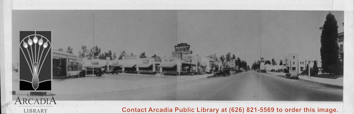
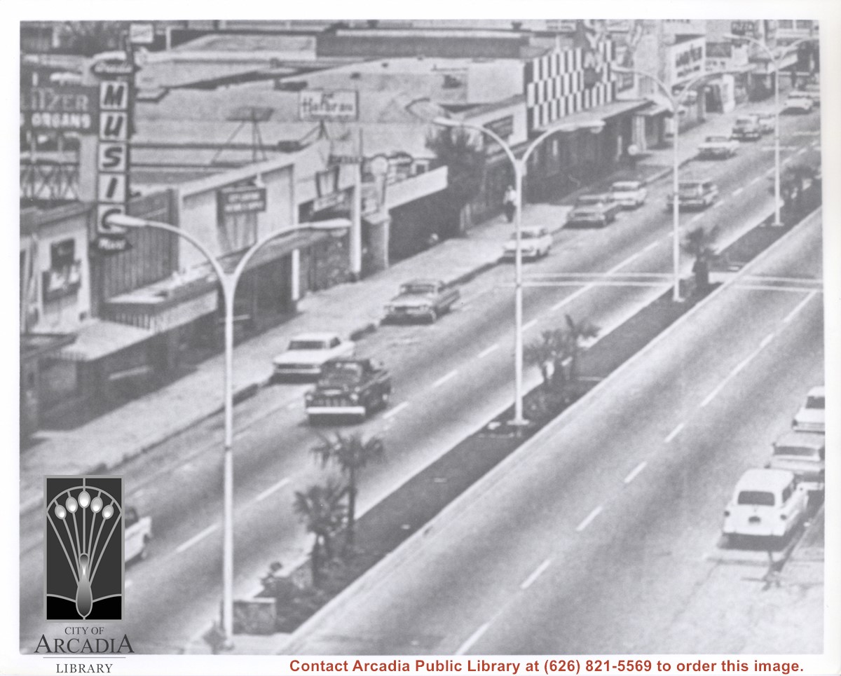
Photo taken from above Huntington Drive looking NE at the block between Santa Anita and First Avenue. Only the Music Mart shows clearly enough to identify.
https://arcadiahistory.andornot.com/en/permalink/photographs1109
- Date
- c.1973
1 image
- Date
- c.1973
- Subjects
- Huntington Drive
- Physical Description
- 8x10 b&w (poor quality)
- ID
- 1100
- Collection
- Photographs
Images
Santa Fe Railroad tracks cut diagonally across photo from east to west. Huntington Drive bisects photo from east to west approximately at center of photo. Arcadia County Park appears in lower left corner, showing baseball diamond. Santa Anita Wash is shown on right side of photo.
https://arcadiahistory.andornot.com/en/permalink/photographs625
- Date
- c. early 1950's
1 image
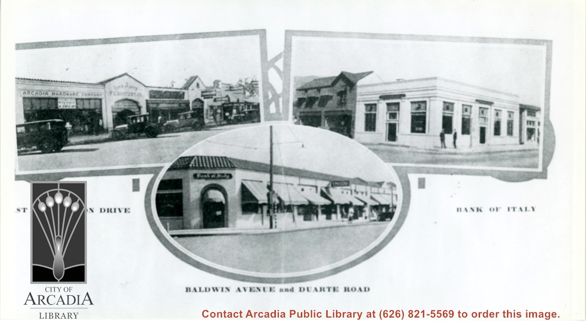
Three views of business areas in Arcadia. On left is south side of Huntington Drive. Arcadia Hardware is still located at 52 E. Huntington Drive as it is shown here. On the right is the Bank of Italy which was located on NE corner of Huntington Drive and First Ave. The building just to the north up First Ave (with awnings) is also still in use.
https://arcadiahistory.andornot.com/en/permalink/photographs896
- Date
- 1928
1 image
- Date
- 1928
- Subjects
- Business & industry
- Huntington Drive
- Baldwin Avenue
- Bank of Italy National Trust Savings
- Arcadia Hardware
- Physical Description
- 5 1/2 x 10 b&w
- ID
- 889
- Collection
- Photographs
Images
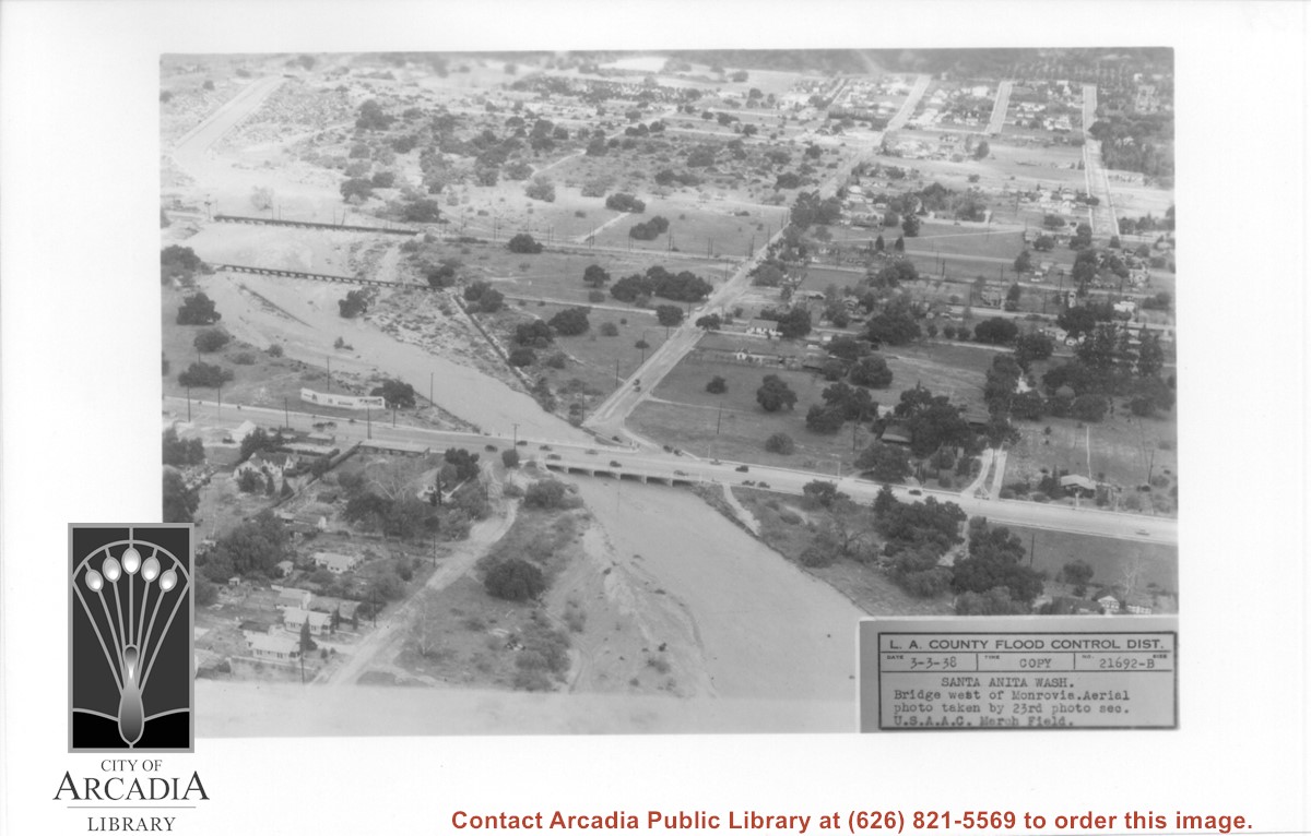
Aerial view looking north over flooded Santa Anita Wash looking upstream. Street cutting across photo closest to bottom is Huntington Drive. The next crossing upstream carries Santa Fe Railroad track. The last crossing that is clearly visible is Pacific Electric Railroad bridge. North/south street crossing Huntington Drive nearest wash would be Fifth Avenue. Foothill Boulevard is just barely visible near top of photo.
https://arcadiahistory.andornot.com/en/permalink/photographs815
- Date
- March 3, 1938
1 image
- Date
- March 3, 1938
- Subjects
- Aerial Photo Collection
- Aerial views
- Fifth Avenue
- Flood control
- Foothill Boulevard
- Huntington Drive
- Railroads
- Santa Anita Wash
- Physical Description
- 5x7 b&w
- ID
- 809
- Collection
- Photographs
Images
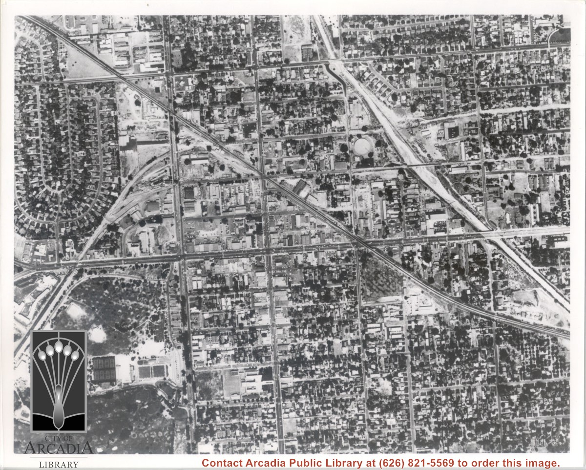
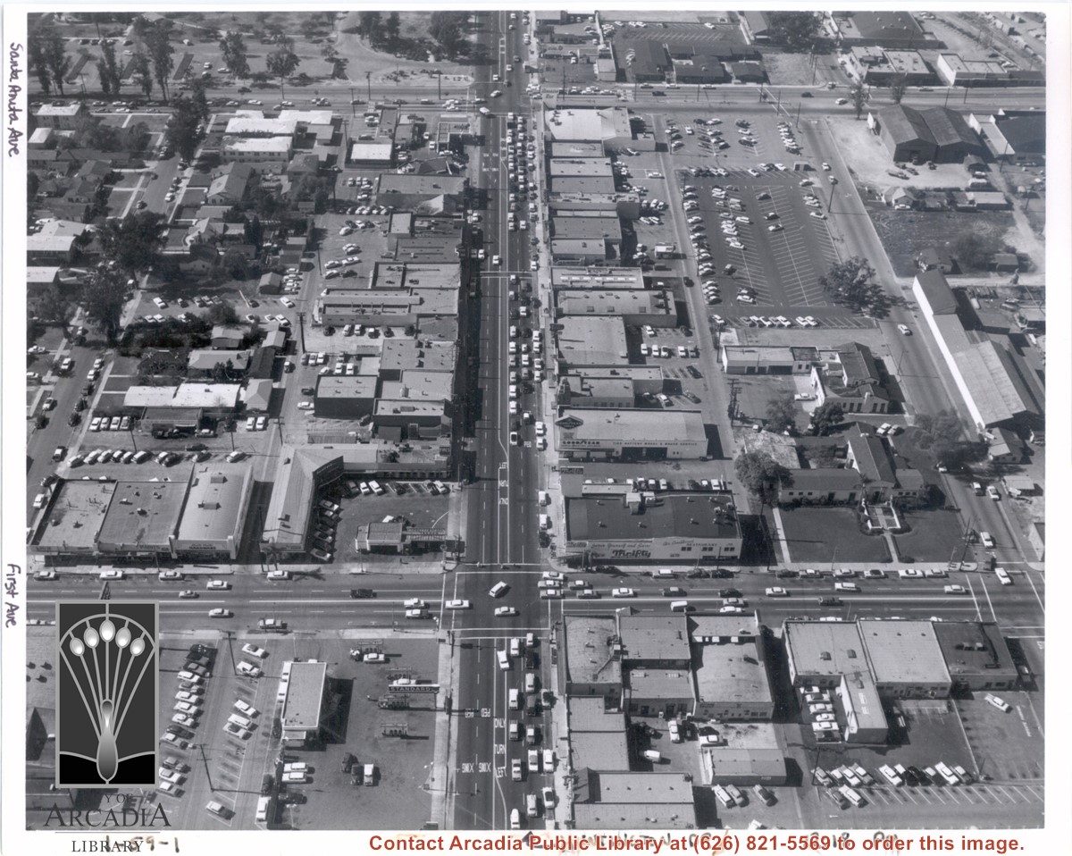
Aerial view from above Huntington Drive between Santa Anita Avenue and First Avenue. Huntington Drive intersects the photo from north to south. The street closest to the bottom is First Avenue and Santa Anita Avenue is near the top.
https://arcadiahistory.andornot.com/en/permalink/photographs1403
- Date
- c.1959
1 image
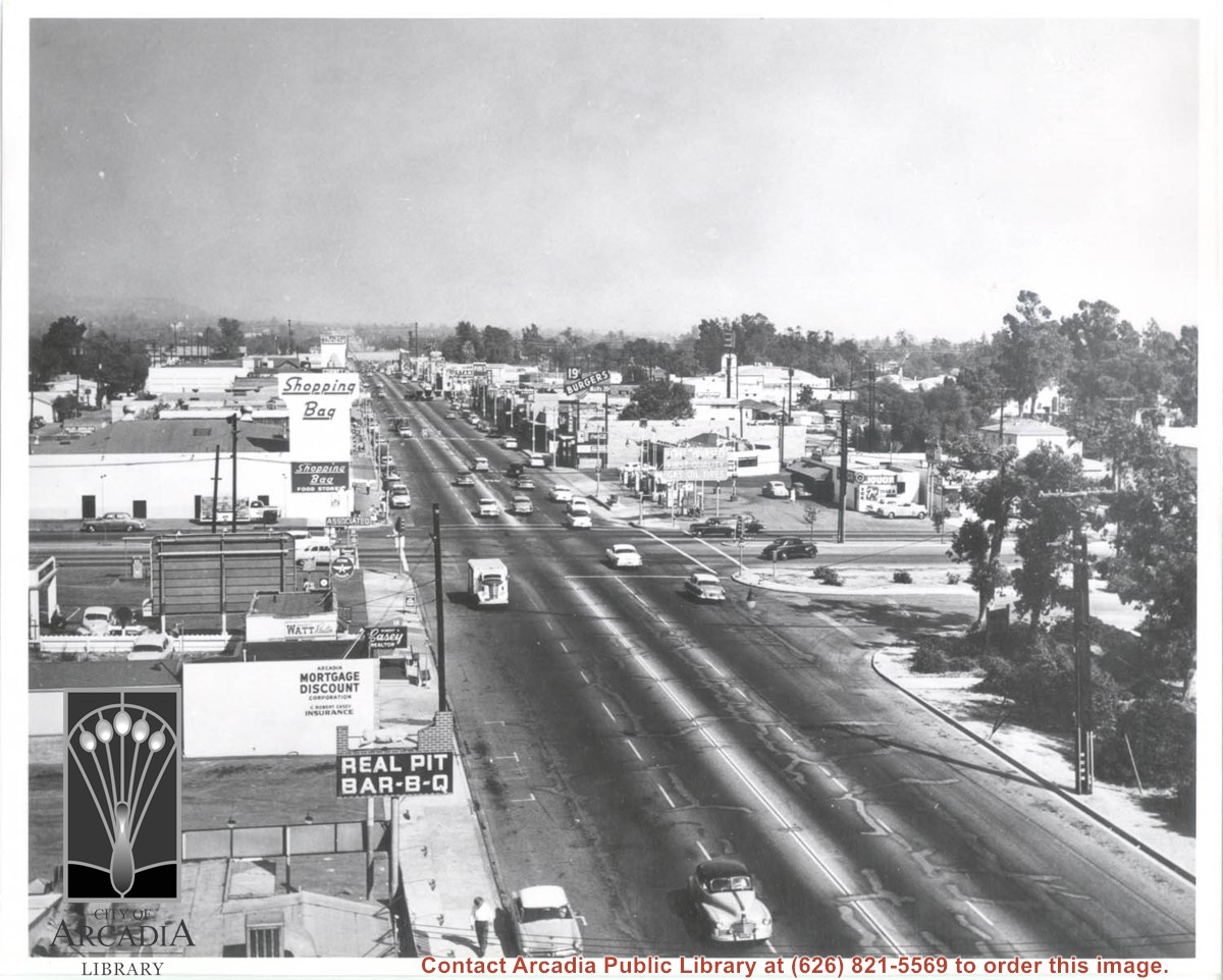
View east on Huntington Drive from a position west of Santa Anita Avenue. Shopping Bag Market is on northeast corner of this intersection (Currently, the site of a Denny's Restaurant, noted 6/19/2013). Pine's Cafe was still located near the SW corner of Huntington Drive and First Avenue. A sign reading "19 cent Burger" in the middle is prominent, as if "Real Pit Bar-B-Q" on the left.
https://arcadiahistory.andornot.com/en/permalink/photographs643
- Date
- c. 1957
1 image
Aerial view south on Colorado Street just over large turn to the west. The residential area known as Santa Anita Gardens shows along upper left section of photo. Note that the only commerical development along the north side of Colorado Street is the Westerner Motel just near intersection with Huntington Drive. Santa Fe Railroad tracks are seen in lower left corner of photo. Santa Anita Park Race Track is on right.
https://arcadiahistory.andornot.com/en/permalink/photographs641
- Date
- c. 1956
1 image
- Date
- c. 1956
- Subjects
- Aerial Photo Collection
- Aerial views
- Colorado Boulevard
- Colorado Street
- Huntington Drive
- Railroads
- Santa Anita Park-1945-1980
- Westerner Motel
- Physical Description
- 8x10 b&w
- ID
- 637
- Collection
- Photographs
Images
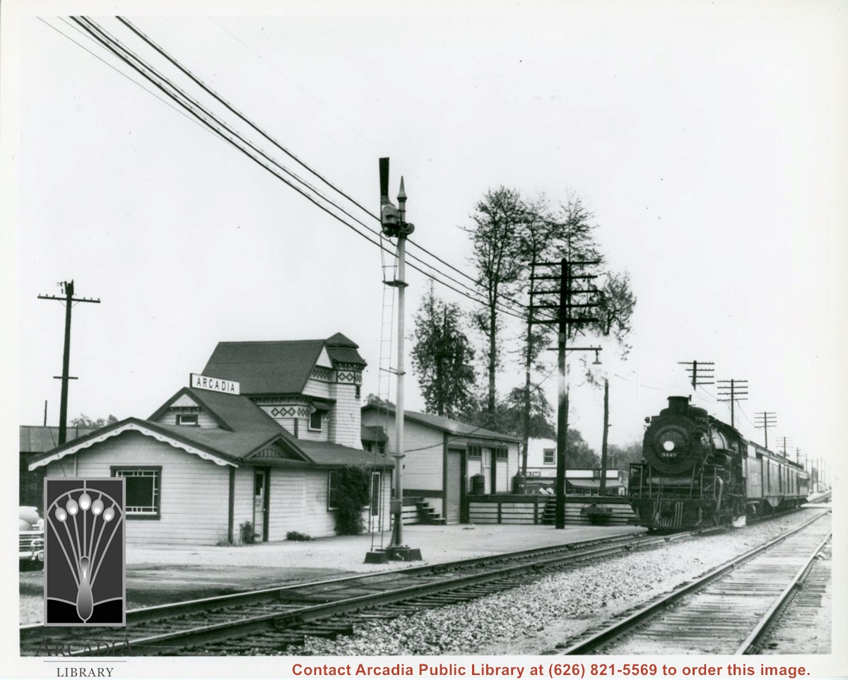
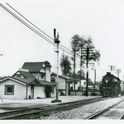
View toward east of Arcadia Santa Fe Station. There is a train on the track in front of station. A white building on east side of First Avenue next to the tracks is also partially visible between station and train.
https://arcadiahistory.andornot.com/en/permalink/photographs516
- Date
- April 1950
1 image
Looking east on Huntington Drive from intersection at First Avenue. Two men on south side of Huntington are not identified. Seven automobiles are seen on street. Building on NE corner is First National Bank or possibly by this time has been taken over by Bank of Italy. Man standing in front of bank, is Dick Hornie. Part of panorama, ID#s 916-921.
https://arcadiahistory.andornot.com/en/permalink/photographs927
- Date
- 1927
- Date
- 1927
- Subjects
- Huntington Drive
- Hornie, Dick
- Physical Description
- 7x10 b&w part of panorama
- ID
- 920
- Collection
- Photographs
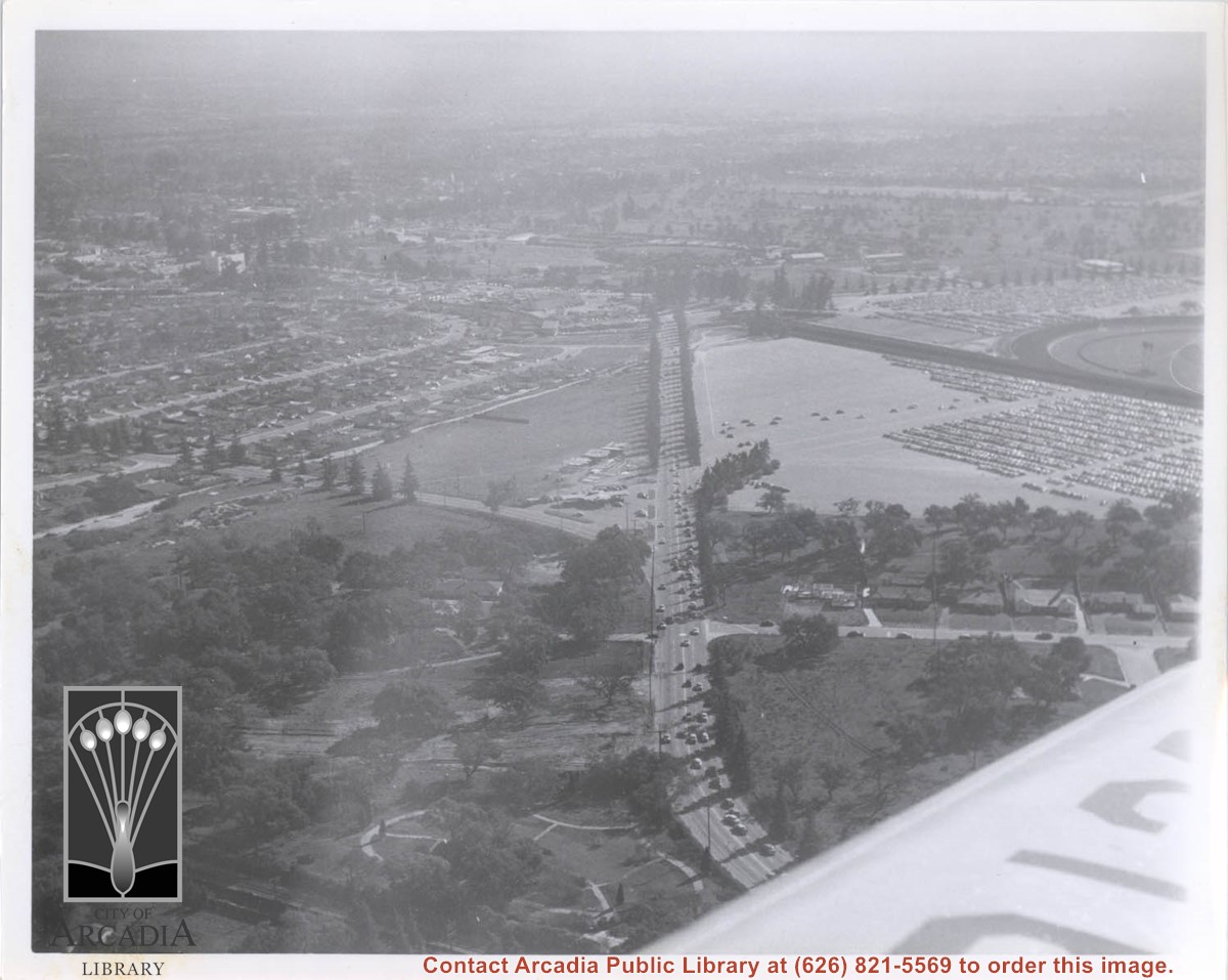
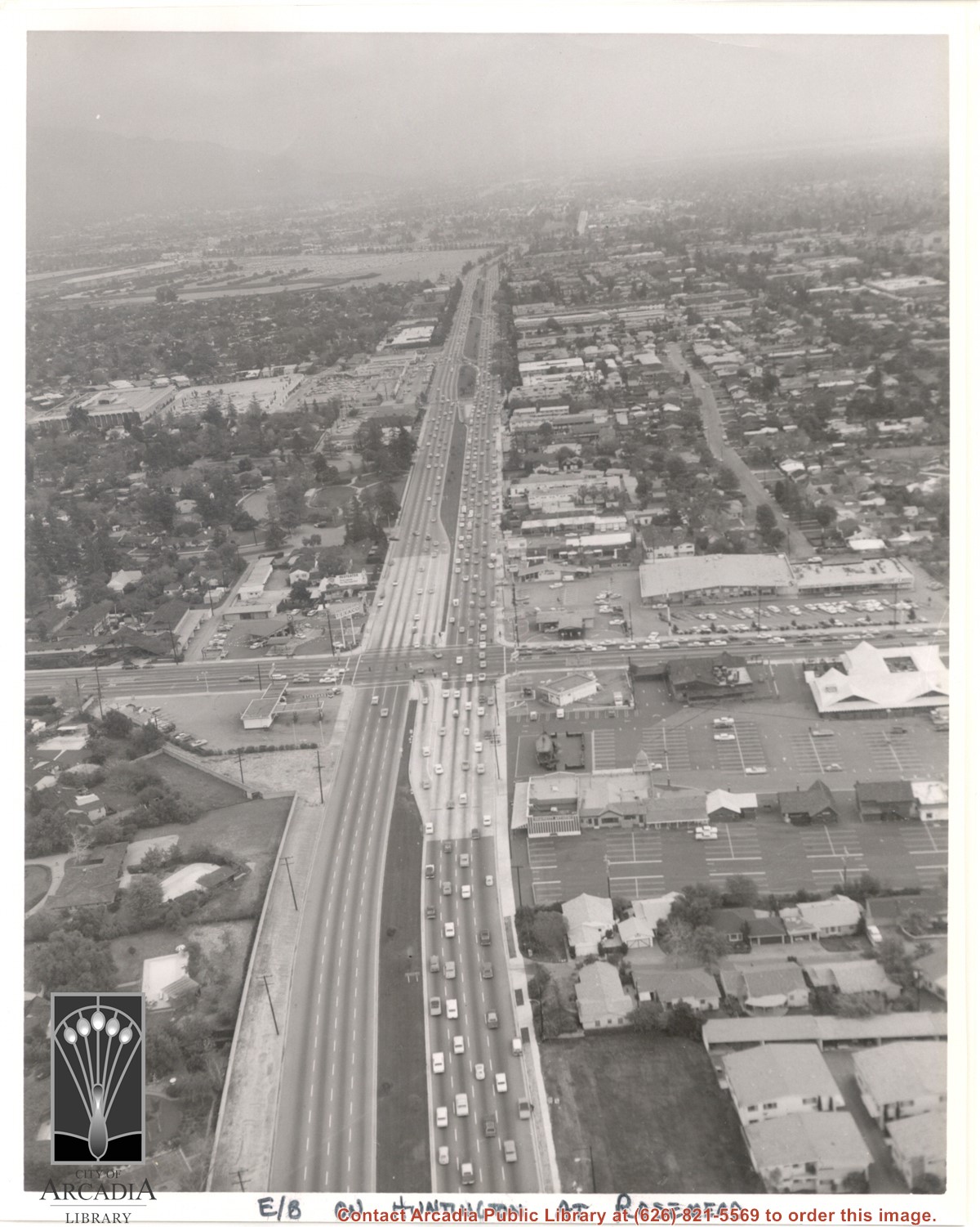
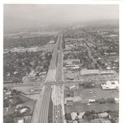
Aerial view east on Huntington Drive toward Arcadia from a position just west of Rosemead Boulevard. El Rancho Shopping Center and May Company Department Store can be seen as the business complex on the north side of Huntington Drive one block east of Rosemead Boulevard. Santa Anita Park Race Track can be seen on the left in upper portion of photo.
https://arcadiahistory.andornot.com/en/permalink/photographs637
- Date
- c.1970
1 image
- Date
- c.1970
- Subjects
- Aerial Photo Collection
- Aerial views
- El Rancho Shopping District
- Huntington Drive
- May Company Department Store
- Santa Anita Park-1945-1980
- Physical Description
- 8x10 b&w
- ID
- 633
- Collection
- Photographs
Images
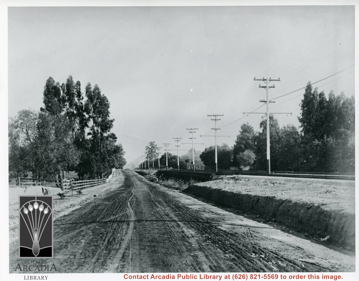
View west, probably from a point about 1/4 mile west of Rosemead, on what is presently Huntington Drive. Street is dirt. There are railroad tracks along the right belonging to San Gabriel Railroad. There is a row of white power poles along side of tracks.
https://arcadiahistory.andornot.com/en/permalink/photographs581
- Date
- c.1895
1 image
- Date
- c.1895
- Subjects
- Huntington Drive
- Railroads
- Physical Description
- 8x10 b&w
- ID
- 577
- Collection
- Photographs
Images
Huntington Bank on First Avenue between Wheeler and Santa Clara Streets. Former site of Oakwood Hotel.
https://arcadiahistory.andornot.com/en/permalink/photographs1237
- Date
- 1979
1 image
- Date
- 1979
- Subjects
- Huntington Bank
- Oakwood Hotel
- Physical Description
- 4x5 color
- ID
- 1228
- Collection
- Photographs
Images
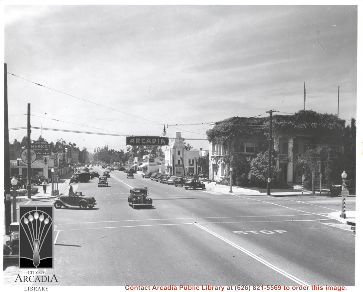
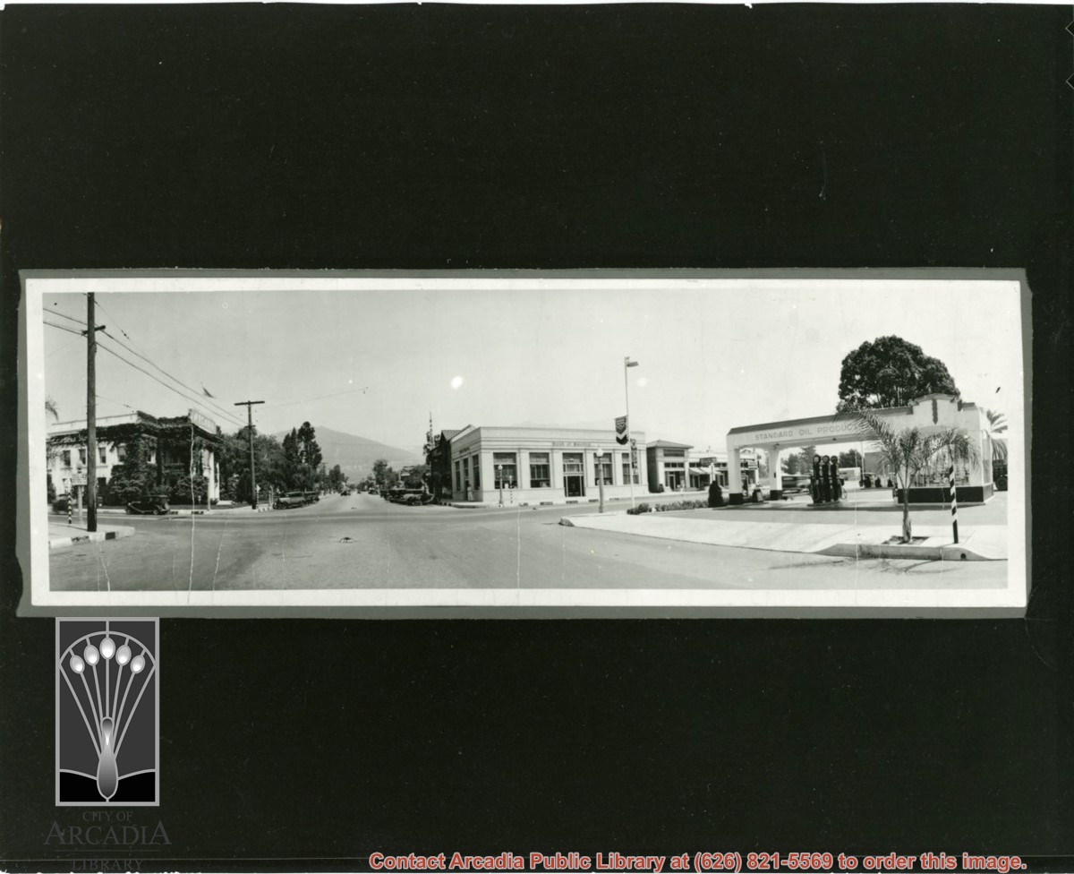
View looking north from intersection of Huntington Drive and First Avenue. Old City Hall is on the NW corner with quite a bit of ivy growing on the walls. There is a Standard Oil gas station on the SE corner. There is a stop sign in the middle of First Avenue.
https://arcadiahistory.andornot.com/en/permalink/photographs863
- Date
- probably 1920's
1 image
- Date
- probably 1920's
- Physical Description
- 8x24 original 3x9 copy print
- ID
- 857
- Collection
- Photographs
Images
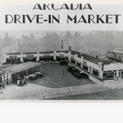
View south, perhaps from top of City Hall on Corner of First and Huntington Drive, to Arcadia Drive-In Market. Located on SW corner of the same intersection there was, in addition to the Service Station, a dry cleaners, a bakery, a fresh vegetable market, a meat market, a grocery store, and the Pines Cafe. First Avenue is street seen on the left.
https://arcadiahistory.andornot.com/en/permalink/photographs899
- Date
- Market opened 1929
1 image
- Date
- Market opened 1929
- Physical Description
- 6 1/2 x 10 b&w
- ID
- 892
- Collection
- Photographs
Images

Huntington Drive looking west from near intersection of First Avenue. On NW corner is vine-covered City Hall. Open roadster has just made a left turn and is going south on First. There is a moving picture theater mid-way along street on south side with large banner advertising Charles Laughton Film. This photo belongs to the Huntington Library. It is shown here for research only.
https://arcadiahistory.andornot.com/en/permalink/photographs594
- Date
- 1938
1 image