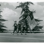
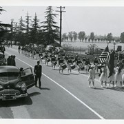
Three uniformed young men carrying large American flag at Peach Blossom Festival Parade as it passes in front of Santa Anita Race Track parking lot.
https://arcadiahistory.andornot.com/en/permalink/photographs428
- Date
- c.1950
1 image
- Date
- c.1950
- Subjects
- Peach Blossom Festival
- Physical Description
- 4x6 b&w
- ID
- 426
- Collection
- Photographs
Images

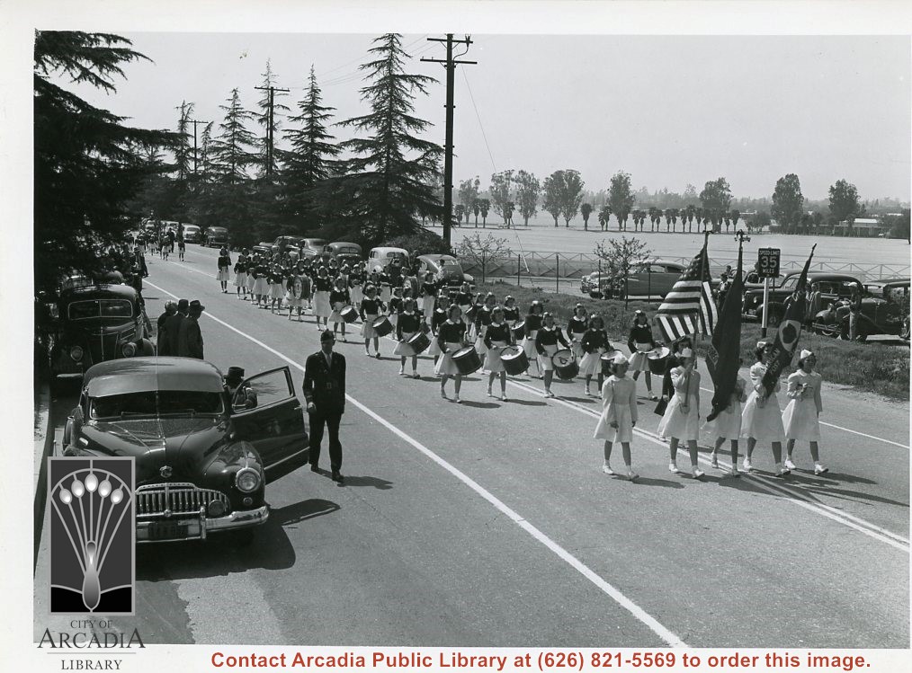
What appears to be an American Legion Girl's Drum & Bugle Corps marching on Huntington Drive near Santa Anita Race Track parking lot during Peach Blossom Festival.
https://arcadiahistory.andornot.com/en/permalink/photographs373
- Date
- March 1949
1 image
- Date
- March 1949
- Subjects
- Peach Blossom Festival
- Physical Description
- 5x7 b&w
- ID
- 371
- Collection
- Photographs
Images
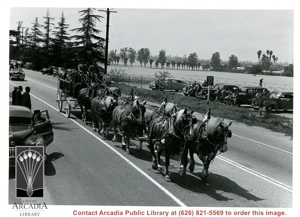
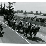
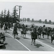
Wagon pulled by eight horses in parade on Huntington Drive to celebrate Peach Blossom Festival. Location of team is on Huntington Drive near Santa Anita parking lot near Club House.
https://arcadiahistory.andornot.com/en/permalink/photographs370
- Date
- probably March 1949
1 image
- Date
- probably March 1949
- Subjects
- Peach Blossom Festival
- Physical Description
- 5x7 b&w
- ID
- 368
- Collection
- Photographs
Images
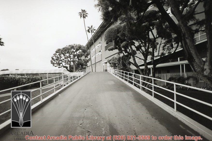
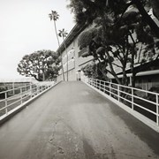
Walkway up to Santa Anita Park. Photo by Terry Miller.
https://arcadiahistory.andornot.com/en/permalink/photographs2358
- Date
- 2001
1 image
- Date
- 2001
- Subjects
- Santa Anita Park (2001-2010)
- Physical Description
- 4x6 b&w
- ID
- 2252C
- Collection
- Photographs
Images
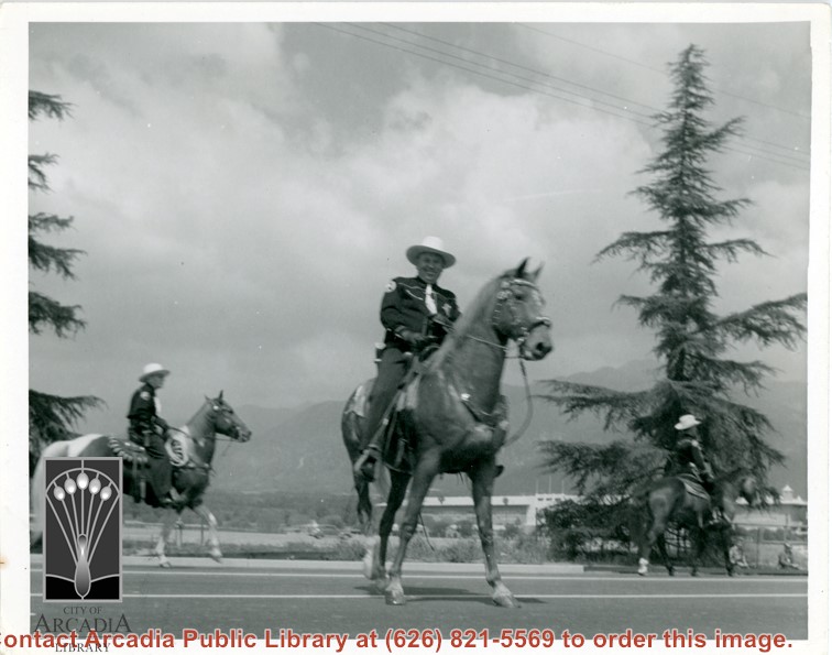
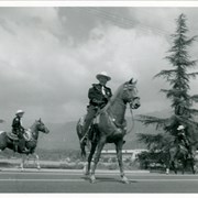
View north across Santa Anita Race Track parking lot toward San Gabriel Mountains with three members of Los Angeles County Sheriff's Posse mounted for Peach Blossom Festival.
https://arcadiahistory.andornot.com/en/permalink/photographs427
- Date
- c.1950
1 image
- Date
- c.1950
- Subjects
- Peach Blossom Festival
- Physical Description
- 4x6 b&w
- ID
- 425
- Collection
- Photographs
Images
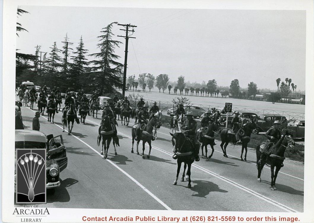
Mounted unit of about 31 men on Huntington Drive near Santa Anita Race Track Club House during parade for Peach Blossom Festival.
https://arcadiahistory.andornot.com/en/permalink/photographs371
- Date
- March 1949
1 image
- Date
- March 1949
- Subjects
- Peach Blossom Festival
- Physical Description
- 5x7 b&w
- ID
- 369
- Collection
- Photographs
Images
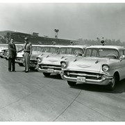
Captain Jim Hayes taking delivery of a new fleet of 1957 Chevrolet police cars. Santa Anita Park's grandstand is in the background.
https://arcadiahistory.andornot.com/en/permalink/photographs2111
- Date
- 1957
1 image
- Date
- 1957
- Subjects
- Arcadia Police Department
- Hayes, Jim
- Physical Description
- 8 x 10 b&w
- ID
- 2090
- Collection
- Photographs
Images

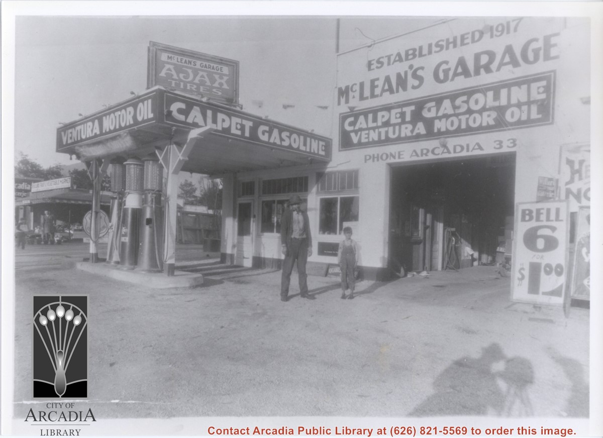
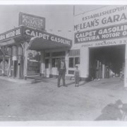
View looking east toward McLean's Garage located at 808 S. Santa Anita Avenue. Standing in front is Mr. McLean, owner, and an unknown boy. North of garage and service station is seen Arcadia Cash Market and Arcadia Fruit and Vegetable Market at 804 S. Santa Anita Avenue.
https://arcadiahistory.andornot.com/en/permalink/photographs856
- Date
- c.1928
1 image
- Date
- c.1928
- Subjects
- McLean's Garage
- Arcadia Cash Market
- Arcadia Fruit and Vegetable Market
- Gas stations
- Markets
- McLean, C.A.
- Physical Description
- 8x10 b&w
- ID
- 850
- Collection
- Photographs
Images
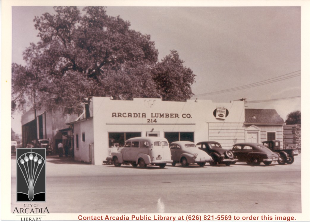
View from Santa Anita Ave toward east side at Arcadia Lumber Company at 214 N. Santa Anita Avenue. Four cars and one pick-up truck are parked in front. A large oak tree is behind office building.
https://arcadiahistory.andornot.com/en/permalink/photographs730
- Date
- c.1950
1 image
- Date
- c.1950
- Subjects
- Arcadia Lumber Company
- Physical Description
- 5x7 color
- ID
- 726
- Collection
- Photographs
Images
Aerial view toward north from a position south of Huntington Drive near intersection with Baldwin Avenue. It shows Santa Anita Fashion Park (currently known as Westfield Santa Anita Shopping Mall) developed by and on property owned by Santa Anita Consolidated. The Santa Anita Park Race Track and club house can be seen in center of photo. The straight white line about one inch above the club house roof is 210 Foothill Freeway. Chantry Flats road can be seen going up into San Gabriel Mountains in distance.
https://arcadiahistory.andornot.com/en/permalink/photographs646
- Date
- c. 1975
1 image
- Date
- c. 1975
- Subjects
- Aerial Photo Collection
- Aerial views
- 210 Foothill Freeway
- Chantry Flats Road
- Malls
- San Gabriel Mountains
- Santa Anita Park-1945-1980
- Santa Anita Fashion Park
- Westfield Santa Anita Shopping Mall
- Physical Description
- 8x10 b&w
- ID
- 642
- Collection
- Photographs
Images


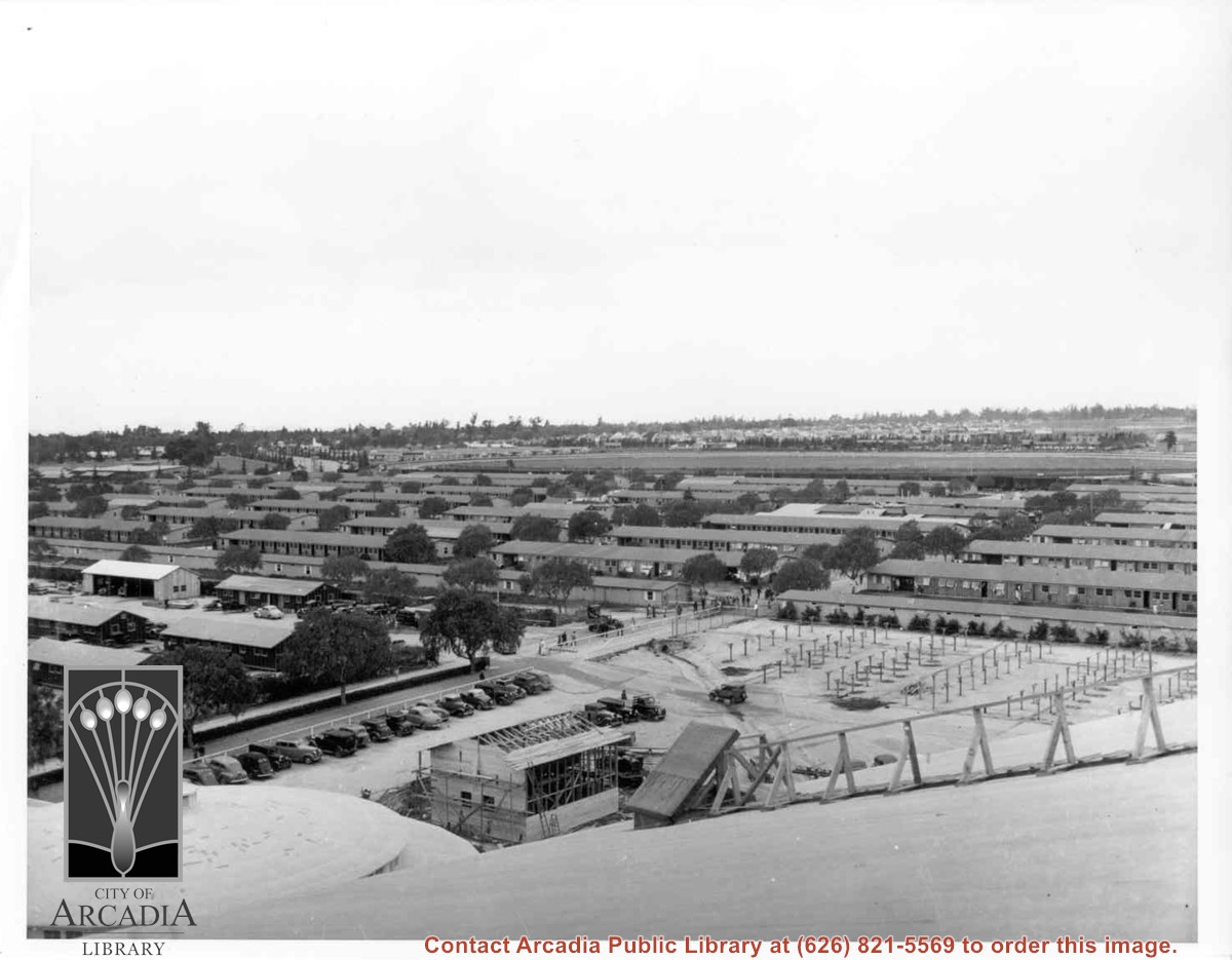
View almost due west from Santa Anita Race track Clubhouse roof over portion of housing put up for the evacuees at the Santa Anita Assembly Center for the Japanese. Note training track in the center of photo. Beyond it can be seen houses in Santa Anita Village. This entire area became part of Fashion Park later. This photo, together with photos #655 and 656, form a panorama.
https://arcadiahistory.andornot.com/en/permalink/photographs658
- Date
- April 1942
1 image
- Date
- April 1942
- Subjects
- Santa Anita Assembly Center for the Japanese-Buildings and grounds
- Santa Anita Park-1942-1945
- Fashion Park
- Physical Description
- 8x10 b&w
- ID
- 654
- Collection
- Photographs
Images
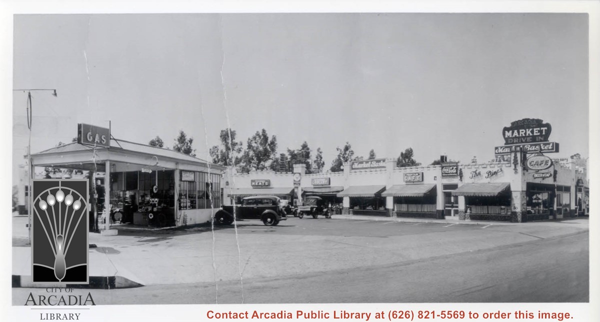
View toward west into Arcadia Drive-In Market (aka Market Basket). On the left is John C. Baldwin Gas Station. The Pines Cafe is the business establishment nearest the right side of the photo. One sedan, one pick-up and one convertible are parked in area.
https://arcadiahistory.andornot.com/en/permalink/photographs1073
- Date
- c.1934
1 image
- Date
- c.1934
- Subjects
- Arcadia Drive-In Market (aka Market Basket)
- Gas stations
- John C. Baldwin Gas Station
- Markets
- The Pines Cafe
- Physical Description
- 8x10 b&w
- ID
- 1064
- Collection
- Photographs
Images
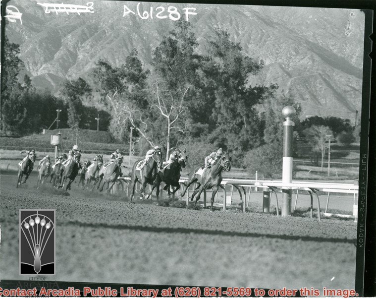
About ten thoroughbreds and jockeys, round turn toward finish of a race at Santa Anita Park. San Gabriel Mountains loom up behind. One can tell that this is early years of the track because of the dust kicked up by horses. Later, track was completely excavated and new improved mixture was put in place.
https://arcadiahistory.andornot.com/en/permalink/photographs991
- Date
- c.1940
1 image
- Date
- c.1940
- Subjects
- Santa Anita Park-1934-1942
- Physical Description
- 3x5 b&w
- ID
- 984
- Collection
- Photographs
Images
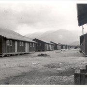
Close-up view of one row of about 11 units of tarpaper covered housing put up for the evacuees at Santa Anita Assembly Center for the Japanese. Santa Anita Canyon can be seen in about the center of the mountains in the background.
https://arcadiahistory.andornot.com/en/permalink/photographs651
- Date
- April 1942
1 image
- Date
- April 1942
- Subjects
- Santa Anita Assembly Center for the Japanese-Buildings and grounds
- Santa Anita Park-1942-1945
- Physical Description
- 8x10 b&w
- ID
- 647
- Collection
- Photographs
Images

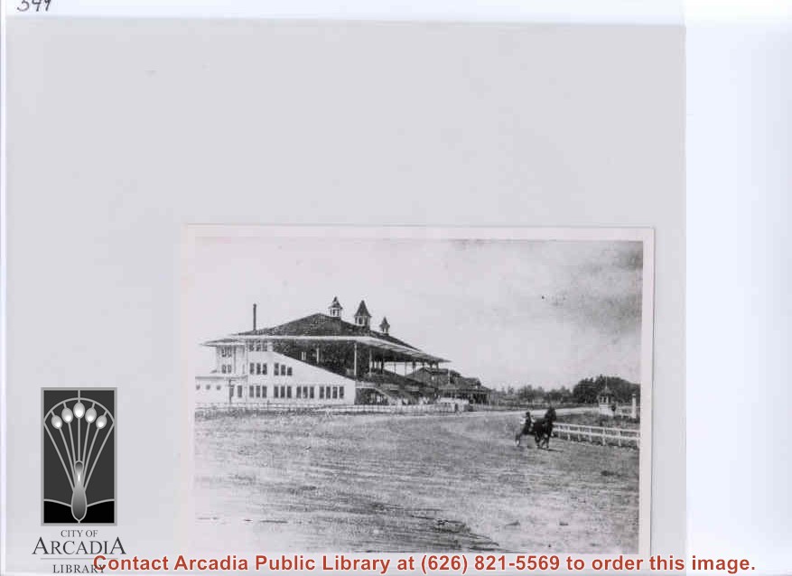
Santa Anita Park looking across the track toward grandstand. There is a sulky and driver on the track. This photo appears on xerox of material from Santa Anita Park vertical file (Arcadia-Santa Anita Park-1907-1912 #8).
https://arcadiahistory.andornot.com/en/permalink/photographs553
- Date
- c.1907
1 image

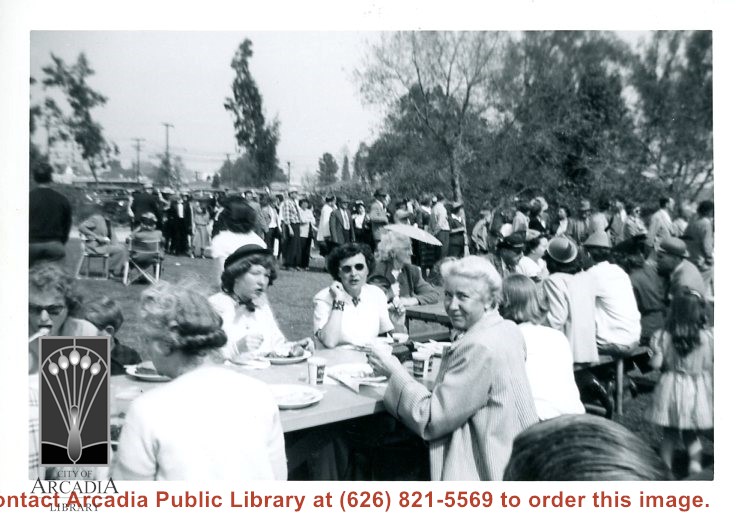
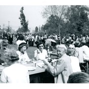
Large group of people, some seated at tables and many waiting in line, apparently for food. Part of Peach Blossom Festival festivities.
https://arcadiahistory.andornot.com/en/permalink/photographs547
- Date
- March 1949
1 image
- Date
- March 1949
- Subjects
- Peach Blossom Festival
- Physical Description
- 3x5 b&w
- ID
- 543
- Collection
- Photographs
Images
View across Arcadia taken from Chantry Flats Road at night. Long diagonal streak starting near bottom of lower right, marks Santa Anita Avenue.
https://arcadiahistory.andornot.com/en/permalink/photographs1159
- Date
- c.1952
1 image


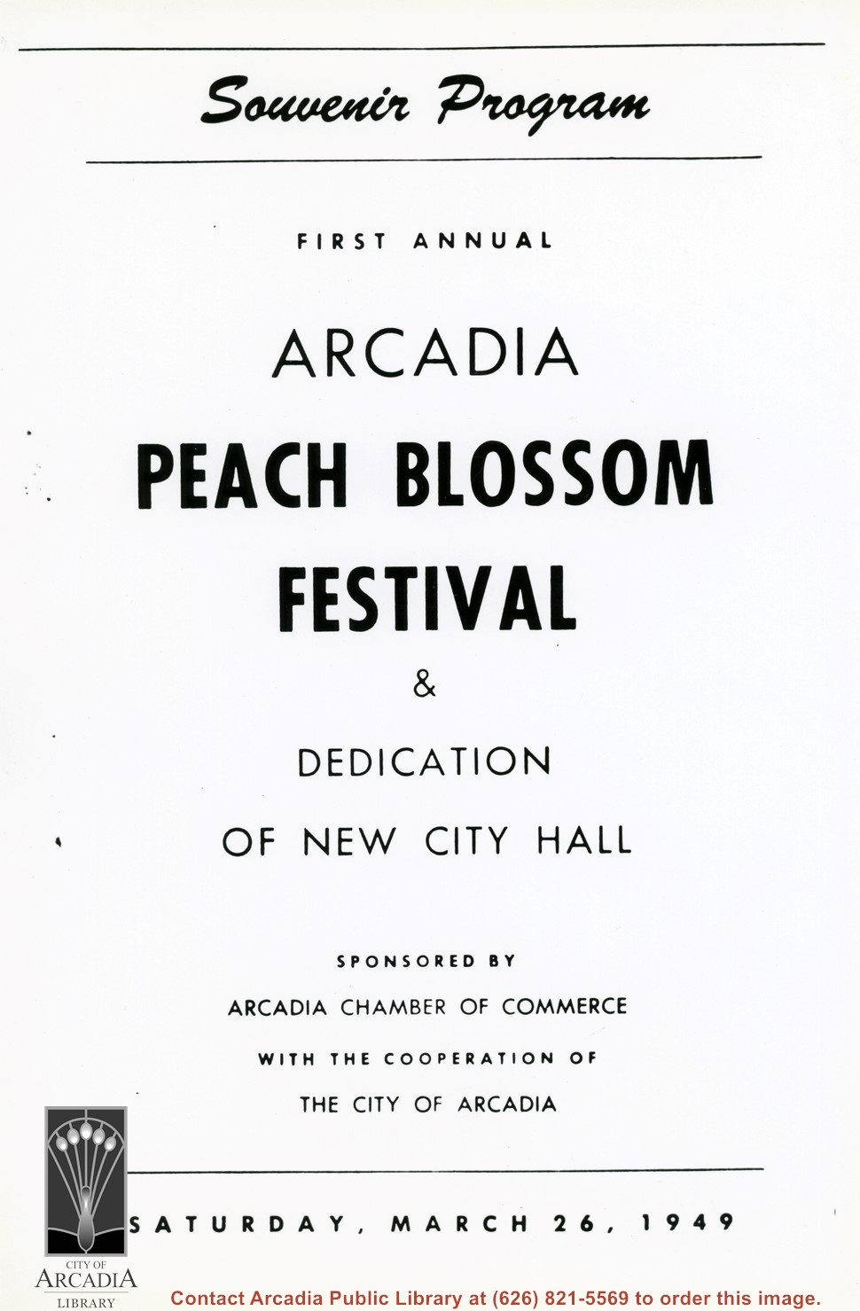
Photo of cover of the souvenir program from the First Annual Peach Blossom Festival.
https://arcadiahistory.andornot.com/en/permalink/photographs1132
- Date
- March 26, 1949
1 image
- Date
- March 26, 1949
- Subjects
- Peach Blossom Festival
- Physical Description
- 8x10 b&w
- ID
- 1123
- Collection
- Photographs
Images
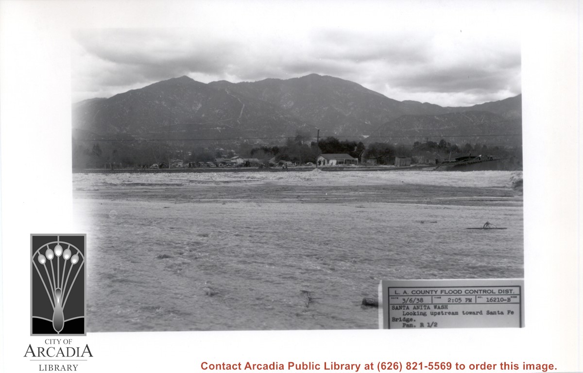
Looking NE up flooded Santa Anita Wash following heavy rains of early March 1938. Caption on photo reads: Looking upstream toward Santa Fe Bridge. San Gabriel Mountains in background. Where cars are parked would be east side of wash.
https://arcadiahistory.andornot.com/en/permalink/photographs811
- Date
- March 6, 1938
1 image
- Date
- March 6, 1938
- Subjects
- Flood control
- Physical Description
- 5x7 b&w
- ID
- 805
- Collection
- Photographs
Images
View north up Santa Anita Avenue with mountains in background. This photo was taken about where present Orange Grove Avenue intersects with Santa Anita Avenue. Note orange groves all along west side of Santa Anita as far as the mountains. Street is not paved.
https://arcadiahistory.andornot.com/en/permalink/photographs584
- Date
- 1916
1 image
- Date
- 1916
- Subjects
- Santa Anita Avenue
- Agriculture
- Physical Description
- 8x11 b&w
- ID
- 580
- Collection
- Photographs
Images