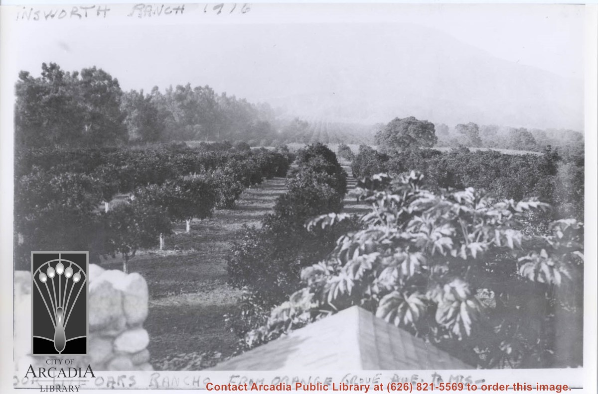
View north toward mountains and Chantry Flats Road. From vicinity just east of Santa Anita, where present Orange Grove intersects, showing orange groves. An open field apparently planted to grain and having a large oak tree, would be present site of Highland Oaks School. Eucalyptus trees lining Santa Anita are on left in photo, this property belonged to Harry and Hattie Ainsworth.
https://arcadiahistory.andornot.com/en/permalink/photographs368
- Date
- 1916
1 image
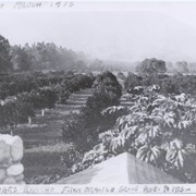
View north up Santa Anita Avenue with mountains in background. This photo was taken about where present Orange Grove Avenue intersects with Santa Anita Avenue. Note orange groves all along west side of Santa Anita as far as the mountains. Street is not paved.
https://arcadiahistory.andornot.com/en/permalink/photographs584
- Date
- 1916
1 image
- Date
- 1916
- Subjects
- Santa Anita Avenue
- Agriculture
- Physical Description
- 8x11 b&w
- ID
- 580
- Collection
- Photographs
Images
Arcadia Lumber Company sells to San Gabriel Valley Lumber Company
https://arcadiahistory.andornot.com/en/permalink/newspaper3743
- Newspaper
- Arcadia Journal
- Date
- February 23, 1918
- Pages
- p. 1
- Item ID
- 3712AN
- Collection
- Newspaper Index
Drug store on First Avenue
https://arcadiahistory.andornot.com/en/permalink/newspaper3828
- Newspaper
- Arcadia Journal
- Date
- June 8, 1918
- Pages
- p. 1
- Subjects
- Business and Industry
- Item ID
- 3701AN
- Collection
- Newspaper Index
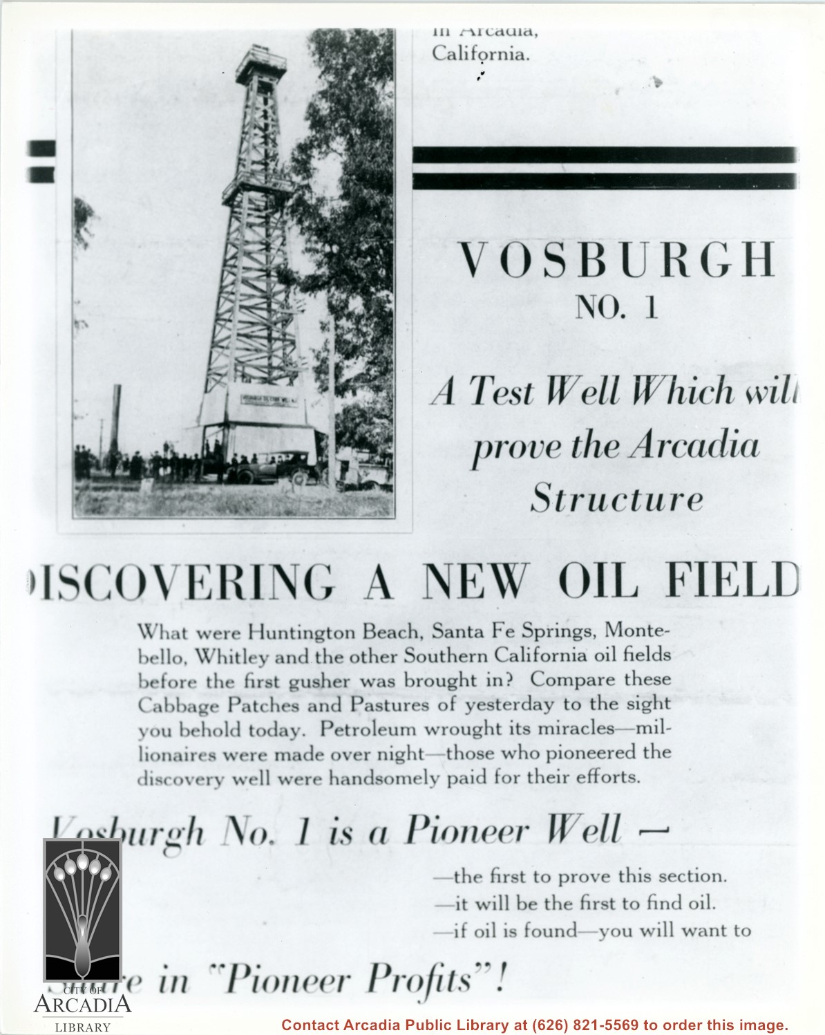
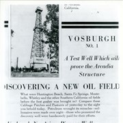
Photo of front cover of Vosburgh Oil Corporation promotional brochure for an oil drilling operation which was entered into with high hopes. Oil was not found. (see Vertical file for copy of entire brochure in Arcadia-Business and industry.)
https://arcadiahistory.andornot.com/en/permalink/photographs897
- Date
- 1925
1 image
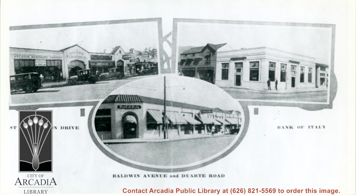
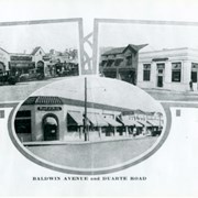
Three views of business areas in Arcadia. On left is south side of Huntington Drive. Arcadia Hardware is still located at 52 E. Huntington Drive as it is shown here. On the right is the Bank of Italy which was located on NE corner of Huntington Drive and First Ave. The building just to the north up First Ave (with awnings) is also still in use.
https://arcadiahistory.andornot.com/en/permalink/photographs896
- Date
- 1928
1 image
- Date
- 1928
- Subjects
- Business & industry
- Huntington Drive
- Baldwin Avenue
- Bank of Italy National Trust Savings
- Arcadia Hardware
- Physical Description
- 5 1/2 x 10 b&w
- ID
- 889
- Collection
- Photographs
Images
Aerial view west toward Santa Anita Ave. from above First Avenue, site of new grammar school. Long driveway heads to Jaspar N. Teague home in center of 10 acre orange grove. (Address in City Directory for this name is 1380 S. Santa Anita.) House to left and south was that of Charles W. Stewart in another 10 acre plot. Both ranches are now occupied by First Avenue Junior High School.
https://arcadiahistory.andornot.com/en/permalink/photographs12
- Date
- November 1929
1 image
- Date
- November 1929
- Subjects
- Houses
- Teague, Jaspar
- Stewart, Charles W.
- Agriculture
- First Avenue Junior High School
- Arcadia(City)-History-1920-1929
- Physical Description
- 6x10 b&w
- ID
- 12
- Collection
- Photographs
Images
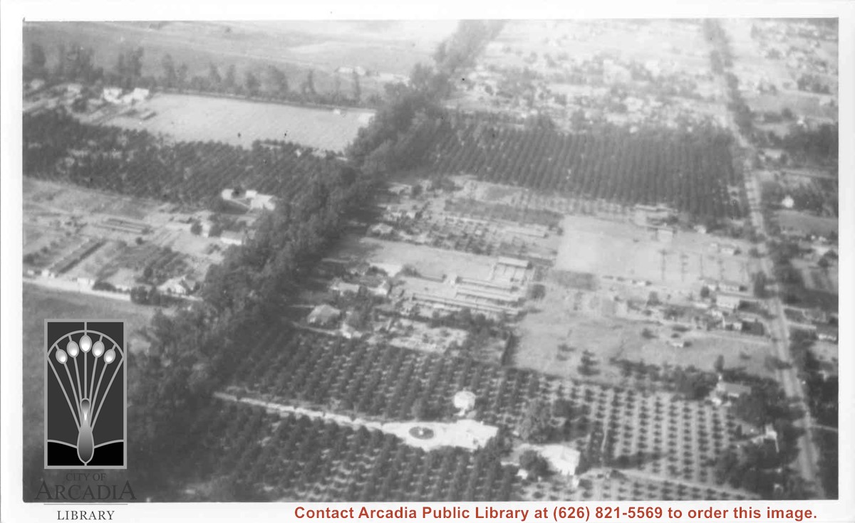
Aerial view toward NE. Plane is over property of Charles W. Stewart (10 acres), and Jaspar Teague (10 acres), at 1320 S. Santa Anita Avenue, which is directly under the plane. Next street east is First Avenue, then Second Avenue, the Fourth Avenue. Reservoir is at corner of Valnett Avenue and Second Avenue and was owned by Walnut Grove Mutual Water Company (Valnett Avenue was first through street south of Duarte Road at this time and became Camino Real).
https://arcadiahistory.andornot.com/en/permalink/photographs644
- Date
- November 1929
1 image
- Date
- November 1929
- Subjects
- Aerial Photo Collection
- Aerial views
- Camino Real
- Duarte Road
- First Avenue
- Fourth Avenue
- Second Avenue
- Santa Anita Avenue (South)
- Stewart, Charles W.
- Teague, Jaspar
- Valnett Avenue
- Physical Description
- 6x10 b&w
- ID
- 640
- Collection
- Photographs
Images


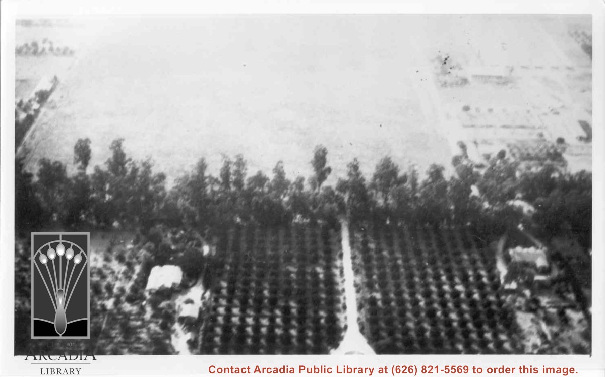
Aerial view north. Main tree-lined street is Santa Anita Avenue. Most of the orange grove in center of photo was owned by Jaspar Teague family. They had built a circular art gallery on their property at 1380 South Santa Anita Avenue. The large buildings north of Teague's and to the west of Santa Anita Avenue are chicken houses. Duarte Road is the east/west street across photo near top of photo.
https://arcadiahistory.andornot.com/en/permalink/photographs645
- Date
- November 1929
1 image
- Date
- November 1929
- Subjects
- Aerial Photo Collection
- Aerial views
- Agriculture
- Duarte Road
- Orange groves
- Poultry
- Santa Anita Avenue
- Teague, Jaspar
- Physical Description
- 6x10 b&w
- ID
- 641
- Collection
- Photographs
Images
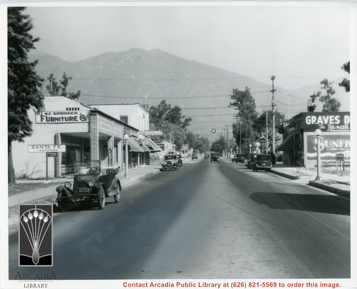
View north on First Avenue just north of Santa Fe Railroad Tracks. Graves Drug Store on right with a bank next to it. The two story building on SW corner of St. Joseph Street and First was McCoy Building. According to information given by Stu Henderson, current owner of King Pharmacy, the history of Graves Drug Store is as follows: Originally it was opened by Oscar Seaquist, later bought by Walter A. Graves. Some years later it was bought by R.B. and R.B. Bagnall Jr. (circa 1940's) and was relocated to 54 E. Huntington Drive. By 1950 the City directory listed it as owned by A.P.King and has been known by that name since.
https://arcadiahistory.andornot.com/en/permalink/photographs588
- Date
- 1930
1 image
- Date
- 1930
- Subjects
- First Avenue
- W.F. Springer Furniture Company
- Restaurants-Queen City Club
- Graves Drug Store
- Stores
- Physical Description
- 8x10 b&w
- ID
- 584
- Collection
- Photographs
Images
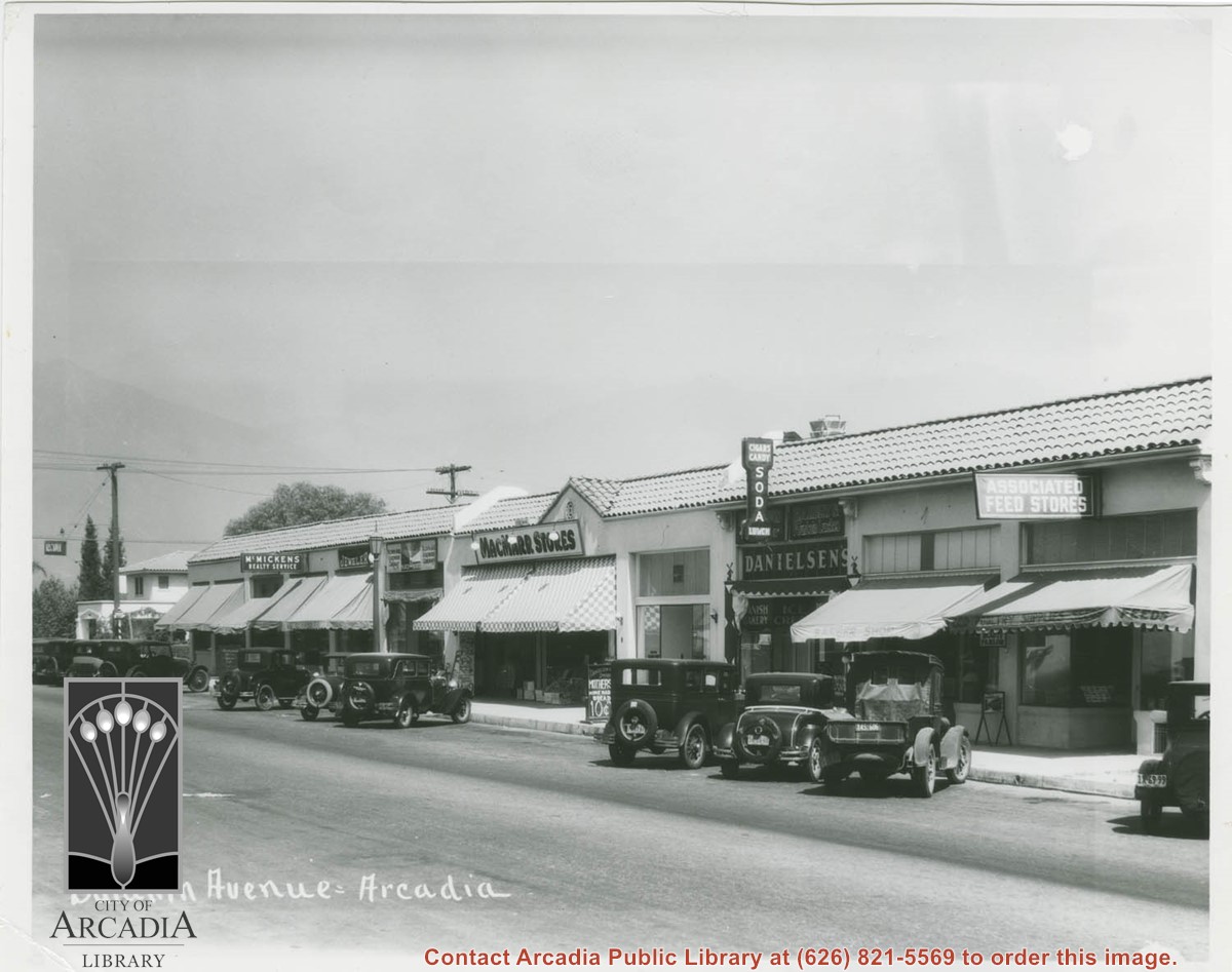
View of a section of Baldwin Avenue business district in the 1000 S. Baldwin block. Eleven automobiles are diagonally parked in front of the various shops.
https://arcadiahistory.andornot.com/en/permalink/photographs589
- Date
- 1930
1 image
- Date
- 1930
- Subjects
- Baldwin Avenue
- Business & industry
- Physical Description
- 8x10 b&w
- ID
- 585
- Collection
- Photographs
Images
Rexall Drug Store
https://arcadiahistory.andornot.com/en/permalink/newspaper3858
- Newspaper
- Arcadia Tribune
- Date
- September 18, 1931
- Pages
- p. 1
- Item ID
- 3733AN
- Collection
- Newspaper Index
Proctor's Tavern
https://arcadiahistory.andornot.com/en/permalink/newspaper3857
- Newspaper
- Arcadia Tribune
- Date
- October 2, 1931
- Pages
- p. 1
- Item ID
- 3732AN
- Collection
- Newspaper Index
Robinson's Market
https://arcadiahistory.andornot.com/en/permalink/newspaper3859
- Newspaper
- Arcadia Tribune
- Date
- December 16, 1932
- Pages
- p. 1
- Item ID
- 3734AN
- Collection
- Newspaper Index
Schmidt Brewery
https://arcadiahistory.andornot.com/en/permalink/newspaper3861
- Newspaper
- Arcadia Tribune
- Date
- June 23, 1933
- Pages
- p. 1
- Item ID
- 3736AN
- Collection
- Newspaper Index
- Newspaper
- Arcadia Tribune
- Date
- August 3, 1934
- Pages
- p. A-3
- Item ID
- 4066AN
- Collection
- Newspaper Index
Pioneer Feed Company opening
https://arcadiahistory.andornot.com/en/permalink/newspaper3856
- Newspaper
- Arcadia Tribune
- Date
- September 16, 1936
- Pages
- p. 1
- Item ID
- 3731AN
- Collection
- Newspaper Index
Sheehan Furniture and Mercantile Company opening
https://arcadiahistory.andornot.com/en/permalink/newspaper3862
- Newspaper
- Arcadia Tribune
- Date
- January 12, 1937
- Pages
- p. 1
- Item ID
- 3737AN
- Collection
- Newspaper Index
Owens Store opening
https://arcadiahistory.andornot.com/en/permalink/newspaper3853
- Newspaper
- Arcadia Tribune
- Date
- November 4, 1937
- Pages
- p. 1
- Subjects
- Business and Industry - Owens Store
- Item ID
- 3728AN
- Collection
- Newspaper Index
Santa Anita Park Race Track just right of center at south edge of photo. Oval to the left of Santa Anita Park Race Track was training track which was removed to make room for Santa Anita Fashion Park (currently Westfield Santa Anita Shopping Mall). Street just to left of training track is Baldwin Avenue. Huntington Drive and Colorado Place form a "y" just east of Santa Anita Park Race Track. Along both can be noticed the conifer trees planted a few years earlier. Street completely bisecting photo just below center is Foothill Boulevard, next one is Orange Grove Avenue. Santa Anita Avenue is partially in view on right edge of photo. Oval on extreme lower left side of photo is old Baldwin training track. Baseball diamond in lower right corner is at Arcadia County Park. Scale: 1"=660'
https://arcadiahistory.andornot.com/en/permalink/photographs620
- Date
- June 5, 1938
1 image
- Date
- June 5, 1938
- Subjects
- Aerial Photo Collection
- Aerial views
- Baldwin Avenue
- Colorado Boulevard
- Colorado Place
- Colorado Street
- Foothill Boulevard
- Huntington Drive
- Orange Grove Avenue
- Santa Anita Fashion Park (later known as Westfield Santa Anita)
- Santa Anita Park-1934-1942
- Physical Description
- 8x10 b&w
- ID
- 616
- Collection
- Photographs
Images

