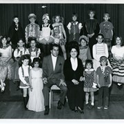
17 children and two adults pose on a stage in three rows. Children are dressed in various costumes. Written on back: Arcadia Children's Chorale "Around the World in Song," a performance of Disney songs. Directors William Pirigyi and Adele Pirigyi. Saturday, March 29th. Prior to Holly Avenue PTA movie. According to the perpetual calendar, March 29 was a Saturday in 1969 and 1975, so it could be either.
https://arcadiahistory.andornot.com/en/permalink/photographs1905
- Date
- Probably 1975
1 image
- Date
- Probably 1975
- Subjects
- Recreation Department Collection
- Arcadia Children's Chorale
- Pirigyi, Adele
- Pirigyi, William
- Singers
- Physical Description
- 8x10 b&w
- ID
- 1886
- Collection
- Photographs
Images

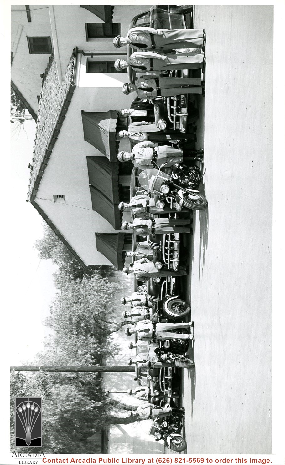
1954 Arcadia Police Department with Pontiac patrol cars and three motorcycles. Thirteen officers in uniform and four men in suits are standing in this photo, none are identified.
https://arcadiahistory.andornot.com/en/permalink/photographs2406
- Date
- 1954
1 image
About 12 girls in white are seen walking across the lawn at front of First Avenue School (Arcadia Grammar School at this time, 1935). They have garlands of flowers over their shoulders to commemorate their graduation from 8th grade. Photo is also interesting because construction scaffolding is across front of school.
https://arcadiahistory.andornot.com/en/permalink/photographs873
- Date
- June 1935
1 image

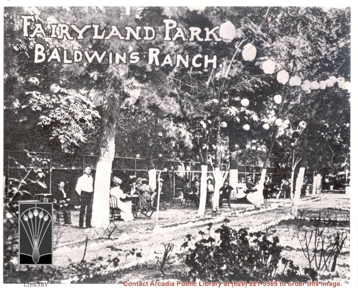
About 18 people are seen seated outdoors at tables under trees decorated with Japanese paper lanterns. A waiter stands by closest tree. Printed on photo are words: FAIRYLAND PARK BALDWIN'S RANCH.
https://arcadiahistory.andornot.com/en/permalink/photographs934
- Date
- c.1905
1 image
- Date
- c.1905
- Subjects
- Oakwood Hotel
- Fairyland Park
- Physical Description
- 8x10 b&w
- ID
- 927
- Collection
- Photographs
Images
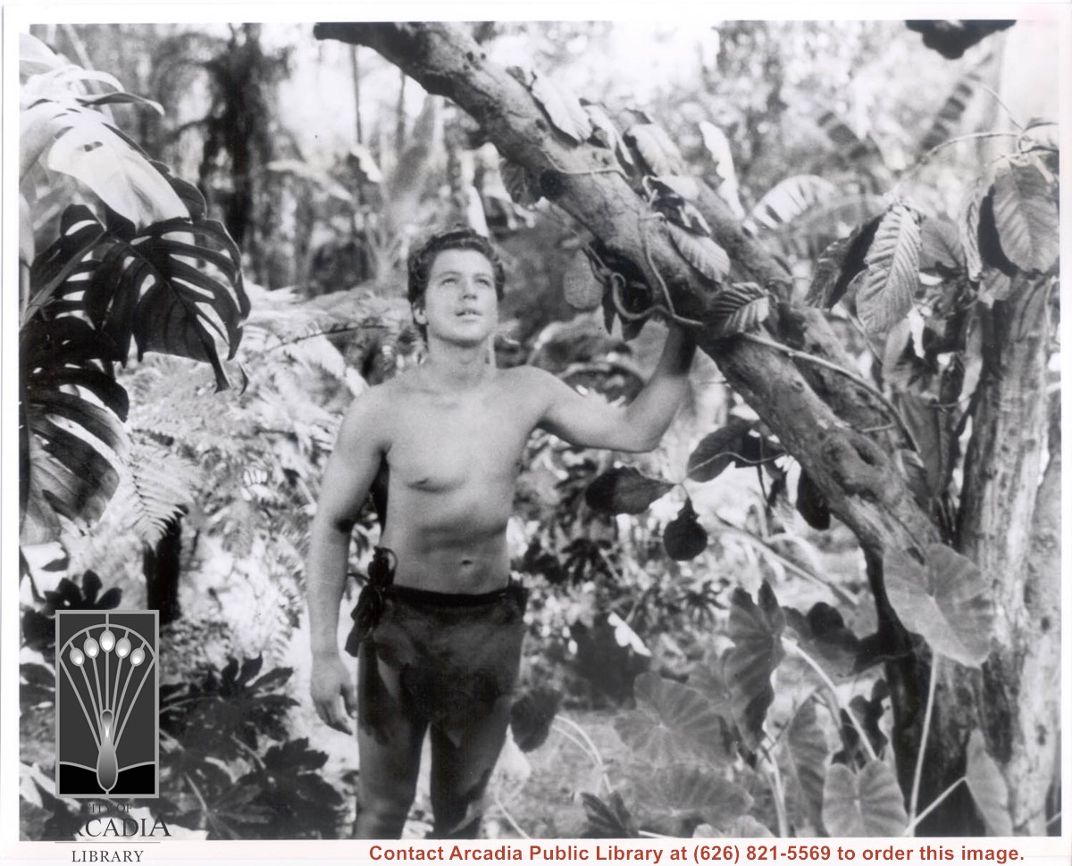
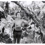
Actor Johnny Sheffield is seen in costume for filming at the Arboretum. He is looking up and holding onto a tree limb with his left hand. Photo probably taken during filming of a Tarzan movie.
https://arcadiahistory.andornot.com/en/permalink/photographs1554
- Date
- c.1936-1939
1 image
- Date
- c.1936-1939
- Subjects
- Motion pictures
- Arboretum
- Sheffield, Johnny
- Physical Description
- 8x10 b&w
- ID
- 1531
- Collection
- Photographs
Images
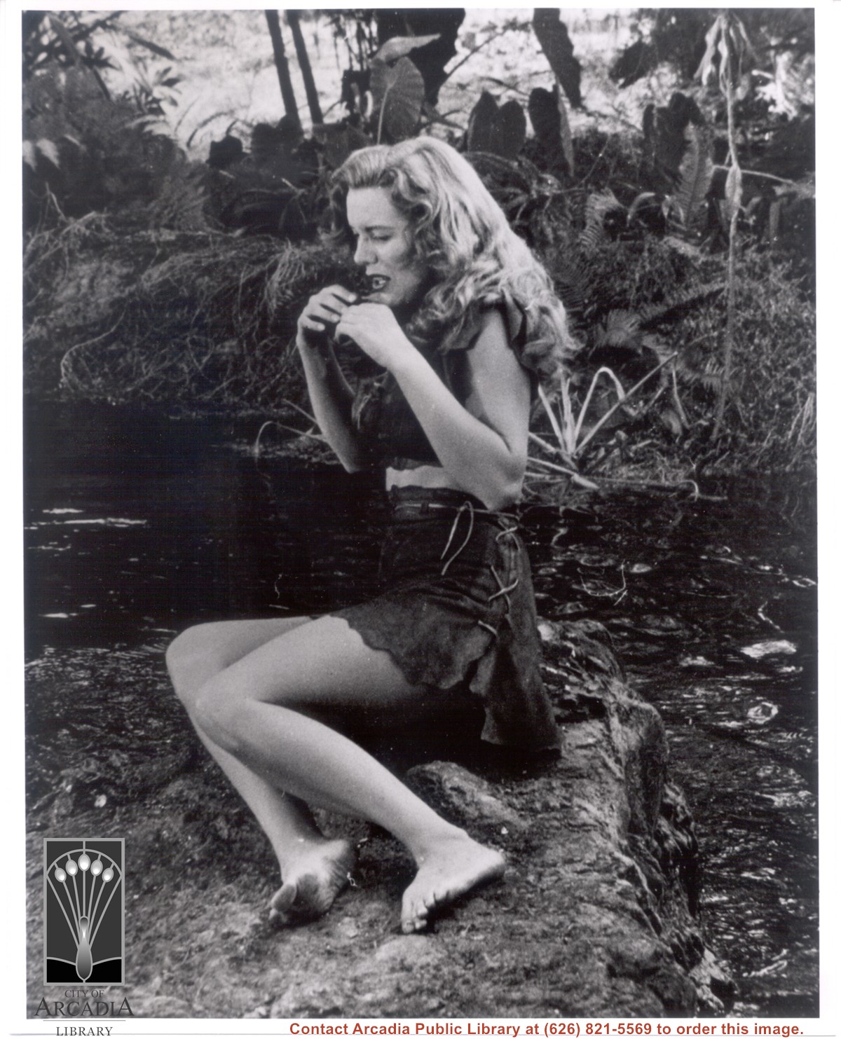
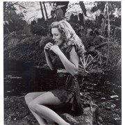
Actress Yvette Vickers is seen with her arms bent and hands by her mouth. She is wearing a short skirt with bare legs and feet. According to Sandy Snider, photo was taken during the filming of the movie, "Attack of the Giant Leeches." This movie was filmed at the Arboretum during the latter half of 1958.
https://arcadiahistory.andornot.com/en/permalink/photographs1559
- Date
- c.1958
1 image
- Date
- c.1958
- Subjects
- Motion pictures
- Vickers, Yvette
- Physical Description
- 8x10 b&w
- ID
- 1530
- Collection
- Photographs
Images
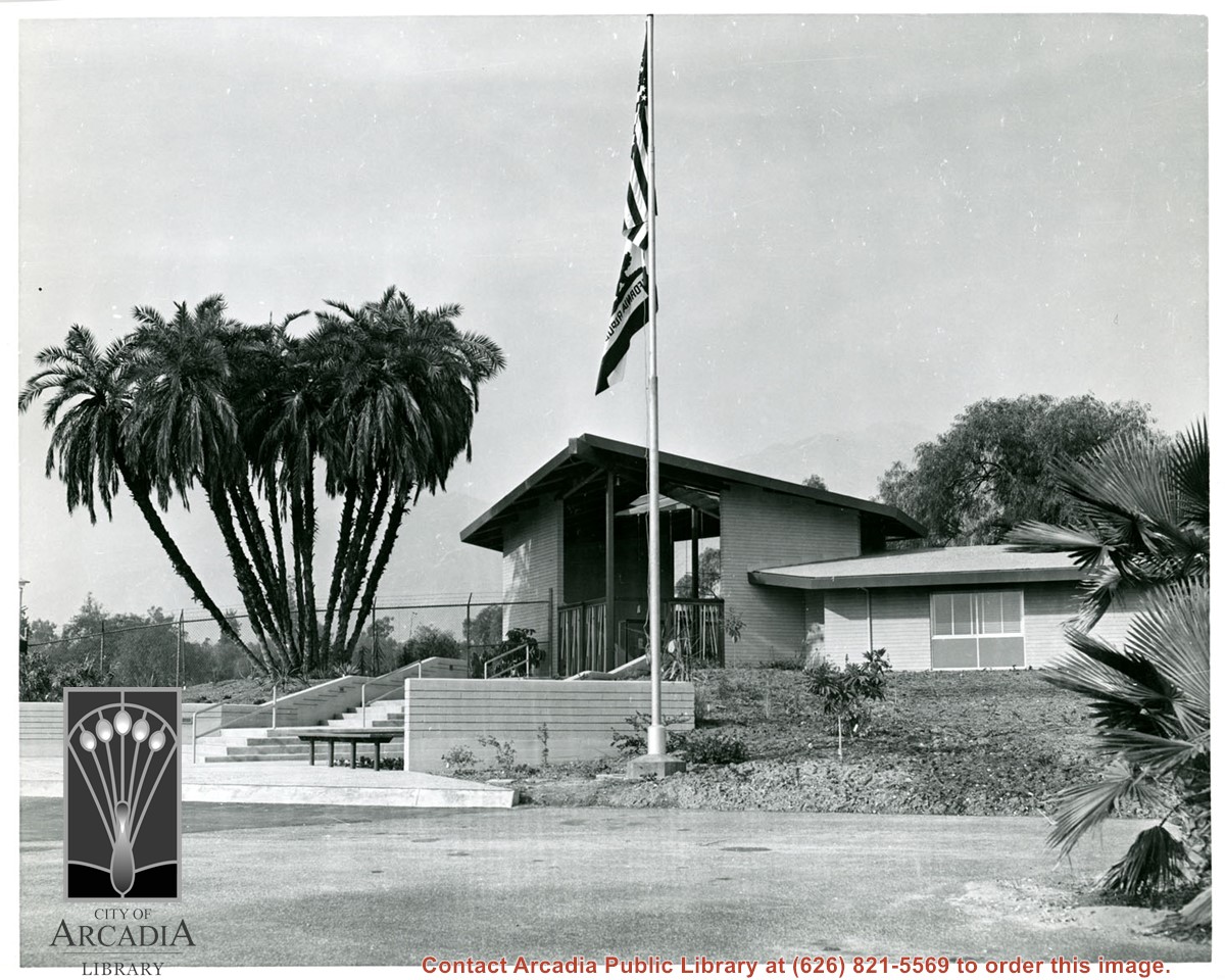
Administration Building at the Arboretum. A flag pole with two flags is in the center of the photo. No one is visible.
https://arcadiahistory.andornot.com/en/permalink/photographs1455
- Date
- unknown
1 image
- Date
- unknown
- Subjects
- Arboretum
- Physical Description
- 8x10 b&w
- ID
- 1439
- Collection
- Photographs
Images
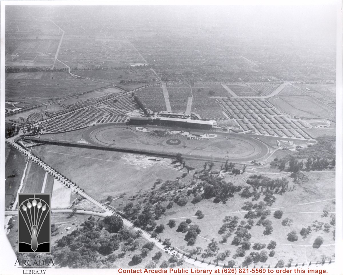
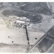
Aerial view due south from a position almost directly over sharp curve of Colorado Street. Showing in this photo are the Track and Club House on a day of large attendance, the stables, and a training track. All along Huntington Drive and Colorado Street young trees have been planted. Old-time resident Reid Greer says that the large tree at the very left edge of photo about 2 1/2 in. from bottom is same tree as seen in photo #654, on flat ground just below knolls seen here, and therefore he places homes of Indians on ranch at this spot. E.J."Lucky" Baldwin winery is only building seen on knoll. There is an "x" on reverse side to mark location. This photo belongs to the Huntington Library. It is shown here for research only.
https://arcadiahistory.andornot.com/en/permalink/photographs632
- Date
- c. 1935
1 image
- Date
- c. 1935
- Subjects
- Baldwin, Elias J. "Lucky"-Wines and winemaking
- Colorado Blvd
- Colorado Street
- Huntington Drive
- Santa Anita Park-1934-1942
- Physical Description
- 8x10 b&w
- ID
- 628
- Collection
- Photographs
Images
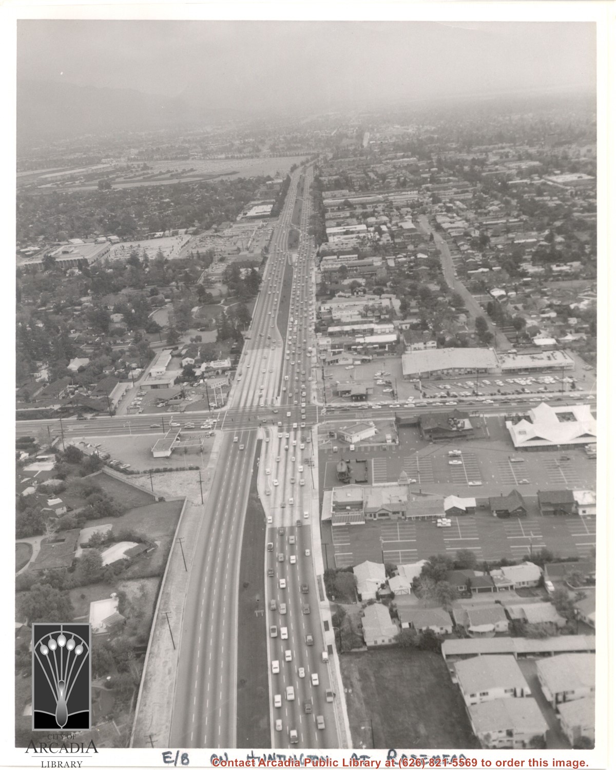
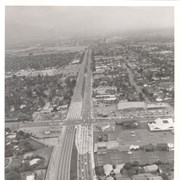
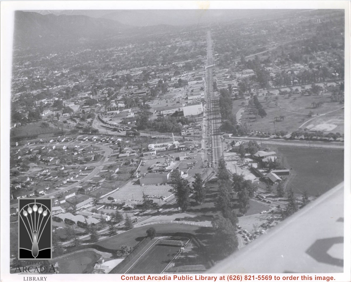
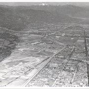
Aerial view east on Huntington Drive toward Arcadia from a position just west of Rosemead Boulevard. El Rancho Shopping Center and May Company Department Store can be seen as the business complex on the north side of Huntington Drive one block east of Rosemead Boulevard. Santa Anita Park Race Track can be seen on the left in upper portion of photo.
https://arcadiahistory.andornot.com/en/permalink/photographs637
- Date
- c.1970
1 image
- Date
- c.1970
- Subjects
- Aerial Photo Collection
- Aerial views
- El Rancho Shopping District
- Huntington Drive
- May Company Department Store
- Santa Anita Park-1945-1980
- Physical Description
- 8x10 b&w
- ID
- 633
- Collection
- Photographs
Images
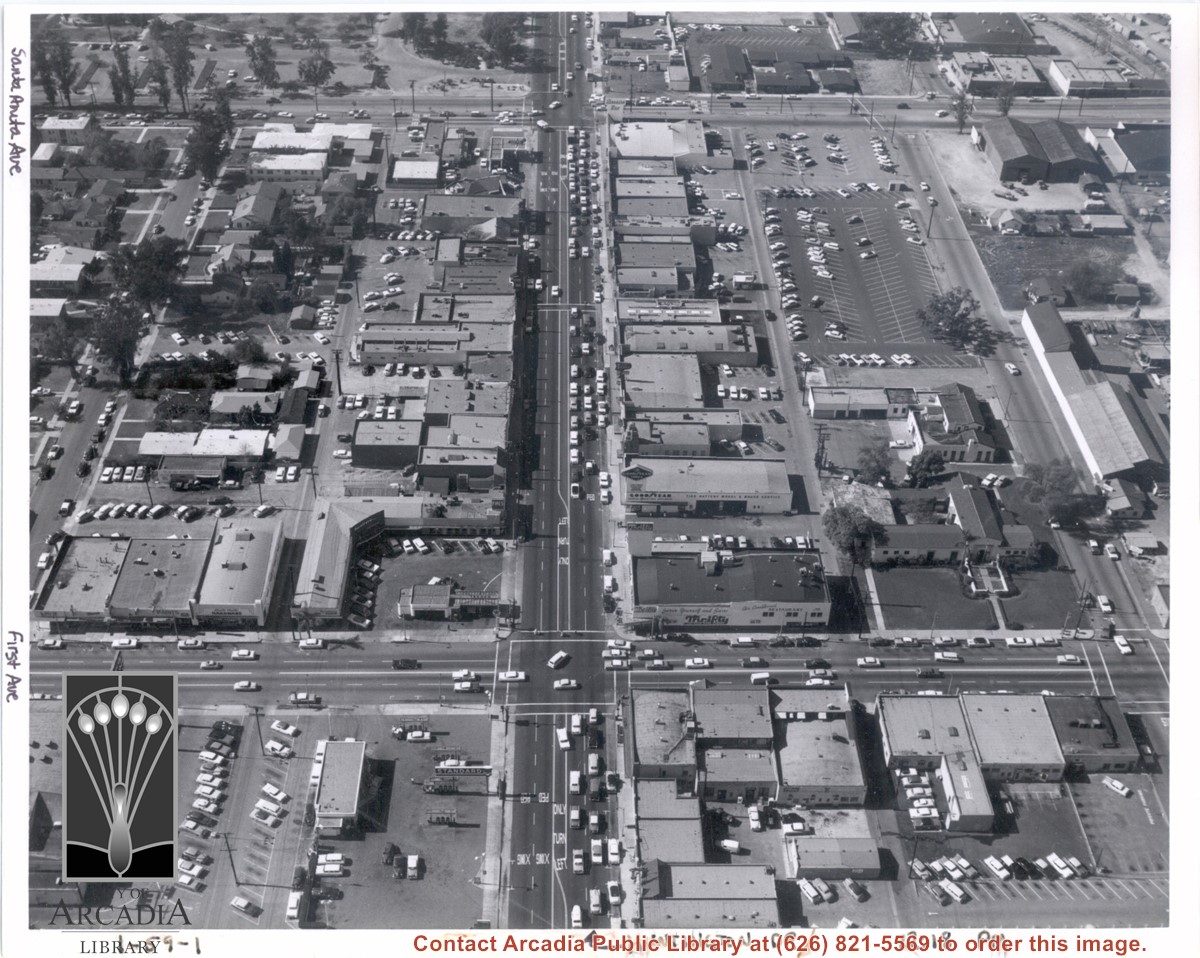
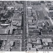
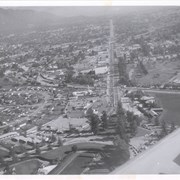
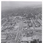
Aerial view from above Huntington Drive between Santa Anita Avenue and First Avenue. Huntington Drive intersects the photo from north to south. The street closest to the bottom is First Avenue and Santa Anita Avenue is near the top.
https://arcadiahistory.andornot.com/en/permalink/photographs1403
- Date
- c.1959
1 image
Aerial view from position above Huntington Drive near Holly Avenue intersection looking north over Santa Anita Park. Colorado Place and Huntington Drive are seen coming together at right side of photo. Note how small the deodar (?) trees planted along Huntington Drive and Colorado Place are. Row of trees seen in center of photo were apparently left from Ranch days and were later removed.
https://arcadiahistory.andornot.com/en/permalink/photographs984
- Date
- December 1, 1935
1 image
- Date
- December 1, 1935
- Subjects
- Aerial Photo Collection
- Aerial views
- Colorado Place
- Huntington Drive
- Santa Anita Park-1934-1942
- Physical Description
- 8x10 b&w
- ID
- 976
- Collection
- Photographs
Images

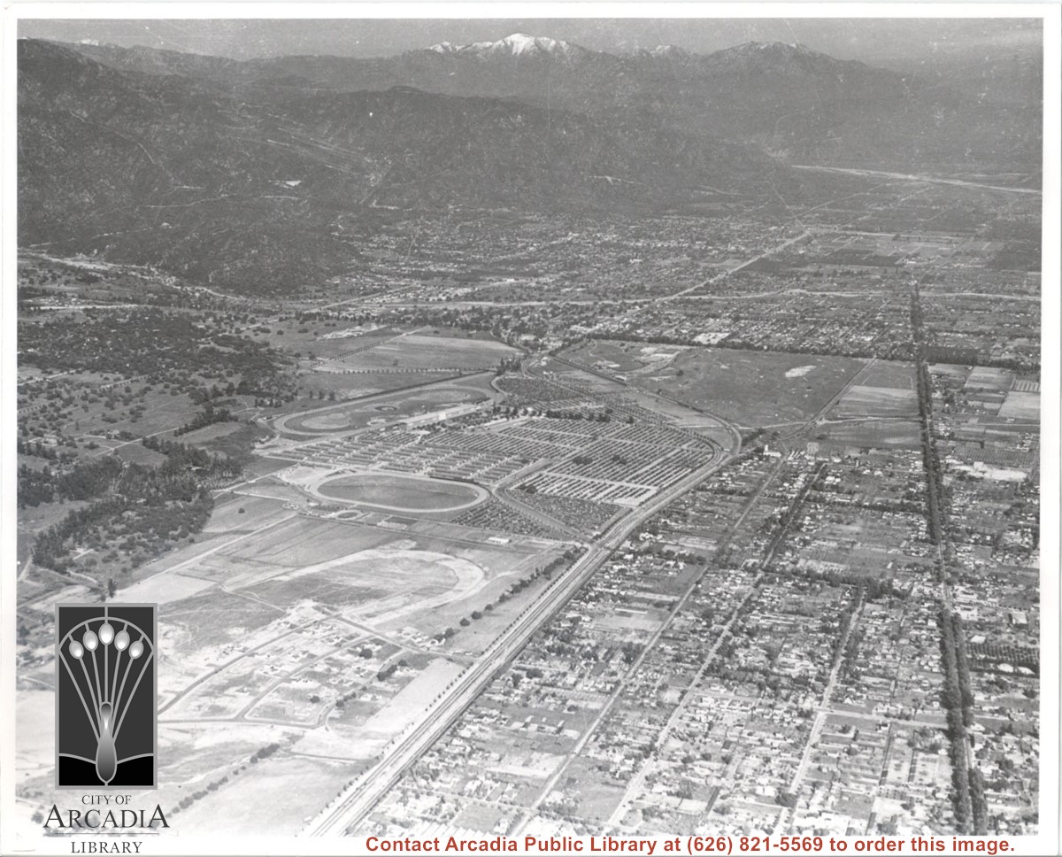
Aerial view looking east across Santa Anita Park taken from a position just west of Baldwin Avenue, which is seen at bottom of photo. Huntington Drive appears exactly in center of photo just east of race track. The 210 Foothill Freeway enters area in upper right portion of picture and exits at left side in upper left portion.
https://arcadiahistory.andornot.com/en/permalink/photographs996
- Date
- c.1979
1 image
- Date
- c.1979
- Subjects
- Aerial Photo Collection
- Aerial views
- 210 Foothill Freeway
- Huntington Drive
- Santa Anita Park-1945-1980
- Physical Description
- 8x10 b&w
- ID
- 989
- Collection
- Photographs
Images


Aerial view looking east along Huntington Drive taken over the Club House at Santa Anita Park Race Track. Pony Express Museum is just to right of the "y" intersection of Huntington Drive coming into Arcadia just below the wing of the plane. Theater that was opened in 1942 is almost directly opposite Museum. Santa Anita Motor Inn, two buildings east of theater, distinguished by tall tower, opened in 1938. (It was torn down in 1975.) The residential area directly north of there is known as Santa Anita Gardens. Santa Anita Avenue is just beyond Arcadia County Park on right.
https://arcadiahistory.andornot.com/en/permalink/photographs642
- Date
- c. 1957-58
1 image
- Date
- c. 1957-58
- Subjects
- Aerial Photo Collection
- Aerial views
- Huntington Drive
- Pony Express Museum
- Santa Anita Avenue
- Santa Anita Motor Inn
- Physical Description
- 8x10 b&w
- ID
- 638
- Collection
- Photographs
Images
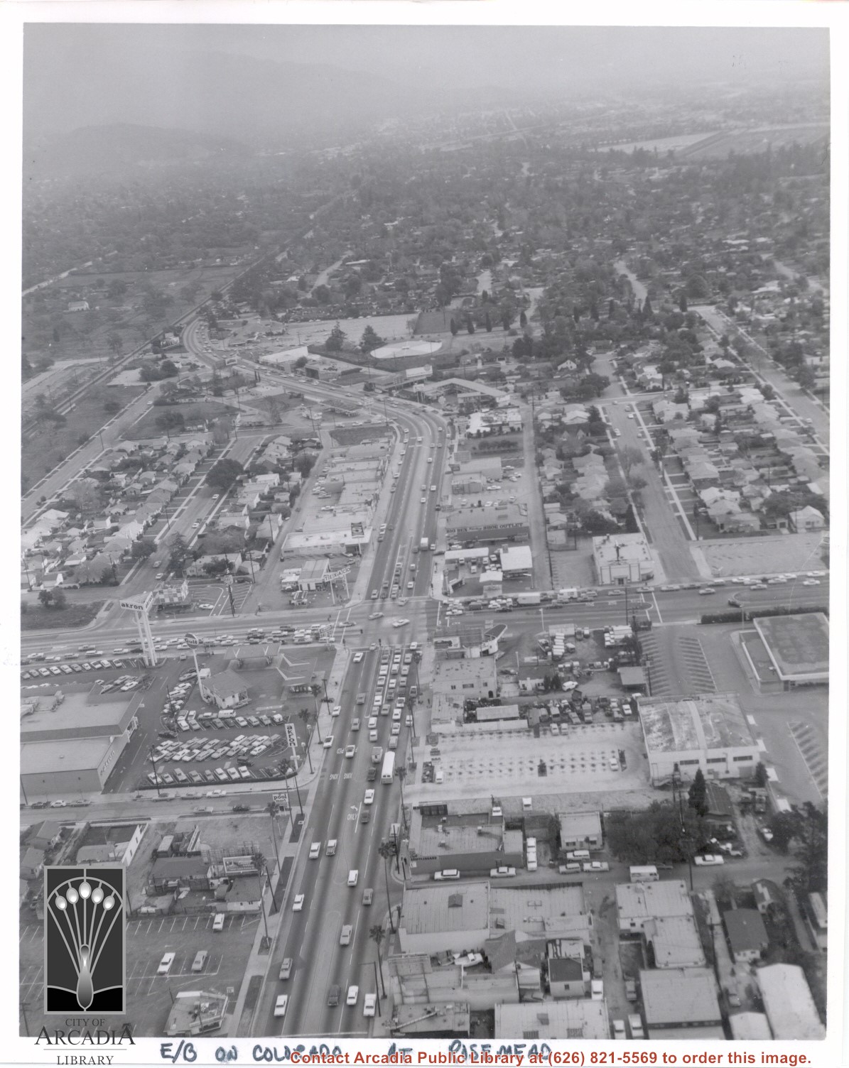
Aerial view looking east into Arcadia from near intersection of Rosemead Boulevard and Colorado Boulevard. Eaton's Santa Anita Hotel and Restaurant is still seen at far end of curve on south side of Colorado Boulevard and Michillinda Avenue (this is present site of Coco's Restaurant and Oak Tree Banquet Room, formerly Reuben's Restaurant, address 1150 W. Colorado Boulevard). The Santa Fe Railroad Tracks are seen just north of Colorado Boulevard. Large clear area in upper right portion of photo is Santa Anita Park Race Track.
https://arcadiahistory.andornot.com/en/permalink/photographs638
- Date
- c.1970
1 image
- Date
- c.1970
- Subjects
- Aerial Photo Collection
- Aerial views
- Colorado Boulevard
- Colorado Street
- Eaton's Santa Anita Hotel and Restaurant (1939-1969)
- Michillinda Avenue
- Railroads
- Santa Anita Park-1945-1980
- Physical Description
- 8x10 b&w
- ID
- 634
- Collection
- Photographs
Images
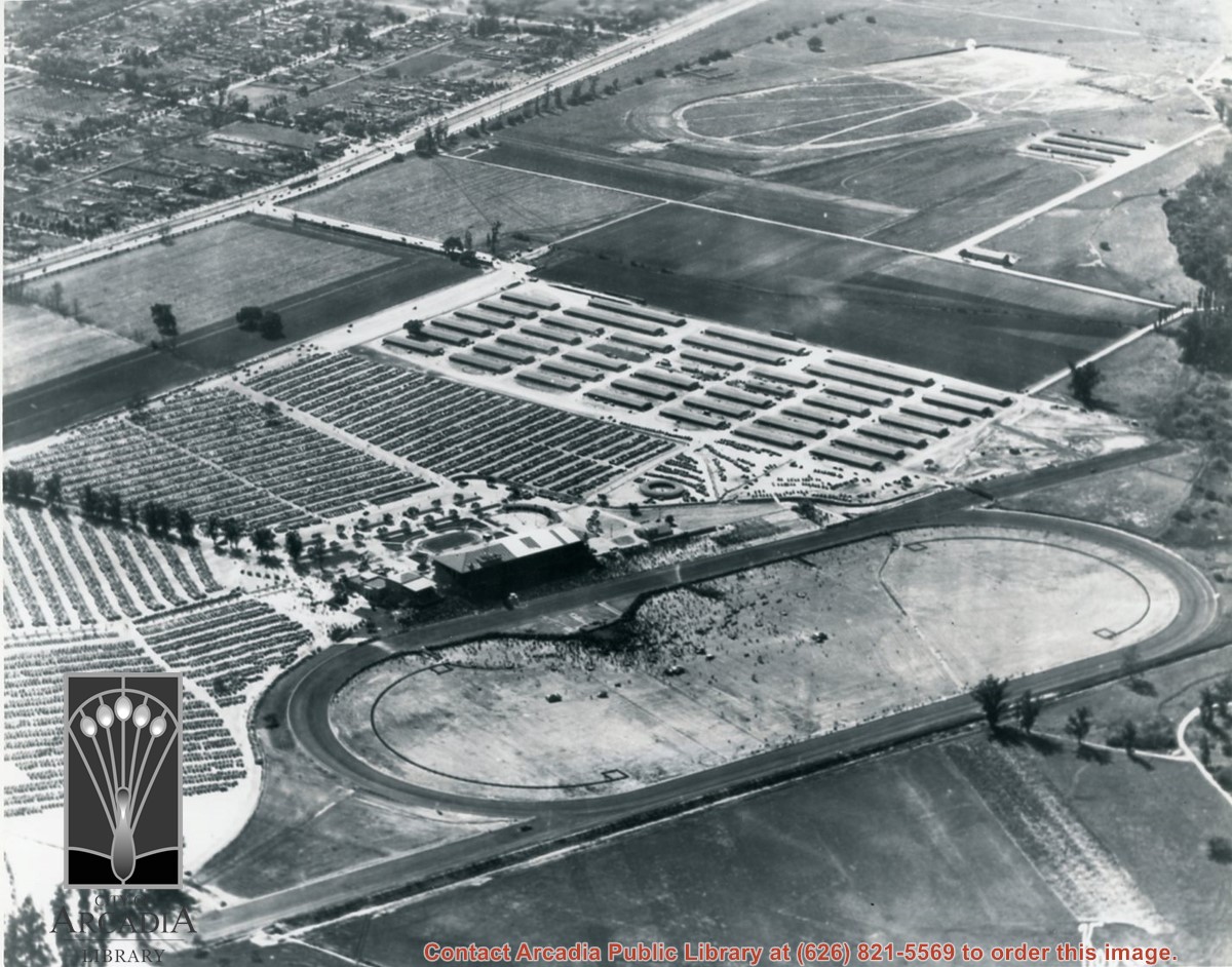
Aerial view. Looking east. Street along right edge of photo which is lined with trees is Duarte Road. Santa Anita Avenue cuts across photo from right to left and up into the San Gabriel Mountains. Huntington Drive can be seen in center of photo with young trees planted on north side of it. Santa Anita Race Track is one furthest from camera. The next small track is a training track belonging to Santa Anita. There is a VERY small round track across the street from the training track, which was part of a private horse stables. The incompleted oval was part of work done in 1933 by Joe Smoot and Anita Baldwin in their effort to develop the Jockey Club Track. This photo belongs to the Huntington Library. It is shown here for research only.
https://arcadiahistory.andornot.com/en/permalink/photographs627
- Date
- c. 1935
1 image
- Date
- c. 1935
- Subjects
- Duarte Road
- Huntington Drive
- Los Angeles Jockey Club
- San Gabriel Mountains
- Santa Anita Park-1934-1942
- Physical Description
- 8x10 b&w
- ID
- 623
- Collection
- Photographs
Images
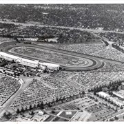
Aerial view looking north across Santa Anita Park from a position over Arcadia County Park. Large infield crowd is evident and all parking areas are filled. Arcadia Methodist Hospital shows in lower left part of photo and Arcadia Police facility is seen in lower right. The 210 Foothill Freeway cuts across photo near the top.
https://arcadiahistory.andornot.com/en/permalink/photographs995
- Date
- c.1979
1 image
- Date
- c.1979
- Subjects
- Aerial Photo Collection
- Aerial views
- 210 Foothill Freeway
- Arcadia Methodist Hospital
- Santa Anita Park-1945-1980
- Physical Description
- 8x10 b&w
- ID
- 988
- Collection
- Photographs
Images

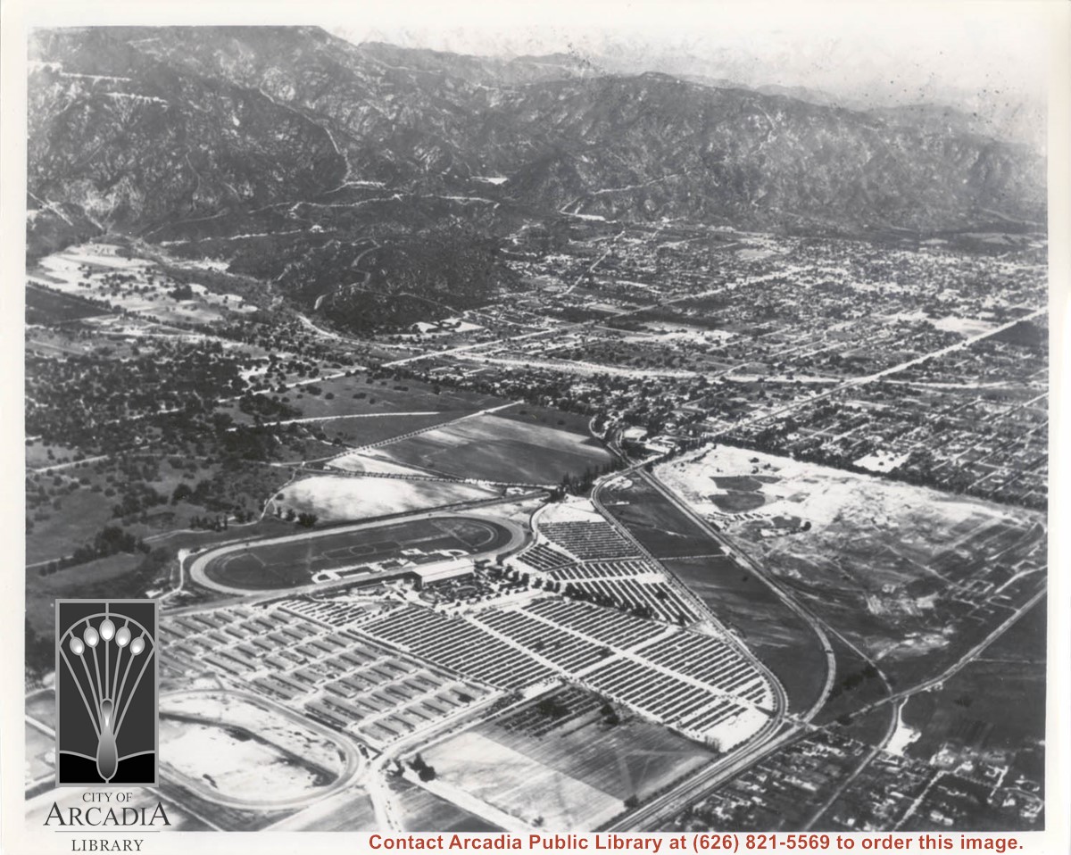
Aerial view looking northeast across Santa Anita Park toward mountains. Note training track called Anita Chiquita has been added (lower left corner), open grandstand has been added to west of covered stand. Note, too, that work has begun to change Balloon School site to Arcadia County Park. Santa Anita Avenue is tree-lined street running entire width of photo about middle of print.
https://arcadiahistory.andornot.com/en/permalink/photographs987
- Date
- 1937
1 image
- Date
- 1937
- Subjects
- Aerial Photo Collection
- Aerial views
- Anita Chiquita training track
- Arcadia County Park
- Balloon School
- Santa Anita Avenue
- Santa Anita Park-1934-1942
- Physical Description
- 8x10 b&w
- ID
- 979
- Collection
- Photographs
Images
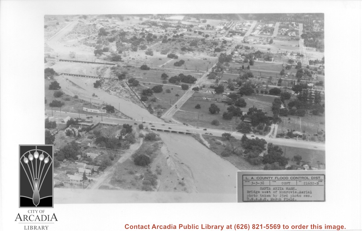
Aerial view looking north over flooded Santa Anita Wash looking upstream. Street cutting across photo closest to bottom is Huntington Drive. The next crossing upstream carries Santa Fe Railroad track. The last crossing that is clearly visible is Pacific Electric Railroad bridge. North/south street crossing Huntington Drive nearest wash would be Fifth Avenue. Foothill Boulevard is just barely visible near top of photo.
https://arcadiahistory.andornot.com/en/permalink/photographs815
- Date
- March 3, 1938
1 image
- Date
- March 3, 1938
- Subjects
- Aerial Photo Collection
- Aerial views
- Fifth Avenue
- Flood control
- Foothill Boulevard
- Huntington Drive
- Railroads
- Santa Anita Wash
- Physical Description
- 5x7 b&w
- ID
- 809
- Collection
- Photographs
Images
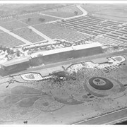
Aerial view looking south over Santa Anita Race Track on a day of very heavy attendance. The floral plantings which form designs in the in-field are shown clearly. Also seen are: the clubhouse, the stables, and the training track. These latter were either moved or done away with to make way for the Fashion Park. Main gate was at NE corner of Huntington Drive and Baldwin, which was not cut through at that time. This photo belongs to the Huntington Library. It is shown here for research only.
https://arcadiahistory.andornot.com/en/permalink/photographs631
- Date
- c. 1935
1 image

Aerial view looking west across Santa Anita Park from a position about Santa Anita Avenue just north of Huntington Drive. In the upper right portion of the photo can be seen the extensive earthwork done for the track Anita Baldwin and Joe Smoot planned to build. That vast area now is entirely built with homes and apartments and is called Santa Anita Village. Present-day Baldwin Avenue would follow the line shown by the Ranch Road bisecting the photo from right to left just east of the track abandoned by Anita Baldwin and Joe Smoot.
https://arcadiahistory.andornot.com/en/permalink/photographs985
- Date
- c.1934
1 image