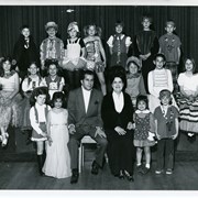
17 children and two adults pose on a stage in three rows. Children are dressed in various costumes. Written on back: Arcadia Children's Chorale "Around the World in Song," a performance of Disney songs. Directors William Pirigyi and Adele Pirigyi. Saturday, March 29th. Prior to Holly Avenue PTA movie. According to the perpetual calendar, March 29 was a Saturday in 1969 and 1975, so it could be either.
https://arcadiahistory.andornot.com/en/permalink/photographs1905
- Date
- Probably 1975
1 image
- Date
- Probably 1975
- Subjects
- Recreation Department Collection
- Arcadia Children's Chorale
- Pirigyi, Adele
- Pirigyi, William
- Singers
- Physical Description
- 8x10 b&w
- ID
- 1886
- Collection
- Photographs
Images

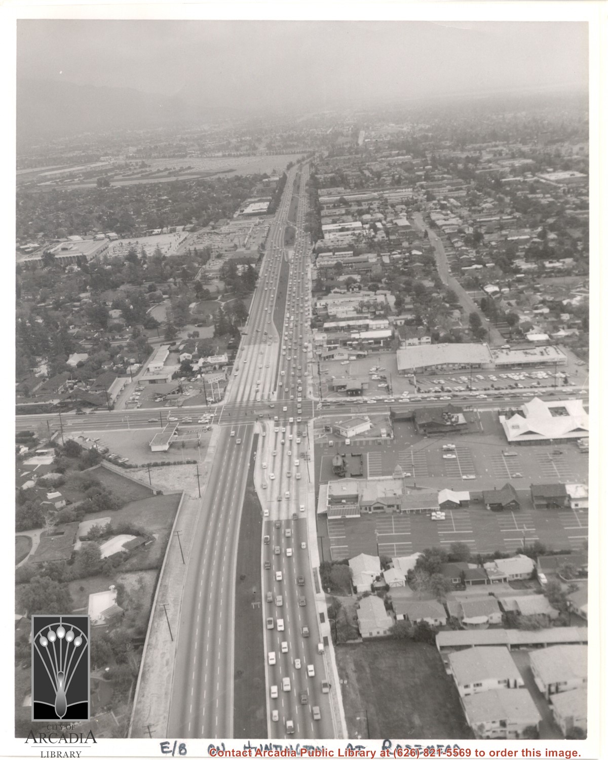
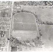
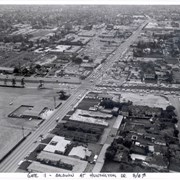
Aerial view east on Huntington Drive toward Arcadia from a position just west of Rosemead Boulevard. El Rancho Shopping Center and May Company Department Store can be seen as the business complex on the north side of Huntington Drive one block east of Rosemead Boulevard. Santa Anita Park Race Track can be seen on the left in upper portion of photo.
https://arcadiahistory.andornot.com/en/permalink/photographs637
- Date
- c.1970
1 image
- Date
- c.1970
- Subjects
- Aerial Photo Collection
- Aerial views
- El Rancho Shopping District
- Huntington Drive
- May Company Department Store
- Santa Anita Park-1945-1980
- Physical Description
- 8x10 b&w
- ID
- 633
- Collection
- Photographs
Images
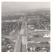
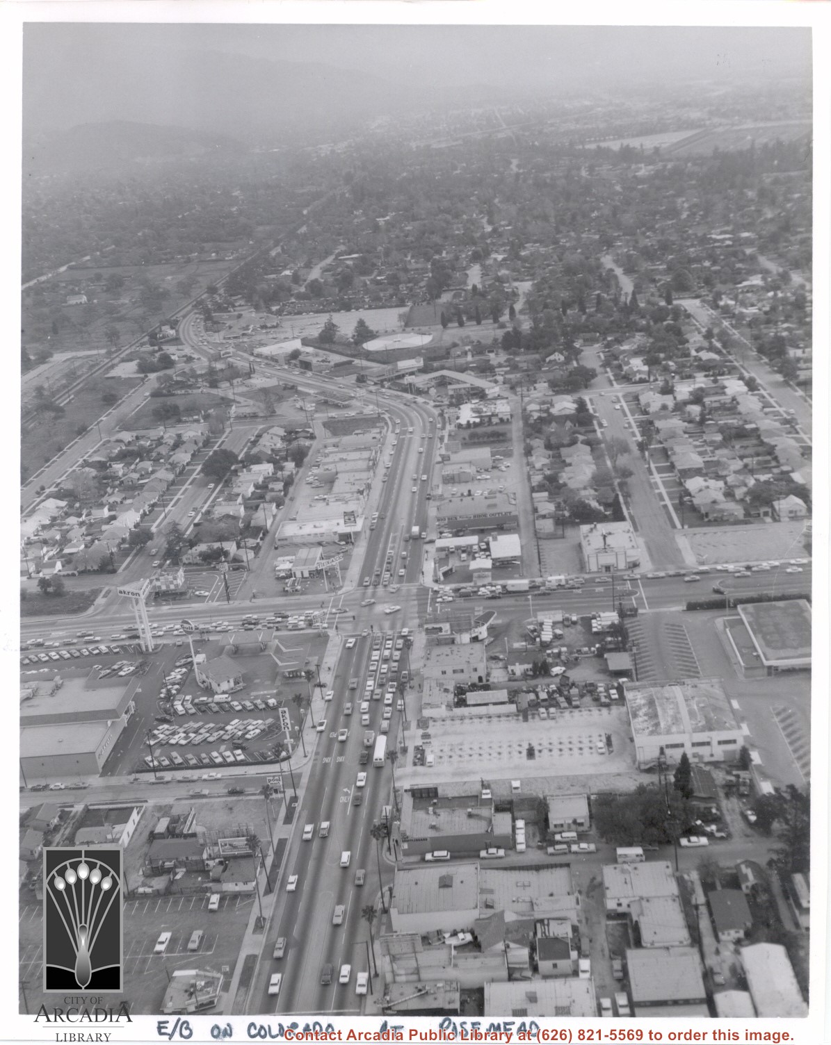
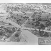
Aerial view looking east into Arcadia from near intersection of Rosemead Boulevard and Colorado Boulevard. Eaton's Santa Anita Hotel and Restaurant is still seen at far end of curve on south side of Colorado Boulevard and Michillinda Avenue (this is present site of Coco's Restaurant and Oak Tree Banquet Room, formerly Reuben's Restaurant, address 1150 W. Colorado Boulevard). The Santa Fe Railroad Tracks are seen just north of Colorado Boulevard. Large clear area in upper right portion of photo is Santa Anita Park Race Track.
https://arcadiahistory.andornot.com/en/permalink/photographs638
- Date
- c.1970
1 image
- Date
- c.1970
- Subjects
- Aerial Photo Collection
- Aerial views
- Colorado Boulevard
- Colorado Street
- Eaton's Santa Anita Hotel and Restaurant (1939-1969)
- Michillinda Avenue
- Railroads
- Santa Anita Park-1945-1980
- Physical Description
- 8x10 b&w
- ID
- 634
- Collection
- Photographs
Images
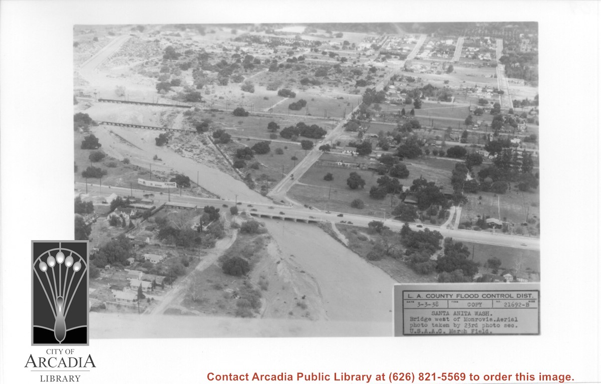
Aerial view looking north over flooded Santa Anita Wash looking upstream. Street cutting across photo closest to bottom is Huntington Drive. The next crossing upstream carries Santa Fe Railroad track. The last crossing that is clearly visible is Pacific Electric Railroad bridge. North/south street crossing Huntington Drive nearest wash would be Fifth Avenue. Foothill Boulevard is just barely visible near top of photo.
https://arcadiahistory.andornot.com/en/permalink/photographs815
- Date
- March 3, 1938
1 image
- Date
- March 3, 1938
- Subjects
- Aerial Photo Collection
- Aerial views
- Fifth Avenue
- Flood control
- Foothill Boulevard
- Huntington Drive
- Railroads
- Santa Anita Wash
- Physical Description
- 5x7 b&w
- ID
- 809
- Collection
- Photographs
Images
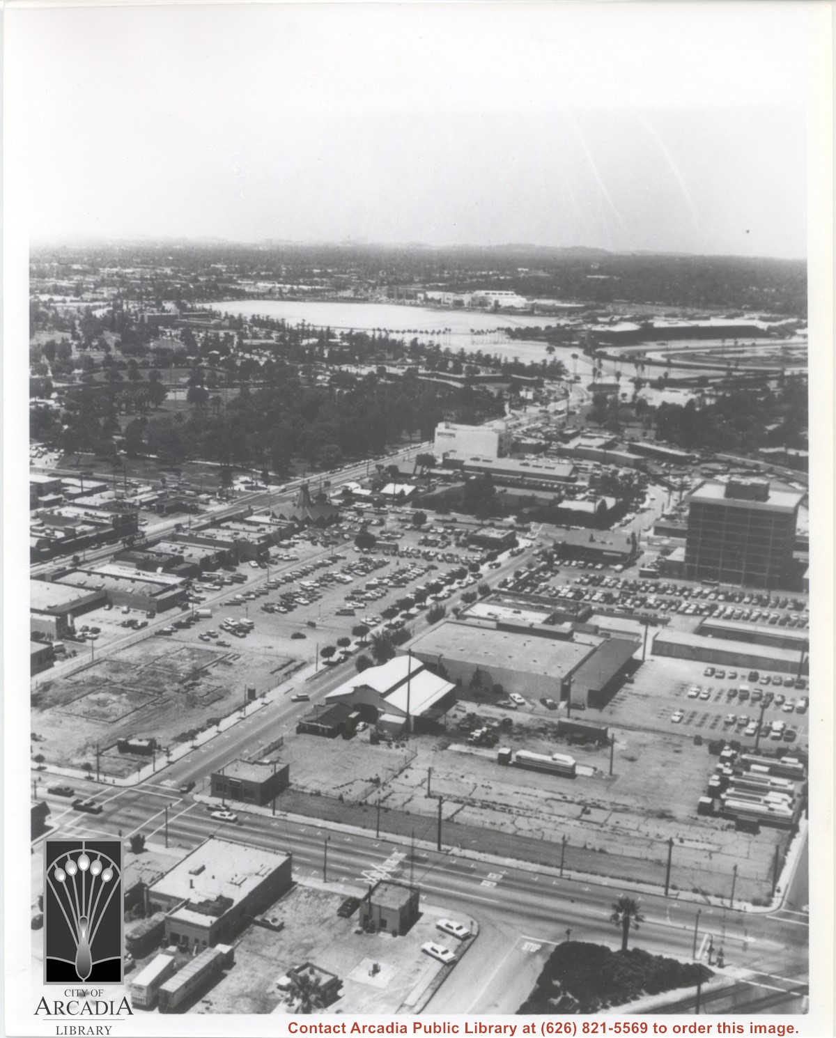
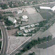
Aerial view looking west from a position approximately over Santa Fe railroad tracks between First Avenue and Second Avenue. Street closest to camera is First Avenue, running north/south, and we see its intersection with Wheeler Avenue in lower left portion of photo. Almost vacant lot on northwest corner of Wheeler Avenue and First Avenue is where Sawmill Restaurant was built in about 1977 (Sawmill Restaurant closed in early 1990's). Foundation work on South side of Wheeler Avenue at corner of First Avenue is for medical building which became 65 N. First Avenue. (Former site of Arcadia Public Library until 1961.) Post Office is largest building in center of the block on north side of Wheeler Avenue. Large white area is parking area for Santa Anita Park Race Track.
https://arcadiahistory.andornot.com/en/permalink/photographs640
- Date
- July 1976
1 image
- Date
- July 1976
- Subjects
- Aerial Photo Collection
- Aerial views
- First Avenue
- Postal Service
- Santa Anita Park-1945-1980
- United States Post Office
- Wheeler Avenue
- Physical Description
- 8x10 b&w
- ID
- 636
- Collection
- Photographs
Images
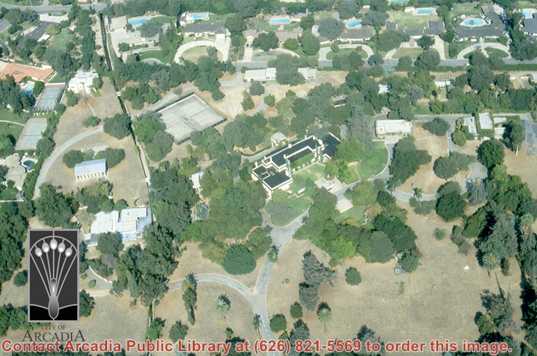
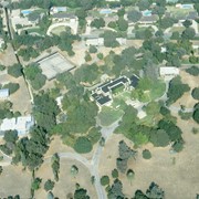
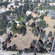
Aerial view, of Anita M. Baldwin's former estate known as Anoakia, looking north. Address was at 701 West Foothill Boulevard in Arcadia, when it was the Anoakia School. Any use of this image must be credited "Photograph by David Stevens. Copyright David Stevens."
https://arcadiahistory.andornot.com/en/permalink/photographs2411
- Date
- 1990?
1 image
- Date
- 1990?
- Subjects
- Aerial Photo Collection
- Aerial views
- Anoakia
- Anoakia School
- Baldwin, Anita M.
- David Stevens Collection
- Physical Description
- color image, digital, see i:images
- ID
- 2271
- Collection
- Photographs
Images
Aerial view, of Anita M. Baldwin's former estate known as Anoakia, looking north. Address was at 701 West Foothill Boulevard in Arcadia, when it was the Anoakia School. Any use of this image must be credited "Photograph by David Stevens. Copyright David Stevens."
https://arcadiahistory.andornot.com/en/permalink/photographs2414
- Date
- 1990?
1 image
- Date
- 1990?
- Subjects
- Aerial Photo Collection
- Aerial views
- Anoakia
- Anoakia School
- Baldwin, Anita M.
- David Stevens Collection
- Physical Description
- color image, digital, see i:images
- ID
- 2272A
- Collection
- Photographs
Images
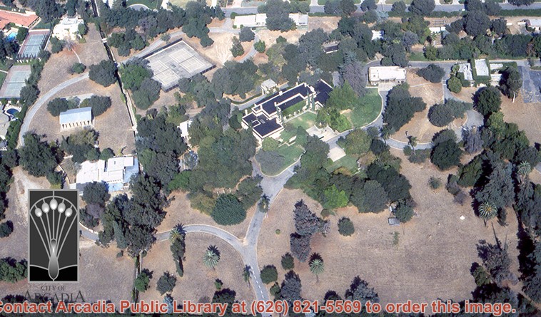
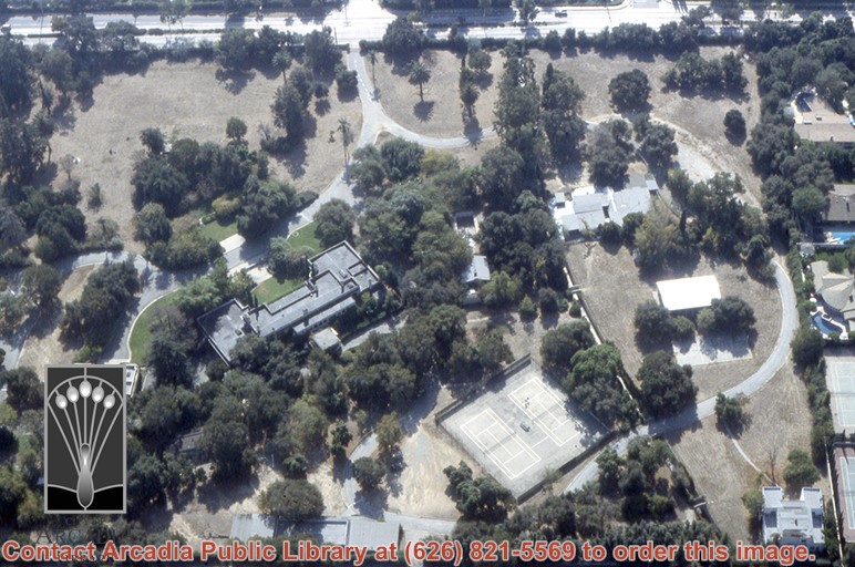
Aerial view, of Anita M. Baldwin's former estate known as Anoakia, looking north. Address was at 701 West Foothill Boulevard in Arcadia, when it was the Anoakia School. The street that runs north/south is North Baldwin Avenue. The street that runs east/west is Foothill Boulevard. Any use of this image must be credited "Photograph by David Stevens. Copyright David Stevens."
https://arcadiahistory.andornot.com/en/permalink/photographs2413
- Date
- 1990?
1 image
- Date
- 1990?
- Subjects
- Aerial Photo Collection
- Aerial views
- Anoakia
- Anoakia School
- Baldwin, Anita M.
- David Stevens Collection
- Physical Description
- color image, digital, see i:images
- ID
- 2271A
- Collection
- Photographs
Images
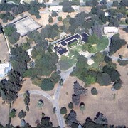
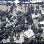
Aerial view, of Anita M. Baldwin's former estate known as Anoakia, looking south. Address was at 701 West Foothill Boulevard in Arcadia, when it was the Anoakia School. Any use of this image must be credited "Photograph by David Stevens. Copyright David Stevens."
https://arcadiahistory.andornot.com/en/permalink/photographs2412
- Date
- 1990?
1 image
- Date
- 1990?
- Subjects
- Aerial Photo Collection
- Aerial views
- Anoakia
- Anoakia School
- Baldwin, Anita M.
- David Stevens Collection
- Physical Description
- color image, digital, see i:images
- ID
- 2272
- Collection
- Photographs
Images
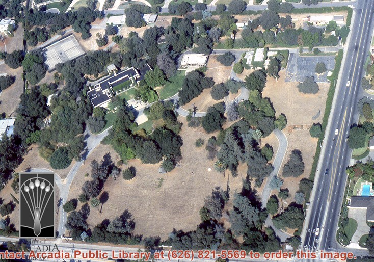
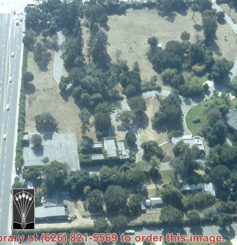
Aerial view, of Anita M. Baldwin's former estate known as Anoakia, looking west. Address was at 701 West Foothill Boulevard in Arcadia, when it was the Anoakia School. Street on the left is Foothill Boulevard? Gatehouse in the lower left corner? Any use of this image must be credited "Photograph by David Stevens. Copyright David Stevens."
https://arcadiahistory.andornot.com/en/permalink/photographs2415
- Date
- 1990?
1 image
- Date
- 1990?
- Subjects
- Aerial Photo Collection
- Aerial views
- Anoakia
- Anoakia School
- Baldwin, Anita M.
- David Stevens Collection
- Physical Description
- color image, digital, see i:images
- ID
- 2273
- Collection
- Photographs
Images
Aerial view of Rancho Santa Anita taken above Dairy, looking north, with 5,000,000 gallon reservoir in lower left, and Baldwin's one mile training track built in 1876 with stud barn buildings on south end of track. Eaton's Santa Anita at Colorado Boulevard and Michillinda Avenue just visible at top of photo.
https://arcadiahistory.andornot.com/en/permalink/photographs1542
- Date
- March 7, 1940
1 image
- Date
- March 7, 1940
- Subjects
- Aerial Photo Collection
- Aerial views
- Baldwin, Elias J. "Lucky" - Horses and horse racing
- Colorado Boulevard
- Michillinda Avenue
- Rancho Santa Anita
- Restaurants, bars, etc - Eaton's Santa Anita Hotel and Restaurant
- Physical Description
- 8x10 b&w
- ID
- 1526
- Collection
- Photographs
Images

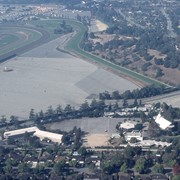
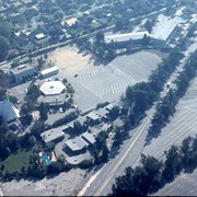
Aerial view, of Santa Anita Park Race Track in the upper left quadrant (address is 285 West Huntington Drive) and the white A-Frame roof of Santa Anita Church (address is 226 West Colorado Boulevard) in the lower right quadrant. A six-sided, hexagon building seen to the left of Santa Anita Church, is the Fireside Room and Fellowship Hall, which is part of the Santa Anita Church. Any use of this image must be credited "Photograph by David Stevens. Copyright David Stevens."
https://arcadiahistory.andornot.com/en/permalink/photographs2416
- Date
- 1990?
1 image
- Date
- 1990?
- Subjects
- Aerial Photo Collection
- Aerial views
- David Stevens Collection
- Santa Anita Church
- Santa Anita Park
- Physical Description
- color image, digital, see i:images
- ID
- 2274
- Collection
- Photographs
Images

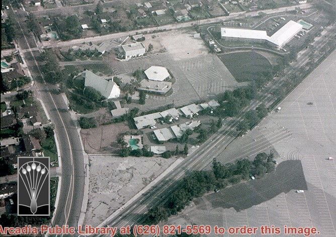
Aerial view, of the white A-Frame roof of Santa Anita Church (address is 226 West Colorado Boulevard, Arcadia, California). A six-sided, hexagon building near Santa Anita Church is the Fireside Room and Fellowship Hall, which is part of the Santa Anita Church. Any use of this image must be credited "Photograph by David Stevens. Copyright David Stevens."
https://arcadiahistory.andornot.com/en/permalink/photographs2420
- Date
- 1990?
1 image
- Date
- 1990?
- Physical Description
- color image, digital, see i:images
- ID
- 2278
- Collection
- Photographs
Images
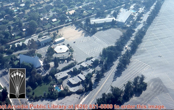
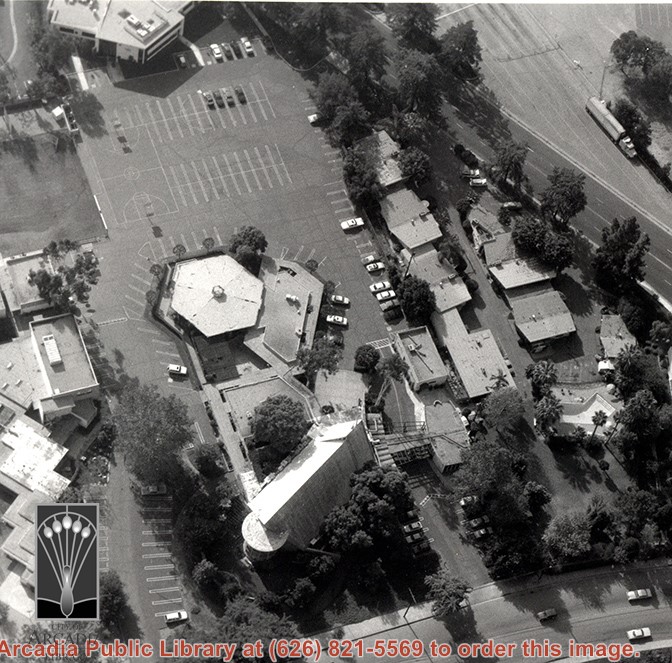
Aerial view, of the white A-Frame roof of Santa Anita Church (address is 226 West Colorado Boulevard, Arcadia, California). A six-sided, hexagon building near Santa Anita Church is the Fireside Room and Fellowship Hall, which is part of the Santa Anita Church. The church property goes all the way to Colorado Place (including "The Village Apartments," formerly the Frontier Motel, which the church purchased in 1972) and includes the parking lot and the building at the top of the photo, the Margaret Stevens Center. Any use of this image must be credited "Photograph by David Stevens. Copyright David Stevens."
https://arcadiahistory.andornot.com/en/permalink/photographs2421
- Date
- 1990?
1 image
- Date
- 1990?
- Physical Description
- color image, digital, see i:images
- ID
- 2279
- Collection
- Photographs
Images
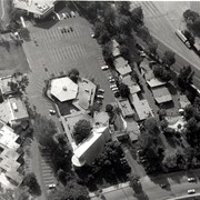
Aerial view, of the white A-Frame roof of Santa Anita Church (address is 226 West Colorado Boulevard, Arcadia, California). The Fireside Room and Fellowship Hall is the building with a hexagonal roof, seen to the right of Santa Anita Church. Any use of this image must be credited "Photograph by David Stevens. Copyright David Stevens."
https://arcadiahistory.andornot.com/en/permalink/photographs2419
- Date
- 1990?
1 image
- Date
- 1990?
- Physical Description
- color image, digital, see i:images
- ID
- 2277
- Collection
- Photographs
Images
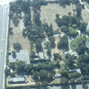
Aerial view of what appears to be either an informal horse show or possible horse sale with a great number of people in attendance. The location has been identified as near intersection of Las Tunas Drive and (with what seem to be railroad tracks in center) Temple City Boulevard. The building (we see only roof) in the lower left corner is Vernon's Pharmacy. The letters VGS can be seen over front entry. There are probably about 100 autos parked nearby. (There is another photo of this event, #539.)
https://arcadiahistory.andornot.com/en/permalink/photographs647
- Date
- c. early 1930's
1 image


Aerial view showing Eaton's Santa Anita in foreground, looking south from Colorado Boulevard and Michillinda Avenue. Lucky Baldwin's one mile training track built in 1876 is visible with stud barn buildings on south end of track.
https://arcadiahistory.andornot.com/en/permalink/photographs1541
- Date
- March 7, 1940
1 image
- Date
- March 7, 1940
- Subjects
- Aerial Photo Collection
- Aerial views
- Baldwin, Elias J. "Lucky" - Horses and horse racing
- Colorado Boulevard
- Michillinda Avenue
- Rancho Santa Anita
- Restaurants, bars, etc - Eaton's Santa Anita Hotel and Restaurant
- Physical Description
- 8x10 b&w
- ID
- 1525
- Collection
- Photographs
Images
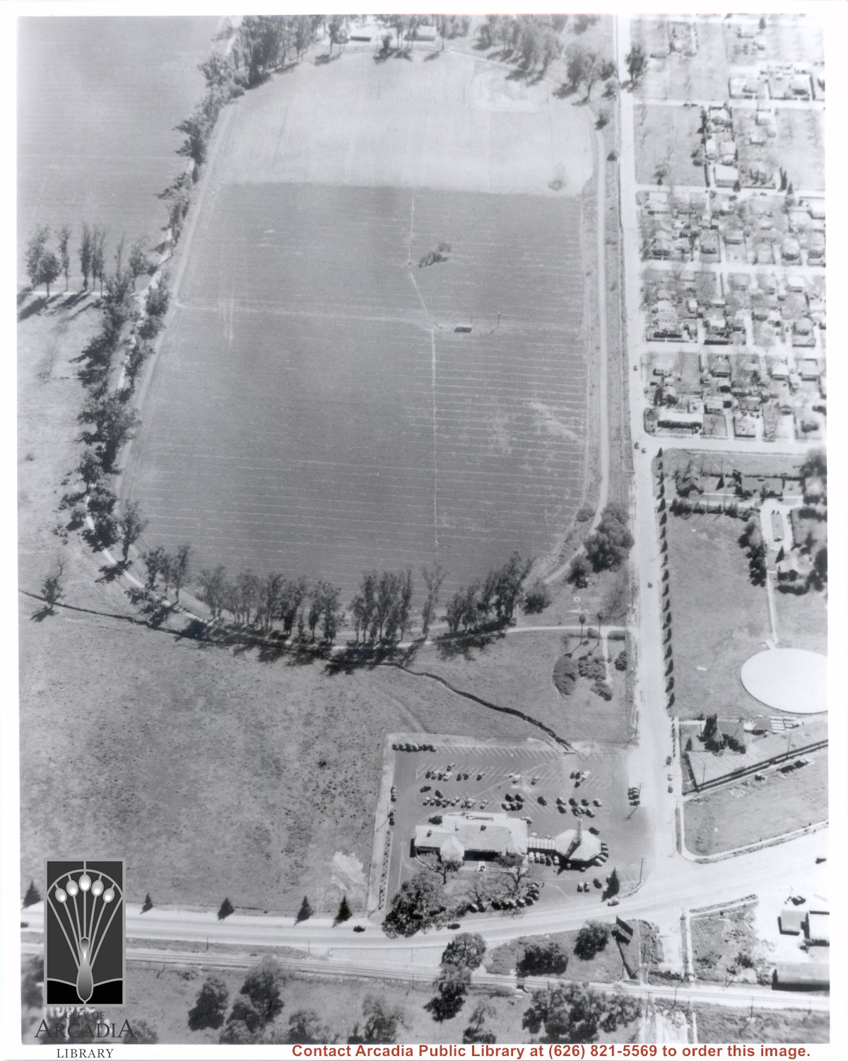
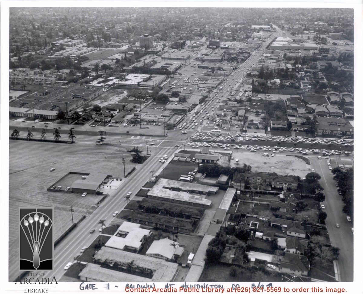
Aerial view south on Baldwin Avenue. From position just north of Huntington Drive (during racing season) showing great number of cars coming east on Huntington Drive to races through Gate #1. One building in Santa Anita Park Race Track parking lot is Fire Station at 630 S. Baldwin Avenue. Duarte Road is distantly seen in upper portion of photo, about 1 1/4 in. from top of photo. The multi-storied Medical Building seen is at 612 W. Duarte Road.
https://arcadiahistory.andornot.com/en/permalink/photographs636
- Date
- c.1970
1 image
- Date
- c.1970
- Subjects
- Aerial Photo Collection
- Aerial views
- Arcadia Fire Department
- Baldwin Avenue
- Duarte Road
- Huntington Drive
- Santa Anita Park-1945-1980
- Physical Description
- 8x10 b&w
- ID
- 632
- Collection
- Photographs
Images
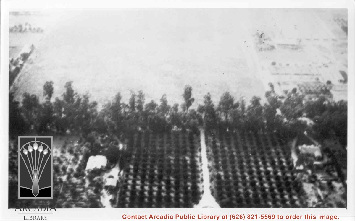
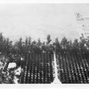
Aerial view west toward Santa Anita Ave. from above First Avenue, site of new grammar school. Long driveway heads to Jaspar N. Teague home in center of 10 acre orange grove. (Address in City Directory for this name is 1380 S. Santa Anita.) House to left and south was that of Charles W. Stewart in another 10 acre plot. Both ranches are now occupied by First Avenue Junior High School.
https://arcadiahistory.andornot.com/en/permalink/photographs12
- Date
- November 1929
1 image
- Date
- November 1929
- Subjects
- Houses
- Teague, Jaspar
- Stewart, Charles W.
- Agriculture
- First Avenue Junior High School
- Arcadia(City)-History-1920-1929
- Physical Description
- 6x10 b&w
- ID
- 12
- Collection
- Photographs
Images
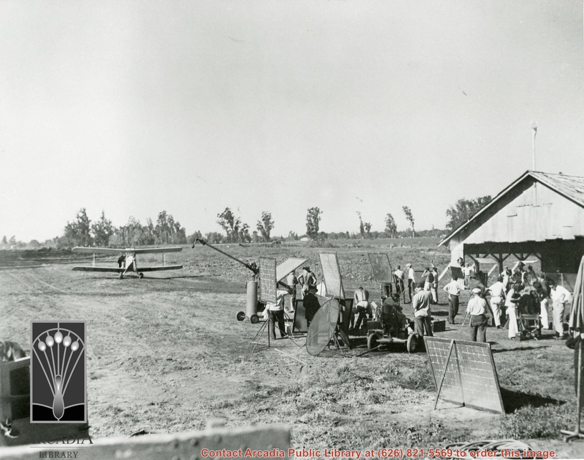
Airport scene taken at the Arboretum. Airplane on left and part of hangar visible on right. A number of people are standing around by the hangar. Handwritten note on back of photo states, "The plane taking off from landing field just west of Rancho Santa Anita Park in 'Safari'."
https://arcadiahistory.andornot.com/en/permalink/photographs1537
- Date
- undated
1 image
- Date
- undated
- Subjects
- Motion pictures
- Arboretum
- Physical Description
- 8x10 b&w
- ID
- 1521
- Collection
- Photographs
Images