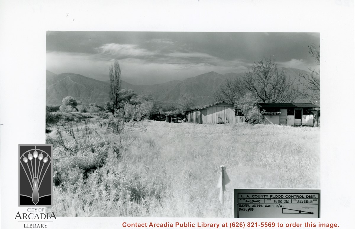
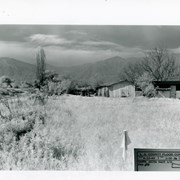
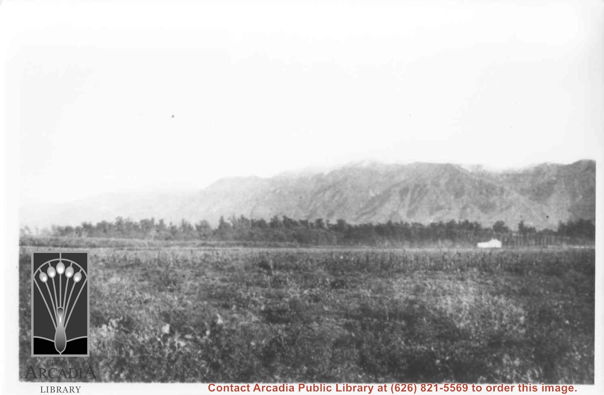
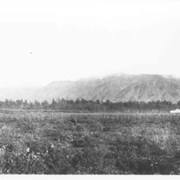
Small house and garage pictured on right side of photo. The view is across field of grass toward San Gabriel Mountains in background. Dramatic clouds fill the sky. There is a bare, tall Lombardy Poplar pictured near the wash. Caption on photo says it is Santa Anita Wash, but viewer is not aware of it. It must lie along left side of photo.
https://arcadiahistory.andornot.com/en/permalink/photographs826
- Date
- April 19, 1940
1 image
- Date
- April 19, 1940
- Subjects
- Santa Anita Wash
- San Gabriel Mountains
- Physical Description
- 5x7 b&w
- ID
- 820
- Collection
- Photographs
Images
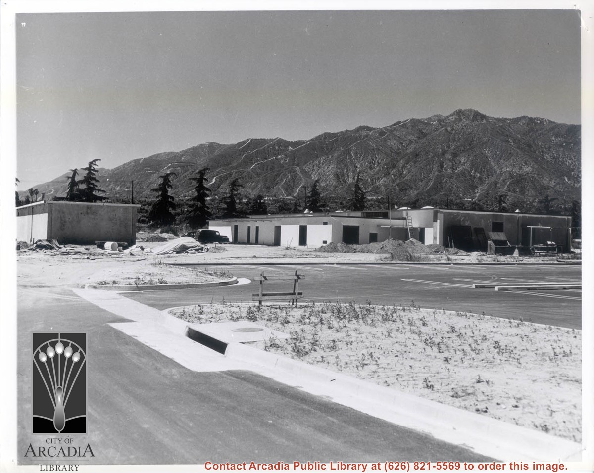
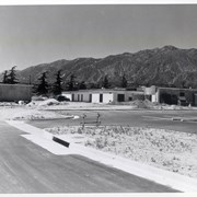
Side and back view of the yet unfinished Arcadia Police Department and its parking lot at 250 W. Huntington Drive. View of the San Gabriel Mountains is clear in the background.
https://arcadiahistory.andornot.com/en/permalink/photographs1787
- Date
- 1956
1 image
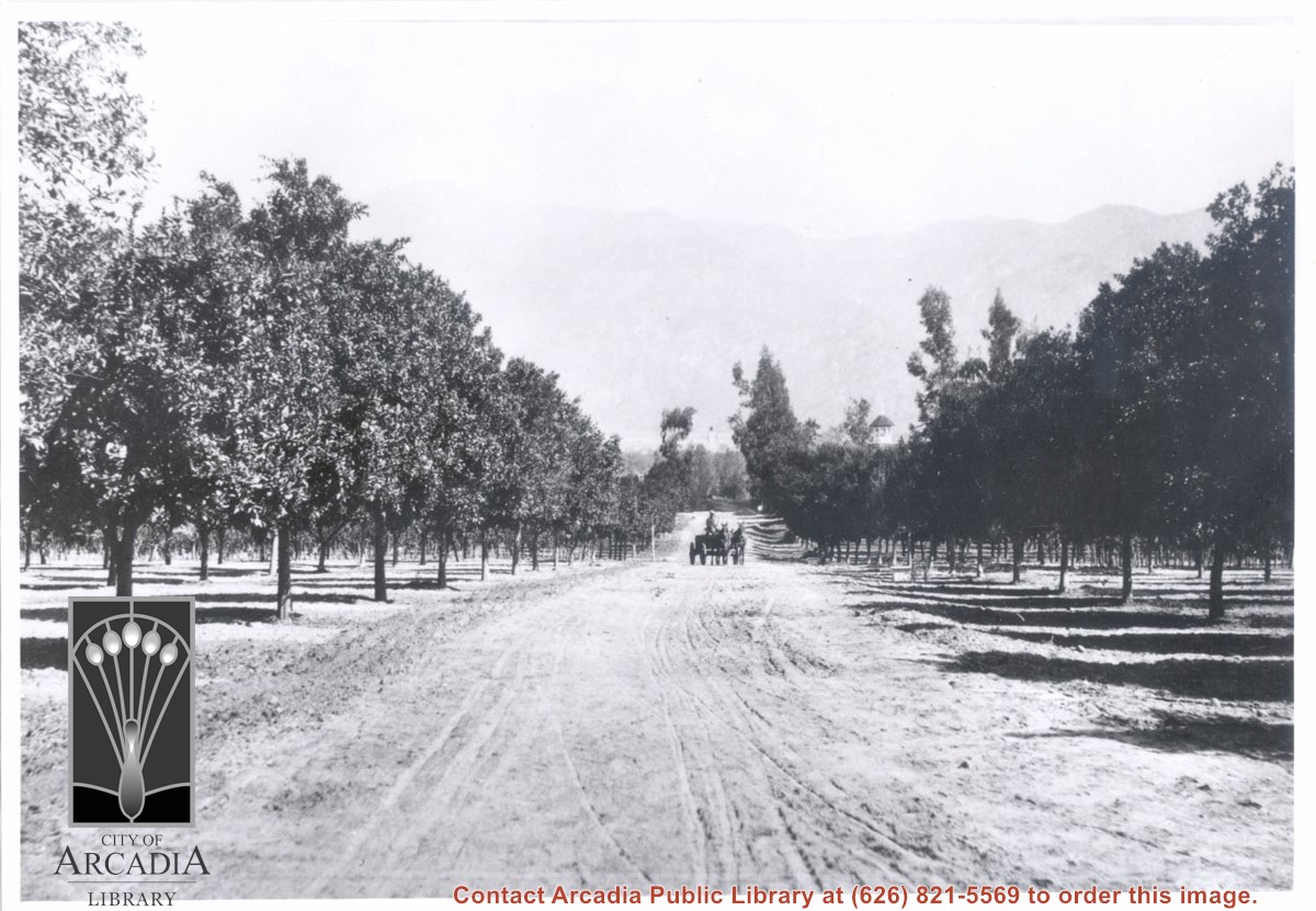
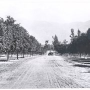
View north toward San Gabriel Mountains from orchards on Baldwin Ranch. Wagon pulled by two horses is on dirt lane coming toward camera. Note tower of Queen Anne Cottage on the right side of lane. On the back of this photo at Huntington Library is printed: Carter, 1937. Possible given by N. Carter family of Sierra Madre at this time. This photo belongs to the Huntington Library. It is shown here for research only.
https://arcadiahistory.andornot.com/en/permalink/photographs220
- Date
- c.1890
1 image
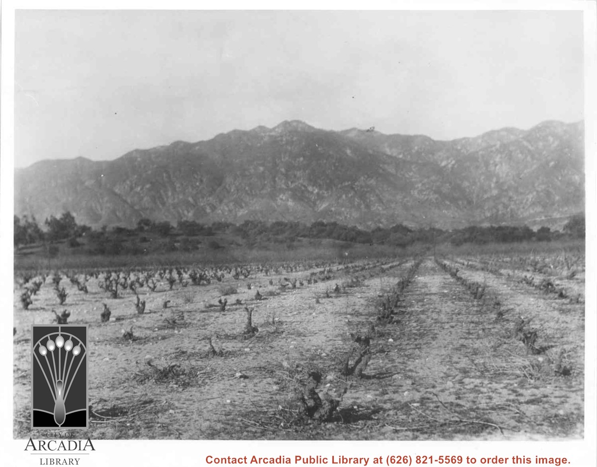
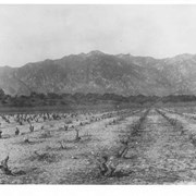
Vineyards on Baldwin Ranch. View is north from a point of present Huntington Drive. Chantry Flats Road is visible at right edge of photo. San Gabriel Mountains form background.
https://arcadiahistory.andornot.com/en/permalink/photographs2
- Date
- c.1900
1 image
- Date
- c.1900
- Subjects
- Agriculture
- Rancho Santa Anita
- Baldwin, Elias J. "Lucky" - Wines and winemaking
- San Gabriel Mountains
- Physical Description
- 8x10 b&w 2 prints 2 slides
- ID
- 2
- Collection
- Photographs
Images
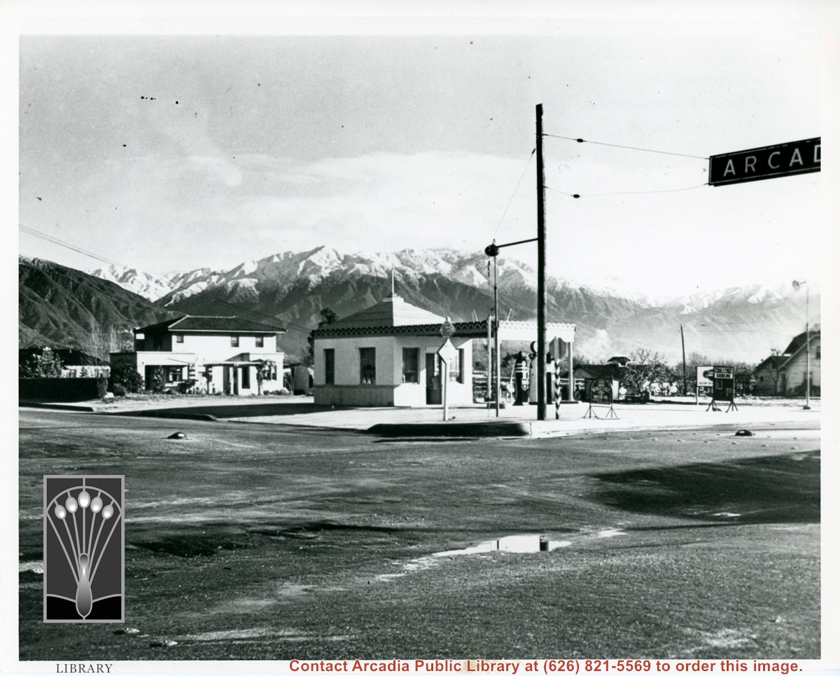
View of intersection of Baldwin Avenue and Duarte Road. Service station on the NE corner was owned by Mr. Renshaw. There is a two story house just north of station. There has been a recent snow fall in the San Gabriel Mountains. Home to the north is F.E. Grote home.
https://arcadiahistory.andornot.com/en/permalink/photographs590
- Date
- c.1935
1 image
View across Santa Anita Rancho lands toward San Gabriel Mountains, looking north, slightly to the west.
https://arcadiahistory.andornot.com/en/permalink/photographs16
- Date
- probably 1935
1 image
- Date
- probably 1935
- Physical Description
- one 3x5, one 8x10 b&w
- ID
- 16
- Collection
- Photographs
Images
Arcadia supports the North San Gabriel Valley Educational Center
https://arcadiahistory.andornot.com/en/permalink/newspaper4295
- Newspaper
- Arcadia Tribune
- Date
- April 30, 1969
- Pages
- p. 1
- Subjects
- San Gabriel Valley
- Item ID
- 4171AN
- Collection
- Newspaper Index
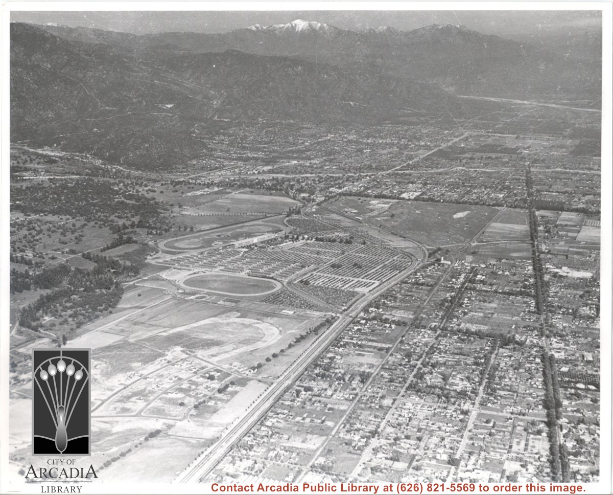
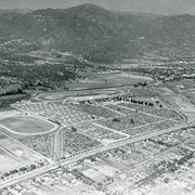
Aerial view. Looking east. Street along right edge of photo which is lined with trees is Duarte Road. Santa Anita Avenue cuts across photo from right to left and up into the San Gabriel Mountains. Huntington Drive can be seen in center of photo with young trees planted on north side of it. Santa Anita Race Track is one furthest from camera. The next small track is a training track belonging to Santa Anita. There is a VERY small round track across the street from the training track, which was part of a private horse stables. The incompleted oval was part of work done in 1933 by Joe Smoot and Anita Baldwin in their effort to develop the Jockey Club Track. This photo belongs to the Huntington Library. It is shown here for research only.
https://arcadiahistory.andornot.com/en/permalink/photographs627
- Date
- c. 1935
1 image
- Date
- c. 1935
- Subjects
- Duarte Road
- Huntington Drive
- Los Angeles Jockey Club
- San Gabriel Mountains
- Santa Anita Park-1934-1942
- Physical Description
- 8x10 b&w
- ID
- 623
- Collection
- Photographs
Images
Reaction was mixed among San Gabriel Valley officials on a bill before the State Legislature that would prohibit small splinter movements. This would make difficult any effort by local secessionists to get enough support to break away from Los Angeles County.
https://arcadiahistory.andornot.com/en/permalink/newspaper2422
- Newspaper
- Arcadia Tribune
- Date
- September 28 , 1977
- Pages
- p. A-1
- Subjects
- San Gabriel Valley - Secession
- Item ID
- 2373AN
- Collection
- Newspaper Index
Flames continue north to homes. Residents evacuate as Bobcat Fire jumps Highway 2, tops mountain ridge, menaces Antelope Valley. The 50,539-acre fire which once primarily threatened San Gabriel Valley foothill communities after it started on September 6, jumped Highway 2 overnight and continues to spread north, putting Antelope Valley under an evacuation warning. Evacuation warnings were still in place for parts of Monrovia, Arcadia, Duarte, Bradbury, Sierra Madre, Pasadena, and Altadena, though evacuation orders in parts of Sierra Madre and Arcadia were lifted Wednesday.
https://arcadiahistory.andornot.com/en/permalink/newspaper35806
- Newspaper
- Pasadena Star News
- Date
- September 18, 2020
- Pages
- p. A1, A7
- Collection
- Newspaper Index
With the House of Representatives leaderless and legislation going nowhere, President Biden has been urged to expand the San Gabriel Mountains National Monument. More cities, elected officials, ask president to use his executive power to add acreage to the area, including Alhambra, Monterey Park, Santa Clarita and South Pasadena. The proposed addition of 109,000 ares to the San Gabriel Mountains National Monument includes forest sections just above the cities of Monrovia, Arcadia, and Sierra Madre, and up to Santa Clarita.
https://arcadiahistory.andornot.com/en/permalink/newspaper36558
- Newspaper
- Pasadena Star News
- Date
- October 16, 2023
- Pages
- p. A1, A4
- Collection
- Newspaper Index
Aerial view toward north from a position south of Huntington Drive near intersection with Baldwin Avenue. It shows Santa Anita Fashion Park (currently known as Westfield Santa Anita Shopping Mall) developed by and on property owned by Santa Anita Consolidated. The Santa Anita Park Race Track and club house can be seen in center of photo. The straight white line about one inch above the club house roof is 210 Foothill Freeway. Chantry Flats road can be seen going up into San Gabriel Mountains in distance.
https://arcadiahistory.andornot.com/en/permalink/photographs646
- Date
- c. 1975
1 image
- Date
- c. 1975
- Subjects
- Aerial Photo Collection
- Aerial views
- 210 Foothill Freeway
- Chantry Flats Road
- Malls
- San Gabriel Mountains
- Santa Anita Park-1945-1980
- Santa Anita Fashion Park
- Westfield Santa Anita Shopping Mall
- Physical Description
- 8x10 b&w
- ID
- 642
- Collection
- Photographs
Images


The San Gabriel Valley Juvenile Diversion Program has been established to divert local youths from the criminal justice system to local counseling agencies. Arcadia is participating in this program along with Temple City, Alhambra, Monterey Park, Rosemead and San Gabriel.
https://arcadiahistory.andornot.com/en/permalink/newspaper3635
- Newspaper
- Arcadia Tribune
- Date
- June 23, 1974
- Pages
- p. A-1
- Item ID
- 3510AN
- Collection
- Newspaper Index
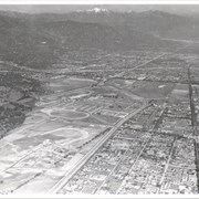
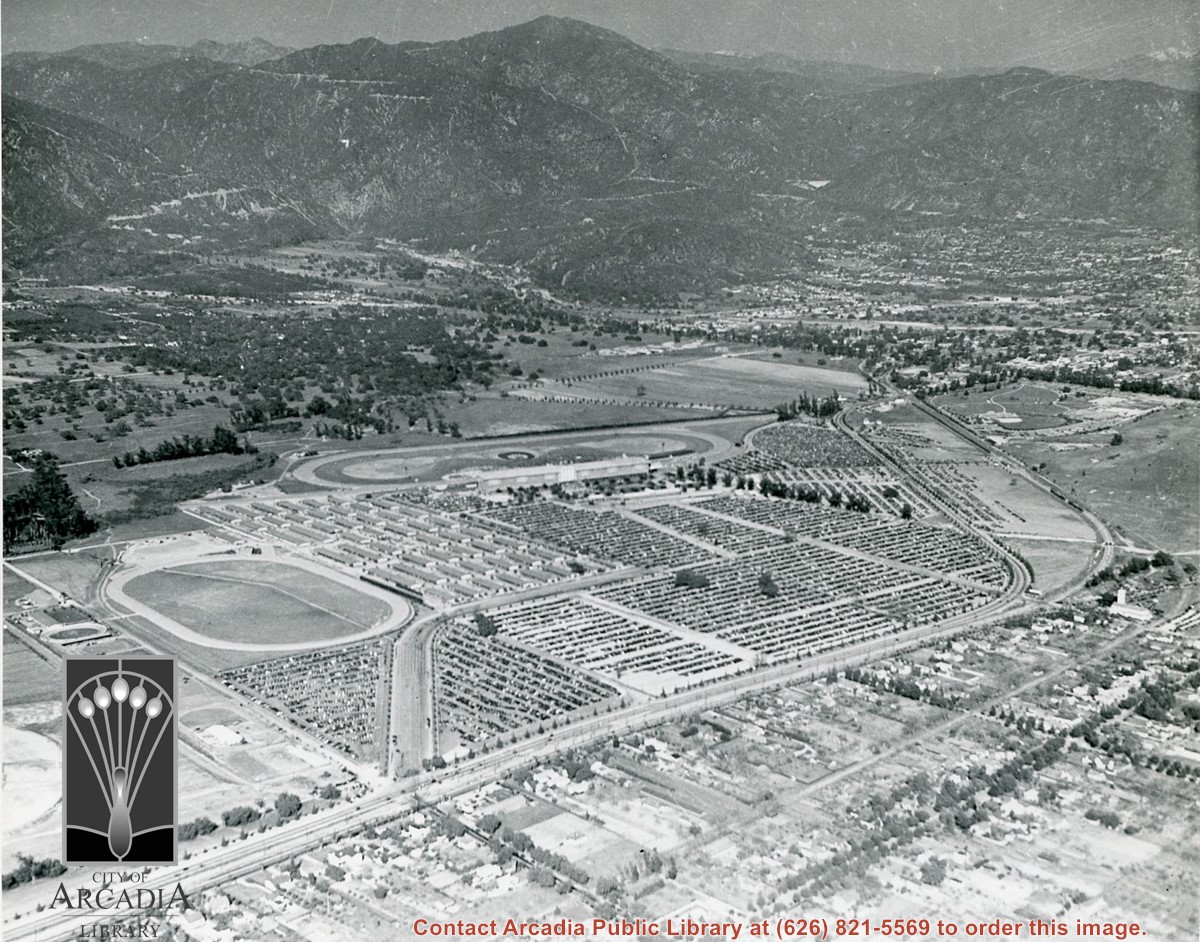
Aerial view toward NE. Main thoroughfare cutting across east to west with young trees planted on north side, is Huntington Drive. Main race track at Santa Anita is seen almost directly in center of photo, with Club House on side closest to camera. The smaller oval near left edge of photo was a training track belonging to Santa Anita which was removed for the Fashion Park. The Chantry Flats Road up to Santa Anita Canyon is clearly seen as it zig-zags around San Gabriel Mountains. This photo belongs to the Huntington Library. It is shown here for research only.
https://arcadiahistory.andornot.com/en/permalink/photographs629
- Date
- c. 1940s
1 image
- Date
- c. 1940s
- Subjects
- San Gabriel Mountains
- Santa Anita Park-1934-1942
- Chantry Flats Road
- Huntington Drive
- Fashion Park
- Physical Description
- 8x10 b&w
- ID
- 625
- Collection
- Photographs
Images
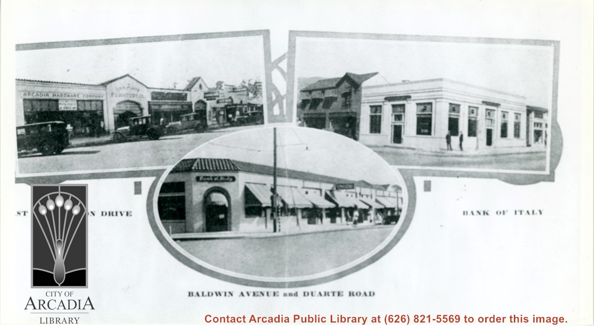
Three views of business areas in Arcadia. On left is south side of Huntington Drive. Arcadia Hardware is still located at 52 E. Huntington Drive as it is shown here. On the right is the Bank of Italy which was located on NE corner of Huntington Drive and First Ave. The building just to the north up First Ave (with awnings) is also still in use.
https://arcadiahistory.andornot.com/en/permalink/photographs896
- Date
- 1928
1 image
- Date
- 1928
- Subjects
- Business & industry
- Huntington Drive
- Baldwin Avenue
- Bank of Italy National Trust Savings
- Arcadia Hardware
- Physical Description
- 5 1/2 x 10 b&w
- ID
- 889
- Collection
- Photographs
Images
View north across part of Arcadia County Park while bleachers at ball field are still under construction. Directly north and just to the right of the eucalyptus trees can be seen the back of the Pony Express Museum on Huntington Drive. Building on right appears to be bath house for pool.
https://arcadiahistory.andornot.com/en/permalink/photographs898
- Date
- c.1937
1 image
- Date
- c.1937
- Subjects
- Arcadia County Park
- Physical Description
- 8x10 b&w
- ID
- 891
- Collection
- Photographs
Images

Bobcat Fire, on its 9th day in the San Gabriel Mountains, continued to grow north of the San Gabriel Valley. It had charred 38,299 acres Monday with containment at 3%. The fire has crossed to west side of Santa Anita Canyon. On Sunday, residents in Arcadia and Sierra Madre who live north of Elkins Avenue and east of Santa Anita Avenue were ordered to evacuate. About 305 homes were in the evacuation zone. Most are in Arcadia and 32 are in Sierra Madre.
https://arcadiahistory.andornot.com/en/permalink/newspaper35803
- Newspaper
- Pasadena Star News
- Date
- September 15, 2020
- Pages
- p. A1, A6
- Collection
- Newspaper Index
Secession took a new turn with the news that the San Fernando Valley is also considering splitting off from Los Angeles County. Background of the reasons and feelings behind these moves in both the San Fernando and San Gabriel valleys is outlined.
https://arcadiahistory.andornot.com/en/permalink/newspaper2410
- Newspaper
- Arcadia Tribune
- Date
- June 22, 1975
- Pages
- p. A-1
- Subjects
- San Gabriel Valley - Secession
- Item ID
- 2361AN
- Collection
- Newspaper Index
Bill seeks addition to forest landscape. Rep. Judy Chu, D-Pasadena, hopes to expand San Gabriel Mountains National Monument by 100,000-plus acres with the San Gabriel Mountains Protection Act, written by Representative Judy Chu. The San Gabriel Mountains are north of Arcadia.
https://arcadiahistory.andornot.com/en/permalink/newspaper36488
- Newspaper
- Pasadena Star News
- Date
- May 30, 2023
- Pages
- p. A1, A7
- Collection
- Newspaper Index
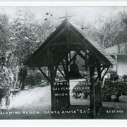
View looking east toward wing of Hugo Reid adobe added by Baldwin. Lake is on left. In foreground is a rustic shelter built to house bell which came from San Gabriel Mission under peculiar circumstances (and that was in later years returned to Mission by Anita Baldwin). There is also one of Baldwin's mastiffs (dog) standing in left foreground and unidentified man in background.
https://arcadiahistory.andornot.com/en/permalink/photographs886
- Date
- c.1893
1 image
- Date
- c.1893
- Subjects
- Rancho Santa Anita-1875-1909
- Physical Description
- 7x10 b&w
- ID
- 879
- Collection
- Photographs
Images