Reopening of long-term care facilities is a necessity.
https://arcadiahistory.andornot.com/en/permalink/newspaper35923
- Newspaper
- Pasadena Star News
- Date
- March 8, 2021
- Pages
- p. A3, A7
- Subjects
- Coronavirus-COVID-19
- Huntington Drive Health and Rehabilitation
- Long-term care facilities
- Pandemics
- Public Health
- Stark, Bill
- Stark, Melody Taylor
- Viruses
- Collection
- Newspaper Index
Every 10 minutes, someone in Los Angeles County dies from the effects of COVID-19. Melody Stark of Monrovia is shown in photo displaying a photo of her husband Dr. William Stark who was a resident of Huntington Drive Health and Rehabilitation Center in Arcadia. He died on November 22, 2020. Since March, 2020, 10,056 people have died from the coronavirus.
https://arcadiahistory.andornot.com/en/permalink/newspaper35887
- Newspaper
- Pasadena Star News
- Date
- January 1, 2021
- Pages
- p. A1, A11
- Subjects
- Coronavirus-COVID-19
- Deaths
- Huntington Drive Health and Rehabilitation Center
- Pandemics
- Public Health
- Stark, Melody
- Stark, William (Dr.)
- Collection
- Newspaper Index
Dr. William A. Stark, 84, a retired dentist who had several medical issues, died after he and his wife endured months of pandemic visitation restrictions at his Arcadia nursing home.
https://arcadiahistory.andornot.com/en/permalink/newspaper35863
- Newspaper
- Pasadena Star News
- Date
- December 8, 2020
- Pages
- p. A1, A5
- Subjects
- Coronavirus-COVID-19
- Deaths
- Huntington Drive Health and Rehabilitation Center
- Nursing homes
- Pandemics
- Stark, Melody Taylor
- Stark, William A.
- Collection
- Newspaper Index
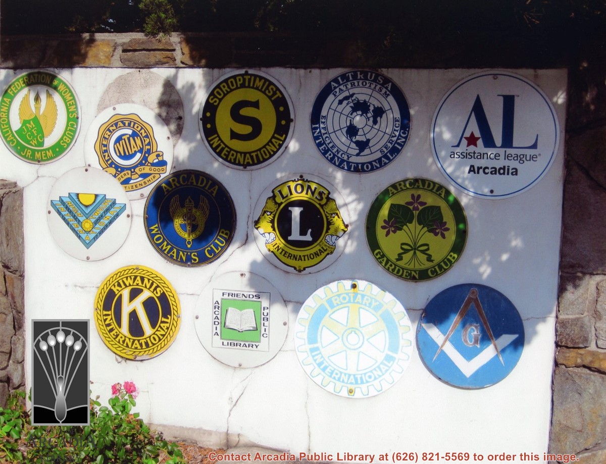
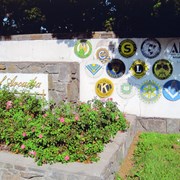
Service club plaques at the West Huntington monument sign. Location is the center divider at Huntington Drive at Michillinda Avenue. Plaques of the California Federation of Women's Clubs, Civitan, Soroptimist International, Friends of the Arcadia Public Library, Freemasons, Rotary International, Altrusa, Inc., Assistance League Arcadia, High Twelve International, Arcadia Woman's Club, Lions International, Arcadia Garden Club, Kiwanis International. Digital image printed on photo paper by inkjet printer.
https://arcadiahistory.andornot.com/en/permalink/photographs1889
- Date
- September 18, 2013
1 image
- Date
- September 18, 2013
- Physical Description
- 8x10 color
- ID
- 1870
- Collection
- Photographs
Images
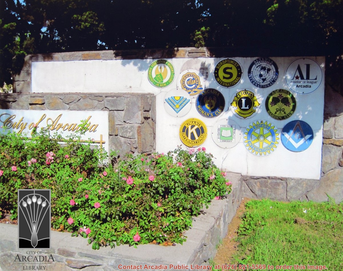
Service club plaques at the West Huntington monument sign. "City of Arcadia" sign is in view. Location is the center divider at Huntington Drive at Michillinda Avenue. Plaques of the California Federation of Women's Clubs, Civitan, Soroptimist International, Friends of the Arcadia Public Library, Freemasons, Rotary International, Altrusa, Inc., Assistance League Arcadia, High Twelve International, Arcadia Woman's Club, Lions International, Arcadia Garden Club, Kiwanis International. Digital image printed on photo paper by inkjet printer.
https://arcadiahistory.andornot.com/en/permalink/photographs1890
- Date
- September 18, 2013
1 image
- Date
- September 18, 2013
- Physical Description
- 8x10 color
- ID
- 1871
- Collection
- Photographs
Images
A portion of Huntington Drive will be closed intermittently from Dec. 8 to 17 for the filming of "Numbers," starring John Travolta.
https://arcadiahistory.andornot.com/en/permalink/newspaper17834
- Newspaper
- Pasadena Star News p A4
- Date
- November 22, 1999
- Item ID
- 18034AN
- Collection
- Newspaper Index
The Arcadia intersection of Huntington Drive and Sunset Blvd. was one of the nine worst in Los Angeles County in 1998 according to a study by the Automobile Association of Southern California.
https://arcadiahistory.andornot.com/en/permalink/newspaper27139
- Newspaper
- Arcadia Weekly
- Date
- September 30, 1999
- Pages
- p. 1
- Item ID
- 27337AN
- Collection
- Newspaper Index
Information about the formal opening of Huntington Drive on April 11, 1929 is presented.
https://arcadiahistory.andornot.com/en/permalink/newspaper26398
- Newspaper
- Arcadia Weekly
- Date
- August 20, 1998
- Pages
- p. 1
- Subjects
- Streets - Huntington Drive
- Item ID
- 26598AN
- Collection
- Newspaper Index
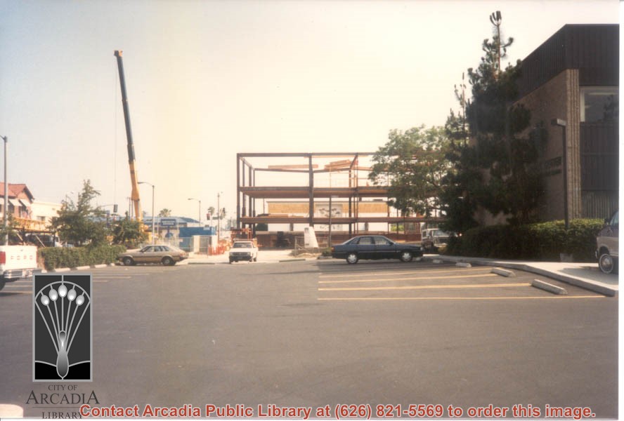
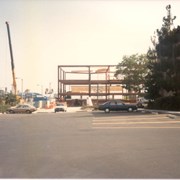
Construction site of a multi-story building at NW corner of Huntington Drive and First Avenue.
https://arcadiahistory.andornot.com/en/permalink/photographs1200
- Date
- July 8, 1987
1 image
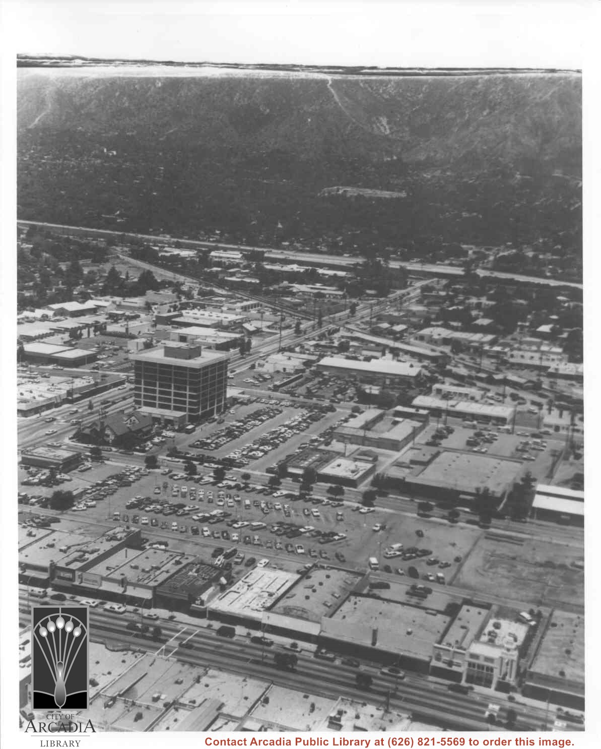
Aerial view north toward San Gabriel Mountains from a position above Huntington Drive near First Avenue. Santa Anita Avenue can plainly be seen running north and south in front of six-story building in center of photo. The 210 Foothill Freeway is top band running across photo from east to west.
https://arcadiahistory.andornot.com/en/permalink/photographs611
- Date
- July 1976
1 image

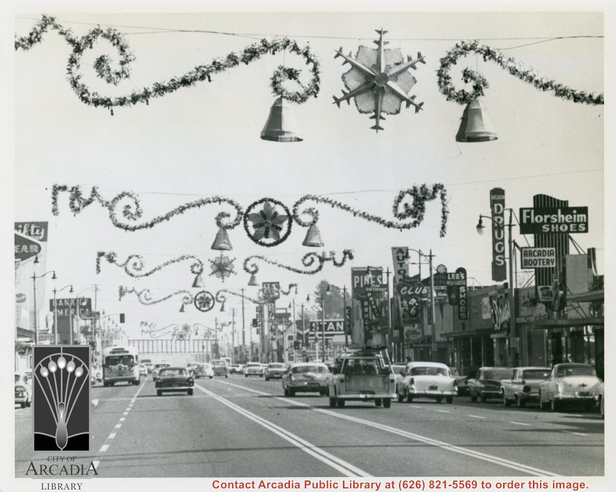
View east on Huntington Drive mid-way in block between Santa Anita and First Avenue during holiday season. Notice the Arcadia sign that had for many years hung over intersection at First Avenue has been removed (also referred to as a "Welcome" sign). Santa Fe Railroad overpass in view crossing over Huntington Drive.
https://arcadiahistory.andornot.com/en/permalink/photographs605
- Date
- November 13, 1959
1 image
- Date
- November 13, 1959
- Physical Description
- 8x10 b&w
- ID
- 601
- Collection
- Photographs
Images
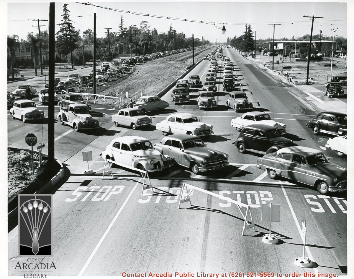
In bound Santa Anita race track traffic looking west on Huntington Drive at Baldwin Avenue. Cars bumper to bumper waiting to enter parking lot.
https://arcadiahistory.andornot.com/en/permalink/photographs1751
- Date
- 1954
1 image
Santa Anita Park Race Track just right of center at south edge of photo. Oval to the left of Santa Anita Park Race Track was training track which was removed to make room for Santa Anita Fashion Park (currently Westfield Santa Anita Shopping Mall). Street just to left of training track is Baldwin Avenue. Huntington Drive and Colorado Place form a "y" just east of Santa Anita Park Race Track. Along both can be noticed the conifer trees planted a few years earlier. Street completely bisecting photo just below center is Foothill Boulevard, next one is Orange Grove Avenue. Santa Anita Avenue is partially in view on right edge of photo. Oval on extreme lower left side of photo is old Baldwin training track. Baseball diamond in lower right corner is at Arcadia County Park. Scale: 1"=660'
https://arcadiahistory.andornot.com/en/permalink/photographs620
- Date
- June 5, 1938
1 image
- Date
- June 5, 1938
- Subjects
- Aerial Photo Collection
- Aerial views
- Baldwin Avenue
- Colorado Boulevard
- Colorado Place
- Colorado Street
- Foothill Boulevard
- Huntington Drive
- Orange Grove Avenue
- Santa Anita Fashion Park (later known as Westfield Santa Anita)
- Santa Anita Park-1934-1942
- Physical Description
- 8x10 b&w
- ID
- 616
- Collection
- Photographs
Images


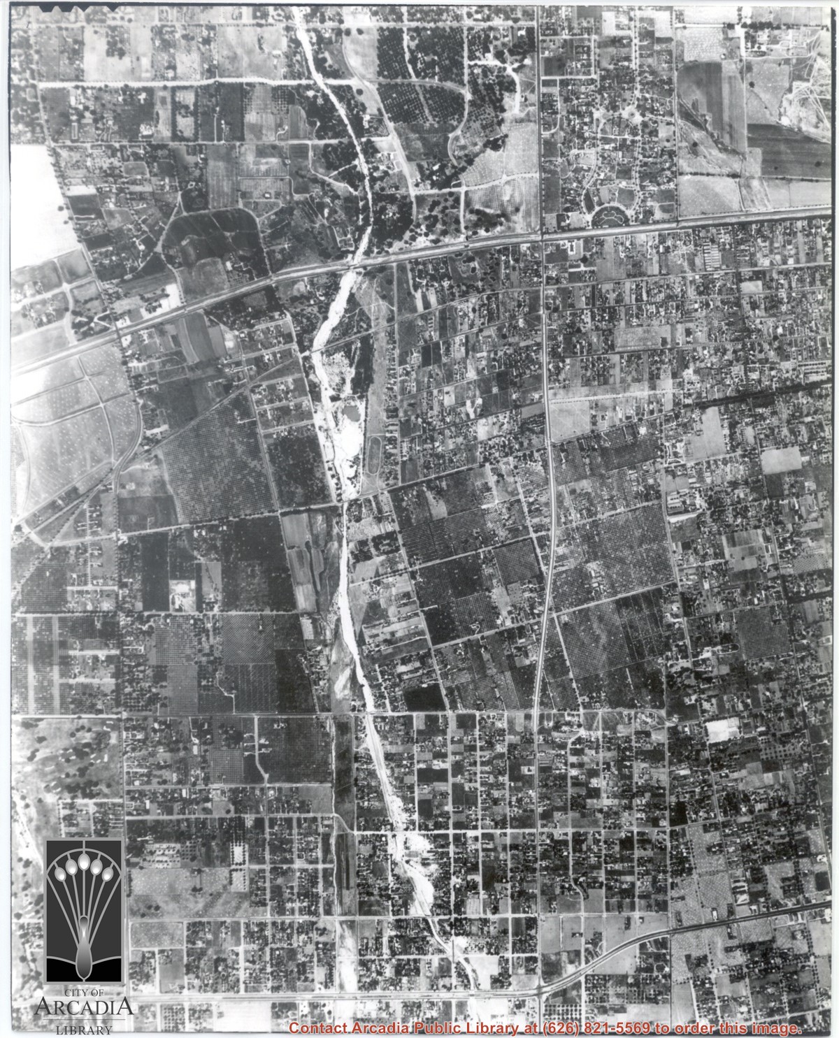
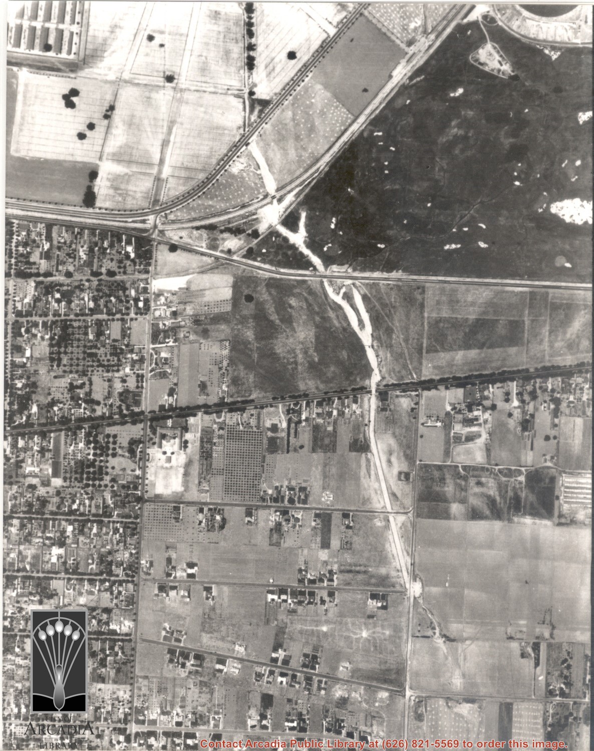
Main road crossing photo east to west in top third of photo is Huntington Drive. The main street running North/South in right portion of photo is Rosemead Boulevard. Wash running North/South is Eaton Wash. Very little in this view is of Arcadia.
https://arcadiahistory.andornot.com/en/permalink/photographs624
- Date
- June 5, 1938
1 image
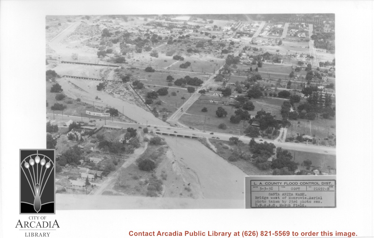
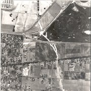
Aerial view looking north over flooded Santa Anita Wash looking upstream. Street cutting across photo closest to bottom is Huntington Drive. The next crossing upstream carries Santa Fe Railroad track. The last crossing that is clearly visible is Pacific Electric Railroad bridge. North/south street crossing Huntington Drive nearest wash would be Fifth Avenue. Foothill Boulevard is just barely visible near top of photo.
https://arcadiahistory.andornot.com/en/permalink/photographs815
- Date
- March 3, 1938
1 image
- Date
- March 3, 1938
- Subjects
- Aerial Photo Collection
- Aerial views
- Fifth Avenue
- Flood control
- Foothill Boulevard
- Huntington Drive
- Railroads
- Santa Anita Wash
- Physical Description
- 5x7 b&w
- ID
- 809
- Collection
- Photographs
Images
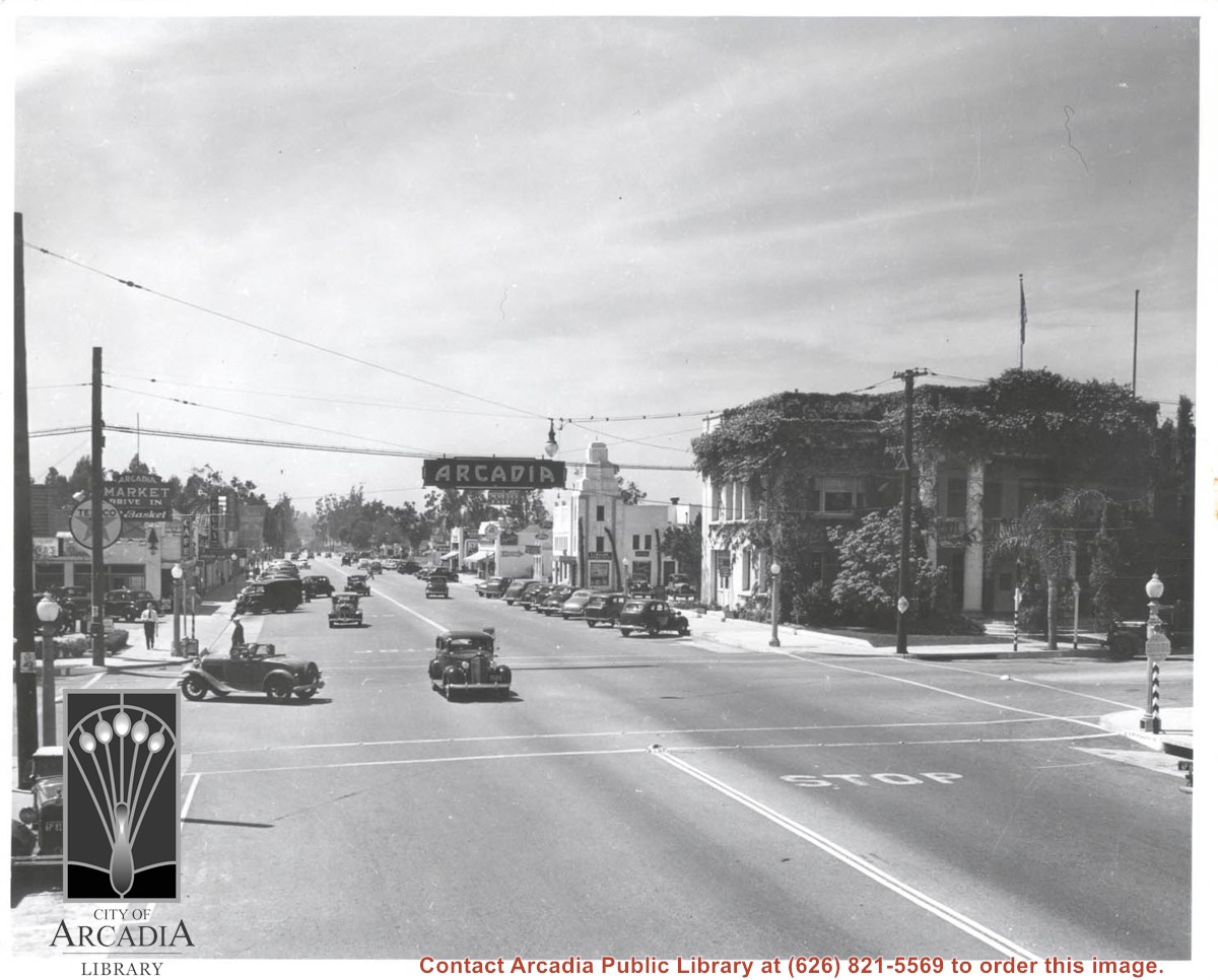
Huntington Drive looking west from near intersection of First Avenue. On NW corner is vine-covered City Hall. Open roadster has just made a left turn and is going south on First. There is a moving picture theater mid-way along street on south side with large banner advertising Charles Laughton Film. This photo belongs to the Huntington Library. It is shown here for research only.
https://arcadiahistory.andornot.com/en/permalink/photographs594
- Date
- 1938
1 image
Huntington Drive looking east from near intersection of Santa Anita Avenue. This was taken same day as photo #590 looking in the opposite direction. Note both markets on north side were completely open across entire front as was customary at this time. This photograph belongs to the Huntington Library. It is shown here for research only.
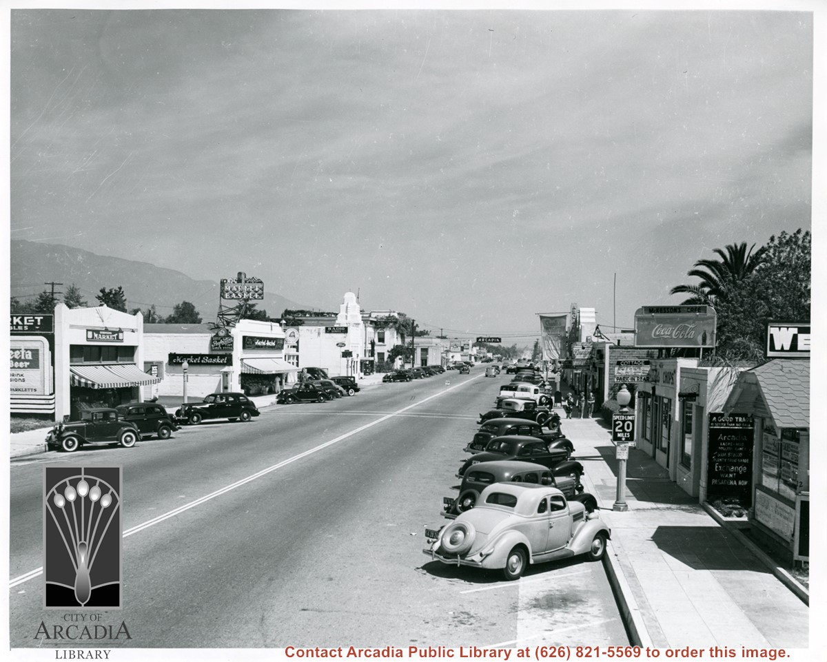
https://arcadiahistory.andornot.com/en/permalink/photographs595
- Date
- 1938
1 image
- Date
- 1938
- Subjects
- Huntington Drive
- Robinson's Market
- Arcadia Theater
- Markets
- Market Basket
- Wendell Realty
- Restaurants-The Cottage
- Physical Description
- 8x10 b&w
- ID
- 591
- Collection
- Photographs
Images
Duarte Road running east-west intersects the middle and a small portion of Santa Anita Park parking lot visible in the upper left. Enlargement of a section of photo ID 617.
https://arcadiahistory.andornot.com/en/permalink/photographs1450
- Date
- 1938
1 image
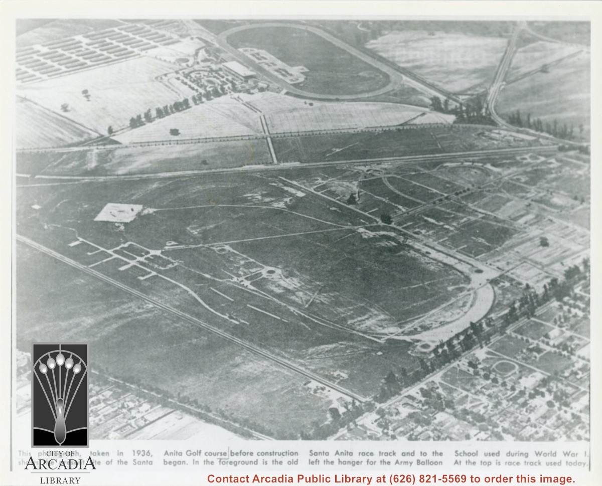
Photographically reproduced copy of an old newspaper photo taken in 1936 which is an aerial view looking north west over original race track built by Baldwin. In lower right corner can be seen Santa Anita Ave lined with Eucalyptus. On lower left, one can see present Campus Drive. Across top third of photo, one can see Huntington Drive. Note how small the trees are that line the street.
https://arcadiahistory.andornot.com/en/permalink/photographs864
- Date
- 1936
1 image
- Date
- 1936
- Subjects
- Baldwin, Elias J. "Lucky"-Horses and horse racing
- Huntington Drive
- Santa Anita Park-1907-1912
- Balloon School
- Physical Description
- 8x10 b&w
- ID
- 858
- Collection
- Photographs
Images
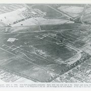
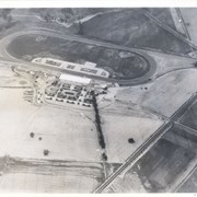
Aerial view from position above Huntington Drive near Holly Avenue intersection looking north over Santa Anita Park. Colorado Place and Huntington Drive are seen coming together at right side of photo. Note how small the deodar (?) trees planted along Huntington Drive and Colorado Place are. Row of trees seen in center of photo were apparently left from Ranch days and were later removed.
https://arcadiahistory.andornot.com/en/permalink/photographs984
- Date
- December 1, 1935
1 image
- Date
- December 1, 1935
- Subjects
- Aerial Photo Collection
- Aerial views
- Colorado Place
- Huntington Drive
- Santa Anita Park-1934-1942
- Physical Description
- 8x10 b&w
- ID
- 976
- Collection
- Photographs
Images