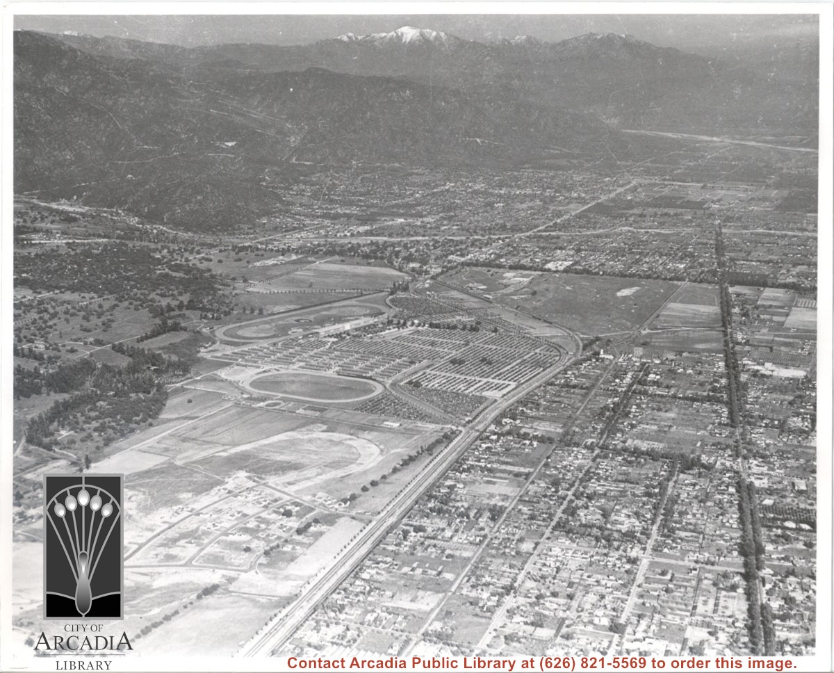
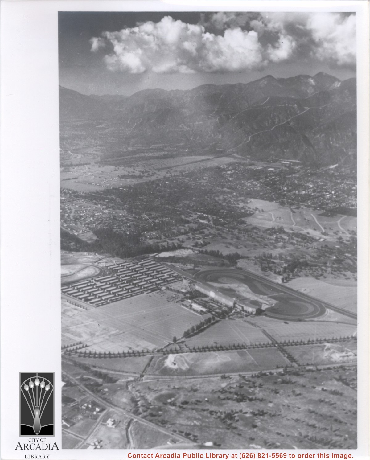
Aerial view. Looking east. Street along right edge of photo which is lined with trees is Duarte Road. Santa Anita Avenue cuts across photo from right to left and up into the San Gabriel Mountains. Huntington Drive can be seen in center of photo with young trees planted on north side of it. Santa Anita Race Track is one furthest from camera. The next small track is a training track belonging to Santa Anita. There is a VERY small round track across the street from the training track, which was part of a private horse stables. The incompleted oval was part of work done in 1933 by Joe Smoot and Anita Baldwin in their effort to develop the Jockey Club Track. This photo belongs to the Huntington Library. It is shown here for research only.
https://arcadiahistory.andornot.com/en/permalink/photographs627
- Date
- c. 1935
1 image
- Date
- c. 1935
- Subjects
- Duarte Road
- Huntington Drive
- Los Angeles Jockey Club
- San Gabriel Mountains
- Santa Anita Park-1934-1942
- Physical Description
- 8x10 b&w
- ID
- 623
- Collection
- Photographs
Images
Aerial view looking towards San Gabriel Mountains showing intersection of Baldwin Avenue and Huntington Drive, the Santa Anita Park and training track where Santa Anita Fashion Park (currently known as Westfield Santa Anita Shopping Mall) was built.
https://arcadiahistory.andornot.com/en/permalink/photographs1754
- Date
- Unknown
1 image
- Date
- Unknown
- Subjects
- Aerial Photo Collection
- Aerial views
- Baldwin Avenue
- Huntington Drive
- Malls
- San Gabriel Mountains
- Santa Anita Fashion Park
- Santa Anita Park, 1945-1980
- Westfield Santa Anita Shopping Mall
- Physical Description
- 8x10 b&w photocopy
- ID
- 1742
- Collection
- Photographs
Images
Aerial view taken from about over what became Campus Drive and Arcadia High School, and looking toward (NW) Pasadena and Sierra Madre at foot of San Gabriel Mountains. Photo shows Santa Anita Park Race Track possibly just a few years after opening.
https://arcadiahistory.andornot.com/en/permalink/photographs633
- Date
- c.1936
1 image
- Date
- c.1936
- Subjects
- Aerial Photo Collection
- Aerial views
- Arcadia High School
- Campus Drive
- San Gabriel Mountains
- Santa Anita Park-1934-1942
- Physical Description
- 8x10 b&w
- ID
- 629
- Collection
- Photographs
Images
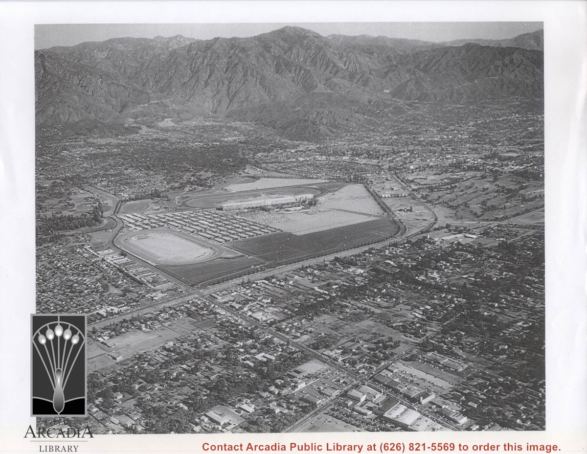
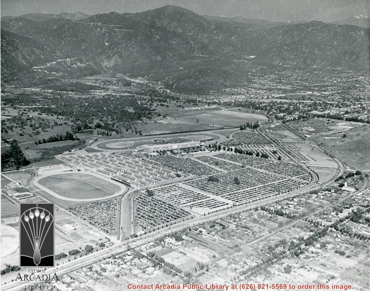
Aerial view toward NE. Main thoroughfare cutting across east to west with young trees planted on north side, is Huntington Drive. Main race track at Santa Anita is seen almost directly in center of photo, with Club House on side closest to camera. The smaller oval near left edge of photo was a training track belonging to Santa Anita which was removed for the Fashion Park. The Chantry Flats Road up to Santa Anita Canyon is clearly seen as it zig-zags around San Gabriel Mountains. This photo belongs to the Huntington Library. It is shown here for research only.
https://arcadiahistory.andornot.com/en/permalink/photographs629
- Date
- c. 1940s
1 image
- Date
- c. 1940s
- Subjects
- San Gabriel Mountains
- Santa Anita Park-1934-1942
- Chantry Flats Road
- Huntington Drive
- Fashion Park
- Physical Description
- 8x10 b&w
- ID
- 625
- Collection
- Photographs
Images
Aerial view toward north from a position south of Huntington Drive near intersection with Baldwin Avenue. It shows Santa Anita Fashion Park (currently known as Westfield Santa Anita Shopping Mall) developed by and on property owned by Santa Anita Consolidated. The Santa Anita Park Race Track and club house can be seen in center of photo. The straight white line about one inch above the club house roof is 210 Foothill Freeway. Chantry Flats road can be seen going up into San Gabriel Mountains in distance.
https://arcadiahistory.andornot.com/en/permalink/photographs646
- Date
- c. 1975
1 image
- Date
- c. 1975
- Subjects
- Aerial Photo Collection
- Aerial views
- 210 Foothill Freeway
- Chantry Flats Road
- Malls
- San Gabriel Mountains
- Santa Anita Park-1945-1980
- Santa Anita Fashion Park
- Westfield Santa Anita Shopping Mall
- Physical Description
- 8x10 b&w
- ID
- 642
- Collection
- Photographs
Images


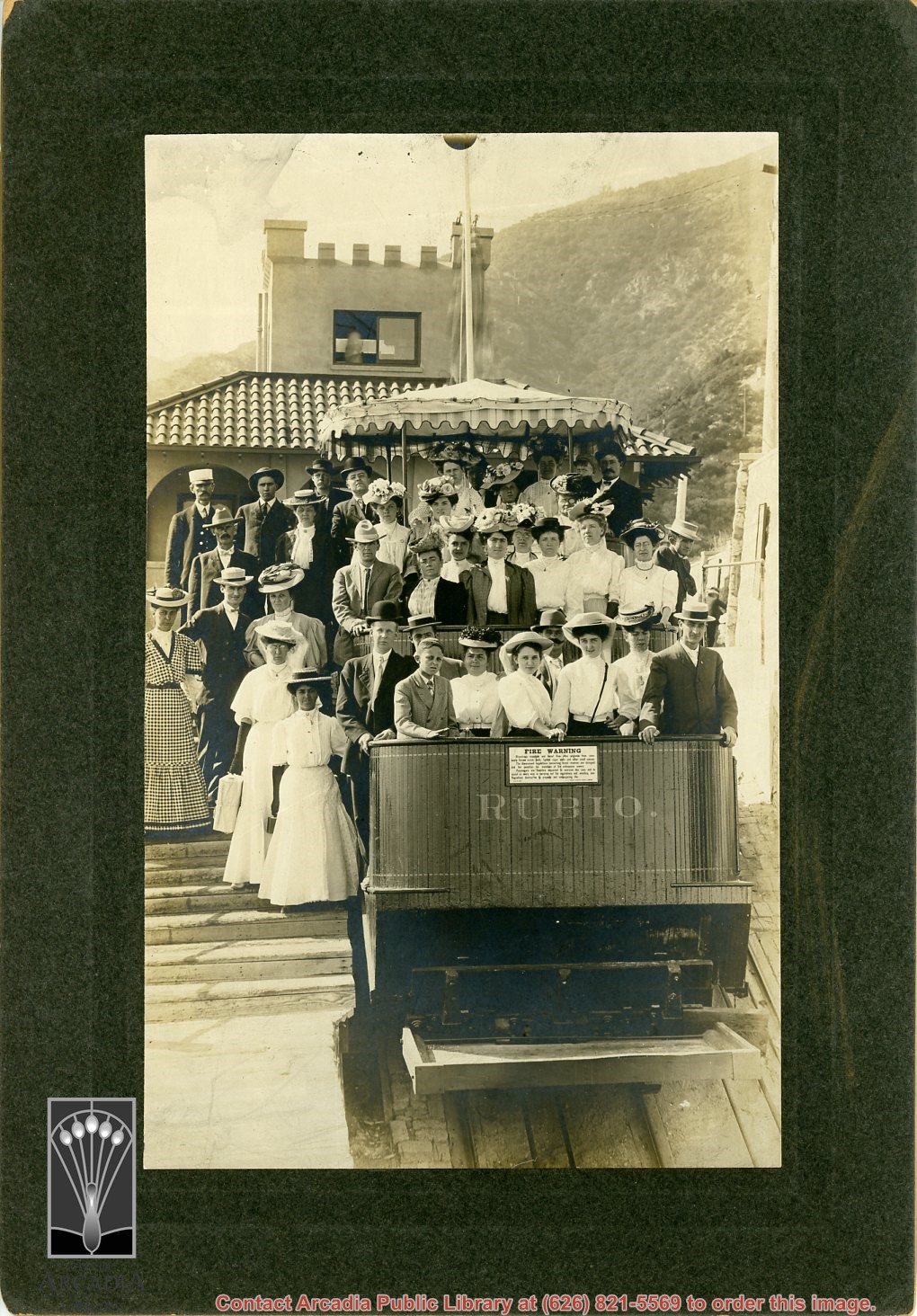
Approximately 36 men and women, many about to make the descent in the Mt. Rubio incline railroad car. (For info on this line, see Altadena Golden Years, p. 56.)
https://arcadiahistory.andornot.com/en/permalink/photographs617
- Date
- c. 1893
1 image
- Date
- c. 1893
- Subjects
- Recreation
- San Gabriel Mountains
- Physical Description
- 7x10 b&w
- ID
- 613
- Collection
- Photographs
Images
Arcadia has new hiking shuttle. U.S. Forest Service starts bus service to Chantry Flat trails from Arcadia Gold Line station. The shuttle goes to Chantry Flat Road, an area that connects to trails that lead to Sturtevant Falls, Hermit Falls, and historic Mount Wilson. The shuttle will run the next three weekends. Plans to make it permanent have not been formulated. See also Pasadena Star News, September 21, 2016, p. A7.
https://arcadiahistory.andornot.com/en/permalink/newspaper34675
- Newspaper
- Pasadena Star News
- Date
- September 20, 2016
- Pages
- p. A1, A6
- Subjects
- Angeles National Forest
- Bus
- Chantry Flat
- Hiking
- San Gabriel Mountains
- Shuttle Service
- United States Forest Service
- Item ID
- 34867AN
- Collection
- Newspaper Index
Bill seeks addition to forest landscape. Rep. Judy Chu, D-Pasadena, hopes to expand San Gabriel Mountains National Monument by 100,000-plus acres with the San Gabriel Mountains Protection Act, written by Representative Judy Chu. The San Gabriel Mountains are north of Arcadia.
https://arcadiahistory.andornot.com/en/permalink/newspaper36488
- Newspaper
- Pasadena Star News
- Date
- May 30, 2023
- Pages
- p. A1, A7
- Collection
- Newspaper Index
Bobcat Fire continues to wreak havoc. Nearly 24,000 acres burned above foothill communities, north of Monrovia, and still spreading out of control yesterday as firefighters contended with powerful winds. The fire has burned 23,890 acres of pristine forest lands. It was 6% contained. Evacuation warnings are still in effect in Monrovia, Arcadia, Azusa, Sierra Madre, Duarte, Pasadena, Altadena & Bradbury.
https://arcadiahistory.andornot.com/en/permalink/newspaper35801
- Newspaper
- Pasadena Star News
- Date
- September 11, 2020
- Pages
- p. A1, A4
- Collection
- Newspaper Index
Bobcat Fire, on its 9th day in the San Gabriel Mountains, continued to grow north of the San Gabriel Valley. It had charred 38,299 acres Monday with containment at 3%. The fire has crossed to west side of Santa Anita Canyon. On Sunday, residents in Arcadia and Sierra Madre who live north of Elkins Avenue and east of Santa Anita Avenue were ordered to evacuate. About 305 homes were in the evacuation zone. Most are in Arcadia and 32 are in Sierra Madre.
https://arcadiahistory.andornot.com/en/permalink/newspaper35803
- Newspaper
- Pasadena Star News
- Date
- September 15, 2020
- Pages
- p. A1, A6
- Collection
- Newspaper Index
Car sitting alongside Holly Avenue at property just purchased by Aloyosius Mauch and his family near Palm Avenue and Holly Avenue. This view is toward NE.
https://arcadiahistory.andornot.com/en/permalink/photographs1007
- Date
- Feb. 1922
1 image
- Date
- Feb. 1922
- Physical Description
- 6x10 b&w (this is right portion of a panorama - photo 999 forms left portion)
- ID
- 1000
- Collection
- Photographs
Images
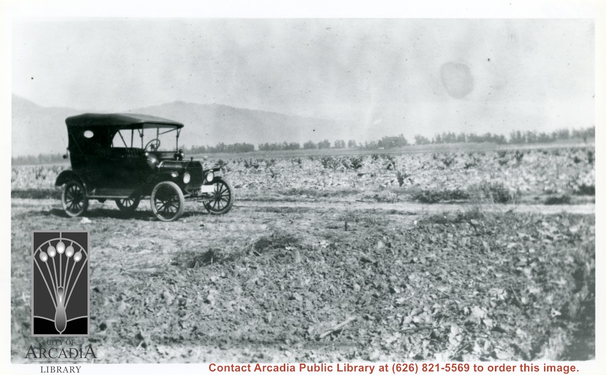
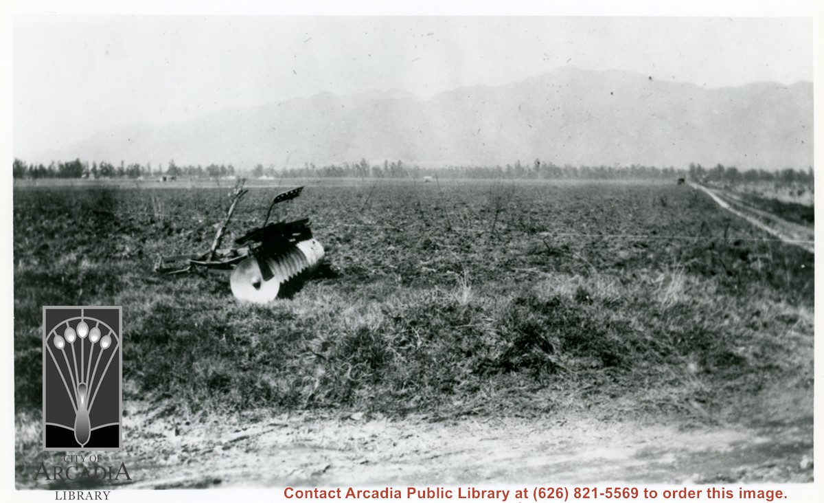
A disc plow sits in field in this view looking north toward mountains. This was very shortly after Mauch family bought the 5 acres near Palm Avenue and Holly Avenue. The dirt road on extreme right is Holly Avenue.
https://arcadiahistory.andornot.com/en/permalink/photographs1006
- Date
- Feb. 1922
1 image
- Date
- Feb. 1922
- Physical Description
- 6x10 b&w (this is left portion of a panorama - photo 1000 completes scene)
- ID
- 999
- Collection
- Photographs
Images
Elias J. "Lucky" Baldwin in carriage on his original track which was adjacent to Michillinda and near Colorado Blvd. With him is W. McClelland, Baldwin's horse trainer at this time. There are 16 other people in photo; some are mounted on horses, some standing. Etched on the photo is "On the track - Lucky Baldwins Place. S.G.V.R.R."
https://arcadiahistory.andornot.com/en/permalink/photographs111
- Date
- March 4, 1887
1 image
- Date
- March 4, 1887
- Physical Description
- 8x10 b&w hardboard professional photo, also 2 prints
- ID
- 111
- Collection
- Photographs
Images

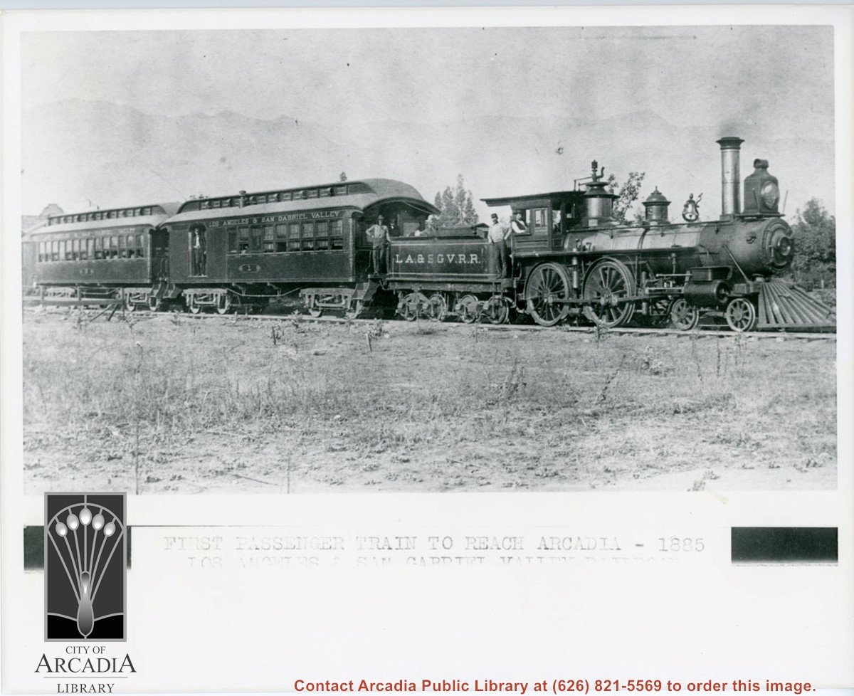
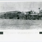
Engine, coal car, and two passenger coaches standing on track. The train is of the Los Angeles and San Gabriel Valley line. The engineer is sitting at his window in cab. Several other crew members can be seen. San Gabriel Mountains form backdrop of photo.
https://arcadiahistory.andornot.com/en/permalink/photographs216
- Date
- c.1885
1 image
- Date
- c.1885
- Subjects
- Railroads
- San Gabriel Mountains
- Physical Description
- 8x10 b&w
- ID
- 215
- Collection
- Photographs
Images
Flames continue north to homes. Residents evacuate as Bobcat Fire jumps Highway 2, tops mountain ridge, menaces Antelope Valley. The 50,539-acre fire which once primarily threatened San Gabriel Valley foothill communities after it started on September 6, jumped Highway 2 overnight and continues to spread north, putting Antelope Valley under an evacuation warning. Evacuation warnings were still in place for parts of Monrovia, Arcadia, Duarte, Bradbury, Sierra Madre, Pasadena, and Altadena, though evacuation orders in parts of Sierra Madre and Arcadia were lifted Wednesday.
https://arcadiahistory.andornot.com/en/permalink/newspaper35806
- Newspaper
- Pasadena Star News
- Date
- September 18, 2020
- Pages
- p. A1, A7
- Collection
- Newspaper Index
House passes preservation bill on a bipartisan vote. The Protecting America's Wilderness and Public Lands Act, or House Resolution 803 seeks to conserve 1 million acres of public land in California, much of it in Southern California. HR 803 incorporates two local measures, including the San Gabriel Mountains Foothills and Rivers Protection Act that will protect the Angeles National Forest, located just north of Arcadia.
https://arcadiahistory.andornot.com/en/permalink/newspaper35915
- Newspaper
- Pasadena Star News
- Date
- February 27, 2021
- Pages
- p. A1, A4
- Subjects
- Angeles National Forest
- Chu, Judy
- Congress
- Conservation
- Environment
- Legislation
- San Gabriel Mountains
- Schiff, Adam
- Collection
- Newspaper Index
Huge California conservation bill heads to vote in Congress today. The Protecting America's Wilderness and Public Lands Act, or House Resolution 803, seeks to preserve 1 million acres of public land in California. Part of it is the San Gabriel Mountains and Rivers Protection Act, authored by Rep. Judy Chu-D. to extend the San Gabriel Mountains National Monument designation by adding 109,143 acres of the western front-facing Angeles National Forest. This includes popular hiking areas within Chantry Flat, located just north of Arcadia.
https://arcadiahistory.andornot.com/en/permalink/newspaper35914
- Newspaper
- Pasadena Star News
- Date
- February 26, 2021
- Pages
- p. A1, A8
- Subjects
- Angeles National Forest
- Chu, Judy
- Congress
- Conservation
- Environment
- Legislation
- San Gabriel Mountains
- Schiff, Adam
- Collection
- Newspaper Index
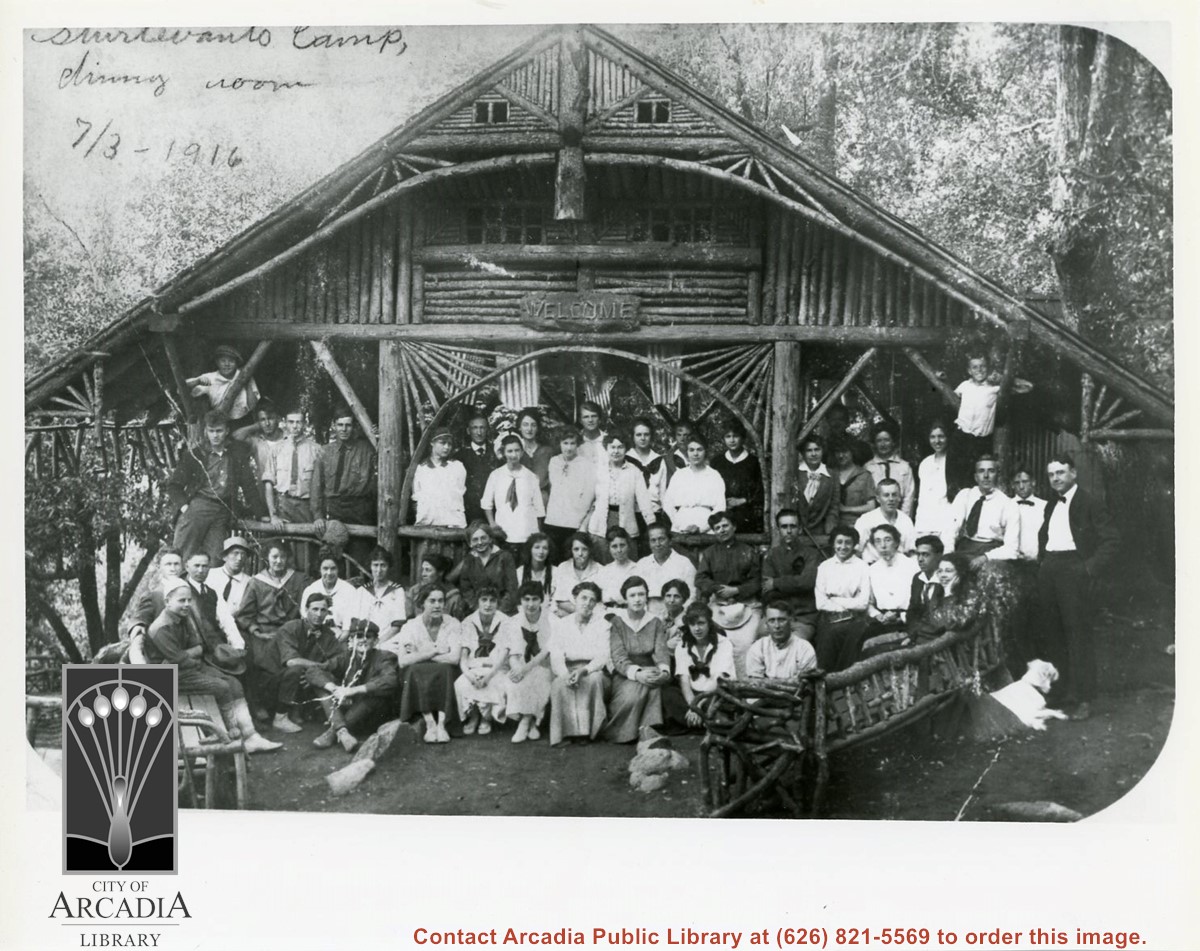
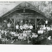
A large group is pictured sitting or standing near entrance to Sturtevant Camp dining room. (Camp was one of many in San Gabriel Mountains; it was up Big Santa Anita Canyon.) In back row, on left, man in dark shirt and tie next to pillar, is John C. Juvinall of Monrovia.
https://arcadiahistory.andornot.com/en/permalink/photographs976
- Date
- July 3, 1916
1 image
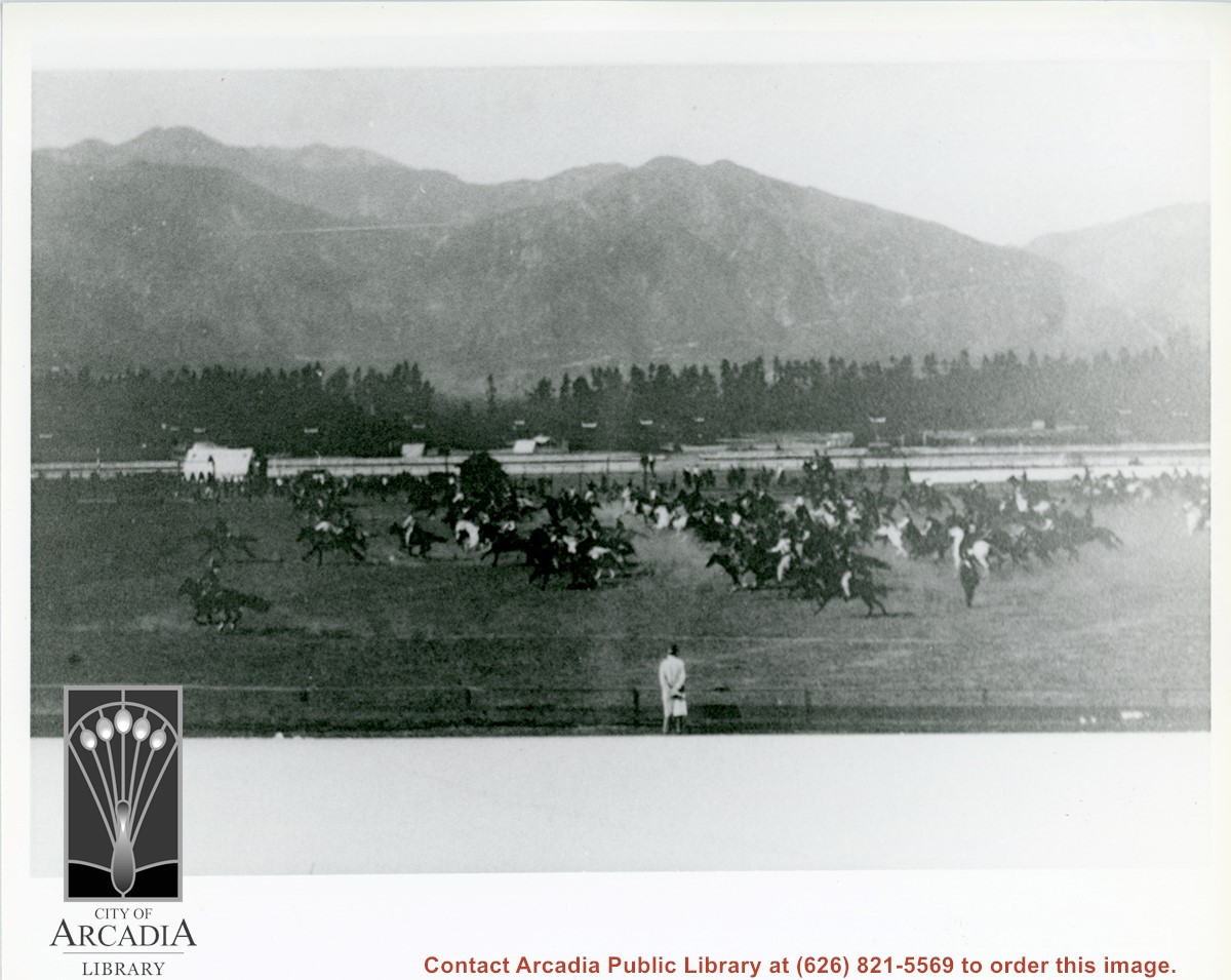
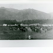
Many horses with riders are seen galloping west across infield of original Elias J."Lucky" Baldwin Santa Anita Race Track. We were told by Vesta Tucker Reeves, that the infield was used for rodeos when racing season was not in progress. This apparently was taken from grandstand.
https://arcadiahistory.andornot.com/en/permalink/photographs1091
- Date
- c.1909
1 image
National monument expansion possible. Report claims United States President Joe Biden plans to add a third more land to the protection of the San Gabriel Mountains.
https://arcadiahistory.andornot.com/en/permalink/newspaper36677
- Newspaper
- Pasadena Star News
- Date
- April 12, 2024
- Pages
- p. A1, A5
- Subjects
- Angeles National Forest
- Biden, Joe, President of the United States
- Chu, Judy
- Forests
- Legislation
- Padilla, Alex
- San Gabriel Mountains National Monument
- Collection
- Newspaper Index